
















Abrahamsodden

Natural harbour

favoritt

Region: Norway (3502), Agder (287), Aust-Agder (149), Lillesand (46) and Grimstad (28)

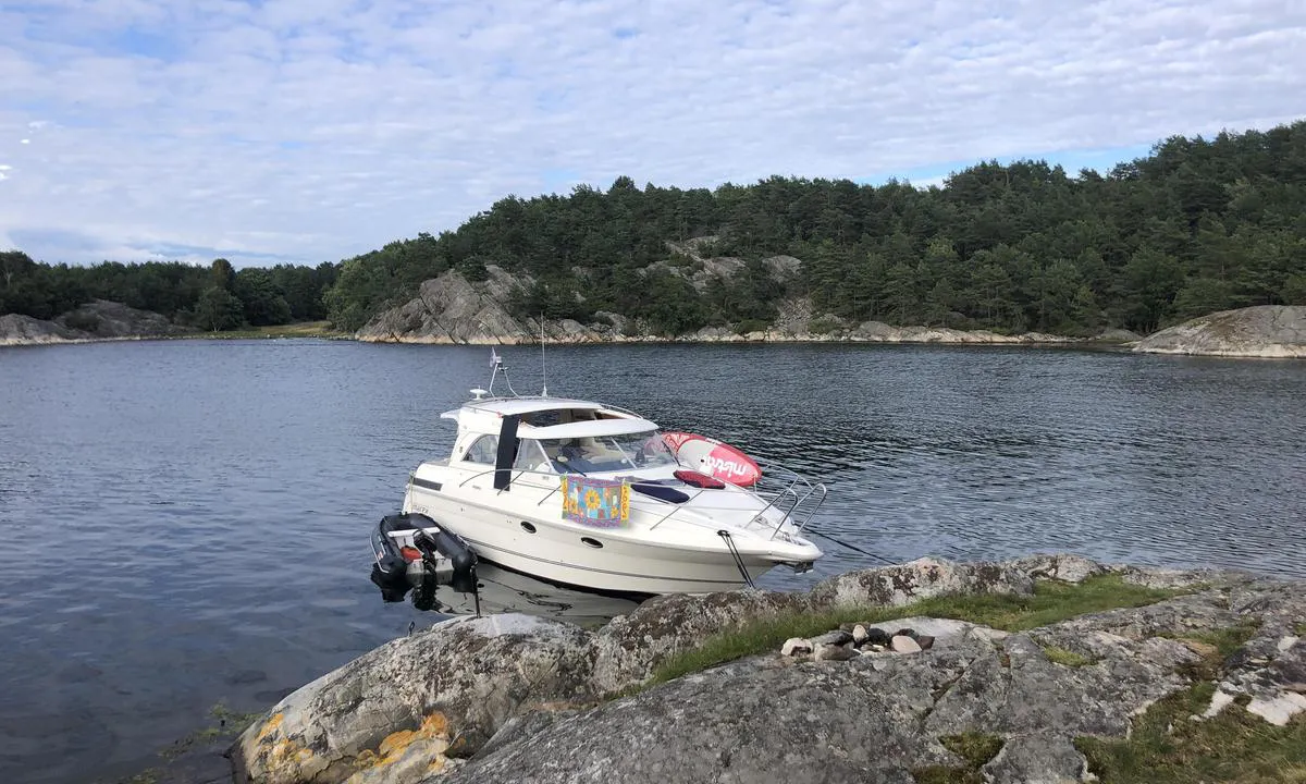
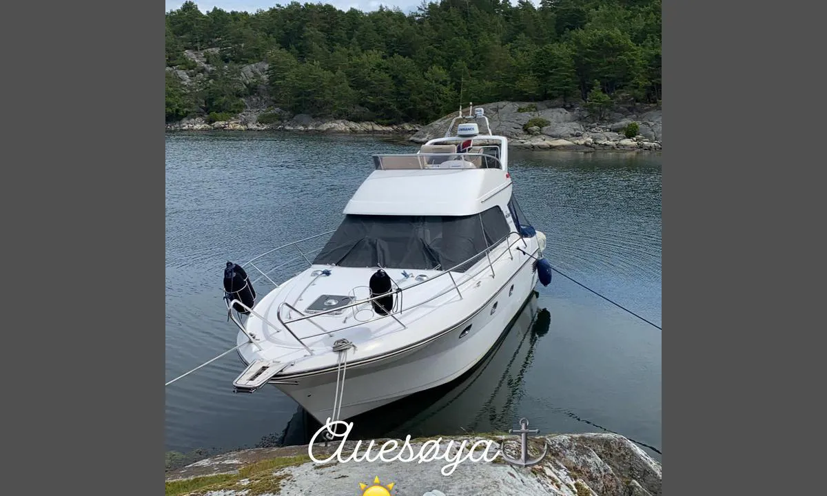
Abrahamsodden: {"base": "no", "no": "Flere bolter i fjell. Her har jeg lagt til p\u00e5 den ytterste av to sm\u00e5 odder her inne.", "se": "Flera bultar i berg. H\u00e4r har jag lagt till vid den yttersta av tv\u00e5 sm\u00e5 uddar h\u00e4r inne.", "en": "Several bolts in the rock. Here I have docked at the outermost of two small points in here.", "da": "Flere bolte i fjeld. Her har jeg lagt til ved den yderste af to sm\u00e5 odder herinde."}
Abrahamsodden
Abrahamsodden: {"base": "no", "no": "God svaiplass. S\u00f8lebunn, 3-4 meter. Enkelte grunnere partier.", "se": "Bra sv\u00e4ngrum. Lerbotten, 3-4 meter. N\u00e5gra grundare partier.", "en": "Good swinging room. Mud bottom, 3-4 meters. Some shallower areas.", "da": "God svingplads. Mudderbund, 3-4 meter. Enkelte grundere partier.", "fr": "Bon espace de mouillage. Fond vaseux, 3-4 m\u00e8tres. Certaines zones plus peu profondes.", "de": "Guter Schwojeraum. Schlammgrund, 3-4 Meter. Einige flachere Stellen.", "es": "Buen espacio de giro. Fondo de sedimento, 3-4 metros. Algunas partes son menos profundas.", "it": "Buona area di evoluzione. Fondale fangoso, 3-4 metri. Alcune parti pi\u00f9 basse.", "pt": "Bom espa\u00e7o de oscila\u00e7\u00e3o. Fundo de lama, 3-4 metros. Algumas \u00e1reas mais rasas.", "nl": "Goede draaiplek. Modderbodem, 3-4 meter. Enkele ondiepere delen.", "pl": "Dobre miejsce do ko\u0142ysania. Mule, 3-4 metry. Niekt\u00f3re p\u0142ytsze partie.", "uk": "\u0414\u043e\u0431\u0440\u0435 \u043c\u0456\u0441\u0446\u0435 \u0434\u043b\u044f \u0441\u0442\u043e\u044f\u043d\u043a\u0438. \u0414\u043d\u043e \u0437 \u043e\u0441\u0430\u0434\u043e\u043c, 3-4 \u043c\u0435\u0442\u0440\u0438. \u041c\u0456\u0441\u0446\u044f\u043c\u0438 \u0454 \u043c\u0456\u043b\u043a\u043e\u0432\u043e\u0434\u043d\u0456 \u0434\u0456\u043b\u044f\u043d\u043a\u0438.", "ro": "Spa\u021biu bun pentru ancorare. Fund de noroi, 3-4 metri. Unele por\u021biuni mai pu\u021bin ad\u00e2nci.", "tr": "\u0130yi demirleme alan\u0131. \u00c7amur dip, 3-4 metre. Baz\u0131 s\u0131\u011f noktalar.", "el": "\u039a\u03b1\u03bb\u03ae \u03c0\u03b5\u03c1\u03b9\u03bf\u03c7\u03ae \u03b3\u03b9\u03b1 \u03b1\u03b9\u03ce\u03c1\u03b7\u03c3\u03b7. \u039b\u03b1\u03c3\u03c0\u03ce\u03b4\u03b7\u03c2 \u03b2\u03c5\u03b8\u03cc\u03c2, 3-4 \u03bc\u03ad\u03c4\u03c1\u03b1. \u039f\u03c1\u03b9\u03c3\u03bc\u03ad\u03bd\u03b1 \u03c0\u03b9\u03bf \u03c1\u03b7\u03c7\u03ac \u03c3\u03b7\u03bc\u03b5\u03af\u03b1.", "cs": "Dobr\u00e1 kotevn\u00ed plocha. Bahnit\u00e9 dno, 3-4 metry. N\u011bkter\u00e9 m\u011bl\u010d\u00ed oblasti.", "hu": "J\u00f3 hint\u00e1z\u00e1si hely. Iszapos fen\u00e9k, 3-4 m\u00e9ter m\u00e9lys\u00e9g. N\u00e9h\u00e1ny sek\u00e9lyebb r\u00e9szek.", "fi": "Hyv\u00e4 k\u00e4\u00e4ntymisalue. Liejupohja, 3-4 metri\u00e4. Joitakin matalampia alueita.", "bg": "\u0414\u043e\u0431\u0440\u043e \u043f\u0440\u043e\u0441\u0442\u0440\u0430\u043d\u0441\u0442\u0432\u043e \u0437\u0430 \u043b\u044e\u043b\u0435\u0435\u043d\u0435. \u041a\u0430\u043b\u043d\u043e \u0434\u044a\u043d\u043e, 3-4 \u043c\u0435\u0442\u0440\u0430. \u041d\u044f\u043a\u043e\u0438 \u043f\u043e-\u043f\u043b\u0438\u0442\u043a\u0438 \u0443\u0447\u0430\u0441\u0442\u044a\u0446\u0438.", "sr": "Dobro mesta za okretanje. Muljevito dno, 3-4 metra. Pojedini pli\u0107i delovi.", "et": "Hea man\u00f6\u00f6verdamisruum. Mudap\u00f5hi, 3-4 meetrit. M\u00f5ned madalamad alad.", "lv": "Dieva \u0161\u016bpoles vieta. Dub\u013cu dibens, 3-4 metri. Da\u017eas sekl\u0101kas da\u013cas.", "lt": "Gera manevravimo erdv\u0117. Dumblingas dugnas, 3-4 metrai. Kai kurios seklesn\u0117s dalys."}
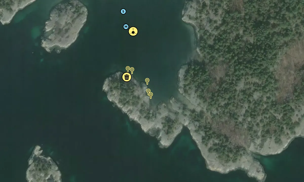
Satelite image of Abrahamsodden

📸 Upload a photo

Show off your photos and help others plan their journey to Abrahamsodden.harbourmaps.com is created by the sailing community, in a collective effort to make cruising simpler and more fun. Uploading a photo takes less than a minutes and can be done from your phone, tablet or laptop.

📸 Upload a photo

Facilities

We don't have any data on available facilities in this harbour. If you know which facilities are available here, please update this site to help your fellow sailors. Update facilities.

Mooring

Options for mooring in this harbour: Anchoring, Mooring buoy<br>(for easy "anchoring", not to be confused with bouys used in marinas), Towards land.

Updated on 1. Sep 2023. Update mooring.

Descriptions and reviews

Dan Mossmann says:

area

maritime qualities

description

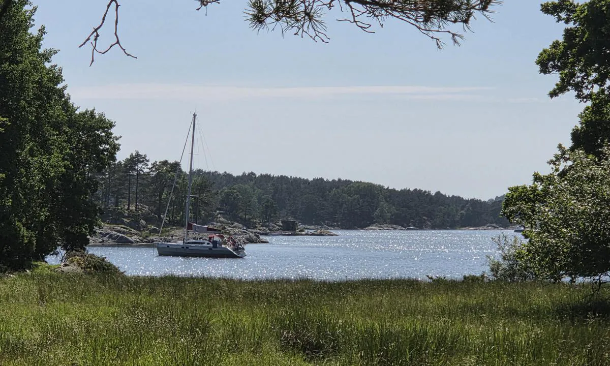
This is a very safe and good harbour primarily for motorboats that can hide completely behind this point. Sailboats can anchor closer to the opening in the lagoon. There is also a blue buoy here that serves as a mooring.
Easy to dock. Bolts in the rock, but you might need to wedge something extra.
Enter carefully and keep a little distance from the tip of the point as it is somewhat shallow right there. Do not use the propeller more than necessary to avoid stirring up sediment from the bottom.
Space for 2 boats at the innermost part and 2-3 boats on the starboard side at the entrance.

[translated from Norwegian with AI]

1 x helpful | written on 31. Aug 2023 | updated_on 16. Aug 2024

Do you know this harbour? It's a huge help to other sailors if you add a short description or review of the harbour.

📜 Add description

Map of Abrahamsodden

Facilities

We don't have any data on available facilities in this harbour. If you know which facilities are available here, please update this site to help your fellow sailors. Update facilities.

Mooring

Options for mooring in this harbour: Anchoring, Mooring buoy<br>(for easy "anchoring", not to be confused with bouys used in marinas), Towards land.

Updated on 1. Sep 2023. Update mooring.

Wind protection

Protection next night

90 points

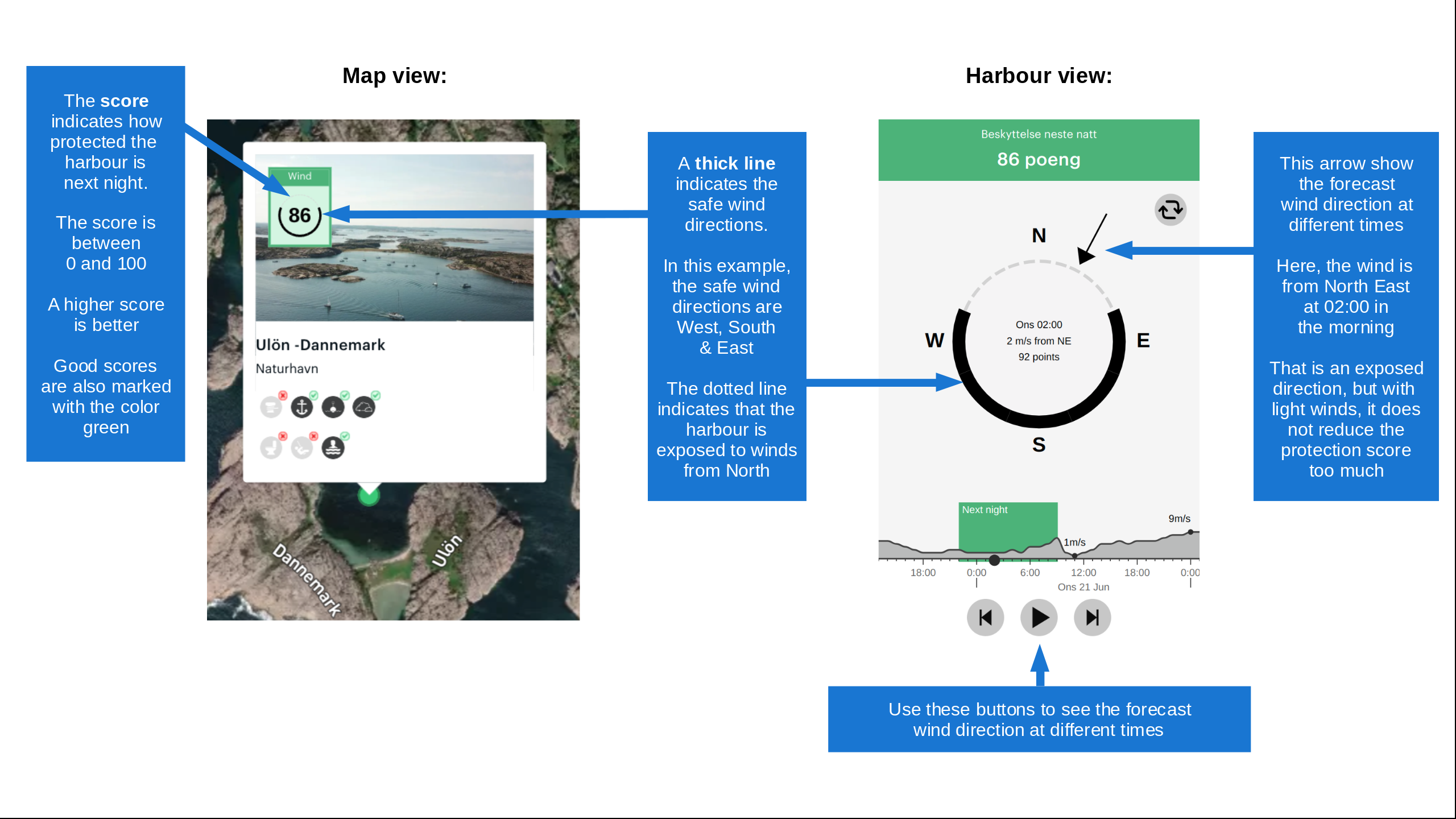
N E S W --> } } } } } } } } } } } } } } } } } } } } } } } } } } } } } } } } } } } } } } } } } } } } } } } } } } } } } } } } } } } } } } } } } } } } } } } } } } } } } } } } } } } } } } } } } } } } } } } } } } } } } } } } } } } } } } } } } } } } } } } } } } } } } } } } } } } } } } } } } } } } } } } } } } } } } } } } } } } } } } } } } } } } } } } } } } } } } } } } } } } } } } } } } } } } } } } } } } } } } } } } } } } } } } } } } } } } } } } } } } } } } } } } } } } } } } } } } } } } } } } } } } } } } } } } } } } } } } } } } } } } } } } } } } } } } } } } } } } } } } } } } } } } } } } } } } } } } } } } } } } } } } } } } } } } } } } } } } } } } } } } } } } } } } } } } } } } } } } } } } } } } } } } } } } } } } } } } } } } } } } } } } } } } } } } } } } } } } } } } } } } } } } } } } } } } } } } } } } } } } } } } } } } } } } } } } } } } } } } } } } } } } } } } } } } } } } } } } } } } } } } } } } } } } } } } } } } } } } } } } } } } } } } } } } } } } } } } } } } } } } } } } } } } } } } } } } } } } } } } } } } } } } } } } } } } } } } } } } } } } } } } } } } } } } } } } } } } } } } } } } } } } } } } } } } } } } } } } } } } } } } } } } } } } } } } } } } } } } } } } } } } } } } } } } } } } } } } } } } } } } } } } } } } } } } } } } } } } } } } } } } } } } } } } } } } } } } } } } } } } } } } } } } } } } } } } } } } } } } } } } } } } } } } } } } } } } } } } } } } } } } } } } } } } } } } } } } } } } } } } } } } } } } } } } } } } } } } } } } } } } } } } } } } } } } } } } } } } } } } } } } } } } } } } } } } } } } } } } } } } } } } } } } } } } } } } } } } } } } } } } } } } } } } } } } } } } } } } } } } } } } } } } } } } } } } } } } } } } } } } } } } } } } } } } } } } } } } } } } } } } } } } } } } } } } } } } } } } } } } } } } } } } } } } } } } } } } } } } } } } } } } } } } } } } } } } } } } } } } } } } } } } } } } } } } } } } } } } } } } } } } } } } } } } } } } } } } } } } } } } } } } } } } } } } } } } } } } } } } } } } } } } } } } } } } } } } } } } } } } } } } Next night 6:00 12:00 Tor 23 Jul 18:00 0:00 6:00 12:00 Fre 24 Jul 7m/s 2m/s

Want to know how the wind score works? Then you should read this explanation.

The wind forecasts come from yr.no (Norwegian Meteorological Institute), and was last updated 1 hour and 40 minutes ago (Thursday 23 July 04:32 AM). The next night score shows you the worst hour between 22:00 and 08:00 the next night. We recommend that you check multiple sources for wind forecasts. windy.com is a good website to show larger wind systems.

The safe wind directions for this harbour has been decided by an algorithm, based on how elevated the land around the harbour is. It's mostly correct, but sometimes the underlying data about elevation levels is not good enough to make correct decisions. It's a great help to other if you can validate or adjust the safe wind directions. You can see the data used by the algorithm to decide the safe wind directions by clicking here.

Last visits to Abrahamsodden

Thu 02 Jul 2026

MIRAWAL [MMSI: 259009480]

Tue 29 Jul 2025

CUSARARE II [MMSI: 225993067]

Mon 29 Jul 2024

COULD BE [MMSI: 211887520]

Sun 30 Jul 2023

BAJAS [MMSI: 257985090]

Fri 14 Jul 2023

LILLE MY II [MMSI: 258094920]

The visits are retrieved from AIS data. You can click to see all visiting ships to Abrahamsodden, as well as statistics about the ships that visits

Add this harbour to a journey

Check in now

Choose a different date than today

Important: When you check in to a harbour, you add it to a journey on this website. You are not booking a place in the marina.

Contributors

Users that contributed to this page: Dan Mossmann, Tove Lunde and Knut Kjorkleiv

harbourmaps.com is updated by the boating community. When you add information, a review or pictures to this page you are listed here with the other contributors (we list your user-name, which can be your real name or a pseudonym).

Closest harbours to Abrahamsodden

Filter by

Natural harbour
Marina
Safe wind next night

Order by

ABC
Popularity
Wind score next night

0 harbours

Show more harbours