Dragsund - flytebrygge
Natural harbour

Region: Norway (3434), Viken (190), Indre Oslofjord (79), Frogn (17) and Drøbak (10)

Descriptions and reviews
Eirik Våge Bogerud says:
area


maritime qualities


description
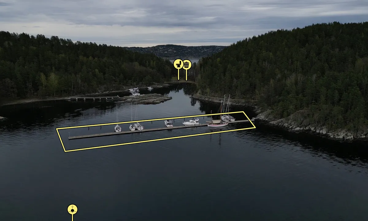
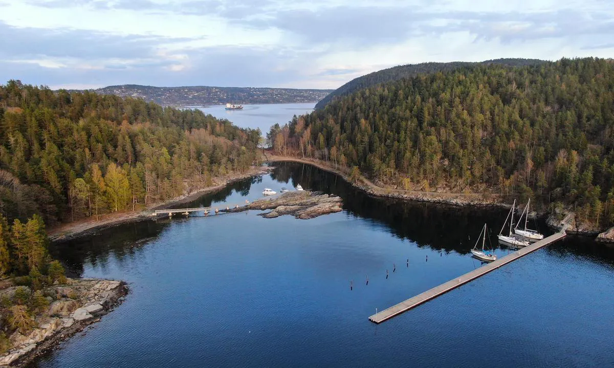
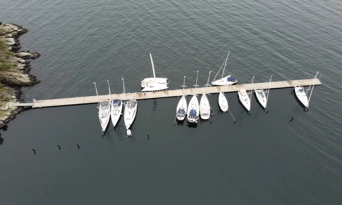
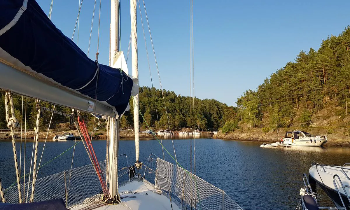
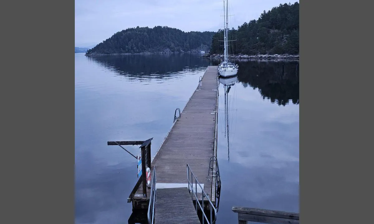
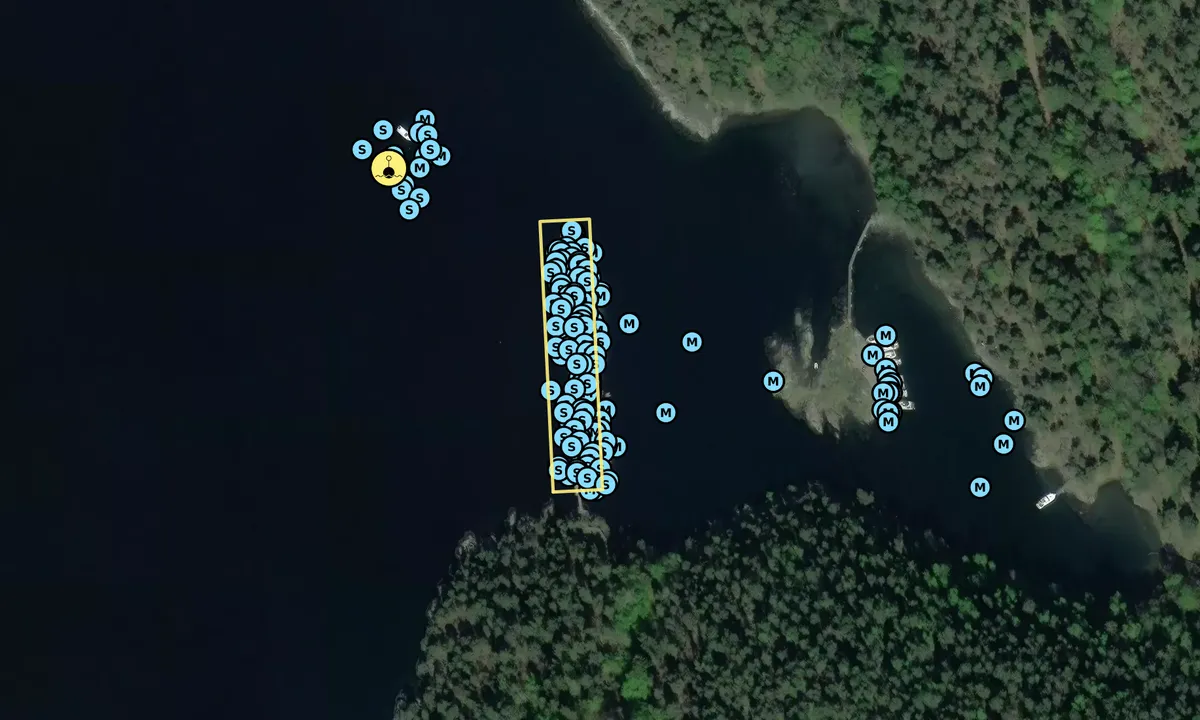
Great to dock at the floating pier with a line to the floating buoy. The pier stops the waves so it is calm on the inside, but it can get a bit choppy/unstable on the outside of the pier.
The gangway from the pier provides easy access to fine hiking trails all over the island. There are several gravel roads in the middle part of the island and smaller trails to the south and north ends of the island. On the south side of the island, there are some cool old cannon positions that are worth a look. From April to October, there are also goats on the island, so watch your dog. :)
From Dragsund, you can also walk to Tåjebukta in a couple of minutes and visit Håøya nature workshop where they sell various baked goods and brownies. Personally, these are the best cinnamon rolls I have ever tasted.
On land, there are good opportunities to dispose of garbage. At the innermost part of Dragsund, there are a bunch of trash bins, and in Tåjebukta, there are some larger garbage containers.
[translated from Norwegian with AI]

1 x helpful | written on 23. Aug 2025
Sussi Lundqvist says:
area


maritime qualities


description
We arrived with a sailboat with a 2m draft. No problem docking to a buoy on the inside of the pier. It's significantly deep on the inside of the pier. If you dock alongside on the outside, you might experience some swell.
Beautiful place!
Great walking paths. At the pier to the south, there is a cafe, but we found this pier cozier and quieter. You can stay for free for 5 days, but there is no electricity or water available here. There are toilets and a place to dispose of garbage.
[translated from Swedish with AI]

2 x helpful | written on 24. Jul 2025 | updated_on 24. Jul 2025
Terje Jørgensen says:
description
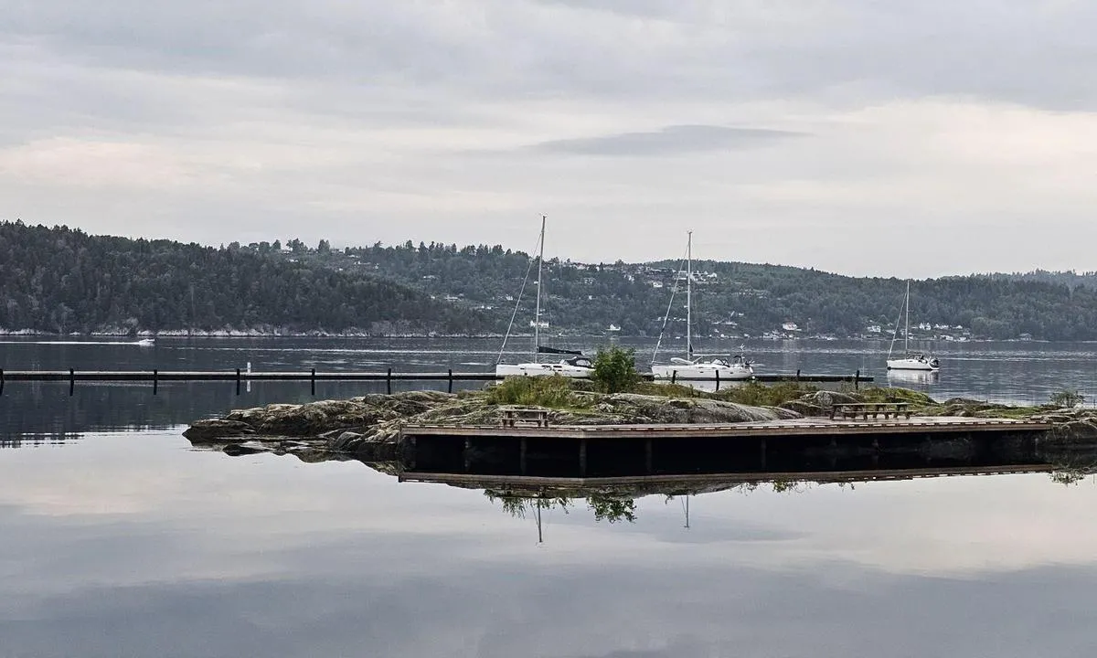
Approach and Maritime Conditions: Usually calm waters within (west of) Håøya.
There are some reefs between the island and Sætre along the approach from the south, but after passing them, one can quickly head into Tåjebukta and follow the island up to Dragsund.
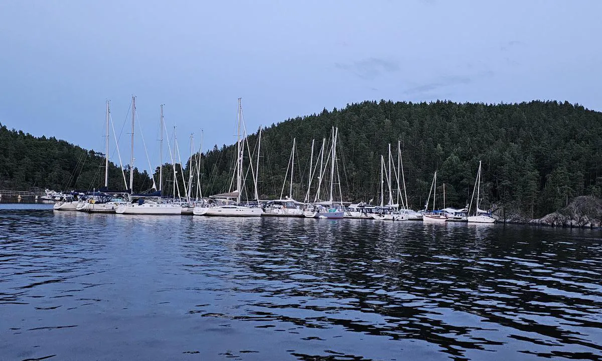
Anchoring: Boats from 35-40 feet can lie comfortably alongside the breakwater, while smaller boats are well shielded inside and moored to a buoy that must be shared with neighbors and linked to the breakwater.
Approximately 7-15 meters depth.
Well sheltered under normal wind conditions.
It’s possible to move further into the bay with smaller motorboats and perhaps one or two sailboats, but be aware of a couple of reefs at a depth of 1.5 meters!
A 36-foot sailboat has been observed anchored stern-to and secured to the rock face there.
The Area: Delightful island with a bakery in summer, check FB; otherwise, a couple of basic facilities north and south of Dragsund.
There are a number of ticks on the island, so it's good to bring remedies and check yourself well upon returning to the dock.
Beautiful hiking area with lots of history, including from explosives production and WWII when the island was used as an execution site.
Relatively short trip into Sætre with shops, a liquor store, building supplies, etc.
[translated from Norwegian with AI]

1 x helpful | written on 23. Jul 2021
Do you know this harbour? It's a huge help to other sailors if you add a short description or review of the harbour.
Map of Dragsund - flytebrygge

Wind protection
Protection next night
74 points


Want to know how the wind score works? Then you should read this explanation.
The wind forecasts come from yr.no (Norwegian Meteorological Institute), and was last updated 1 hour and 37 minutes ago (Friday 06 February 05:27 AM). The next night score shows you the worst hour between 22:00 and 08:00 the next night. We recommend that you check multiple sources for wind forecasts. windy.com is a good website to show larger wind systems.
The safe directions for this harbour was added at None. Click here to edit.
Last visits to Dragsund - flytebrygge
Fri 10 Oct 2025 |
|
|
Sat 27 Sep 2025 |
|
|
|
|
Fri 19 Sep 2025 |
|
|
Thu 18 Sep 2025 |
|
|
The visits are retrieved from AIS data. You can click to see all visiting ships to Dragsund - flytebrygge, as well as statistics about the ships that visits
Add this harbour to a journey
Choose a different date than today
Important: When you check in to a harbour, you add it to a journey on this website. You are not booking a place in the marina.
Contributors
Users that contributed to this page: Terje Jørgensen, Cato Kaasa @ Sailing ZERO, Anonymous sailor 197816, Iwonah, Eirik Våge Bogerud, Stein Ødegård, Timor and SV Metanoia
harbourmaps.com is updated by the boating community. When you add information, a review or pictures to this page you are listed here with the other contributors (we list your user-name, which can be your real name or a pseudonym).
Closest harbours to Dragsund - flytebrygge
Filter by
Order by
0 harbours
Show more harbours





 HVALBORG [MMSI: 257766290]