


Dramstadbukta badeplass svai
Natural harbour

Region: Norway (3482), Viken (190), Asker (34), Drammensfjorden (13) and Klokkarstua (1)


Descriptions and reviews
Terje Jørgensen says:
description
Entrance and maritime conditions: Right inside Svelviksundet, where Norway's shortest ferry route operates regularly.
Cargo vessels pass at all times of the day, which can create choppy waves.
The wind usually follows the fjord either in or out, rarely experienced crosswind.
Anchoring: Drop the anchor into a moraine from the last ice age, it has worked well for bathing trips to lie with one anchor when there is no northerly wind.
The beach and bottom consist of sand and stones, conditions can become unstable with stronger northerly winds.
With southerly winds, the remaining part of the moraine acts as a good windscreen, very calm even with winds over 8-10 m/s.
It's quite possible to lie along the beach with one anchor at each end at 7-9 meters, varying depth along.
It becomes quite deep the further north from the moraine you place yourself.
The area: There is access to the beach via road and parking facilities for cars.
Along the beach and down along the strait, there are strolling opportunities, which transition into a hiking trail down to the ferry port at Verket.
Therefore, you are not dependent on a car to get over to Svelvik for shopping.
For more information about the place, visit Asker municipality's website:
https://www.asker.kommune.no/natur-og-friluft/friluftsliv/badeplasser/dramstadbukta/
[translated from Norwegian with AI]

1 x helpful | written on 6. Jul 2021
Do you know this harbour? It's a huge help to other sailors if you add a short description or review of the harbour.
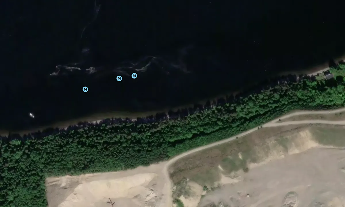
Map of Dramstadbukta badeplass svai

Wind protection
Protection next night
77 points


Want to know how the wind score works? Then you should read this explanation.
The wind forecasts come from yr.no (Norwegian Meteorological Institute), and was last updated 1 hour and 42 minutes ago (Monday 06 July 08:28 PM). The next night score shows you the worst hour between 22:00 and 08:00 the next night. We recommend that you check multiple sources for wind forecasts. windy.com is a good website to show larger wind systems.
The safe directions for this harbour was added at 6. Jul 2021. Click here to edit.
Last visits to Dramstadbukta badeplass svai
Sun 02 Jun 2024 |
|
|
Sat 25 May 2024 |
|
|
 FELICIA [MMSI: 258132730]
The visits are retrieved from AIS data. You can click to see all visiting ships to Dramstadbukta badeplass svai, as well as statistics about the ships that visits
Add this harbour to a journey
Choose a different date than today
Important: When you check in to a harbour, you add it to a journey on this website. You are not booking a place in the marina.
Contributors
Users that contributed to this page: Terje Jørgensen
harbourmaps.com is updated by the boating community. When you add information, a review or pictures to this page you are listed here with the other contributors (we list your user-name, which can be your real name or a pseudonym).
Closest harbours to Dramstadbukta badeplass svai
Filter by
Order by
0 harbours
Show more harbours
