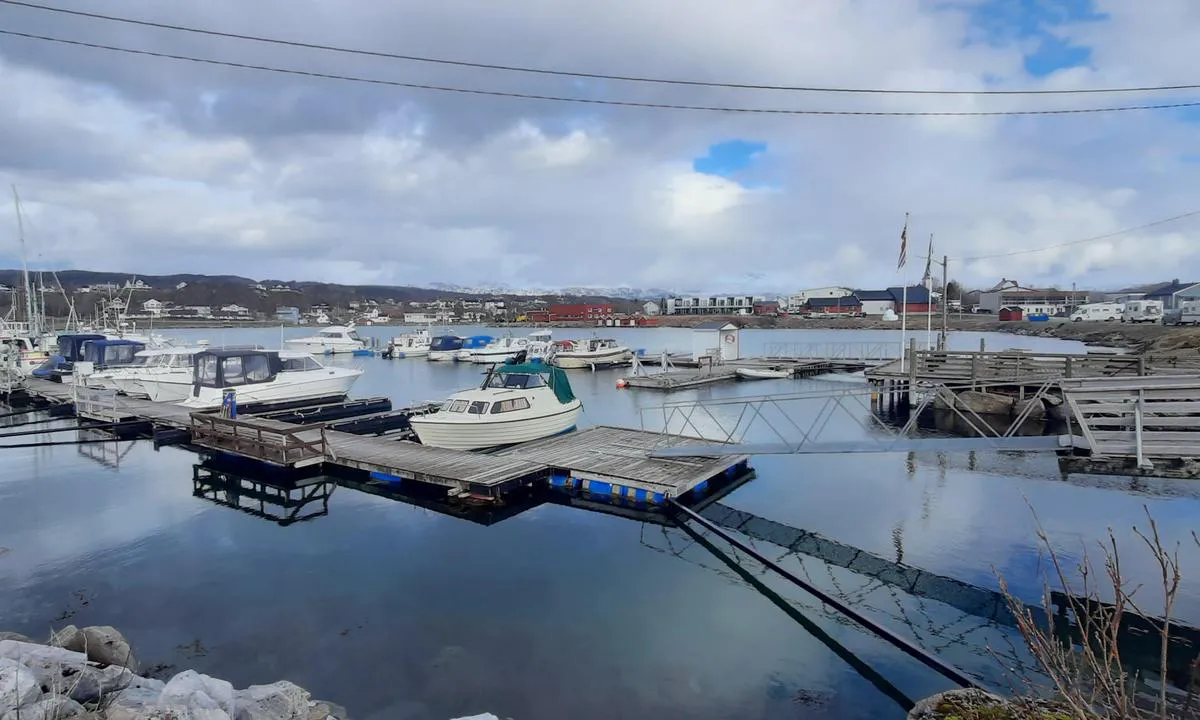
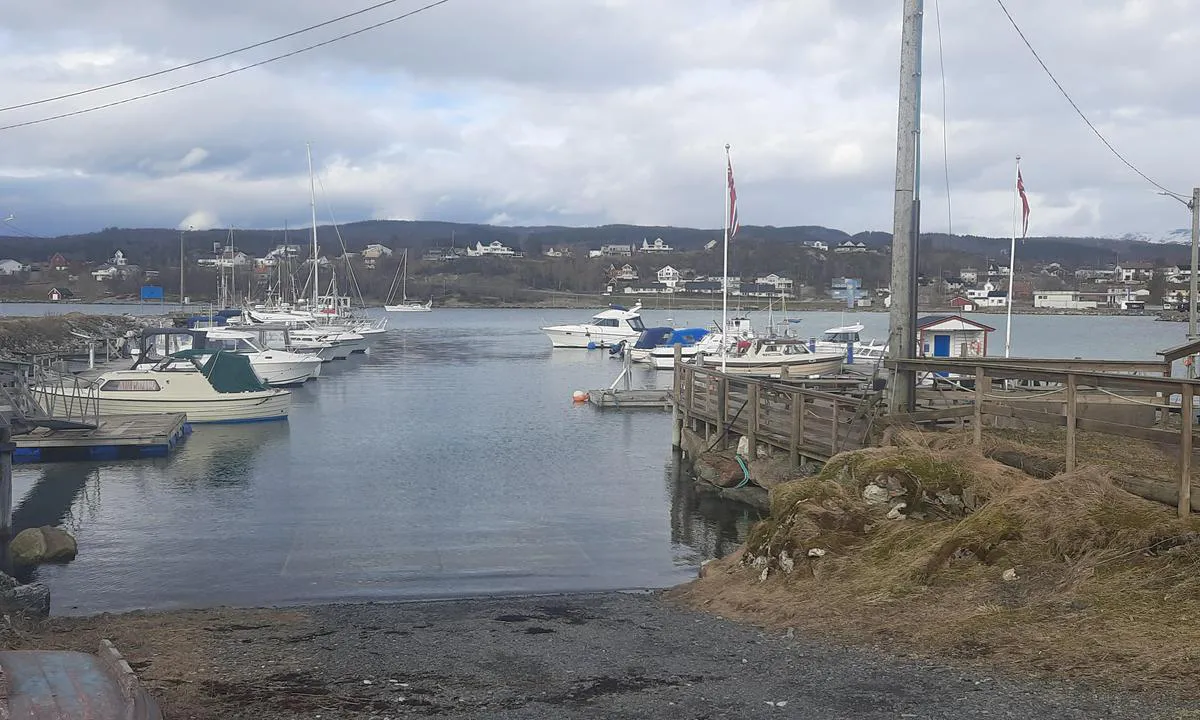
Evenskjær: {"base": "en", "no": "Gjestebrygge - Maksimal B\u00e5tlengde: 35 Fot", "se": "Bes\u00f6ksponton - Maximal b\u00e5tl\u00e4ngd: 35 fot", "en": "Visitor Pontoon \u2013 Maximum Boat Length: 35 Feet", "da": "Bes\u00f8gsbro - Maksimal b\u00e5dl\u00e6ngde: 35 fod", "fr": "Ponton Visiteurs - Longueur Maximale du Bateau : 35 Pieds", "de": "Besucher-Schwimmsteg - Maximale Bootsl\u00e4nge: 35 Fu\u00df", "es": "Ponton para Visitantes - Longitud M\u00e1xima del Barco: 35 Pies", "it": "Pontile Visitatori - Lunghezza Massima Barca: 35 Piedi", "pt": "Pont\u00e3o de Visitantes - Comprimento M\u00e1ximo do Barco: 35 P\u00e9s", "nl": "Bezoekers Ponton - Maximale Bootlengte: 35 voet", "pl": "Ponton dla Go\u015bci - Maksymalna D\u0142ugo\u015b\u0107 \u0141odzi: 35 St\u00f3p", "uk": "\u041f\u043e\u043d\u0442\u043e\u043d\u0438 \u0434\u043b\u044f \u0432\u0456\u0434\u0432\u0456\u0434\u0443\u0432\u0430\u0447\u0456\u0432 - \u041c\u0430\u043a\u0441\u0438\u043c\u0430\u043b\u044c\u043d\u0430 \u0434\u043e\u0432\u0436\u0438\u043d\u0430 \u0447\u043e\u0432\u043d\u0430: 35 \u0444\u0443\u0442\u0456\u0432", "ro": "Pontona Vizitatorilor - Lungime Maxim\u0103 a B\u0103rcii: 35 Picioare", "tr": "Ziyaret\u00e7i \u0130skele - Maksimum Tekne Uzunlu\u011fu: 35 Feet", "el": "\u03a0\u03bb\u03c9\u03c4\u03ae \u03a0\u03c1\u03bf\u03b2\u03bb\u03ae\u03c4\u03b1 \u0395\u03c0\u03b9\u03c3\u03ba\u03b5\u03c0\u03c4\u03ce\u03bd - \u039c\u03ad\u03b3\u03b9\u03c3\u03c4\u03bf \u039c\u03ae\u03ba\u03bf\u03c2 \u03a3\u03ba\u03ac\u03c6\u03bf\u03c5\u03c2: 35 \u03a0\u03cc\u03b4\u03b9\u03b1", "cs": "N\u00e1v\u0161t\u011bvnick\u00e9 molo - Maxim\u00e1ln\u00ed d\u00e9lka lod\u011b: 35 stop", "hu": "L\u00e1togat\u00f3i m\u00f3l\u00f3 - Maxim\u00e1lis haj\u00f3hossz: 35 l\u00e1b", "fi": "Vieraslaituri - Suurin venepituus: 35 jalkaa", "bg": "\u041f\u043e\u043d\u0442\u043e\u043d \u0437\u0430 \u043f\u043e\u0441\u0435\u0442\u0438\u0442\u0435\u043b\u0438 - \u041c\u0430\u043a\u0441\u0438\u043c\u0430\u043b\u043d\u0430 \u0434\u044a\u043b\u0436\u0438\u043d\u0430 \u043d\u0430 \u043b\u043e\u0434\u043a\u0430\u0442\u0430: 35 \u0444\u0443\u0442\u0430", "sr": "Pontonski Privez za Posetioce - Maksimalna Du\u017eina Broda: 35 Stopa", "et": "K\u00fclastajate pontoon - Maksimaalne paadi pikkus: 35 jalga", "lv": "Apciemot\u0101ju pontons - Maksim\u0101lais ku\u0123a garums: 35 p\u0113das", "lt": "Sve\u010dio Pontonas - Maksimalus Laivo Ilgis: 35 P\u0117dos"}
Evenskjær
Evenskjær
Evenskjær
Satelite image of Evenskjær

📸 Upload a photo

Show off your photos and help others plan their journey to Evenskjær.harbourmaps.com is created by the sailing community, in a collective effort to make cruising simpler and more fun. Uploading a photo takes less than a minutes and can be done from your phone, tablet or laptop.

📸 Upload a photo

Facilities

Available facilities: Shore power, Fresh water.

Updated on 2. May 2025. Update facilities.

Mooring

Options for mooring in this harbour: To pier/wharf.

Updated on 2. May 2025. Update mooring.

Contact information

website: Add website

phone: Add phone number

email: Add email

Descriptions and reviews

Anita Winther says:

area

maritime qualities

description

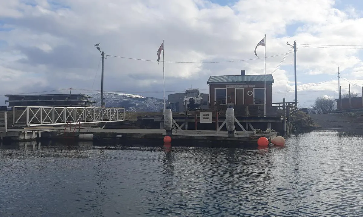
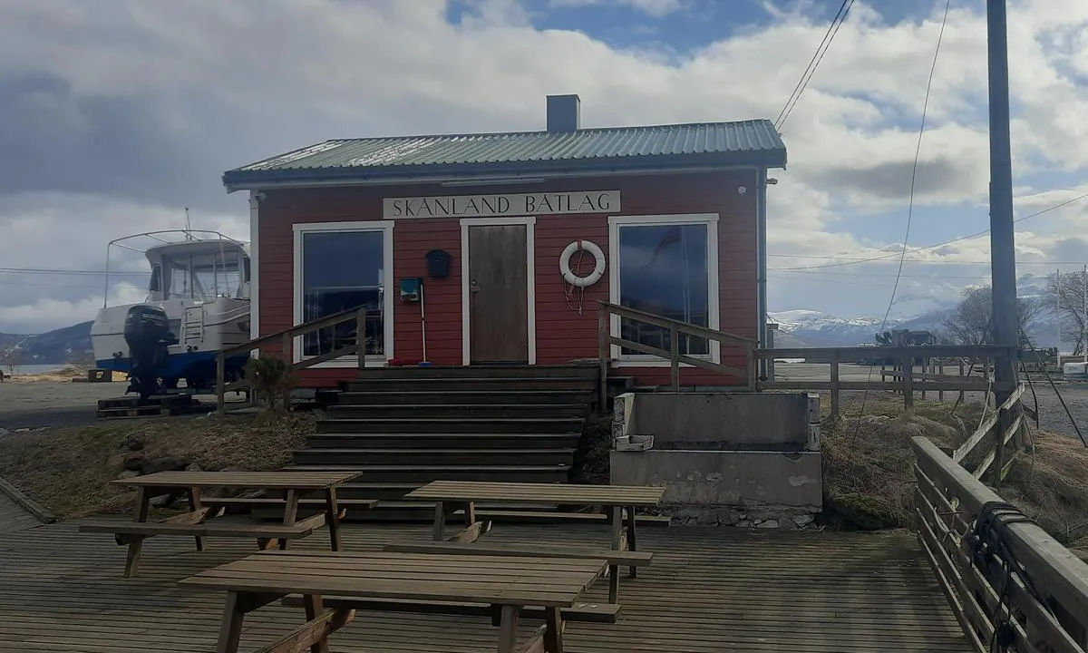
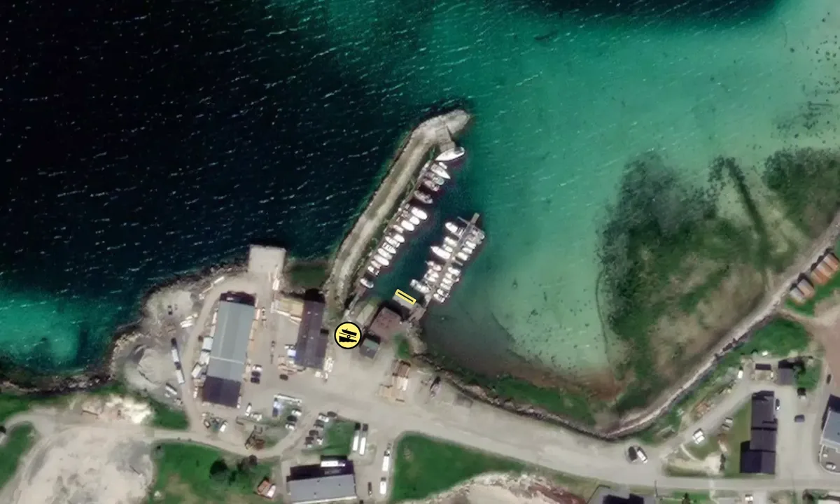
Good access and the guest pier is well marked. Nice spot for boats up to 35 feet on the front side of the pier. Significantly smaller boats on the other side, as the water level is much lower there. One power outlet.

[translated from Norwegian with AI]

1 x helpful | written on 20. Jul 2024

Do you know this harbour? It's a huge help to other sailors if you add a short description or review of the harbour.

📜 Add description

Map of Evenskjær

Facilities

Available facilities: Shore power, Fresh water.

Updated on 2. May 2025. Update facilities.

Mooring

Options for mooring in this harbour: To pier/wharf.

Updated on 2. May 2025. Update mooring.

Wind protection

Protection next night

68 points

N E S W --> } } } } } } } } } } } } } } } } } } } } } } } } } } } } } } } } } } } } } } } } } } } } } } } } } } } } } } } } } } } } } } } } } } } } } } } } } } } } } } } } } } } } } } } } } } } } } } } } } } } } } } } } } } } } } } } } } } } } } } } } } } } } } } } } } } } } } } } } } } } } } } } } } } } } } } } } } } } } } } } } } } } } } } } } } } } } } } } } } } } } } } } } } } } } } } } } } } } } } } } } } } } } } } } } } } } } } } } } } } } } } } } } } } } } } } } } } } } } } } } } } } } } } } } } } } } } } } } } } } } } } } } } } } } } } } } } } } } } } } } } } } } } } } } } } } } } } } } } } } } } } } } } } } } } } } } } } } } } } } } } } } } } } } } } } } } } } } } } } } } } } } } } } } } } } } } } } } } } } } } } } } } } } } } } } } } } } } } } } } } } } } } } } } } } } } } } } } } } } } } } } } } } } } } } } } } } } } } } } } } } } } } } } } } } } } } } } } } } } } } } } } } } } } } } } } } } } } } } } } } } } } } } } } } } } } } } } } } } } } } } } } } } } } } } } } } } } } } } } } } } } } } } } } } } } } } } } } } } } } } } } } } } } } } } } } } } } } } } } } } } } } } } } } } } } } } } } } } } } } } } } } } } } } } } } } } } } } } } } } } } } } } } } } } } } } } } } } } } } } } } } } } } } } } } } } } } } } } } } } } } } } } } } } } } } } } } } } } } } } } } } } } } } } } } } } } } } } } } } } } } } } } } } } } } } } } } } } } } } } } } } } } } } } } } } } } } } } } } } } } } } } } } } } } } } } } } } } } } } } } } } } } } } } } } } } } } } } } } } } } } } } } } } } } } } } } } } } } } } } } } } } } } } } } } } } } } } } } } } } } } } } } } } } } } } } } } } } } } } } } } } } } } } } } } } } } } } } } } } } } } } } } } } } } } } } } } } } } } } } } } } } } } } } } } } } } } } } } } } } } } } } } } } } } } } } } } } } } } } } } } } } } } } } } } } } } } } } } } } } } } } } } } } } } } } } } } } } } } } } } } } } } } } } } } } } } } } } } } } } } } } } } } } } } } } } } } } } } } } } } } } } } } } } } } } } } } } } } } } } } } Next night 12:00 Tir 13 Mai 18:00 0:00 6:00 12:00 Ons 14 Mai 18:00 11m/s 1m/s

Want to know how the wind score works? Then you should read this explanation.

The wind forecasts come from yr.no (Norwegian Meteorological Institute), and was last updated 1 hour and 52 minutes ago (Tuesday 13 May 07:34 AM). The next night score shows you the worst hour between 22:00 and 08:00 the next night. We recommend that you check multiple sources for wind forecasts. windy.com is a good website to show larger wind systems.

The safe directions for this harbour was added at None. Click here to edit.

Last visits to Evenskjær

Thu 08 Feb 2024

FAY MARI [MMSI: 257997190]

Thu 11 Jan 2024

AEGIR [MMSI: 258190070]

Wed 03 Jan 2024

EOS [MMSI: 257832190]

Sun 01 Oct 2023

EOS [MMSI: 257832190]

Thu 31 Aug 2023

FAY MARI [MMSI: 257997190]

The visits are retrieved from AIS data. You can click to see all visiting ships to Evenskjær, as well as statistics about the ships that visits

Add this harbour to a journey

Check in now

Choose a different date than today

Important: When you check in to a harbour, you add it to a journey on this website. You are not booking a place in the marina.

Contributors

Users that contributed to this page: k a, Anita Winther and Chris SV Blue Peter

harbourmaps.com is updated by the boating community. When you add information, a review or pictures to this page you are listed here with the other contributors (we list your user-name, which can be your real name or a pseudonym).

Closest harbours to Evenskjær

Filter by

Natural harbour
Marina
Safe wind next night

Order by

ABC
Popularity
Wind score next night

0 harbours

Show more harbours