


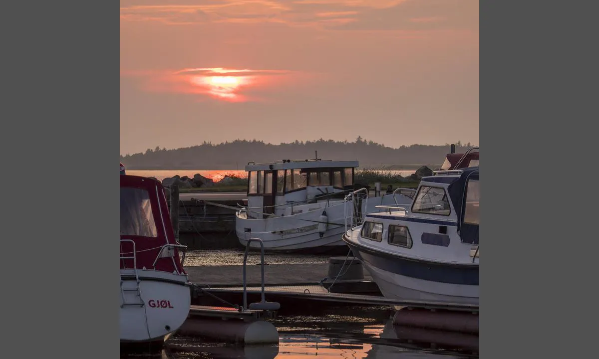
Gjøl Fiskeri og Lystbådehavn
Marina

Region: Denmark (630), Jylland (240), Limfjorden (72) and Aabybro (1)


Descriptions and reviews
Jute of Cowes
 says:
says:
area

maritime qualities
description
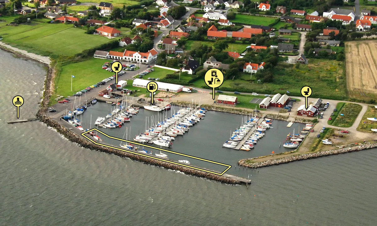
Fairly simple approach using Navionics. Little more than 2m in entrance and some places in harbour.
Guests can look for green finger berths or berth alongside the breakwater with water and electricity.
Plenty of space 15th August. 180 Danish Kroner including electricity, showers and washing machine.

1 x helpful | written on 15. Aug 2024
Do you know this harbour? It's a huge help to other sailors if you add a short description or review of the harbour.
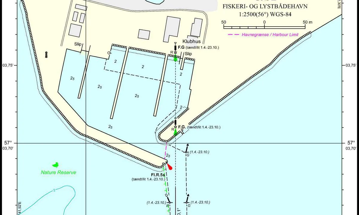
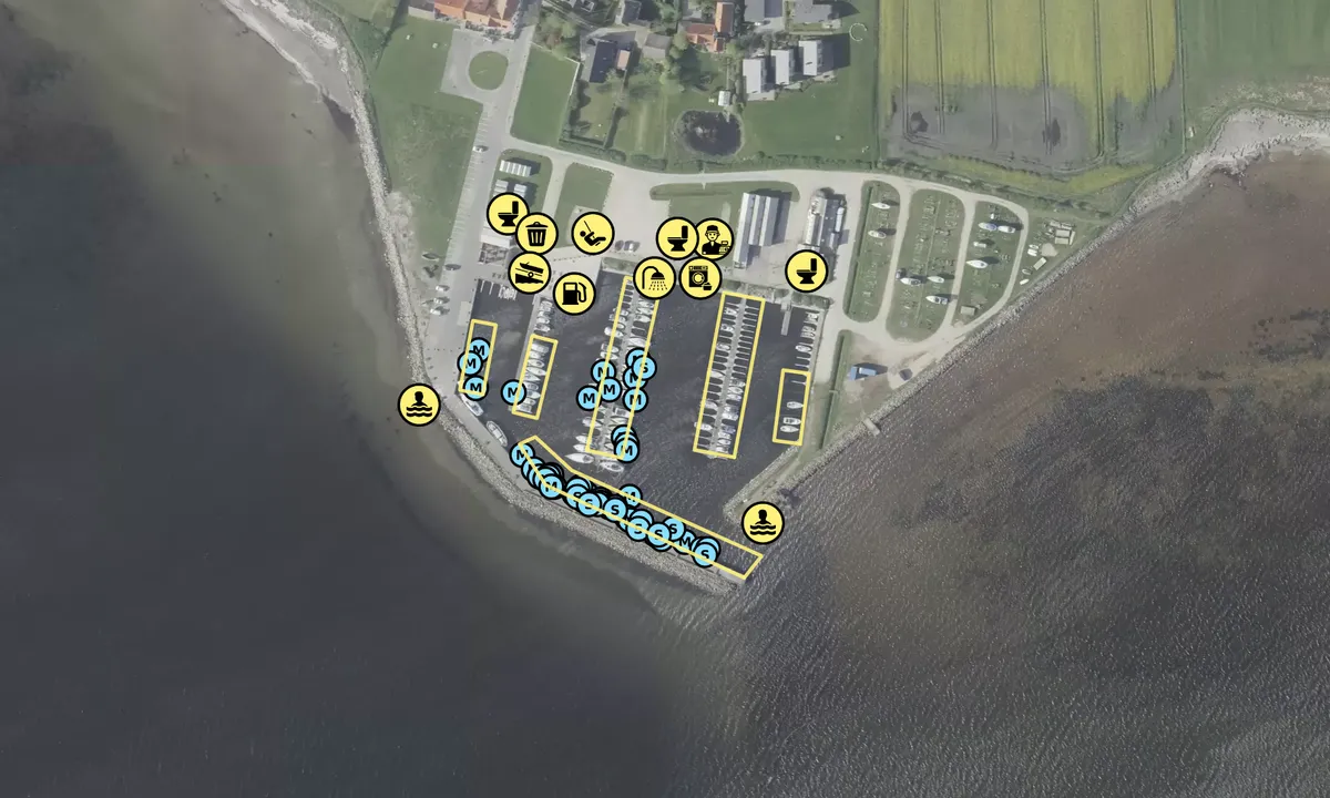
Map of Gjøl Fiskeri og Lystbådehavn

Wind protection
Protection next night
89 points


Want to know how the wind score works? Then you should read this explanation.
The wind forecasts come from yr.no (Norwegian Meteorological Institute), and was last updated 1 hour and 28 minutes ago (Wednesday 15 July 06:28 PM). The next night score shows you the worst hour between 22:00 and 08:00 the next night. We recommend that you check multiple sources for wind forecasts. windy.com is a good website to show larger wind systems.

The safe wind directions for this harbour has been decided by an algorithm, based on how elevated the land around the harbour is. It's mostly correct, but sometimes the underlying data about elevation levels is not good enough to make correct decisions. It's a great help to other if you can validate or adjust the safe wind directions. You can see the data used by the algorithm to decide the safe wind directions by clicking here.
Last visits to Gjøl Fiskeri og Lystbådehavn
Tue 14 Jul 2026 |
|
|
|
|
|
|
Sat 11 Jul 2026 |
|
|
|
|
 GAUDII 2 [MMSI: 211401080]
 BINCK [MMSI: 219021191]
 NEVIS [MMSI: 244373063]
The visits are retrieved from AIS data. You can click to see all visiting ships to Gjøl Fiskeri og Lystbådehavn, as well as statistics about the ships that visits
Add this harbour to a journey
Choose a different date than today
Important: When you check in to a harbour, you add it to a journey on this website. You are not booking a place in the marina.
Contributors
Users that contributed to this page: HarbourMaps (site admin), Per kristian, Olav Pekeberg, Amarose, Tranquillitas, Tim Holst Gregersen and Henrik Kildegaard
harbourmaps.com is updated by the boating community. When you add information, a review or pictures to this page you are listed here with the other contributors (we list your user-name, which can be your real name or a pseudonym).
Closest harbours to Gjøl Fiskeri og Lystbådehavn
Filter by
Order by
0 harbours
Show more harbours
