













Hamnaberget småbåtforening gjestehavn
Natural harbour

Region: Norway (3487), Møre og Romsdal (310), Hustadvika (20), Bud (7) and Nørdre Bjørnsund (3)

Show off your photos and help others plan their journey to Hamnaberget småbåtforening gjestehavn.








Descriptions and reviews
Kjetil Kroknes says:
area

maritime qualities
description
Approach
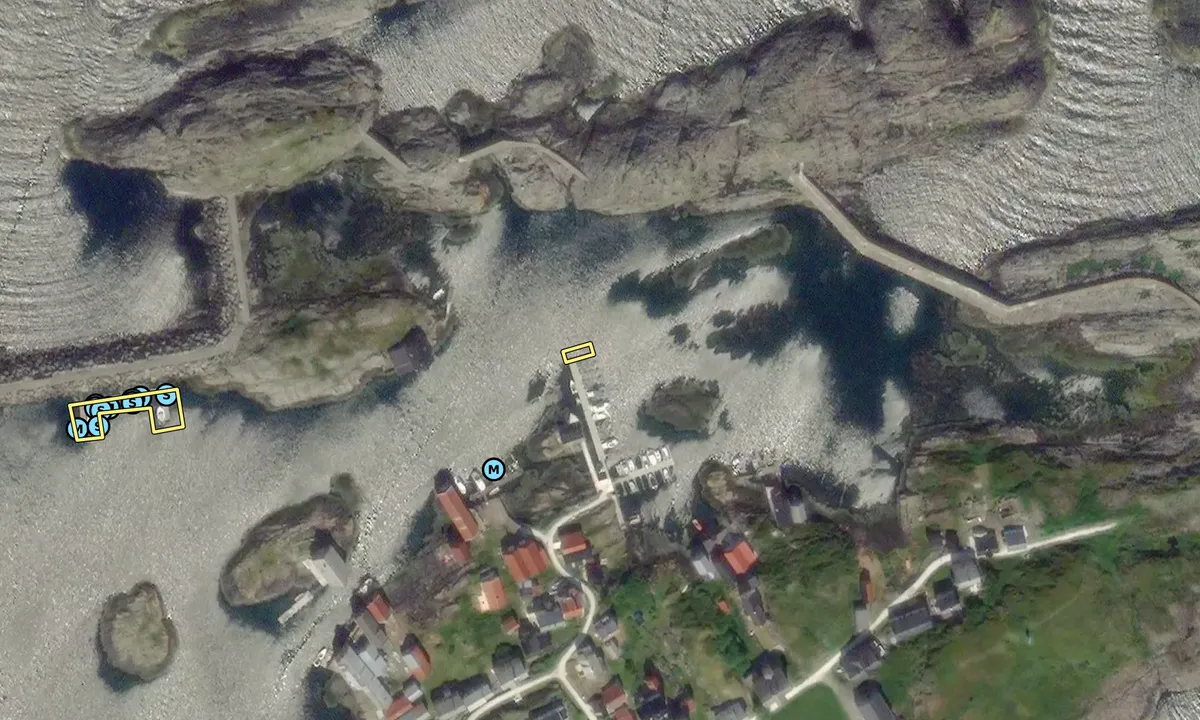
It is possible to approach the islands from different directions. If you are coming from the north through the inner route via Hustadvika, you turn westwards at Bud and pass through Bjørnøysundet (between Nordre Bjørnsund and Bjørnøya). Watch out for the unmarked Digergallet, which you will pass portside before you go through Bjørnøysundet. If you are coming from the north through the outer route past Hustadvika, stay well within Galdeskjæra and head towards Bjørnsund Lighthouse. If the sea is not rough, go between the small island Bollen and the lighthouse island (Måøya), before navigating around either the east or west side of Søndre Bjørnsund. If the sea is rough, it may be safer to head towards Bud and enter Bjørnsund through Bjørnøysundet. If you are coming from the south through the route from Ålesund, either continue towards outer Hustadvika and turn in between Bollen and the lighthouse island (Måøya), or go south of Søre Orholmskjæret and navigate cautiously past the markers. Common to all approaches is treacherous waters, and you need to closely follow the chart/GPS.
See the pictures, which indicate a typical place where many sailboats run aground. In the inner harbor, it feels natural to follow the red dotted line, but several sailboats get stuck here every summer. Instead, follow the blue dotted line towards the guest piers.
There is also an overhead cable with a clearance of 22 meters on your way into the harbor.
[translated from Norwegian with AI]

1 x helpful | written on 7. Jul 2026
Do you know this harbour? It's a huge help to other sailors if you add a short description or review of the harbour.
Map of Hamnaberget småbåtforening gjestehavn

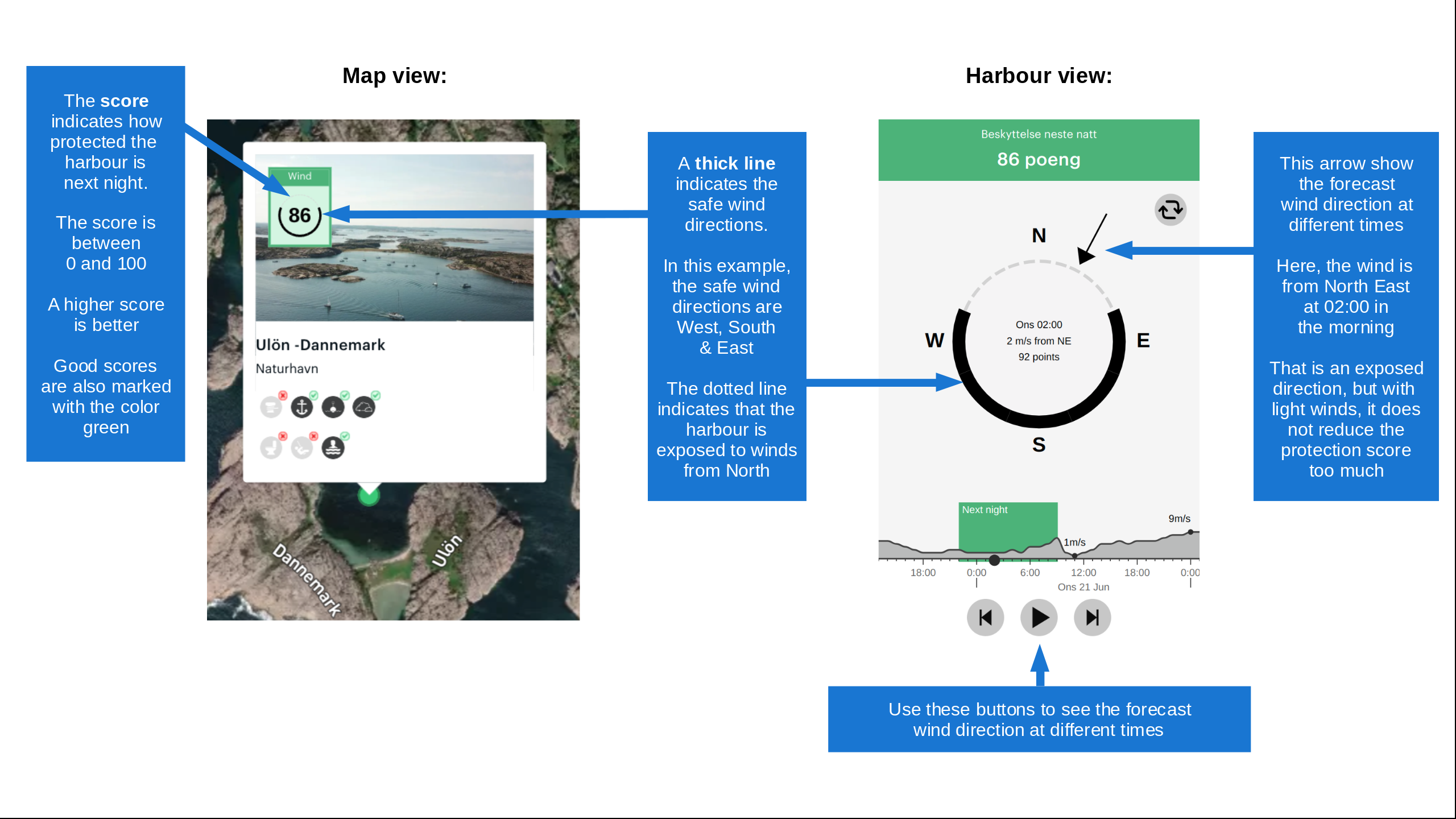
Wind protection
Protection next night
58 points



Want to know how the wind score works? Then you should read this explanation.
The wind forecasts come from yr.no (Norwegian Meteorological Institute), and was last updated 1 hour and 48 minutes ago (Wednesday 08 July 03:28 PM). The next night score shows you the worst hour between 22:00 and 08:00 the next night. We recommend that you check multiple sources for wind forecasts. windy.com is a good website to show larger wind systems.

The safe wind directions for this harbour has been decided by an algorithm, based on how elevated the land around the harbour is. It's mostly correct, but sometimes the underlying data about elevation levels is not good enough to make correct decisions. It's a great help to other if you can validate or adjust the safe wind directions. You can see the data used by the algorithm to decide the safe wind directions by clicking here.
Last visits to Hamnaberget småbåtforening gjestehavn
Sat 30 Dec 2023 |
|
|
Sat 21 Oct 2023 |
|
|
Thu 27 Jul 2023 |
|
|
 NORVAAG [MMSI: 257881510]
The visits are retrieved from AIS data. You can click to see all visiting ships to Hamnaberget småbåtforening gjestehavn, as well as statistics about the ships that visits
Add this harbour to a journey
Choose a different date than today
Important: When you check in to a harbour, you add it to a journey on this website. You are not booking a place in the marina.
Contributors
Users that contributed to this page: Kjetil Kroknes
harbourmaps.com is updated by the boating community. When you add information, a review or pictures to this page you are listed here with the other contributors (we list your user-name, which can be your real name or a pseudonym).
Closest harbours to Hamnaberget småbåtforening gjestehavn
Filter by
Order by
0 harbours
Show more harbours