


Härmanö - SXK Västkust bouy
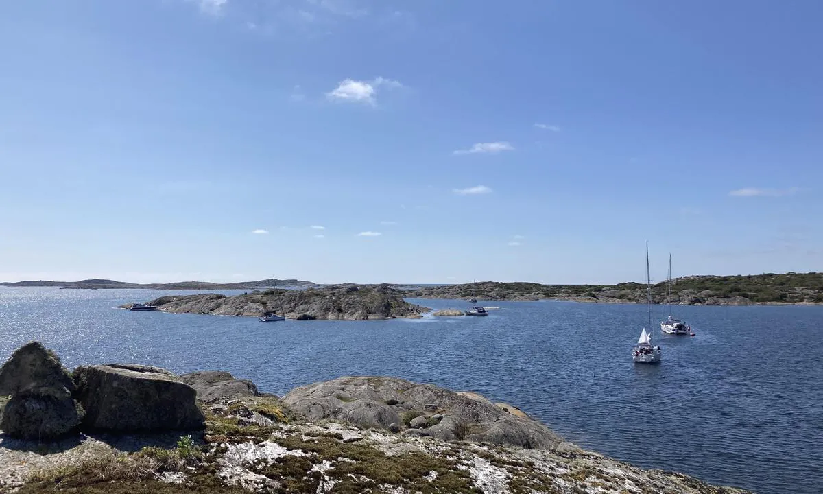
Natural harbour

Region: Sweden (2151), Västra Götaland (666), Västkusten (536), Bohuslän (507), Orust (84) and Gullholmen (8)


Descriptions and reviews
Solveig Risan says:
description
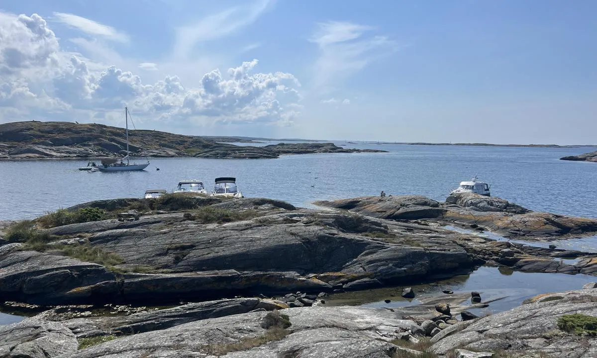
Nice to moor against the rock. Lots of grass at the bottom. Clear water. Great hiking opportunities. Supposedly a 30-minute walk to a restaurant, but we did not test it. Several nice places to anchor where you can find shelter. Also possible to moor to a buoy. We had 2 boats at 37 feet. Note, somewhat shallower on the right side at the entrance.
[translated from Norwegian with AI]

1 x helpful | written on 15. Jul 2025 | updated_on 15. Jul 2025
Eirik Siggerud says:
area

maritime qualities

description
We stayed here the night of July 8, 2025. Anchor ⚓️ indicated on the chart plotter, which should mean good holding for the anchor on the bottom. During the night, with wind shifting to NE and about 7 m/s, the anchor did not hold for four out of eight boats. A couple of boats drifted into each other, causing a lot of commotion in the dark. Our own anchor moved about 15 meters in about 2 hours.
[translated from Norwegian with AI]
1 x helpful | written on 8. Jul 2025
aaa says:
description
Entrance
The shoals south-southwest of Slipestenen extend quite far out. There is also a shoal northeast of Roparen.
There are some bolts in the cliff at Roparen, Slipestenen, and Härmanö.
[translated from Norwegian with AI]
1 x helpful | written on 9. Aug 2023
HarbourMaps (site admin) says:
description
The bouy is owned by SXK Västkust
0 x helpful | written on 13. Jul 2022
Do you know this harbour? It's a huge help to other sailors if you add a short description or review of the harbour.
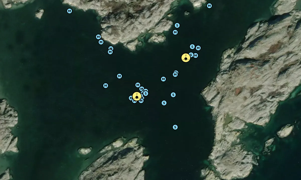
Map of Härmanö - SXK Västkust bouy

Wind protection
Protection next night
48 points


Want to know how the wind score works? Then you should read this explanation.
The wind forecasts come from yr.no (Norwegian Meteorological Institute), and was last updated 1 hour and 36 minutes ago (Saturday 04 July 08:28 PM). The next night score shows you the worst hour between 22:00 and 08:00 the next night. We recommend that you check multiple sources for wind forecasts. windy.com is a good website to show larger wind systems.

The safe wind directions for this harbour has been decided by an algorithm, based on how elevated the land around the harbour is. It's mostly correct, but sometimes the underlying data about elevation levels is not good enough to make correct decisions. It's a great help to other if you can validate or adjust the safe wind directions. You can see the data used by the algorithm to decide the safe wind directions by clicking here.
Last visits to Härmanö - SXK Västkust bouy
Sat 27 Jun 2026 |
|
|
Fri 22 May 2026 |
|
|
Sun 17 Aug 2025 |
|
|
Mon 21 Jul 2025 |
|
|
|
|
 S/Y EVELINA [MMSI: 265569820]
 FREYJA [MMSI: 211463160]
 MARY 1 [MMSI: 229000562]
The visits are retrieved from AIS data. You can click to see all visiting ships to Härmanö - SXK Västkust bouy, as well as statistics about the ships that visits
Add this harbour to a journey
Choose a different date than today
Important: When you check in to a harbour, you add it to a journey on this website. You are not booking a place in the marina.
Contributors
Users that contributed to this page: Solveig Risan and aaa
harbourmaps.com is updated by the boating community. When you add information, a review or pictures to this page you are listed here with the other contributors (we list your user-name, which can be your real name or a pseudonym).
Closest harbours to Härmanö - SXK Västkust bouy
Filter by
Order by
0 harbours
Show more harbours
