Message from the system: You need to be logged in to upload images. You can either log in or create a new user.

Harön - Nordvästra udden

Natural harbour

favoritt

Region: Sweden (2115), Blekinge (79) and Ronneby (18)

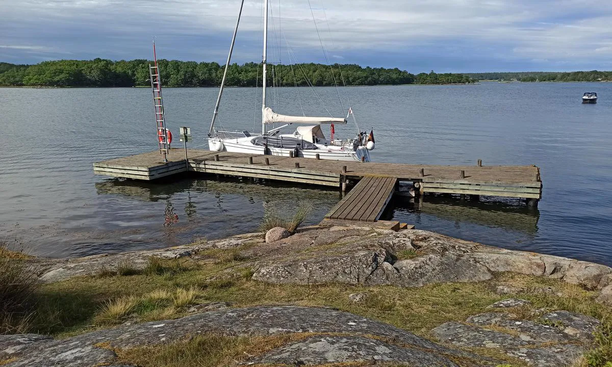
Harön - Nordvästra udden: {"base": "en", "no": "Bryggen p\u00e5 nordvestlige bredden av Har\u00f6n", "se": "Bryggan vid nordv\u00e4stra stranden av Har\u00f6n", "en": "The jetty of northwestern bank of Har\u00f6n", "da": "Kajen p\u00e5 den nordvestlige bred af Har\u00f6n", "fr": "La jet\u00e9e de la rive nord-ouest de Har\u00f6n", "de": "Der Steg der nordwestlichen Uferseite von Har\u00f6n", "es": "El embarcadero del banco noroeste de Har\u00f6n", "it": "Il pontile della sponda nord-occidentale di Har\u00f6n", "pt": "O cais da margem noroeste de Har\u00f6n", "nl": "De steiger van de noordwestelijke oever van Har\u00f6n", "pl": "Pirs p\u00f3\u0142nocno-zachodniego brzegu Har\u00f6n", "uk": "\u041f\u0456\u0440\u0441 \u043f\u0456\u0432\u043d\u0456\u0447\u043d\u043e-\u0437\u0430\u0445\u0456\u0434\u043d\u043e\u0433\u043e \u0431\u0435\u0440\u0435\u0433\u0430 \u0425\u0430\u0440\u0435\u043d\u0430", "ro": "Cheiul malului de nord-vest al Har\u00f6n", "tr": "Har\u00f6n'\u00fcn kuzeybat\u0131 k\u0131y\u0131s\u0131n\u0131n iskele", "el": "\u0397 \u03c0\u03c1\u03bf\u03b2\u03bb\u03ae\u03c4\u03b1 \u03c4\u03b7\u03c2 \u03b2\u03bf\u03c1\u03b5\u03b9\u03bf\u03b4\u03c5\u03c4\u03b9\u03ba\u03ae\u03c2 \u03cc\u03c7\u03b8\u03b7\u03c2 \u03c4\u03b7\u03c2 \u03a7\u03b1\u03c1\u03cc\u03bd", "cs": "Molo severoz\u00e1padn\u00edho b\u0159ehu Har\u00f6nu", "hu": "Har\u00f6n \u00e9szaknyugati partj\u00e1nak m\u00f3l\u00f3ja", "fi": "Har\u00f6n luoteisrannan laituri", "bg": "\u041f\u0440\u0438\u0441\u0442\u0430\u043d\u0438\u0449\u0435\u0442\u043e \u043d\u0430 \u0441\u0435\u0432\u0435\u0440\u043e\u0437\u0430\u043f\u0430\u0434\u043d\u0438\u044f \u0431\u0440\u044f\u0433 \u043d\u0430 \u0425\u0430\u0440\u044c\u043e\u043d", "sr": "Pristani\u0161te severozapadne obale Har\u00f6na", "et": "Har\u00f6ni loodepoolse kalda kai", "lv": "Har\u0113ns zieme\u013crietumu krasta gatve", "lt": "\u0160iaur\u0117s vakar\u0173 Har\u00f6n krantin\u0117s prieplauka"}
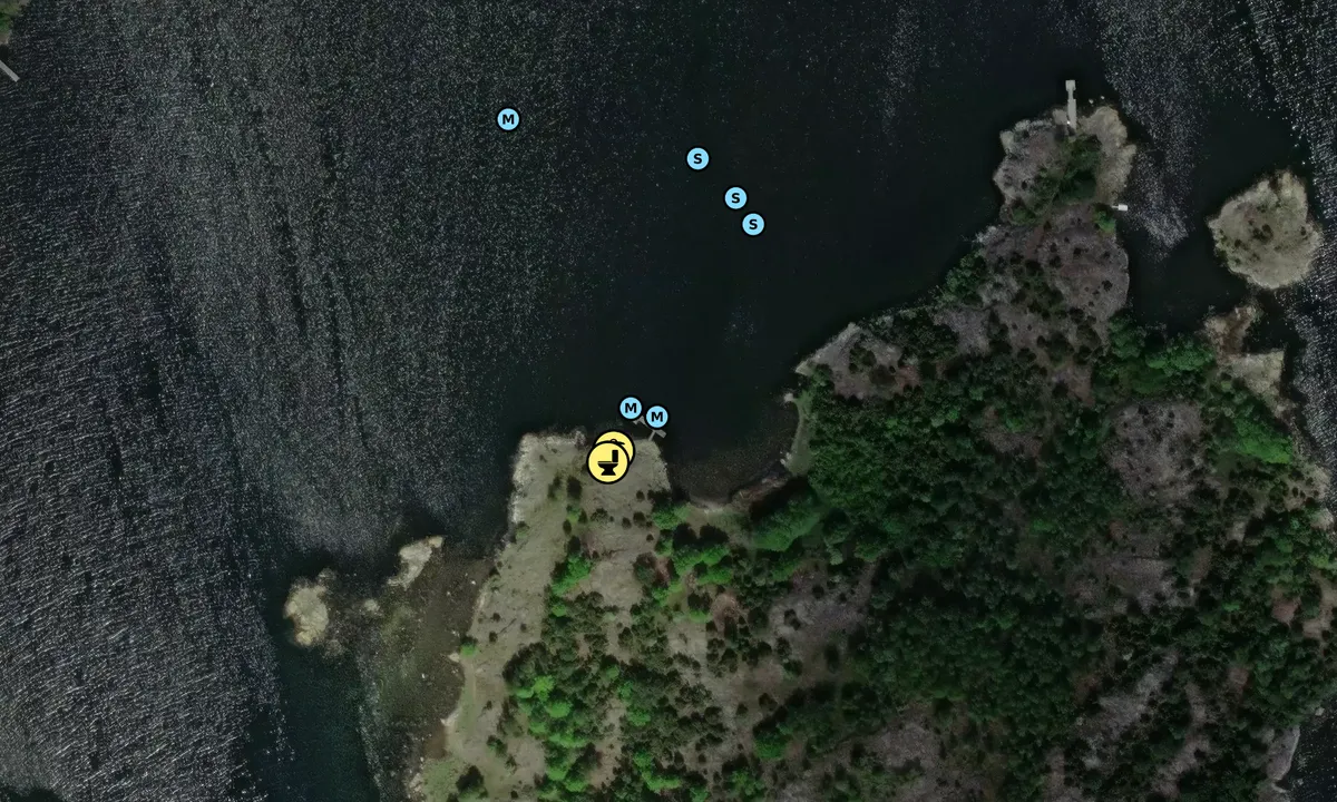
Satelite image of Harön - Nordvästra udden

📸 Upload a photo

Show off your photos and help others plan their journey to Harön - Nordvästra udden.harbourmaps.com is created by the sailing community, in a collective effort to make cruising simpler and more fun. Uploading a photo takes less than a minutes and can be done from your phone, tablet or laptop.

📸 Upload a photo

Facilities

Available facilities: Toilet.

Updated on 23. Jul 2025. Update facilities.

Mooring

Options for mooring in this harbour: To pier/wharf, Anchoring, Towards land.

Updated on 23. Jul 2025. Update mooring.

Descriptions and reviews

Joachim K. says:

description

Beautiful natural harbor on the northwest side of Harön.
The water depth at the approximately 15-meter-long wooden jetty is about 2-2.5 meters. Mooring is possible with a stern anchor or alongside.
There is a dry toilet and a small beach.

1 x helpful | written on 23. Jul 2025

Do you know this harbour? It's a huge help to other sailors if you add a short description or review of the harbour.

📜 Add description

Map of Harön - Nordvästra udden

Facilities

Available facilities: Toilet.

Updated on 23. Jul 2025. Update facilities.

Mooring

Options for mooring in this harbour: To pier/wharf, Anchoring, Towards land.

Updated on 23. Jul 2025. Update mooring.

Wind protection

Protection next night

89 points

N E S W --> } } } } } } } } } } } } } } } } } } } } } } } } } } } } } } } } } } } } } } } } } } } } } } } } } } } } } } } } } } } } } } } } } } } } } } } } } } } } } } } } } } } } } } } } } } } } } } } } } } } } } } } } } } } } } } } } } } } } } } } } } } } } } } } } } } } } } } } } } } } } } } } } } } } } } } } } } } } } } } } } } } } } } } } } } } } } } } } } } } } } } } } } } } } } } } } } } } } } } } } } } } } } } } } } } } } } } } } } } } } } } } } } } } } } } } } } } } } } } } } } } } } } } } } } } } } } } } } } } } } } } } } } } } } } } } } } } } } } } } } } } } } } } } } } } } } } } } } } } } } } } } } } } } } } } } } } } } } } } } } } } } } } } } } } } } } } } } } } } } } } } } } } } } } } } } } } } } } } } } } } } } } } } } } } } } } } } } } } } } } } } } } } } } } } } } } } } } } } } } } } } } } } } } } } } } } } } } } } } } } } } } } } } } } } } } } } } } } } } } } } } } } } } } } } } } } } } } } } } } } } } } } } } } } } } } } } } } } } } } } } } } } } } } } } } } } } } } } } } } } } } } } } } } } } } } } } } } } } } } } } } } } } } } } } } } } } } } } } } } } } } } } } } } } } } } } } } } } } } } } } } } } } } } } } } } } } } } } } } } } } } } } } } } } } } } } } } } } } } } } } } } } } } } } } } } } } } } } } } } } } } } } } } } } } } } } } } } } } } } } } } } } } } } } } } } } } } } } } } } } } } } } } } } } } } } } } } } } } } } } } } } } } } } } } } } } } } } } } } } } } } } } } } } } } } } } } } } } } } } } } } } } } } } } } } } } } } } } } } } } } } } } } } } } } } } } } } } } } } } } } } } } } } } } } } } } } } } } } } } } } } } } } } } } } } } } } } } } } } } } } } } } } } } } } } } } } } } } } } } } } } } } } } } } } } } } } } } } } } } } } } } } } } } } } } } } } } } } } } } } } } } } } } } } } } } } } } } } } } } } } } } } } } } } } } } } } } } } } } } } } } } } } } } } } } } } } } } } } } } } } } } } } } } } } } } } } } } } } } } } } } } } } } } } } } } } } } } } } } } } } } } } } } } } } } } } } } } } } } } } } Next night 12:00 Tor 31 Jul 18:00 0:00 6:00 12:00 Fre 01 Aug 18:00 4m/s 1m/s

Want to know how the wind score works? Then you should read this explanation.

The wind forecasts come from yr.no (Norwegian Meteorological Institute), and was last updated 1 hour and 50 minutes ago (Thursday 31 July 07:28 AM). The next night score shows you the worst hour between 22:00 and 08:00 the next night. We recommend that you check multiple sources for wind forecasts. windy.com is a good website to show larger wind systems.

The safe wind directions for this harbour has been decided by an algorithm, based on how elevated the land around the harbour is. It's mostly correct, but sometimes the underlying data about elevation levels is not good enough to make correct decisions. It's a great help to other if you can validate or adjust the safe wind directions. You can see the data used by the algorithm to decide the safe wind directions by clicking here.

Last visits to Harön - Nordvästra udden

Wed 23 Jul 2025

MAXL [MMSI: 211473960]

Tue 08 Jul 2025

MARACUJA [MMSI: 265023080]

Sat 05 Jul 2025

JONATHAN [MMSI: 211193180]

Wed 18 Jun 2025

S/Y PEGASUS [MMSI: 265725320]

Thu 12 Jun 2025

REGINA FELIZ [MMSI: 265653060]

The visits are retrieved from AIS data. You can click to see all visiting ships to Harön - Nordvästra udden, as well as statistics about the ships that visits

Add this harbour to a journey

Check in now

Choose a different date than today

Important: When you check in to a harbour, you add it to a journey on this website. You are not booking a place in the marina.

Contributors

Users that contributed to this page: Joachim K.

harbourmaps.com is updated by the boating community. When you add information, a review or pictures to this page you are listed here with the other contributors (we list your user-name, which can be your real name or a pseudonym).

Closest harbours to Harön - Nordvästra udden

Filter by

Natural harbour
Marina
Safe wind next night

Order by

ABC
Popularity
Wind score next night

0 harbours

Show more harbours