


Hattholmen
Natural harbour

Region: Norway (3487), Agder (287), Vest-Agder (145), Lindesnes (43) and Mandal (21)


Descriptions and reviews
Johan Almqvist
 says:
says:
description
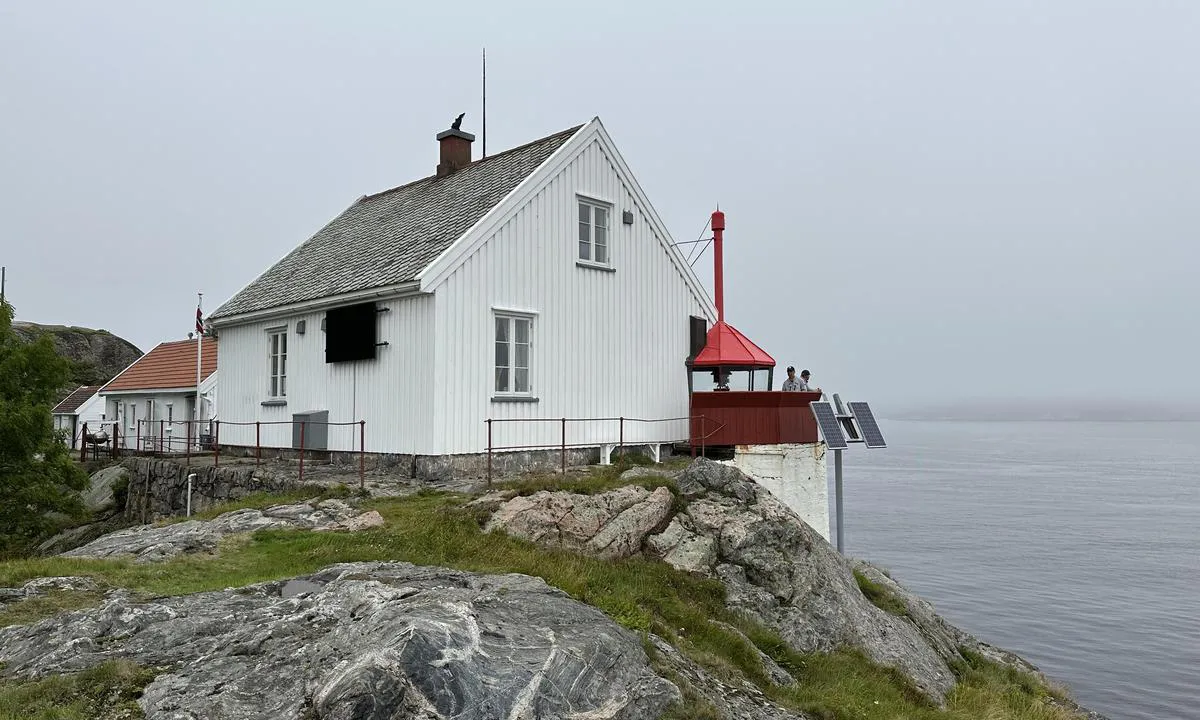
Approach and maritime conditions: The harbor and the lighthouse are maintained by the Mandal coastal team.
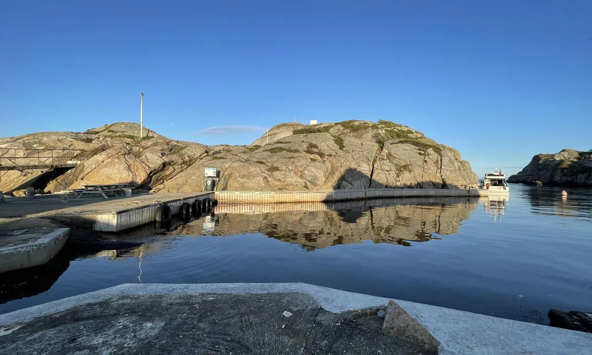
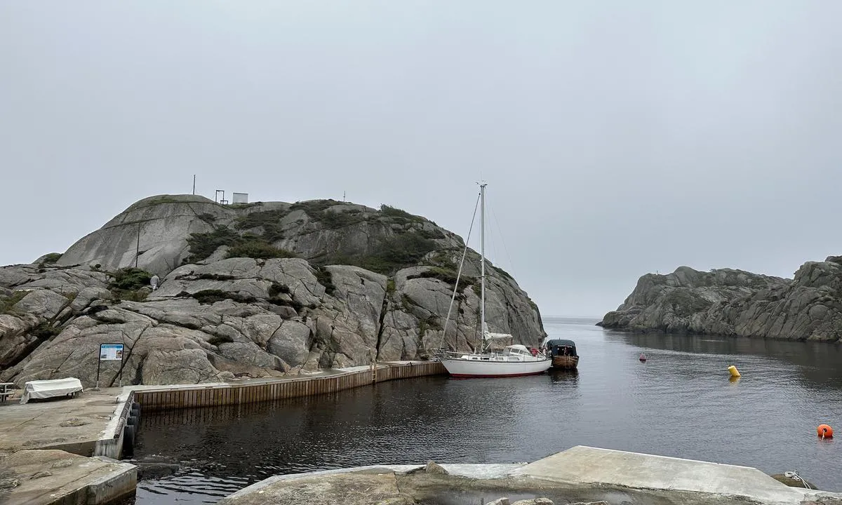
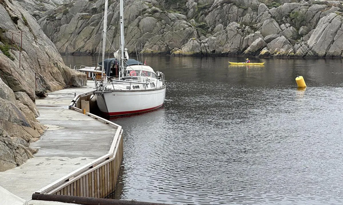
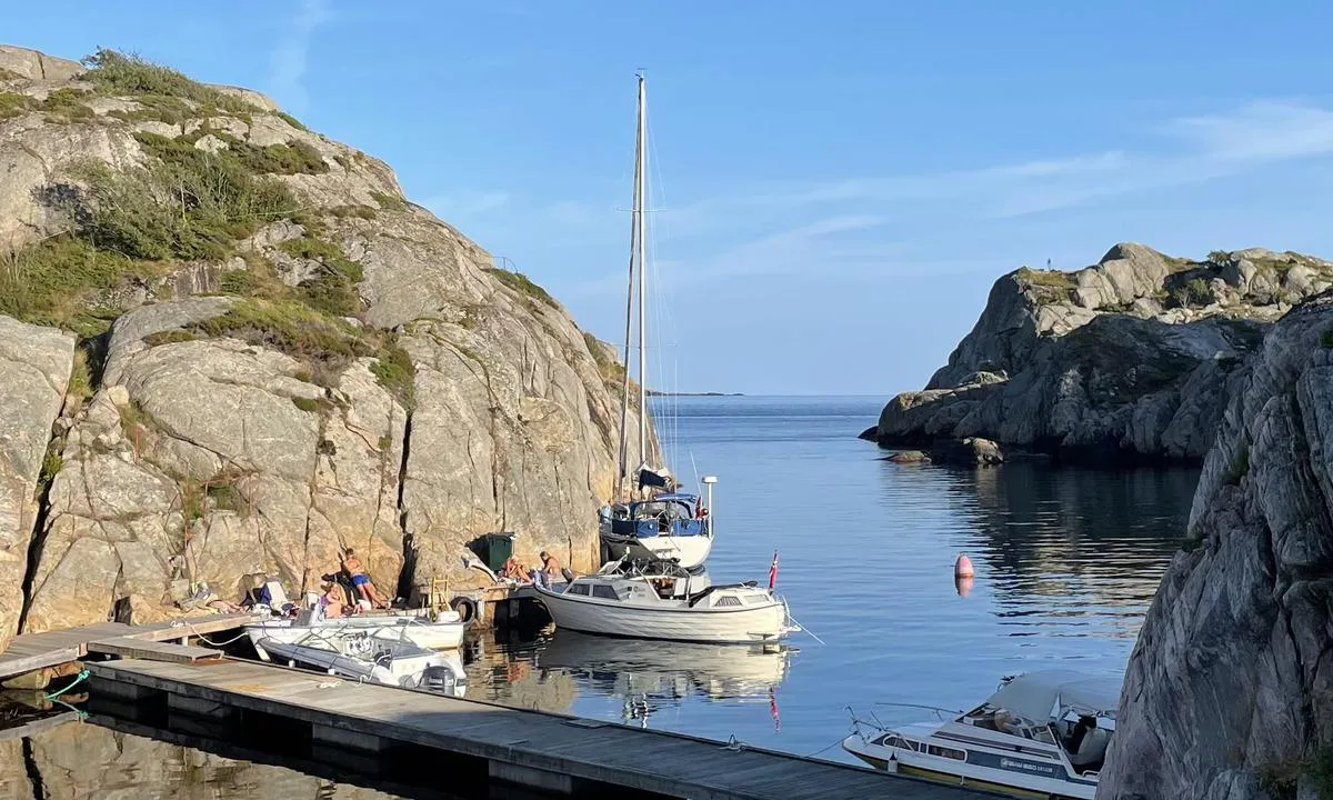
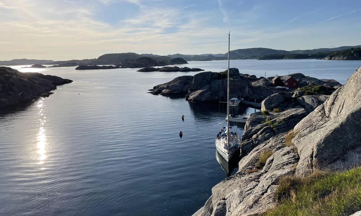
Anchoring: Dock facilities for motorboats in the bay northeast on Indre Hattholmen (the northwestern island). Sailboats can moor alongside bolts in the rock somewhat further east.
The area: Nice view from the top of the islet, by the lighthouse.
[translated from Norwegian with AI]

1 x helpful | written on 1. Jun 2021
Do you know this harbour? It's a huge help to other sailors if you add a short description or review of the harbour.
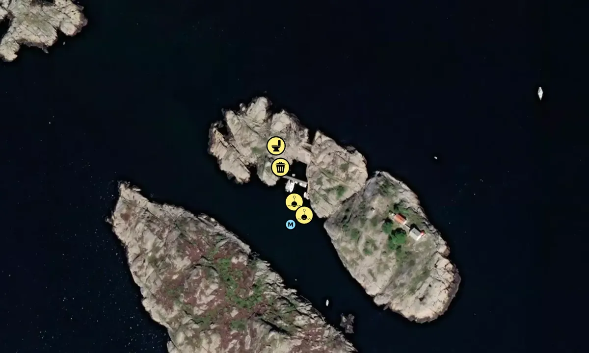
Map of Hattholmen

Wind protection
Protection next night
88 points


Want to know how the wind score works? Then you should read this explanation.
The wind forecasts come from yr.no (Norwegian Meteorological Institute), and was last updated 1 hour and 38 minutes ago (Thursday 09 July 03:28 AM). The next night score shows you the worst hour between 22:00 and 08:00 the next night. We recommend that you check multiple sources for wind forecasts. windy.com is a good website to show larger wind systems.
The safe directions for this harbour was added at 1. Jun 2021. Click here to edit.
Last visits to Hattholmen
Fri 11 Aug 2023 |
|
|
Sat 29 Jul 2023 |
|
|
 BJUTI [MMSI: 258116490]
 TOTALLY KNUTS [MMSI: 235110058]
The visits are retrieved from AIS data. You can click to see all visiting ships to Hattholmen, as well as statistics about the ships that visits
Add this harbour to a journey
Choose a different date than today
Important: When you check in to a harbour, you add it to a journey on this website. You are not booking a place in the marina.
Contributors
Users that contributed to this page: Johnny Eftevand, Ivar Kaas Ibsen, Peter Hammervold and Johan Almqvist
harbourmaps.com is updated by the boating community. When you add information, a review or pictures to this page you are listed here with the other contributors (we list your user-name, which can be your real name or a pseudonym).
Closest harbours to Hattholmen
Filter by
Order by
0 harbours
Show more harbours
