


Hummersundholmen (Brekkestø)
Natural harbour

Region: Norway (3471), Agder (286), Aust-Agder (150), Lillesand (47), Blindleia (30) and Brekkestø (15)


Descriptions and reviews
Knut Kjorkleiv
 says:
says:
description
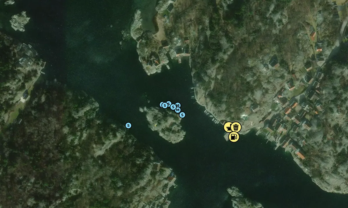
There have been several incidents in Brekkestø where sailboats have come into contact with a power line.
In March 2026, the aerial line was removed and placed in a cable on the seabed. The aerial line is still marked on most charts.
See also https://kommunikasjon.ntb.no/pressemelding/18842431/sjokabel-erstatter-luftledning-ved-brekkesto
[translated from Norwegian with AI]

1 x helpful | written on 26. May 2026
Thorstein Sjursen says:
area

maritime qualities
description
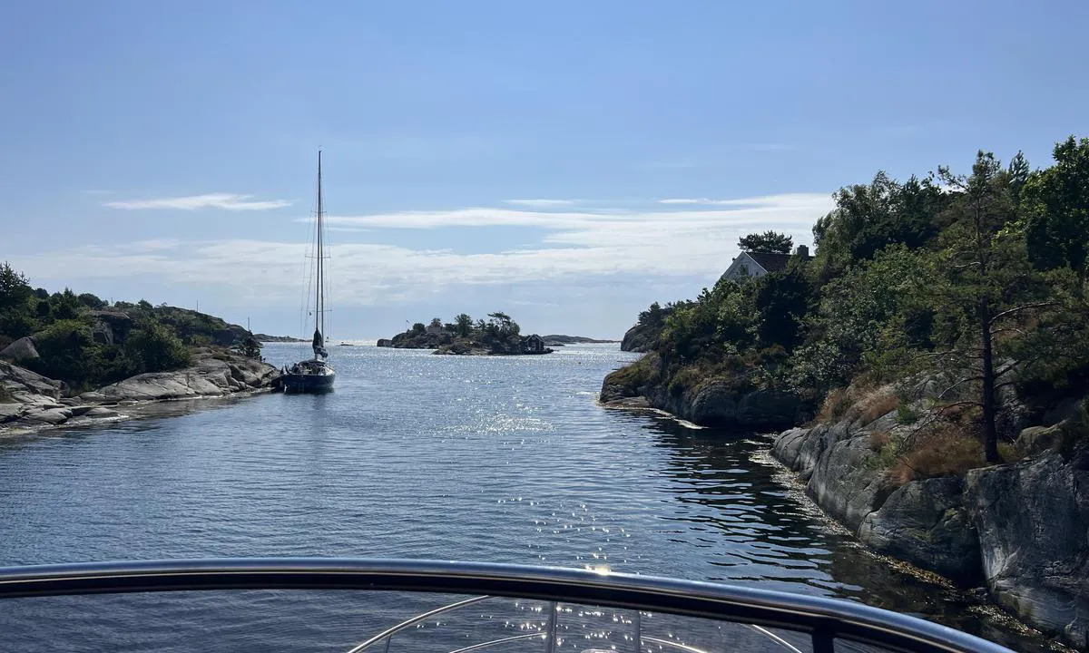
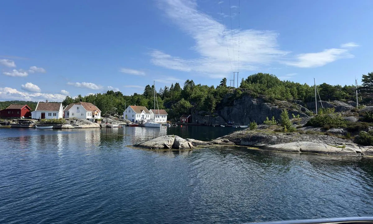
Idyllic and very well protected. Space for two larger boats alongside a steep cliff (approximately 5 meters close to the cliff). Multiple sturdy mooring rings and left-behind pitons. Be aware of the 20-meter-aerial NW of the islet. There is a lot of traffic from cabin residents passing the islet on their way in and out to Brekkestø, so those who want to lie in seclusion should choose another spot. Brekkestø is a stone's throw away with a store, post office, ice cream kiosk, and refueling, WC, and waste disposal.
[translated from Norwegian with AI]
1 x helpful | written on 8. Jul 2024
Do you know this harbour? It's a huge help to other sailors if you add a short description or review of the harbour.
Map of Hummersundholmen (Brekkestø)

Wind protection
Protection next night
92 points


Want to know how the wind score works? Then you should read this explanation.
The wind forecasts come from yr.no (Norwegian Meteorological Institute), and was last updated 1 hour and 36 minutes ago (Tuesday 30 June 09:27 AM). The next night score shows you the worst hour between 22:00 and 08:00 the next night. We recommend that you check multiple sources for wind forecasts. windy.com is a good website to show larger wind systems.
The safe directions for this harbour was added at 9. Jul 2024. Click here to edit.
Last visits to Hummersundholmen (Brekkestø)
Mon 31 Jul 2023 |
|
|
Sun 30 Jul 2023 |
|
|
|
|
Mon 24 Jul 2023 |
|
|
Fri 21 Jul 2023 |
|
|
 OTILIE [MMSI: 257881490]
The visits are retrieved from AIS data. You can click to see all visiting ships to Hummersundholmen (Brekkestø), as well as statistics about the ships that visits
Add this harbour to a journey
Choose a different date than today
Important: When you check in to a harbour, you add it to a journey on this website. You are not booking a place in the marina.
Contributors
Users that contributed to this page: Thorstein Sjursen and Lars Hatletveit
harbourmaps.com is updated by the boating community. When you add information, a review or pictures to this page you are listed here with the other contributors (we list your user-name, which can be your real name or a pseudonym).
Closest harbours to Hummersundholmen (Brekkestø)
Filter by
Order by
0 harbours
Show more harbours
