Kjøpsøy
Natural harbour

Region: Norway (3431), Agder (283), Vest-Agder (142), Lyngdal (10) and Korshamn (7)

Descriptions and reviews
Dan Mossmann says:
says:
area


maritime qualities


description
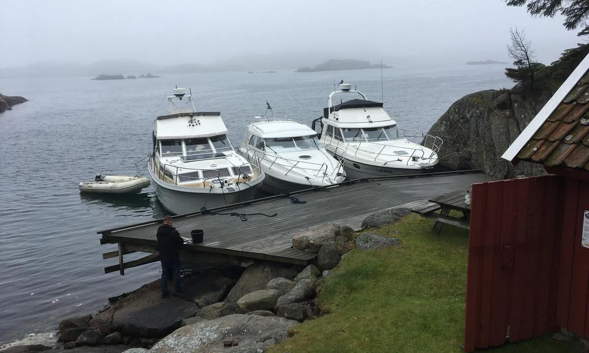
Brygga på styrbord side brukes longside. Rimelig dypt langt inn. Seilbåt ligger fint ytterst.
Brygga foran rødt båthus(Tilhører Lista og Seløer kystlag) kan en legge seg på moringen som ligger foran denne, eller dregg. Bolter i fjell på babord side. (Utenom sesong kan legge seg longside også her da det er dypt nok til det for motorbåter.
Den gule hytta er under renovering og blir trolig klar for utleie som kystledhytte i 2025.
Flotte merkede turstier f.eks opp til kompassrosa (datert til år 1520) som finnes på toppen, midt på øya, med utsikt mot Korshavn.("Fløyet")
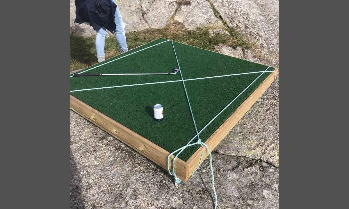
Havgolf på den sydøstlige toppen. Utstyr kjøpes/leies av Korshavn rorbuer.
Historisk har denne øya fungert som handelsplass for spesielt treller, mellom år 750-1200 Evt. (Interneringsleir)
Øya het da Kefsir. Flere slike øyer ligger langs kysten vår, og hadde da samme navn og funksjon.

2 x helpful | written on 30. Aug 2023 | updated_on 3. Jun 2025
Lyngdalsperla says:
description
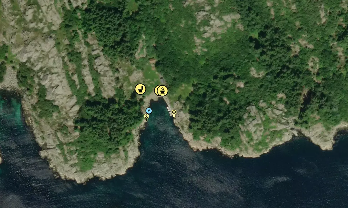
Approach and maritime conditions: Kjøpsøy is located between Korshamn and Selør
Anchorage: There is a solid quay with the possibility to moor with a sailboat at the very end
The area: nice trails up to the top where there is a beautiful viewpoint
[translated from Norwegian with AI]

1 x helpful | written on 16. Sep 2021
Do you know this harbour? It's a huge help to other sailors if you add a short description or review of the harbour.
Map of Kjøpsøy

Wind protection
Protection next night
60 points


Want to know how the wind score works? Then you should read this explanation.
The wind forecasts come from yr.no (Norwegian Meteorological Institute), and was last updated 1 hour and 37 minutes ago (Tuesday 13 January 06:27 PM). The next night score shows you the worst hour between 22:00 and 08:00 the next night. We recommend that you check multiple sources for wind forecasts. windy.com is a good website to show larger wind systems.
The safe directions for this harbour was added at 16. Sep 2021. Click here to edit.
Last visits to Kjøpsøy
Tue 12 Sep 2023 |
|
|
The visits are retrieved from AIS data. You can click to see all visiting ships to Kjøpsøy, as well as statistics about the ships that visits
Add this harbour to a journey
Choose a different date than today
Important: When you check in to a harbour, you add it to a journey on this website. You are not booking a place in the marina.
Contributors
Users that contributed to this page: Lyngdalsperla and Dan Mossmann
harbourmaps.com is updated by the boating community. When you add information, a review or pictures to this page you are listed here with the other contributors (we list your user-name, which can be your real name or a pseudonym).
Closest harbours to Kjøpsøy
Filter by
Order by
0 harbours
Show more harbours


 ULKA [MMSI: 258011350]