


Knutvika
Marina

Region: Norway (3088), Viken (192), Ytre Oslofjord (160), Østfoldkysten (104), Moss (16) og Larkollen (5)


Descriptions and reviews
Bjørn Wilhelmsen says:
area


maritime qualities
description
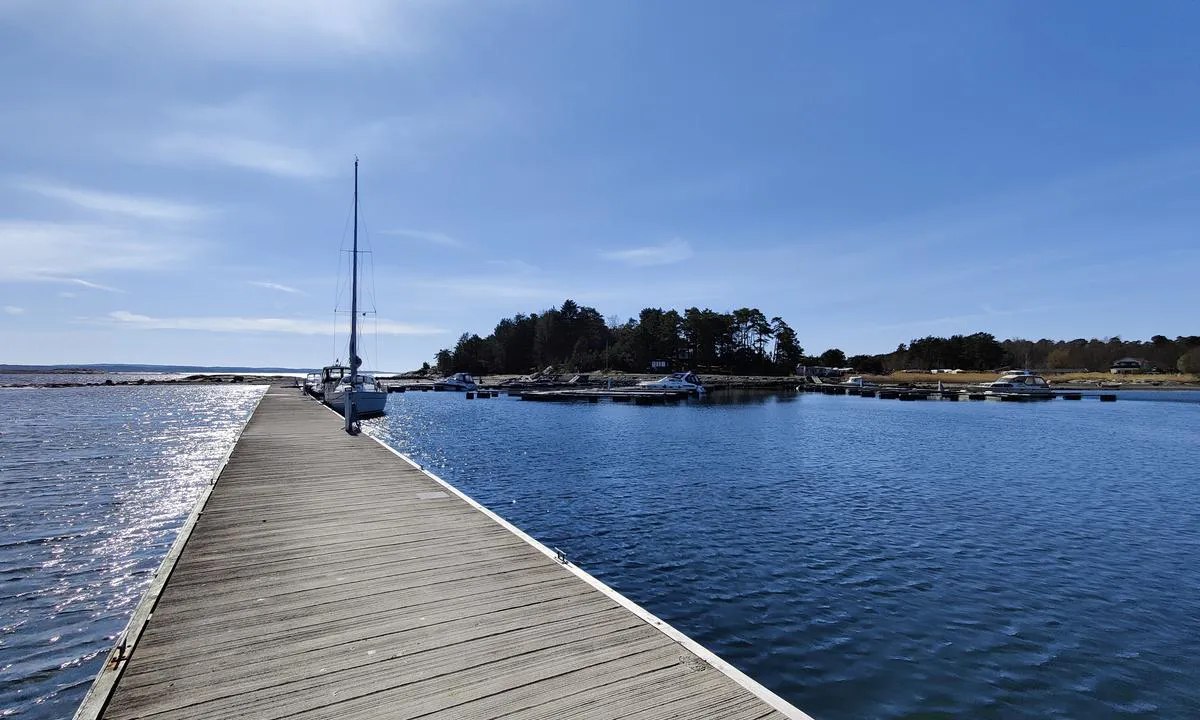
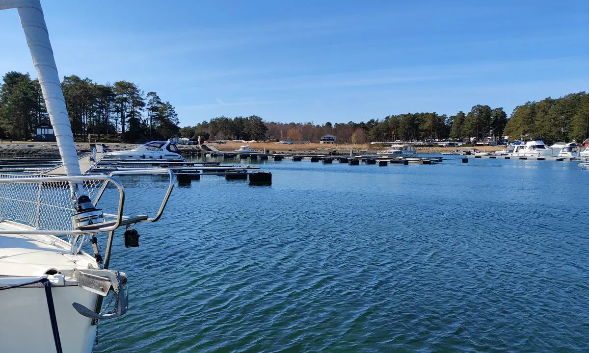
Flytebrygge ytterst i havna. Langside fortøyning på ut- og innside. Utsiden utsatt ved nord og nordøst vind. Dybde +2meter sandbunn. Innseiling - følg sjøkart!
Fin stopp på vei ut/inn fjorden.
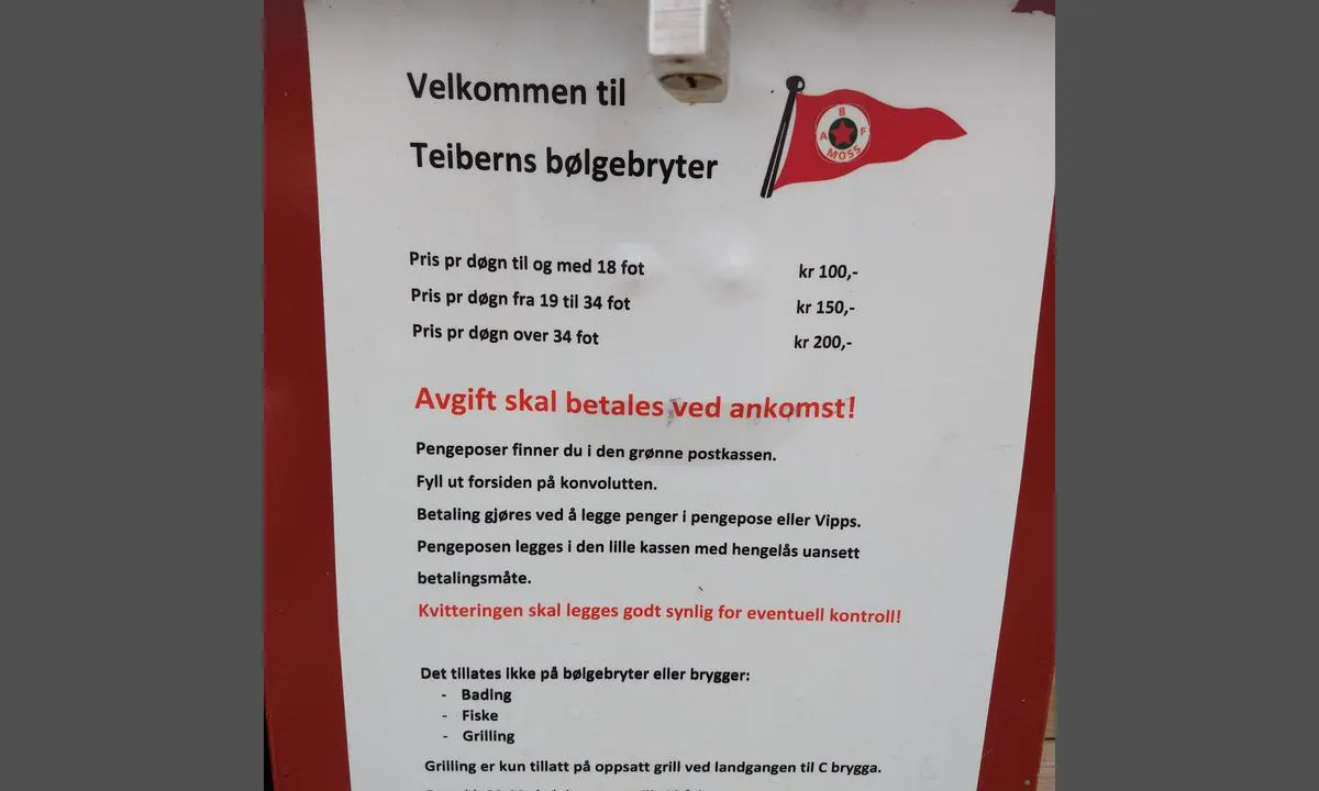
Havneavgift betales med app/Vipps.

1 x helpful | written on 28. May 2023
Do you know this harbour? It's a huge help to other sailors if you add a short description or review of the harbour.
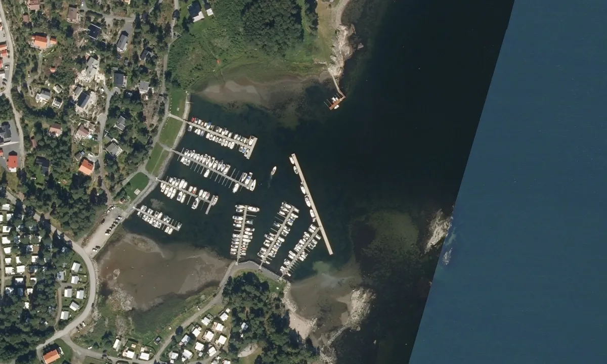
Map of Knutvika

Wind protection
Protection next night
92 points


Want to know how the wind score works? Then you should read this explanation.
The wind forecasts come from yr.no (Norwegian Meteorological Institute), and was last updated 2 hours and 10 minutes ago (Monday 20 May 12:39 AM). The next night score shows you the worst hour between 22:00 and 08:00 the next night. We recommend that you check multiple sources for wind forecasts. windy.com is a good website to show larger wind systems.
The safe directions for this harbour was added at 21. Jun 2021. Click here to edit.
Add this harbour to a journey
Choose a different date than today
Important: When you check in to a harbour, you add it to a journey on this website. You are not booking a place in the marina.
Contributors
Users that contributed to this page: Johann Kjartansson, SY Serenity, ©norgeskart.no, Tom Mamen Braastad og SY Luna
harbourmaps.com is updated by the boating community. When you add information, a review or pictures to this page you are listed here with the other contributors (we list your user-name, which can be your real name or a pseudonym).
Closest harbours to Knutvika
Filter by
Order by
0 harbours
Show more harbours