Langør/Stavn Fjord

Natural harbour

favoritt

Region: Denmark (619), Aarhus Bugt (36) and Samsø (10)

Langør/Stavn Fjord: {"base": "de", "no": "Foto: realdania.dk / Se", "se": "Foto: realdania.dk / Se", "en": "Photo: realdania.dk / View", "da": "Foto: realdania.dk / Se", "fr": "Photo : realdania.dk / Voir", "de": "Foto: realdania.dk / Sehen", "es": "Foto: realdania.dk / Ver", "it": "Foto: realdania.dk / Guarda", "pt": "<img src='realdania.dk' alt='Foto: realdania.dk / Ver' />", "nl": "Foto: realdania.dk / Zien", "pl": "Zdj\u0119cie: realdania.dk / Zobacz", "uk": "\u0424\u043e\u0442\u043e: realdania.dk / \u041f\u0435\u0440\u0435\u0433\u043b\u044f\u043d\u0443\u0442\u0438", "ro": "Foto: realdania.dk / Vedere", "tr": "Foto: realdania.dk / G\u00f6r", "el": "\u03a6\u03c9\u03c4\u03bf\u03b3\u03c1\u03b1\u03c6\u03af\u03b1: realdania.dk / Sehen", "cs": "Foto: realdania.dk / Zobrazit", "hu": "Fot\u00f3: realdania.dk / N\u00e9zd", "fi": "Kuva: realdania.dk / N\u00e4e", "bg": "\u0421\u043d\u0438\u043c\u043a\u0430: realdania.dk / \u0412\u0438\u0436", "sr": "Fotografija: realdania.dk / Pogledajte", "et": "Foto: realdania.dk / Vaata", "lv": "Foto: realdania.dk / Skat\u012bt", "lt": "Nuotrauka: realdania.dk / \u017di\u016br\u0117kite"}
Langør/Stavn Fjord
Langør/Stavn Fjord: {"base": "no", "no": "Mot nord\u00f8st", "se": "Mot nordost", "en": "Towards the northeast", "da": "Mod nord\u00f8st"}
Langør/Stavn Fjord: {"base": "da", "no": "Ti minutter med jolle inn til Lang\u00f8r havn", "se": "Tio minuter med jolle in till Lang\u00f6r hamn", "en": "Ten minutes by dinghy to Lang\u00f8r harbor", "da": "Ti minutter med jolle inn til Lang\u00f8r havn"}
Langør/Stavn Fjord: {"base": "no", "no": "Klokket\u00e5rnet tilh\u00f8rer kirken som ligger litt vekk fra plassen, s\u00e5 ved feil vindretning kunne ikke buboerne h\u00f8re klokkene, derfor denne", "se": "Klocktornet tillh\u00f6r kyrkan som ligger lite bort fr\u00e5n platsen, s\u00e5 vid fel vindriktning kunde inv\u00e5narna inte h\u00f6ra klockorna, d\u00e4rf\u00f6r detta", "en": "The bell tower belongs to the church which is situated a bit away from the place, so with the wrong wind direction, the residents couldn't hear the bells, therefore this", "da": "Klokket\u00e5rnet tilh\u00f8rer kirken, som ligger lidt v\u00e6k fra pladsen, s\u00e5 ved forkert vindretning kunne buboerne ikke h\u00f8re klokkerne, derfor denne"}
Langør/Stavn Fjord: {"base": "no", "no": "Utkikken p\u00e5 Bjalleberg, tungt \u00e5 sykle opp, men g\u00e5r ille fort ned", "se": "Utkiken p\u00e5 Bjalleberg, tungt att cykla upp, men g\u00e5r v\u00e4ldigt fort ner", "en": "The lookout at Bjalleberg, tough to cycle up, but goes wickedly fast down", "da": "Udkigsposten p\u00e5 Bjalleberg, tungt at cykle op, men g\u00e5r rasende hurtigt ned"}
Langør/Stavn Fjord: {"base": "no", "no": "Thun\u00f8, er ogs\u00e5 en utrolig vakker liten \u00f8y. Ifra utsikten p\u00e5 Bjalleberg", "se": "Thun\u00f8 \u00e4r ocks\u00e5 en otroligt vacker liten \u00f6. Utsikten fr\u00e5n Bjalleberg", "en": "Thun\u00f8 is also an incredibly beautiful little island. From the view at Bjalleberg", "da": "Tun\u00f8, er ogs\u00e5 en utrolig smuk lille \u00f8. Fra udsigten p\u00e5 Bjalleberg"}
Langør/Stavn Fjord
Satelite image of Langør/Stavn Fjord

📸 Upload a photo

Show off your photos and help others plan their journey to Langør/Stavn Fjord.harbourmaps.com is created by the sailing community, in a collective effort to make cruising simpler and more fun. Uploading a photo takes less than a minutes and can be done from your phone, tablet or laptop.

📸 Upload a photo

Facilities

Available facilities: Playground, Swimming area.

Updated on 31. Mar 2022. Update facilities.

Mooring

Options for mooring in this harbour: Anchoring.

Updated on 31. Mar 2022. Update mooring.

Descriptions and reviews

Bjørn Solem says:

description

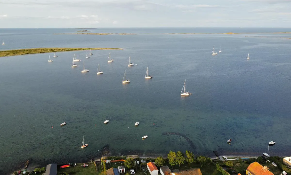
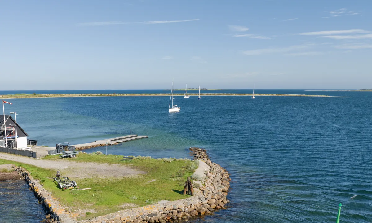
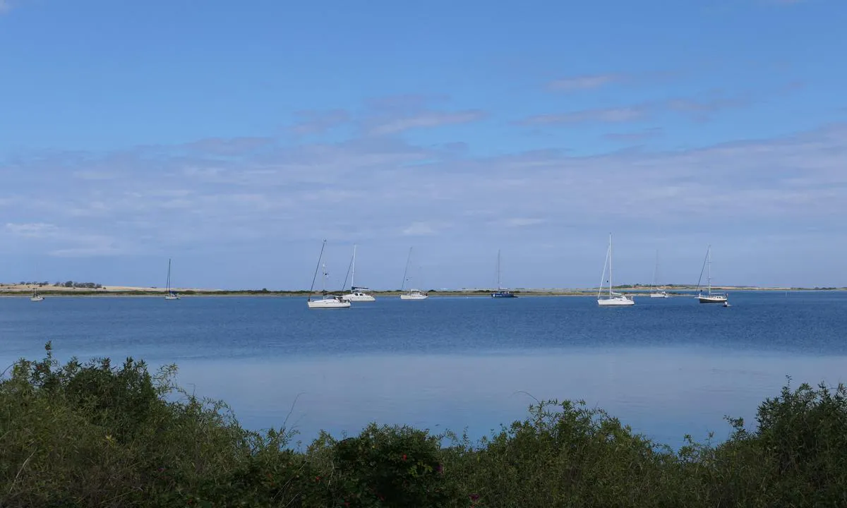
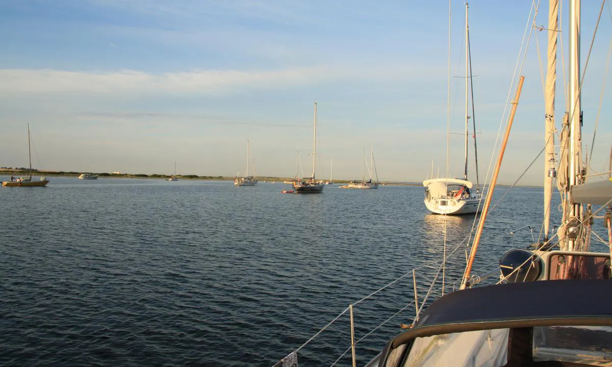
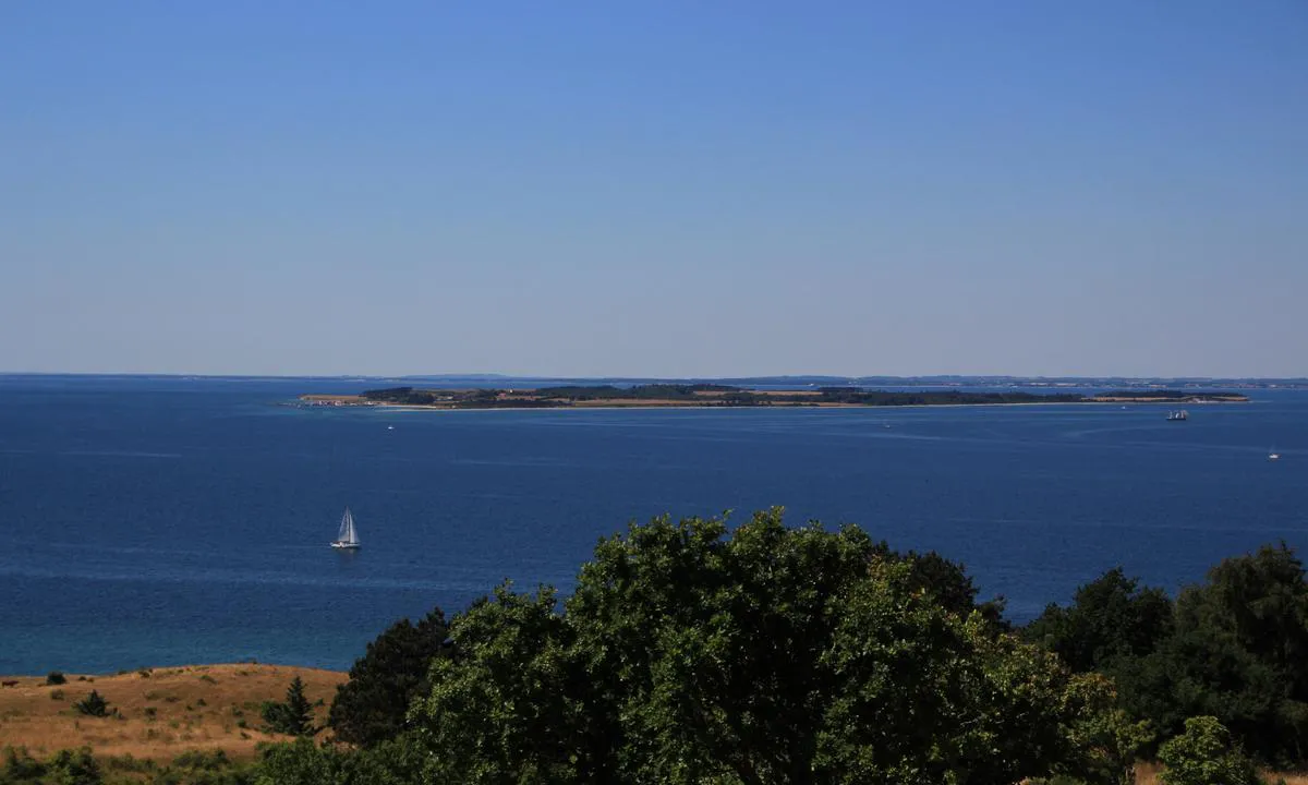
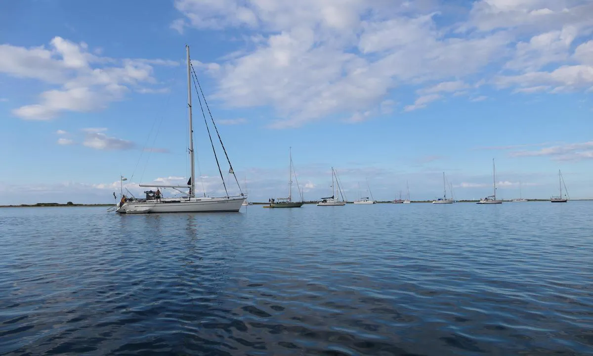
Entrance and maritime conditions: In the middle of the east side of Samsø. Do not enter/exit after daylight; many shallows but well marked with standard buoys. I have a 2 m keel myself and it goes well in the anchorage bay even though it seems too shallow.
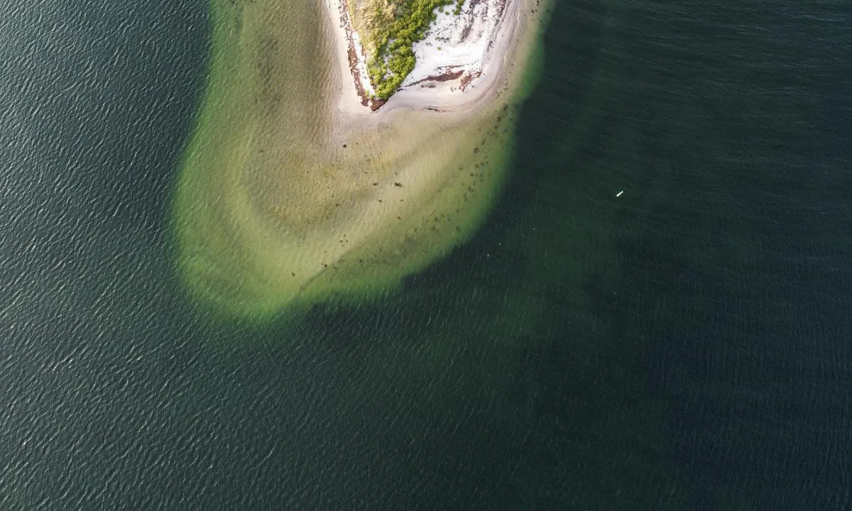
Anchoring: The seabed is sandy, patchily vegetated but clearly visible due to approximately 3 m of water.
The area: This is perhaps the closest you will come to a lagoon in the South Pacific. Low sandbanks surround the entire bay, offering good swimming opportunities. It can get quite windy but without much sea swell.
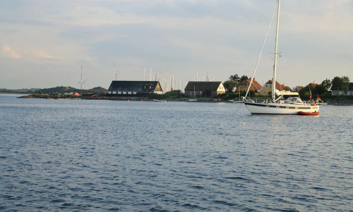
Langør harbor is a ten-minute row away, where there is a small kiosk and toilets with showers. There is also bike rental, self-service. Rent a bike and take a trip northward to the "capital" Nordby, have lunch at one of the many small cafes. Also, take a trip up to the highest point, Bjalleberg, with an incredibly beautiful view especially towards Thunø a little to the west.

[translated from Norwegian with AI]

1 x helpful | written on 31. Mar 2022

Do you know this harbour? It's a huge help to other sailors if you add a short description or review of the harbour.

📜 Add description

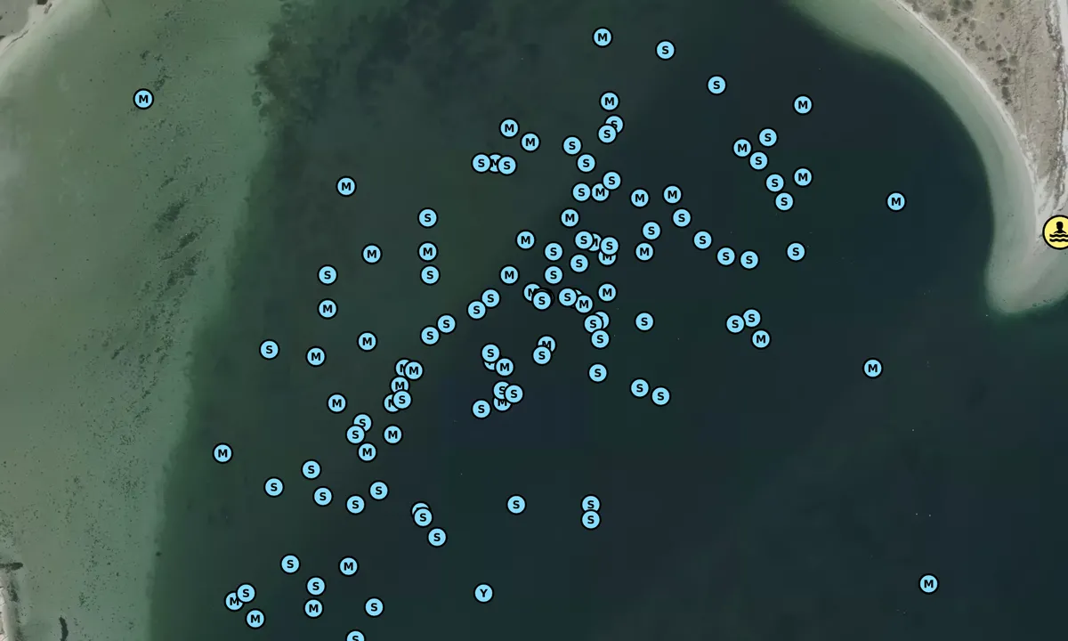
Map of Langør/Stavn Fjord

Facilities

Available facilities: Playground, Swimming area.

Updated on 31. Mar 2022. Update facilities.

Mooring

Options for mooring in this harbour: Anchoring.

Updated on 31. Mar 2022. Update mooring.

Wind protection

Protection next night

93 points

N E S W --> } } } } } } } } } } } } } } } } } } } } } } } } } } } } } } } } } } } } } } } } } } } } } } } } } } } } } } } } } } } } } } } } } } } } } } } } } } } } } } } } } } } } } } } } } } } } } } } } } } } } } } } } } } } } } } } } } } } } } } } } } } } } } } } } } } } } } } } } } } } } } } } } } } } } } } } } } } } } } } } } } } } } } } } } } } } } } } } } } } } } } } } } } } } } } } } } } } } } } } } } } } } } } } } } } } } } } } } } } } } } } } } } } } } } } } } } } } } } } } } } } } } } } } } } } } } } } } } } } } } } } } } } } } } } } } } } } } } } } } } } } } } } } } } } } } } } } } } } } } } } } } } } } } } } } } } } } } } } } } } } } } } } } } } } } } } } } } } } } } } } } } } } } } } } } } } } } } } } } } } } } } } } } } } } } } } } } } } } } } } } } } } } } } } } } } } } } } } } } } } } } } } } } } } } } } } } } } } } } } } } } } } } } } } } } } } } } } } } } } } } } } } } } } } } } } } } } } } } } } } } } } } } } } } } } } } } } } } } } } } } } } } } } } } } } } } } } } } } } } } } } } } } } } } } } } } } } } } } } } } } } } } } } } } } } } } } } } } } } } } } } } } } } } } } } } } } } } } } } } } } } } } } } } } } } } } } } } } } } } } } } } } } } } } } } } } } } } } } } } } } } } } } } } } } } } } } } } } } } } } } } } } } } } } } } } } } } } } } } } } } } } } } } } } } } } } } } } } } } } } } } } } } } } } } } } } } } } } } } } } } } } } } } } } } } } } } } } } } } } } } } } } } } } } } } } } } } } } } } } } } } } } } } } } } } } } } } } } } } } } } } } } } } } } } } } } } } } } } } } } } } } } } } } } } } } } } } } } } } } } } } } } } } } } } } } } } } } } } } } } } } } } } } } } } } } } } } } } } } } } } } } } } } } } } } } } } } } } } } } } } } } } } } } } } } } } } } } } } } } } } } } } } } } } } } } } } } } } } } } } } } } } } } } } } } } } } } } } } } } } } } } } } } } } } } } } } } } } } } } } } } } } } } } } } } } } } } } } } } } } } } } } } } } } } } } } } } } } } } } } } } } } } } } } } } } } } } } } } } } } } Next night 12:00 Ons 19 Mar 18:00 0:00 6:00 12:00 Tor 20 Mar 18:00 6m/s 2m/s

Want to know how the wind score works? Then you should read this explanation.

The wind forecasts come from yr.no (Norwegian Meteorological Institute), and was last updated 2 hours and 5 minutes ago (Wednesday 19 March 09:26 AM). The next night score shows you the worst hour between 22:00 and 08:00 the next night. We recommend that you check multiple sources for wind forecasts. windy.com is a good website to show larger wind systems.

The safe directions for this harbour was added at 31. Mar 2022. Click here to edit.

Langør/Stavn Fjord and/or the surrounding seas is not well protected from strong winds and waves, and you should take caution in foul weather. Click to edit protection level.

Last visits to Langør/Stavn Fjord

Thu 19 Sep 2024

VEGA [MMSI: 219030168]

Tue 03 Sep 2024

COYA [MMSI: 211335930]

GLORIA [MMSI: 211746410]

Mon 02 Sep 2024

ALOA [MMSI: 219023260]

Fri 30 Aug 2024

SY SAILABOUT [MMSI: 219013782]

The visits are retrieved from AIS data. You can click to see all visiting ships to Langør/Stavn Fjord, as well as statistics about the ships that visits

Add this harbour to a journey

Check in now

Choose a different date than today

Important: When you check in to a harbour, you add it to a journey on this website. You are not booking a place in the marina.

Contributors

Users that contributed to this page: Olav Pekeberg, Arjen Weber and Bjørn Solem

harbourmaps.com is updated by the boating community. When you add information, a review or pictures to this page you are listed here with the other contributors (we list your user-name, which can be your real name or a pseudonym).

Closest harbours to Langør/Stavn Fjord

Filter by

Natural harbour
Marina
Safe wind next night

Order by

ABC
Popularity
Wind score next night

0 harbours

Show more harbours