
















Lundeborg Kirke bouy

Natural harbour

favoritt

Region: Denmark (636), Fyn (97) and Hesselager (4)

Do you know this harbour?

harbourmaps.com is created by the sailing community, but there is no information on this page yet.

If you answer some quick questions or upload a photo, the harbour will be updated. It only takes a minute, with mostly yes/no questions and the page is designed for small mobile screens.

Your knowledge is highly valuable to other users who are searching for information about Lundeborg Kirke bouy.

📜 Add info about the harbour

Lundeborg Kirke bouy: {"base": "en", "no": "Tang p\u00e5 bakken", "se": "T\u00e5ng p\u00e5 marken", "en": "Seaweed on ground", "da": "Tang p\u00e5 jorden", "fr": "Algues sur le sol", "de": "Seetang auf Grund", "es": "Algas en el suelo", "it": "Alghe sul fondo", "pt": "Alga marinha no solo", "nl": "Zeewier op de grond", "pl": "Glony na dnie", "uk": "\u0412\u043e\u0434\u043e\u0440\u043e\u0441\u0442\u0456 \u043d\u0430 \u0437\u0435\u043c\u043b\u0456", "ro": "Alge marine pe sol", "tr": "Zeminde deniz yosunu", "el": "\u03a6\u03cd\u03ba\u03b9\u03b1 \u03c3\u03c4\u03bf \u03ad\u03b4\u03b1\u03c6\u03bf\u03c2", "cs": "Mo\u0159sk\u00e9 \u0159asy na zemi", "hu": "H\u00edn\u00e1r a f\u00f6ld\u00f6n", "fi": "Merilev\u00e4\u00e4 maassa", "bg": "\u0412\u043e\u0434\u043e\u0440\u0430\u0441\u043b\u0438 \u043d\u0430 \u0441\u0443\u0448\u0430\u0442\u0430", "sr": "\u041c\u043e\u0440\u0441\u043a\u0435 \u0430\u043b\u0433\u0435 \u043d\u0430 \u043e\u0431\u0430\u043b\u0438", "et": "Vetikas maas", "lv": "J\u016brasz\u0101les uz zemes", "lt": "Dumbliai ant dugno"}
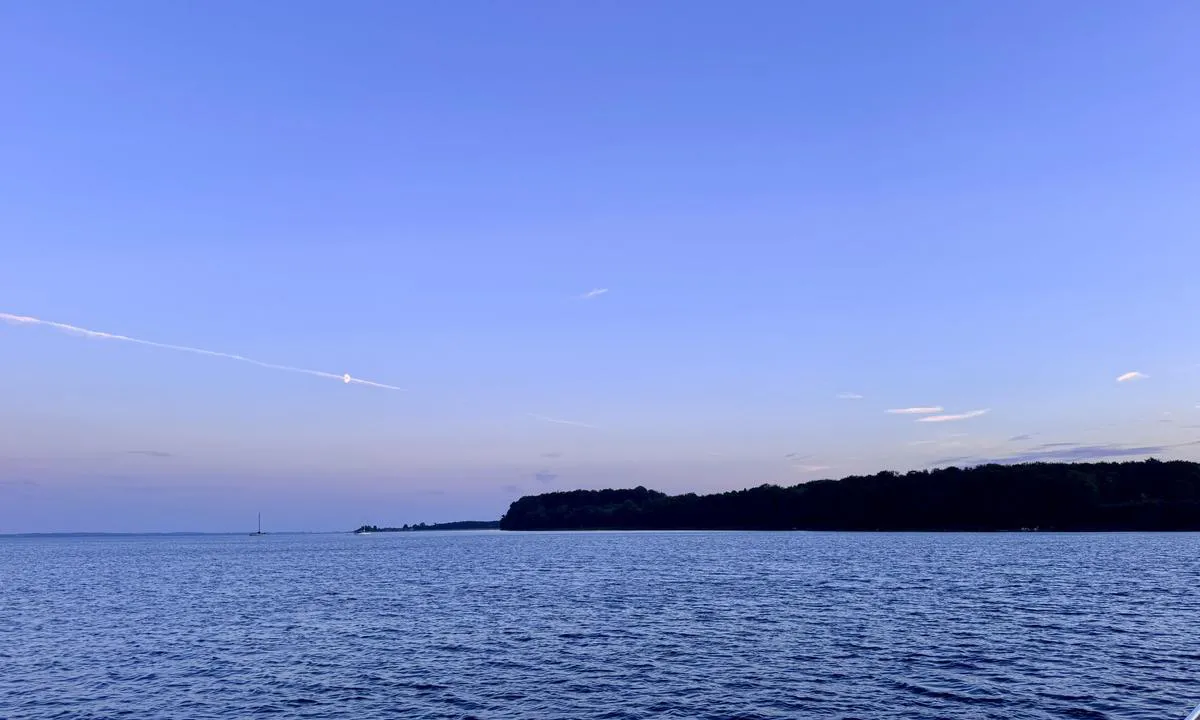
Lundeborg Kirke bouy: {"base": "en", "no": "Popul\u00e6r naturhavn, by i rekkevidde med jolle", "se": "Popul\u00e4r naturhamn, staden n\u00e5s med jolle", "en": "Popular natural harbor, city in reach by dinghy", "da": "Popul\u00e6r naturhavn, by inden for r\u00e6kkevidde med jolle", "fr": "Port naturel populaire, ville accessible en annexe", "de": "Beliebter Naturhafen, Stadt mit Beiboot erreichbar", "es": "Puerto natural popular, ciudad accesible en bote auxiliar", "it": "Popolare porto naturale, citt\u00e0 raggiungibile in gommone", "pt": "Porto natural popular, cidade acess\u00edvel por bote", "nl": "Populaire natuurlijke haven, stad bereikbaar met bijboot", "pl": "Popularny naturalny port, miasto w zasi\u0119gu pontonu", "uk": "\u041f\u043e\u043f\u0443\u043b\u044f\u0440\u043d\u0430 \u043f\u0440\u0438\u0440\u043e\u0434\u043d\u0430 \u0433\u0430\u0432\u0430\u043d\u044c, \u043c\u0456\u0441\u0442\u043e \u043d\u0430 \u0434\u043e\u0441\u0442\u0443\u043f\u0456 \u0448\u043b\u044e\u043f\u043a\u043e\u044e", "ro": "Port natural popular, ora\u0219 accesibil cu barca pneumatic\u0103", "tr": "Pop\u00fcler do\u011fal liman, sandal ile ula\u015f\u0131labilen \u015fehir", "el": "\u0394\u03b7\u03bc\u03bf\u03c6\u03b9\u03bb\u03ad\u03c2 \u03c6\u03c5\u03c3\u03b9\u03ba\u03cc \u03bb\u03b9\u03bc\u03ac\u03bd\u03b9, \u03b7 \u03c0\u03cc\u03bb\u03b7 \u03b5\u03af\u03bd\u03b1\u03b9 \u03c0\u03c1\u03bf\u03c3\u03b2\u03ac\u03c3\u03b9\u03bc\u03b7 \u03bc\u03b5 \u03c4\u03bf \u03c6\u03bf\u03c5\u03c3\u03ba\u03c9\u03c4\u03cc", "cs": "Obl\u00edben\u00fd p\u0159\u00edrodn\u00ed p\u0159\u00edstav, m\u011bsto dosa\u017eiteln\u00e9 pomoc\u00ed \u010dlunu", "hu": "N\u00e9pszer\u0171 term\u00e9szetes kik\u00f6t\u0151, a v\u00e1ros el\u00e9rhet\u0151 cs\u00f3nakkal", "fi": "Suosittu luonnonsatama, kaupunki saavutettavissa kumiveneell\u00e4", "bg": "\u041f\u043e\u043f\u0443\u043b\u044f\u0440\u043d\u043e \u0435\u0441\u0442\u0435\u0441\u0442\u0432\u0435\u043d\u043e \u043f\u0440\u0438\u0441\u0442\u0430\u043d\u0438\u0449\u0435, \u0433\u0440\u0430\u0434\u044a\u0442 \u0435 \u0434\u043e\u0441\u0442\u044a\u043f\u0435\u043d \u0441 \u0434\u0432\u0443\u043c\u0435\u0441\u0442\u043d\u0430 \u043b\u043e\u0434\u043a\u0430", "sr": "Popularna prirodna luka, grad na dohvat ruke \u010damcem na vesla", "et": "Populaarne looduslik sadam, linn on kummipaadiga k\u00e4ttesaadav", "lv": "Popul\u0101ra dab\u012bga osta, pils\u0113ta pieejama ar laivu", "lt": "Populiarus nat\u016bralus uostas, miest\u0105 galima pasiekti su nedideliu valtele"}
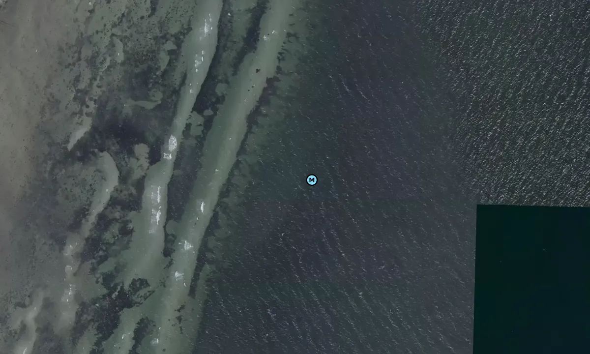
Satelite image of Lundeborg Kirke bouy

📸 Upload a photo

Show off your photos and help others plan their journey to Lundeborg Kirke bouy.harbourmaps.com is created by the sailing community, in a collective effort to make cruising simpler and more fun. Uploading a photo takes less than a minutes and can be done from your phone, tablet or laptop.

📸 Upload a photo

Facilities

We don't have any data on available facilities in this harbour. If you know which facilities are available here, please update this site to help your fellow sailors. Update facilities.

Mooring

Options for mooring in this harbour: Anchoring, Mooring buoy<br>(for easy "anchoring", not to be confused with bouys used in marinas).

Updated on 13. Jul 2022. Update mooring.

Descriptions and reviews

HarbourMaps (site admin) says:

description

The bouy is owned by Danske Tursejlere

0 x helpful | written on 13. Jul 2022

Do you know this harbour? It's a huge help to other sailors if you add a short description or review of the harbour.

📜 Add description

Map of Lundeborg Kirke bouy

Facilities

We don't have any data on available facilities in this harbour. If you know which facilities are available here, please update this site to help your fellow sailors. Update facilities.

Mooring

Options for mooring in this harbour: Anchoring, Mooring buoy<br>(for easy "anchoring", not to be confused with bouys used in marinas).

Updated on 13. Jul 2022. Update mooring.

Wind protection

Protection next night

77 points

N E S W --> } } } } } } } } } } } } } } } } } } } } } } } } } } } } } } } } } } } } } } } } } } } } } } } } } } } } } } } } } } } } } } } } } } } } } } } } } } } } } } } } } } } } } } } } } } } } } } } } } } } } } } } } } } } } } } } } } } } } } } } } } } } } } } } } } } } } } } } } } } } } } } } } } } } } } } } } } } } } } } } } } } } } } } } } } } } } } } } } } } } } } } } } } } } } } } } } } } } } } } } } } } } } } } } } } } } } } } } } } } } } } } } } } } } } } } } } } } } } } } } } } } } } } } } } } } } } } } } } } } } } } } } } } } } } } } } } } } } } } } } } } } } } } } } } } } } } } } } } } } } } } } } } } } } } } } } } } } } } } } } } } } } } } } } } } } } } } } } } } } } } } } } } } } } } } } } } } } } } } } } } } } } } } } } } } } } } } } } } } } } } } } } } } } } } } } } } } } } } } } } } } } } } } } } } } } } } } } } } } } } } } } } } } } } } } } } } } } } } } } } } } } } } } } } } } } } } } } } } } } } } } } } } } } } } } } } } } } } } } } } } } } } } } } } } } } } } } } } } } } } } } } } } } } } } } } } } } } } } } } } } } } } } } } } } } } } } } } } } } } } } } } } } } } } } } } } } } } } } } } } } } } } } } } } } } } } } } } } } } } } } } } } } } } } } } } } } } } } } } } } } } } } } } } } } } } } } } } } } } } } } } } } } } } } } } } } } } } } } } } } } } } } } } } } } } } } } } } } } } } } } } } } } } } } } } } } } } } } } } } } } } } } } } } } } } } } } } } } } } } } } } } } } } } } } } } } } } } } } } } } } } } } } } } } } } } } } } } } } } } } } } } } } } } } } } } } } } } } } } } } } } } } } } } } } } } } } } } } } } } } } } } } } } } } } } } } } } } } } } } } } } } } } } } } } } } } } } } } } } } } } } } } } } } } } } } } } } } } } } } } } } } } } } } } } } } } } } } } } } } } } } } } } } } } } } } } } } } } } } } } } } } } } } } } } } } } } } } } } } } } } } } } } } } } } } } } } } } } } } } } } } } } } } } } } } } } } } } } } } } } } } } } } } } } } } } } } } } } } } } } } } } } } } } } } } } } } } } } } } } } } Next night 6:00 12:00 Tor 03 Sep 18:00 0:00 6:00 12:00 Fre 04 Sep 18:00 9m/s 2m/s

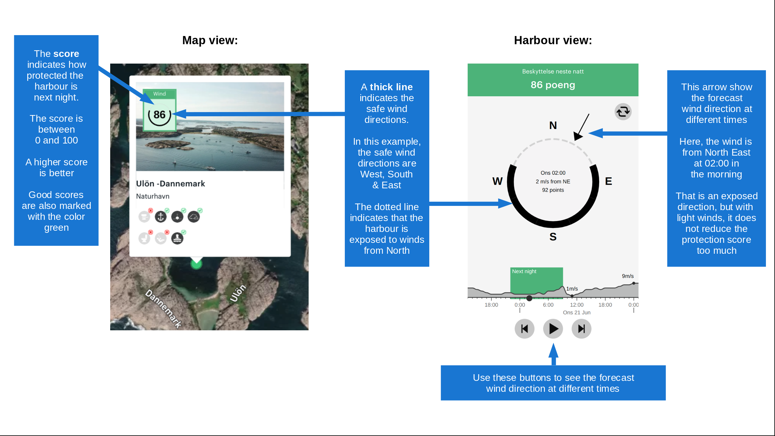
Want to know how the wind score works? Then you should read this explanation.

The wind forecasts come from yr.no (Norwegian Meteorological Institute), and was last updated 2 hours and 22 minutes ago (Thursday 03 September 05:31 AM). The next night score shows you the worst hour between 22:00 and 08:00 the next night. We recommend that you check multiple sources for wind forecasts. windy.com is a good website to show larger wind systems.

The safe wind directions for this harbour has been decided by an algorithm, based on how elevated the land around the harbour is. It's mostly correct, but sometimes the underlying data about elevation levels is not good enough to make correct decisions. It's a great help to other if you can validate or adjust the safe wind directions. You can see the data used by the algorithm to decide the safe wind directions by clicking here.

Last visits to Lundeborg Kirke bouy

Fri 14 Aug 2026

FAROE [MMSI: 219032839]

Sat 01 Aug 2026

DAJAN [MMSI: 218046920]

Sat 11 Jul 2026

KAROLINE SVANE [MMSI: 219033483]

Mon 31 Jul 2023

SASSA [MMSI: 219005347]

The visits are retrieved from AIS data. You can click to see all visiting ships to Lundeborg Kirke bouy, as well as statistics about the ships that visits

Add this harbour to a journey

Check in now

Choose a different date than today

Important: When you check in to a harbour, you add it to a journey on this website. You are not booking a place in the marina.

Contributors

Users that contributed to this page: Eli

harbourmaps.com is updated by the boating community. When you add information, a review or pictures to this page you are listed here with the other contributors (we list your user-name, which can be your real name or a pseudonym).

Closest harbours to Lundeborg Kirke bouy

Filter by

Natural harbour
Marina
Safe wind next night

Order by

ABC
Popularity
Wind score next night

0 harbours

Show more harbours