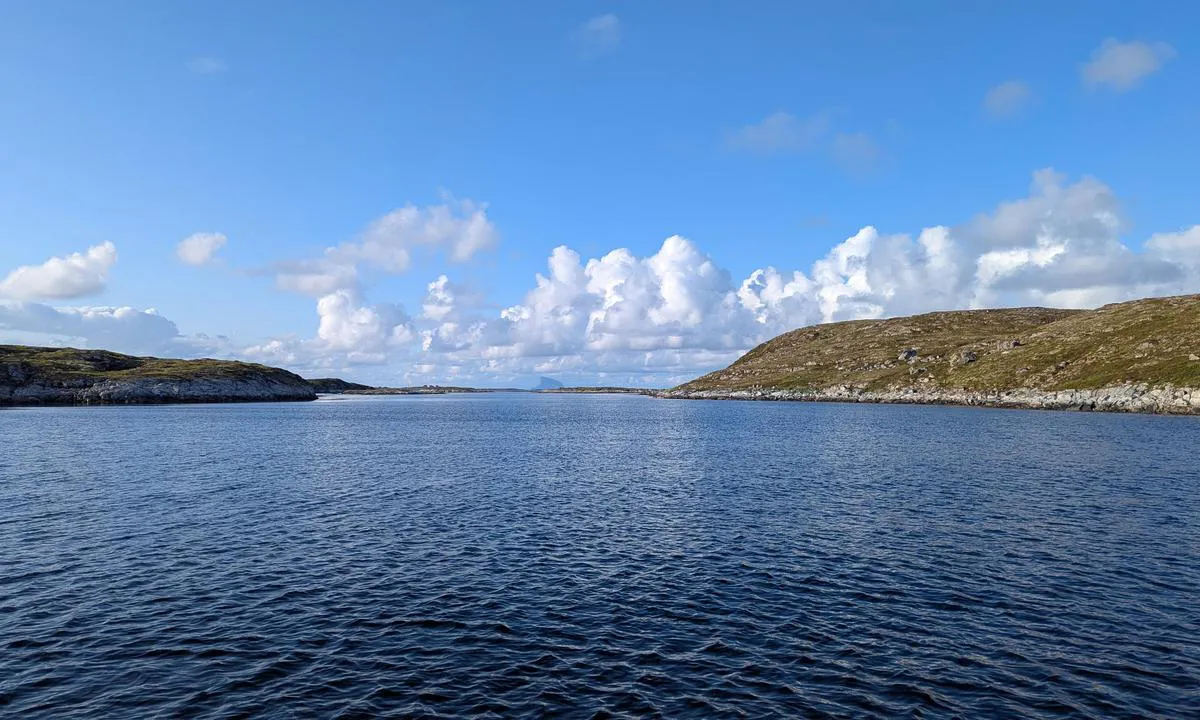
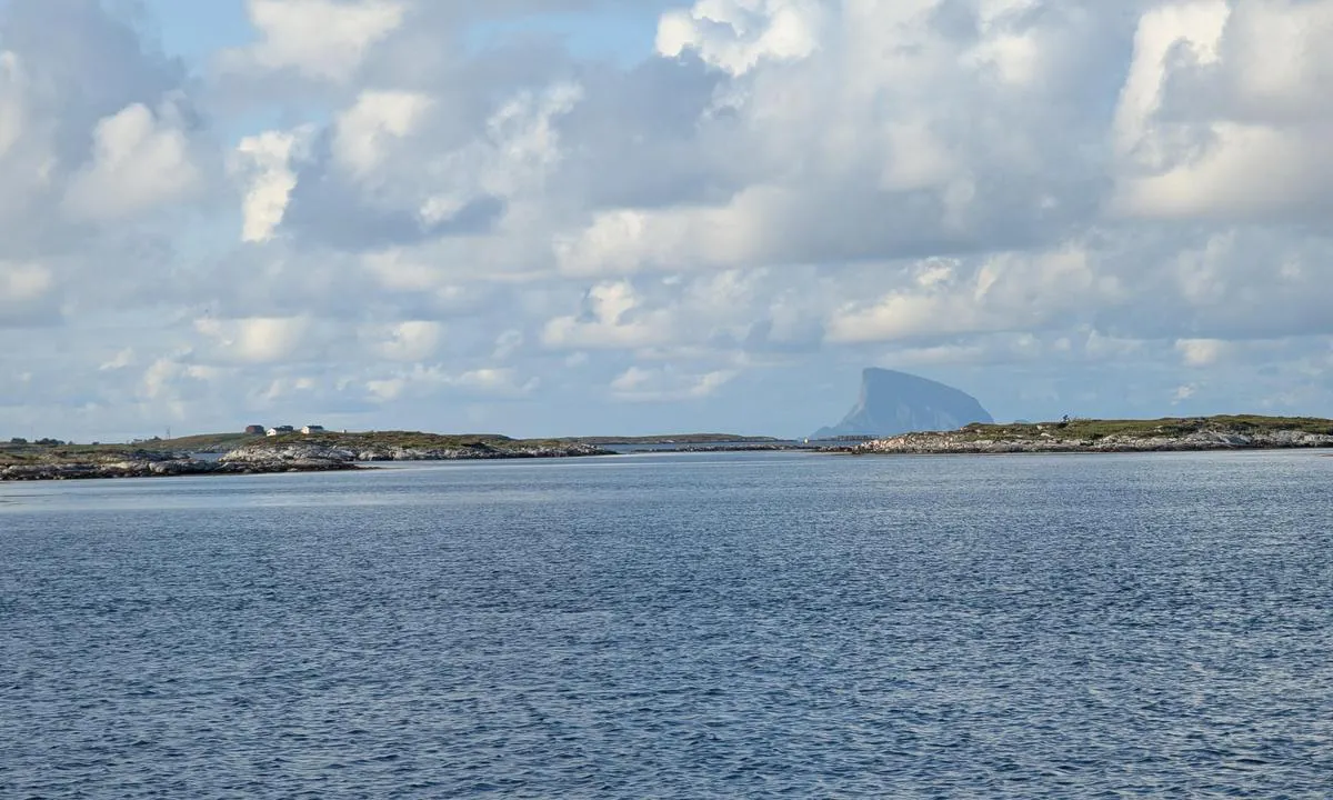
Ramnøya - Herøy

Natural harbour

favoritt

Region: Norway (3333), Nordland (651), Helgelandskysten (244) and Herøy (31)

Ramnøya - Herøy: {"base": "en", "no": "Ankr opp i ca. 10m p\u00e5 sand/gress. Nyttig stopp p\u00e5 vei til Lovund eller Tr\u00e6na", "se": "Ankare p\u00e5 cirka 10m p\u00e5 sand/v\u00e4xtlighet. Anv\u00e4ndbart stopp p\u00e5 v\u00e4g till Lovund eller Tr\u00e6na", "en": "Anchor in approx 10m on sand/weed. Useful stop on your way to Lovund or Tr\u00e6na", "da": "Anker p\u00e5 ca. 10m p\u00e5 sand/ukrudt. Nyttigt stop p\u00e5 vej til Lovund eller Tr\u00e6na", "fr": "Ancrez-vous \u00e0 environ 10 m sur le sable/les herbes marines. Arr\u00eat utile en route vers Lovund ou Tr\u00e6na", "de": "Ankern Sie in ca. 10 m auf Sand/Seegras. N\u00fctzlicher Stopp auf Ihrem Weg nach Lovund oder Tr\u00e6na", "es": "Anclar en aproximadamente 10m sobre fondo de arena/algas. Parada \u00fatil en su camino a Lovund o Tr\u00e6na", "it": "Ancora in circa 10m su sabbia/alga. Sosta utile sulla tua rotta verso Lovund o Tr\u00e6na", "pt": "Ancore em aproximadamente 10m em areia/algas. Parada \u00fatil no seu caminho para Lovund ou Tr\u00e6na", "nl": "Anker op circa 10m op zand/wier. Nuttige stop op weg naar Lovund of Tr\u00e6na", "pl": "Zakr\u0119tuj na g\u0142\u0119boko\u015bci oko\u0142o 10 metr\u00f3w na piasku/wodorostach. Przydatny przystanek w drodze do Lovund lub Tr\u00e6na", "uk": "\u0421\u0442\u0430\u043d\u044c\u0442\u0435 \u043d\u0430 \u044f\u043a\u0456\u0440 \u043f\u0440\u0438\u0431\u043b\u0438\u0437\u043d\u043e \u043d\u0430 \u0433\u043b\u0438\u0431\u0438\u043d\u0456 10 \u043c \u043d\u0430 \u043f\u0456\u0441\u043a\u0443/\u0432\u043e\u0434\u043e\u0440\u043e\u0441\u0442\u044f\u0445. \u041a\u043e\u0440\u0438\u0441\u043d\u0430 \u0437\u0443\u043f\u0438\u043d\u043a\u0430 \u043d\u0430 \u0448\u043b\u044f\u0445\u0443 \u0434\u043e \u041b\u043e\u0432\u0443\u043d\u0434\u0430 \u0430\u0431\u043e \u0422\u0440\u0435\u043d\u0438", "ro": "Ancoreaz\u0103 la aproximativ 10m pe nisip/alg\u0103. Oprire util\u0103 \u00een drumul t\u0103u spre Lovund sau Tr\u00e6na", "tr": "Kum/ot \u00fczerinde yakla\u015f\u0131k 10m derinlikte demirleyin. Lovund veya Tr\u00e6na yolunda kullan\u0131\u015fl\u0131 bir durak", "el": "\u0391\u03b3\u03ba\u03c5\u03c1\u03bf\u03b2\u03bf\u03bb\u03ae\u03c3\u03c4\u03b5 \u03c3\u03b5 \u03c0\u03b5\u03c1\u03af\u03c0\u03bf\u03c5 10\u03bc \u03c0\u03ac\u03bd\u03c9 \u03c3\u03b5 \u03ac\u03bc\u03bc\u03bf/\u03c6\u03cd\u03ba\u03b9\u03b1. \u03a7\u03c1\u03ae\u03c3\u03b9\u03bc\u03b7 \u03c3\u03c4\u03ac\u03c3\u03b7 \u03c3\u03c4\u03bf \u03b4\u03c1\u03cc\u03bc\u03bf \u03c0\u03c1\u03bf\u03c2 Lovund \u03ae Tr\u00e6na", "cs": "Zakotv\u011bte p\u0159ibli\u017en\u011b v 10m na p\u00edsku/tr\u00e1v\u011b. U\u017eite\u010dn\u00e1 zast\u00e1vka na cest\u011b do Lovundu nebo Tr\u00e6ny", "hu": "Horgonyozzon meg kb. 10 m\u00e9ter m\u00e9lyen homok/gaz alapon. Hasznos meg\u00e1ll\u00f3 Lovund vagy Tr\u00e6na fel\u00e9 vezet\u0151 \u00faton.", "fi": "Ankkuroi noin 10 metrin syvyyteen hiekka-/merilev\u00e4pohjaan. Hy\u00f6dyllinen pys\u00e4hdyspaikka matkallasi kohti Lovundia tai Tr\u00e6naa", "bg": "\u0417\u0430\u043a\u043e\u0442\u0432\u0435\u0442\u0435 \u043d\u0430 \u043f\u0440\u0438\u0431\u043b\u0438\u0437\u0438\u0442\u0435\u043b\u043d\u043e 10\u043c \u0432\u044a\u0440\u0445\u0443 \u043f\u044f\u0441\u044a\u043a/\u0432\u043e\u0434\u043e\u0440\u0430\u0441\u043b\u0438. \u041f\u043e\u043b\u0435\u0437\u043d\u0430 \u0441\u043f\u0438\u0440\u043a\u0430 \u043f\u043e \u043f\u044a\u0442\u044f \u0432\u0438 \u043a\u044a\u043c \u041b\u043e\u0432\u0443\u043d\u0434 \u0438\u043b\u0438 \u0422\u0440\u0435\u043d\u0430", "sr": "Sidri\u0161te na pribli\u017eno 10m na pesku/morskoj travi. Korisna stanica na putu ka Lovundu ili Tr\u00e6ni", "et": "Ankru umbes 10m s\u00fcgavusel liiva/vee kohal. Kasulik peatus teel Lovundi v\u00f5i Tr\u00e6na poole", "lv": "Nometiet enkuru aptuveni 10m dzi\u013cum\u0101 uz smilt\u012bm/j\u016brasz\u0101l\u0113m. Noder\u012bga pietura j\u016bsu ce\u013c\u0101 uz Lovundu vai Tr\u0113nu", "lt": "\u012esimesti inkar\u0105 ma\u017edaug 10 m ant sm\u0117lio/j\u016bros dumbli\u0173. Naudingas stabtel\u0117jimas j\u016bs\u0173 kelion\u0117je \u012f Lovund arba Tr\u00e6na"}
Ramnøya - Herøy
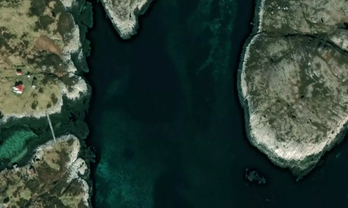
Satelite image of Ramnøya - Herøy

📸 Upload a photo

Show off your photos and help others plan their journey to Ramnøya - Herøy.harbourmaps.com is created by the sailing community, in a collective effort to make cruising simpler and more fun. Uploading a photo takes less than a minutes and can be done from your phone, tablet or laptop.

📸 Upload a photo

Facilities

We don't have any data on available facilities in this harbour. If you know which facilities are available here, please update this site to help your fellow sailors. Update facilities.

Mooring

Options for mooring in this harbour: Anchoring.

Updated on 3. Jul 2025. Update mooring.

Descriptions and reviews

John Lancaster-Smith says:

area

maritime qualities

description

Pay attention to rocks either side of entry. Chartplotter required

1 x helpful | written on 3. Jul 2025

Do you know this harbour? It's a huge help to other sailors if you add a short description or review of the harbour.

📜 Add description

Map of Ramnøya - Herøy

Facilities

We don't have any data on available facilities in this harbour. If you know which facilities are available here, please update this site to help your fellow sailors. Update facilities.

Mooring

Options for mooring in this harbour: Anchoring.

Updated on 3. Jul 2025. Update mooring.

Wind protection

Protection next night

83 points

N E S W --> } } } } } } } } } } } } } } } } } } } } } } } } } } } } } } } } } } } } } } } } } } } } } } } } } } } } } } } } } } } } } } } } } } } } } } } } } } } } } } } } } } } } } } } } } } } } } } } } } } } } } } } } } } } } } } } } } } } } } } } } } } } } } } } } } } } } } } } } } } } } } } } } } } } } } } } } } } } } } } } } } } } } } } } } } } } } } } } } } } } } } } } } } } } } } } } } } } } } } } } } } } } } } } } } } } } } } } } } } } } } } } } } } } } } } } } } } } } } } } } } } } } } } } } } } } } } } } } } } } } } } } } } } } } } } } } } } } } } } } } } } } } } } } } } } } } } } } } } } } } } } } } } } } } } } } } } } } } } } } } } } } } } } } } } } } } } } } } } } } } } } } } } } } } } } } } } } } } } } } } } } } } } } } } } } } } } } } } } } } } } } } } } } } } } } } } } } } } } } } } } } } } } } } } } } } } } } } } } } } } } } } } } } } } } } } } } } } } } } } } } } } } } } } } } } } } } } } } } } } } } } } } } } } } } } } } } } } } } } } } } } } } } } } } } } } } } } } } } } } } } } } } } } } } } } } } } } } } } } } } } } } } } } } } } } } } } } } } } } } } } } } } } } } } } } } } } } } } } } } } } } } } } } } } } } } } } } } } } } } } } } } } } } } } } } } } } } } } } } } } } } } } } } } } } } } } } } } } } } } } } } } } } } } } } } } } } } } } } } } } } } } } } } } } } } } } } } } } } } } } } } } } } } } } } } } } } } } } } } } } } } } } } } } } } } } } } } } } } } } } } } } } } } } } } } } } } } } } } } } } } } } } } } } } } } } } } } } } } } } } } } } } } } } } } } } } } } } } } } } } } } } } } } } } } } } } } } } } } } } } } } } } } } } } } } } } } } } } } } } } } } } } } } } } } } } } } } } } } } } } } } } } } } } } } } } } } } } } } } } } } } } } } } } } } } } } } } } } } } } } } } } } } } } } } } } } } } } } } } } } } } } } } } } } } } } } } } } } } } } } } } } } } } } } } } } } } } } } } } } } } } } } } } } } } } } } } } } } } } } } } } } } } } } } } } } } } } } } } } } } } } } } } } } } } } } } } } } } } } } } } Next night 12:00 Fre 04 Jul 18:00 0:00 6:00 12:00 Lør 05 Jul 18:00 6m/s 0m/s

Want to know how the wind score works? Then you should read this explanation.

The wind forecasts come from yr.no (Norwegian Meteorological Institute), and was last updated 1 hour and 16 minutes ago (Friday 04 July 10:27 AM). The next night score shows you the worst hour between 22:00 and 08:00 the next night. We recommend that you check multiple sources for wind forecasts. windy.com is a good website to show larger wind systems.

The safe directions for this harbour was added at 3. Jul 2025. Click here to edit.

Last visits to Ramnøya - Herøy

The visits are retrieved from AIS data. You can click to see all visiting ships to Ramnøya - Herøy, as well as statistics about the ships that visits

Add this harbour to a journey

Check in now

Choose a different date than today

Important: When you check in to a harbour, you add it to a journey on this website. You are not booking a place in the marina.

Contributors

Users that contributed to this page: John Lancaster-Smith

harbourmaps.com is updated by the boating community. When you add information, a review or pictures to this page you are listed here with the other contributors (we list your user-name, which can be your real name or a pseudonym).

Closest harbours to Ramnøya - Herøy

Filter by

Natural harbour
Marina
Safe wind next night

Order by

ABC
Popularity
Wind score next night

0 harbours

Show more harbours