


Rubbestad
Marina

Region: Norway (3463), Vestland (610), Hordaland (401), Bømlo (45) and Rubbestadneset (5)


Descriptions and reviews
Per Garen says:
says:
area


maritime qualities
description
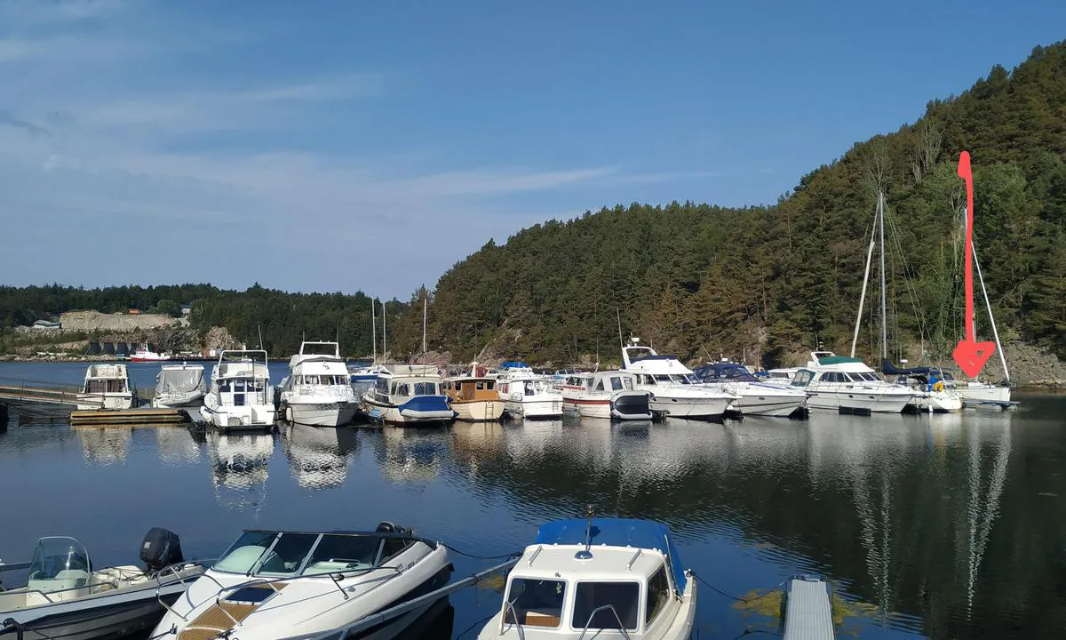
Nice area, but the quay is too small to dock with a boat. We couldn't find a spot and had to sneak into the shipyard and borrow a place. A bit disappointed, heard a lot about the place, but wasn't impressed.
[translated from Norwegian with AI]

1 x helpful | written on 9. Dec 2024 | updated_on 10. Dec 2024
MarLei
 says:
says:
area
maritime qualities
description
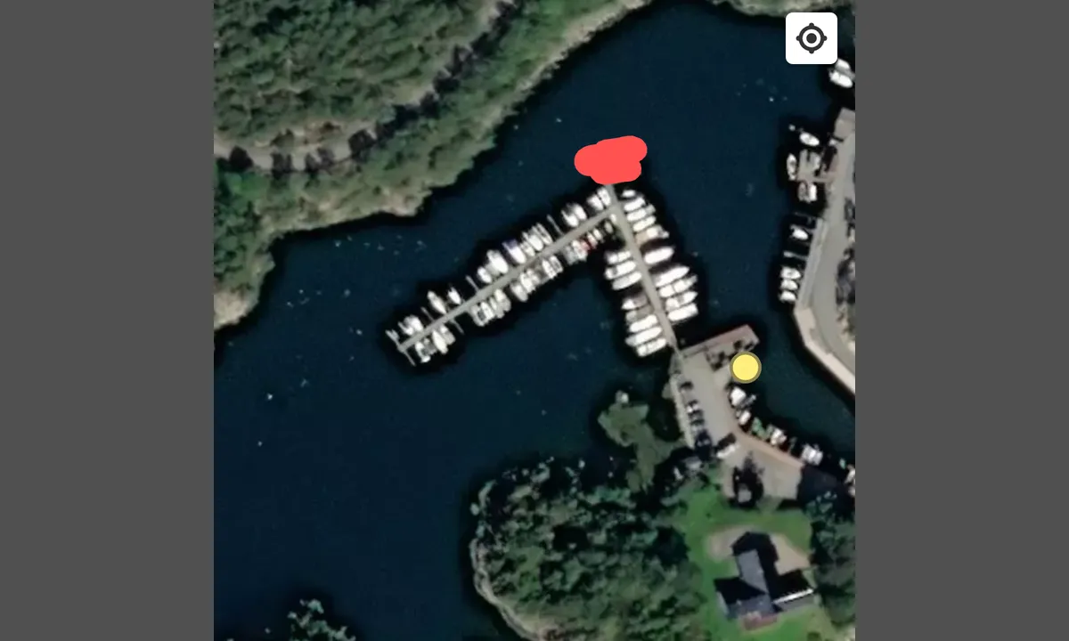
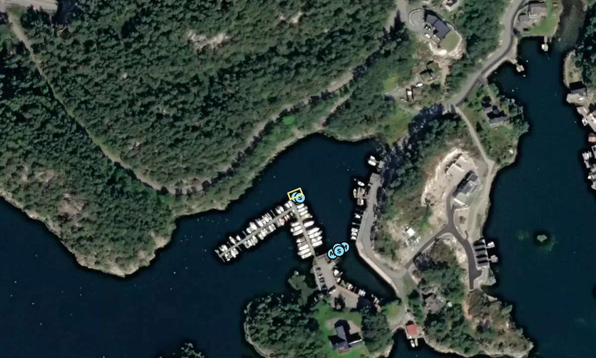
Called Landkjenning on the sign at the entrance. Very well-sheltered harbor. 1 km to a large and nice grocery store, 3.5 km to BestMarin store with workshop.
Good depth all the way in; 8-10 meters.
Guest quay one is an old floating dock, 12 meters long. 1 berth.
Water, electricity, and garbage
2023: 200,- incl. electricity
[translated from Norwegian with AI]
1 x helpful | written on 26. Jun 2023 | updated_on 26. Jun 2023
Do you know this harbour? It's a huge help to other sailors if you add a short description or review of the harbour.
Map of Rubbestad

Wind protection
Protection next night
89 points


Want to know how the wind score works? Then you should read this explanation.
The wind forecasts come from yr.no (Norwegian Meteorological Institute), and was last updated 1 hour and 56 minutes ago (Sunday 21 June 05:27 PM). The next night score shows you the worst hour between 22:00 and 08:00 the next night. We recommend that you check multiple sources for wind forecasts. windy.com is a good website to show larger wind systems.
The safe directions for this harbour was added at None. Click here to edit.
Last visits to Rubbestad
Mon 02 Feb 2026 |
|
|
Sat 21 Oct 2023 |
|
|
|
|
Sun 01 Oct 2023 |
|
|
Sat 23 Sep 2023 |
|
|
 VALLY III [MMSI: 257010160]
The visits are retrieved from AIS data. You can click to see all visiting ships to Rubbestad, as well as statistics about the ships that visits
Add this harbour to a journey
Choose a different date than today
Important: When you check in to a harbour, you add it to a journey on this website. You are not booking a place in the marina.
Closest harbours to Rubbestad
Filter by
Order by
0 harbours
Show more harbours
