


Selvågen - Mandal
Natural harbour

Region: Norway (3465), Agder (286), Vest-Agder (144), Lindesnes (43) and Mandal (21)


Descriptions and reviews
Vilhelm Lunde Holme says:
says:
area

maritime qualities

description
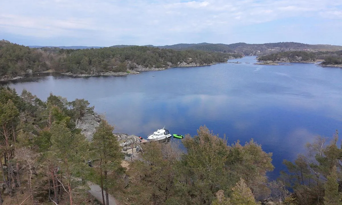
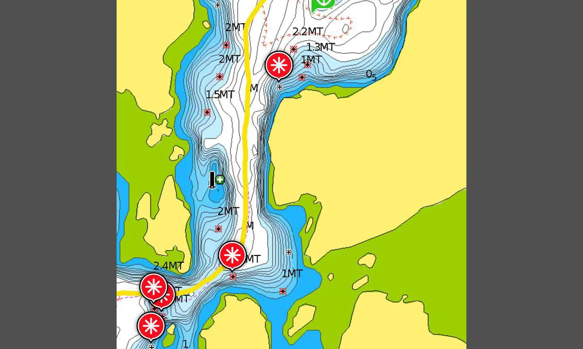
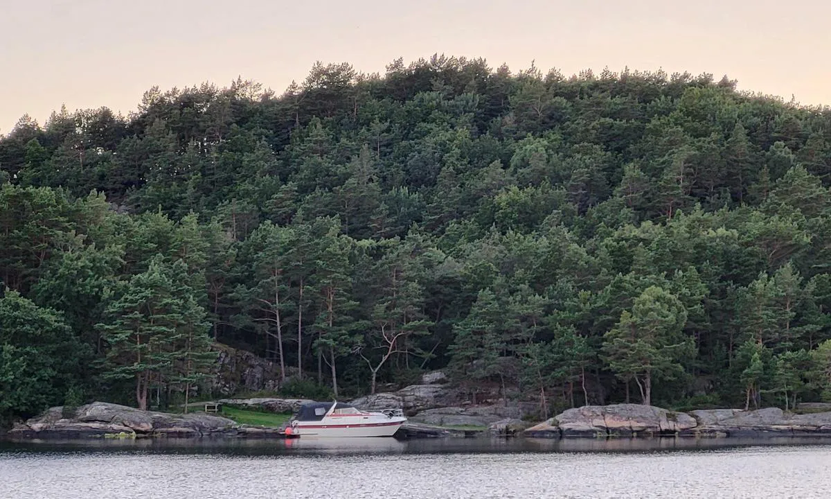
Litt krevende innseiling ved Aas brygge særlig for båter som stikker over 1,4 meter da det er en grunne på det som ikke står i alle kart.
For båter med begrenset dybde er det fint å gå gjennom "strømmen" og videre inn i Harkmarksfjorden. Mange fine plasser å ligge.
Ved Aas brygge er det en offentlig kai for korte anløp. Her kan man gå med jolla og traske opp bakken til de to gårdsutsalgene som selges blant annet brød, egg og is :)

1 x helpful | written on 7. Jun 2025 | updated_on 9. May 2026
Snorre Smith says:
says:
area
maritime qualities
description
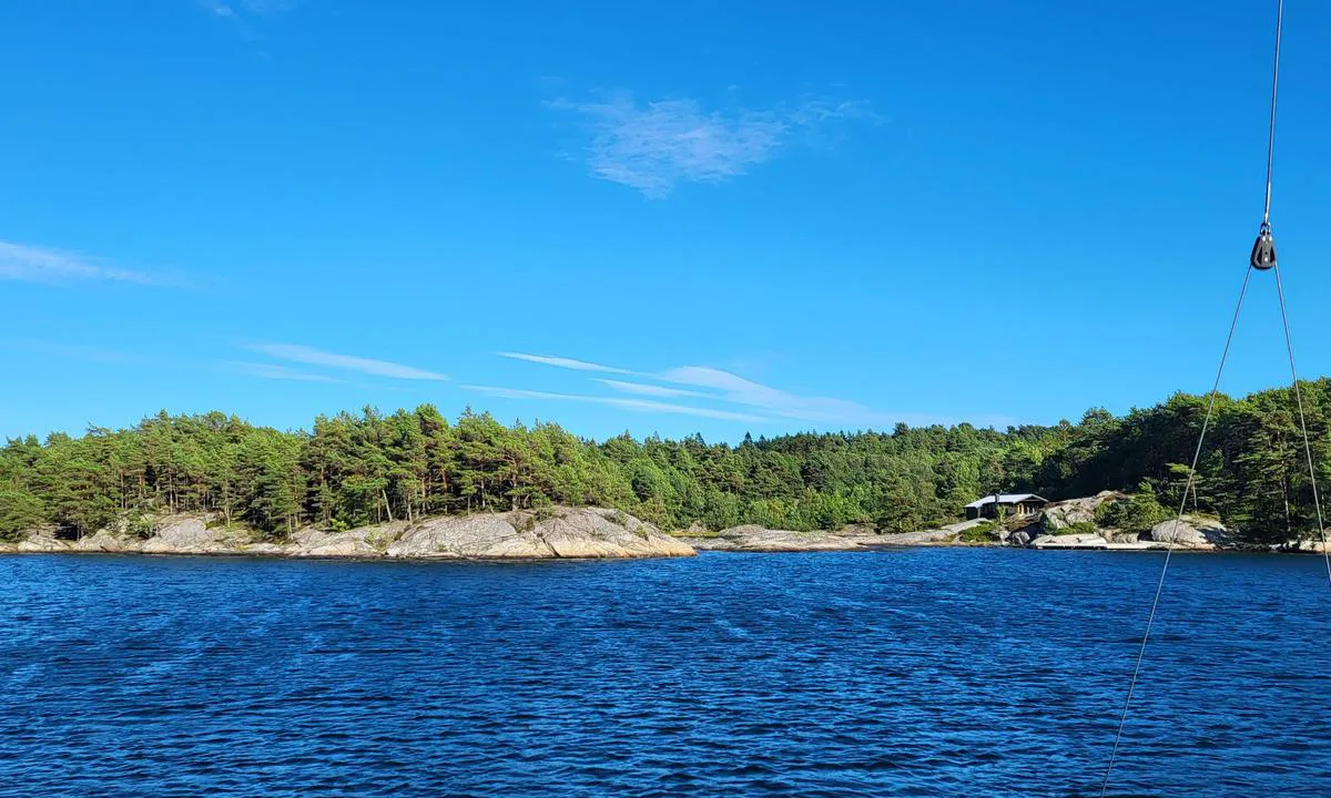
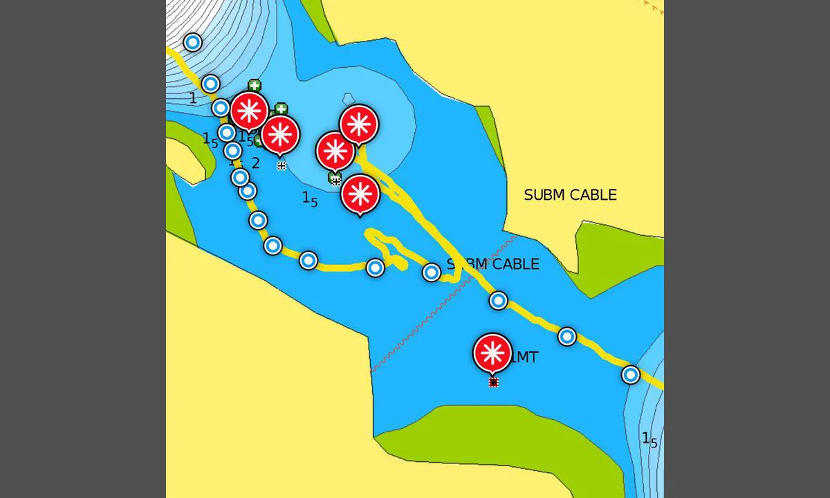
Challenging entrance for boats drawing one and a half meters or more. And when (if...) you manage to find the route in, a fantastic cove/bay reveals itself, well worth the effort. Inside the bay, there is ample swinging room with a depth of about 4-8 meters. There are a couple of piers and several rocks with bolts. Be aware of several shallows if you move towards the rocks in the southeast and northwest. A small handful of cabins, but at a decent distance from the piers and swinging area. Naturally, there is no swell or waves entering here. However, the terrain all around is low, so at the swinging area, you will notice winds from all directions, albeit dampened from offshore. If you moor towards the land, you will get protection from the direction you are mooring towards. The entrance has three challenging sections. If you succeed with the first one, you can easily handle the last two narrow spots by closely following a good nautical chart. For the first and difficult one, see the description in the accompanying image.
[translated from Norwegian with AI]
1 x helpful | written on 10. Aug 2023 | updated_on 10. Aug 2023
Do you know this harbour? It's a huge help to other sailors if you add a short description or review of the harbour.
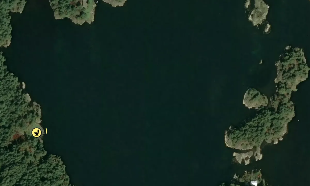
Map of Selvågen - Mandal

Wind protection
Protection next night
95 points


Want to know how the wind score works? Then you should read this explanation.
The wind forecasts come from yr.no (Norwegian Meteorological Institute), and was last updated 1 hour and 59 minutes ago (Thursday 25 June 10:28 AM). The next night score shows you the worst hour between 22:00 and 08:00 the next night. We recommend that you check multiple sources for wind forecasts. windy.com is a good website to show larger wind systems.

The safe wind directions for this harbour has been decided by an algorithm, based on how elevated the land around the harbour is. It's mostly correct, but sometimes the underlying data about elevation levels is not good enough to make correct decisions. It's a great help to other if you can validate or adjust the safe wind directions. You can see the data used by the algorithm to decide the safe wind directions by clicking here.
Last visits to Selvågen - Mandal
The visits are retrieved from AIS data. You can click to see all visiting ships to Selvågen - Mandal, as well as statistics about the ships that visits
Add this harbour to a journey
Choose a different date than today
Important: When you check in to a harbour, you add it to a journey on this website. You are not booking a place in the marina.
Contributors
Users that contributed to this page: Snorre Smith and Vilhelm Lunde Holme
harbourmaps.com is updated by the boating community. When you add information, a review or pictures to this page you are listed here with the other contributors (we list your user-name, which can be your real name or a pseudonym).
Closest harbours to Selvågen - Mandal
Filter by
Order by
0 harbours
Show more harbours
