Message from the system: You need to log in to write a review of the harour.

Skjøtningberg

Natural harbour

favoritt

Region: Norway (3278), Finnmark (224), Lebesby (26), Kjøllefjord (3) and Skjøtningberg (1)

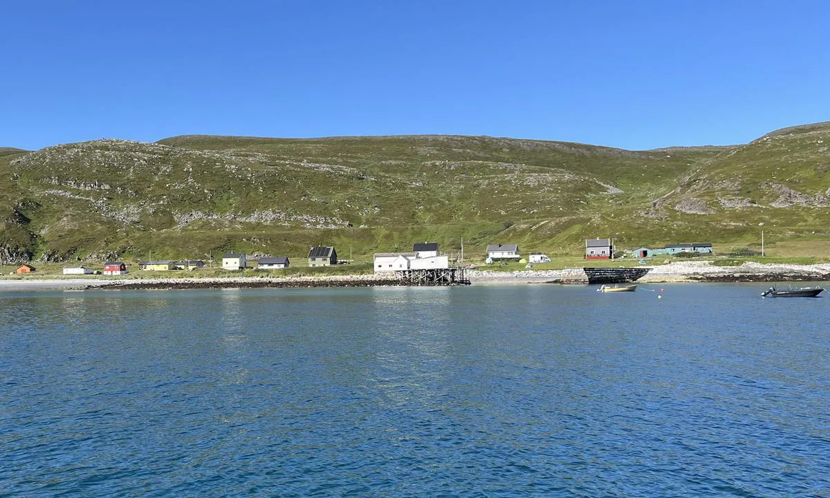
Skjøtningberg: {"base": "no", "no": "Sett mot vest. God plass. Dybde i bukta mellom 3-10m ytterst. Legg merke til  stein under vann s\u00f8r-vest i bukta merket p\u00e5 sj\u00f8kart.", "se": "Sedd mot v\u00e4st. Gott om plats. Djup i bukten mellan 3-10m ytterst. L\u00e4gg m\u00e4rke till sten under vatten sydv\u00e4st i bukten markerad p\u00e5 sj\u00f6kort.", "en": "Facing west. Plenty of space. Depth in the bay between 3-10m at the outermost. Note the underwater rock in the southwest of the bay marked on the nautical chart.", "da": "Set mod vest. God plads. Dybde i bugten mellem 3-10m yderst. Bem\u00e6rk sten under vand syd-vest i bugten markeret p\u00e5 s\u00f8kort.", "fr": "Vue vers l'ouest. Beaucoup d'espace. Profondeur dans la baie entre 3-10m \u00e0 l'ext\u00e9rieur. Faites attention aux pierres sous l'eau au sud-ouest de la baie marqu\u00e9es sur la carte marine.", "de": "Blick nach Westen. Viel Platz. Tiefe in der Bucht zwischen 3-10m, am \u00e4u\u00dfersten Punkt. Achten Sie auf den unter Wasser gelegenen Stein im S\u00fcdwesten der Bucht, markiert auf der Seekarte.", "es": "Orientado hacia el oeste. Buena disponibilidad de espacio. Profundidad en la bah\u00eda de entre 3-10m en su parte exterior. Presta atenci\u00f3n a la piedra bajo el agua al suroeste de la bah\u00eda marcada en la carta n\u00e1utica.", "it": "Guardando verso ovest. Ampio spazio. Profondit\u00e0 nella baia tra 3-10m all'esterno. Notare la pietra sott'acqua a sud-ovest della baia segnata sulla carta nautica.", "pt": "Voltado para oeste. Ampla capacidade. Profundidade na ba\u00eda entre 3-10m na parte externa. Note a pedra submersa ao sudoeste da ba\u00eda marcada no mapa n\u00e1utico.", "nl": "Gelegen naar het westen. Veel ruimte. Diepte in de baai tussen 3-10m aan de buitenkant. Let op de stenen onder water in het zuidwesten van de baai, gemarkeerd op de zeekaart.", "pl": "Ustawiony na zach\u00f3d. Du\u017co miejsca. G\u0142\u0119boko\u015b\u0107 w zatoce od 3-10m na zewn\u0105trz. Zwr\u00f3\u0107 uwag\u0119 na kamienie pod wod\u0105 na po\u0142udniowy zach\u00f3d w zatoce oznaczone na mapie morskiej.", "uk": "\u041f\u043e\u0433\u043b\u044f\u0434 \u043d\u0430 \u0437\u0430\u0445\u0456\u0434. \u0414\u043e\u0441\u0442\u0430\u0442\u043d\u044c\u043e \u043c\u0456\u0441\u0446\u044f. \u0413\u043b\u0438\u0431\u0438\u043d\u0430 \u0432 \u0431\u0443\u0445\u0442\u0456 \u0437\u043e\u0432\u043d\u0456 \u0432\u0456\u0434 3 \u0434\u043e 10 \u043c\u0435\u0442\u0440\u0456\u0432. \u0417\u0432\u0435\u0440\u043d\u0456\u0442\u044c \u0443\u0432\u0430\u0433\u0443 \u043d\u0430 \u043a\u0430\u043c\u0456\u043d\u044c \u043f\u0456\u0434 \u0432\u043e\u0434\u043e\u044e \u043d\u0430 \u043f\u0456\u0432\u0434\u0435\u043d\u043d\u043e\u043c\u0443 \u0437\u0430\u0445\u043e\u0434\u0456 \u0431\u0443\u0445\u0442\u0438, \u043f\u043e\u0437\u043d\u0430\u0447\u0435\u043d\u0438\u0439 \u043d\u0430 \u043d\u0430\u0432\u0456\u0433\u0430\u0446\u0456\u0439\u043d\u0456\u0439 \u043a\u0430\u0440\u0442\u0456.", "ro": "Vedere spre vest. Loc spa\u021bios. Ad\u00e2ncime \u00een golf \u00eentre 3-10m la exterior. Observa\u021bi piatra sub ap\u0103 spre sud-vestul golfului marcat\u0103 pe harta marin\u0103.", "tr": "Bat\u0131ya do\u011fru bak. Geni\u015f alan. Koyun d\u0131\u015f k\u0131sm\u0131ndaki derinlik 3-10m. Deniz haritas\u0131nda i\u015faretli olan koyun g\u00fcney-bat\u0131s\u0131ndaki su alt\u0131 ta\u015f\u0131na dikkat et.", "el": "\u03a0\u03c1\u03bf\u03c3\u03b1\u03bd\u03b1\u03c4\u03bf\u03bb\u03b9\u03c3\u03bc\u03cc\u03c2 \u03c0\u03c1\u03bf\u03c2 \u03c4\u03b1 \u03b4\u03c5\u03c4\u03b9\u03ba\u03ac. \u0386\u03c6\u03b8\u03bf\u03bd\u03bf\u03c2 \u03c7\u03ce\u03c1\u03bf\u03c2. \u0392\u03ac\u03b8\u03bf\u03c2 \u03c3\u03c4\u03bf\u03bd \u03cc\u03c1\u03bc\u03bf \u03bc\u03b5\u03c4\u03b1\u03be\u03cd 3-10\u03bc \u03c3\u03c4\u03bf \u03b5\u03be\u03c9\u03c4\u03b5\u03c1\u03b9\u03ba\u03cc \u03bc\u03ad\u03c1\u03bf\u03c2. \u03a0\u03c1\u03bf\u03c3\u03ad\u03be\u03c4\u03b5 \u03c4\u03b7\u03bd \u03c0\u03ad\u03c4\u03c1\u03b1 \u03ba\u03ac\u03c4\u03c9 \u03b1\u03c0\u03cc \u03c4\u03bf \u03bd\u03b5\u03c1\u03cc \u03bd\u03bf\u03c4\u03b9\u03bf-\u03b4\u03c5\u03c4\u03b9\u03ba\u03ac \u03c3\u03c4\u03bf\u03bd \u03cc\u03c1\u03bc\u03bf \u03c3\u03b7\u03bc\u03b1\u03c4\u03bf\u03b4\u03bf\u03c4\u03b7\u03bc\u03ad\u03bd\u03b7 \u03c3\u03c4\u03bf\u03bd \u03b8\u03b1\u03bb\u03ac\u03c3\u03c3\u03b9\u03bf \u03c7\u03ac\u03c1\u03c4\u03b7.", "cs": "Pohled na z\u00e1pad. Hodn\u011b m\u00edsta. Hloubka v z\u00e1toce mezi 3-10 m na vn\u011bj\u0161\u00ed \u010d\u00e1sti. V\u0161imn\u011bte si kamene pod vodou na jihoz\u00e1pad\u011b z\u00e1toky ozna\u010den\u00e9ho na n\u00e1mo\u0159n\u00ed map\u011b.", "hu": "N\u00e9zz nyugat fel\u00e9. Sok hely van. A kik\u00f6t\u0151 m\u00e9lys\u00e9ge k\u00edv\u00fcl 3-10 m k\u00f6z\u00f6tt v\u00e1ltozik. Vedd \u00e9szre a v\u00edz alatt l\u00e9v\u0151 k\u00f6vet a kik\u00f6t\u0151 d\u00e9l-nyugati r\u00e9sz\u00e9n, amely a tengeri t\u00e9rk\u00e9pen jel\u00f6lve van.", "fi": "Suunnattu l\u00e4nteen. Hyvin tilaa. Syvyys lahdessa ulkona 3-10 m. Huomioi vedess\u00e4 oleva kivi lahden lounaisosassa, merkitty merikarttaan.", "bg": "\u0418\u0437\u043f\u0440\u0430\u0432\u0435\u043d \u0441\u0440\u0435\u0449\u0443 \u0437\u0430\u043f\u0430\u0434. \u0418\u043c\u0430 \u0434\u043e\u0441\u0442\u0430\u0442\u044a\u0447\u043d\u043e \u043c\u044f\u0441\u0442\u043e. \u0414\u044a\u043b\u0431\u043e\u0447\u0438\u043d\u0430 \u0432 \u0437\u0430\u043b\u0438\u0432\u0430 \u043c\u0435\u0436\u0434\u0443 3-10 \u043c \u043d\u0430\u0439-\u0432\u044a\u043d. \u041e\u0431\u044a\u0440\u043d\u0435\u0442\u0435 \u0432\u043d\u0438\u043c\u0430\u043d\u0438\u0435 \u043d\u0430 \u043f\u043e\u0434\u0432\u043e\u0434\u043d\u0438\u0442\u0435 \u043a\u0430\u043c\u044a\u043d\u0438 \u0432 \u044e\u0433\u043e\u0437\u0430\u043f\u0430\u0434\u043d\u0430\u0442\u0430 \u0447\u0430\u0441\u0442 \u043d\u0430 \u0437\u0430\u043b\u0438\u0432\u0430, \u043e\u0442\u0431\u0435\u043b\u044f\u0437\u0430\u043d\u0438 \u043d\u0430 \u043c\u043e\u0440\u0441\u043a\u0430\u0442\u0430 \u043a\u0430\u0440\u0442\u0430.", "sr": "\u0413\u043b\u0435\u0434\u0430 \u043a\u0430 \u0437\u0430\u043f\u0430\u0434\u0443. \u0414\u043e\u0432\u043e\u0459\u043d\u043e \u043f\u0440\u043e\u0441\u0442\u043e\u0440\u0430. \u0414\u0443\u0431\u0438\u043d\u0430 \u0443 \u0437\u0430\u043b\u0438\u0432\u0443 \u0438\u0437\u043c\u0435\u0452\u0443 3-10\u043c \u043d\u0430 \u0443\u043b\u0430\u0437\u0443. \u041e\u0431\u0440\u0430\u0442\u0438\u0442\u0435 \u043f\u0430\u0436\u045a\u0443 \u043d\u0430 \u043a\u0430\u043c\u0435\u043d \u043f\u043e\u0434 \u0432\u043e\u0434\u043e\u043c \u0458\u0443\u0433\u043e\u0437\u0430\u043f\u0430\u0434\u043d\u043e \u0443 \u0437\u0430\u043b\u0438\u0432\u0443, \u043e\u0437\u043d\u0430\u0447\u0435\u043d \u043d\u0430 \u043d\u0430\u0443\u0442\u0438\u0447\u043a\u043e\u0458 \u043a\u0430\u0440\u0442\u0438.", "et": "Suunaga l\u00e4\u00e4nde. K\u00fcllalt ruumi. S\u00fcgavus lahes 3-10 m \u00e4\u00e4repoolsemates osades. P\u00f6\u00f6rake t\u00e4helepanu veealustele kividele lahe edelaosas, mis on merekaardil m\u00e4rgitud.", "lv": "V\u0113rsts uz rietumiem. Pietiekami daudz vietas. Dzi\u013cums l\u012bc\u012b no 3-10 m \u0101rmal\u0101. Piev\u0113rsiet uzman\u012bbu akmenim zem \u016bdens dienvidrietumos l\u012bc\u012b, kas ir atz\u012bm\u0113ts j\u016bras kart\u0113.", "lt": "Nukreipta \u012f vakarus. Daug vietos. \u012elankos gylis tarp 3-10m kra\u0161te. Atkreipkite d\u0117mes\u012f \u012f po vandeniu esan\u010dius akmenis pietvakariuose, pa\u017eym\u0117tus j\u016briniame \u017eem\u0117lapyje."}
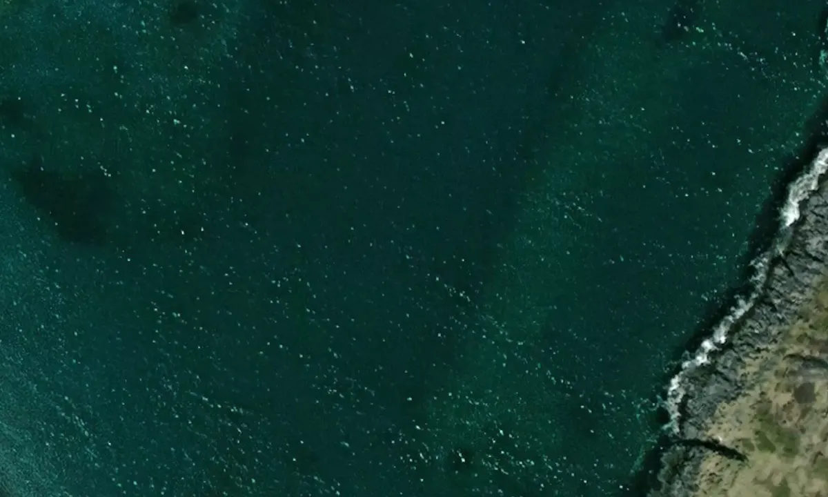
Satelite image of Skjøtningberg

📸 Upload a photo

Show off your photos and help others plan their journey to Skjøtningberg.harbourmaps.com is created by the sailing community, in a collective effort to make cruising simpler and more fun. Uploading a photo takes less than a minutes and can be done from your phone, tablet or laptop.

📸 Upload a photo

Facilities

Available facilities: Swimming area.

Updated on 5. Aug 2024. Update facilities.

Mooring

Options for mooring in this harbour: Anchoring.

Updated on 5. Aug 2024. Update mooring.

Descriptions and reviews

Do you know this harbour? It's a huge help to other sailors if you add a short description or review of the harbour.

📜 Add description

Map of Skjøtningberg

Facilities

Available facilities: Swimming area.

Updated on 5. Aug 2024. Update facilities.

Mooring

Options for mooring in this harbour: Anchoring.

Updated on 5. Aug 2024. Update mooring.

Wind protection

Protection next night

54 points

N E S W --> } } } } } } } } } } } } } } } } } } } } } } } } } } } } } } } } } } } } } } } } } } } } } } } } } } } } } } } } } } } } } } } } } } } } } } } } } } } } } } } } } } } } } } } } } } } } } } } } } } } } } } } } } } } } } } } } } } } } } } } } } } } } } } } } } } } } } } } } } } } } } } } } } } } } } } } } } } } } } } } } } } } } } } } } } } } } } } } } } } } } } } } } } } } } } } } } } } } } } } } } } } } } } } } } } } } } } } } } } } } } } } } } } } } } } } } } } } } } } } } } } } } } } } } } } } } } } } } } } } } } } } } } } } } } } } } } } } } } } } } } } } } } } } } } } } } } } } } } } } } } } } } } } } } } } } } } } } } } } } } } } } } } } } } } } } } } } } } } } } } } } } } } } } } } } } } } } } } } } } } } } } } } } } } } } } } } } } } } } } } } } } } } } } } } } } } } } } } } } } } } } } } } } } } } } } } } } } } } } } } } } } } } } } } } } } } } } } } } } } } } } } } } } } } } } } } } } } } } } } } } } } } } } } } } } } } } } } } } } } } } } } } } } } } } } } } } } } } } } } } } } } } } } } } } } } } } } } } } } } } } } } } } } } } } } } } } } } } } } } } } } } } } } } } } } } } } } } } } } } } } } } } } } } } } } } } } } } } } } } } } } } } } } } } } } } } } } } } } } } } } } } } } } } } } } } } } } } } } } } } } } } } } } } } } } } } } } } } } } } } } } } } } } } } } } } } } } } } } } } } } } } } } } } } } } } } } } } } } } } } } } } } } } } } } } } } } } } } } } } } } } } } } } } } } } } } } } } } } } } } } } } } } } } } } } } } } } } } } } } } } } } } } } } } } } } } } } } } } } } } } } } } } } } } } } } } } } } } } } } } } } } } } } } } } } } } } } } } } } } } } } } } } } } } } } } } } } } } } } } } } } } } } } } } } } } } } } } } } } } } } } } } } } } } } } } } } } } } } } } } } } } } } } } } } } } } } } } } } } } } } } } } } } } } } } } } } } } } } } } } } } } } } } } } } } } } } } } } } } } } } } } } } } } } } } } } } } } } } } } } } } } } } } } } } } } } } } } } } } } } } } } } } } } } } } } } } } } } } } } } } Next night 12:00 Tor 01 Mai 18:00 0:00 6:00 12:00 Fre 02 Mai 18:00 10m/s 1m/s

Want to know how the wind score works? Then you should read this explanation.

The wind forecasts come from yr.no (Norwegian Meteorological Institute), and was last updated 1 hour and 56 minutes ago (Thursday 01 May 10:28 AM). The next night score shows you the worst hour between 22:00 and 08:00 the next night. We recommend that you check multiple sources for wind forecasts. windy.com is a good website to show larger wind systems.

The safe directions for this harbour was added at 5. Aug 2024. Click here to edit.

Last visits to Skjøtningberg

The visits are retrieved from AIS data. You can click to see all visiting ships to Skjøtningberg, as well as statistics about the ships that visits

Add this harbour to a journey

Check in now

Choose a different date than today

Important: When you check in to a harbour, you add it to a journey on this website. You are not booking a place in the marina.

Contributors

Users that contributed to this page: Dagmar Steffan

harbourmaps.com is updated by the boating community. When you add information, a review or pictures to this page you are listed here with the other contributors (we list your user-name, which can be your real name or a pseudonym).

Closest harbours to Skjøtningberg

Filter by

Natural harbour
Marina
Safe wind next night

Order by

ABC
Popularity
Wind score next night

0 harbours

Show more harbours