Underøy (Indre)

Natural harbour

favoritt

Region: Norway (3234), Agder (252), Vest-Agder (123), Lindesnes (38), Snig (6) and Sør-audnedal (6)

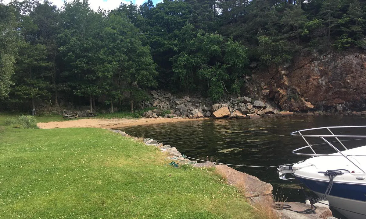
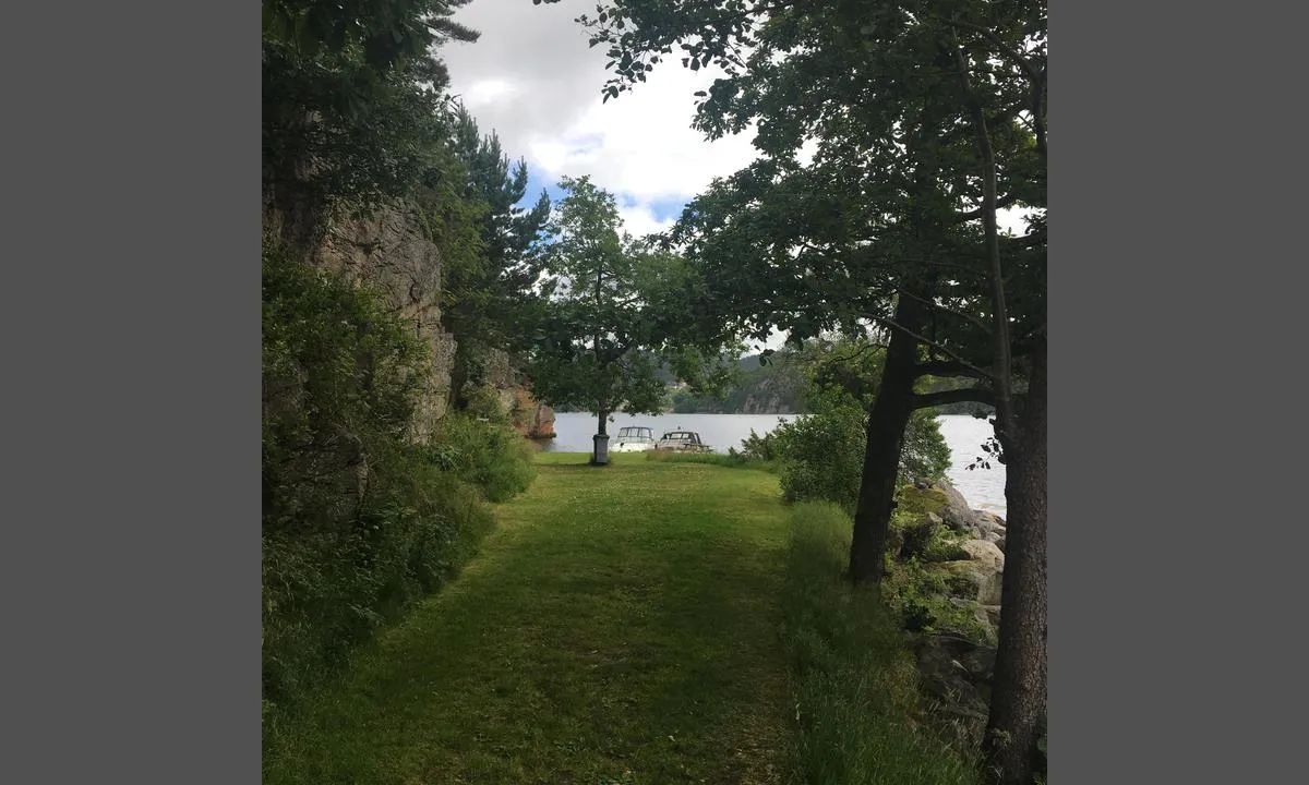
Underøy (Indre): {"base": "no", "no": "Bolter i stein ved gress-slette. Bruk dregg. Plass til 7-8 b\u00e5ter.\r\nFin badeplass ved sandstrand.\r\nLigger veldig godt her inne om det er mye sj\u00f8 og drag utp\u00e5. Audna-elva demper dette.\r\nLigger godt gjemt for nord/vesten som kan bli plagsom p\u00e5 disse kanter.", "se": "Bultar i sten vid gr\u00e4splan. Anv\u00e4nd ankare. Plats f\u00f6r 7-8 b\u00e5tar.<br>Fin badplats vid sandstrand.<br>Ligger mycket bra h\u00e4r inne om det \u00e4r mycket sj\u00f6 och drag ute. Audna-\u00e4lven d\u00e4mpar detta.<br>Ligger v\u00e4l g\u00f6md f\u00f6r nord/v\u00e4st som kan bli besv\u00e4rande h\u00e4r.", "en": "Bolts in stone near grass field. Use anchor. Space for 7-8 boats.<br>Nice swimming spot by the sandy beach.<br>Sheltered well here if there's a lot of sea and swell outside. The Audna River mitigates this.<br>Well hidden from the northwest wind, which can be bothersome in this area.", "da": "Bolte i sten ved gr\u00e6sfletten. Brug anker. Plads til 7-8 b\u00e5de.<br>Fin badestrand ved sandstrand.<br>Meget beskyttet herinde, hvis der er meget s\u00f8 og tr\u00e6k udenfor. Audna-floden d\u00e6mper dette.<br>Godt gemt for nordvestenvinden, som kan v\u00e6re generende her.<br>"}
Underøy (Indre): {"base": "no", "no": "Fin gress-slette ved sandstrand.", "se": "Fin gr\u00e4syta vid sandstrand.", "en": "Nice grassy area by sandy beach.", "da": "Fin gr\u00e6s-pl\u00e6ne ved sandstrand."}
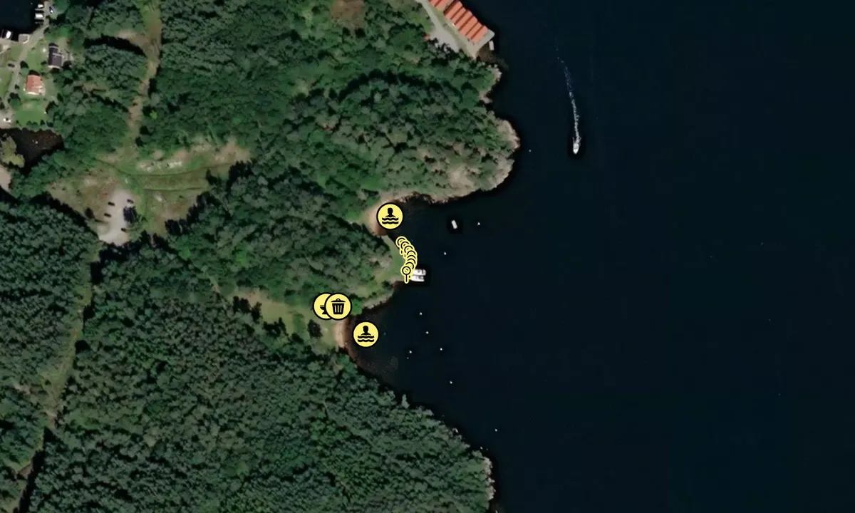
Flyfoto av Underøy (Indre)

📸 Upload a photo

Show off your photos and help others plan their journey to Underøy (Indre).harbourmaps.com is created by the sailing community, in a collective effort to make cruising simpler and more fun. Uploading a photo takes less than a minutes and can be done from your phone, tablet or laptop.

📸 Upload a photo

Facilities

Available facilities: Toilet, Swimming area.

Updated on 3. Sep 2023. Update facilities.

Mooring

Options for mooring in this harbour: Anchoring, Towards land.

Updated on 3. Sep 2023. Update mooring.

Descriptions and reviews

Dan Mossmann says:

description

You can approach this place from the west if you can get under the bridge span of 3.5 meters over Navarsundet. If you have a flybridge, sailboat, or a boat larger than 40 feet, consider entering from the east side, but watch out for Sniksrevet out in the fjord. Navigate on the right side of the marker there!
Use a dredge and the many bolts in the rock for mooring.
Nice hiking trails all over Underøy. Several nice beaches. Several burial mounds from the Migration Period all the way out at 'Draiet'.

[translated from Norwegian with AI]

1 x helpful | written on 31. Aug 2023 | updated_on 31. Aug 2023

Do you know this harbour? It's a huge help to other sailors if you add a short description or review of the harbour.

📜 Add description

Map of Underøy (Indre)

Facilities

Available facilities: Toilet, Swimming area.

Updated on 3. Sep 2023. Update facilities.

Mooring

Options for mooring in this harbour: Anchoring, Towards land.

Updated on 3. Sep 2023. Update mooring.

Wind protection

Protection next night

86 points

N E S W --> } } } } } } } } } } } } } } } } } } } } } } } } } } } } } } } } } } } } } } } } } } } } } } } } } } } } } } } } } } } } } } } } } } } } } } } } } } } } } } } } } } } } } } } } } } } } } } } } } } } } } } } } } } } } } } } } } } } } } } } } } } } } } } } } } } } } } } } } } } } } } } } } } } } } } } } } } } } } } } } } } } } } } } } } } } } } } } } } } } } } } } } } } } } } } } } } } } } } } } } } } } } } } } } } } } } } } } } } } } } } } } } } } } } } } } } } } } } } } } } } } } } } } } } } } } } } } } } } } } } } } } } } } } } } } } } } } } } } } } } } } } } } } } } } } } } } } } } } } } } } } } } } } } } } } } } } } } } } } } } } } } } } } } } } } } } } } } } } } } } } } } } } } } } } } } } } } } } } } } } } } } } } } } } } } } } } } } } } } } } } } } } } } } } } } } } } } } } } } } } } } } } } } } } } } } } } } } } } } } } } } } } } } } } } } } } } } } } } } } } } } } } } } } } } } } } } } } } } } } } } } } } } } } } } } } } } } } } } } } } } } } } } } } } } } } } } } } } } } } } } } } } } } } } } } } } } } } } } } } } } } } } } } } } } } } } } } } } } } } } } } } } } } } } } } } } } } } } } } } } } } } } } } } } } } } } } } } } } } } } } } } } } } } } } } } } } } } } } } } } } } } } } } } } } } } } } } } } } } } } } } } } } } } } } } } } } } } } } } } } } } } } } } } } } } } } } } } } } } } } } } } } } } } } } } } } } } } } } } } } } } } } } } } } } } } } } } } } } } } } } } } } } } } } } } } } } } } } } } } } } } } } } } } } } } } } } } } } } } } } } } } } } } } } } } } } } } } } } } } } } } } } } } } } } } } } } } } } } } } } } } } } } } } } } } } } } } } } } } } } } } } } } } } } } } } } } } } } } } } } } } } } } } } } } } } } } } } } } } } } } } } } } } } } } } } } } } } } } } } } } } } } } } } } } } } } } } } } } } } } } } } } } } } } } } } } } } } } } } } } } } } } } } } } } } } } } } } } } } } } } } } } } } } } } } } } } } } } } } } } } } } } } } } } } } } } } } } } } } } } } } } } } } } } } } } } } } } } } } } } } Next night 12:00 Fre 13 Des 18:00 0:00 6:00 12:00 Lør 14 Des 18:00 7m/s 0m/s

Want to know how the wind score works? Then you should read this explanation.

The wind forecasts come from yr.no (Norwegian Meteorological Institute), and was last updated 1 hour and 28 minutes ago (Friday 13 December 09:26 AM). The next night score shows you the worst hour between 22:00 and 08:00 the next night. We recommend that you check multiple sources for wind forecasts. windy.com is a good website to show larger wind systems.

The safe wind directions for this harbour has been decided by an algorithm, based on how elevated the land around the harbour is. It's mostly correct, but sometimes the underlying data about elevation levels is not good enough to make correct decisions. It's a great help to other if you can validate or adjust the safe wind directions. You can see the data used by the algorithm to decide the safe wind directions by clicking here.

Last visits to Underøy (Indre)

The visits are retrieved from AIS data. You can click to see all visiting ships to Underøy (Indre), as well as statistics about the ships that visits

Add this harbour to a journey

Check in now

Choose a different date than today

Important: When you check in to a harbour, you add it to a journey on this website. You are not booking a place in the marina.

Contributors

Users that contributed to this page: Dan Mossmann

harbourmaps.com is updated by the boating community. When you add information, a review or pictures to this page you are listed here with the other contributors (we list your user-name, which can be your real name or a pseudonym).

Closest harbours to Underøy (Indre)

Filter by

Natural harbour
Marina
Safe wind next night

Order by

ABC
Popularity
Wind score next night

0 harbours

Show more harbours