


































Descriptions and reviews
Marion Köhler says:
says:
area


maritime qualities
description
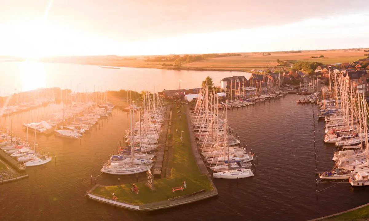
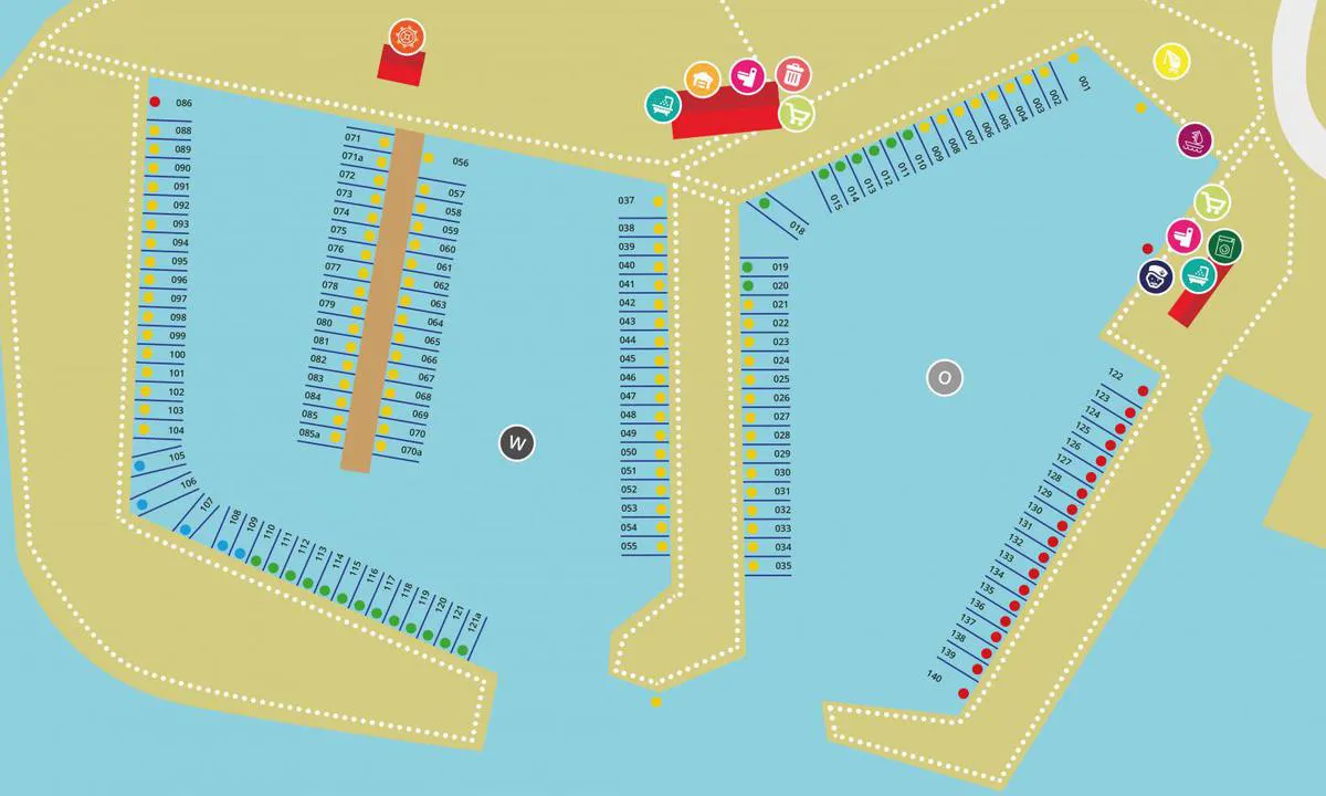
The harbor of the Segler-Verein Lemkenhafen Fehmarn is located in the charming Orther Bay - well protected in all weather conditions. The two basins offer 140 berths with depths of up to 2.5 meters. Available spots are marked with green signs. Even ships over 40 feet always find a place in the large basin. There is something for everyone here: children play on the playground and swim in the shallow bay or learn to sail, while the youth enjoy activities like surfing and kiting. In the evening, the barbecue area guarantees cozy hours. The spacious clubhouse offers a lot of comfort: a communal kitchen, free showers, as well as a washing machine and dryer at the harbor master's office.
Payment is made at the BEAS card machine. The access code for the sanitary facilities can also be obtained here. Lemkenhafen offers a crane service for up to 35 tons, a slipway for trailer boats, and nearby winter storage. Those in need of a sailmaker or engine service can contact the harbor master.
Approach
The approach to the harbor is very easy. From Fehmarnsund, steer towards the first pair of buoys from Orth. With a course of 82°, follow the red buoys to the illuminated approach buoy Lemkenhafen 1. Keep the buoys to port. The marked channel offers a water depth of 2.5 meters. Even at night, navigation is not a problem thanks to the buoy lights and reflectors on the poles.
Surroundings
The idyllic village attracts visitors with its good restaurants and bars. Picturesque walking and cycling paths surround the bay. Kite and surfing schools offer courses and rent out SUPs, and a bicycle rental is also located close to the harbor. The mill museum in the village's windmill is worth a visit.
[translated from German with AI]

1 x helpful | written on 7. Jul 2026
Do you know this harbour? It's a huge help to other sailors if you add a short description or review of the harbour.
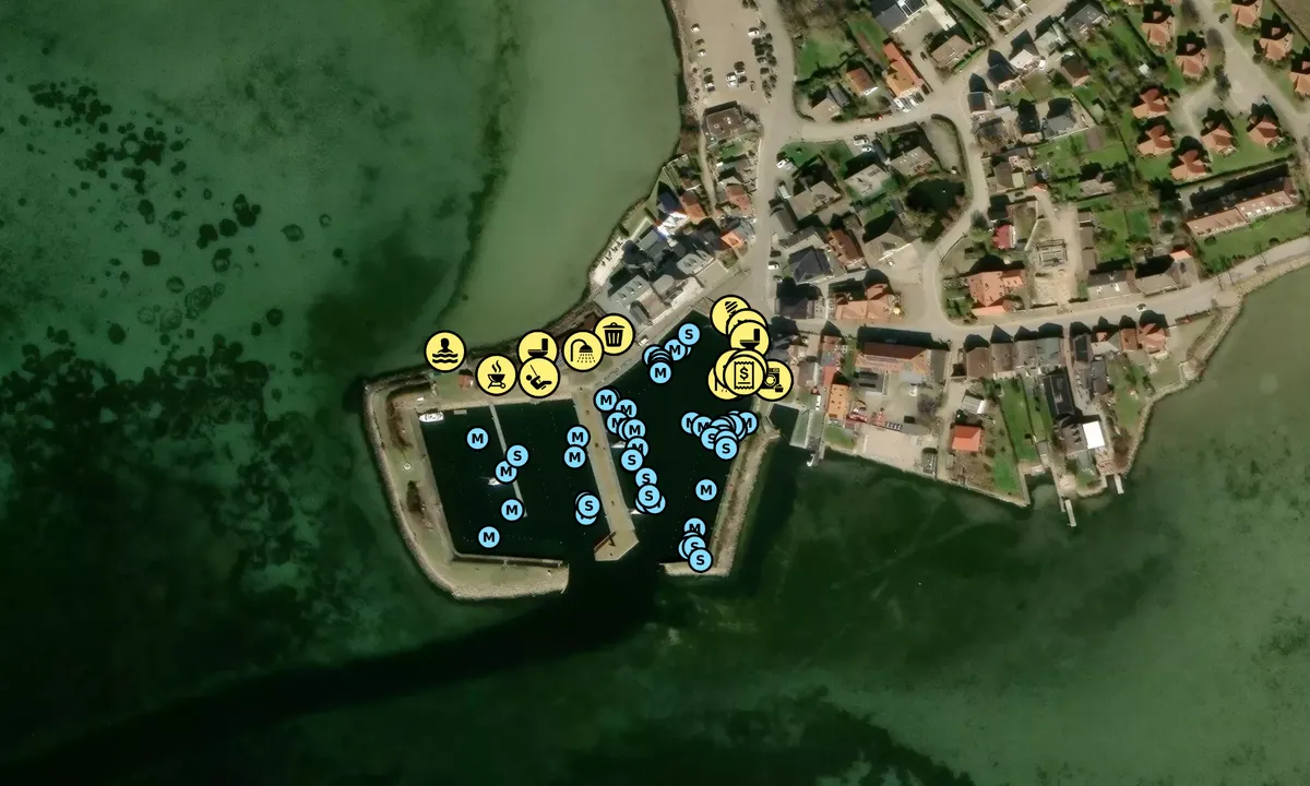
Map of Yachthafen Lemkenhafen

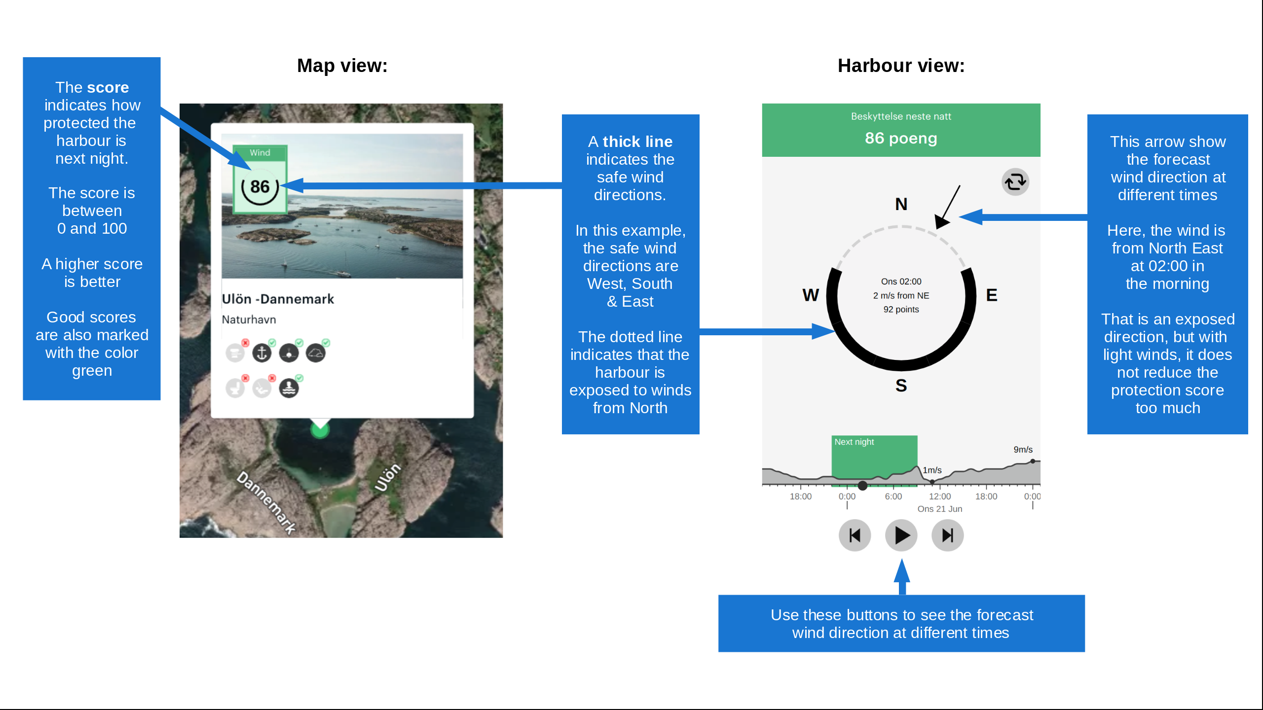
Wind protection
Protection next night
66 points



Want to know how the wind score works? Then you should read this explanation.
The wind forecasts come from yr.no (Norwegian Meteorological Institute), and was last updated 2 hours and 7 minutes ago (Thursday 22 October 09:29 PM). The next night score shows you the worst hour between 22:00 and 08:00 the next night. We recommend that you check multiple sources for wind forecasts. windy.com is a good website to show larger wind systems.

The safe wind directions for this harbour has been decided by an algorithm, based on how elevated the land around the harbour is. It's mostly correct, but sometimes the underlying data about elevation levels is not good enough to make correct decisions. It's a great help to other if you can validate or adjust the safe wind directions. You can see the data used by the algorithm to decide the safe wind directions by clicking here.
Last visits to Yachthafen Lemkenhafen
Wed 21 Oct 2026 |
|
|
Sat 03 Oct 2026 |
|
|
Thu 24 Sep 2026 |
|
|
Wed 23 Sep 2026 |
|
|
Tue 22 Sep 2026 |
|
|
 CHARLIE [MMSI: 211155470]
 VIA 2 [MMSI: 211796140]
The visits are retrieved from AIS data. You can click to see all visiting ships to Yachthafen Lemkenhafen, as well as statistics about the ships that visits
Add this harbour to a journey
Choose a different date than today
Important: When you check in to a harbour, you add it to a journey on this website. You are not booking a place in the marina.
Contributors
Users that contributed to this page: Marion Köhler
harbourmaps.com is updated by the boating community. When you add information, a review or pictures to this page you are listed here with the other contributors (we list your user-name, which can be your real name or a pseudonym).
Closest harbours to Yachthafen Lemkenhafen
Filter by
Order by
0 harbours
Show more harbours