harbourmaps.com
Search for marinas, anchorages, ships, MMSI, ++
Guide to understand the wind scores
Where in the harbour can you moor and anchor?
Explanation of icons
Log in
Top contributing users
Thematic lists of harbours
Terms of use, privacy & GDPR
Terms of sale
United Kingdom
Follow the journey
2023
Mandag 06 November 2023
Safe Harbor Skull Creek
Fredag 03 November 2023
Unnamed harbour
Torsdag 02 November 2023
Søndag 29 Oktober 2023
Sugar Loaf Island South
Onsdag 25 Oktober 2023
Windmill Point Marina
Tirsdag 24 Oktober 2023
Mill Creek - 1 - Solomons
Mandag 23 Oktober 2023
Rhode River - 1
Torsdag 19 Oktober 2023
Onsdag 18 Oktober 2023
Fredag 13 Oktober 2023
Lake Ogleton
Onsdag 11 Oktober 2023
Tirsdag 10 Oktober 2023
Mandag 09 Oktober 2023
Cockrell Creek East
Søndag 08 Oktober 2023
Hicks Wharf
Lørdag 07 Oktober 2023
Williams Wharf - 2
Onsdag 04 Oktober 2023
Riverwalk Landing Piers
Tirsdag 03 Oktober 2023
Jackson Creek - 2
Søndag 01 Oktober 2023
Jackson Creek - 3
Fredag 29 September 2023
Mandag 14 August 2023
Zimmerman Marine, Inc - Mobjack Bay, VA
Torsdag 16 Mars 2023
Charlotte Amalie Harbor
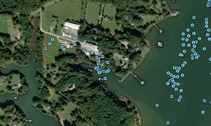
Images of MISTY BLUE
📸 Upload a photo
Share a photo of MISTY BLUE. Uploading a photo takes less than a minute and can be done from your phone, tablet or laptop.
About the ship
Owner
[add]
MMSI
232045209
Callsign
Sail number
Lenght
12m / 39.4ft
Draft (depth)
Height
Width
8m / 26.2ft
Ship type
Sailing Vessel
Builder and make
Year build
Engine
Edit the ship info
Journey statistics
Preferred harbour type
29% marina
natural harbour 71%