


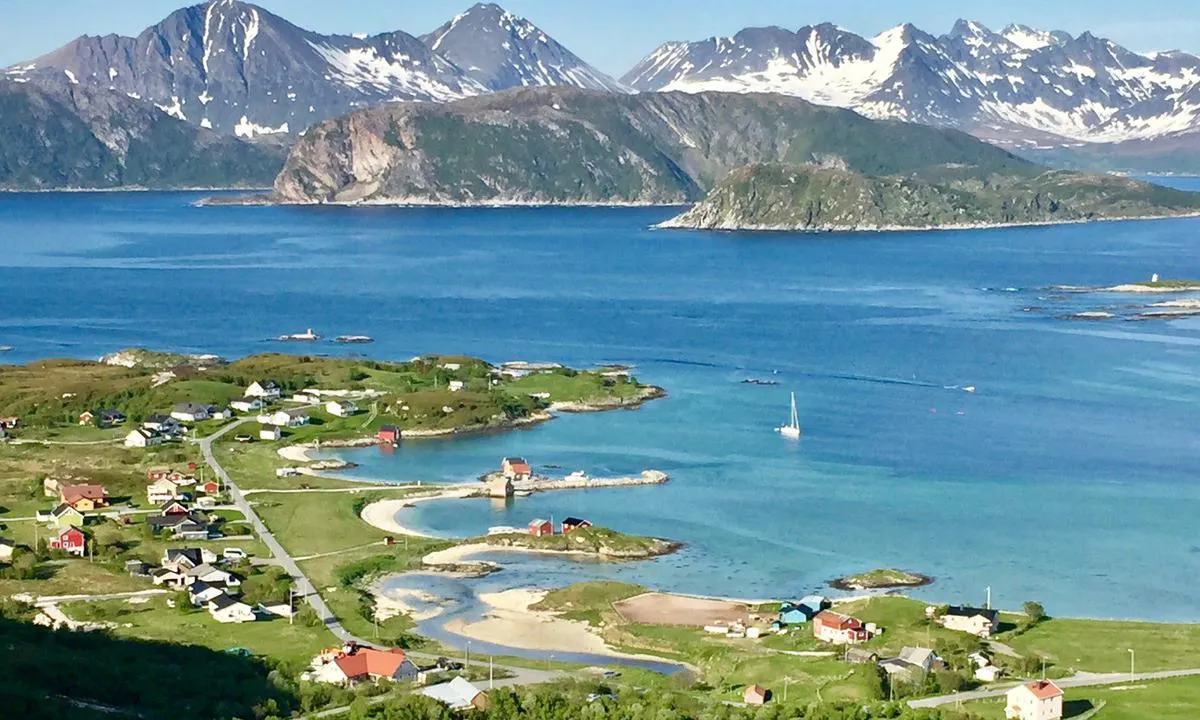
Avløsbukta
Natural harbour

Region: Norway (3448), Troms og Finnmark (454), Troms (277), Tromsø (51) and Sommarøy (2)


Descriptions and reviews
Jan Halstein Haugnes says:
says:
description
Anchoring: Anchoring depth approx. 15 meters, but shallower towards the shore. Good holding ground and ample space. At the pier, there is a floating dock where you can moor with a rubber dinghy. Short distance to the store from the floating dock.
[translated from Norwegian with AI]

1 x helpful | written on 14. Jun 2021
Do you know this harbour? It's a huge help to other sailors if you add a short description or review of the harbour.
Map of Avløsbukta

Wind protection
Protection next night
79 points


Want to know how the wind score works? Then you should read this explanation.
The wind forecasts come from yr.no (Norwegian Meteorological Institute), and was last updated 2 hours and 1 minute ago (Thursday 21 May 03:28 AM). The next night score shows you the worst hour between 22:00 and 08:00 the next night. We recommend that you check multiple sources for wind forecasts. windy.com is a good website to show larger wind systems.
The safe directions for this harbour was added at 14. Jun 2021. Click here to edit.

Avløsbukta and/or the surrounding seas is not well protected from strong winds and waves, and you should take caution in foul weather. Click to edit protection level.
Last visits to Avløsbukta
The visits are retrieved from AIS data. You can click to see all visiting ships to Avløsbukta, as well as statistics about the ships that visits
Add this harbour to a journey
Choose a different date than today
Important: When you check in to a harbour, you add it to a journey on this website. You are not booking a place in the marina.
Contributors
Users that contributed to this page: Jan Halstein Haugnes
harbourmaps.com is updated by the boating community. When you add information, a review or pictures to this page you are listed here with the other contributors (we list your user-name, which can be your real name or a pseudonym).
Closest harbours to Avløsbukta
Filter by
Order by
0 harbours
Show more harbours
