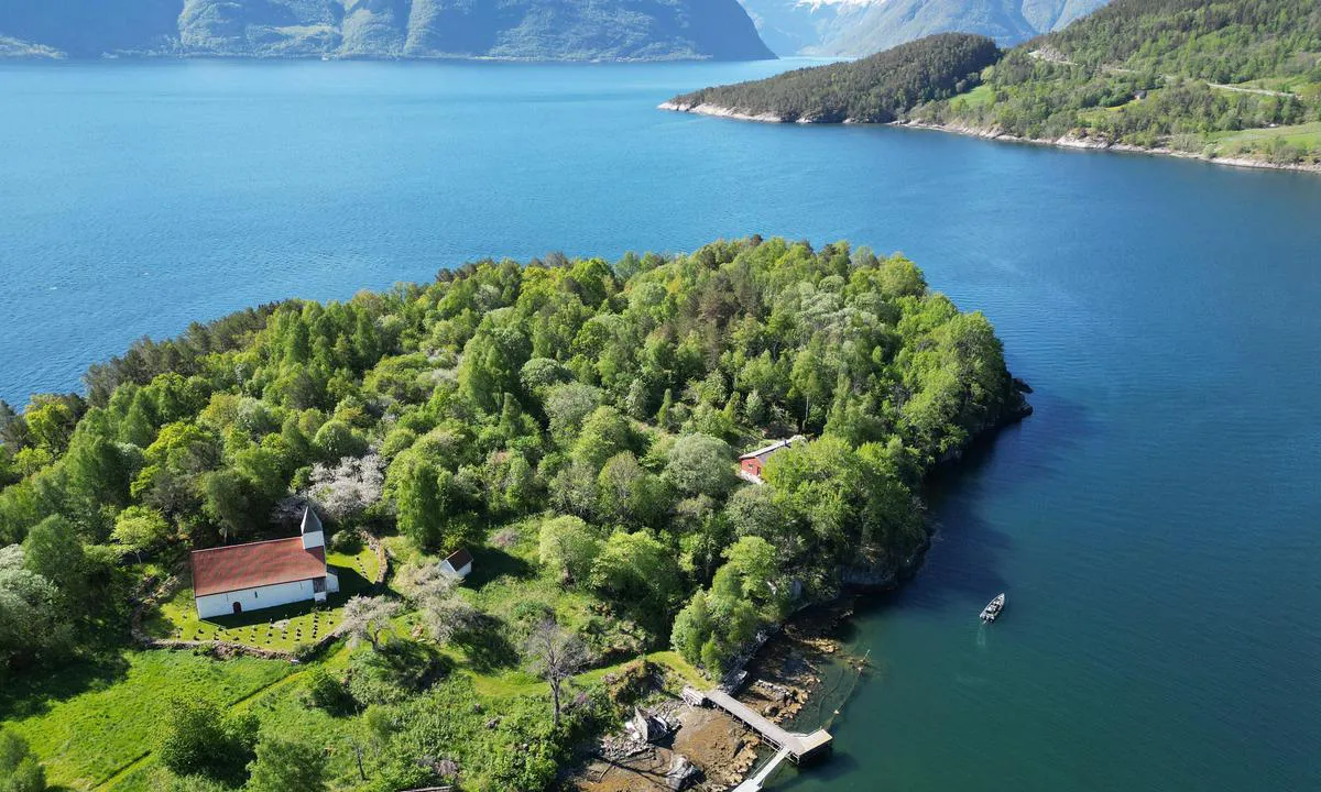
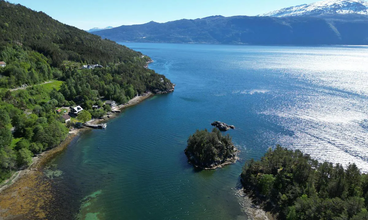
Kvamsøya: {"base": "no", "no": "Ein av dei beste havnene i Sognefjorden.  Gode ankringsforhold.  \"betongkaien\" inne i bukta er ein lektar som har g\u00e5tt ned.  Grunt rundt denne.  \r\n\r\nKvams\u00f8y er verdas minste \u00f8y med eiga kyrkje.  Kyrkja er bygd av stein og fr\u00e5 ca 1300.\r\n\r\nDet var her kong Sverre l\u00e5g med krigsskipet Mariasuden for slaget mot Magnus Erlingsson p\u00e5 Fimreite i 1184.", "se": "En av de b\u00e4sta hamnarna i Sognefjorden. Bra ankringsf\u00f6rh\u00e5llanden. \"betongkajen\" inne i viken \u00e4r en lastpr\u00e5m som har sjunkit. Grund runt denna.<br><br>Kvams\u00f8y \u00e4r v\u00e4rldens minsta \u00f6 med egen kyrka. Kyrkan \u00e4r byggd av sten och fr\u00e5n ca 1300.<br><br>Det var h\u00e4r kung Sverre l\u00e5g med krigsskeppet Mariasuden inf\u00f6r slaget mot Magnus Erlingsson vid Fimreite \u00e5r 1184.", "en": "One of the best harbours in the Sognefjord. Good anchoring conditions. The 'concrete quay' inside the bay is a barge that has sunk. Shallow around this area.<br><br>Kvams\u00f8y is the world's smallest island with its own church. The church is made of stone and dates from around 1300.<br><br>It was here that King Sverre lay with the warship Mariasuden for the battle against Magnus Erlingsson at Fimreite in 1184.", "da": "En af de bedste havne i Sognefjorden. Gode ankerforhold. \"betonkajen\" inde i bugten er en lekter, der er sunket. Lavt omkring denne.\r\n\r\nKvams\u00f8y er verdens mindste \u00f8 med egen kirke. Kirken er bygget af sten og fra ca. 1300.\r\n\r\nDet var her kong Sverre l\u00e5 med krigsskibet Mariasuden til slaget mod Magnus Erlingsson ved Fimreite i 1184."}
Kvamsøya
Kvamsøya
Kvamsøya
Kvamsøya
Kvamsøya
Kvamsøya
Kvamsøya: {"base": "en", "no": "Mot \u00f8st er det veldig grunt, og det er en kabel 9 m over hodet", "se": "Till \u00f6ster \u00e4r det mycket grunt, och \u00f6verliggande kabel 9 m", "en": "To the east is very shallow, and overhead cable 9 m", "da": "Mod \u00f8st er der meget lavvandet, og en luftledning p\u00e5 9 m"}
Kvamsøya
Kvamsøya
Kvamsøya
Kvamsøya
Kvamsøya: {"base": "en", "no": "\u00abKirke\u00bb brygge brukt av \u00f8ybeboere og under kirketjeneste", "se": "\"Kyrka\" brygga anv\u00e4nds av \u00f6bor och vid gudstj\u00e4nst i kyrkan", "en": "\"Church\" jetty used by islanders and when service at church", "da": "\"Kirkebro\" bruges af \u00f8boere og n\u00e5r der er gudstjeneste i kirken"}
Satelite image of Kvamsøya

📸 Upload a photo

Show off your photos and help others plan their journey to Kvamsøya.harbourmaps.com is created by the sailing community, in a collective effort to make cruising simpler and more fun. Uploading a photo takes less than a minutes and can be done from your phone, tablet or laptop.

📸 Upload a photo

Facilities

We don't have any data on available facilities in this harbour. If you know which facilities are available here, please update this site to help your fellow sailors. Update facilities.

Mooring

Options for mooring in this harbour: To pier/wharf, Anchoring.

Updated on 16. May 2024. Update mooring.

Contact information

website: Add website

phone: Add phone number

email: Add email

Descriptions and reviews

Odd Tufte. S/Y Vindreken says:

area

maritime qualities

description

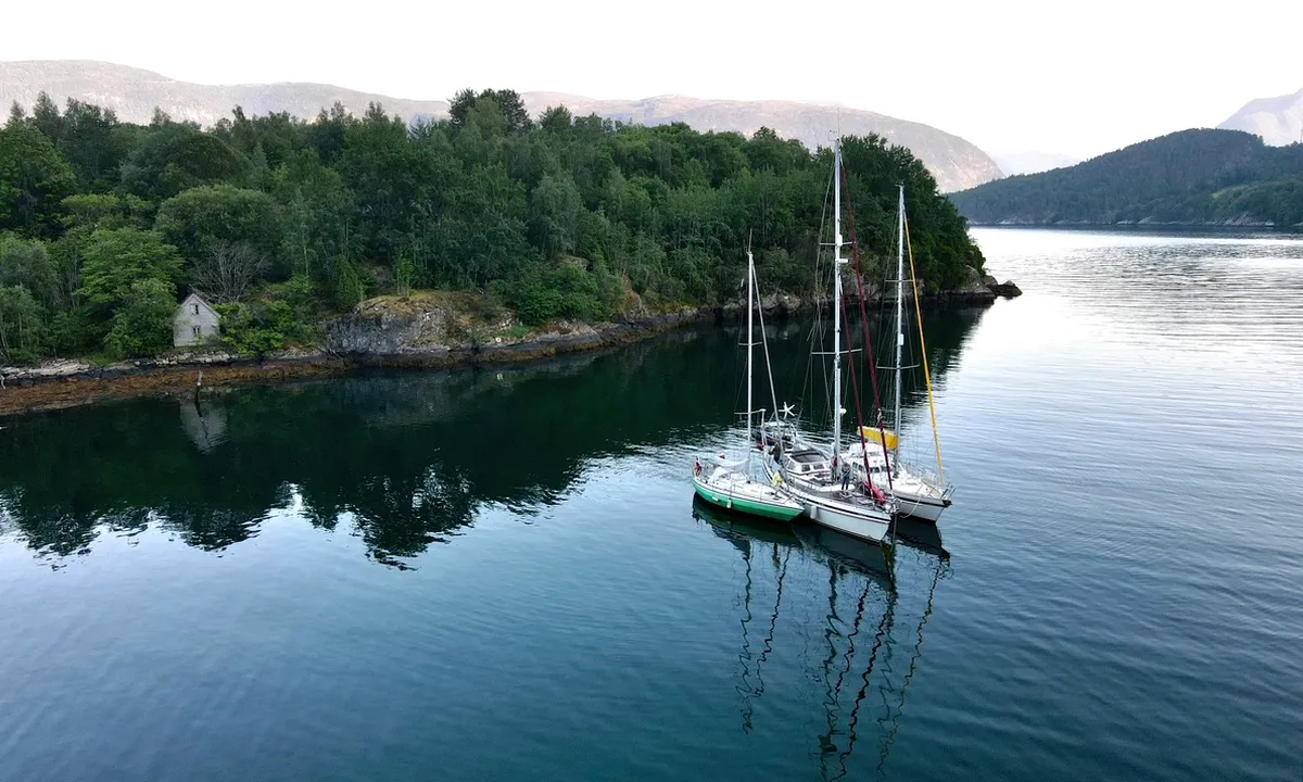
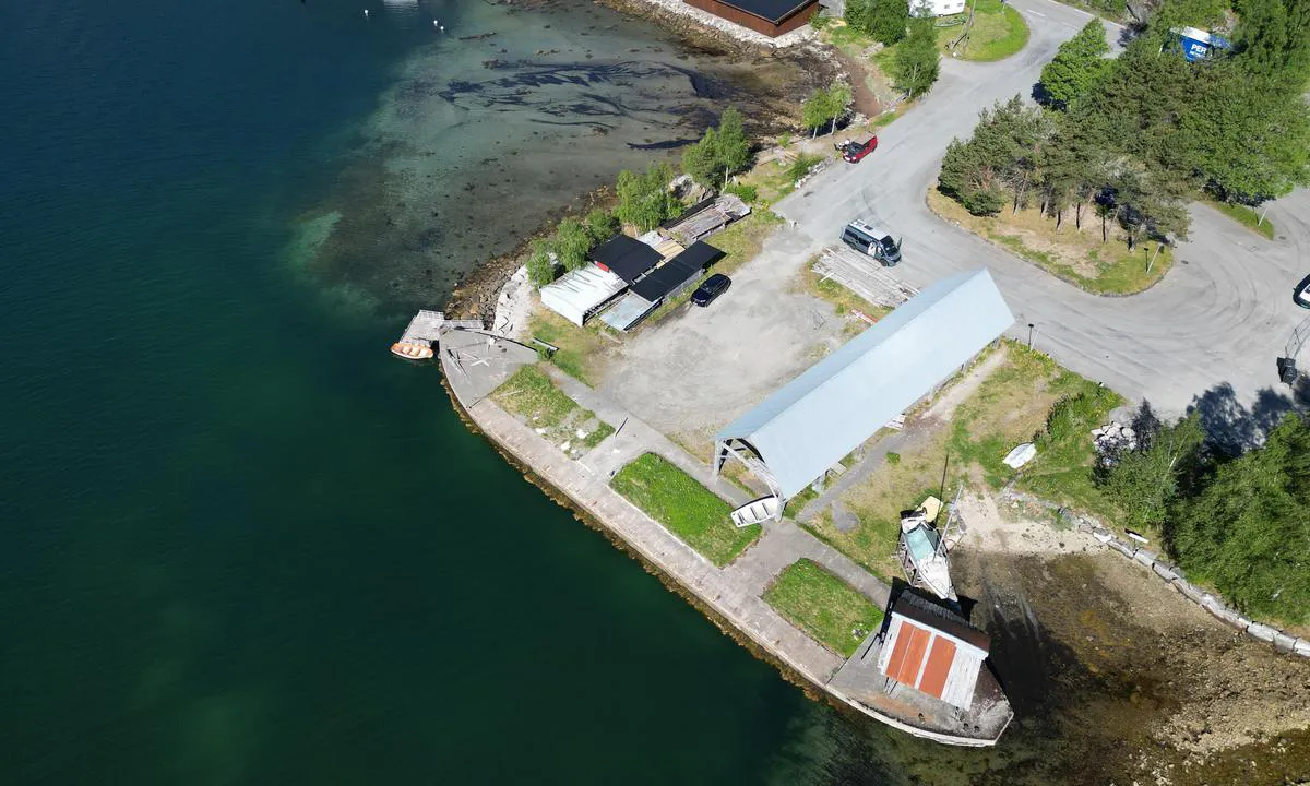
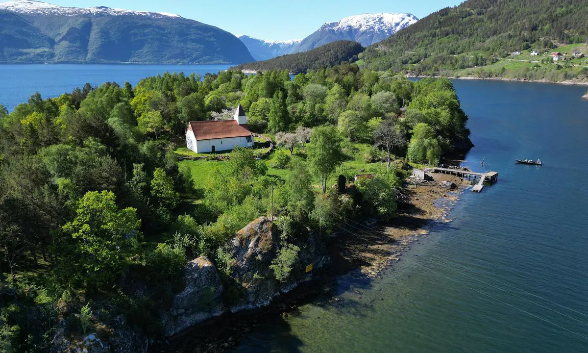
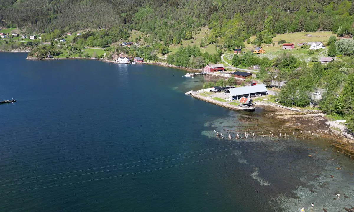
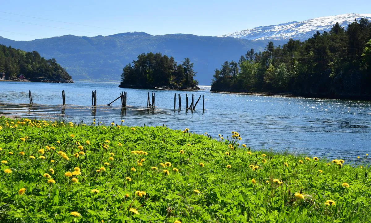
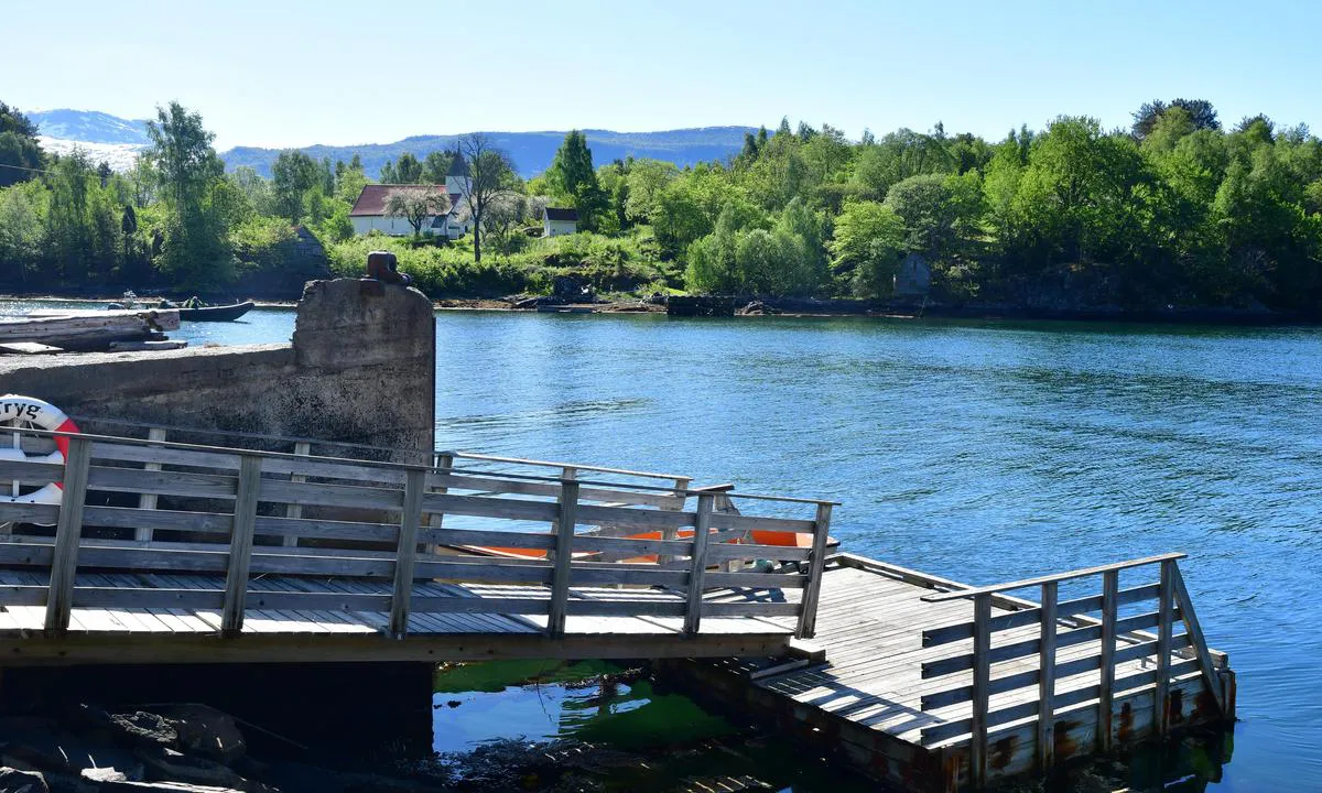
Good Harbour in Sognefjord. Easy entry from West. Good anchorage, but be aware of cable opposite the church
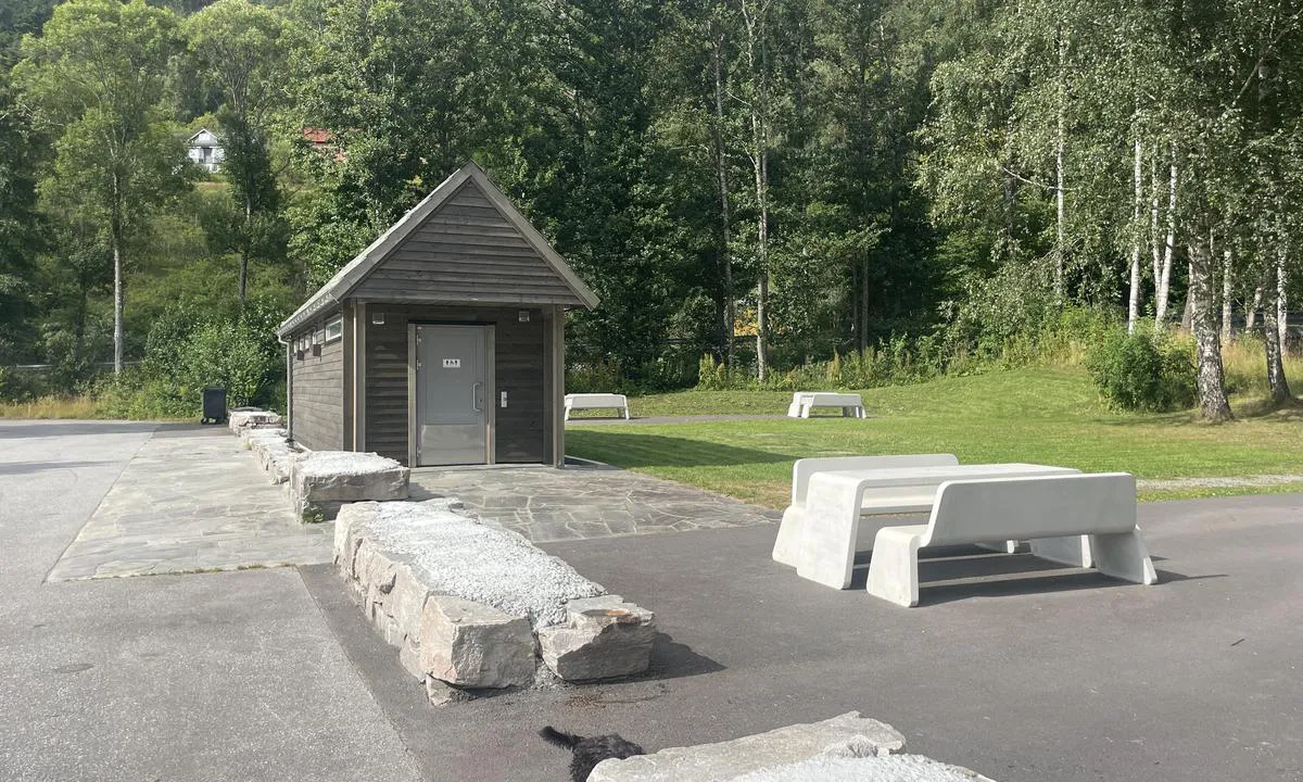
There are a sunken barge which is ok to stay on. but not many places to attach lines. The jetty/barge is public. and mobile home camping nearby

1 x helpful | written on 16. May 2024

Olav Pekeberg says:

description

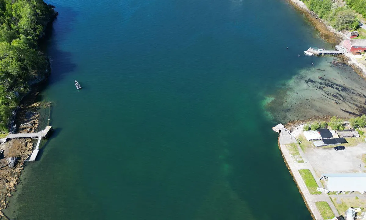
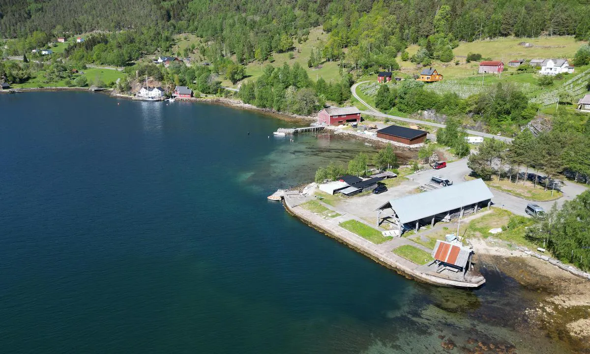
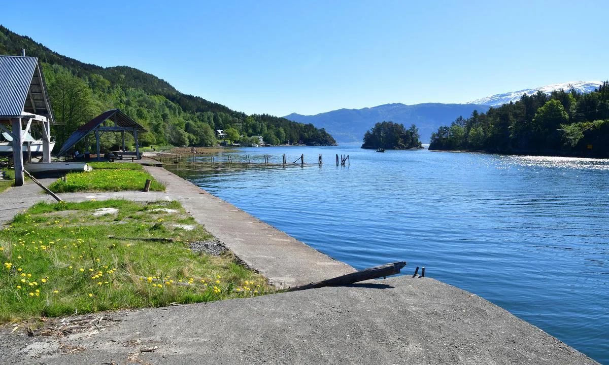
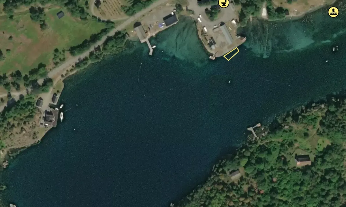
Approach and Maritime Conditions: Concrete pier
Anchoring: The nautical charts indicate a sandy bottom and anchoring depth of 10-20 meters. There is also a report of a concrete quay at the site, which is likely private.

[translated from Norwegian with AI]

0 x helpful | written on 2. Jul 2021

Do you know this harbour? It's a huge help to other sailors if you add a short description or review of the harbour.

📜 Add description

Map of Kvamsøya

Facilities

We don't have any data on available facilities in this harbour. If you know which facilities are available here, please update this site to help your fellow sailors. Update facilities.

Mooring

Options for mooring in this harbour: To pier/wharf, Anchoring.

Updated on 16. May 2024. Update mooring.

Wind protection

Protection next night

97 points

N E S W --> } } } } } } } } } } } } } } } } } } } } } } } } } } } } } } } } } } } } } } } } } } } } } } } } } } } } } } } } } } } } } } } } } } } } } } } } } } } } } } } } } } } } } } } } } } } } } } } } } } } } } } } } } } } } } } } } } } } } } } } } } } } } } } } } } } } } } } } } } } } } } } } } } } } } } } } } } } } } } } } } } } } } } } } } } } } } } } } } } } } } } } } } } } } } } } } } } } } } } } } } } } } } } } } } } } } } } } } } } } } } } } } } } } } } } } } } } } } } } } } } } } } } } } } } } } } } } } } } } } } } } } } } } } } } } } } } } } } } } } } } } } } } } } } } } } } } } } } } } } } } } } } } } } } } } } } } } } } } } } } } } } } } } } } } } } } } } } } } } } } } } } } } } } } } } } } } } } } } } } } } } } } } } } } } } } } } } } } } } } } } } } } } } } } } } } } } } } } } } } } } } } } } } } } } } } } } } } } } } } } } } } } } } } } } } } } } } } } } } } } } } } } } } } } } } } } } } } } } } } } } } } } } } } } } } } } } } } } } } } } } } } } } } } } } } } } } } } } } } } } } } } } } } } } } } } } } } } } } } } } } } } } } } } } } } } } } } } } } } } } } } } } } } } } } } } } } } } } } } } } } } } } } } } } } } } } } } } } } } } } } } } } } } } } } } } } } } } } } } } } } } } } } } } } } } } } } } } } } } } } } } } } } } } } } } } } } } } } } } } } } } } } } } } } } } } } } } } } } } } } } } } } } } } } } } } } } } } } } } } } } } } } } } } } } } } } } } } } } } } } } } } } } } } } } } } } } } } } } } } } } } } } } } } } } } } } } } } } } } } } } } } } } } } } } } } } } } } } } } } } } } } } } } } } } } } } } } } } } } } } } } } } } } } } } } } } } } } } } } } } } } } } } } } } } } } } } } } } } } } } } } } } } } } } } } } } } } } } } } } } } } } } } } } } } } } } } } } } } } } } } } } } } } } } } } } } } } } } } } } } } } } } } } } } } } } } } } } } } } } } } } } } } } } } } } } } } } } } } } } } } } } } } } } } } } } } } } } } } } } } } } } } } } } } } } } } } } } } } } } } } } } } } } } } } } } } } } } } } } } } } Next night 18:00 0:00 6:00 12:00 Tor 01 Mai 18:00 0:00 4m/s 1m/s

Want to know how the wind score works? Then you should read this explanation.

The wind forecasts come from yr.no (Norwegian Meteorological Institute), and was last updated 1 hour and 34 minutes ago (Wednesday 30 April 03:27 PM). The next night score shows you the worst hour between 22:00 and 08:00 the next night. We recommend that you check multiple sources for wind forecasts. windy.com is a good website to show larger wind systems.

The safe directions for this harbour was added at 2. Jul 2021. Click here to edit.

Last visits to Kvamsøya

Sat 22 Jul 2023

ELIXIR [MMSI: 228046610]

The visits are retrieved from AIS data. You can click to see all visiting ships to Kvamsøya, as well as statistics about the ships that visits

Add this harbour to a journey

Check in now

Choose a different date than today

Important: When you check in to a harbour, you add it to a journey on this website. You are not booking a place in the marina.

Contributors

Users that contributed to this page: Odd Tufte. S/Y Vindreken and Olav Pekeberg

harbourmaps.com is updated by the boating community. When you add information, a review or pictures to this page you are listed here with the other contributors (we list your user-name, which can be your real name or a pseudonym).

Closest harbours to Kvamsøya

Filter by

Natural harbour
Marina
Safe wind next night

Order by

ABC
Popularity
Wind score next night

0 harbours

Show more harbours