Venø E bouy

Natural harbour

favoritt

Region: Denmark (619), Jylland (237), Limfjorden (71) and Struer (8)

Do you know this harbour?

harbourmaps.com is created by the sailing community, but there is no information on this page yet.

If you answer some quick questions or upload a photo, the harbour will be updated. It only takes a minute, with mostly yes/no questions and the page is designed for small mobile screens.

Your knowledge is highly valuable to other users who are searching for information about Venø E bouy.

📜 Add info about the harbour

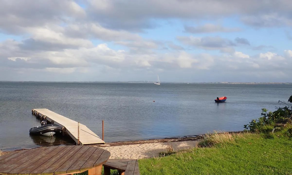
Venø E bouy: {"base": "no", "no": "Ven\u00f8 bukt, fin ankerplass, kort tur inn med jolla. Det er to b\u00f8yer her ogs\u00e5, men god plass og bunn til \u00e5 ligge p\u00e5 svai. Det er langgrunt s\u00e5 helt inn til land kommer man ikke. God le for vestavinden. Ven\u00f8 byr p\u00e5 mange fine turer. En stor lagune p\u00e5 nordenden av \u00f8ya, den kan man g\u00e5 helt rundt (m\u00e5 vasse en kort bit). Reservat for sel, sannsynligheten for \u00e5 se sel p\u00e5 nord\u00f8stenden er stor.", "se": "Ven\u00f8bukten, fin ankringsplats, kort tur in med jollen. Det finns tv\u00e5 bojar h\u00e4r ocks\u00e5, men gott om plats och botten f\u00f6r att ligga p\u00e5 svaj. Det \u00e4r l\u00e5nggrunt s\u00e5 man kommer inte \u00e4nda in till land. Bra l\u00e4 f\u00f6r v\u00e4stanvind. Ven\u00f8 bjuder p\u00e5 m\u00e5nga fina turer. En stor lagun p\u00e5 norra \u00e4nden av \u00f6n, den kan man g\u00e5 runt helt (man m\u00e5ste vada en kort bit). Reservat f\u00f6r s\u00e4l, sannolikheten att se s\u00e4l p\u00e5 nordost\u00e4nden \u00e4r stor.", "en": "Ven\u00f8 Bay, fine anchorage, short trip in with the dinghy. There are two buoys here as well, but plenty of space and a bottom suitable for anchoring freely. It's shallow, so you can't get all the way to shore. Good shelter from the west wind. Ven\u00f8 offers many fine trips. A large lagoon on the north end of the island, which can be circumnavigated (need to wade a short bit). Seal reserve, with a high likelihood of seeing seals on the northeast end.", "da": "Ven\u00f8 bugt, fin ankerplads, kort tur ind med jollen. Der er to b\u00f8jer her ogs\u00e5, men god plads og bund til at ligge for svaj. Det er lavvandet, s\u00e5 man kommer ikke helt ind til land. God l\u00e6 for vestenvinden. Ven\u00f8 byder p\u00e5 mange fine ture. En stor lagune p\u00e5 nordenden af \u00f8en, den kan man g\u00e5 hele vejen rundt (man skal vade et kort stykke). Reservat for s\u00e6ler, sandsynligheden for at se s\u00e6ler p\u00e5 nord\u00f8stenden er stor."}
Satelite image of Venø E bouy

📸 Upload a photo

Show off your photos and help others plan their journey to Venø E bouy.harbourmaps.com is created by the sailing community, in a collective effort to make cruising simpler and more fun. Uploading a photo takes less than a minutes and can be done from your phone, tablet or laptop.

📸 Upload a photo

Facilities

We don't have any data on available facilities in this harbour. If you know which facilities are available here, please update this site to help your fellow sailors. Update facilities.

Mooring

Options for mooring in this harbour: Anchoring, Mooring buoy<br>(for easy "anchoring", not to be confused with bouys used in marinas).

Updated on 13. Jul 2022. Update mooring.

Descriptions and reviews

HarbourMaps (site admin) says:

description

The bouy is owned by Dansk Sejlunion

0 x helpful | written on 13. Jul 2022

Do you know this harbour? It's a huge help to other sailors if you add a short description or review of the harbour.

📜 Add description

Map of Venø E bouy

Facilities

We don't have any data on available facilities in this harbour. If you know which facilities are available here, please update this site to help your fellow sailors. Update facilities.

Mooring

Options for mooring in this harbour: Anchoring, Mooring buoy<br>(for easy "anchoring", not to be confused with bouys used in marinas).

Updated on 13. Jul 2022. Update mooring.

Wind protection

Protection next night

85 points

N E S W --> } } } } } } } } } } } } } } } } } } } } } } } } } } } } } } } } } } } } } } } } } } } } } } } } } } } } } } } } } } } } } } } } } } } } } } } } } } } } } } } } } } } } } } } } } } } } } } } } } } } } } } } } } } } } } } } } } } } } } } } } } } } } } } } } } } } } } } } } } } } } } } } } } } } } } } } } } } } } } } } } } } } } } } } } } } } } } } } } } } } } } } } } } } } } } } } } } } } } } } } } } } } } } } } } } } } } } } } } } } } } } } } } } } } } } } } } } } } } } } } } } } } } } } } } } } } } } } } } } } } } } } } } } } } } } } } } } } } } } } } } } } } } } } } } } } } } } } } } } } } } } } } } } } } } } } } } } } } } } } } } } } } } } } } } } } } } } } } } } } } } } } } } } } } } } } } } } } } } } } } } } } } } } } } } } } } } } } } } } } } } } } } } } } } } } } } } } } } } } } } } } } } } } } } } } } } } } } } } } } } } } } } } } } } } } } } } } } } } } } } } } } } } } } } } } } } } } } } } } } } } } } } } } } } } } } } } } } } } } } } } } } } } } } } } } } } } } } } } } } } } } } } } } } } } } } } } } } } } } } } } } } } } } } } } } } } } } } } } } } } } } } } } } } } } } } } } } } } } } } } } } } } } } } } } } } } } } } } } } } } } } } } } } } } } } } } } } } } } } } } } } } } } } } } } } } } } } } } } } } } } } } } } } } } } } } } } } } } } } } } } } } } } } } } } } } } } } } } } } } } } } } } } } } } } } } } } } } } } } } } } } } } } } } } } } } } } } } } } } } } } } } } } } } } } } } } } } } } } } } } } } } } } } } } } } } } } } } } } } } } } } } } } } } } } } } } } } } } } } } } } } } } } } } } } } } } } } } } } } } } } } } } } } } } } } } } } } } } } } } } } } } } } } } } } } } } } } } } } } } } } } } } } } } } } } } } } } } } } } } } } } } } } } } } } } } } } } } } } } } } } } } } } } } } } } } } } } } } } } } } } } } } } } } } } } } } } } } } } } } } } } } } } } } } } } } } } } } } } } } } } } } } } } } } } } } } } } } } } } } } } } } } } } } } } } } } } } } } } } } } } } } } } } } } } } } } } } } } } } } } } Next night 18:00 0:00 6:00 12:00 Tor 01 Mai 18:00 0:00 6m/s 2m/s

Want to know how the wind score works? Then you should read this explanation.

The wind forecasts come from yr.no (Norwegian Meteorological Institute), and was last updated 1 hour and 51 minutes ago (Wednesday 30 April 01:28 PM). The next night score shows you the worst hour between 22:00 and 08:00 the next night. We recommend that you check multiple sources for wind forecasts. windy.com is a good website to show larger wind systems.

The safe wind directions for this harbour has been decided by an algorithm, based on how elevated the land around the harbour is. It's mostly correct, but sometimes the underlying data about elevation levels is not good enough to make correct decisions. It's a great help to other if you can validate or adjust the safe wind directions. You can see the data used by the algorithm to decide the safe wind directions by clicking here.

Venø E bouy and/or the surrounding seas is not well protected from strong winds and waves, and you should take caution in foul weather. Click to edit protection level.

Last visits to Venø E bouy

The visits are retrieved from AIS data. You can click to see all visiting ships to Venø E bouy, as well as statistics about the ships that visits

Add this harbour to a journey

Check in now

Choose a different date than today

Important: When you check in to a harbour, you add it to a journey on this website. You are not booking a place in the marina.

Contributors

Users that contributed to this page: Ole Widar Saastad

harbourmaps.com is updated by the boating community. When you add information, a review or pictures to this page you are listed here with the other contributors (we list your user-name, which can be your real name or a pseudonym).

Closest harbours to Venø E bouy

Filter by

Natural harbour
Marina
Safe wind next night

Order by

ABC
Popularity
Wind score next night

0 harbours

Show more harbours