


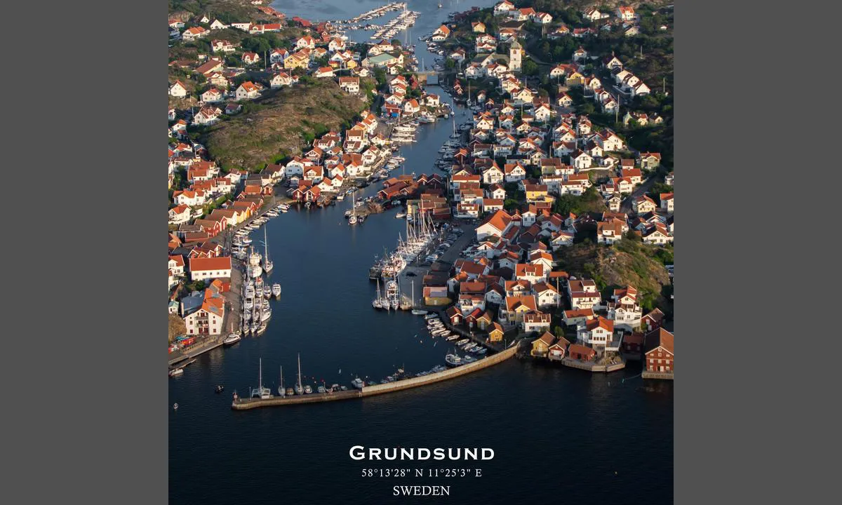
Grundsund
Marina

Region: Sweden (2148), Västra Götaland (663), Västkusten (533), Bohuslän (504), Lysekil (47) and Grundsund (25)


Descriptions and reviews
Ole Kristian Hardangen says:
area

maritime qualities

description
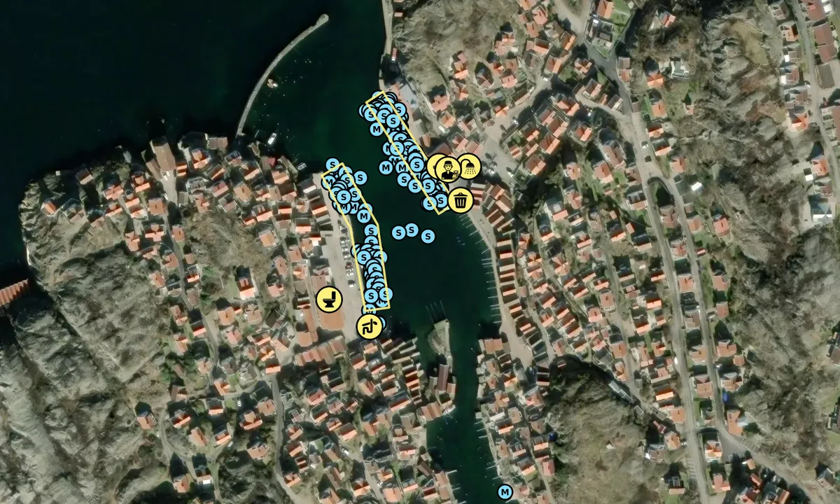
Lay on the west side of the strait with the bow in and a stern anchor rope. The sun sets a bit earlier here. Helpful harbor hosts. Pre-booking not possible. Payment via the web. Electricity on the dock - but regular 'household plug', so remember an adapter. Few water posts, so it's not certain the hose will reach all spots. Shower and toilet as well as a washing machine right nearby.
Very pleasant place!
Septic tank emptying is also on the west side.
[translated from Norwegian with AI]

1 x helpful | written on 1. Aug 2025 | updated_on 1. Aug 2025
Billie Jean says:
area
maritime qualities
description
We hadn’t planned a stay in Grundsund but what a pleasent surprise. Hamnvärden was extremely helpful and kind.
I highly recommend ‘Pelles bar & kök’ followed by a walk a long the water!
1 x helpful | written on 13. Jul 2024
Stig Ulfsby
 says:
says:
description
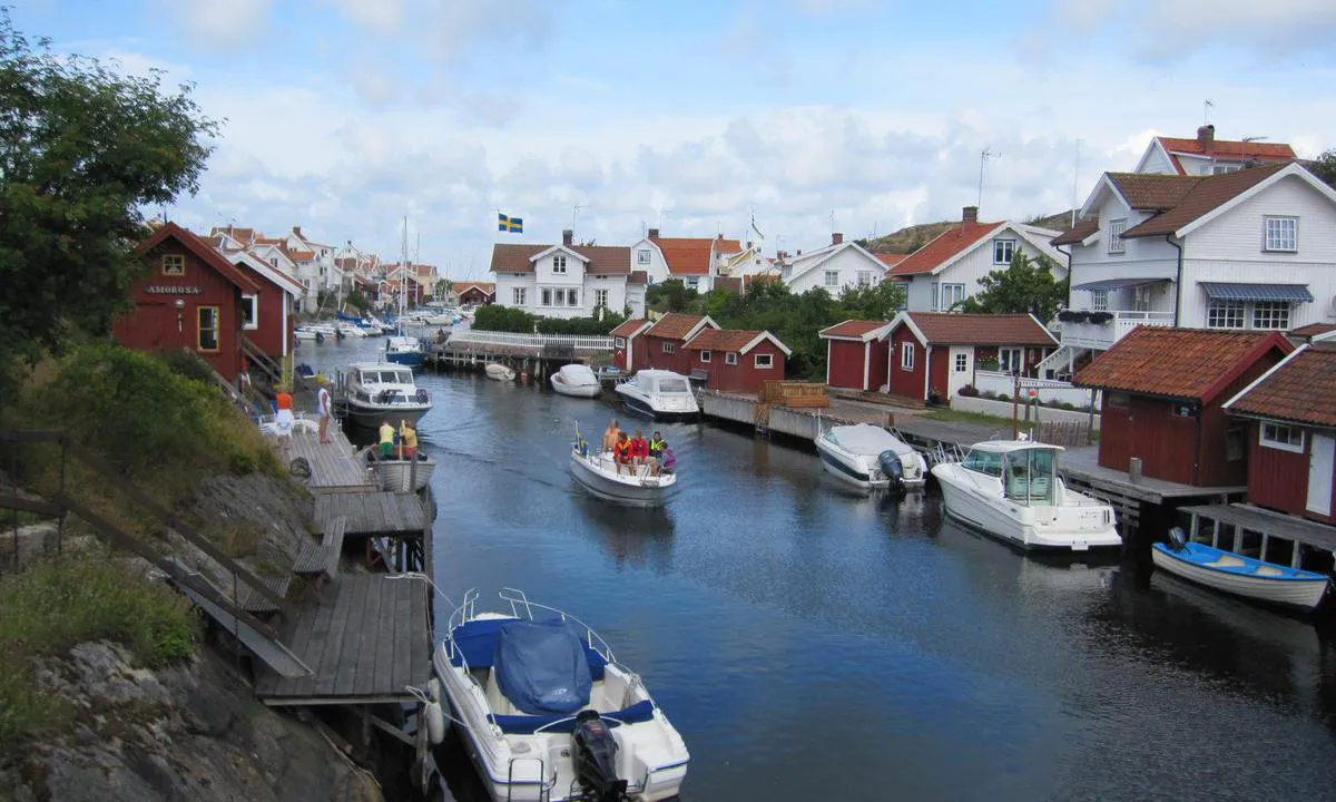
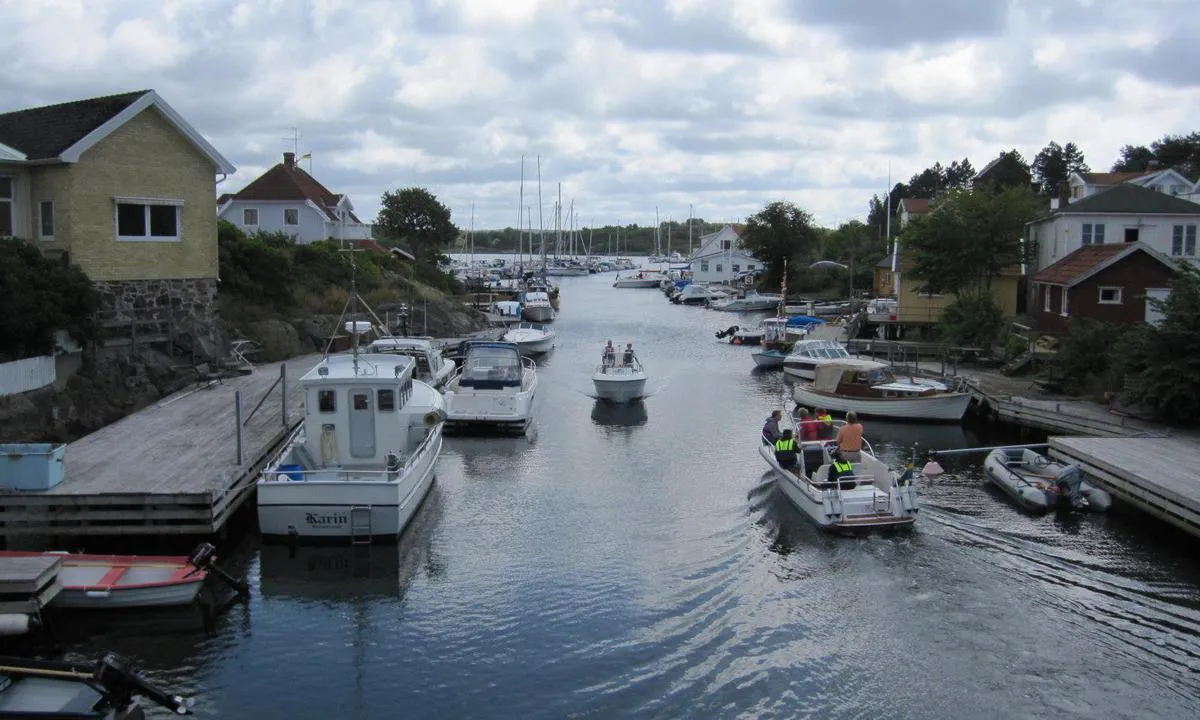
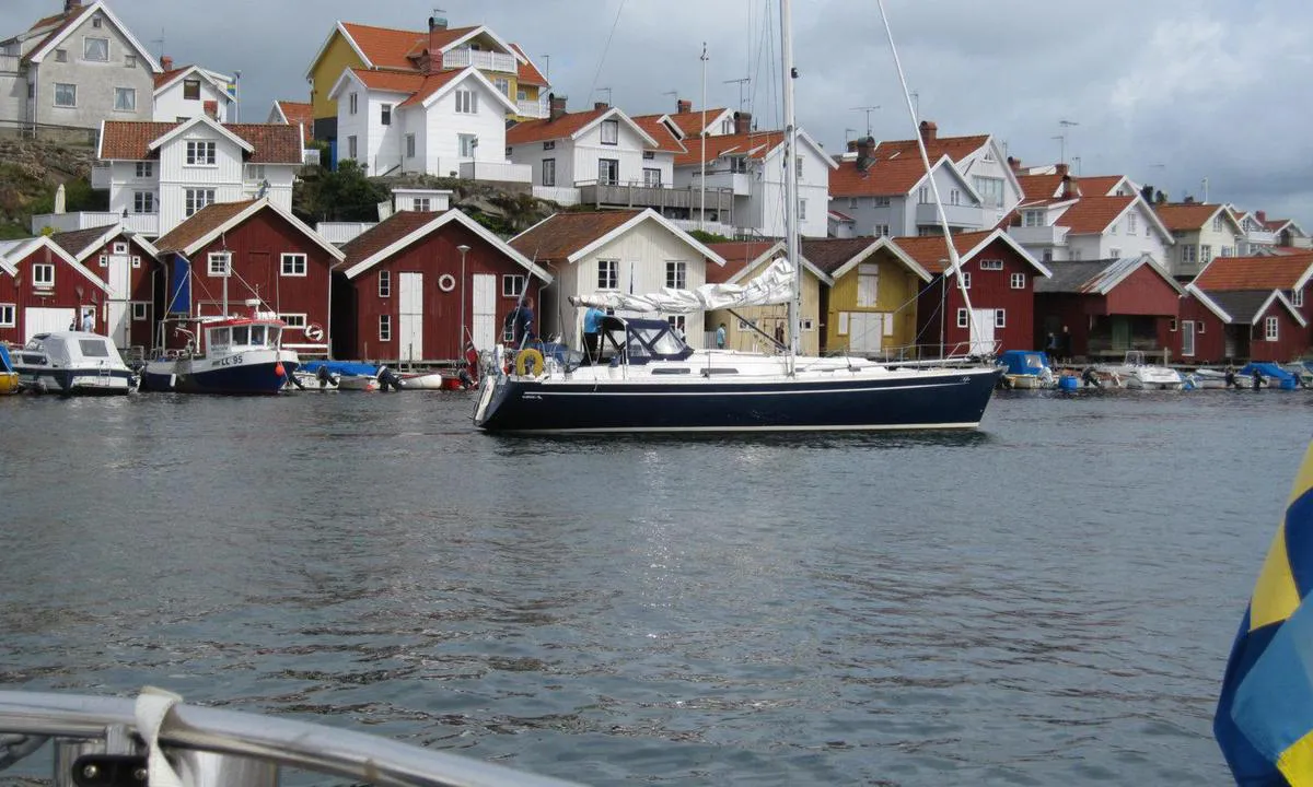
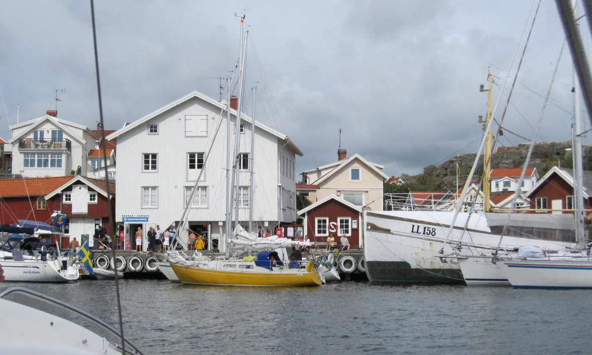
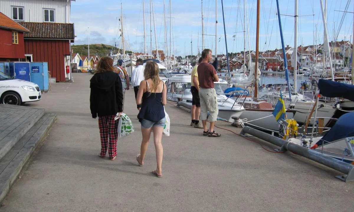
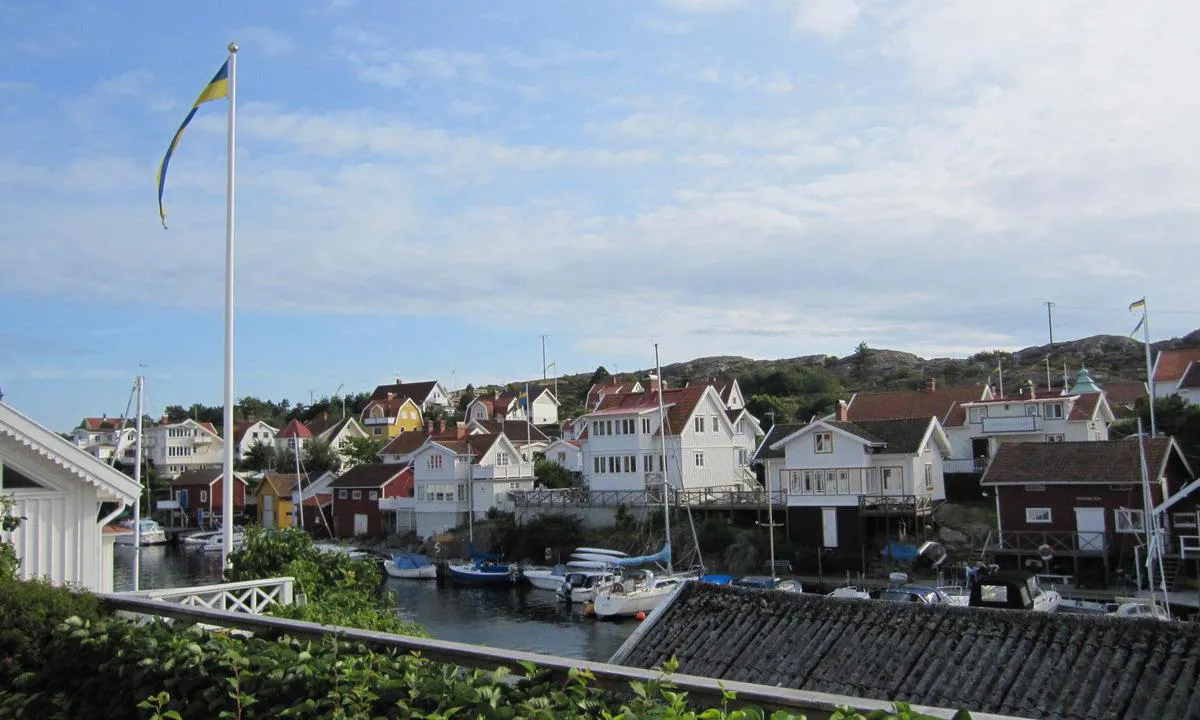
Grundsund is located, as the name suggests, in a shallow strait. The approach is from the north. There are buildings on both sides with boathouses and old houses. There is a connection to the mainland and some cars. On the east side, there is a store, and on the west side lies the church. There is also a small beach at the southernmost part of the strait by the marina. At the end of the pier on the east side, there is a café with a great view of the passage. Here, a walking trail begins, which is built over the rocks along the water.
There are guest berths on both sides, but it is best to moor on the west side of the strait. Here, it is sheltered from the southwest. The guest harbor is located near a parking lot, but it is a short distance to a charming, cobblestone street. Water and electricity are available in the harbor.
[translated from Norwegian with AI]
2 x helpful | written on 25. Jul 2022
HarbourMaps (site admin) says:
description
Harbor depth: 4-5 m, Guest berths: 50, Mooring: fixed stern mooring
[translated from Swedish with AI]
0 x helpful | written on 14. Jul 2022
Do you know this harbour? It's a huge help to other sailors if you add a short description or review of the harbour.
Map of Grundsund

Wind protection
Protection next night
78 points


Want to know how the wind score works? Then you should read this explanation.
The wind forecasts come from yr.no (Norwegian Meteorological Institute), and was last updated 1 hour and 53 minutes ago (Monday 29 June 07:27 PM). The next night score shows you the worst hour between 22:00 and 08:00 the next night. We recommend that you check multiple sources for wind forecasts. windy.com is a good website to show larger wind systems.

The safe wind directions for this harbour has been decided by an algorithm, based on how elevated the land around the harbour is. It's mostly correct, but sometimes the underlying data about elevation levels is not good enough to make correct decisions. It's a great help to other if you can validate or adjust the safe wind directions. You can see the data used by the algorithm to decide the safe wind directions by clicking here.
Last visits to Grundsund
Tue 19 May 2026 |
|
|
Fri 08 May 2026 |
|
|
Sat 07 Feb 2026 |
|
|
Thu 25 Dec 2025 |
|
|
Thu 11 Dec 2025 |
|
|
 COLOMBE [MMSI: 265679120]
The visits are retrieved from AIS data. You can click to see all visiting ships to Grundsund, as well as statistics about the ships that visits
Add this harbour to a journey
Choose a different date than today
Important: When you check in to a harbour, you add it to a journey on this website. You are not booking a place in the marina.
Contributors
Users that contributed to this page: Fotoflyg, Linnea, Stig Ulfsby, Olav Pekeberg and Billie Jean
harbourmaps.com is updated by the boating community. When you add information, a review or pictures to this page you are listed here with the other contributors (we list your user-name, which can be your real name or a pseudonym).
Thematic lists of harbours
This harbour is part of these lists:
Closest harbours to Grundsund
Filter by
Order by
0 harbours
Show more harbours
