


Akerøya
Natural harbour

Region: Norway (3463), Viken (190), Ytre Oslofjord (186), Østfoldkysten (123), Hvaler (57), Østfold (38) and Vesterøy (12)


Descriptions and reviews
Fanteskute Adesso says:
description
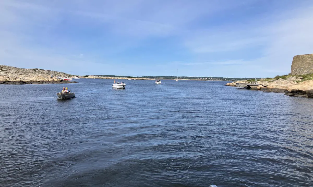
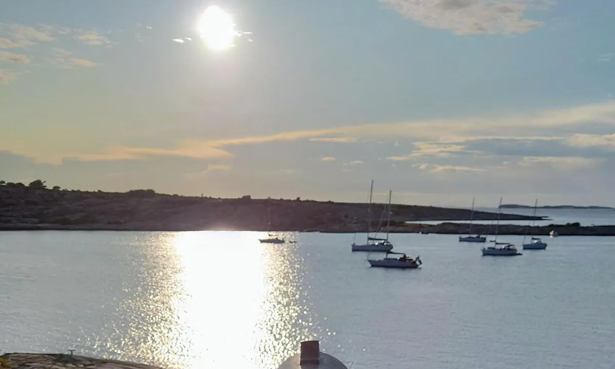
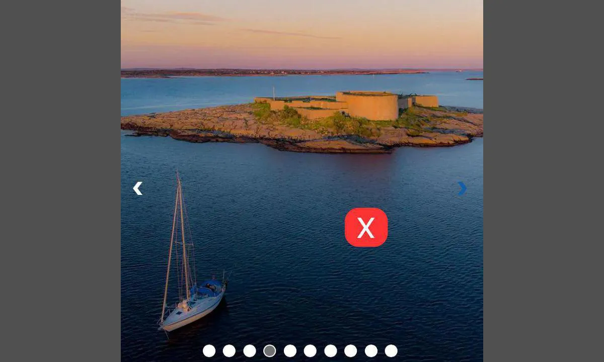
Yesterday I sailed through the strait between Festningdholmen and Akerøy when the motorboat in front of me suddenly gave a signal: Go port‼️ Right between the pier on Festningdholmen and Akerøy, he had run aground! I guess he has a draft between half a meter and one meter.
I didn't stop to check the waters further. The shoal is not marked on my charts. I look forward to hearing from others who have also run aground here.
I have posted a new picture where the alleged shoal (<1 m) is marked with a red X.
[translated from Norwegian with AI]

2 x helpful | written on 30. Jul 2024 | updated_on 13. Aug 2024
Petter Eik says:
area

maritime qualities
description
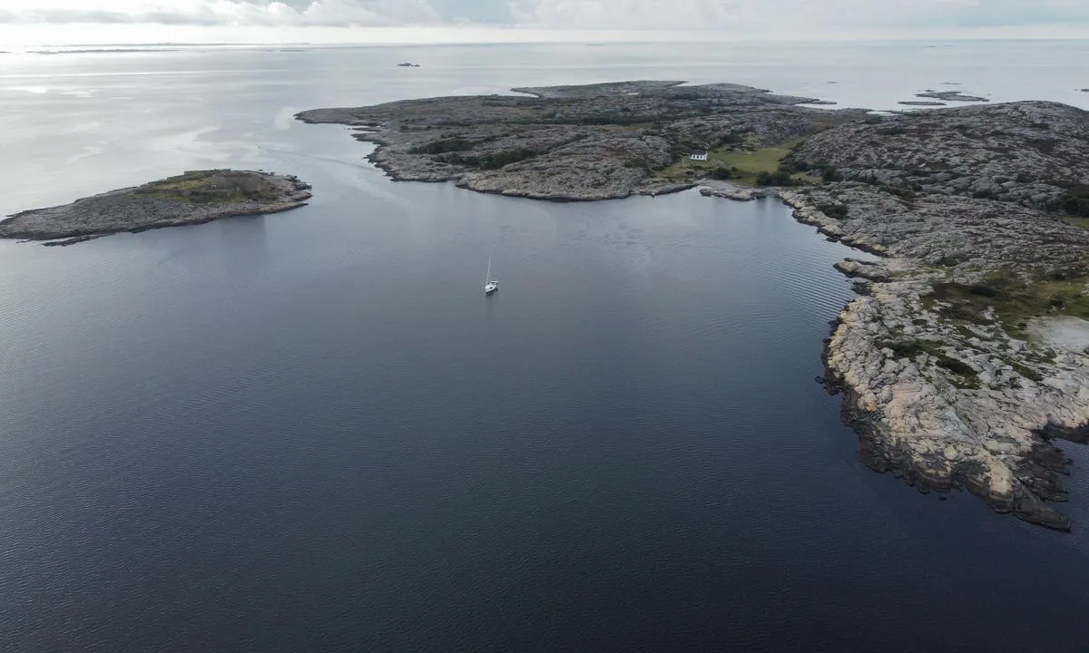
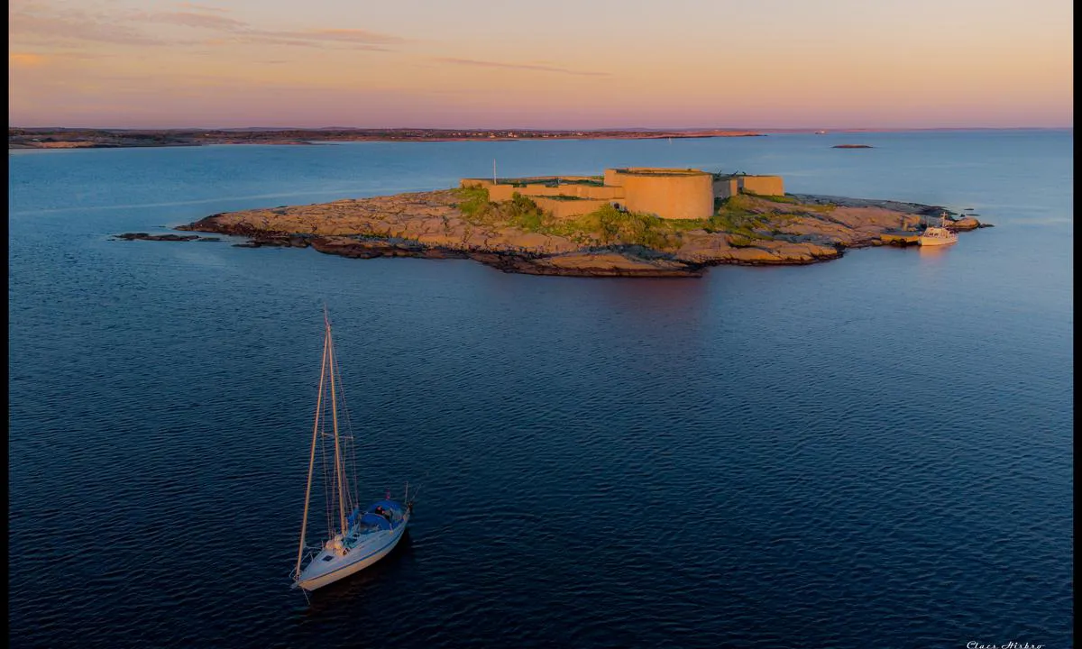
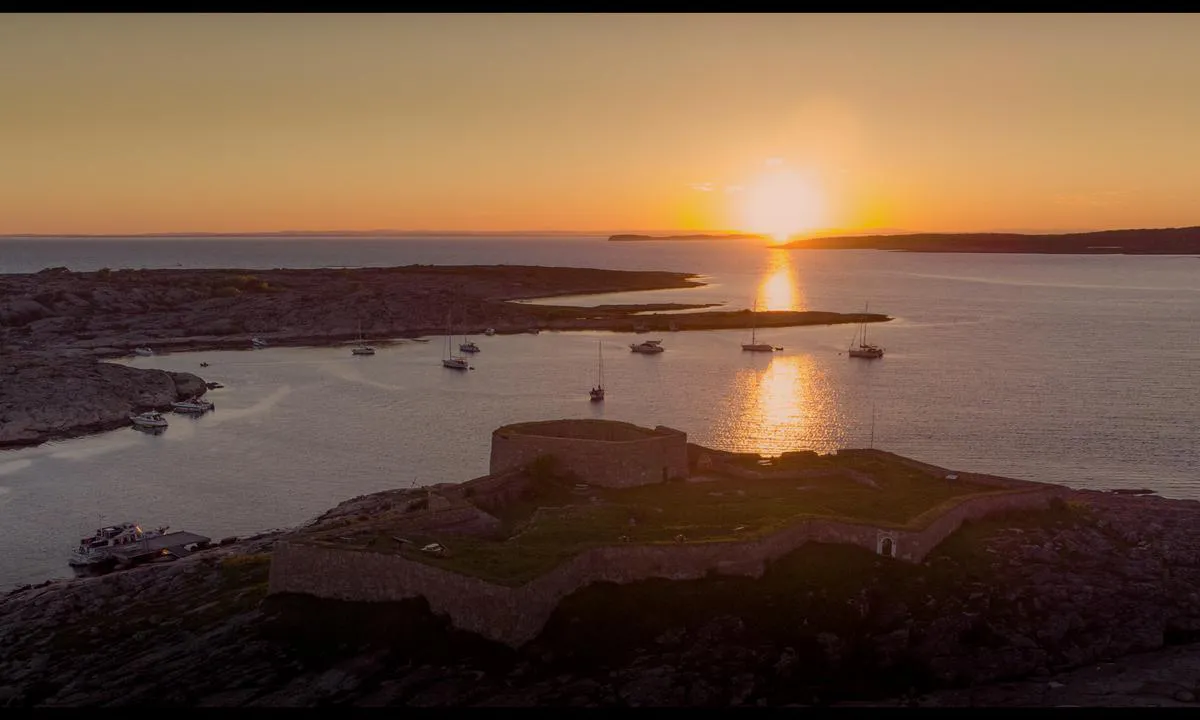
At the top of the island lies the Redoubt. An advanced observation post. From here, one can see Koster, Færder, and much more.
[translated from Norwegian with AI]
1 x helpful | written on 25. Jul 2023
Bjørn Vidar Aaserud says:
description
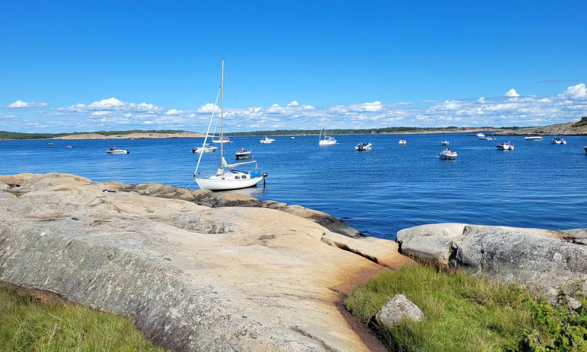
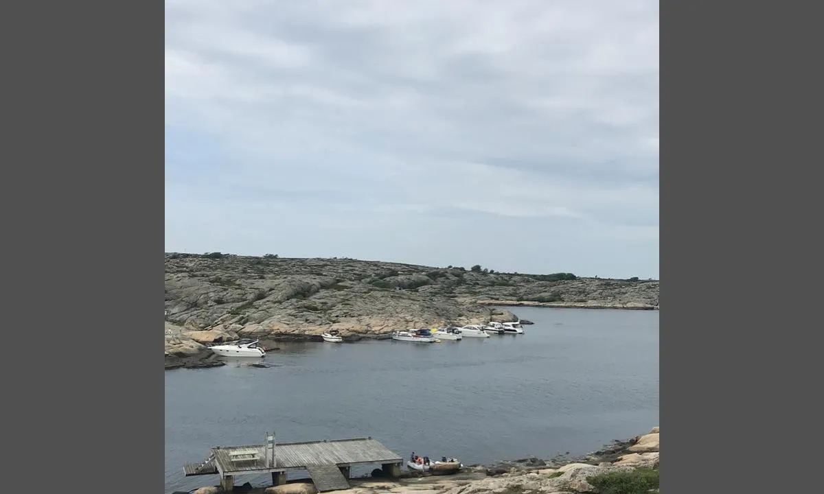
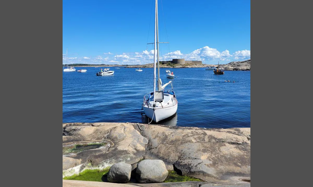
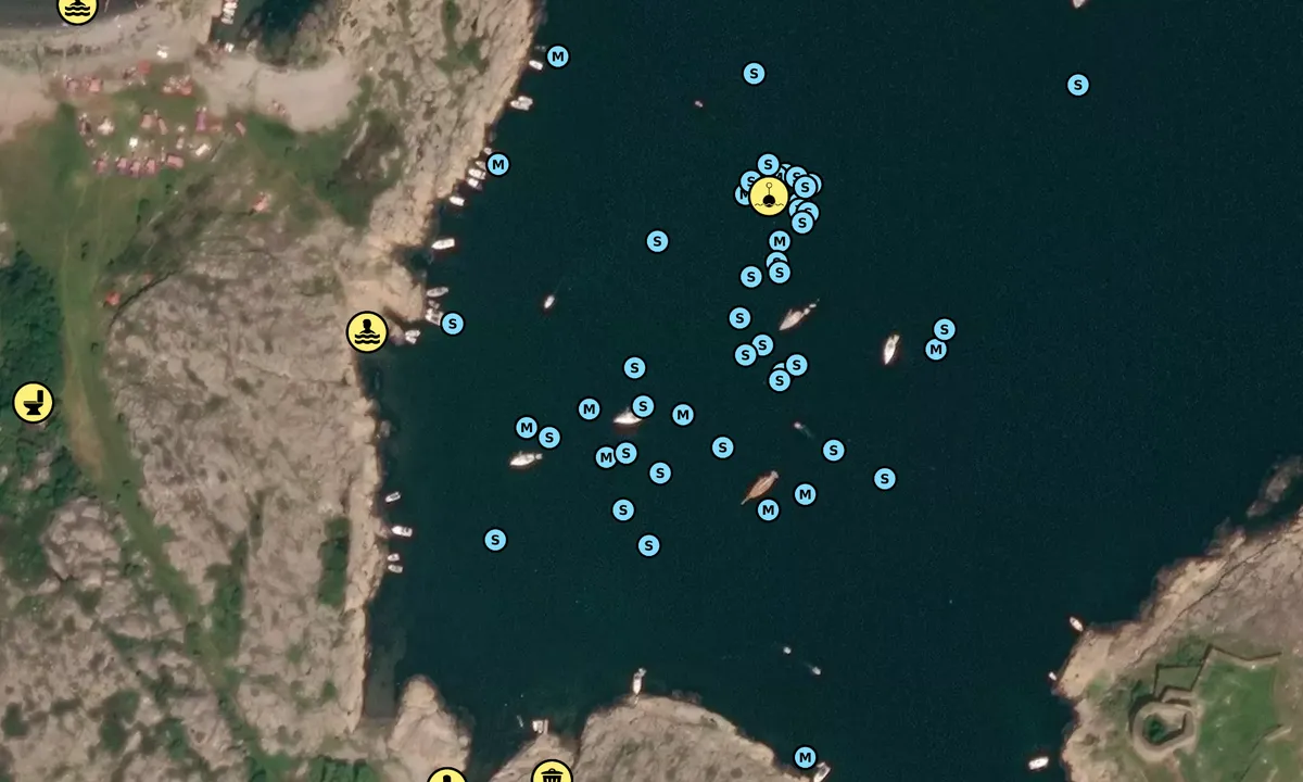
Navigation and Maritime Conditions: Akerøybay northwest of Festningsholmen, Akerøya, Hvaler. Hazardous waters in several places, use nautical charts.
Anchoring: Dock at Festningsholmen. At Akerøya, you can anchor with a kedge and lie alongside depending on the depth of the boat. There are markings on the rock where you can dock, but note that not all places are suitable for boats with a draft of more than 1 meter. Some fixed wedges in the rock, but good opportunities to hammer in wedges yourself. Sailboats usually lie at anchor. A buoy is laid out in the water. Nice beaches on the island.
The Area: This unique area was purchased by the Oslofjord Outdoor Council in 1955 through a joint effort. One of the most frequented recreational areas in the Hvaler archipelago. Opposite the landing dock on the northeast side, you will find drinking water. Parts of the island are a bird reserve. Exciting area with much to see.
[translated from Norwegian with AI]
1 x helpful | written on 10. Jun 2021
Do you know this harbour? It's a huge help to other sailors if you add a short description or review of the harbour.
Map of Akerøya

Wind protection
Protection next night
69 points


Want to know how the wind score works? Then you should read this explanation.
The wind forecasts come from yr.no (Norwegian Meteorological Institute), and was last updated 1 hour and 14 minutes ago (Friday 19 June 04:28 AM). The next night score shows you the worst hour between 22:00 and 08:00 the next night. We recommend that you check multiple sources for wind forecasts. windy.com is a good website to show larger wind systems.
The safe directions for this harbour was added at None. Click here to edit.
Last visits to Akerøya
Sun 10 Aug 2025 |
|
|
Thu 31 Jul 2025 |
|
|
Wed 30 Jul 2025 |
|
|
Sat 26 Jul 2025 |
|
|
|
|
 BLUE CRUISE [MMSI: 211495480]
 AQUADORA [MMSI: 265030160]
 MY WAY [MMSI: 257850060]
The visits are retrieved from AIS data. You can click to see all visiting ships to Akerøya, as well as statistics about the ships that visits
Add this harbour to a journey
Choose a different date than today
Important: When you check in to a harbour, you add it to a journey on this website. You are not booking a place in the marina.
Contributors
Users that contributed to this page: SV Metanoia, Asgeir Larsen, Petter Eik, Fanteskute Adesso, Bjørn Vidar Aaserud, Anonymous sailor 197816 and Claes Hisbro
harbourmaps.com is updated by the boating community. When you add information, a review or pictures to this page you are listed here with the other contributors (we list your user-name, which can be your real name or a pseudonym).
Closest harbours to Akerøya
Filter by
Order by
0 harbours
Show more harbours
