Message from the system: You need to log in to write a review of the harour.

Utgårdkilen - Vesterøy

Natural harbour

favoritt

Region: Norway (3407), Viken (190), Ytre Oslofjord (181), Østfoldkysten (120), Hvaler (55) and Vesterøy (12)

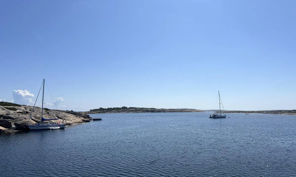
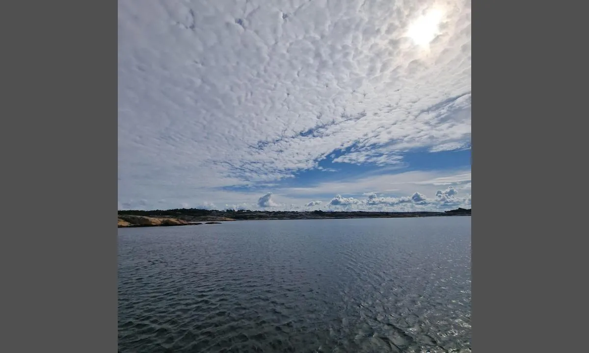
Utgårdkilen - Vesterøy: {"base": "no", "no": "Mot \u00f8st/s\u00f8r\u00f8st. Bolter p\u00e5 T\u00f8mmertangen, OF-b\u00f8ye midt i pollen. Bildet tatt fra svaiankring nord for leden/kabel merket p\u00e5 kart. Skjermet fra alle vindretninger, ingen svell men en del trafikk.", "se": "Mot \u00f6st/syd\u00f6st. Bultar p\u00e5 T\u00f8mmerudden, OF-boj mitt i pollen. Bildet taget fr\u00e5n svajankring norr om leden/kabel m\u00e4rkt p\u00e5 kartan. Skyddad fr\u00e5n alla vindriktningar, ingen svall men en del trafik.", "en": "To the east/southeast. Bolts at T\u00f8mmertangen, OF-buoy in the middle of the pool. Picture taken from a swing anchorage north of the channel/cable marked on the map. Sheltered from all wind directions, no swell but some traffic.", "da": "Mod \u00f8st/syd\u00f8st. Bolter p\u00e5 T\u00f8mmertangen, OF-b\u00f8je midt i pollen. Billedet taget fra svajanker nord for leden/kabel markeret p\u00e5 kortet. Sk\u00e6rmet for alle vindretninger, ingen d\u00f8nning men en del trafik.", "fr": "Vers l'est/sud-est. Boulons sur T\u00f8mmertangen, bou\u00e9e OF au milieu du pollen. Photo prise de l'ancrage au nord du chenal/c\u00e2ble marqu\u00e9 sur la carte. Prot\u00e9g\u00e9 de tous les vents, pas de houle mais pas mal de trafic.", "de": "Nach Osten/S\u00fcdosten. Bolzen am T\u00f8mmertangen, OF-Boje mitten im Pollen. Bild von Schwojenanker n\u00f6rdlich der Fahrrinne/Kabel auf der Karte markiert. Gesch\u00fctzt vor allen Windrichtungen, keine D\u00fcnung, aber viel Verkehr.", "es": "Hacia el este/sureste. Perno en T\u00f8mmertangen, bolla OF en el medio del estuario. Imagen tomada desde anclaje al garete al norte de la ruta/cable marcado en el mapa. Protegido de todos los vientos, sin marejada pero con bastante tr\u00e1fico.", "it": "Verso est/sud-est. Bulloni su T\u00f8mmertangen, boa OF al centro del polline. Foto scattata dall'ancoraggio in oscillazione a nord della rotta/cavo segnato sulla mappa. Riparato da tutte le direzioni del vento, nessun moto ondoso ma un po' di traffico.", "pt": "Vira para leste/sudeste. Parafusos em T\u00f8mmertangen, b\u00f3ia OF no meio da enseada. Foto tirado da ancoragem ao norte da passagem/cabo marcado no mapa. Protegido de todas as dire\u00e7\u00f5es de vento, sem ondula\u00e7\u00e3o, mas com algum tr\u00e1fego.", "nl": "Naar het oosten/zuidoosten. Bolder in T\u00f8mmertangen, OF-boei midden in de baai. Foto genomen vanaf het draaipunt ten noorden van de doorgang/kabel gemarkeerd op de kaart. Beschermd tegen alle windrichtingen, geen deining maar wel wat verkeer.", "pl": "Na wsch\u00f3d/po\u0142udniowy wsch\u00f3d. Bolce na T\u00f8mmertangen, boja OF na \u015brodku odnogi. Zdj\u0119cie zrobione z kotwicowiska na p\u00f3\u0142noc od trasy/kabla oznaczonego na mapie. Os\u0142oni\u0119te od wszystkich kierunk\u00f3w wiatru, brak fal, ale spory ruch.", "uk": "\u041d\u0430 \u0441\u0445\u0456\u0434/\u043f\u0456\u0432\u0434\u0435\u043d\u043d\u0438\u0439 \u0441\u0445\u0456\u0434. \u0411\u043e\u043b\u0442\u0438 \u043d\u0430 \u0422\u044c\u043e\u043c\u043c\u0435\u0440\u0442\u0430\u043d\u0433\u0435\u043d\u0456, \u0431\u0443\u0439 OF \u043f\u043e\u0441\u0435\u0440\u0435\u0434\u0438\u043d\u0456 \u0437\u0430\u0442\u043e\u043a\u0438. \u0417\u043e\u0431\u0440\u0430\u0436\u0435\u043d\u043d\u044f \u0437\u0440\u043e\u0431\u043b\u0435\u043d\u043e \u0437 \u044f\u043a\u043e\u0440\u043d\u043e\u0457 \u0441\u0442\u043e\u044f\u043d\u043a\u0438 \u043d\u0430 \u043f\u0456\u0432\u043d\u0456\u0447 \u0432\u0456\u0434 \u043f\u0440\u043e\u0445\u043e\u0434\u0443/\u043a\u0430\u0431\u0435\u043b\u044c \u043f\u043e\u0437\u043d\u0430\u0447\u0435\u043d\u0438\u0439 \u043d\u0430 \u043a\u0430\u0440\u0442\u0456. \u0417\u0430\u0445\u0438\u0449\u0435\u043d\u0438\u0439 \u0432\u0456\u0434 \u0443\u0441\u0456\u0445 \u043d\u0430\u043f\u0440\u044f\u043c\u043a\u0456\u0432 \u0432\u0456\u0442\u0440\u0443, \u043d\u0435\u043c\u0430\u0454 \u0445\u0432\u0438\u043b\u044e\u0432\u0430\u043d\u043d\u044f, \u0430\u043b\u0435 \u0454 \u0434\u0435\u044f\u043a\u0438\u0439 \u0442\u0440\u0430\u0444\u0456\u043a.", "ro": "C\u0103tre est/sud-est. Bolile pe T\u00f8mmertangen, geamandura OF \u00een mijlocul polenului. Imaginea luat\u0103 de la ancorarea la deriva la nord de rut\u0103/cablu marcat pe hart\u0103. Ecranat de toate direc\u021biile v\u00e2ntului, f\u0103r\u0103 valuri, dar cu destul de mult trafic.", "tr": "Do\u011fu / g\u00fcneydo\u011fu y\u00f6n\u00fcnde. T\u00f8mmertangen'de ba\u011flama yerleri, polenin ortas\u0131nda OF \u015famand\u0131ras\u0131. Resim, rota / haritada i\u015faretli kablonun kuzeyindeki demirleme noktas\u0131ndan \u00e7ekilmi\u015ftir. T\u00fcm r\u00fczgar y\u00f6nlerine kar\u015f\u0131 korunakl\u0131, dalga yok ama bir miktar trafik var.", "el": "\u03a0\u03c1\u03bf\u03c2 \u03b1\u03bd\u03b1\u03c4\u03bf\u03bb\u03ae/\u03bd\u03bf\u03c4\u03b9\u03bf\u03b1\u03bd\u03b1\u03c4\u03bf\u03bb\u03ae. \u039c\u03c0\u03bf\u03c5\u03bb\u03cc\u03bd\u03b9\u03b1 \u03c3\u03c4\u03bf T\u00f8mmertangen, OF-\u03c3\u03b7\u03bc\u03b1\u03b4\u03bf\u03cd\u03c1\u03b1 \u03c3\u03c4\u03bf \u03ba\u03ad\u03bd\u03c4\u03c1\u03bf \u03c4\u03b7\u03c2 \u03bb\u03af\u03bc\u03bd\u03b7\u03c2. \u0397 \u03c6\u03c9\u03c4\u03bf\u03b3\u03c1\u03b1\u03c6\u03af\u03b1 \u03c4\u03c1\u03b1\u03b2\u03ae\u03c7\u03c4\u03b7\u03ba\u03b5 \u03b1\u03c0\u03cc \u03c0\u03bb\u03c9\u03c4\u03ae \u03b1\u03b3\u03ba\u03c5\u03c1\u03bf\u03b2\u03cc\u03bb\u03b7\u03c3\u03b7 \u03b2\u03cc\u03c1\u03b5\u03b9\u03b1 \u03c4\u03bf\u03c5 \u03b4\u03b9\u03b1\u03cd\u03bb\u03bf\u03c5/\u03ba\u03b1\u03bb\u03ce\u03b4\u03b9\u03bf \u03c3\u03b7\u03bc\u03b5\u03b9\u03c9\u03bc\u03ad\u03bd\u03bf \u03c3\u03c4\u03bf\u03bd \u03c7\u03ac\u03c1\u03c4\u03b7. \u03a0\u03c1\u03bf\u03c3\u03c4\u03b1\u03c4\u03b5\u03c5\u03bc\u03ad\u03bd\u03b7 \u03b1\u03c0\u03cc \u03cc\u03bb\u03b5\u03c2 \u03c4\u03b9\u03c2 \u03ba\u03b1\u03c4\u03b5\u03c5\u03b8\u03cd\u03bd\u03c3\u03b5\u03b9\u03c2 \u03c4\u03bf\u03c5 \u03b1\u03bd\u03ad\u03bc\u03bf\u03c5, \u03c7\u03c9\u03c1\u03af\u03c2 \u03ba\u03cd\u03bc\u03b1 \u03b1\u03bb\u03bb\u03ac \u03bc\u03b5 \u03ba\u03ac\u03c0\u03bf\u03b9\u03b1 \u03ba\u03af\u03bd\u03b7\u03c3\u03b7.", "cs": "Na v\u00fdchod/jihov\u00fdchod. Kotv\u00edc\u00ed skoby na T\u00f8mmertangen, b\u00f3je OF uprost\u0159ed z\u00e1toky. Fotografie po\u0159\u00edzena z kotvi\u0161t\u011b severn\u011b od lodn\u00ed trasy/kabelu vyzna\u010den\u00e9ho na map\u011b. Chr\u00e1n\u011bno p\u0159ed v\u0161emi sm\u011bry v\u011btru, bez vlnobit\u00ed, ale s ur\u010ditou dopravou.", "hu": "Kelet/d\u00e9lkelet fel\u00e9. Csavarok a T\u00f8mmertangen-en, OF-b\u00f3ja a bels\u0151 lag\u00fana k\u00f6zep\u00e9n. A k\u00e9p az \u00e9szaki horgonyr\u00f3l k\u00e9sz\u00fclt, az \u00fatvonal/k\u00e1bel a t\u00e9rk\u00e9pen van megjel\u00f6lve. Minden sz\u00e9lir\u00e1nyt\u00f3l v\u00e9dett, hull\u00e1mz\u00e1s nincs, de jelent\u0151s forgalom van.", "fi": "It\u00e4\u00e4n/kaakkoon p\u00e4in. Pultit T\u00f8mmertangenissa, OF-poiju keskell\u00e4 lahtea. Kuva otettu pohjoissa leikkuuankkurissa, reitin/kaapelin kohdalla merkitty karttaan. Suojassa kaikilta tuulensuunnilta, ei maininkeja mutta jonkin verran liikennett\u00e4.", "bg": "\u041d\u0430 \u0438\u0437\u0442\u043e\u043a/\u044e\u0433\u043e\u0438\u0437\u0442\u043e\u043a. \u0411\u043e\u043b\u0442\u043e\u0432\u0435 \u043d\u0430 \u0422\u044c\u043e\u043c\u0435\u0440\u0442\u0430\u043d\u0433\u0435\u043d, OF-\u0431\u0443\u044f \u0432 \u0441\u0440\u0435\u0434\u0430\u0442\u0430 \u043d\u0430 \u0431\u0430\u0441\u0435\u0439\u043d\u0430. \u0421\u043d\u0438\u043c\u043a\u0430\u0442\u0430 \u0435 \u043d\u0430\u043f\u0440\u0430\u0432\u0435\u043d\u0430 \u043e\u0442 \u043a\u043e\u0442\u0432\u0435\u043d\u0430 \u0441\u0442\u043e\u044f\u043d\u043a\u0430 \u0441\u0435\u0432\u0435\u0440\u043d\u043e \u043e\u0442 \u0444\u0430\u0440\u0432\u0430\u0442\u0435\u0440\u0430/\u043a\u0430\u0431\u0435\u043b \u043e\u0431\u043e\u0437\u043d\u0430\u0447\u0435\u043d \u043d\u0430 \u043a\u0430\u0440\u0442\u0430\u0442\u0430. \u0417\u0430\u0449\u0438\u0442\u0435\u043d\u043e \u043e\u0442 \u0432\u0441\u0438\u0447\u043a\u0438 \u043f\u043e\u0441\u043e\u043a\u0438 \u043d\u0430 \u0432\u044f\u0442\u044a\u0440\u0430, \u043d\u044f\u043c\u0430 \u0432\u044a\u043b\u043d\u0438 \u043d\u043e \u0438\u043c\u0430 \u0438\u0437\u0432\u0435\u0441\u0442\u0435\u043d \u0442\u0440\u0430\u0444\u0438\u043a.", "sr": "Ka istoku/jugoistoku. Bolcine na T\u00f8mmertangen-u, OF-bova u sredini polje. Slika je snimljena sa slobodne kote severno od putanje/kabla ozna\u010denog na karti. Za\u0161ti\u0107eno od svih pravaca vetra, bez talasa, ali sa dosta prometa.", "et": "Kagusse/kagu. Poltid T\u00f8mmertangenis, OF-poi tsentris poll. Pilt on tehtud ankurdumiskohast loodes juhtrajast/kabelist, mis on kaardil m\u00e4rgistatud. Kaitstud k\u00f5igi tuulesuundade eest, lainetust ei ole, kuid m\u00f5ningane liiklus.", "lv": "Uz austrumiem/dienvidaustrumiem. Skr\u016bvsp\u012bles uz T\u00f8mmertangen, OF boja vid\u016b pols. Att\u0113ls uz\u0146emts no svaiankring uz zieme\u013ciem no ce\u013ca/kabe\u013cu, kas atz\u012bm\u0113ts kart\u0113. No visiem v\u0113ja virzieniem pasarg\u0101ts, bez vi\u013c\u0146iem, bet diezgan daudz satiksmes.", "lt": "\u012e rytus/pietry\u010dius. Var\u017etai T\u00f8mmertangen, OF pl\u016bd\u0117 viduryje u\u017eutekio. Nuotrauka daryta nuo inkaravimo i\u0161 \u0161iaur\u0117s nuo kanalo/kabelio, pa\u017eym\u0117to \u017eem\u0117lapyje. Apsaugota nuo vis\u0173 v\u0117jo kryp\u010di\u0173, n\u0117ra bangavimo, ta\u010diau yra nema\u017eai eismo."}
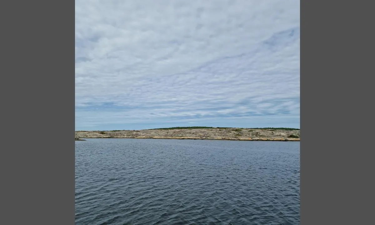
Utgårdkilen - Vesterøy: {"base": "no", "no": "Vest/Sauholmen", "se": "V\u00e4st/Sauholmen", "en": "West/Sauholmen", "da": "Vest/Sauholmen"}
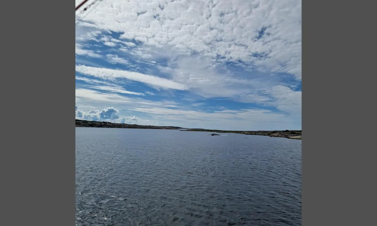
Utgårdkilen - Vesterøy: {"base": "no", "no": "S\u00f8r fra b\u00f8y", "se": "S\u00f6der fr\u00e5n boj", "en": "South from the buoy", "da": "Syd fra b\u00f8je"}
Utgårdkilen - Vesterøy: {"base": "no", "no": "Nord fra b\u00f8y", "se": "Norr fr\u00e5n bojen", "en": "North from the buoy", "da": "Nord fra b\u00f8je"}
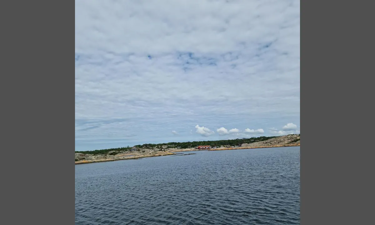
Utgårdkilen - Vesterøy: {"base": "no", "no": "\u00d8st fra b\u00f8y", "se": "\u00d6st fr\u00e5n bojen", "en": "East from buoy", "da": "\u00d8st fra b\u00f8je"}
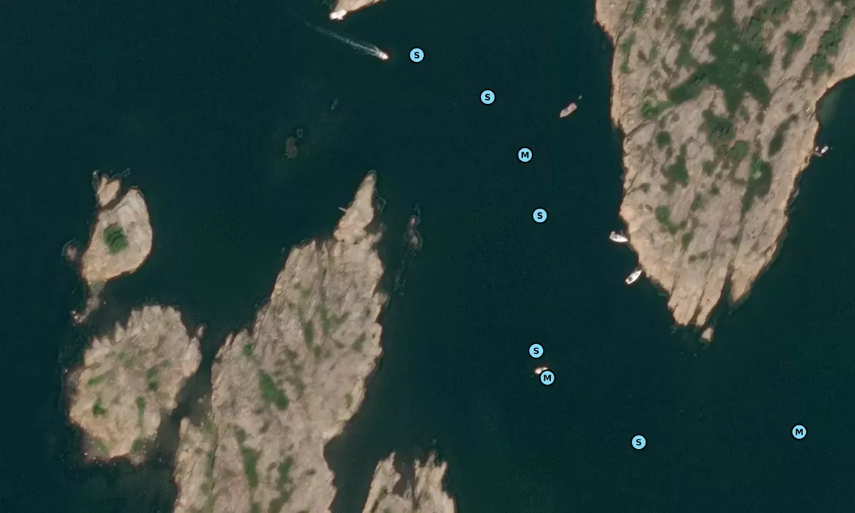
Satelite image of Utgårdkilen - Vesterøy

📸 Upload a photo

Show off your photos and help others plan their journey to Utgårdkilen - Vesterøy.harbourmaps.com is created by the sailing community, in a collective effort to make cruising simpler and more fun. Uploading a photo takes less than a minutes and can be done from your phone, tablet or laptop.

📸 Upload a photo

Facilities

We don't have any data on available facilities in this harbour. If you know which facilities are available here, please update this site to help your fellow sailors. Update facilities.

Mooring

Options for mooring in this harbour: Anchoring, Mooring buoy<br>(for easy "anchoring", not to be confused with bouys used in marinas), Towards land.

Updated on 8. Aug 2022. Update mooring.

Descriptions and reviews

Do you know this harbour? It's a huge help to other sailors if you add a short description or review of the harbour.

📜 Add description

Map of Utgårdkilen - Vesterøy

Facilities

We don't have any data on available facilities in this harbour. If you know which facilities are available here, please update this site to help your fellow sailors. Update facilities.

Mooring

Options for mooring in this harbour: Anchoring, Mooring buoy<br>(for easy "anchoring", not to be confused with bouys used in marinas), Towards land.

Updated on 8. Aug 2022. Update mooring.

Wind protection

Protection next night

89 points

N E S W --> } } } } } } } } } } } } } } } } } } } } } } } } } } } } } } } } } } } } } } } } } } } } } } } } } } } } } } } } } } } } } } } } } } } } } } } } } } } } } } } } } } } } } } } } } } } } } } } } } } } } } } } } } } } } } } } } } } } } } } } } } } } } } } } } } } } } } } } } } } } } } } } } } } } } } } } } } } } } } } } } } } } } } } } } } } } } } } } } } } } } } } } } } } } } } } } } } } } } } } } } } } } } } } } } } } } } } } } } } } } } } } } } } } } } } } } } } } } } } } } } } } } } } } } } } } } } } } } } } } } } } } } } } } } } } } } } } } } } } } } } } } } } } } } } } } } } } } } } } } } } } } } } } } } } } } } } } } } } } } } } } } } } } } } } } } } } } } } } } } } } } } } } } } } } } } } } } } } } } } } } } } } } } } } } } } } } } } } } } } } } } } } } } } } } } } } } } } } } } } } } } } } } } } } } } } } } } } } } } } } } } } } } } } } } } } } } } } } } } } } } } } } } } } } } } } } } } } } } } } } } } } } } } } } } } } } } } } } } } } } } } } } } } } } } } } } } } } } } } } } } } } } } } } } } } } } } } } } } } } } } } } } } } } } } } } } } } } } } } } } } } } } } } } } } } } } } } } } } } } } } } } } } } } } } } } } } } } } } } } } } } } } } } } } } } } } } } } } } } } } } } } } } } } } } } } } } } } } } } } } } } } } } } } } } } } } } } } } } } } } } } } } } } } } } } } } } } } } } } } } } } } } } } } } } } } } } } } } } } } } } } } } } } } } } } } } } } } } } } } } } } } } } } } } } } } } } } } } } } } } } } } } } } } } } } } } } } } } } } } } } } } } } } } } } } } } } } } } } } } } } } } } } } } } } } } } } } } } } } } } } } } } } } } } } } } } } } } } } } } } } } } } } } } } } } } } } } } } } } } } } } } } } } } } } } } } } } } } } } } } } } } } } } } } } } } } } } } } } } } } } } } } } } } } } } } } } } } } } } } } } } } } } } } } } } } } } } } } } } } } } } } } } } } } } } } } } } } } } } } } } } } } } } } } } } } } } } } } } } } } } } } } } } } } } } } } } } } } } } } } } } } } } } } } } } } } } } } } } } } } } Next night 0:00 6:00 12:00 Man 04 Aug 18:00 0:00 6:00 17m/s 2m/s

Want to know how the wind score works? Then you should read this explanation.

The wind forecasts come from yr.no (Norwegian Meteorological Institute), and was last updated 1 hour and 45 minutes ago (Sunday 03 August 09:28 PM). The next night score shows you the worst hour between 22:00 and 08:00 the next night. We recommend that you check multiple sources for wind forecasts. windy.com is a good website to show larger wind systems.

The safe directions for this harbour was added at None. Click here to edit.

Last visits to Utgårdkilen - Vesterøy

Fri 25 Jul 2025

LILLE MY II [MMSI: 258094920]

Fri 11 Jul 2025

DEMRING [MMSI: 257107480]

Thu 10 Jul 2025

DEMRING [MMSI: 257107480]

Wed 09 Jul 2025

DEMRING [MMSI: 257107480]

Wed 25 Jun 2025

DEMAR [MMSI: 257827270]

The visits are retrieved from AIS data. You can click to see all visiting ships to Utgårdkilen - Vesterøy, as well as statistics about the ships that visits

Add this harbour to a journey

Check in now

Choose a different date than today

Important: When you check in to a harbour, you add it to a journey on this website. You are not booking a place in the marina.

Contributors

Users that contributed to this page: Eligijus Pocius, Steinar Nilsen and Truls Vikin

harbourmaps.com is updated by the boating community. When you add information, a review or pictures to this page you are listed here with the other contributors (we list your user-name, which can be your real name or a pseudonym).

Closest harbours to Utgårdkilen - Vesterøy
Filter by

Natural harbour
Marina
Safe wind next night

Order by

ABC
Popularity
Wind score next night

0 harbours

Show more harbours