


Båtnes - Vega
Natural harbour

Region: Norway (3470), Nordland (677), Helgelandskysten (257), Vega (25) and Gladstad (3)


Descriptions and reviews
Chris SV Blue Peter says:
says:
area


maritime qualities
description
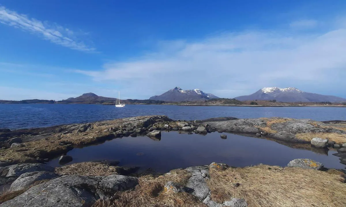
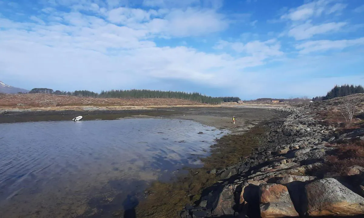
Very beautiful anchorage with 360° protection. Anchor in 14 to 16 meters of depth, with good holding, composed of sand and mud.
The northeast beach slopes very gently, making it difficult to beach the dinghy due to the tides in the area. Larger dinghies will benefit from heading to the Rørøya dock, located 6 cables to the northeast.
The Vega Archipelago is listed as a UNESCO World Heritage site.
[translated from French with AI]

1 x helpful | written on 15. Apr 2025
Do you know this harbour? It's a huge help to other sailors if you add a short description or review of the harbour.
Map of Båtnes - Vega

Wind protection
Protection next night
87 points


Want to know how the wind score works? Then you should read this explanation.
The wind forecasts come from yr.no (Norwegian Meteorological Institute), and was last updated 1 hour and 54 minutes ago (Sunday 28 June 08:28 AM). The next night score shows you the worst hour between 22:00 and 08:00 the next night. We recommend that you check multiple sources for wind forecasts. windy.com is a good website to show larger wind systems.
The safe directions for this harbour was added at None. Click here to edit.
Last visits to Båtnes - Vega
Sun 20 Aug 2023 |
|
|
 CHUGACH [MMSI: 227072210]
The visits are retrieved from AIS data. You can click to see all visiting ships to Båtnes - Vega, as well as statistics about the ships that visits
Add this harbour to a journey
Choose a different date than today
Important: When you check in to a harbour, you add it to a journey on this website. You are not booking a place in the marina.
Contributors
Users that contributed to this page: Chris SV Blue Peter
harbourmaps.com is updated by the boating community. When you add information, a review or pictures to this page you are listed here with the other contributors (we list your user-name, which can be your real name or a pseudonym).
Closest harbours to Båtnes - Vega
Filter by
Order by
0 harbours
Show more harbours
