


Honnørbrygga / Skutebrygga
Marina

Region: Norway (3465), Viken (190), Vestfold (182), Drammensfjorden (12) and Drammen (8)


Descriptions and reviews
Terje Jørgensen says:
description
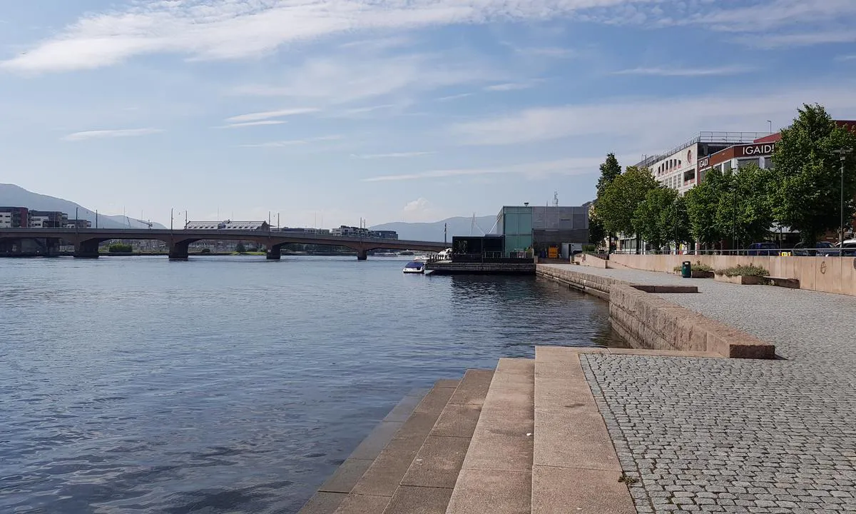
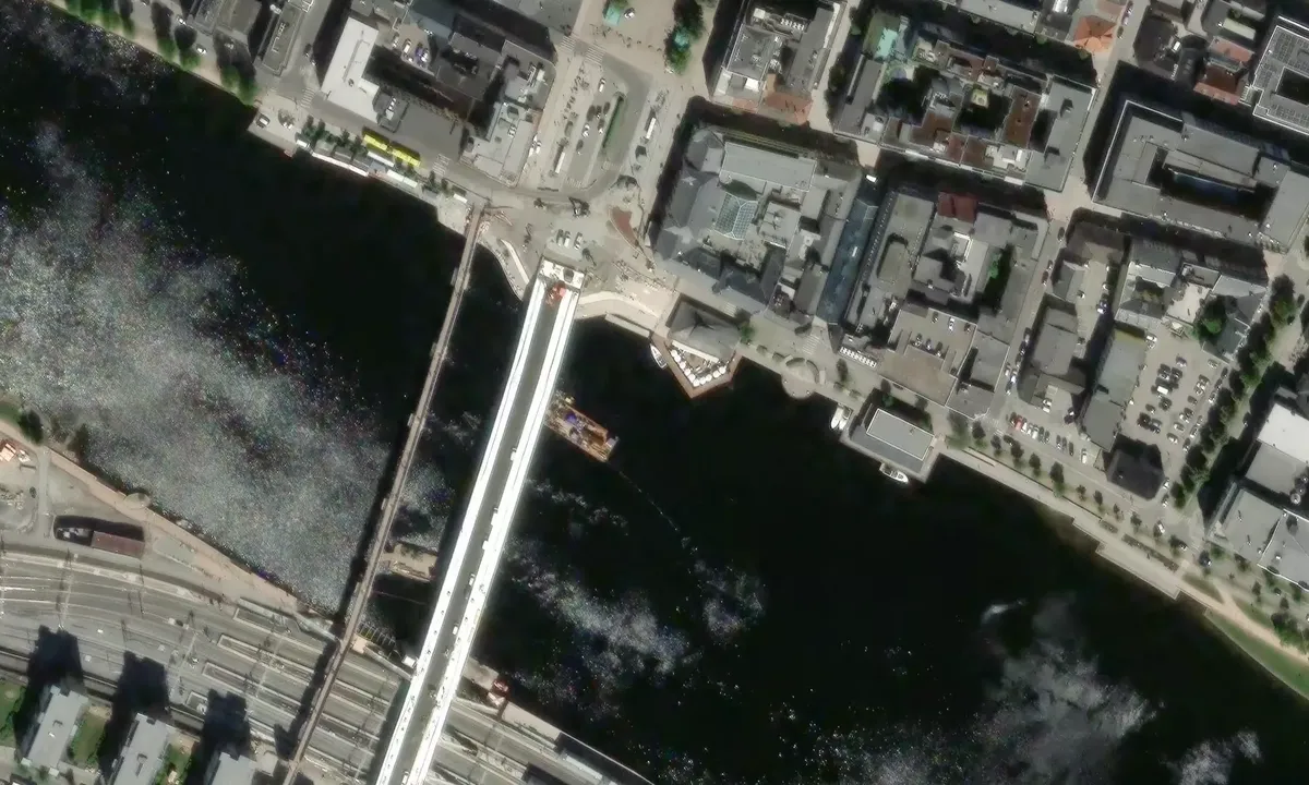
Entry and maritime conditions: In the middle of Drammen city center, on the Bragernes side, on both sides of the City Bridge, there are municipal guest spots free of charge as of June 2021.
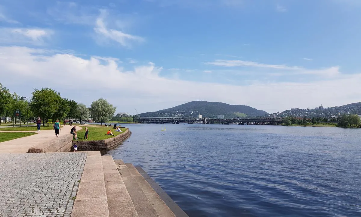
It is not possible to get under the bridges downstream closer to Drammen Harbor with sailboats, the free height on the motorway bridge is 10.5 meters, estimated 6 meters on the bridges above.
The nearest municipal offer for sailboats is in Svelvik, a half-hour bus ride away.
Berthing: Berthing is alongside, regulations state a maximum depth of two boats, alternatively towards land with an anchor, maximum width of 8 boats.
Some current can be expected in the Drammen River, (but no electricity on the pier ;-) ).
There is shore power available, but the system has been plagued with faults.
For regulations and further information
https://www.drammen.kommune.no/tjenester/vei-trafikk-parkering/kommunale-gjestebrygger/
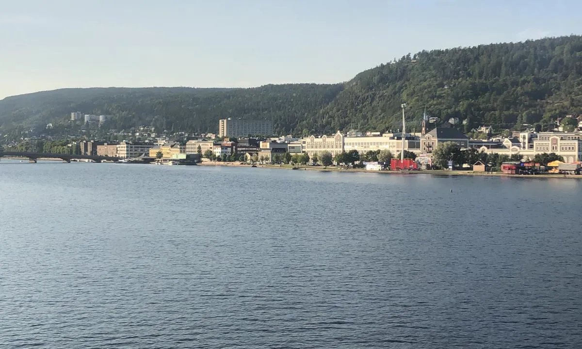
The area: Drammen city center is very compact and you can find most things within walking distance, groceries right across the street, a drink right on the other side of the square.
Tourist information opened in 2021 at Bragernes Square right on the other side of the road that passes, the main hub for public transport is around the City Bridge/Square, the Vestfold and Sørland Railway lines are visible.
The water quality in the river is acceptable and therefore swimming areas have been established right below the pier facilities, there are also indoor/outdoor swimming areas on the Strømsø side, a fifteen-minute leisurely walk away.
The spots on this side fill up quickly during larger events in the city, there have then been better opportunities to dock at the Railway Pier.
Two restaurants on the pier will inevitably cause some noise throughout the night.
[translated from Norwegian with AI]

1 x helpful | written on 17. Jun 2022
Do you know this harbour? It's a huge help to other sailors if you add a short description or review of the harbour.
Map of Honnørbrygga / Skutebrygga

Wind protection
Protection next night
87 points


Want to know how the wind score works? Then you should read this explanation.
The wind forecasts come from yr.no (Norwegian Meteorological Institute), and was last updated 1 hour and 59 minutes ago (Wednesday 24 June 11:28 AM). The next night score shows you the worst hour between 22:00 and 08:00 the next night. We recommend that you check multiple sources for wind forecasts. windy.com is a good website to show larger wind systems.
The safe directions for this harbour was added at None. Click here to edit.
Last visits to Honnørbrygga / Skutebrygga
Sat 30 May 2026 |
|
|
Sat 23 Aug 2025 |
|
|
 SIENNA DEL MAR [MMSI: 257042620]
 KASKAZI [MMSI: 258102820]
The visits are retrieved from AIS data. You can click to see all visiting ships to Honnørbrygga / Skutebrygga, as well as statistics about the ships that visits
Add this harbour to a journey
Choose a different date than today
Important: When you check in to a harbour, you add it to a journey on this website. You are not booking a place in the marina.
Contributors
Users that contributed to this page: Olav Pekeberg and Terje Jørgensen
harbourmaps.com is updated by the boating community. When you add information, a review or pictures to this page you are listed here with the other contributors (we list your user-name, which can be your real name or a pseudonym).
Closest harbours to Honnørbrygga / Skutebrygga
Filter by
Order by
0 harbours
Show more harbours
