Message from the system: You need to log in to write a review of the harour.

Nautøy

Natural harbour

favoritt

Region: Norway (3423), Vestland (599), Hordaland (393) and Stord (11)

Nautøy
Nautøy
Nautøy
Nautøy
Nautøy
Nautøy
Nautøy
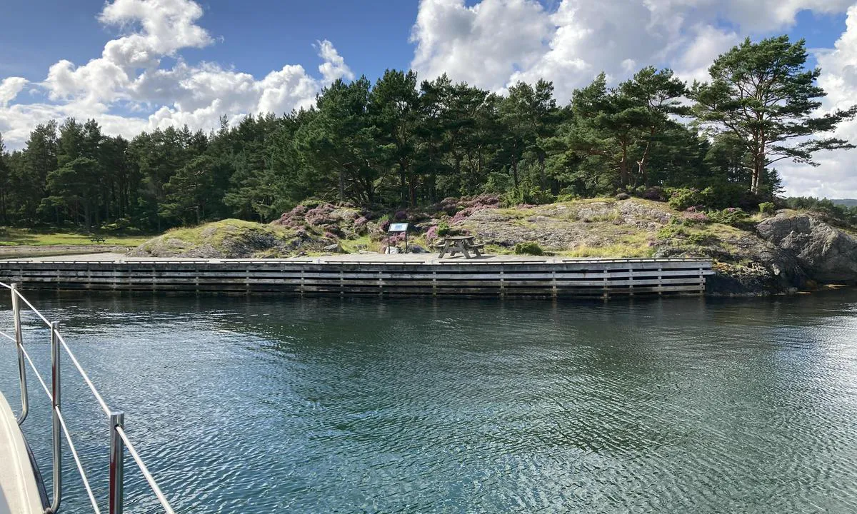
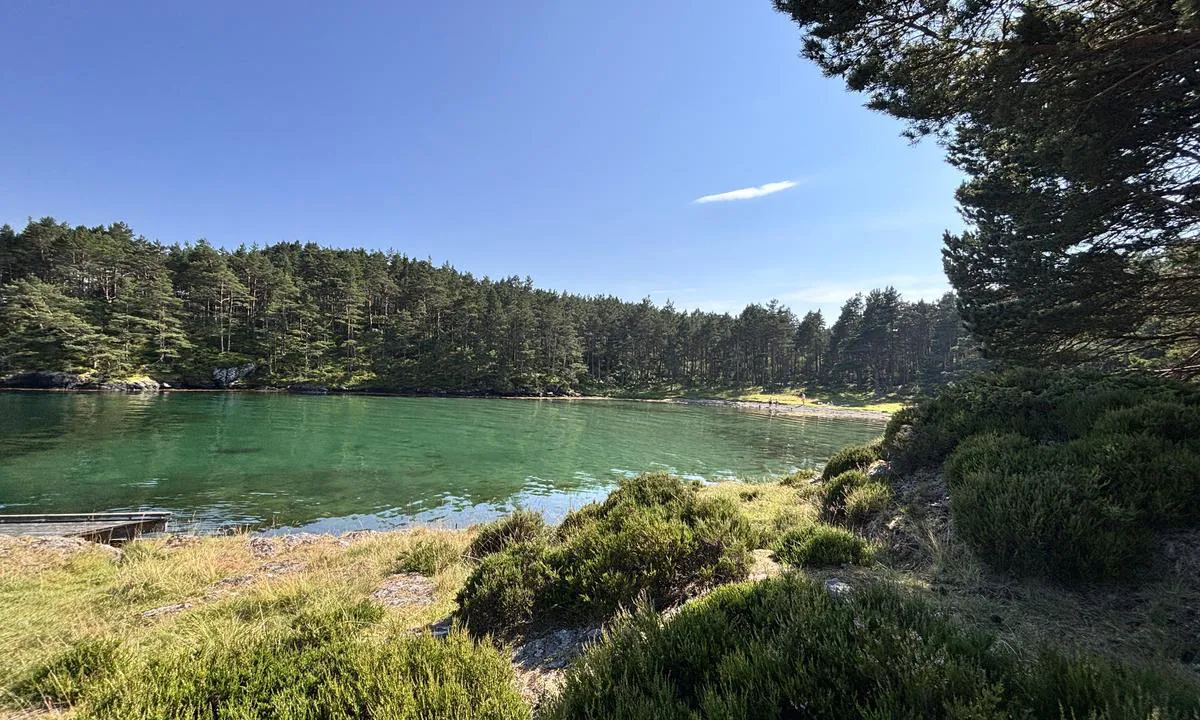
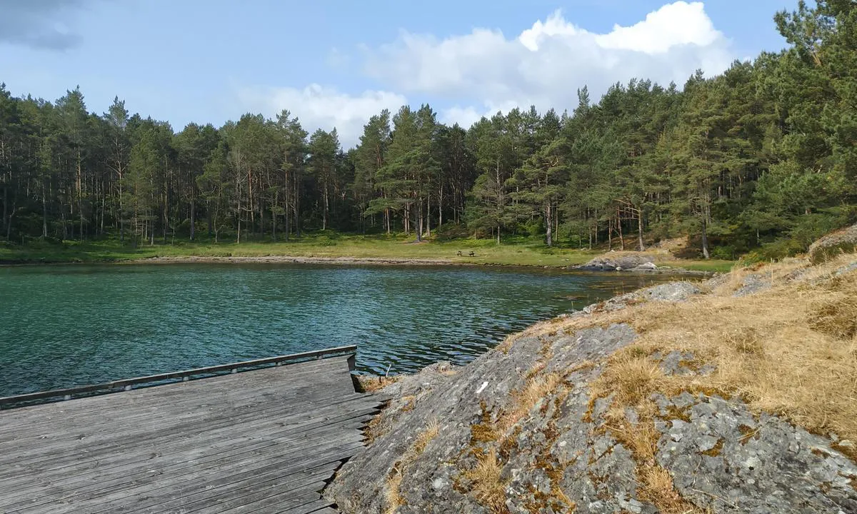
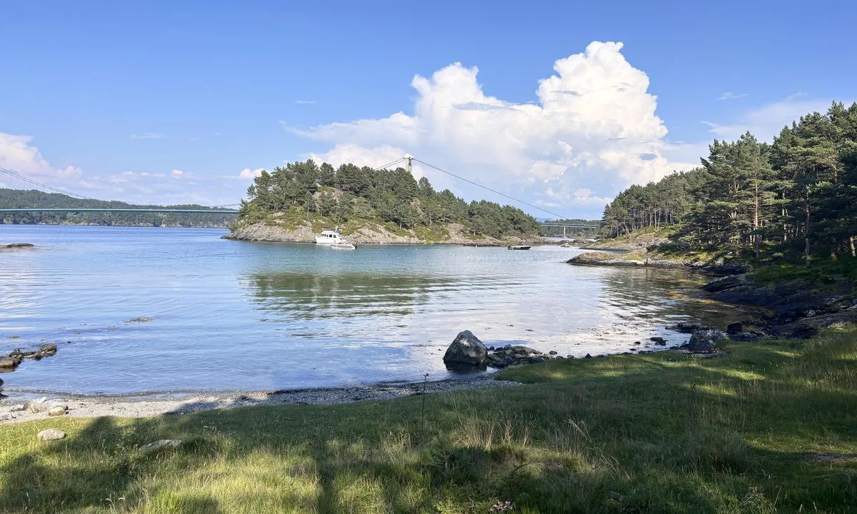
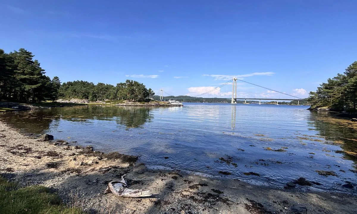
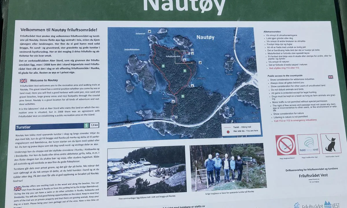
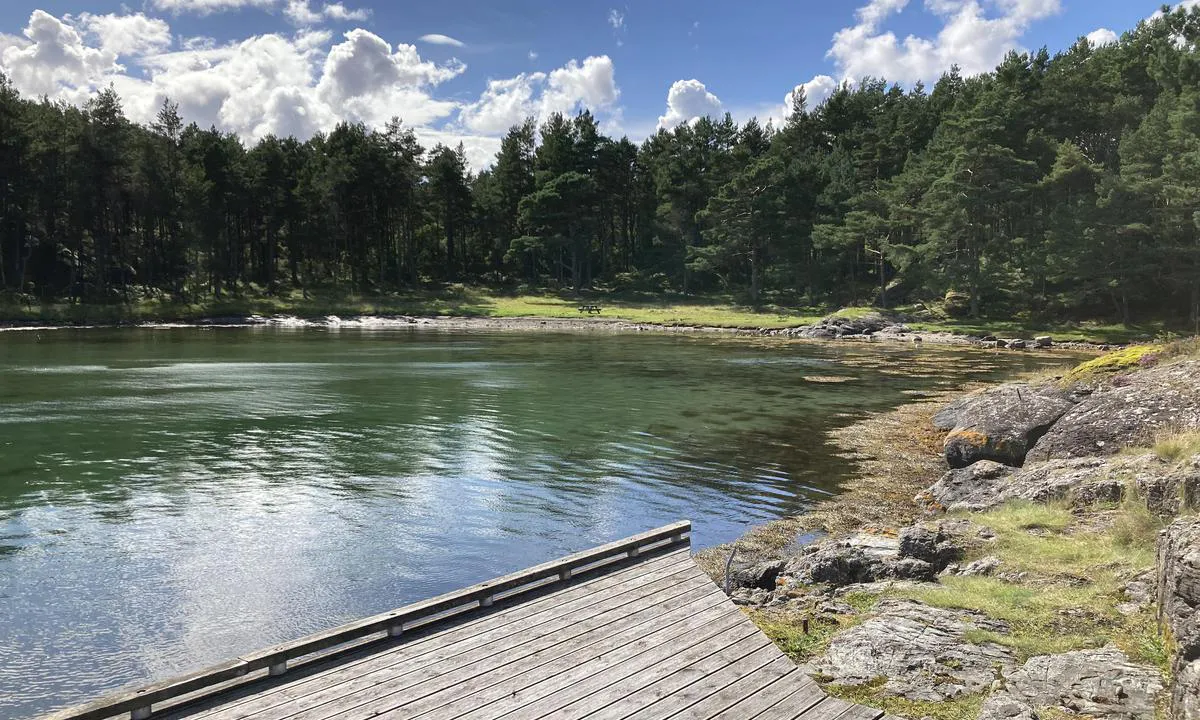
Nautøy: {"base": "no", "no": "Nydelige plasser rundt hele \u00f8yen. Rundtur (sti) p\u00e5 1,5km", "se": "Vackra platser runt hela \u00f6n. Rundtur (stig) p\u00e5 1,5 km", "en": "Beautiful spots around the entire island. Round trip (path) of 1.5 km", "da": "Smukke steder rundt om hele \u00f8en. Rundtur (sti) p\u00e5 1,5 km", "fr": "Des endroits magnifiques autour de toute l'\u00eele. Circuit (sentier) de 1,5 km", "de": "Wundersch\u00f6ne Pl\u00e4tze rund um die ganze Insel. Rundweg (Pfad) von 1,5 km", "es": "Preciosos lugares alrededor de toda la isla. Recorrido (sendero) de 1.5 km", "it": "Posti meravigliosi intorno a tutta l'isola. Giro (sentiero) di 1,5 km", "pt": "Belos lugares em toda a ilha. Tour circular (trilha) de 1,5km", "nl": "Prachtige plekken rondom het hele eiland. Rondwandeling (pad) van 1,5 km", "pl": "<p>Pi\u0119kne miejsca wok\u00f3\u0142 ca\u0142ej wyspy. Trasa piesza (\u015bcie\u017cka) o d\u0142ugo\u015bci 1,5 km</p>", "uk": "\u0427\u0443\u0434\u043e\u0432\u0456 \u043c\u0456\u0441\u0446\u044f \u043d\u0430\u0432\u043a\u043e\u043b\u043e \u0432\u0441\u044c\u043e\u0433\u043e \u043e\u0441\u0442\u0440\u043e\u0432\u0430. \u041a\u0440\u0443\u0433\u043e\u0432\u0438\u0439 \u043c\u0430\u0440\u0448\u0440\u0443\u0442 (\u0441\u0442\u0435\u0436\u043a\u0430) \u0434\u043e\u0432\u0436\u0438\u043d\u043e\u044e 1,5 \u043a\u043c", "ro": "Locuri minunate \u00een jurul \u00eentregii insule. Tur complet (traseu) de 1,5 km", "tr": "Adan\u0131n her yerinde g\u00fczel yerler. 1,5km\u2019lik bir tur (patika)", "el": "\u03a5\u03c0\u03ad\u03c1\u03bf\u03c7\u03b1 \u03bc\u03ad\u03c1\u03b7 \u03b3\u03cd\u03c1\u03c9 \u03b1\u03c0\u03cc \u03cc\u03bb\u03bf \u03c4\u03bf \u03bd\u03b7\u03c3\u03af. \u0393\u03cd\u03c1\u03bf\u03c2 (\u03bc\u03bf\u03bd\u03bf\u03c0\u03ac\u03c4\u03b9) 1,5 \u03c7\u03bb\u03bc", "cs": "Kr\u00e1sn\u00e1 m\u00edsta kolem cel\u00e9ho ostrova. Okru\u017en\u00ed trasa (stezka) 1,5 km", "hu": "Gy\u00f6ny\u00f6r\u0171 helyek az eg\u00e9sz szigeten. K\u00f6r\u00fat (\u00f6sv\u00e9ny) 1,5 km", "fi": "Kauniita paikkoja koko saaren ymp\u00e4ri. Kierros (polku) 1,5 km", "bg": "\u041f\u0440\u0435\u043a\u0440\u0430\u0441\u043d\u0438 \u043c\u0435\u0441\u0442\u0430 \u043e\u043a\u043e\u043b\u043e \u0446\u0435\u043b\u0438\u044f \u043e\u0441\u0442\u0440\u043e\u0432. \u041e\u0431\u0438\u043a\u043e\u043b\u043a\u0430 (\u043f\u044a\u0442\u0435\u043a\u0430) \u043e\u0442 1,5 \u043a\u043c", "sr": "Prekrasna mesta oko celog ostrva. Tura (staza) od 1,5 km", "et": "Kaunid kohad \u00fcle terve saare. Ringi (rada) pikkus on 1,5 km", "lv": "Skaistas vietas vis\u0101 sal\u0101. Ap\u013cveida mar\u0161ruts (taka) 1,5 km", "lt": "Nuostabios vietos aplink vis\u0105 sal\u0105. Apskritasis mar\u0161rutas (takelis) - 1,5 km"}
Nautøy
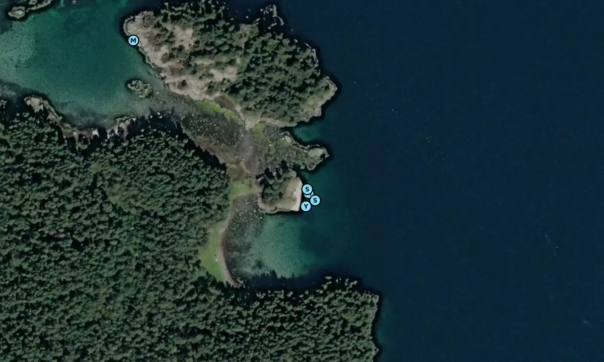
Satelite image of Nautøy

📸 Upload a photo

Show off your photos and help others plan their journey to Nautøy.harbourmaps.com is created by the sailing community, in a collective effort to make cruising simpler and more fun. Uploading a photo takes less than a minutes and can be done from your phone, tablet or laptop.

📸 Upload a photo

Facilities

Available facilities: Swimming area.

Updated on 21. Aug 2022. Update facilities.

Mooring

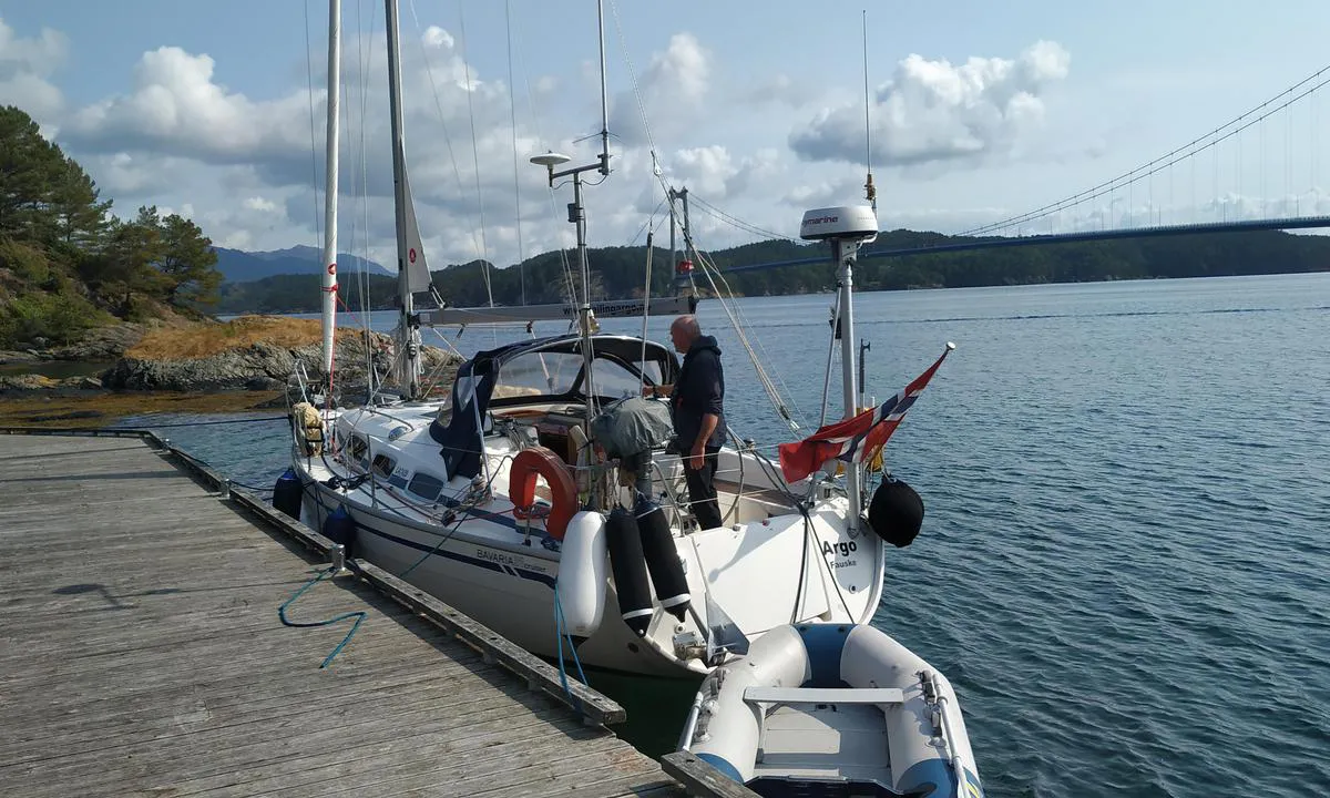
Options for mooring in this harbour: To pier/wharf, Anchoring, Towards land.

Updated on 21. Aug 2022. Update mooring.

Descriptions and reviews

MarLei says:

area

maritime qualities

description

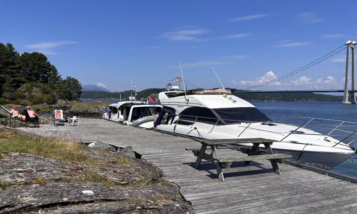
Fixed quay. We logged 3 meters at quay at high tide. Low tide depth is about 2 meters. The fast ferries pass through the strait relatively often and create many waves at the quay. Not a place to stay, unfortunately.

[translated from Norwegian with AI]

4 x helpful | written on 30. Jun 2023

Do you know this harbour? It's a huge help to other sailors if you add a short description or review of the harbour.

📜 Add description

Map of Nautøy

Facilities

Available facilities: Swimming area.

Updated on 21. Aug 2022. Update facilities.

Mooring

Options for mooring in this harbour: To pier/wharf, Anchoring, Towards land.

Updated on 21. Aug 2022. Update mooring.

Wind protection

Protection next night

72 points

N E S W --> } } } } } } } } } } } } } } } } } } } } } } } } } } } } } } } } } } } } } } } } } } } } } } } } } } } } } } } } } } } } } } } } } } } } } } } } } } } } } } } } } } } } } } } } } } } } } } } } } } } } } } } } } } } } } } } } } } } } } } } } } } } } } } } } } } } } } } } } } } } } } } } } } } } } } } } } } } } } } } } } } } } } } } } } } } } } } } } } } } } } } } } } } } } } } } } } } } } } } } } } } } } } } } } } } } } } } } } } } } } } } } } } } } } } } } } } } } } } } } } } } } } } } } } } } } } } } } } } } } } } } } } } } } } } } } } } } } } } } } } } } } } } } } } } } } } } } } } } } } } } } } } } } } } } } } } } } } } } } } } } } } } } } } } } } } } } } } } } } } } } } } } } } } } } } } } } } } } } } } } } } } } } } } } } } } } } } } } } } } } } } } } } } } } } } } } } } } } } } } } } } } } } } } } } } } } } } } } } } } } } } } } } } } } } } } } } } } } } } } } } } } } } } } } } } } } } } } } } } } } } } } } } } } } } } } } } } } } } } } } } } } } } } } } } } } } } } } } } } } } } } } } } } } } } } } } } } } } } } } } } } } } } } } } } } } } } } } } } } } } } } } } } } } } } } } } } } } } } } } } } } } } } } } } } } } } } } } } } } } } } } } } } } } } } } } } } } } } } } } } } } } } } } } } } } } } } } } } } } } } } } } } } } } } } } } } } } } } } } } } } } } } } } } } } } } } } } } } } } } } } } } } } } } } } } } } } } } } } } } } } } } } } } } } } } } } } } } } } } } } } } } } } } } } } } } } } } } } } } } } } } } } } } } } } } } } } } } } } } } } } } } } } } } } } } } } } } } } } } } } } } } } } } } } } } } } } } } } } } } } } } } } } } } } } } } } } } } } } } } } } } } } } } } } } } } } } } } } } } } } } } } } } } } } } } } } } } } } } } } } } } } } } } } } } } } } } } } } } } } } } } } } } } } } } } } } } } } } } } } } } } } } } } } } } } } } } } } } } } } } } } } } } } } } } } } } } } } } } } } } } } } } } } } } } } } } } } } } } } } } } } } } } } } } } } } } } } } } } } } } } } } } } } } } } } } } } } } } } } } } } Next night 6:00 12:00 Tor 21 Aug 18:00 0:00 6:00 12:00 Fre 22 Aug 18:00 9m/s 4m/s

Want to know how the wind score works? Then you should read this explanation.

The wind forecasts come from yr.no (Norwegian Meteorological Institute), and was last updated 1 hour and 33 minutes ago (Thursday 21 August 06:27 AM). The next night score shows you the worst hour between 22:00 and 08:00 the next night. We recommend that you check multiple sources for wind forecasts. windy.com is a good website to show larger wind systems.

The safe directions for this harbour was added at 21. Aug 2022. Click here to edit.

Last visits to Nautøy

Sat 17 May 2025

OLIVIA [MMSI: 258059920]

Fri 19 Jul 2024

ROMSA [MMSI: 258145540]

Wed 23 Aug 2023

C'NORD MAL [MMSI: 269103330]

Sun 13 Aug 2023

STRANA [MMSI: 228025130]

Thu 10 Aug 2023

MARI [MMSI: 258130520]

The visits are retrieved from AIS data. You can click to see all visiting ships to Nautøy, as well as statistics about the ships that visits

Add this harbour to a journey

Check in now

Choose a different date than today

Important: When you check in to a harbour, you add it to a journey on this website. You are not booking a place in the marina.

Contributors

Users that contributed to this page: Olav Pekeberg, PK Holmetun, MarLei and Tor Inge Amdal

harbourmaps.com is updated by the boating community. When you add information, a review or pictures to this page you are listed here with the other contributors (we list your user-name, which can be your real name or a pseudonym).

Closest harbours to Nautøy
Filter by

Natural harbour
Marina
Safe wind next night

Order by

ABC
Popularity
Wind score next night

0 harbours
Show more harbours