Message from the system: You need to log in to write a review of the harour.

Selvågen - Mandal

Natural harbour

favoritt

Region: Norway (3278), Agder (252), Vest-Agder (123), Lindesnes (38) and Mandal (17)

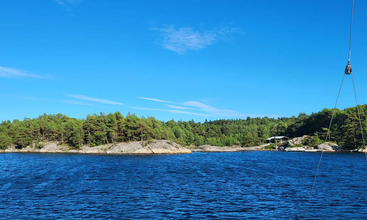
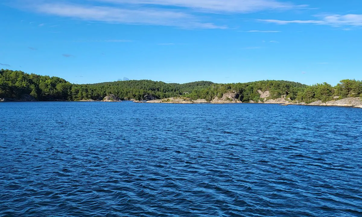
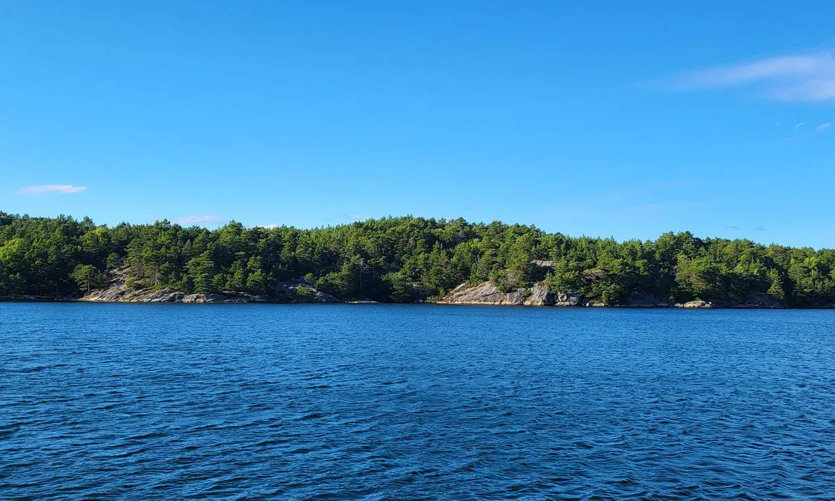
Selvågen - Mandal: {"base": "no", "no": "Svaberg en kan ligge mot. V\u00e6r obs p\u00e5 grunnene.", "se": "Svaberg som man kan l\u00e4gga till vid. Var uppm\u00e4rksam p\u00e5 grunden.", "en": "Rocky cliffs one can moor against. Be aware of the shallows.", "da": "Klippeblokke man kan ligge op mod. V\u00e6r opm\u00e6rksom p\u00e5 grundene."}
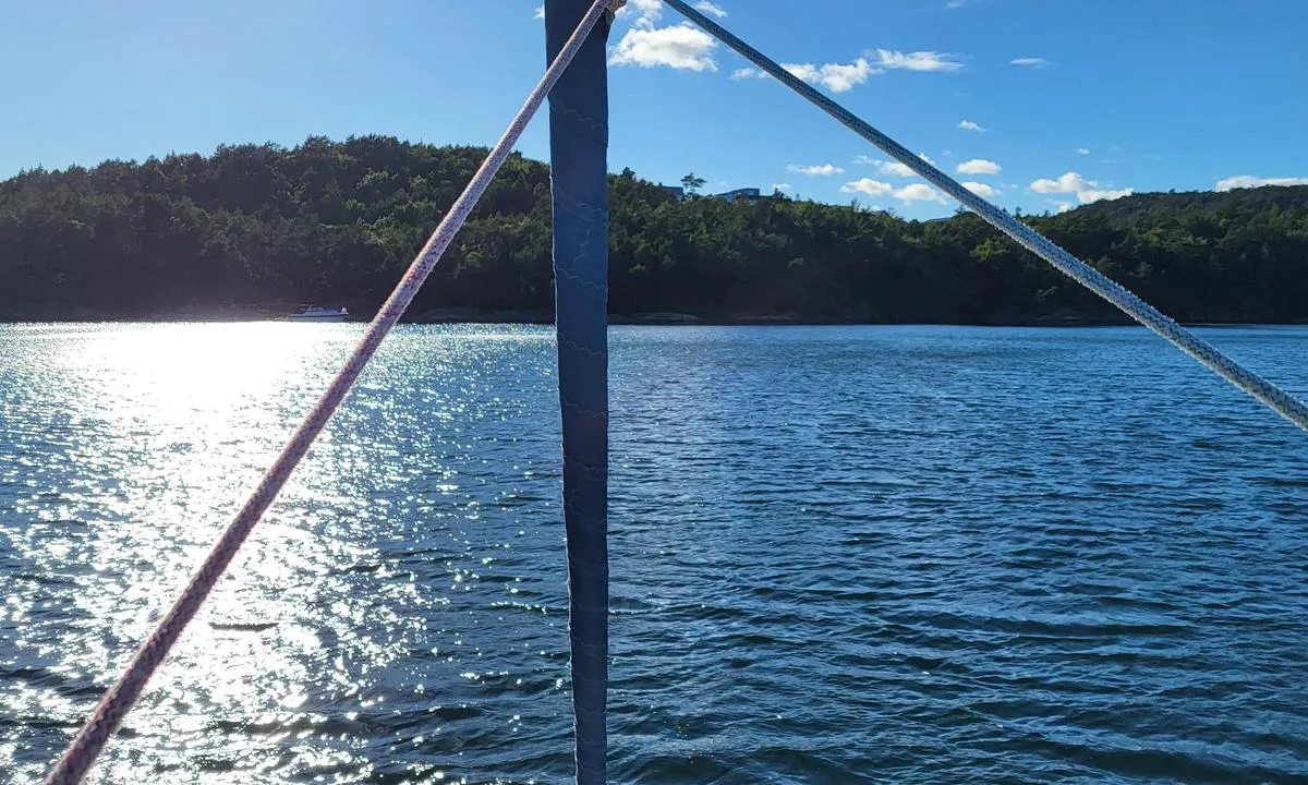
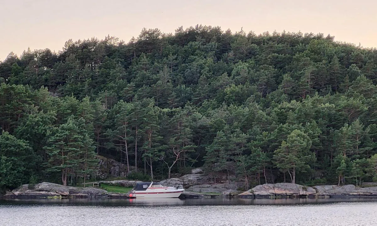
Selvågen - Mandal: {"base": "no", "no": "Romslig svaiplass. Et b\u00e5t ved den ene brygga innerst i v\u00e5gen skimtes til venstre p\u00e5 bildet.", "se": "Rymligt sv\u00e4ngrum. En b\u00e5t vid den ena bryggan l\u00e4ngst in i viken kan skymtas till v\u00e4nster p\u00e5 bilden.", "en": "Spacious anchoring area. A boat at one of the docks at the innermost part of the bay is visible on the left in the picture.", "da": "Rummelig sv\u00e6lgeplads. En b\u00e5d ved den ene bro inderst i v\u00e5gen skimtes til venstre p\u00e5 billedet."}
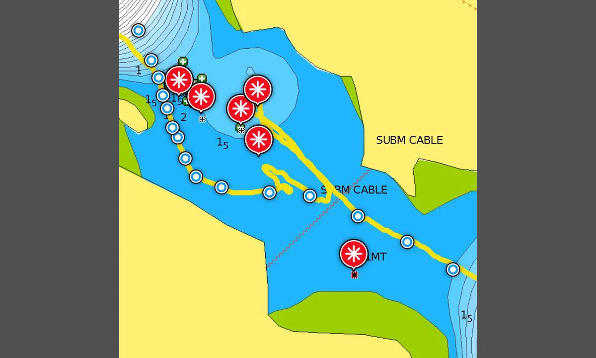
Selvågen - Mandal: {"base": "no", "no": "F\u00f8rste grunne sundet p\u00e5 veien inn. D\u00e5rlig beskrevet i sj\u00f8kartet. Gul strek er v\u00e5rt spor der vi mislyktes og der vi lyktes. R\u00f8de markeringer p\u00e5 skj\u00e6r, men ingen garanti for eksakt plassering og at det ikke er flere. Bl\u00e5 prikker den l\u00f8ypa vi selv vil pr\u00f8ve f\u00f8rst neste gang vi er her. Ingen garanti da vi jo ikke vet hvor n\u00e6rt vi evt seilet noen urenhetet. Hold mot bryggene p\u00e5 h\u00f8yre side n\u00e5r du g\u00e5r inn i grunt omr\u00e5de for \u00e5 unng\u00e5 f\u00f8rste 1,5 meter p\u00e5 venstre side. Sikt deretter mot det indre skj\u00e6ret p\u00e5 venstre side. N\u00e5r du n\u00e6rmer deg skj\u00e6ret g\u00e5 i en bue mot h\u00f8yre. Utkikk i baugen, lav fart! Vanskelig \u00e5 se grunnene pga mye veksling mellom gress og sand. Anbefaler \u00e5 studere Google maps flyfoto grundig s\u00e5 du ser de tre \"knollene\" som blokkerer midt og h\u00f8yre side p\u00e5 veien inn. Er det helt - helt utenkelig for deg \u00e5 sette kj\u00f8len borti bunnen s\u00e5 ikke pr\u00f8v. Med rette ruta som vi tilslutt fant kom vi inn med 1,8 meters dybde midt mellom lav og h\u00f8y vannstand. Bak oss kj\u00f8rte en motorb\u00e5t p\u00e5 h\u00f8yre side over grunnene.", "se": "F\u00f6rsta grunda sundet p\u00e5 v\u00e4gen in. D\u00e5ligt beskrivet i sj\u00f6kortet. Gul linje \u00e4r v\u00e5rt sp\u00e5r d\u00e4r vi misslyckades och d\u00e4r vi lyckades. R\u00f6da markeringar p\u00e5 grund, men ingen garanti f\u00f6r exakt placering och att det inte finns fler. Bl\u00e5 prickar \u00e4r den rutt vi sj\u00e4lva kommer att prova f\u00f6rst n\u00e4sta g\u00e5ng vi \u00e4r h\u00e4r. Ingen garanti d\u00e5 vi ju inte vet hur n\u00e4ra vi eventuellt seglade n\u00e5gra orenheter. H\u00e5ll mot bryggorna p\u00e5 h\u00f6ger sida n\u00e4r du g\u00e5r in i grunt omr\u00e5de f\u00f6r att undvika f\u00f6rsta 1,5 meter p\u00e5 v\u00e4nster sida. Sikta d\u00e4refter mot den inre grunden p\u00e5 v\u00e4nster sida. N\u00e4r du n\u00e4rmar dig grunden, g\u00e5 i en b\u00e5ge mot h\u00f6ger. Utkik i f\u00f6ren, l\u00e5g fart! Sv\u00e5rt att se grunden p\u00e5 grund av mycket v\u00e4xling mellan gr\u00e4s och sand. Rekommenderar att noggrant studera Google Maps flygfoton s\u00e5 att du ser de tre \"kn\u00f6lar\" som blockerar mitten och h\u00f6ger sida p\u00e5 v\u00e4gen in. \u00c4r det helt - helt ot\u00e4nkbart f\u00f6r dig att s\u00e4tta k\u00f6len i botten s\u00e5 f\u00f6rs\u00f6k inte. Med den r\u00e4tta rutt som vi till slut hittade kom vi in med 1,8 meters djup mitt mellan l\u00e5g och h\u00f6g vattenst\u00e5nd. Bakom oss k\u00f6rde en motorb\u00e5t p\u00e5 h\u00f6ger sida \u00f6ver grund.", "en": "First shallow strait on the way in. Poorly described in the nautical chart. Yellow line is our track showing where we failed and where we succeeded. Red markers on rocks, but no guarantee of exact placement and that there aren\u2019t more. Blue dots indicate the route we ourselves will try first the next time we are here. No guarantee as we do not know how close we may have sailed to any impurities. Keep towards the docks on the right side when you enter the shallow area to avoid the first 1.5 meters on the left side. Then aim towards the inner rock on the left side. As you approach the rock, curve to the right. Bow lookout, low speed! Difficult to see the shallows due to much alternation between grass and sand. Recommend studying Google Maps satellite photos thoroughly so you can see the three \u201cknolls\u201d that block the middle and right sides on the way in. If it is completely - completely unthinkable for you to touch the bottom with the keel, then don\u2019t try. With the correct route which we eventually found, we came in with 1.8 meters depth halfway between low and high tide. Behind us, a motorboat drove on the right side over the shallows.", "da": "F\u00f8rste lavvandede sund p\u00e5 vejen ind. D\u00e5rligt beskrevet i s\u00f8kortet. Gul streg er vores spor, hvor vi mislykkedes og hvor vi lykkedes. R\u00f8de markeringer p\u00e5 sk\u00e6r, men ingen garanti for eksakt placering og at der ikke er flere. Bl\u00e5 prikker angiver den rute, vi selv vil pr\u00f8ve f\u00f8rst n\u00e6ste gang vi er her. Ingen garanti da vi jo ikke ved, hvor t\u00e6t vi evt. sejlede p\u00e5 nogle urenheder. Hold mod broerne p\u00e5 h\u00f8jre side, n\u00e5r du g\u00e5r ind i lavvandet omr\u00e5de, for at undg\u00e5 de f\u00f8rste 1,5 meter p\u00e5 venstre side. Sigt derefter mod det indre sk\u00e6r p\u00e5 venstre side. N\u00e5r du n\u00e6rmer dig sk\u00e6ret, g\u00e5 i en bue mod h\u00f8jre. Udkig i st\u00e6vnen, lav fart! Vanskeligt at se grundene pga meget variation mellem gr\u00e6s og sand. Anbefaler at studere Google maps luftfoto grundigt, s\u00e5 du ser de tre \"knolde\", der blokerer midt og h\u00f8jre side p\u00e5 vejen ind. Er det helt - helt ut\u00e6nkeligt for dig at s\u00e6tte k\u00f8len mod bunden, s\u00e5 fors\u00f8g ikke. Med den rette rute, som vi til sidst fandt, kom vi ind med 1,8 meters dybde midt mellem lav og h\u00f8j vandstand. Bag os sejlede en motorb\u00e5d p\u00e5 h\u00f8jre side over grundene."}
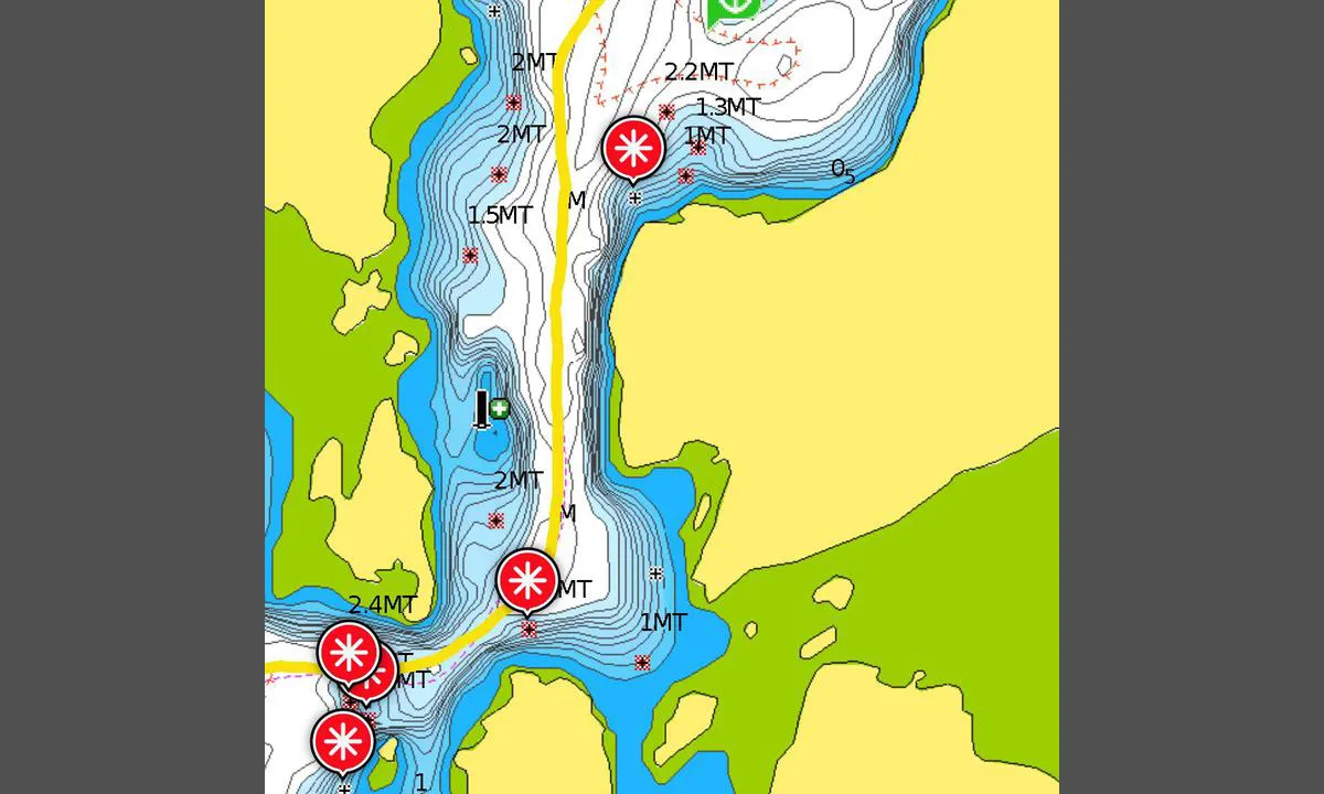
Selvågen - Mandal: {"base": "no", "no": "Andre trange parti \u00f8verst p\u00e5 bildet. Tredje og siste nederst p\u00e5 bildet. Studer sj\u00f8kartet n\u00f8ye og sving elegant gjennom dypeste l\u00f8ypa. Kom du forbi f\u00f8rste g\u00e5r disse bra.", "se": "Andra tr\u00e5nga delen h\u00f6gst upp p\u00e5 bilden. Tredje och sista l\u00e4ngst ned p\u00e5 bilden. Studera sj\u00f6kortet noggrant och sv\u00e4ng elegant genom den djupaste rutten. Kom du f\u00f6rbi f\u00f6rsta, g\u00e5r dessa bra.", "en": "Second narrow part at the top of the picture. Third and last at the bottom of the picture. Study the nautical chart carefully and navigate gracefully through the deepest route. If you got past the first one, these will be fine.", "da": "Andre trange parti \u00f8verst p\u00e5 billedet. Tredje og sidste nederst p\u00e5 billedet. Studer s\u00f8kortet n\u00f8je og sving elegant gennem dybeste rute. Kom du forbi f\u00f8rste, g\u00e5r disse godt."}
Selvågen - Mandal: {"base": "no", "no": "Bilde retning innseiling.", "se": "Bild riktning infart.", "en": "Image direction into port.", "da": "Billede retning indsejling."}
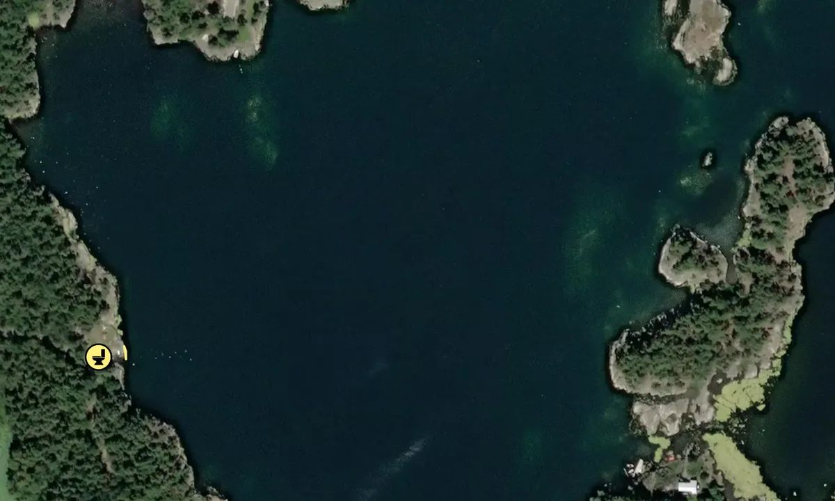
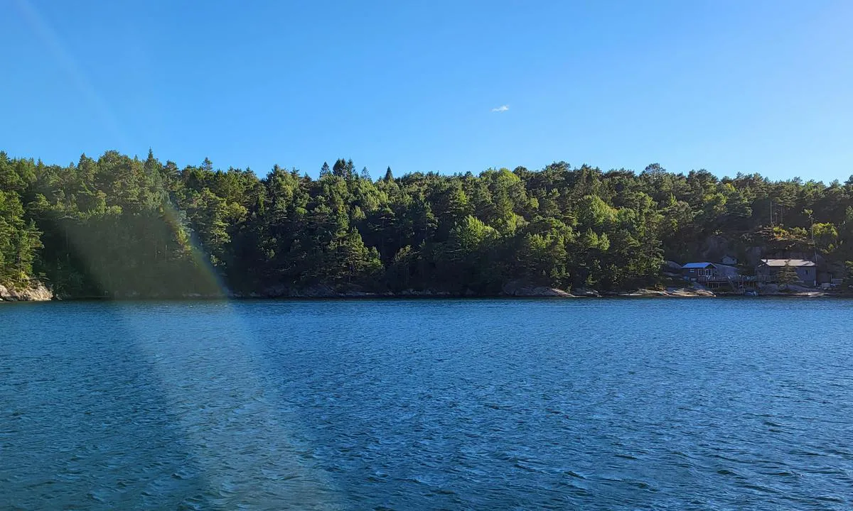
Selvågen - Mandal: {"base": "no", "no": "En brygge innerst i viken i venstre billedkant. Har ett skilt, men ikke sikker p\u00e5 hva det sier.", "se": "En brygga l\u00e4ngst in i viken i v\u00e4nster bildkant. Har en skylt, men \u00e4r inte s\u00e4ker p\u00e5 vad den s\u00e4ger.", "en": "A pier at the innermost part of the bay in the left corner of the picture. Has a sign, but not sure what it says.", "da": "En bro inderst i bugten i venstre billedkant. Har et skilt, men er ikke sikker p\u00e5, hvad der st\u00e5r."}
Selvågen - Mandal: {"base": "no", "no": "Romslig med svaiplass.", "se": "Rymligt med sv\u00e4ngutrymme.", "en": "Spacious with swing room.", "da": "Rummelig med svajplads."}
Selvågen - Mandal: {"base": "no", "no": "En b\u00e5t ved brygga innerst i v\u00e5gen", "se": "En b\u00e5t vid bryggan innerst i v\u00e5gen", "en": "A boat at the dock at the innermost part of the bay", "da": "En b\u00e5d ved broen inderst i v\u00e5gen"}
Flyfoto av Selvågen - Mandal

📸 Upload a photo

Show off your photos and help others plan their journey to Selvågen - Mandal.harbourmaps.com is created by the sailing community, in a collective effort to make cruising simpler and more fun. Uploading a photo takes less than a minutes and can be done from your phone, tablet or laptop.

📸 Upload a photo

Facilities

We don't have any data on available facilities in this harbour. If you know which facilities are available here, please update this site to help your fellow sailors. Update facilities.

Mooring

Options for mooring in this harbour: To pier/wharf, Anchoring, Towards land.

Updated on 10. Aug 2023. Update mooring.

Descriptions and reviews

Snorre Smith says:

area

maritime qualities

description

Challenging entrance for boats drawing one and a half meters or more. And when (if...) you manage to find the route in, a fantastic cove/bay reveals itself, well worth the effort. Inside the bay, there is ample swinging room with a depth of about 4-8 meters. There are a couple of piers and several rocks with bolts. Be aware of several shallows if you move towards the rocks in the southeast and northwest. A small handful of cabins, but at a decent distance from the piers and swinging area. Naturally, there is no swell or waves entering here. However, the terrain all around is low, so at the swinging area, you will notice winds from all directions, albeit dampened from offshore. If you moor towards the land, you will get protection from the direction you are mooring towards. The entrance has three challenging sections. If you succeed with the first one, you can easily handle the last two narrow spots by closely following a good nautical chart. For the first and difficult one, see the description in the accompanying image.

[translated from Norwegian with AI]

1 x helpful | written on 10. Aug 2023 | updated_on 10. Aug 2023

Do you know this harbour? It's a huge help to other sailors if you add a short description or review of the harbour.

📜 Add description

Map of Selvågen - Mandal

Facilities

We don't have any data on available facilities in this harbour. If you know which facilities are available here, please update this site to help your fellow sailors. Update facilities.

Mooring

Options for mooring in this harbour: To pier/wharf, Anchoring, Towards land.

Updated on 10. Aug 2023. Update mooring.

Wind protection

Protection next night

87 points

N E S W --> } } } } } } } } } } } } } } } } } } } } } } } } } } } } } } } } } } } } } } } } } } } } } } } } } } } } } } } } } } } } } } } } } } } } } } } } } } } } } } } } } } } } } } } } } } } } } } } } } } } } } } } } } } } } } } } } } } } } } } } } } } } } } } } } } } } } } } } } } } } } } } } } } } } } } } } } } } } } } } } } } } } } } } } } } } } } } } } } } } } } } } } } } } } } } } } } } } } } } } } } } } } } } } } } } } } } } } } } } } } } } } } } } } } } } } } } } } } } } } } } } } } } } } } } } } } } } } } } } } } } } } } } } } } } } } } } } } } } } } } } } } } } } } } } } } } } } } } } } } } } } } } } } } } } } } } } } } } } } } } } } } } } } } } } } } } } } } } } } } } } } } } } } } } } } } } } } } } } } } } } } } } } } } } } } } } } } } } } } } } } } } } } } } } } } } } } } } } } } } } } } } } } } } } } } } } } } } } } } } } } } } } } } } } } } } } } } } } } } } } } } } } } } } } } } } } } } } } } } } } } } } } } } } } } } } } } } } } } } } } } } } } } } } } } } } } } } } } } } } } } } } } } } } } } } } } } } } } } } } } } } } } } } } } } } } } } } } } } } } } } } } } } } } } } } } } } } } } } } } } } } } } } } } } } } } } } } } } } } } } } } } } } } } } } } } } } } } } } } } } } } } } } } } } } } } } } } } } } } } } } } } } } } } } } } } } } } } } } } } } } } } } } } } } } } } } } } } } } } } } } } } } } } } } } } } } } } } } } } } } } } } } } } } } } } } } } } } } } } } } } } } } } } } } } } } } } } } } } } } } } } } } } } } } } } } } } } } } } } } } } } } } } } } } } } } } } } } } } } } } } } } } } } } } } } } } } } } } } } } } } } } } } } } } } } } } } } } } } } } } } } } } } } } } } } } } } } } } } } } } } } } } } } } } } } } } } } } } } } } } } } } } } } } } } } } } } } } } } } } } } } } } } } } } } } } } } } } } } } } } } } } } } } } } } } } } } } } } } } } } } } } } } } } } } } } } } } } } } } } } } } } } } } } } } } } } } } } } } } } } } } } } } } } } } } } } } } } } } } } } } } } } } } } } } } } } } } } } } } } } } Next night 0:00 6:00 12:00 Tor 01 Mai 18:00 0:00 6:00 12:00 Fre 02 Mai 8m/s 2m/s

Want to know how the wind score works? Then you should read this explanation.

The wind forecasts come from yr.no (Norwegian Meteorological Institute), and was last updated 1 hour and 44 minutes ago (Wednesday 30 April 11:28 PM). The next night score shows you the worst hour between 22:00 and 08:00 the next night. We recommend that you check multiple sources for wind forecasts. windy.com is a good website to show larger wind systems.

The safe wind directions for this harbour has been decided by an algorithm, based on how elevated the land around the harbour is. It's mostly correct, but sometimes the underlying data about elevation levels is not good enough to make correct decisions. It's a great help to other if you can validate or adjust the safe wind directions. You can see the data used by the algorithm to decide the safe wind directions by clicking here.

Last visits to Selvågen - Mandal

The visits are retrieved from AIS data. You can click to see all visiting ships to Selvågen - Mandal, as well as statistics about the ships that visits

Add this harbour to a journey

Check in now

Choose a different date than today

Important: When you check in to a harbour, you add it to a journey on this website. You are not booking a place in the marina.

Contributors

Users that contributed to this page: Snorre Smith

harbourmaps.com is updated by the boating community. When you add information, a review or pictures to this page you are listed here with the other contributors (we list your user-name, which can be your real name or a pseudonym).

Closest harbours to Selvågen - Mandal
Filter by

Natural harbour
Marina
Safe wind next night

Order by

ABC
Popularity
Wind score next night

0 harbours
Show more harbours