


Forøya - Hjelmeland
Natural harbour

Region: Norway (3464), Rogaland (243), Stavanger (67) and Hjelmeland (16)


Descriptions and reviews
Bernt Lennart Jøssang says:
says:
area

maritime qualities

description
Exposed to large waves from passing utility traffic, but good bottom for anchoring
[translated from Norwegian with AI]

1 x helpful | written on 20. May 2026
SY Lilly says:
area
maritime qualities
description
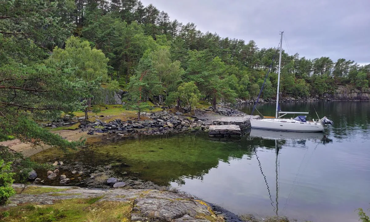
The island is used as a campsite for sea scouts. Old stone pier with a depth around 2 meters. Some sheep grazing on the island. Mooring bolts both on the stone pier and on land.
NB. There is a submerged rock indicated on the nautical chart. The rock is marked with a stick. This rock extends a bit northward. 10 meters north of the stick, the depth is still less than 2 meters.
[translated from Norwegian with AI]
1 x helpful | written on 10. Jul 2024 | updated_on 11. Jul 2024
Do you know this harbour? It's a huge help to other sailors if you add a short description or review of the harbour.
Map of Forøya - Hjelmeland

Wind protection
Protection next night
85 points


Want to know how the wind score works? Then you should read this explanation.
The wind forecasts come from yr.no (Norwegian Meteorological Institute), and was last updated 2 hours and 9 minutes ago (Monday 22 June 07:28 AM). The next night score shows you the worst hour between 22:00 and 08:00 the next night. We recommend that you check multiple sources for wind forecasts. windy.com is a good website to show larger wind systems.
The safe directions for this harbour was added at 11. Jul 2024. Click here to edit.
Last visits to Forøya - Hjelmeland
Sun 29 Mar 2026 |
|
|
Thu 21 Sep 2023 |
|
|
 LIV TORILL [MMSI: 258093630]
The visits are retrieved from AIS data. You can click to see all visiting ships to Forøya - Hjelmeland, as well as statistics about the ships that visits
Add this harbour to a journey
Choose a different date than today
Important: When you check in to a harbour, you add it to a journey on this website. You are not booking a place in the marina.
Contributors
Users that contributed to this page: Chornelius Rød and SY Lilly
harbourmaps.com is updated by the boating community. When you add information, a review or pictures to this page you are listed here with the other contributors (we list your user-name, which can be your real name or a pseudonym).
Closest harbours to Forøya - Hjelmeland
Filter by
Order by
0 harbours
Show more harbours
