News and updates for the 2025 season
1. View images in full size
This feature has been requested for several years, and we’ve finally made it happen.
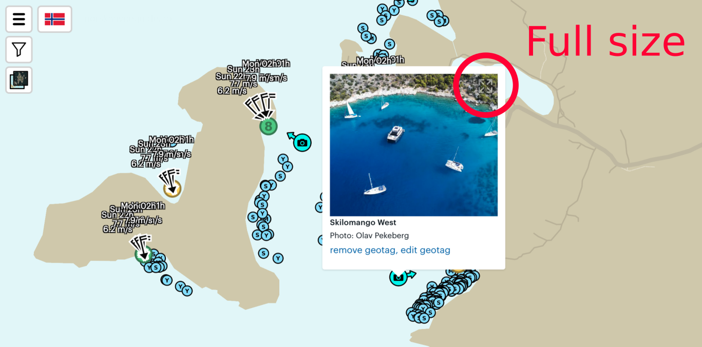
In harbors that have drone images, we mark the most explanatory images on the map. You can view them by clicking on the symbols with a camera inside. The images are quite small, and for planning, you’ll want to see them in full size. We’ve now added a small button in the upper right corner of the image. The "button" is subtly marked so it doesn’t overshadow the image itself. When you click the button, the image opens in full size. You’ll find the same button on all images on the harbor page.
Here is a screenshot from the bay Skilomango West outside Athens in Greece. Note: This is a screenshot, and clicking the image here will not work.
2. Marking of facilities on drone images
Two years ago, we launched the ability to mark harbor facilities on the map. We’re now doing the same with drone images. Have you uploaded a drone image and want to mark it? You’ll find a button just below the images on the harbor pages.
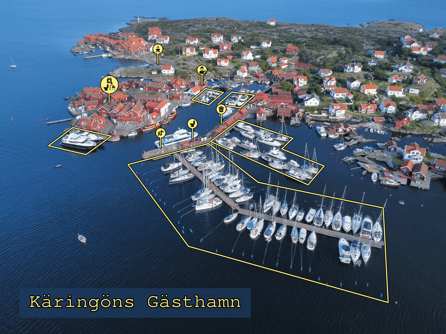
Here’s an example from Käringöns Gästhamn in Bohuslän, on the Swedish West Coast. With the harbor’s facilities marked directly on the photo, it becomes very easy to navigate a new marina.