Dragøy

Natural harbour

favoritt

Region: Norway (3465), Rogaland (243), Karmøy (28), Røyksund (9) and Røksund (2)

Dragøy
Dragøy: Bryggeplass til en båt. (Ev to dersom man ankrer hekken ut) God dybde ved brygga.
Dragøy
Dragøy
Satelite image of Dragøy

📸 Upload a photo

Show off your photos and help others plan their journey to Dragøy.harbourmaps.com is created by the sailing community, in a collective effort to make cruising simpler and more fun. Uploading a photo takes less than a minutes and can be done from your phone, tablet or laptop.

📸 Upload a photo

Facilities

We don't have any data on available facilities in this harbour. If you know which facilities are available here, please update this site to help your fellow sailors. Update facilities.

Mooring

Options for mooring in this harbour: To pier/wharf, Anchoring, Towards land.

Updated on 11. May 2026. Update mooring.

Descriptions and reviews

Taranger says:

description

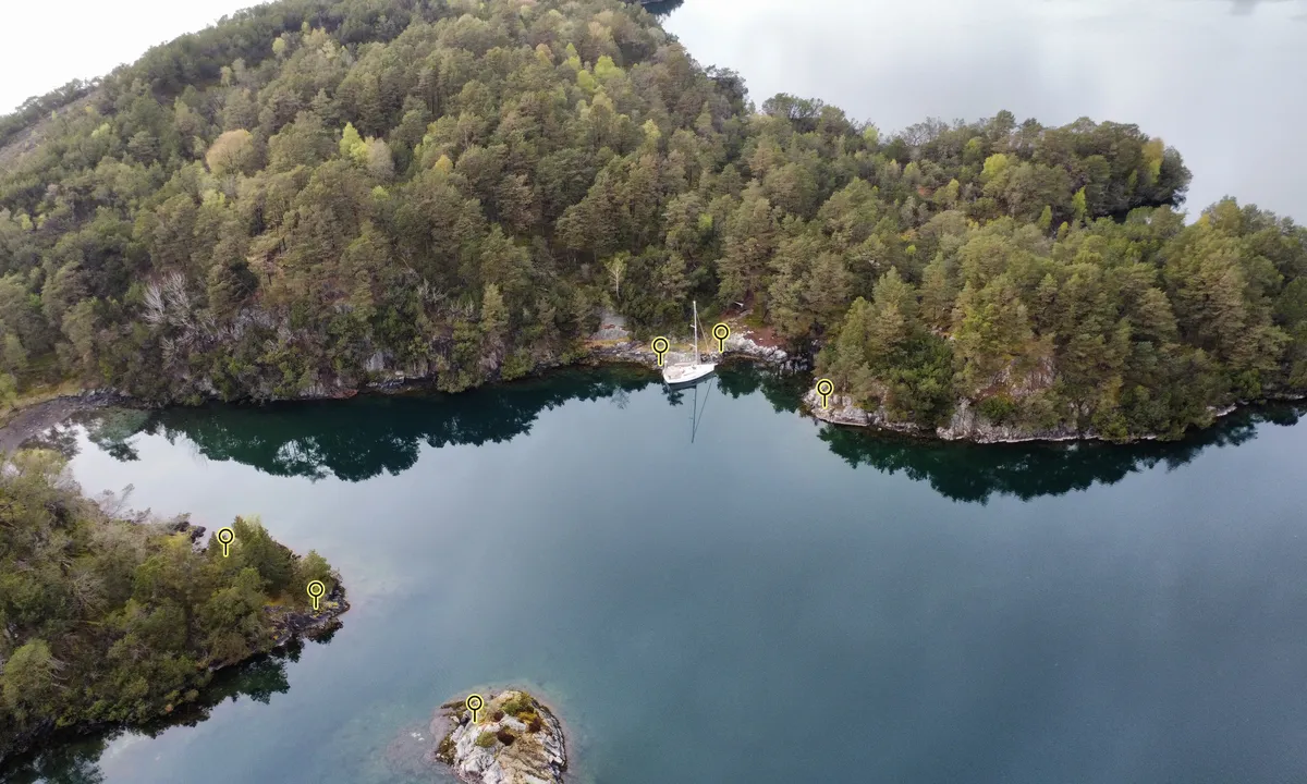
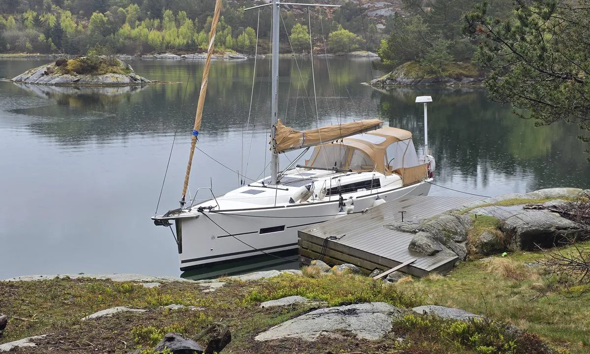
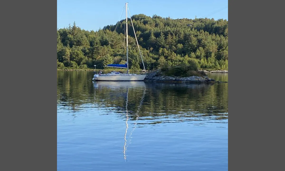
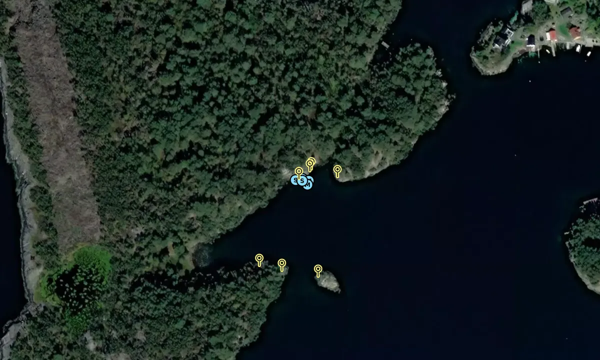
Ankring: Her kan man ligge til brygge eller på svai. Det er gode dybdeforhold ved brygga, men noe grunt i østre ende. Det er derfor lurt å legge til med babord side for seilbåter, dersom man vil ligge longside. Ellers i vika er det gode ankringsforhold og ca 6m dybde. Innseiling er uproblematisk, men kan være utfordrende å komme inn sundet fra vest i mørket. Fra øst er man høydebegrenset til 13 meter pga brua mellom Røyksund og Fosen. Fra vest er man høydebegrenset til 25m av en kraftledning.
Området: Fin og lun plass. Her er man skjermet for de fleste vinder, men særlig fra den fremherskende nordavinden. Øya er et fint lekeområde for barn.

1 x helpful | written on 20. Jun 2021 | updated_on 10. May 2026

Do you know this harbour? It's a huge help to other sailors if you add a short description or review of the harbour.

📜 Add description

Map of Dragøy

Facilities

We don't have any data on available facilities in this harbour. If you know which facilities are available here, please update this site to help your fellow sailors. Update facilities.

Mooring

Options for mooring in this harbour: To pier/wharf, Anchoring, Towards land.

Updated on 11. May 2026. Update mooring.

Wind protection

Protection next night

93 points

N E S W --> } } } } } } } } } } } } } } } } } } } } } } } } } } } } } } } } } } } } } } } } } } } } } } } } } } } } } } } } } } } } } } } } } } } } } } } } } } } } } } } } } } } } } } } } } } } } } } } } } } } } } } } } } } } } } } } } } } } } } } } } } } } } } } } } } } } } } } } } } } } } } } } } } } } } } } } } } } } } } } } } } } } } } } } } } } } } } } } } } } } } } } } } } } } } } } } } } } } } } } } } } } } } } } } } } } } } } } } } } } } } } } } } } } } } } } } } } } } } } } } } } } } } } } } } } } } } } } } } } } } } } } } } } } } } } } } } } } } } } } } } } } } } } } } } } } } } } } } } } } } } } } } } } } } } } } } } } } } } } } } } } } } } } } } } } } } } } } } } } } } } } } } } } } } } } } } } } } } } } } } } } } } } } } } } } } } } } } } } } } } } } } } } } } } } } } } } } } } } } } } } } } } } } } } } } } } } } } } } } } } } } } } } } } } } } } } } } } } } } } } } } } } } } } } } } } } } } } } } } } } } } } } } } } } } } } } } } } } } } } } } } } } } } } } } } } } } } } } } } } } } } } } } } } } } } } } } } } } } } } } } } } } } } } } } } } } } } } } } } } } } } } } } } } } } } } } } } } } } } } } } } } } } } } } } } } } } } } } } } } } } } } } } } } } } } } } } } } } } } } } } } } } } } } } } } } } } } } } } } } } } } } } } } } } } } } } } } } } } } } } } } } } } } } } } } } } } } } } } } } } } } } } } } } } } } } } } } } } } } } } } } } } } } } } } } } } } } } } } } } } } } } } } } } } } } } } } } } } } } } } } } } } } } } } } } } } } } } } } } } } } } } } } } } } } } } } } } } } } } } } } } } } } } } } } } } } } } } } } } } } } } } } } } } } } } } } } } } } } } } } } } } } } } } } } } } } } } } } } } } } } } } } } } } } } } } } } } } } } } } } } } } } } } } } } } } } } } } } } } } } } } } } } } } } } } } } } } } } } } } } } } } } } } } } } } } } } } } } } } } } } } } } } } } } } } } } } } } } } } } } } } } } } } } } } } } } } } } } } } } } } } } } } } } } } } } } } } } } } } } } } } } } } } } } } } } } } } } } } } } } } Next night 12:00 Ons 24 Jun 18:00 0:00 6:00 12:00 Tor 25 Jun 18:00 5m/s 1m/s

Want to know how the wind score works? Then you should read this explanation.

The wind forecasts come from yr.no (Norwegian Meteorological Institute), and was last updated 1 hour and 28 minutes ago (Wednesday 24 June 10:28 AM). The next night score shows you the worst hour between 22:00 and 08:00 the next night. We recommend that you check multiple sources for wind forecasts. windy.com is a good website to show larger wind systems.

The safe directions for this harbour was added at 20. Jun 2021. Click here to edit.

Last visits to Dragøy

Fri 14 Jun 2024

MA [MMSI: 215443000]

Tue 29 Aug 2023

MUGGELE [MMSI: 211680690]

Thu 10 Aug 2023

MIDTHOLM SJOSPEIDER [MMSI: 257968430]

Wed 09 Aug 2023

MINNI SJOSPEIDER [MMSI: 259011340]

Thu 27 Jul 2023

GO TID III [MMSI: 258237270]

The visits are retrieved from AIS data. You can click to see all visiting ships to Dragøy, as well as statistics about the ships that visits

Add this harbour to a journey

Check in now

Choose a different date than today

Important: When you check in to a harbour, you add it to a journey on this website. You are not booking a place in the marina.

Contributors

Users that contributed to this page: Arne Ingmar Eggen and Taranger

harbourmaps.com is updated by the boating community. When you add information, a review or pictures to this page you are listed here with the other contributors (we list your user-name, which can be your real name or a pseudonym).

Closest harbours to Dragøy

Filter by

Natural harbour
Marina
Safe wind next night

Order by

ABC
Popularity
Wind score next night

0 harbours

Show more harbours