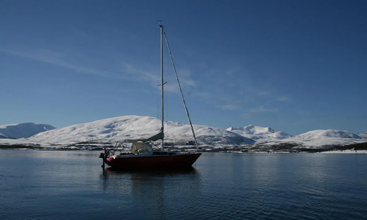
Grindøya
Grindøya
Grindøya
Grindøya: {"base": "no", "no": "Mulig \u00e5 ankre opp n\u00e6rmere land enn dette", "se": "M\u00f6jligt att ankra n\u00e4rmare land \u00e4n detta", "en": "Possible to anchor closer to shore than this", "da": "Muligt at ankre op t\u00e6ttere p\u00e5 land end dette", "fr": "Il est possible de jeter l'ancre plus pr\u00e8s de la terre que cela", "de": "Es ist m\u00f6glich, n\u00e4her an Land zu ankern als dies.", "es": "Posible anclar m\u00e1s cerca de la tierra que esto", "it": "Possibile ancorare pi\u00f9 vicino alla terra di cos\u00ec", "pt": "\u00c9 poss\u00edvel ancorar mais perto da terra do que isso", "nl": "Mogelijk dichter bij het land ankeren dan dit", "pl": "Mo\u017cliwe jest zakotwiczenie bli\u017cej l\u0105du ni\u017c to", "uk": "\u041c\u043e\u0436\u043b\u0438\u0432\u043e \u043a\u0438\u043d\u0443\u0442\u0438 \u044f\u043a\u0456\u0440 \u0431\u043b\u0438\u0436\u0447\u0435 \u0434\u043e \u0431\u0435\u0440\u0435\u0433\u0430, \u043d\u0456\u0436 \u0446\u0435", "ro": "Posibil s\u0103 ancorezi mai aproape de \u021b\u0103rm dec\u00e2t aici", "tr": "Bu mesafeden daha yak\u0131na demir atmak m\u00fcmk\u00fcn", "el": "\u0395\u03af\u03bd\u03b1\u03b9 \u03b4\u03c5\u03bd\u03b1\u03c4\u03cc\u03bd \u03bd\u03b1 \u03b1\u03b3\u03ba\u03c5\u03c1\u03bf\u03b2\u03bf\u03bb\u03ae\u03c3\u03b5\u03b9 \u03ba\u03b1\u03bd\u03b5\u03af\u03c2 \u03c0\u03b9\u03bf \u03ba\u03bf\u03bd\u03c4\u03ac \u03c3\u03c4\u03b7\u03bd \u03b1\u03ba\u03c4\u03ae \u03b1\u03c0\u03cc \u03b1\u03c5\u03c4\u03cc", "cs": "Mo\u017en\u00e9 zakotvit bl\u00ed\u017ee ke b\u0159ehu ne\u017e zde", "hu": "Lehets\u00e9ges k\u00f6zelebb lehorgonyozni a parthoz, mint itt", "fi": "Mahdollista ankkuroida l\u00e4hemm\u00e4ksi rantaa kuin t\u00e4m\u00e4", "bg": "\u0412\u044a\u0437\u043c\u043e\u0436\u043d\u043e \u0435 \u0434\u0430 \u0445\u0432\u044a\u0440\u043b\u0438\u0442\u0435 \u043a\u043e\u0442\u0432\u0430 \u043f\u043e-\u0431\u043b\u0438\u0437\u043e \u0434\u043e \u0431\u0440\u0435\u0433\u0430 \u043e\u0442 \u0442\u043e\u0432\u0430", "sr": "Mogu\u0107e je usidriti se bli\u017ee obali od ovoga", "et": "V\u00f5imalik ankrusse heita rannale l\u00e4hemal kui see", "lv": "Iesp\u0113jams piest\u0101t tuv\u0101k krastam nek\u0101 \u0161eit", "lt": "Galima inkaruoti ar\u010diau \u017eem\u0117s nei \u010dia"}
Grindøya
Flyfoto av Grindøya

📸 Upload a photo

Show off your photos and help others plan their journey to Grindøya.harbourmaps.com is created by the sailing community, in a collective effort to make cruising simpler and more fun. Uploading a photo takes less than a minutes and can be done from your phone, tablet or laptop.

📸 Upload a photo

Facilities

We don't have any data on available facilities in this harbour. If you know which facilities are available here, please update this site to help your fellow sailors. Update facilities.

Mooring

Options for mooring in this harbour: Anchoring.

Updated on 26. Feb 2022. Update mooring.

Descriptions and reviews

Jesperalten says:

area

maritime qualities

description

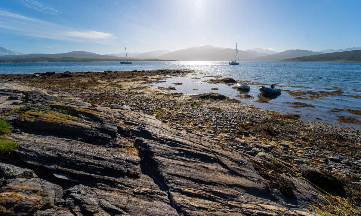
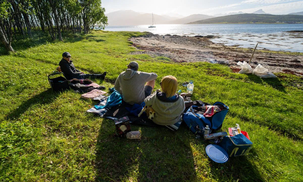
Nice island with good anchoring conditions around large parts of the island.
The island is part of a nature reserve and has a travel ban from May 1st to June 30th over almost the entire island.

[translated from Norwegian with AI]

1 x helpful | written on 30. Mar 2025

Ulf Dahlslett says:

description

Anchoring: Current in the sound and a bit shallow towards the south
The Area: Beautiful place, only an hour's sail from the city of Tromsø

[translated from Norwegian with AI]

1 x helpful | written on 26. Feb 2022

Do you know this harbour? It's a huge help to other sailors if you add a short description or review of the harbour.
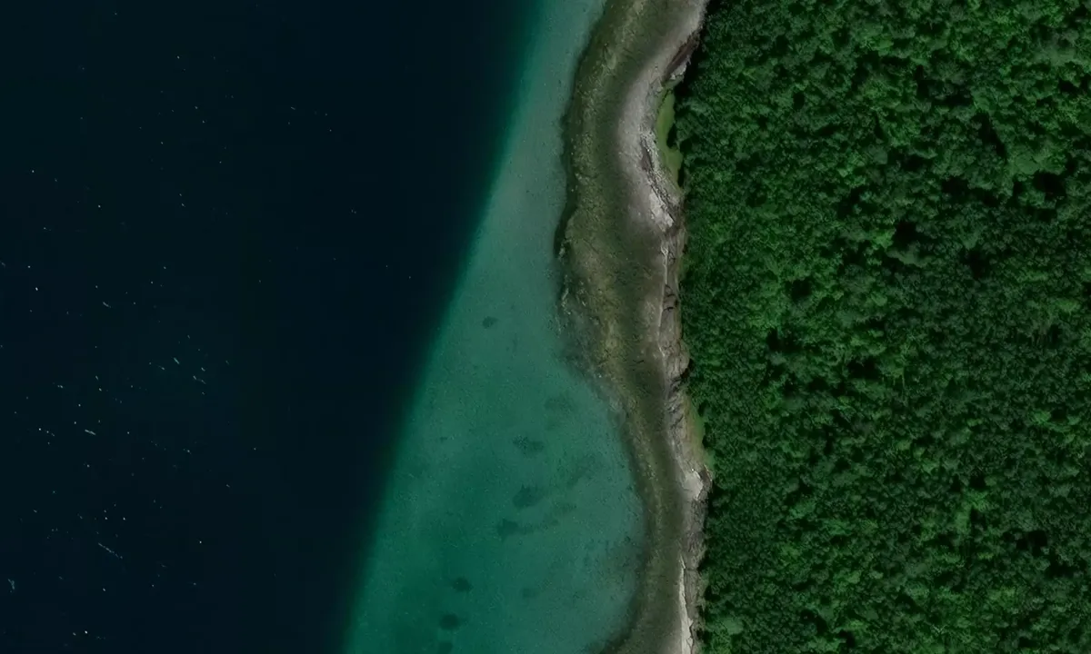
📜 Add description

Map of Grindøya

Facilities

We don't have any data on available facilities in this harbour. If you know which facilities are available here, please update this site to help your fellow sailors. Update facilities.

Mooring

Options for mooring in this harbour: Anchoring.

Updated on 26. Feb 2022. Update mooring.

Wind protection

Protection next night

78 points

N E S W --> } } } } } } } } } } } } } } } } } } } } } } } } } } } } } } } } } } } } } } } } } } } } } } } } } } } } } } } } } } } } } } } } } } } } } } } } } } } } } } } } } } } } } } } } } } } } } } } } } } } } } } } } } } } } } } } } } } } } } } } } } } } } } } } } } } } } } } } } } } } } } } } } } } } } } } } } } } } } } } } } } } } } } } } } } } } } } } } } } } } } } } } } } } } } } } } } } } } } } } } } } } } } } } } } } } } } } } } } } } } } } } } } } } } } } } } } } } } } } } } } } } } } } } } } } } } } } } } } } } } } } } } } } } } } } } } } } } } } } } } } } } } } } } } } } } } } } } } } } } } } } } } } } } } } } } } } } } } } } } } } } } } } } } } } } } } } } } } } } } } } } } } } } } } } } } } } } } } } } } } } } } } } } } } } } } } } } } } } } } } } } } } } } } } } } } } } } } } } } } } } } } } } } } } } } } } } } } } } } } } } } } } } } } } } } } } } } } } } } } } } } } } } } } } } } } } } } } } } } } } } } } } } } } } } } } } } } } } } } } } } } } } } } } } } } } } } } } } } } } } } } } } } } } } } } } } } } } } } } } } } } } } } } } } } } } } } } } } } } } } } } } } } } } } } } } } } } } } } } } } } } } } } } } } } } } } } } } } } } } } } } } } } } } } } } } } } } } } } } } } } } } } } } } } } } } } } } } } } } } } } } } } } } } } } } } } } } } } } } } } } } } } } } } } } } } } } } } } } } } } } } } } } } } } } } } } } } } } } } } } } } } } } } } } } } } } } } } } } } } } } } } } } } } } } } } } } } } } } } } } } } } } } } } } } } } } } } } } } } } } } } } } } } } } } } } } } } } } } } } } } } } } } } } } } } } } } } } } } } } } } } } } } } } } } } } } } } } } } } } } } } } } } } } } } } } } } } } } } } } } } } } } } } } } } } } } } } } } } } } } } } } } } } } } } } } } } } } } } } } } } } } } } } } } } } } } } } } } } } } } } } } } } } } } } } } } } } } } } } } } } } } } } } } } } } } } } } } } } } } } } } } } } } } } } } } } } } } } } } } } } } } } } } } } } } } } } } } } } } } } } } } } } } } } } } } } } } } } } } } } } Next night 12:00 Ons 30 Apr 18:00 0:00 6:00 12:00 Tor 01 Mai 18:00 7m/s 1m/s

Want to know how the wind score works? Then you should read this explanation.

The wind forecasts come from yr.no (Norwegian Meteorological Institute), and was last updated 1 hour and 45 minutes ago (Wednesday 30 April 10:35 AM). The next night score shows you the worst hour between 22:00 and 08:00 the next night. We recommend that you check multiple sources for wind forecasts. windy.com is a good website to show larger wind systems.

The safe wind directions for this harbour has been decided by an algorithm, based on how elevated the land around the harbour is. It's mostly correct, but sometimes the underlying data about elevation levels is not good enough to make correct decisions. It's a great help to other if you can validate or adjust the safe wind directions. You can see the data used by the algorithm to decide the safe wind directions by clicking here.

Grindøya and/or the surrounding seas is not well protected from strong winds and waves, and you should take caution in foul weather. Click to edit protection level.

Last visits to Grindøya

The visits are retrieved from AIS data. You can click to see all visiting ships to Grindøya, as well as statistics about the ships that visits

Add this harbour to a journey

Check in now

Choose a different date than today

Important: When you check in to a harbour, you add it to a journey on this website. You are not booking a place in the marina.

Contributors

Users that contributed to this page: Ulf Dahlslett, ©norgeskart.no and Jesperalten

harbourmaps.com is updated by the boating community. When you add information, a review or pictures to this page you are listed here with the other contributors (we list your user-name, which can be your real name or a pseudonym).

Closest harbours to Grindøya

Filter by

Natural harbour
Marina
Safe wind next night

Order by

ABC
Popularity
Wind score next night

0 harbours

Show more harbours