


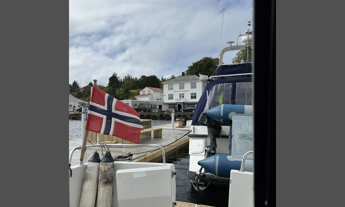
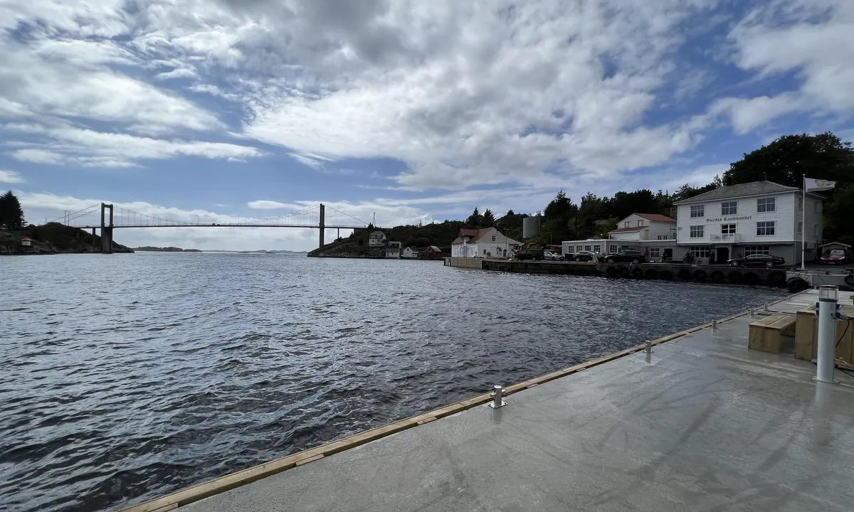
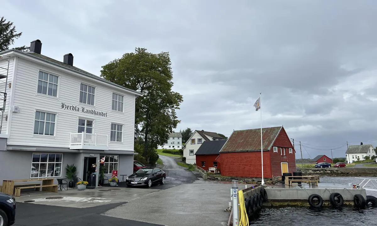
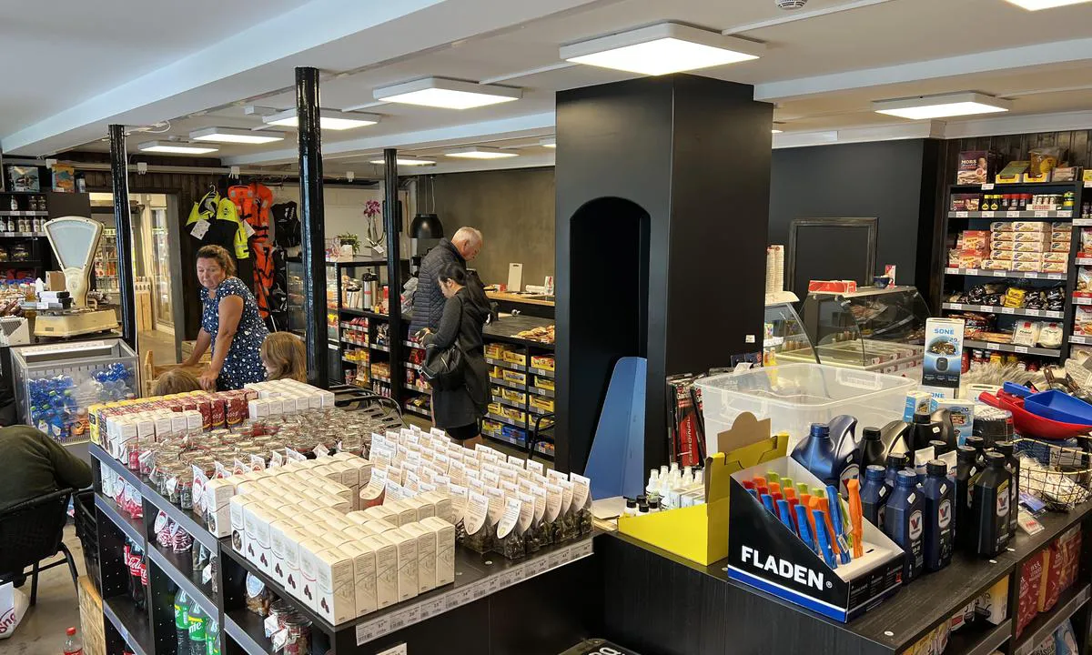
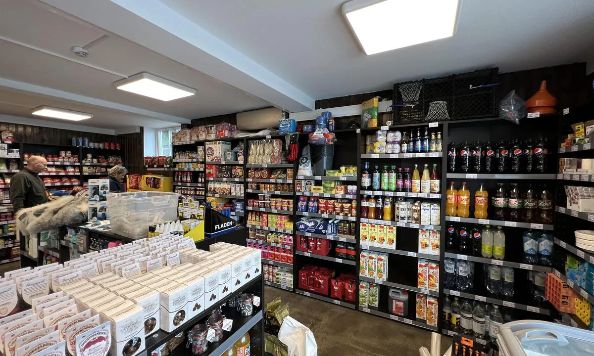
Herdla Landhandel - Herdlesund
Marina

Region: Norway (3464), Vestland (610), Hordaland (401), Askøy (26) and Herdla (6)


Descriptions and reviews
Suse / SY Ronja says:
says:
area


maritime qualities
description
In November 2024, Fryd Askøy opened its second floating sauna here, right on the guest pier. Booking at https://frydaskoy.no. There is a cold water shower and a bathing ladder right outside the sauna. Please be aware that there can be strong tidal currents here.
[translated from Norwegian with AI]

1 x helpful | written on 21. Nov 2024
Jomani says:
area
maritime qualities
description
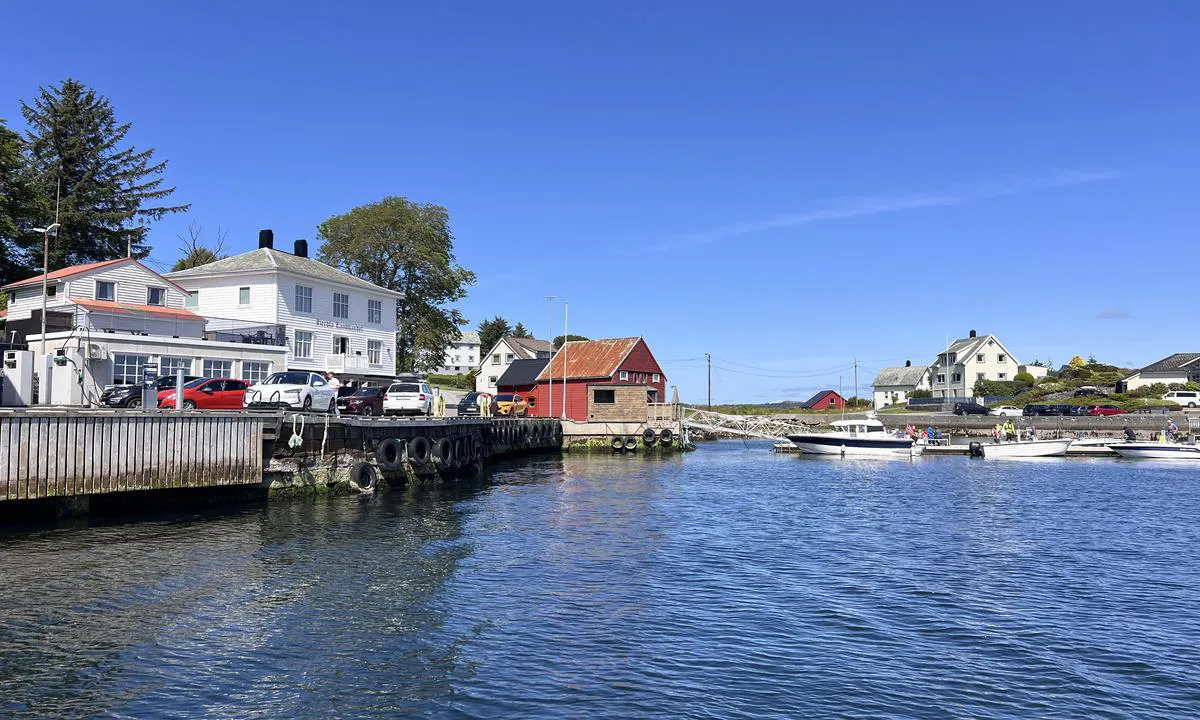
Well facilitated area. Important to fend properly, also to the floating dock, as there is a lot of traffic in the strait. We experienced that a neighboring boat had its fenders lifted onto the floating dock due to waves, and consequently, the boat hit the dock.
[translated from Norwegian with AI]
1 x helpful | written on 7. Aug 2023
TESO says:
area
maritime qualities
description
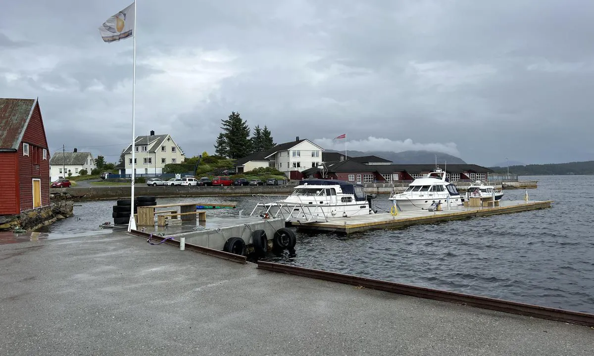
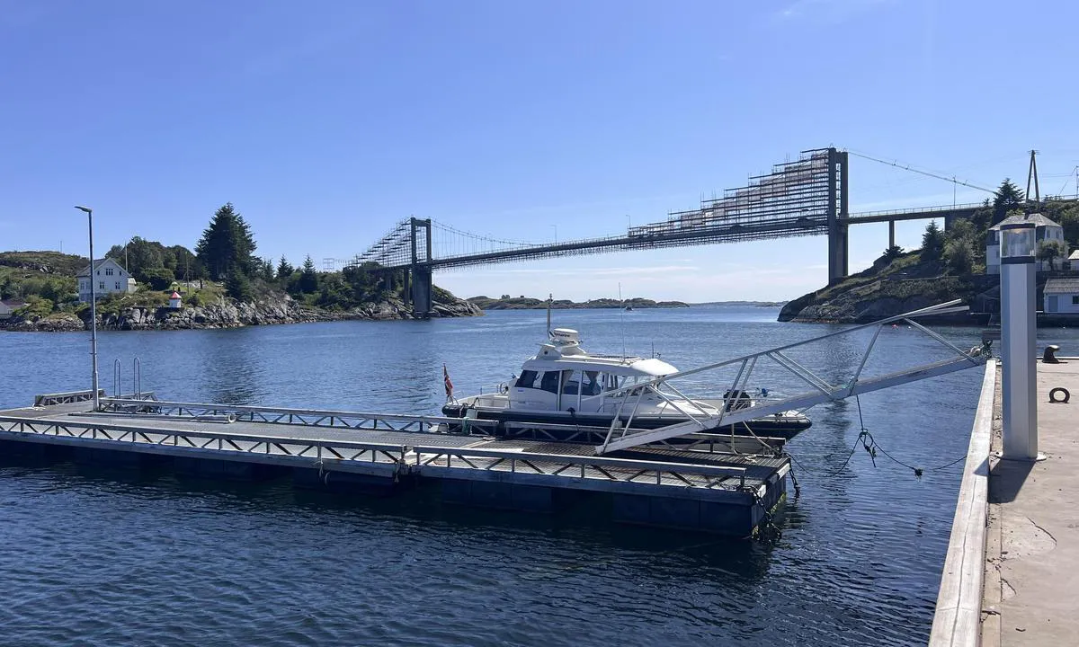
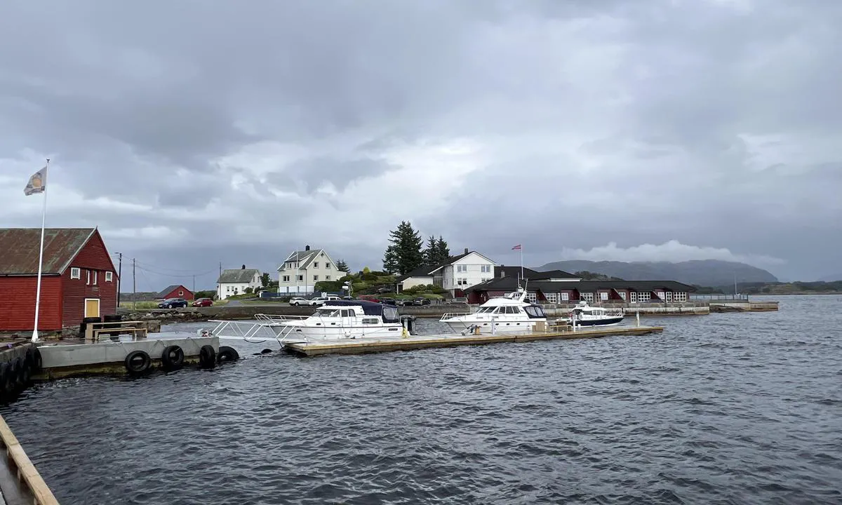
Easy arrival in the middle of the channel at Herdlesund/Herdla Bridge. Good depth at both quay and floating dock. You can also moor to the concrete quay at the innermost part of the harbor (on the inside of the floating dock, but preferably for slightly smaller boats due to quay length.
Mooring to quay or floating dock. The floating dock, in particular, is exposed to sea and wind from the south/southwest direction. When we were there, a gust of wind caused the floating dock to rock severely and waves to crash over the floating dock. This was at approximately 12 m/s in a south/southwest direction. Update: An additional floating dock has now been installed at the bunker quay, making the inner floating dock calmer.
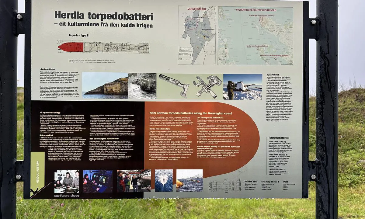
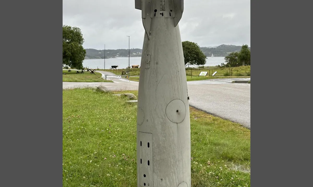
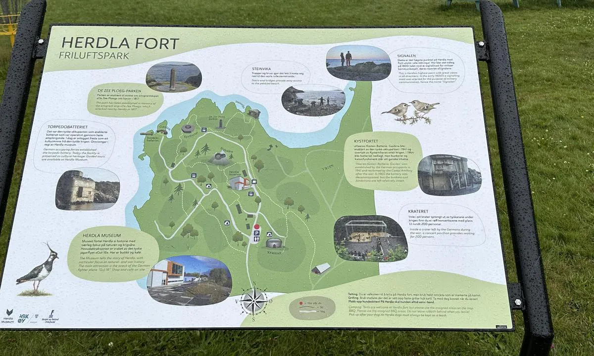
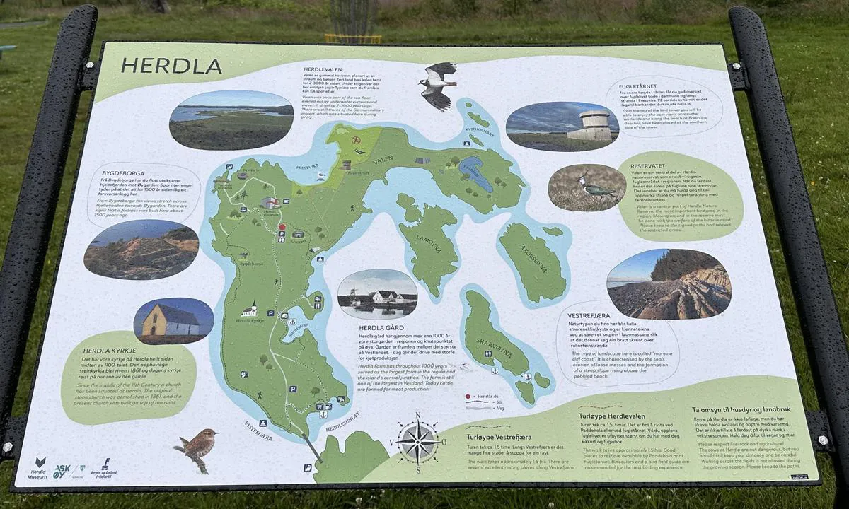
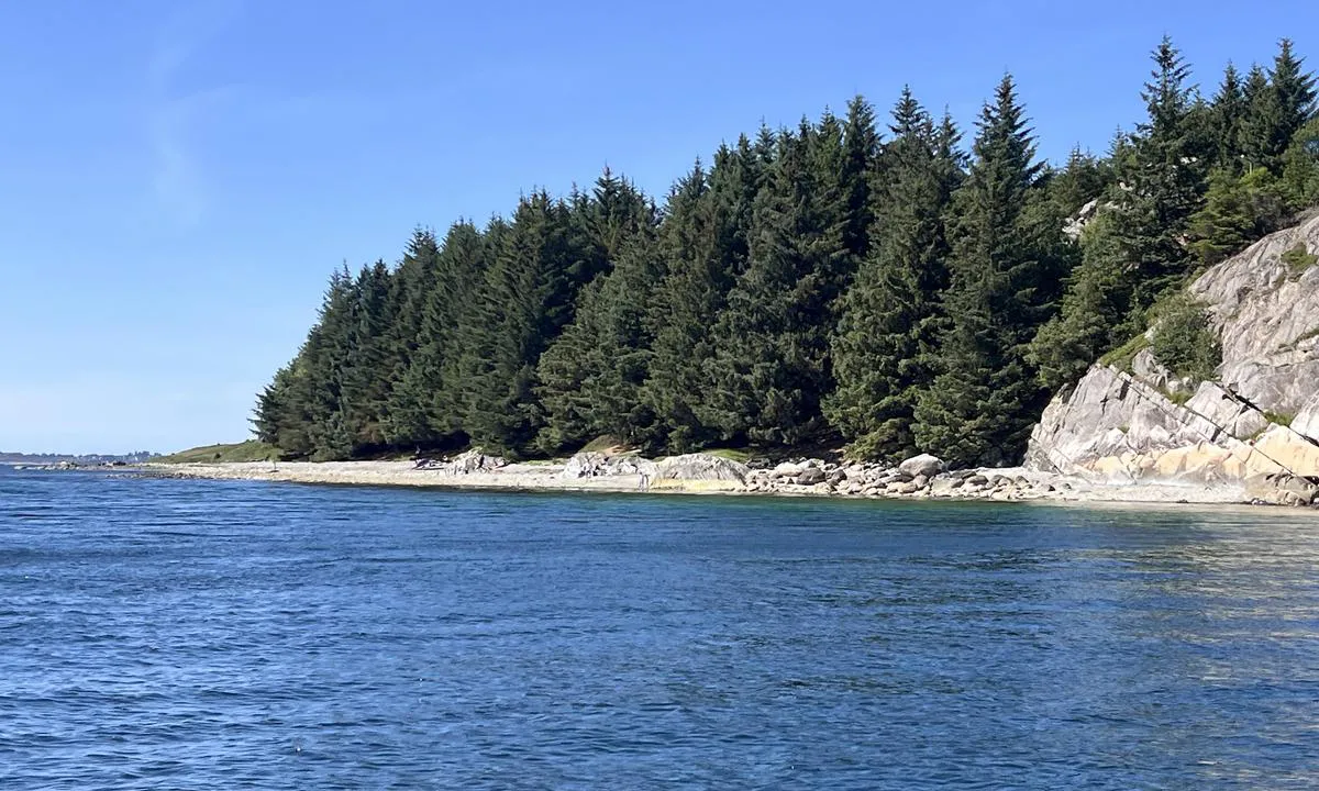
There is a lot of war history at Herdla, in addition, there is a beautiful pebble beach on the west side, as well as a sandy beach at the grass field where the airport was.
[translated from Norwegian with AI]
2 x helpful | written on 20. Aug 2022 | updated_on 2. Sep 2024
TESO says:
area
maritime qualities
description
New concrete floating dock and concrete quay. Approximately three boat lengths on each side of the floating dock. Possible to dock with a small boat at the innermost part of the inlet on the concrete dock.
The quay and floating dock are exposed to wind/waves from SW. We arrived with wind of 12-15 m/s from SW direction, and the floating dock was rocking heavily.
Cozy place with wartime history, including Herdla Airport which was a base for German planes, and numerous other traces from the war days.
Beautiful pebble beach and sandy beach on Herdla. Local providers offer activities such as paddling, windsurfing, canyoning/via ferrata.
[translated from Norwegian with AI]
1 x helpful | written on 20. Aug 2022
Do you know this harbour? It's a huge help to other sailors if you add a short description or review of the harbour.
Map of Herdla Landhandel - Herdlesund

Wind protection
Protection next night
71 points


Want to know how the wind score works? Then you should read this explanation.
The wind forecasts come from yr.no (Norwegian Meteorological Institute), and was last updated 1 hour and 39 minutes ago (Monday 22 June 01:28 PM). The next night score shows you the worst hour between 22:00 and 08:00 the next night. We recommend that you check multiple sources for wind forecasts. windy.com is a good website to show larger wind systems.

The safe wind directions for this harbour has been decided by an algorithm, based on how elevated the land around the harbour is. It's mostly correct, but sometimes the underlying data about elevation levels is not good enough to make correct decisions. It's a great help to other if you can validate or adjust the safe wind directions. You can see the data used by the algorithm to decide the safe wind directions by clicking here.
Last visits to Herdla Landhandel - Herdlesund
Fri 10 Nov 2023 |
|
|
Wed 01 Nov 2023 |
|
|
Fri 27 Oct 2023 |
|
|
Thu 26 Oct 2023 |
|
|
|
|
 LYRA [MMSI: 258009110]
The visits are retrieved from AIS data. You can click to see all visiting ships to Herdla Landhandel - Herdlesund, as well as statistics about the ships that visits
Add this harbour to a journey
Choose a different date than today
Important: When you check in to a harbour, you add it to a journey on this website. You are not booking a place in the marina.
Contributors
Users that contributed to this page: Torgeir Håvik, Jakub Szeluga, TESO and Lene Ø
harbourmaps.com is updated by the boating community. When you add information, a review or pictures to this page you are listed here with the other contributors (we list your user-name, which can be your real name or a pseudonym).
Thematic lists of harbours
This harbour is part of these lists:
Norway: Fishing villages and old trading posts along the coast
Closest harbours to Herdla Landhandel - Herdlesund
Filter by
Order by
0 harbours
Show more harbours
