


Contributions by TESO
TESO has uploaded 235 images and written 44 reviews. Click on the images and reviews below to see the harbour pages.
TESO has 2448 contribution points and is a top contributor to this site. See all the top contributing users.
Harbour images
See an image you like? Please click the 👍 below the image to let TESO know you liked it. The images are sorted by popularity.
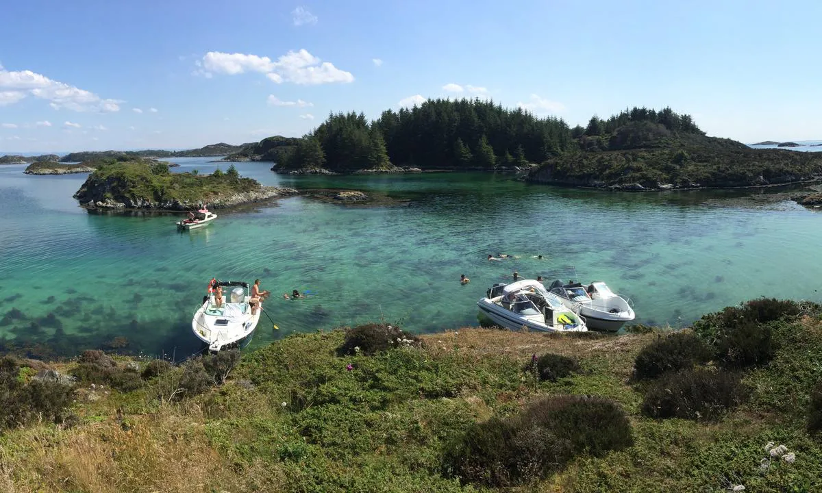
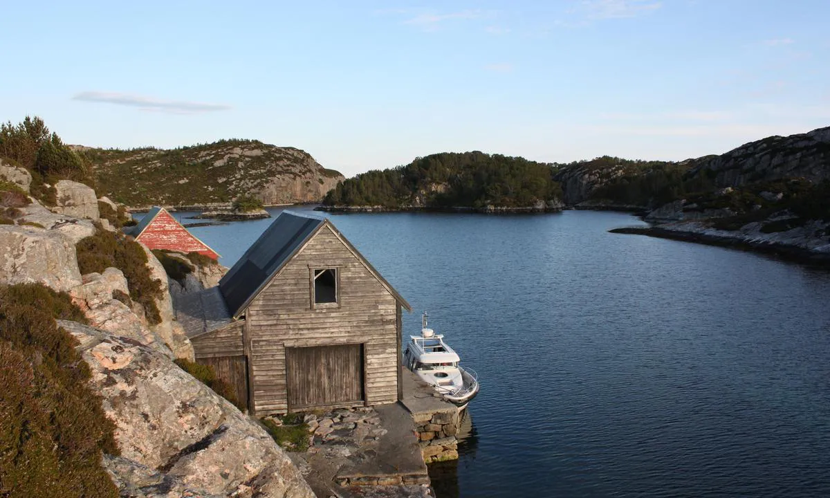
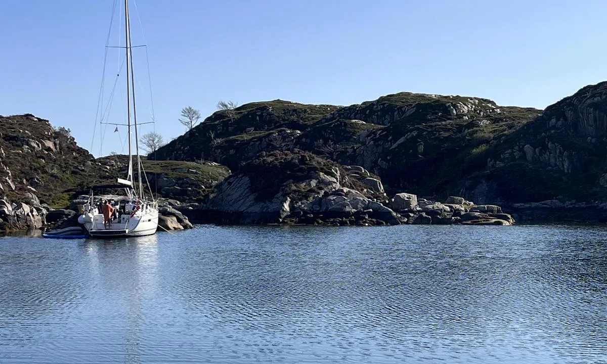
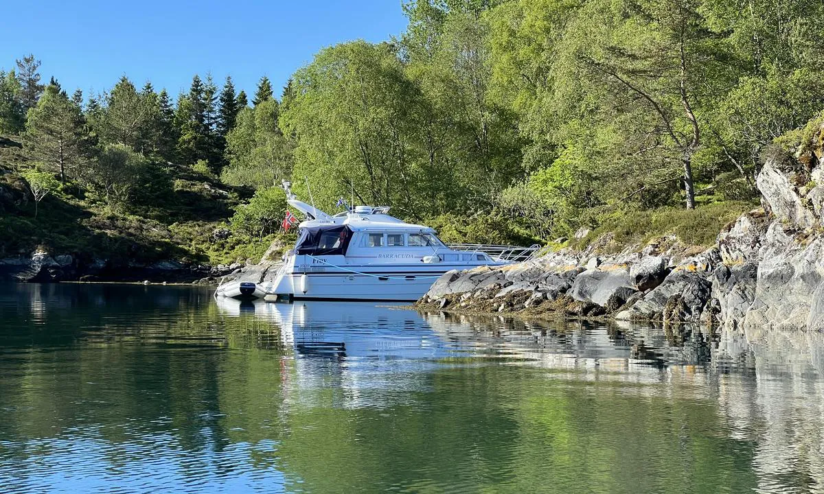
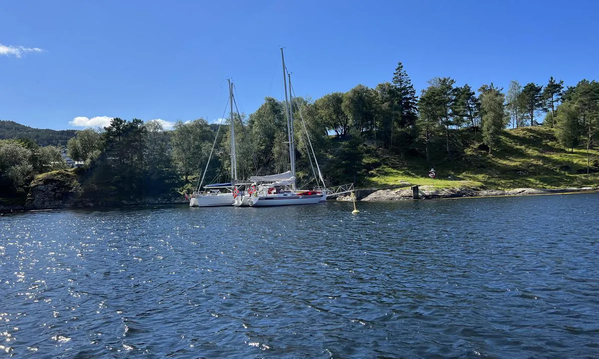
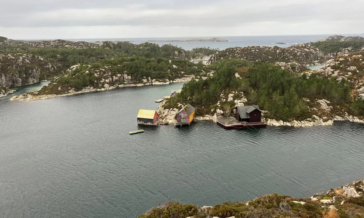
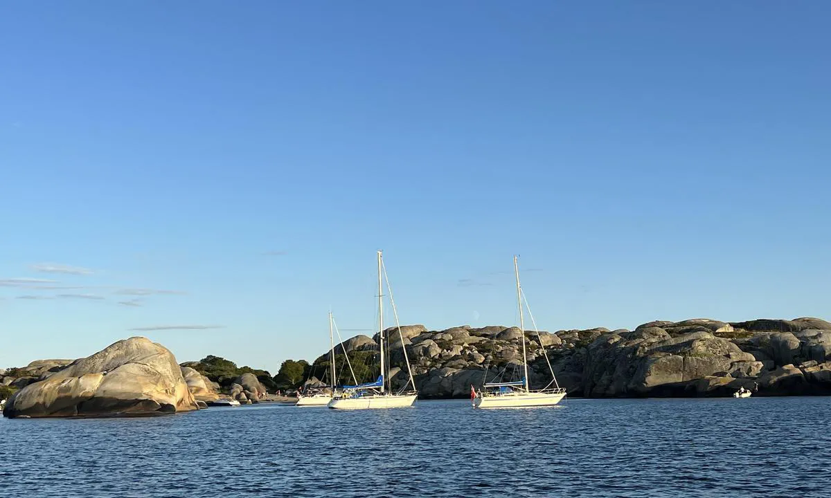
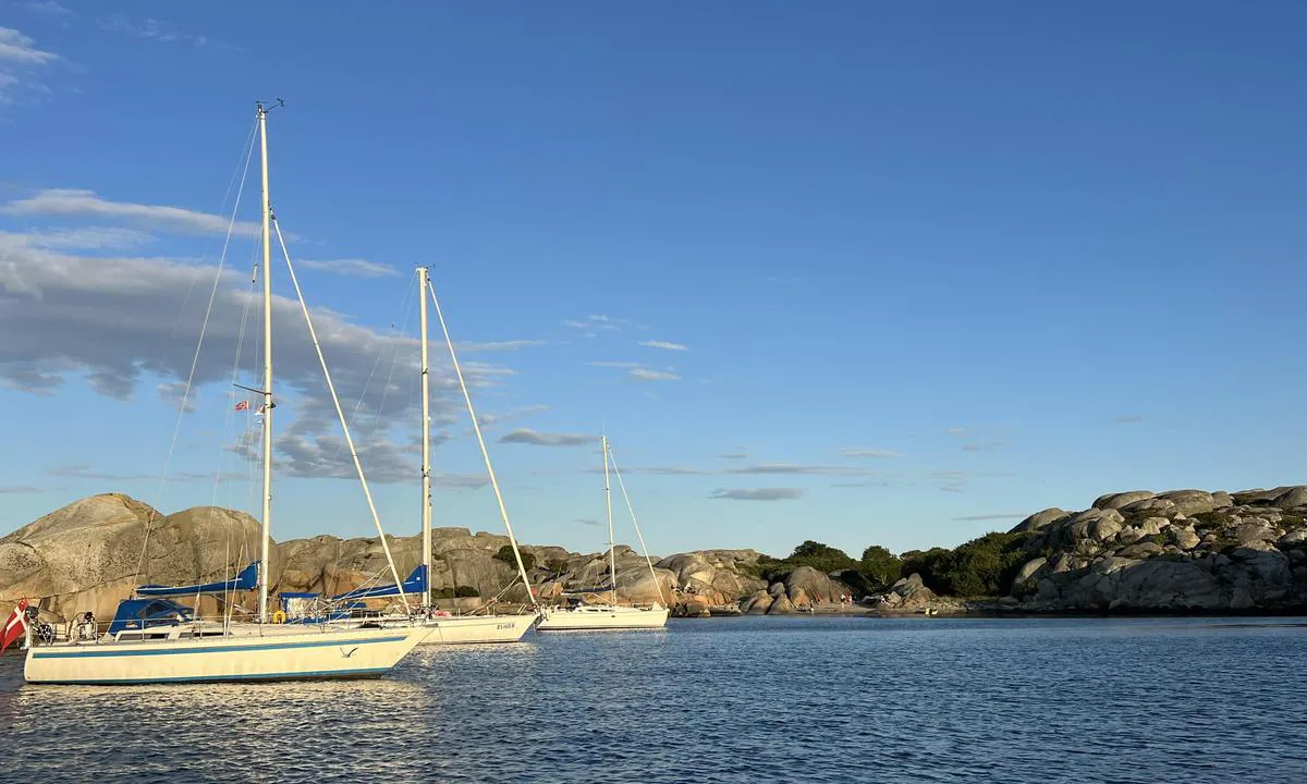
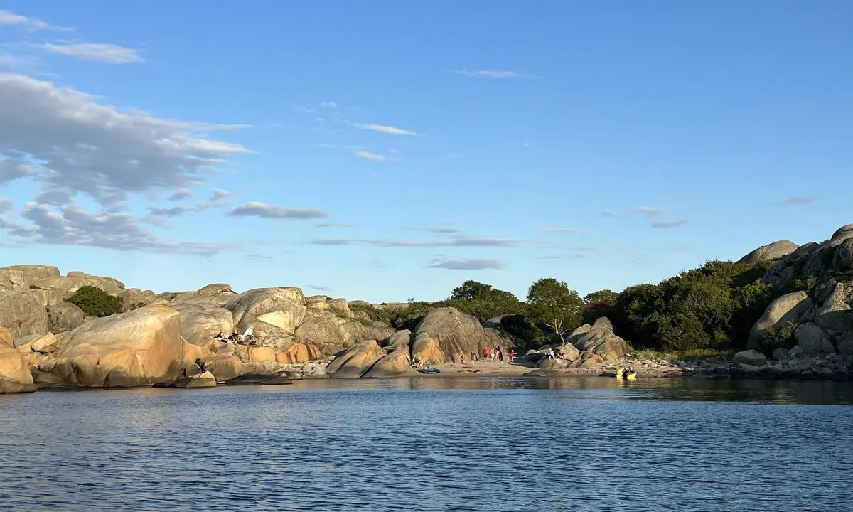
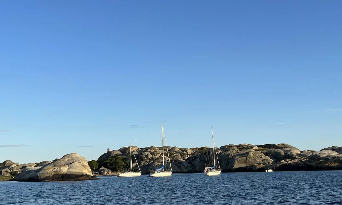
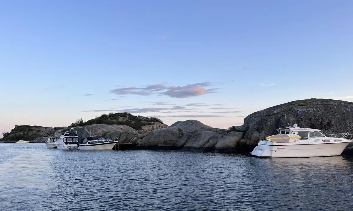
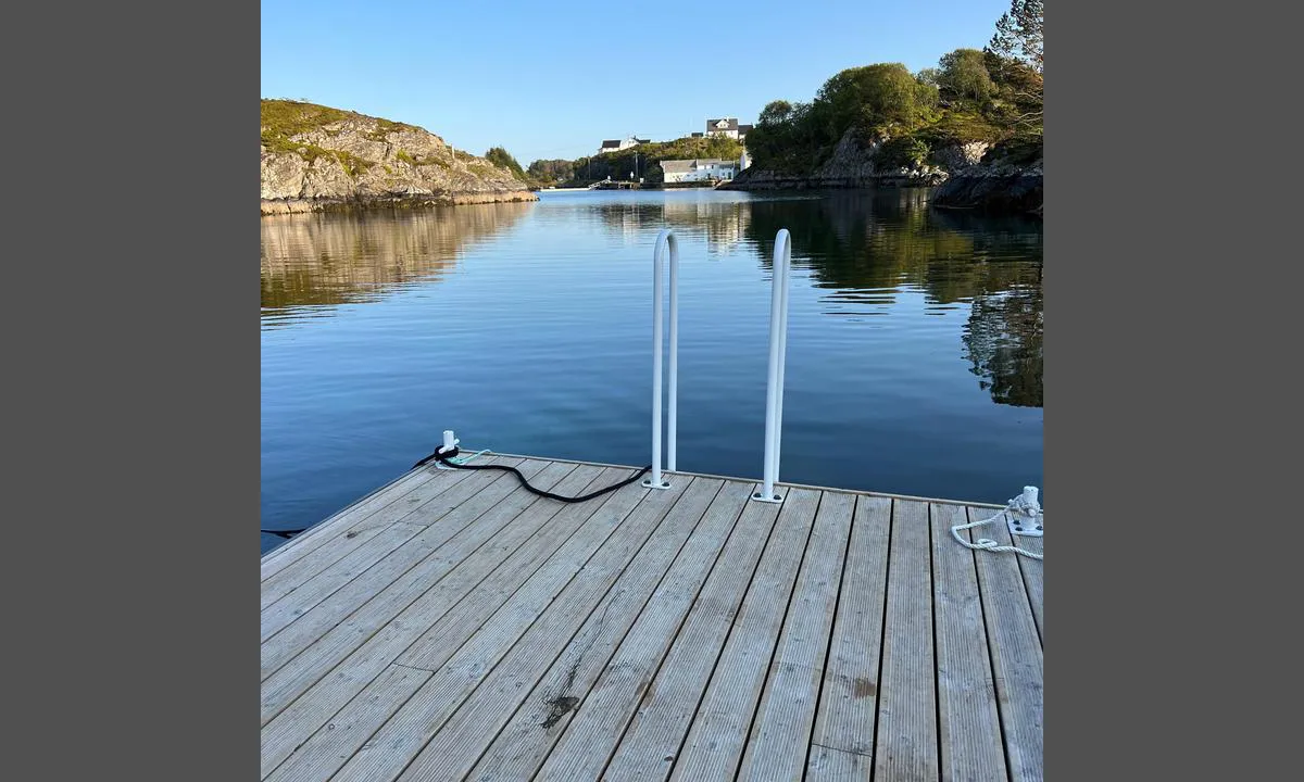
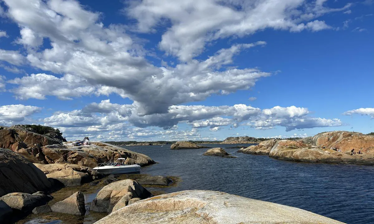
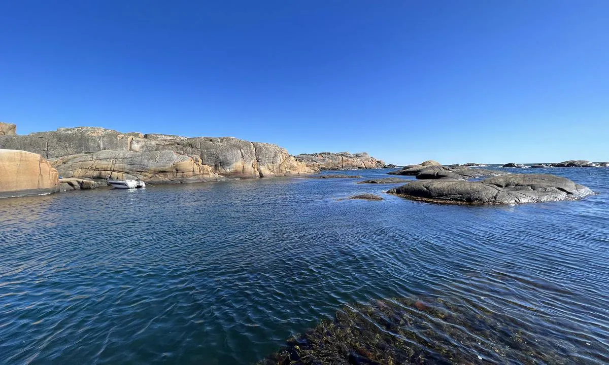
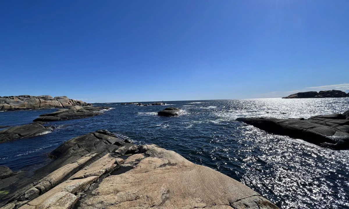
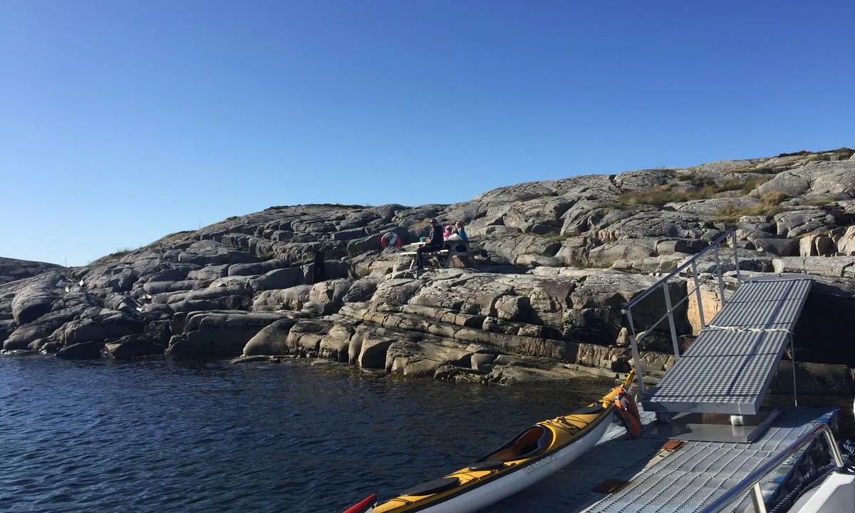
Volmene
natural_harbour

3 liker bildet
Image uploaded on 25. Jul 2025
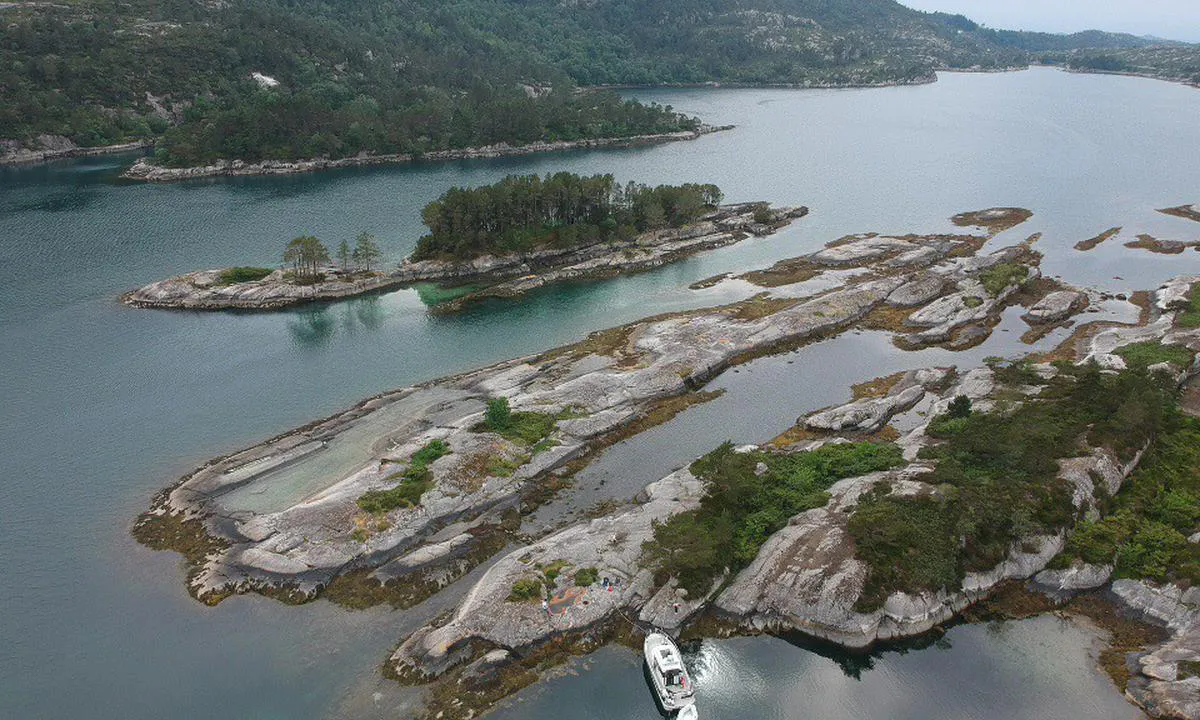
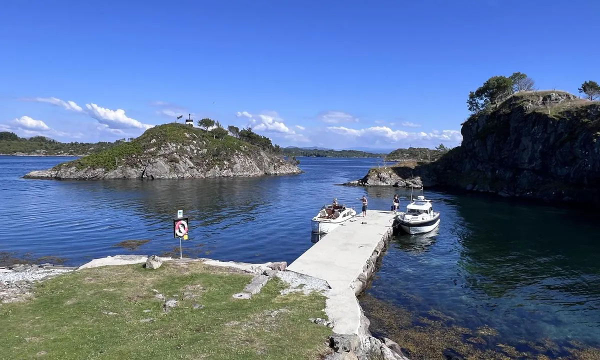
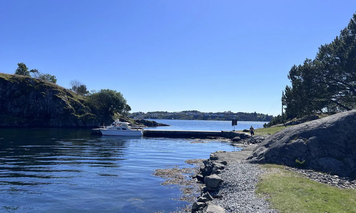
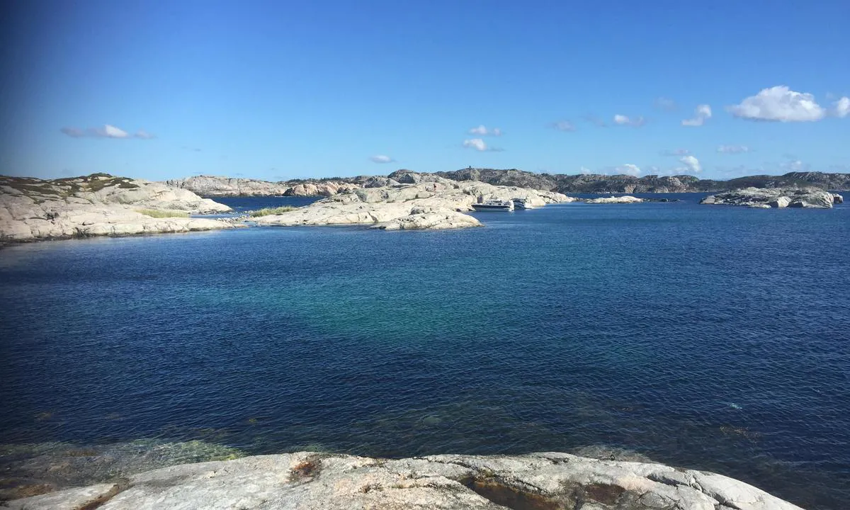
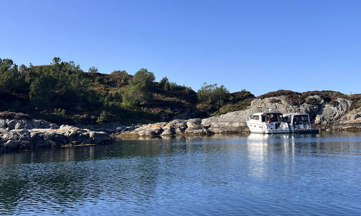
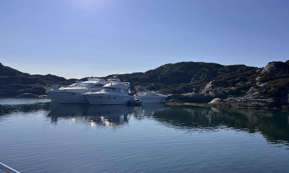
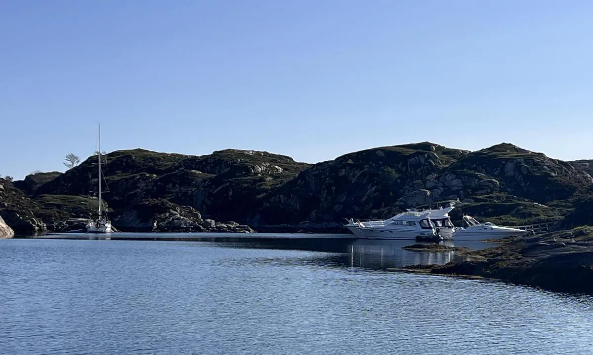
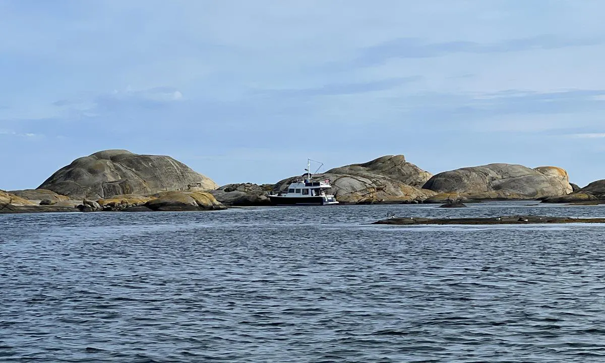
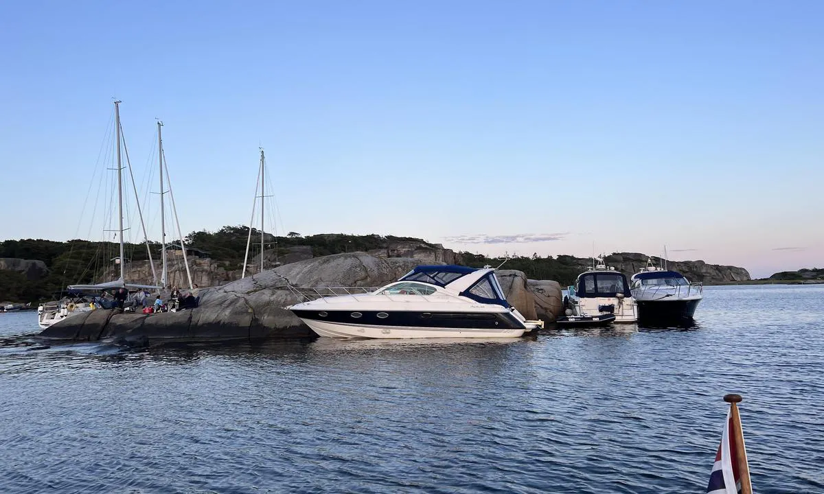
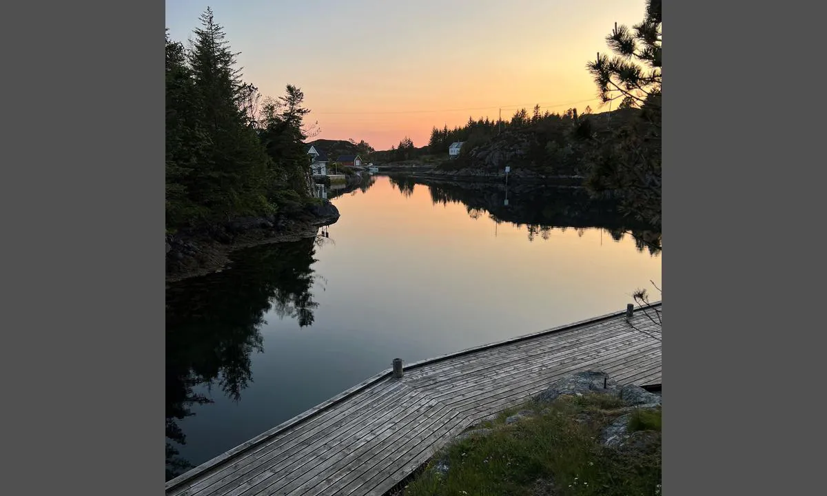
Søre Vågen - Småholmene - Nyhammarneset
natural_harbour
3 liker bildet
Image uploaded on 3. Jun 2021
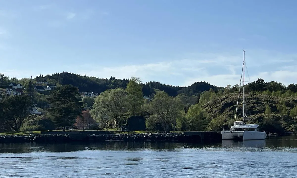
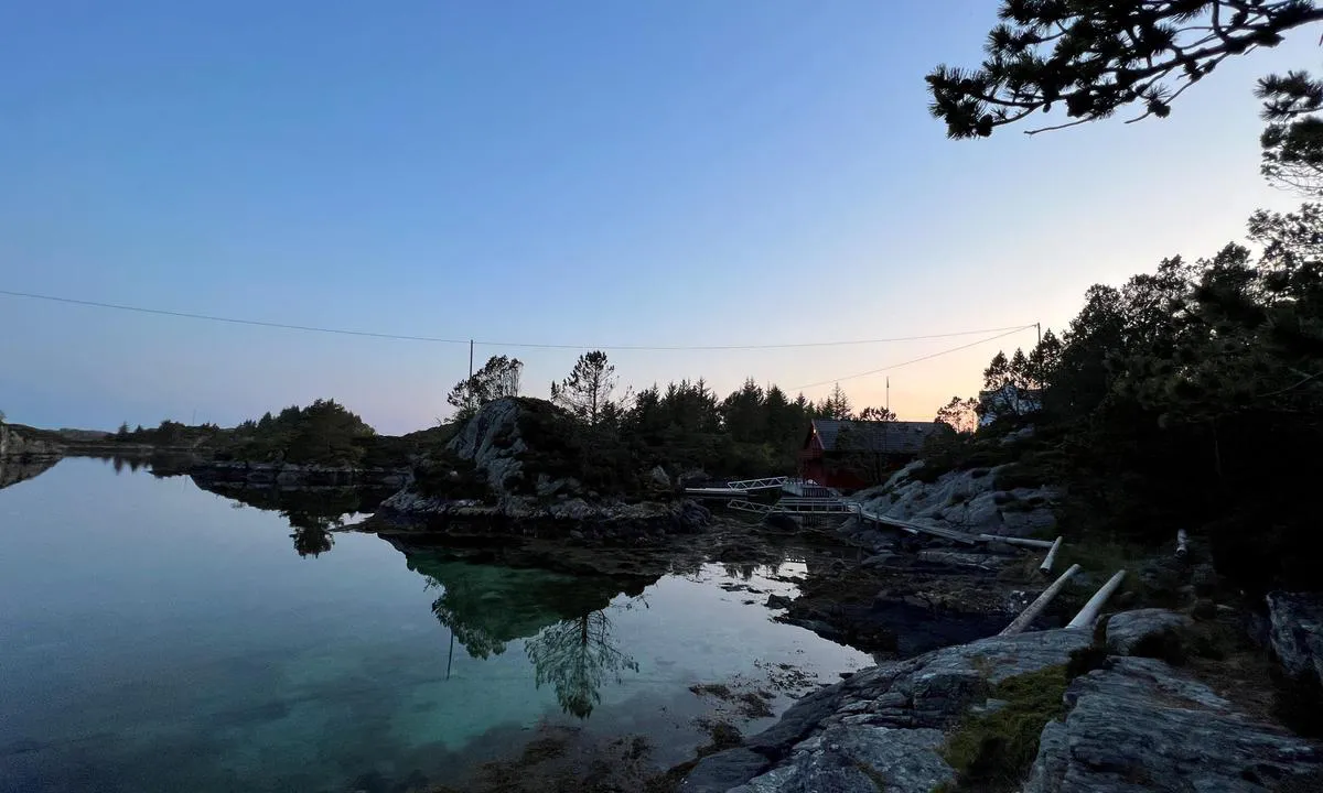
Bruvik - Osterøy
marina
2 liker bildet
Image uploaded on 9. Nov 2024
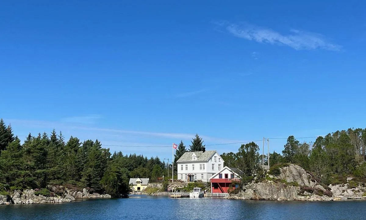
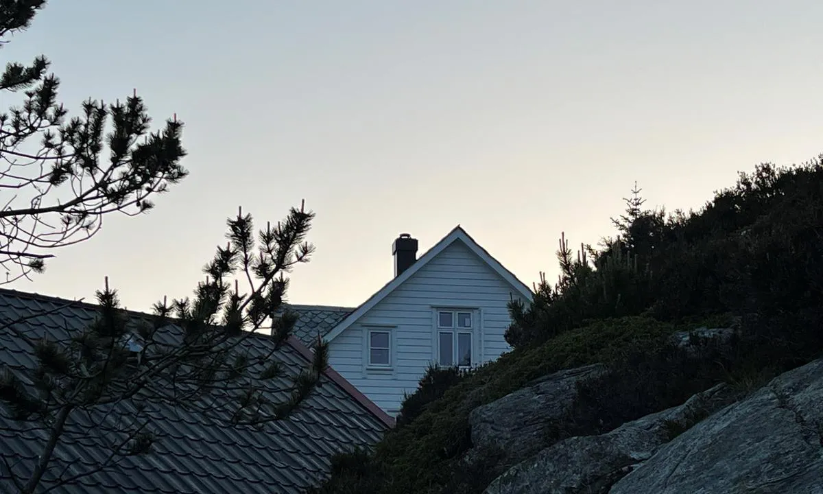
Feste
marina
2 liker bildet
Image uploaded on 26. Jun 2025
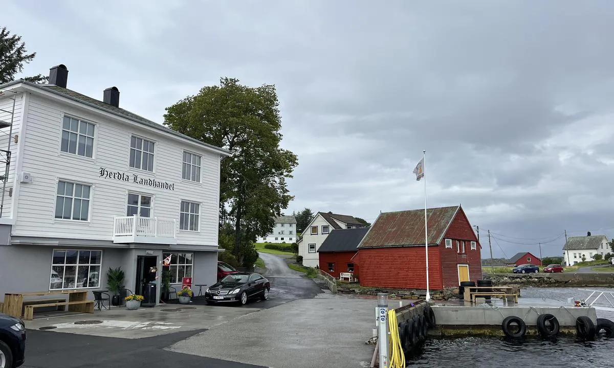
Herdla Landhandel - Herdlesund
marina
2 liker bildet
Image uploaded on 26. Jun 2025
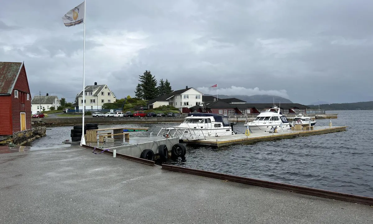
Herdla Landhandel - Herdlesund
marina
2 liker bildet
Image uploaded on 26. Jun 2025
Herdla Landhandel - Herdlesund
marina
2 liker bildet
Image uploaded on 26. Jun 2025
Svenner Fyr
natural_harbour
2 liker bildet
Image uploaded on 14. Jul 2021
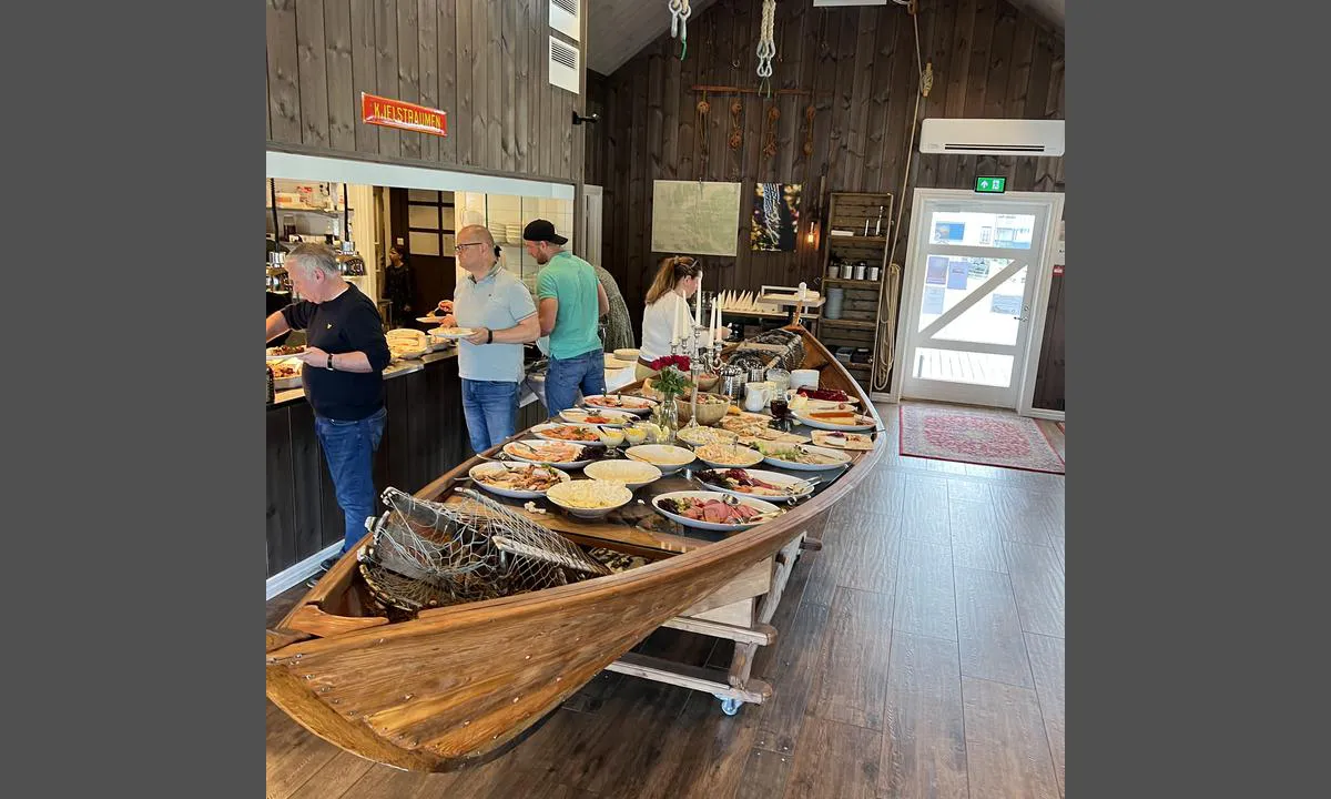
Kilstraumen
marina
2 liker bildet
Image uploaded on 5. Jun 2022
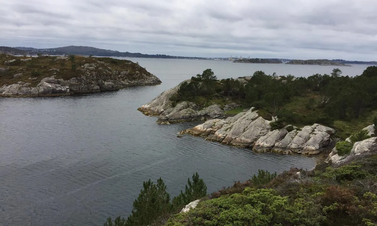
Søre Vågen - Småholmene - Nyhammarneset
natural_harbour
2 liker bildet
Image uploaded on 3. Jun 2021
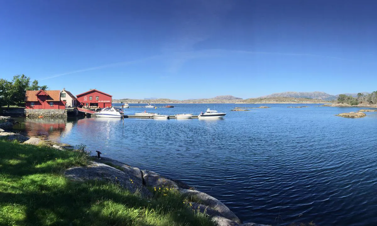
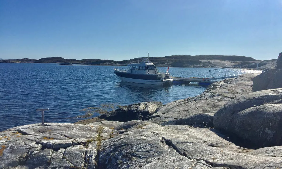
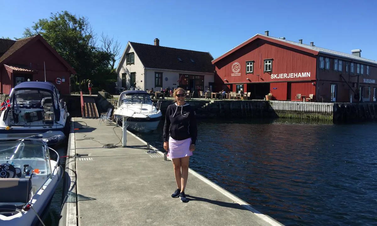
Skjerjehamn
marina
2 liker bildet
Image uploaded on 8. Jun 2022
Sjøbuosen
natural_harbour
2 liker bildet
Image uploaded on 28. May 2021
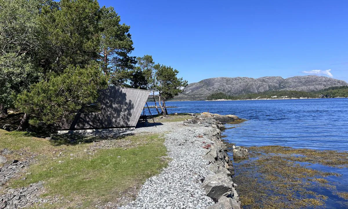
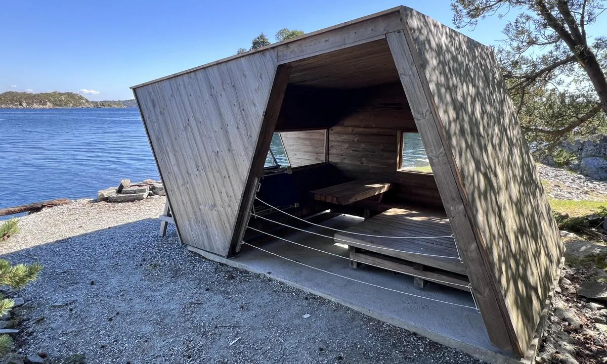
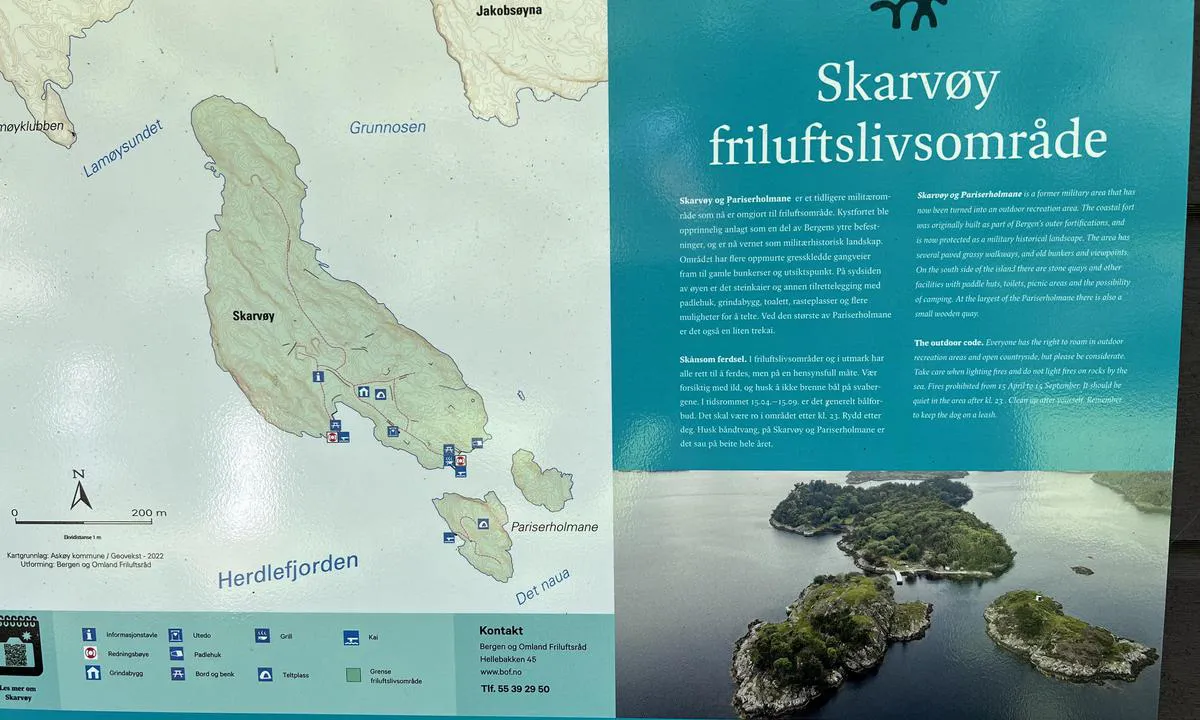
Skarvøyna - Herdla
natural_harbour
2 liker bildet
Image uploaded on 26. Jun 2024
Skarvøyna - Herdla
natural_harbour
2 liker bildet
Image uploaded on 26. Jun 2024
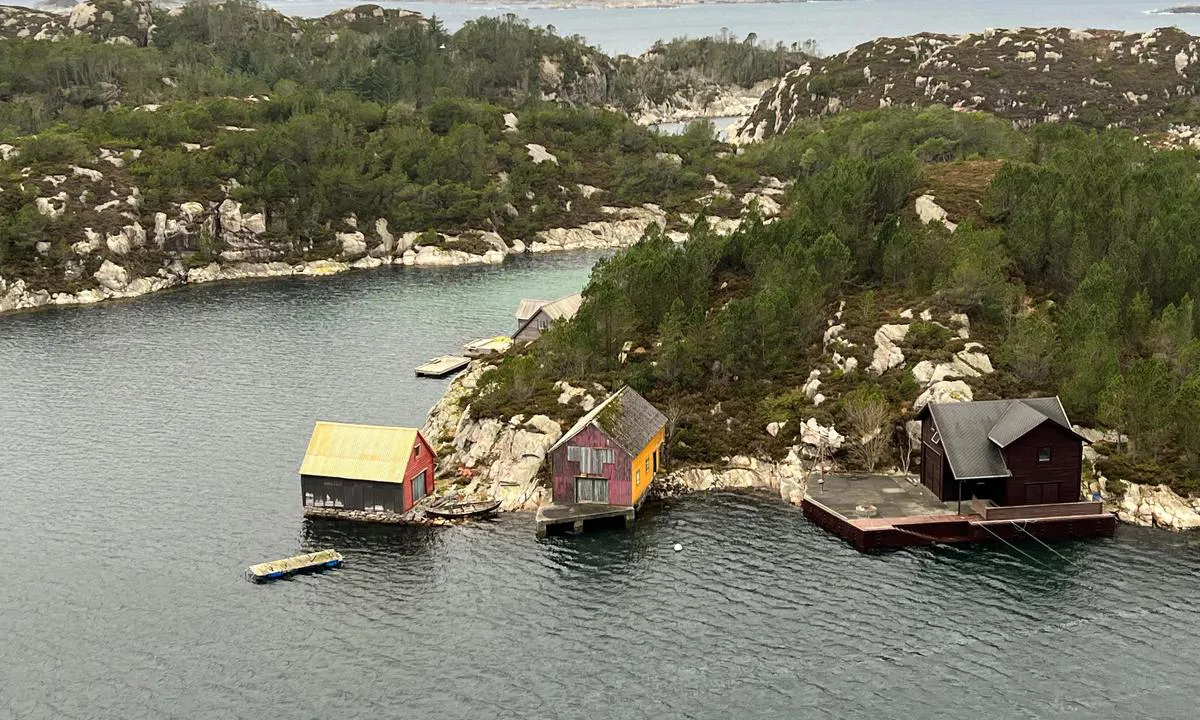
Herdla Landhandel - Herdlesund
marina
2 liker bildet
Image uploaded on 20. Aug 2022
Herdla Landhandel - Herdlesund
marina
2 liker bildet
Image uploaded on 20. Aug 2022
Herdla
marina
2 liker bildet
Image uploaded on 14. Jul 2024
Volmene
natural_harbour
2 liker bildet
Image uploaded on 6. Aug 2022
Herdla
marina
2 liker bildet
Image uploaded on 1. Sep 2024
Volmene
natural_harbour
2 liker bildet
Image uploaded on 6. Aug 2022
Storøyen, Eidsvåg
natural_harbour
2 liker bildet
Image uploaded on 28. Aug 2022
Storøyen, Eidsvåg
natural_harbour
2 liker bildet
Image uploaded on 28. Aug 2022
Bruvik - Osterøy
marina
1 liker bildet
Image uploaded on 9. Nov 2024
Bruvik - Osterøy
marina
1 liker bildet
Image uploaded on 9. Nov 2024
Bruvik - Osterøy
marina
1 liker bildet
Image uploaded on 9. Nov 2024
Hjelmo
natural_harbour
1 liker bildet
Image uploaded on 31. Jan 2024
Hjelmo
natural_harbour
1 liker bildet
Image uploaded on 31. Jan 2024
Hosanger
marina
1 liker bildet
Image uploaded on 13. May 2023
Turøy Kobbeviken
natural_harbour
1 liker bildet
Image uploaded on 1. Feb 2024
Langøyna
natural_harbour

1 liker bildet
Image uploaded on 19. Feb 2026
Svennerfyr stranda
natural_harbour
1 liker bildet
Image uploaded on 28. Jul 2023
Geitøy i Alverstraumen
natural_harbour
1 liker bildet
Image uploaded on 6. Mar 2026
Langøyna
natural_harbour
1 liker bildet
Image uploaded on 1. Jun 2021
Geitøy i Alverstraumen
natural_harbour
1 liker bildet
Image uploaded on 6. Mar 2026
Geitøy i Alverstraumen
natural_harbour
1 liker bildet
Image uploaded on 6. Mar 2026
Skarvøyna - Herdla
natural_harbour
1 liker bildet
Image uploaded on 1. Jun 2021
Skarvøyna - Herdla
natural_harbour
1 liker bildet
Image uploaded on 1. Jun 2021
Geitøy i Alverstraumen
natural_harbour
1 liker bildet
Image uploaded on 30. Jun 2023
Sandøy - Turøy
natural_harbour

1 liker bildet
Image uploaded on 10. May 2022
Uttoskavågen
natural_harbour
1 liker bildet
Image uploaded on 18. Mar 2025
Mastrevik
marina
1 liker bildet
Image uploaded on 15. Jun 2025
Mastrevik
marina
1 liker bildet
Image uploaded on 15. Jun 2025
Mastrevik
marina
1 liker bildet
Image uploaded on 15. Jun 2025
Nordåsvannet Marmorøyene
natural_harbour
1 liker bildet
Image uploaded on 22. May 2022
Nordåsvannet Marmorøyene
natural_harbour
1 liker bildet
Image uploaded on 22. May 2022
Svenner Fyr
natural_harbour
1 liker bildet
Image uploaded on 14. Jul 2021
Svenner Fyr
natural_harbour
1 liker bildet
Image uploaded on 14. Jul 2021
Vassøyene
natural_harbour
1 liker bildet
Image uploaded on 24. May 2022
Hernar
marina
1 liker bildet
Image uploaded on 25. May 2022
Sandøy - Turøy
natural_harbour
1 liker bildet
Image uploaded on 25. Sep 2025
Sandøy - Turøy
natural_harbour
1 liker bildet
Image uploaded on 25. Sep 2025
Sandøy - Turøy
natural_harbour
1 liker bildet
Image uploaded on 25. Sep 2025
Sandøy - Turøy
natural_harbour
1 liker bildet
Image uploaded on 25. Sep 2025
Horgo - Austrevågen
natural_harbour
1 liker bildet
Image uploaded on 15. Sep 2025
Horgo - Austrevågen
natural_harbour
1 liker bildet
Image uploaded on 15. Sep 2025
Horgo - Austrevågen
natural_harbour
1 liker bildet
Image uploaded on 15. Sep 2025
Horgo - Austrevågen
natural_harbour
1 liker bildet
Image uploaded on 15. Sep 2025
Horgo - Austrevågen
natural_harbour
1 liker bildet
Image uploaded on 15. Sep 2025
Børøypollen
natural_harbour
1 liker bildet
Image uploaded on 3. Jun 2021
Børøypollen
natural_harbour
1 liker bildet
Image uploaded on 3. Jun 2021
Kilstraumen
marina
1 liker bildet
Image uploaded on 5. Jun 2022
Nordre Kjerringa, Rongevær Kysthytte (DNT, Bergen
natural_harbour
1 liker bildet
Image uploaded on 13. May 2026
Nordre Kjerringa, Rongevær Kysthytte (DNT, Bergen
natural_harbour
1 liker bildet
Image uploaded on 13. May 2026
Nordre Kjerringa, Rongevær Kysthytte (DNT, Bergen
natural_harbour
1 liker bildet
Image uploaded on 13. May 2026
Nordre Kjerringa, Rongevær Kysthytte (DNT, Bergen
natural_harbour
1 liker bildet
Image uploaded on 13. May 2026
Nordre Kjerringa, Rongevær Kysthytte (DNT, Bergen
natural_harbour
1 liker bildet
Image uploaded on 13. May 2026
Skår Austevoll
natural_harbour
1 liker bildet
Image uploaded on 28. May 2021
Skår Austevoll
natural_harbour
1 liker bildet
Image uploaded on 28. May 2021
Nordre Kjerringa, Rongevær Kysthytte (DNT, Bergen
natural_harbour
1 liker bildet
Image uploaded on 13. May 2026
Ådnøya
natural_harbour
1 liker bildet
Image uploaded on 8. Jun 2022
Ådnøya
natural_harbour
1 liker bildet
Image uploaded on 8. Jun 2022
Ådnøya
natural_harbour
1 liker bildet
Image uploaded on 8. Jun 2022
Ådnøya
natural_harbour
1 liker bildet
Image uploaded on 8. Jun 2022
Nordre Kjerringa, Rongevær Kysthytte (DNT, Bergen
natural_harbour
1 liker bildet
Image uploaded on 4. Apr 2024
Nordre Kjerringa, Rongevær Kysthytte (DNT, Bergen
natural_harbour
1 liker bildet
Image uploaded on 4. Apr 2024
Nordre Kjerringa, Rongevær Kysthytte (DNT, Bergen
natural_harbour
1 liker bildet
Image uploaded on 4. Apr 2024
Skjerjehamn
marina
1 liker bildet
Image uploaded on 8. Jun 2022
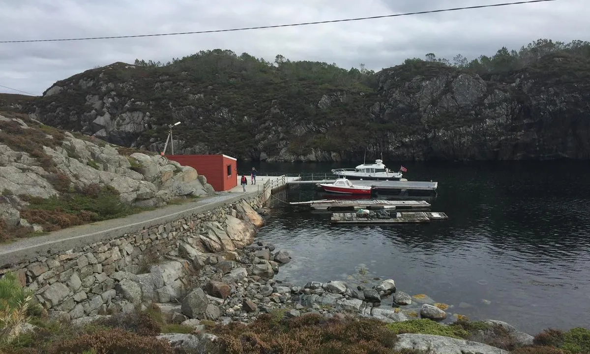
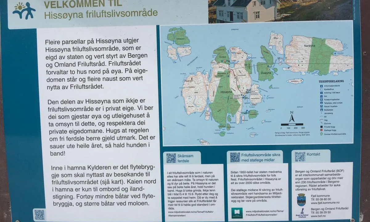
Hissøyna
natural_harbour
1 liker bildet
Image uploaded on 9. Apr 2024
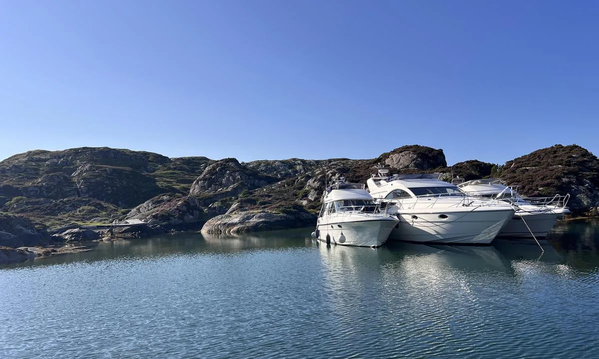
Stangholmen
marina
1 liker bildet
Image uploaded on 7. Jul 2025
Stangholmen
marina
1 liker bildet
Image uploaded on 7. Jul 2025
Hissøyna
natural_harbour
1 liker bildet
Image uploaded on 10. Apr 2024
Hissøyna
natural_harbour
1 liker bildet
Image uploaded on 10. Apr 2024
Stangholmen
marina
1 liker bildet
Image uploaded on 7. Jul 2025
Stangholmen
marina
1 liker bildet
Image uploaded on 7. Jul 2025
Skarvøyna - Herdla
natural_harbour
1 liker bildet
Image uploaded on 26. Jun 2024
Ramsøy kai
marina
1 liker bildet
Image uploaded on 14. Jul 2024
Skarvøyna - Herdla
natural_harbour

1 liker bildet
Image uploaded on 26. Jun 2024
Ramsøy kai
marina
1 liker bildet
Image uploaded on 14. Jul 2024
Skarvøyna - Herdla
natural_harbour
1 liker bildet
Image uploaded on 26. Jun 2024
Geitøy i Alverstraumen
natural_harbour
1 liker bildet
Image uploaded on 8. Sep 2024
Herdla Landhandel - Herdlesund
marina
1 liker bildet
Image uploaded on 20. Aug 2022
Herdla Landhandel - Herdlesund
marina
1 liker bildet
Image uploaded on 20. Aug 2022
Herdla
marina
1 liker bildet
Image uploaded on 14. Jul 2024
Herdla Landhandel - Herdlesund
marina
1 liker bildet
Image uploaded on 20. Aug 2022
Herdla
marina
1 liker bildet
Image uploaded on 14. Jul 2024
Herdla Landhandel - Herdlesund
marina
1 liker bildet
Image uploaded on 20. Aug 2022
Herdla Landhandel - Herdlesund
marina
1 liker bildet
Image uploaded on 20. Aug 2022
Herdla
marina
1 liker bildet
Image uploaded on 1. Sep 2024
Herdla
marina
1 liker bildet
Image uploaded on 1. Sep 2024
Bramskjæra
natural_harbour
1 liker bildet
Image uploaded on 6. Aug 2022
Storøyen, Eidsvåg
natural_harbour
1 liker bildet
Image uploaded on 28. Aug 2022
Bruvik - Osterøy
marina
0 liker bildet
Image uploaded on 9. Nov 2024
Bruvik - Osterøy
marina
0 liker bildet
Image uploaded on 9. Nov 2024
Bruvik - Osterøy
marina
0 liker bildet
Image uploaded on 9. Nov 2024
Bruvik - Osterøy
marina
0 liker bildet
Image uploaded on 9. Nov 2024
Hjelmo
natural_harbour
0 liker bildet
Image uploaded on 31. Jan 2024
Hjelmo
natural_harbour
0 liker bildet
Image uploaded on 31. Jan 2024
Turøy Kobbeviken
natural_harbour
0 liker bildet
Image uploaded on 1. Feb 2024
Hosanger
marina
0 liker bildet
Image uploaded on 13. May 2023
Turøy Kobbeviken
natural_harbour
0 liker bildet
Image uploaded on 1. Feb 2024
Hosanger
marina
0 liker bildet
Image uploaded on 13. May 2023
Turøy Kobbeviken
natural_harbour
0 liker bildet
Image uploaded on 1. Feb 2024
Hosanger
marina
0 liker bildet
Image uploaded on 13. May 2023
Turøy Kobbeviken
natural_harbour
0 liker bildet
Image uploaded on 1. Feb 2024
Turøy Kobbeviken
natural_harbour
0 liker bildet
Image uploaded on 1. Feb 2024
Hosanger
marina
0 liker bildet
Image uploaded on 13. May 2023
Turøy Kobbeviken
natural_harbour
0 liker bildet
Image uploaded on 1. Feb 2024
Hosanger
marina
0 liker bildet
Image uploaded on 13. May 2023
Hosanger
marina
0 liker bildet
Image uploaded on 13. May 2023
Svennerfyr stranda
natural_harbour
0 liker bildet
Image uploaded on 28. Jul 2023
Svennerfyr stranda
natural_harbour
0 liker bildet
Image uploaded on 28. Jul 2023
Svennerfyr stranda
natural_harbour
0 liker bildet
Image uploaded on 28. Jul 2023
Svennerfyr stranda
natural_harbour
0 liker bildet
Image uploaded on 28. Jul 2023
Sør i Ommane - Ølbergholmen
natural_harbour
0 liker bildet
Image uploaded on 28. Jul 2023
Sør i Ommane - Ølbergholmen
natural_harbour
0 liker bildet
Image uploaded on 28. Jul 2023
Geitøy i Alverstraumen
natural_harbour
0 liker bildet
Image uploaded on 4. May 2024
Geitøy i Alverstraumen
natural_harbour
0 liker bildet
Image uploaded on 30. Jun 2023
Geitøy i Alverstraumen
natural_harbour

0 liker bildet
Image uploaded on 30. Jun 2023
Geitøy i Alverstraumen
natural_harbour
0 liker bildet
Image uploaded on 30. Jun 2023
Geitøy i Alverstraumen
natural_harbour
0 liker bildet
Image uploaded on 30. Jun 2023
Geitøy i Alverstraumen
natural_harbour
0 liker bildet
Image uploaded on 30. Jun 2023
Geitøy i Alverstraumen
natural_harbour
0 liker bildet
Image uploaded on 30. Jun 2023
Mastrevik
marina
0 liker bildet
Image uploaded on 15. Jun 2025
Mastrevik
marina
0 liker bildet
Image uploaded on 15. Jun 2025
Mastrevik
marina
0 liker bildet
Image uploaded on 15. Jun 2025
Nordre Kjerringa, Rongevær Kysthytte (DNT, Bergen
natural_harbour
0 liker bildet
Image uploaded on 4. Apr 2024
Nordre Kjerringa, Rongevær Kysthytte (DNT, Bergen
natural_harbour
0 liker bildet
Image uploaded on 4. Apr 2024
Nordre Kjerringa, Rongevær Kysthytte (DNT, Bergen
natural_harbour
0 liker bildet
Image uploaded on 4. Apr 2024
Nordre Kjerringa, Rongevær Kysthytte (DNT, Bergen
natural_harbour
0 liker bildet
Image uploaded on 4. Apr 2024
Nordre Kjerringa, Rongevær Kysthytte (DNT, Bergen
natural_harbour
0 liker bildet
Image uploaded on 4. Apr 2024
Nordre Kjerringa, Rongevær Kysthytte (DNT, Bergen
natural_harbour
0 liker bildet
Image uploaded on 4. Apr 2024
Nordre Kjerringa, Rongevær Kysthytte (DNT, Bergen
natural_harbour
0 liker bildet
Image uploaded on 4. Apr 2024
Nordre Kjerringa, Rongevær Kysthytte (DNT, Bergen
natural_harbour
0 liker bildet
Image uploaded on 4. Apr 2024
Nordre Kjerringa, Rongevær Kysthytte (DNT, Bergen
natural_harbour
0 liker bildet
Image uploaded on 4. Apr 2024
Nordre Kjerringa, Rongevær Kysthytte (DNT, Bergen
natural_harbour
0 liker bildet
Image uploaded on 4. Apr 2024
Nordre Kjerringa, Rongevær Kysthytte (DNT, Bergen
natural_harbour
0 liker bildet
Image uploaded on 4. Apr 2024
Nordre Kjerringa, Rongevær Kysthytte (DNT, Bergen
natural_harbour
0 liker bildet
Image uploaded on 4. Apr 2024
Hissøyna
natural_harbour
0 liker bildet
Image uploaded on 9. Apr 2024
Hissøyna
natural_harbour
0 liker bildet
Image uploaded on 9. Apr 2024
Stangholmen
marina
0 liker bildet
Image uploaded on 7. Jul 2025
Hissøyna
natural_harbour
0 liker bildet
Image uploaded on 9. Apr 2024
Stangholmen
marina
0 liker bildet
Image uploaded on 7. Jul 2025
Hissøyna
natural_harbour
0 liker bildet
Image uploaded on 9. Apr 2024
Hissøyna
natural_harbour
0 liker bildet
Image uploaded on 9. Apr 2024
Stangholmen
marina
0 liker bildet
Image uploaded on 7. Jul 2025
Hissøyna
natural_harbour
0 liker bildet
Image uploaded on 9. Apr 2024
Stangholmen
marina
0 liker bildet
Image uploaded on 7. Jul 2025
Hissøyna
natural_harbour
0 liker bildet
Image uploaded on 10. Apr 2024
Stangholmen
marina
0 liker bildet
Image uploaded on 7. Jul 2025
Stangholmen
marina
0 liker bildet
Image uploaded on 7. Jul 2025
Hissøyna
natural_harbour
0 liker bildet
Image uploaded on 10. Apr 2024
Stangholmen
marina
0 liker bildet
Image uploaded on 7. Jul 2025
Stangholmen
marina
0 liker bildet
Image uploaded on 7. Jul 2025
Skarvøyna - Herdla
natural_harbour
0 liker bildet
Image uploaded on 26. Jun 2024
Skarvøyna - Herdla
natural_harbour
0 liker bildet
Image uploaded on 26. Jun 2024
Skarvøyna - Herdla
natural_harbour
0 liker bildet
Image uploaded on 26. Jun 2024
Skarvøyna - Herdla
natural_harbour
0 liker bildet
Image uploaded on 26. Jun 2024
Ramsøy kai
marina
0 liker bildet
Image uploaded on 14. Jul 2024
Skarvøyna - Herdla
natural_harbour
0 liker bildet
Image uploaded on 26. Jun 2024
Ramsøy kai
marina
0 liker bildet
Image uploaded on 14. Jul 2024
Skarvøyna - Herdla
natural_harbour
0 liker bildet
Image uploaded on 26. Jun 2024
Ramsøy kai
marina
0 liker bildet
Image uploaded on 14. Jul 2024
Skarvøyna - Herdla
natural_harbour
0 liker bildet
Image uploaded on 26. Jun 2024
Ramsøy kai
marina
0 liker bildet
Image uploaded on 14. Jul 2024
Ramsøy kai
marina
0 liker bildet
Image uploaded on 14. Jul 2024
Skarvøyna - Herdla
natural_harbour
0 liker bildet
Image uploaded on 26. Jun 2024
Ramsøy kai
marina
0 liker bildet
Image uploaded on 14. Jul 2024
Skarvøyna - Herdla
natural_harbour
0 liker bildet
Image uploaded on 26. Jun 2024
Ramsøy kai
marina
0 liker bildet
Image uploaded on 14. Jul 2024
Ramsøy kai
marina
0 liker bildet
Image uploaded on 14. Jul 2024
Ramsøy kai
marina
0 liker bildet
Image uploaded on 14. Jul 2024
Herdla
marina
0 liker bildet
Image uploaded on 14. Jul 2024
Herdla Landhandel - Herdlesund
marina
0 liker bildet
Image uploaded on 20. Aug 2022
Volmene
natural_harbour
0 liker bildet
Image uploaded on 6. Aug 2022
Volmene
natural_harbour
0 liker bildet
Image uploaded on 6. Aug 2022
Volmene
natural_harbour
0 liker bildet
Image uploaded on 6. Aug 2022
Volmene
natural_harbour
0 liker bildet
Image uploaded on 6. Aug 2022
Volmene
natural_harbour
0 liker bildet
Image uploaded on 6. Aug 2022
Gullholm
natural_harbour
0 liker bildet
Image uploaded on 16. Feb 2023
Gullholm
natural_harbour
0 liker bildet
Image uploaded on 16. Feb 2023
Gullholm
natural_harbour
0 liker bildet
Image uploaded on 16. Feb 2023
Skorpo - Apalholmen
natural_harbour
0 liker bildet
Image uploaded on 24. Jun 2021
Skorpo - Apalholmen
natural_harbour
0 liker bildet
Image uploaded on 24. Jun 2021
Langøyna
natural_harbour
0 liker bildet
Image uploaded on 1. Jun 2021
Langøyna
natural_harbour
0 liker bildet
Image uploaded on 1. Jun 2021
Skogsøy
natural_harbour
0 liker bildet
Image uploaded on 1. Jun 2021
Skogsøy
natural_harbour
0 liker bildet
Image uploaded on 1. Jun 2021
Skogsøy
natural_harbour
0 liker bildet
Image uploaded on 1. Jun 2021
Skogsøy
natural_harbour
0 liker bildet
Image uploaded on 1. Jun 2021
Skogsøy
natural_harbour
0 liker bildet
Image uploaded on 1. Jun 2021
Skogsøy
natural_harbour
0 liker bildet
Image uploaded on 1. Jun 2021
Skogsøy
natural_harbour
0 liker bildet
Image uploaded on 1. Jun 2021
Skarvøyna - Herdla
natural_harbour
0 liker bildet
Image uploaded on 1. Jun 2021
Skarvøyna - Herdla
natural_harbour
0 liker bildet
Image uploaded on 1. Jun 2021
Sandøy - Turøy
natural_harbour
0 liker bildet
Image uploaded on 10. May 2022
Sandøy - Turøy
natural_harbour
0 liker bildet
Image uploaded on 10. May 2022
Brandasund
marina
0 liker bildet
Image uploaded on 11. May 2022
Brandasund
marina
0 liker bildet
Image uploaded on 11. May 2022
Brandasund
marina
0 liker bildet
Image uploaded on 11. May 2022
Brandasund
marina
0 liker bildet
Image uploaded on 11. May 2022
Nordåsvannet Marmorøyene
natural_harbour
0 liker bildet
Image uploaded on 22. May 2022
Nordåsvannet Marmorøyene
natural_harbour
0 liker bildet
Image uploaded on 22. May 2022
Svenner Fyr
natural_harbour
0 liker bildet
Image uploaded on 14. Jul 2021
Grønøy Byrknesøy
natural_harbour
0 liker bildet
Image uploaded on 23. May 2022
Grønøy Byrknesøy
natural_harbour
0 liker bildet
Image uploaded on 23. May 2022
Grønøy Byrknesøy
natural_harbour
0 liker bildet
Image uploaded on 23. May 2022
Grønøy Byrknesøy
natural_harbour
0 liker bildet
Image uploaded on 23. May 2022
Grønøy Byrknesøy
natural_harbour
0 liker bildet
Image uploaded on 23. May 2022
Vassøyene
natural_harbour
0 liker bildet
Image uploaded on 24. May 2022
Vassøyene
natural_harbour
0 liker bildet
Image uploaded on 24. May 2022
Børøypollen
natural_harbour
0 liker bildet
Image uploaded on 3. Jun 2021
Børøypollen
natural_harbour
0 liker bildet
Image uploaded on 3. Jun 2021
Børøypollen
natural_harbour
0 liker bildet
Image uploaded on 3. Jun 2021
Skorpo - Apalholmen
natural_harbour
0 liker bildet
Image uploaded on 3. Jun 2021
Skorpo - Apalholmen
natural_harbour
0 liker bildet
Image uploaded on 3. Jun 2021
Ådnøya
natural_harbour
0 liker bildet
Image uploaded on 8. Jun 2022
Skjerjehamn
marina
0 liker bildet
Image uploaded on 8. Jun 2022
Skjerjehamn
marina
0 liker bildet
Image uploaded on 8. Jun 2022
Skjerjehamn
marina
0 liker bildet
Image uploaded on 8. Jun 2022
Sjøbuosen
natural_harbour
0 liker bildet
Image uploaded on 28. May 2021
Sjøbuosen
natural_harbour
0 liker bildet
Image uploaded on 28. May 2021
Uttoskavågen
natural_harbour
0 liker bildet
Image uploaded on 19. Aug 2021
Uttoskavågen
natural_harbour
0 liker bildet
Image uploaded on 19. Aug 2021
Uttoskavågen
natural_harbour

0 liker bildet
Image uploaded on 19. Aug 2021
Uttoskavågen
natural_harbour
0 liker bildet
Image uploaded on 19. Aug 2021
Reviews
See a helpful review? Please click the 👍 below the review to let TESO know that you found it helpful.
TESO says:
area

maritime qualities
description
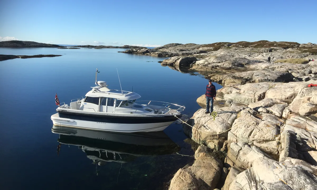
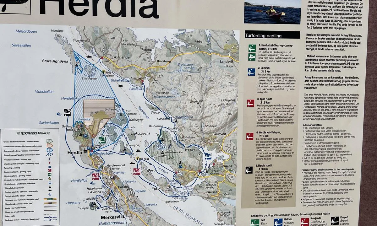
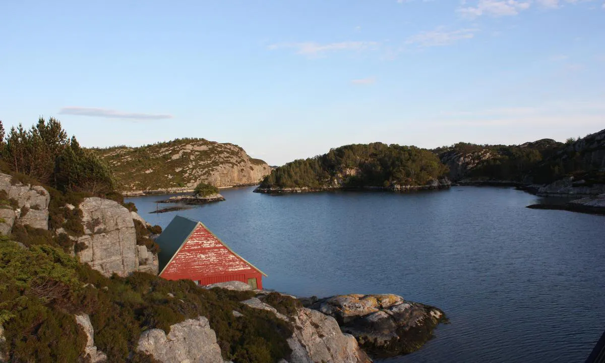
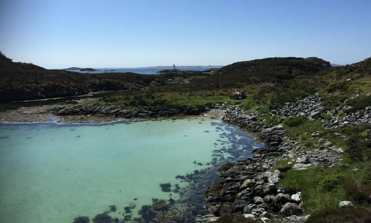
Easy access via the south/east side of the island. Approach via the northern passage is also possible, but there are some shoals in the strait.
One can anchor east of the island, possibly in front of Vollane beach. The bay is quite deep in several places (20m +)
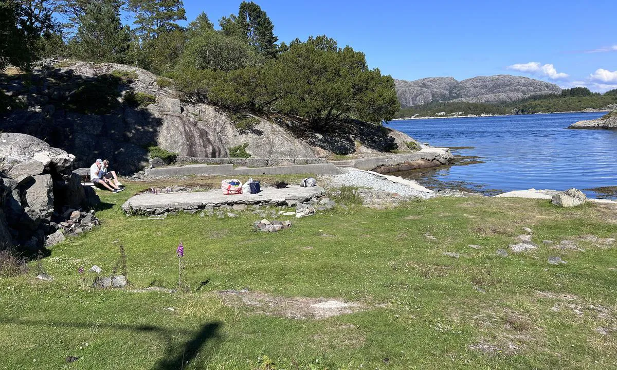
The island is a recreational area. In the past, this was a small croft. The history of the place is signposted on the island.
In several places, there are bolts in the rock for mooring with an anchor.
With a dinghy, one can reach Eidsvåg where there is a bus to the city center of Bergen.
3 x helpful | written on 28. Aug 2022 | updated_on 28. Aug 2022
TESO says:
area
maritime qualities
description
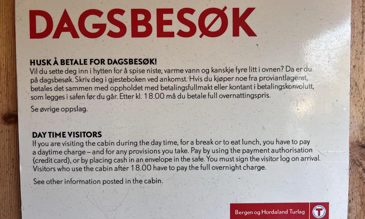
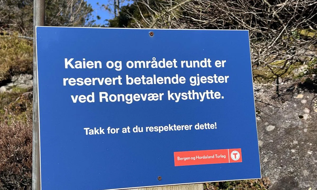
Flytebrygge skal ikke benyttes av båtgjester. Disse er for adkomst med robåt/kajakk for overnattingsgjester til DNT hytten. Båtgjester skal benytte kai på vestsiden. Kai kan benyttes mot at det betales for besøket iht gjeldende prisliste oppslått på hytten.
Betaling i DNT appen eller ved skjema i hytten.
Ta hensyn til øvrige gjester.
Austrheim er ett fantastisk område særlig for motorbåt. Et mylder av øyer, sund, holmer og skjær, flere friområder og kommunale kaier som kan benyttes. Alt er innenskjærs likevel rett ved havet. Lett tilgjengelig fra indre og ytre led, men vær obs, her får du testet navigasjonskunnskaper og utkikk med navigasjon på staker, båker, varder, lykter og blink gjennom utallige trange sund.
Grunnet luftspenn og flere lave broer bør seilere planlegge ankomsten til denne havnen fra vest fra Fedjeosen eller nord fra Fensfjorden. Det er luftspenn på 20 meter for begge disse retninger, fra øst og sør er det broer på 6 meter man må passere under. For å anløpe kaien må man under ett luftspenn på 12m. Av denne grunn er ikke kaien tilgjengelig for båter som stikker høyere enn 12m. Båter med høyde under 20m kan ankre på bukten utenfor flytebryggen. Båter høyere enn 20m kan ikke anløpe havnen.
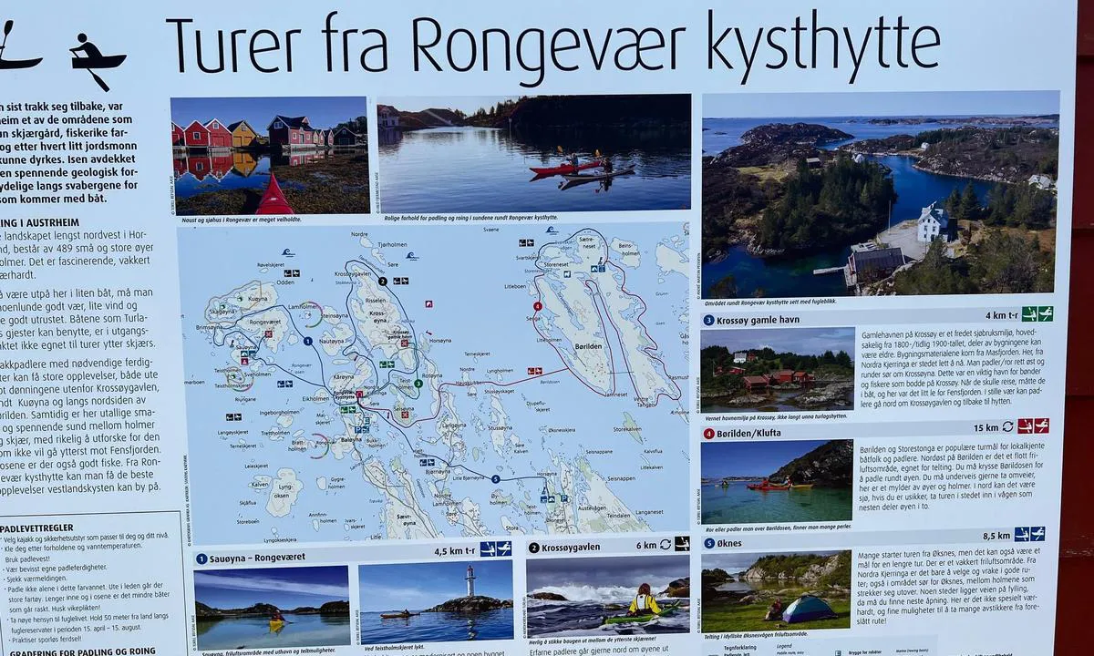
Fra DNT:
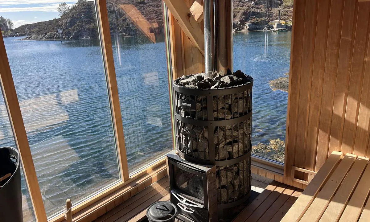
Rongevær kysthytte. Et eventyrlig sted for kystaktiviteter. Anlegget består av flere bygninger, brygger og uteområder. Her kan du komme padlende alene eller ta med deg bedriften, storfamilien eller vennegjengen og få noen uforglemmelige dager i havgapet.
Rongevær kysthytte har primært rombestilling. For leie av hele Skulehuset, Naustet eller anlegget samlet, kontakt Bergen og Hordaland Turlag,
Dronefilm av Rongevær kysthytte: https://www.youtube.com/watch?v=W-Umaoj6efk
Regler: https://hyttebestilling.dnt.no/hytte/101077830/vilkaar
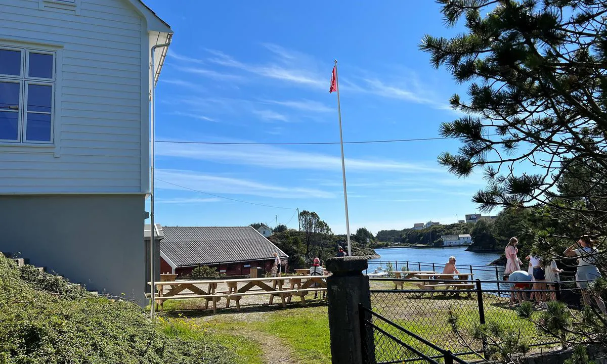
Rongevær kysthytte har lange tradisjoner. Den ble bygget som Rongevær skule på 1930 tallet og var i bruk helt fram til 1989. Den ble lagt ned da øyene i ytre del av Austrheim kommune fikk vei. Da tok buss over for båt og skolen ble omgjort til Rongevær kyst - og fritidssenter. I juni 2021 inngikk Turlaget en langsiktig avtale med Austrheim kommune. Bergen og Hordaland Turlag sin første kysthytte var en realitet!
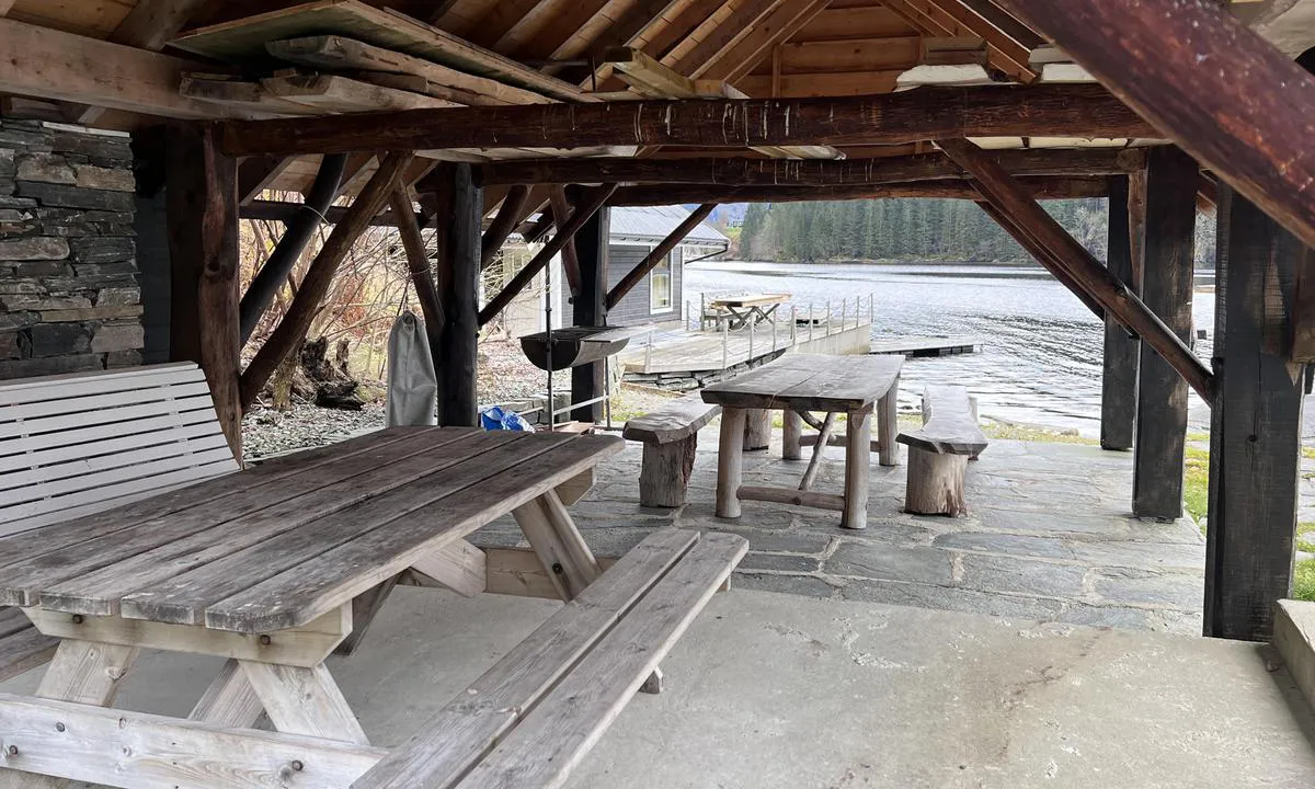
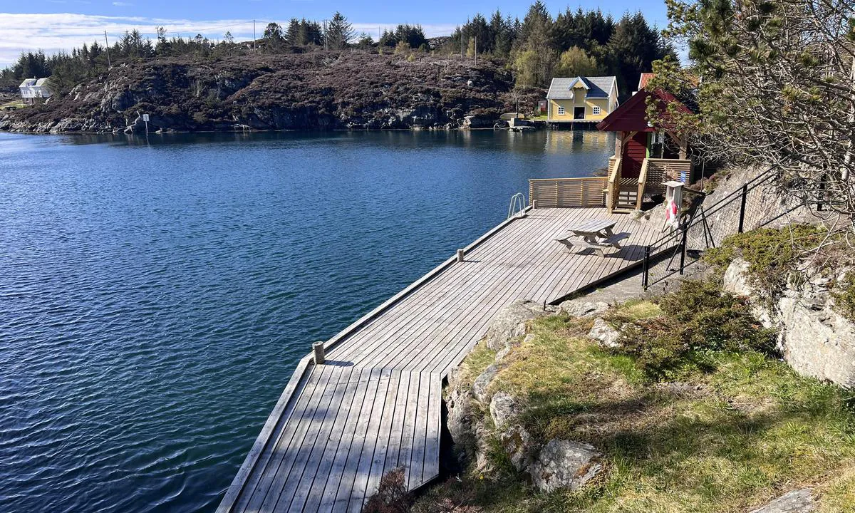
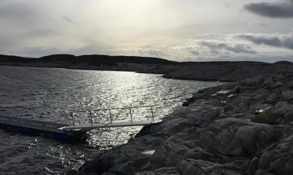
Hele anlegget består av et hovedbygg og to etasjers naust med forsamlingslokale, 100 m2 kai og flytebrygge.
Skulehuset - Flere oppholdsrom, sengeplasser til 24 personer fordelt på rom og loft. Det er spisestue og et større allrom. Nyoppusset og innbydende. Kjøkken med bla. oppvaskmaskin, kaffetrakter og kjøleskap. Flere toalett og bad med dusj. Det er 2 barnesenger med dyne/pute, og barnestoler tilgjengelig. En seng er plassert på rom 12 og en på lageret i 2.etasje. Dette er en reiseseng som kan brukes der det er behov.
Naustet - Mange mindre soverom med køyeseng. Totalt 6 rom med plass til 14 personer. 3 rom er tilrettelagt for hund med hundebur. Et rom har ekstra dørbredde og er delvis tilpasset rullestol. 2 toalett med dusj/bad. I underetasjen er det et større forsamlingslokale. Der det kan dekkes bord til 30 -40 gjester. Dette lokalet har strøm, men ingen varme. Egner seg til bruk om sommeren.
Rongevær kysthytte ligger på øya Nordra Kjerringa . Det er ca. 300 meter i luftlinje fra endeplass/parkering på Baløy til kysthytta. Mulighet for sjøsetting av kajakk ved snuplass. Rolig farvann mellom Baløy og Nordra Kjerringa. Turen er beskyttet mot bølger og foregår i smult farvann.
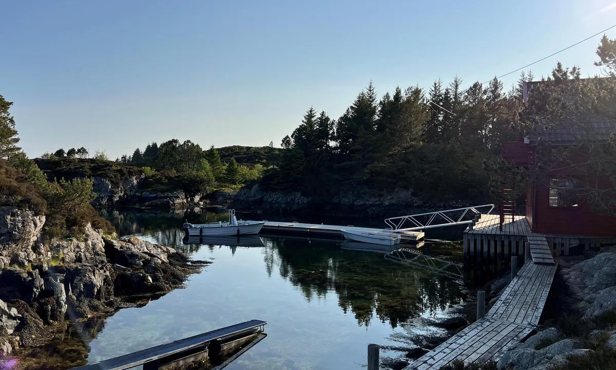
Det er etablert flytebryggeanlegg på Baløy med robåter som gjester kan benytte til og fra kysthytta. I naust (300 meter fra marinaen) er det redningsvester og annet utstyr. Her er det kodeboks for å komme inn.
Rongevær kysthytte har trådløst bredbånd. I Skulehuset er det tilrettelagt med skjerm både i spisestue og peisestue. Det er best forhold i 2 etasje. Naustet og uteområdene har dårlig dekning. Se oppslag ved inngang i Skulehuset.
Bestilling:
Rom/seng: Rongevær kysthytte har primært rombestilling, men det er mulig å bestille seng på loftet i Skulehuset når det ikke er utleid. Leievilkår for nettbestlling og informasjon om Rongevær kysthytte kan du lese mer om her.
Gruppeleie: Større grupper og utleie av hele anlegget tar kontakt på e-post: bht@dnt.no. Ved gruppeleie er det egne priser/avbestillingsvilkår, se her: Vilkår og priser for gruppeleie
Bergen og Omland Friluftsråd (BOF) har tilrettelagt flere områder i Austrheim. Sjekk lenker til kajakkturer, friluftsområder og turtips. Her er det mye å velge i !
Rongevær kysthytte driftes av Bergen og Hordaland Turlag. Nordhordland Turlag vil ha tilsyn. I høysesong vil det være vertskap på hytten.
Hund på Rongevær
På Rongevær er hunder velkommen og det er tilrettelagt for å ha med hund på anviste plasser. Det er ikke tillatt med hund på Skulehuset, men tilrettelagt med 3 stk. 2-mannsrom på Naustet. Her kan du sove sammen med hund. Se plantegning under bilder.
Denne hytta har fått støtte av overskuddet fra spillemidlene til Norsk Tipping.
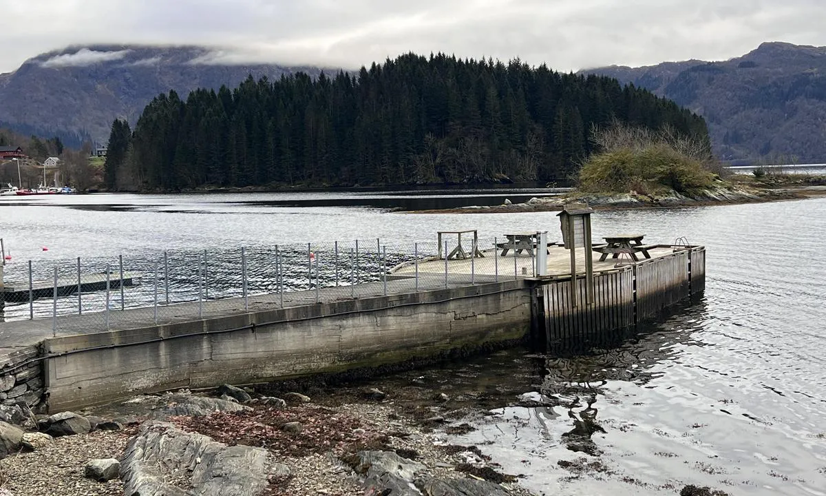
3 x helpful | written on 4. Apr 2024 | updated_on 13. May 2026
TESO says:
description
Entrance and Maritime Conditions: Easy entrance from the east. Sailboats should be aware of the power line. When entering from the east, there is a power line with a clearance height of 14 meters. When entering from the west, there is a narrow passage with a depth of 3.5 meters and an estimated width of 4-6 meters.
Small floating dock, about 3m depth.
Hernar is one of several inhabited islands north of Hellesøy. 6 residents live permanently on the island, but many more have holiday homes.
Mooring: Mooring is done within the ferry quay; as of June 21, the municipal quay is not fendered. The ferry docks at the fendered part of the quay.
It is not encouraged to moor at private quays.
Anchoring with a drag anchor is discouraged due to a submarine cable in the strait.
The Area: Sheltered harbor facing the sea, but protected from swells and one can lie safely moored.
The islands have a history dating back to the Viking era. At that time, boats waited here for favorable winds before setting out.
Despite the lack of all amenities, the island exudes charm. Small paved roads with street names and pedestrian crossings (despite being a car-free island) make Hernar worth a visit.
3 x helpful | written on 25. May 2022
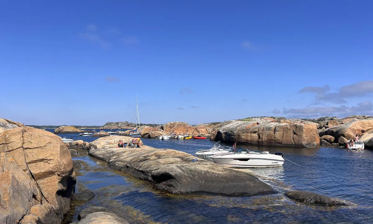
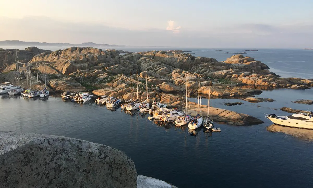
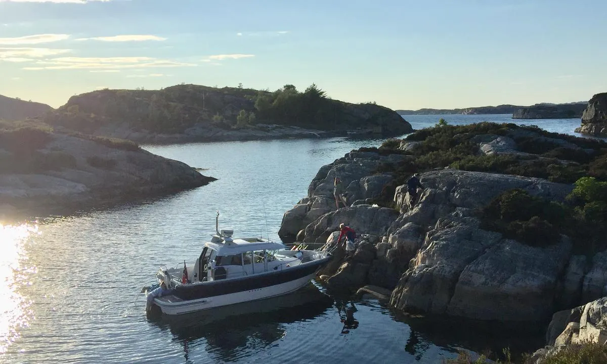
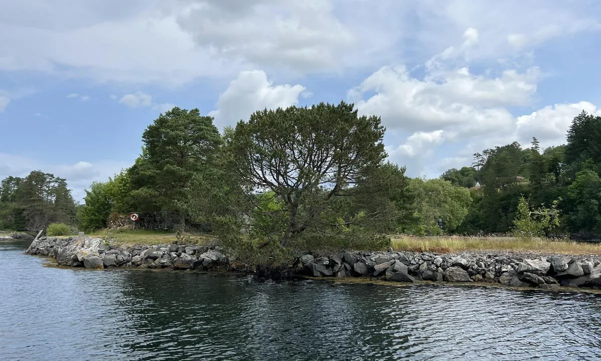
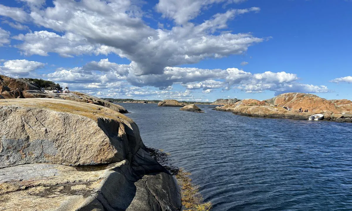
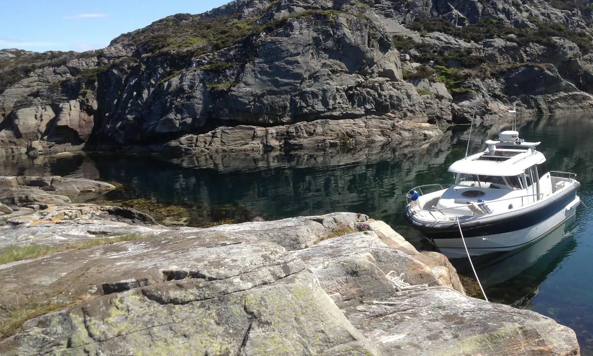
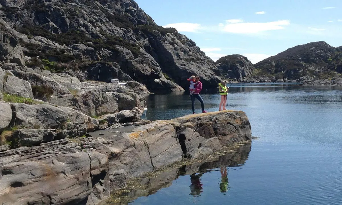
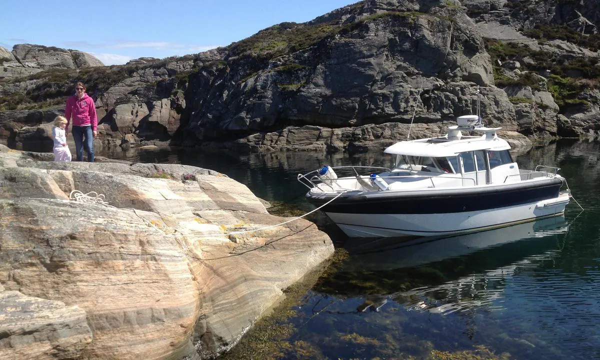
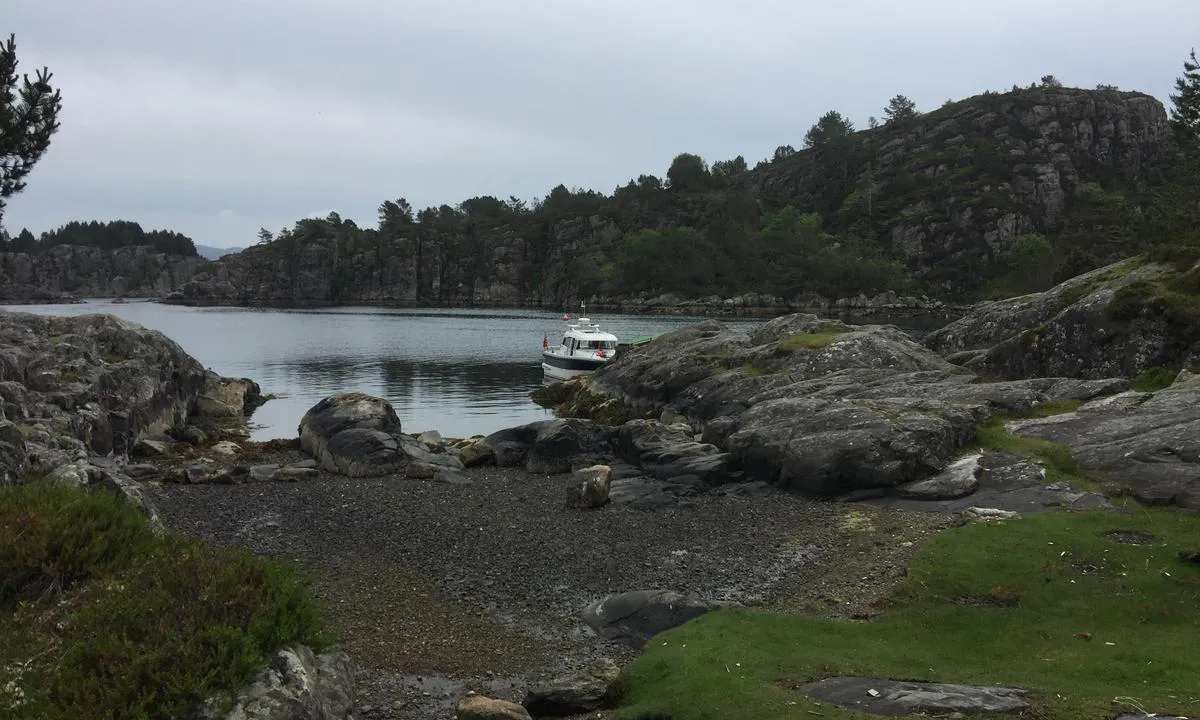
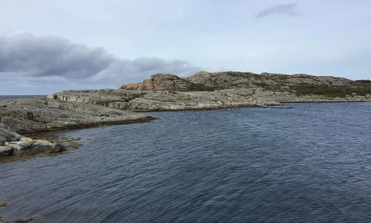
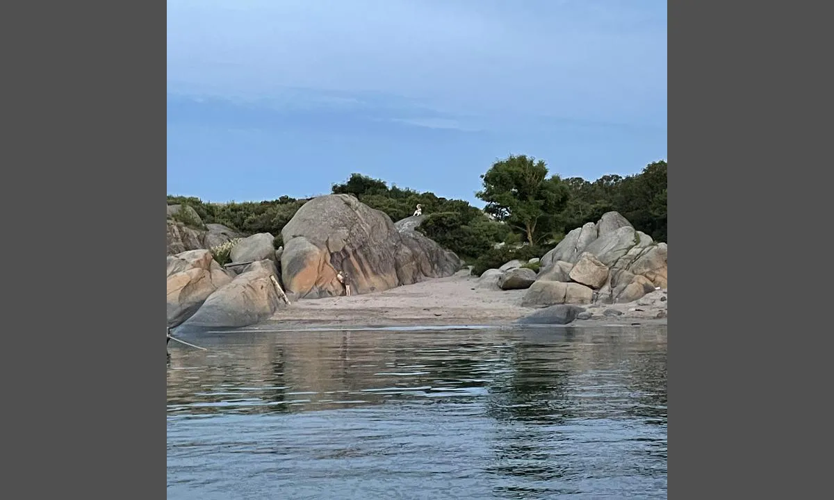
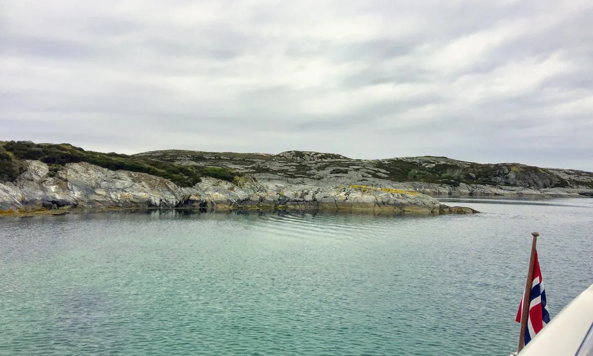
TESO says:
area
maritime qualities
description
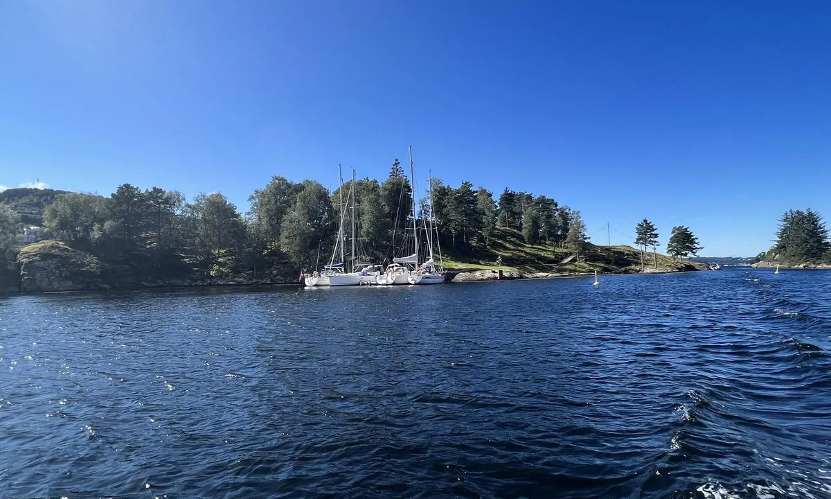
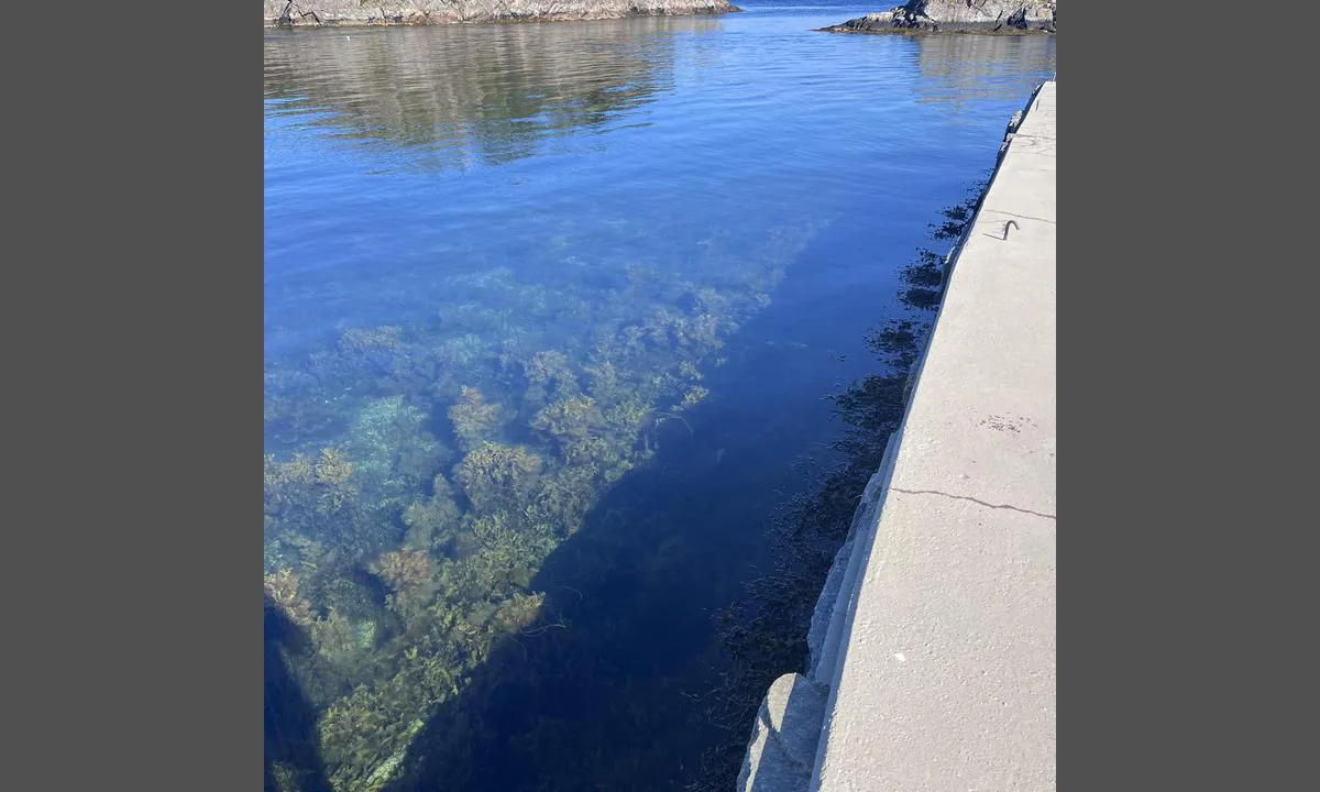
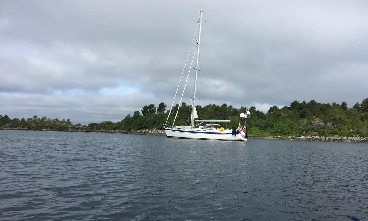
The Volmene are small islets/islands/straits towards Skagerak. It is a beautiful natural harbour with smooth, scoured rock outcrops. Here, you can moor alongside or with an anchor. Good holding for an anchor. There are no bolts in the rock, but many cracks where bolts you bring along can be set. Easy approach from the north/Viksfjord; from the south, there are some shallows before the strait and also a narrow passage, but with good depth.
Exposed to wind from the south/southwest, and there can be some swell if there are waves outside. In the photos, the wind speed is 10 m/s from SW/SSW.
3 x helpful | written on 6. Aug 2022 | updated_on 6. Aug 2022
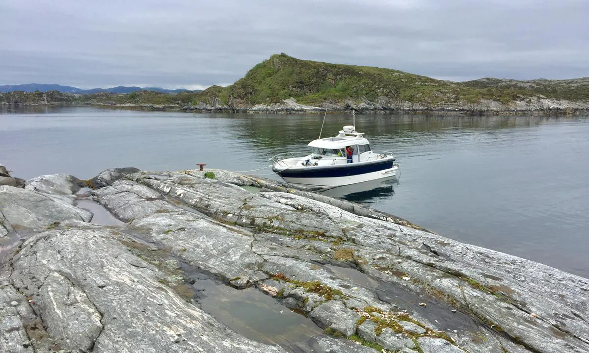
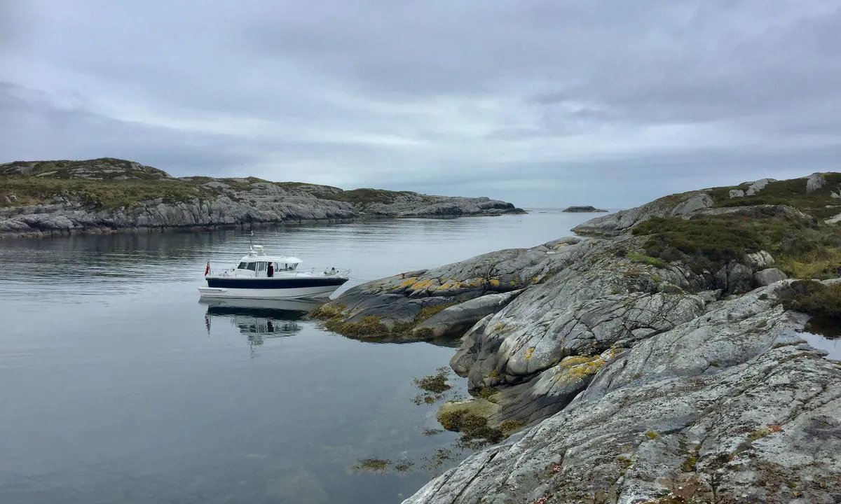
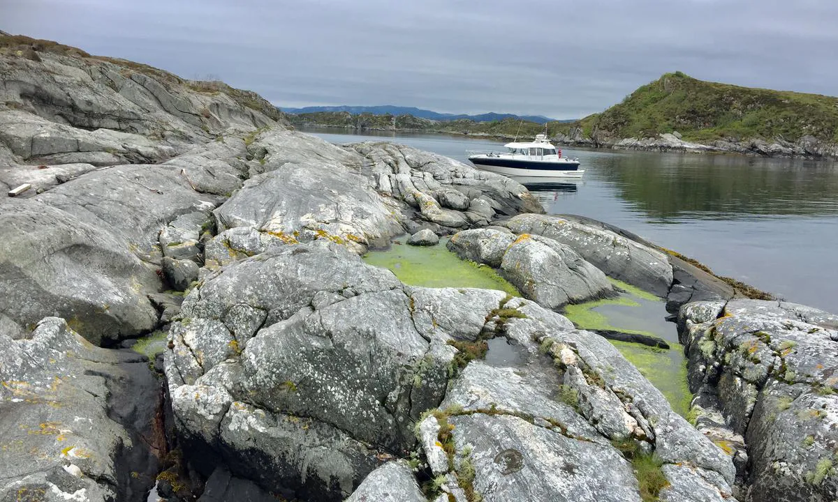
TESO says:
area
maritime qualities

description
Ved anløp mot moloen i sundet mellom øyene bør man være forsiktig, da det her er umerkede grunner (merket i kart). Dybden langs østsiden av moloen er grunn (rundt/under 1 meter), her bør man kun fortøye med små båter.
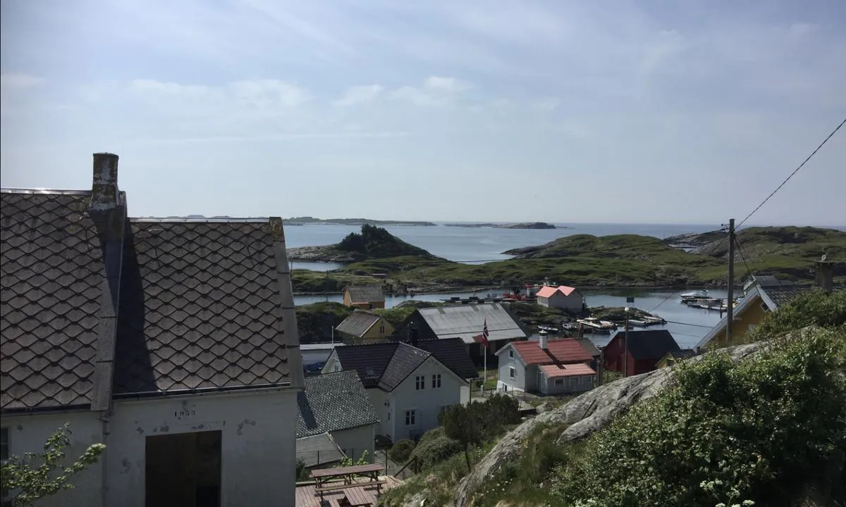
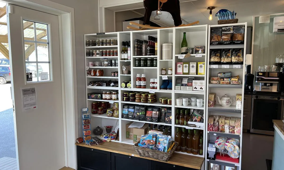
Kort over til Herdla (ca 5 min) hvor det er vann, bensin, diesel, døgnåpen landhandel, restaurant og bar/pub. Hotel Biologen ved Herdlevågen er nyoppusset i 2024 og verdt ett besøk. Her er også flytebrygge og sandstrand.
Det går sauer på helårs beite på øyene og hund må derfor holdes i bånd.
3 x helpful | written on 31. Jan 2023 | updated_on 15. May 2026
TESO says:
area
maritime qualities
description
Mooring towards the south/east end of the islet, or further into the bay. It is somewhat shallow in the eastern channel, motorboats can navigate easily, while sailboats should choose the western channel which is 2 meters. Otherwise, direct access from Landrosen. In west/northwest winds, there may be some swell. Good holding for anchor.
3 x helpful | written on 16. Feb 2023 | updated_on 16. Feb 2023
TESO says:
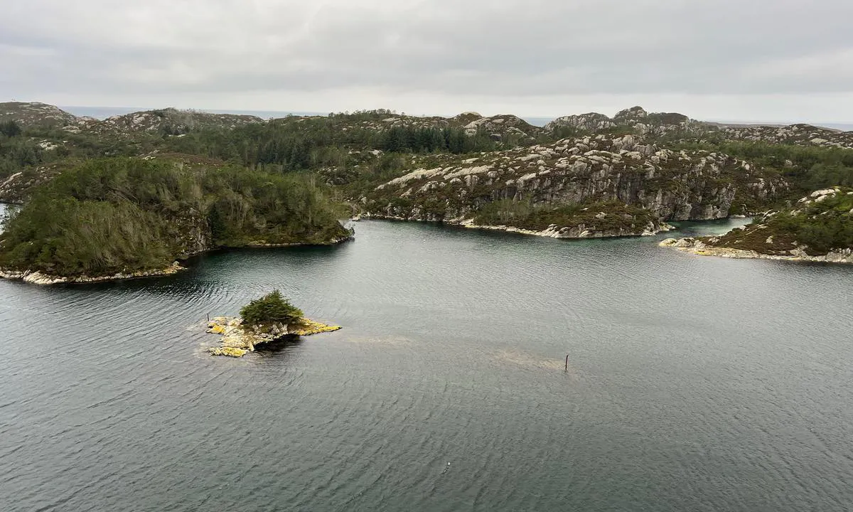
area
maritime qualities
description
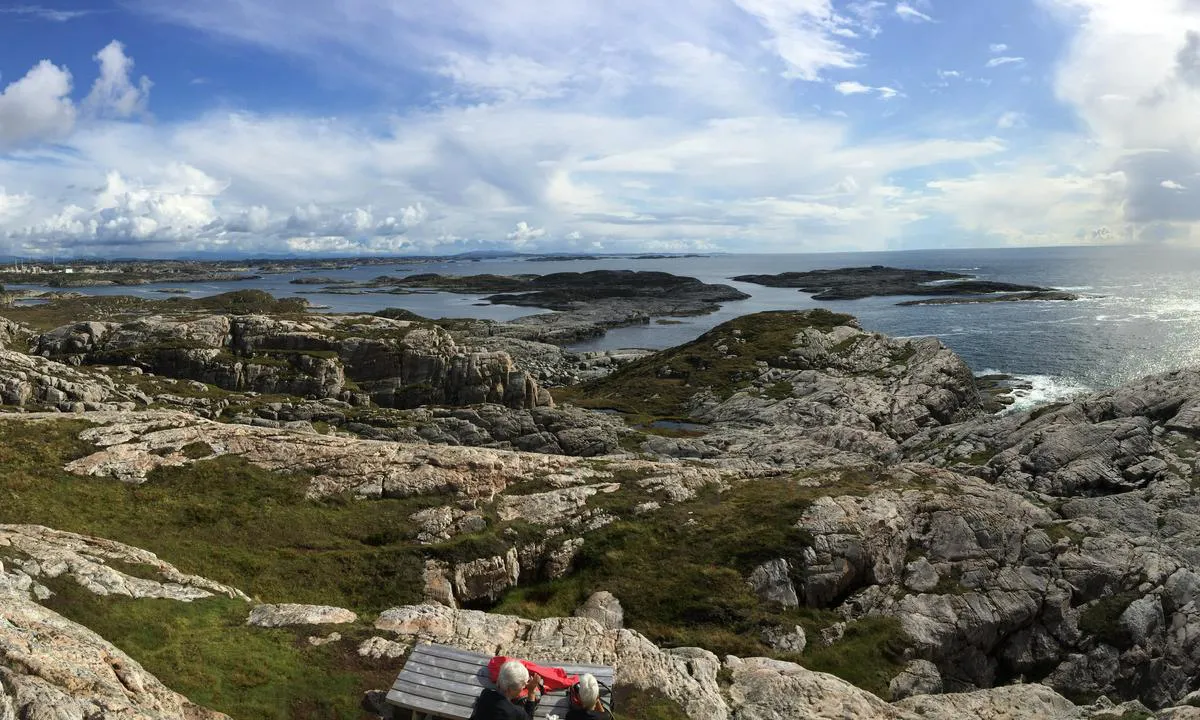
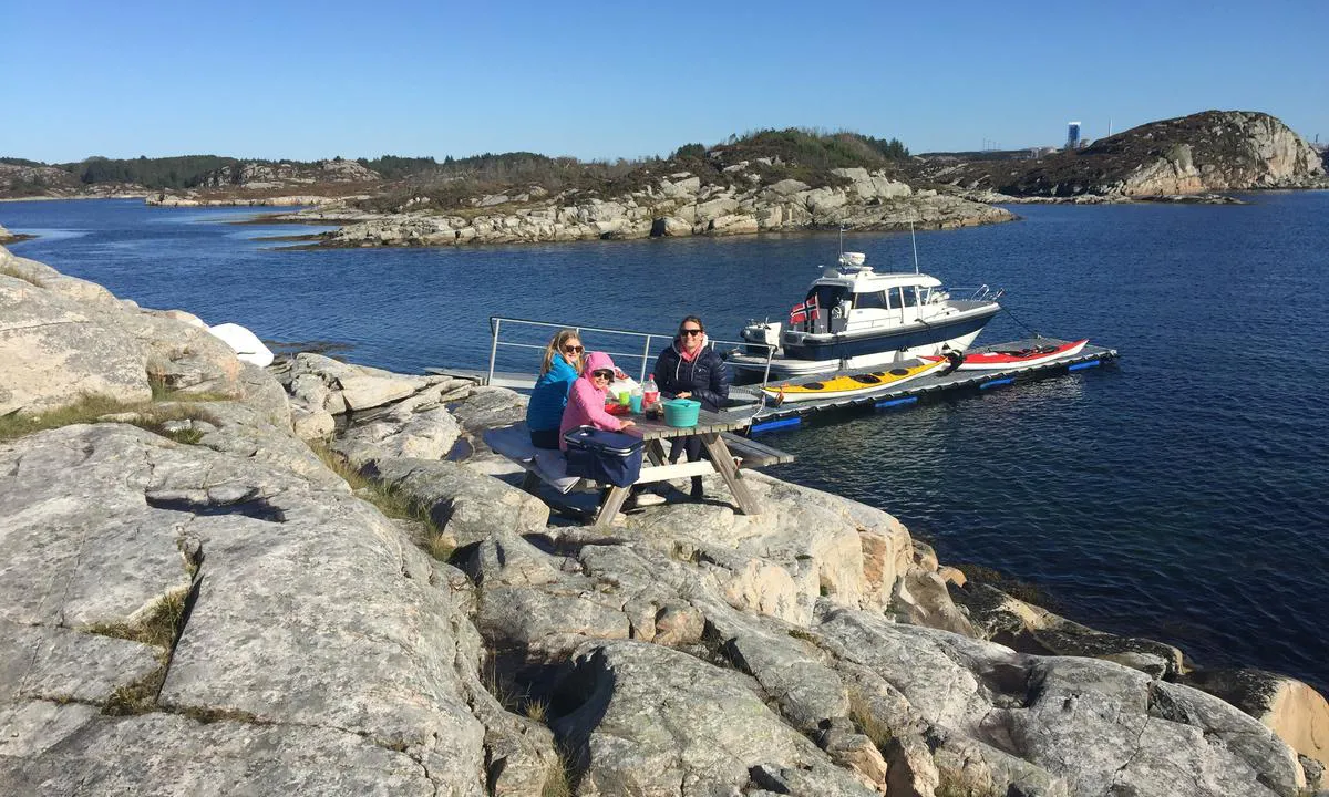
Located in/directly by the inner fairway approximately 10 nm north of Bergen. The islet is situated comfortably and pleasantly in Alverstraumen. The islet is a recreational area belonging to BOF.
There is a current in Alverstraumen. Anchoring should take place on the west side of the islet. Shallows in the area are marked with stakes. Easy access from both directions, be aware that the current can be strong in the narrowest stretches of Alverstraumen.
3 x helpful | written on 30. Jun 2023
TESO says:
area
maritime qualities
description
Mooring with a stern anchor towards the land on the west side or alongside a well-fendered quay on the east side. Some traffic on the east side of the islet can cause waves along the quay.
The islet is well sheltered from all wind directions. Especially on days with cool northerly breezes, this is a nice spot.
3 x helpful | written on 30. Jun 2023 | updated_on 30. Jun 2023
TESO says:
description
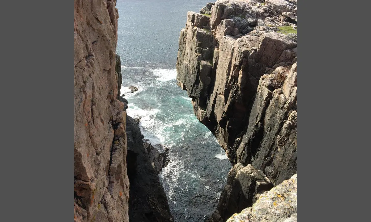
Approach and maritime conditions: Beautiful, well-sheltered natural harbor situated at the outermost edge facing the sea.
Easy access, some shoals which are marked.
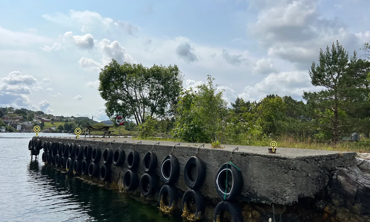
To reach the Vassøyene, one needs to cross open stretches where there can be fairly large seas. In Ytre Fensfjord and Fedjeosen, there is also heavy traffic of utility vessels ranging from small coastal boats to supertankers. The Hurtigruten passes east of the Vassøyene.
Anchoring: Mooring with anchor towards the cliffs, with anchor towards the mole, or in some places alongside. Some bolts in the cliff, bringing your own is recommended.
One area is fendered with old tires where the bolts in the cliff are located.
The area: Beautiful harbor originally established by the navy. Situated at the outermost edge facing the sea but is sheltered from waves/swells. Rich bird life and fishing.
Great view from the top of the island.
Short distance to Byrknesøy, where fuel, water, and provisions are available.
The Vassøyene is a protected bird reserve, so landing is not permitted between April 1 and August 1, according to the Regulation on the protection of Vassøyene (https://lovdata.no/dokument/LF/forskrift/1991-12-20-944/KAPITTEL_1#KAPITTEL_1).
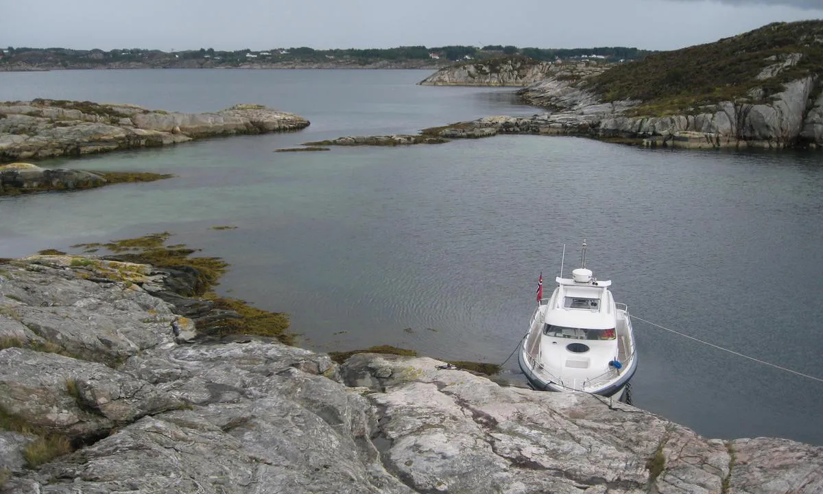
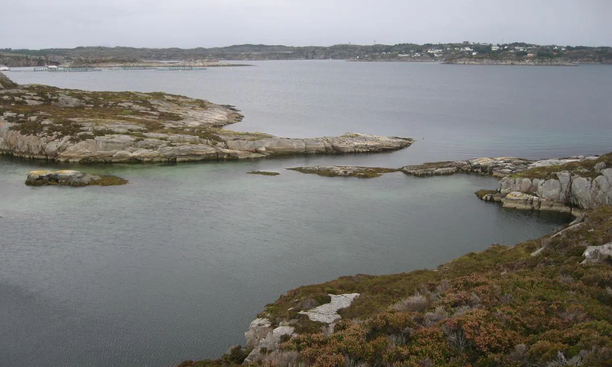
2 x helpful | written on 25. May 2022
TESO says:
description
Approach and Maritime Conditions: From the north/east side of Lurefjorden, one can find the way into a system of coves, bays, straits, and islets. Be aware that some currents can set in the strait between Ådnøy and Engholmen.
Inside the coves, there are many unmarked shoals and reefs that barely rise above the water. They are marked on charts, but there are no stakes. The charted positions also differ somewhat from their actual locations.
One should not attempt to navigate through Veråsstraumen except with a dinghy due to the shallow depth in the current. There is also at times very strong tidal current here.
Anchoring: Either anchor towards land or swing freely. In a few places, it is possible to moor alongside with good/large fenders.
Plenty of places to moor. Inside, you will find sheltered spots regardless of wind direction. Good holding ground for anchors with varying bottoms from sand to mud.
There are no bolts in the rocks, so bringing your own is necessary. In some places, you can tie to trees.
Depths vary from 1-2 meters to approximately 30 meters.
The Area: Many nice and sheltered bays. In several places, there are grassy slopes and gravel beaches with beautiful sandy bottoms.
There is some vegetation in the form of heather and trees, in some places spruce trees.
It is possible to explore Lindåspollene all the way to Lindåsbrygge (where you can walk to a store), Vågseidestranda, and Lindås Sluse via Veråsstrømmen, but only small boats should attempt to go through the current. It becomes like a fast-flowing river when the tide turns, and there is also a shallow area at the outlet on the Lindås side that lies in the natural path of travel. Be aware.
2 x helpful | written on 8. Jun 2022
TESO says:
area
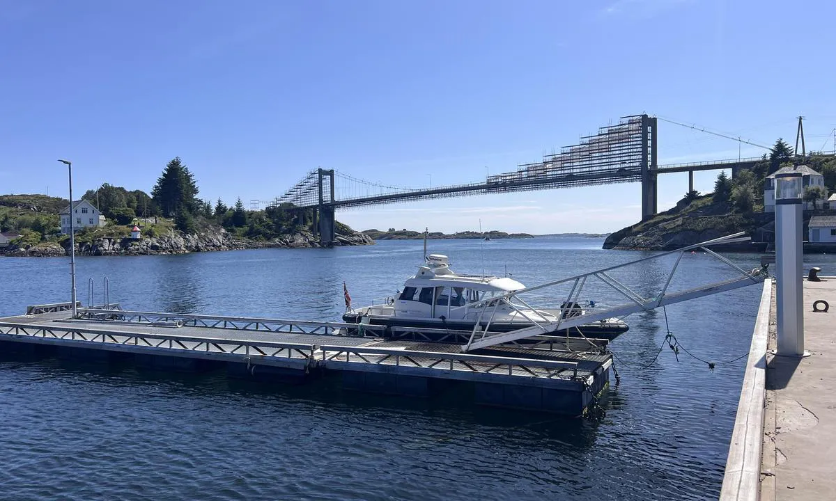
maritime qualities
description
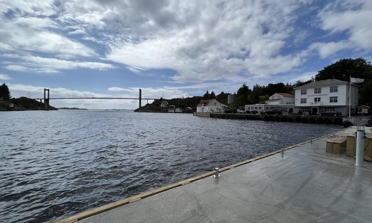
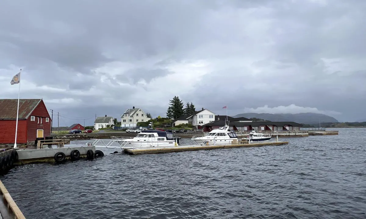
Easy arrival in the middle of the channel at Herdlesund/Herdla Bridge. Good depth at both quay and floating dock. You can also moor to the concrete quay at the innermost part of the harbor (on the inside of the floating dock, but preferably for slightly smaller boats due to quay length.
Mooring to quay or floating dock. The floating dock, in particular, is exposed to sea and wind from the south/southwest direction. When we were there, a gust of wind caused the floating dock to rock severely and waves to crash over the floating dock. This was at approximately 12 m/s in a south/southwest direction. Update: An additional floating dock has now been installed at the bunker quay, making the inner floating dock calmer.
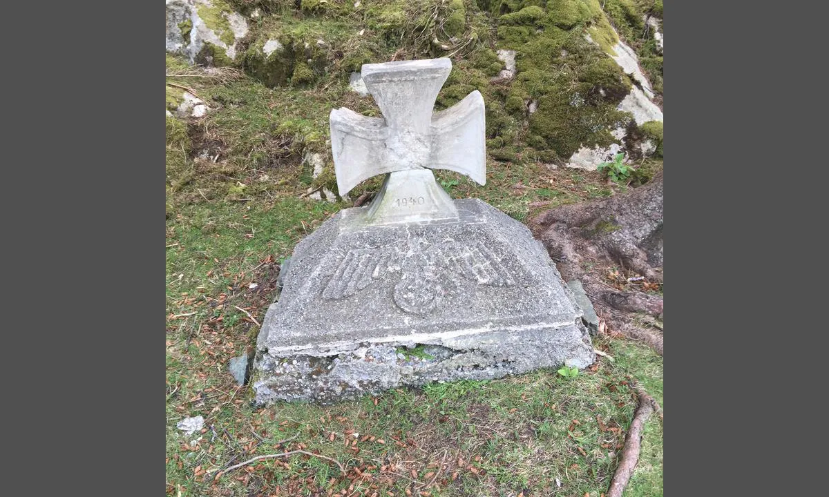
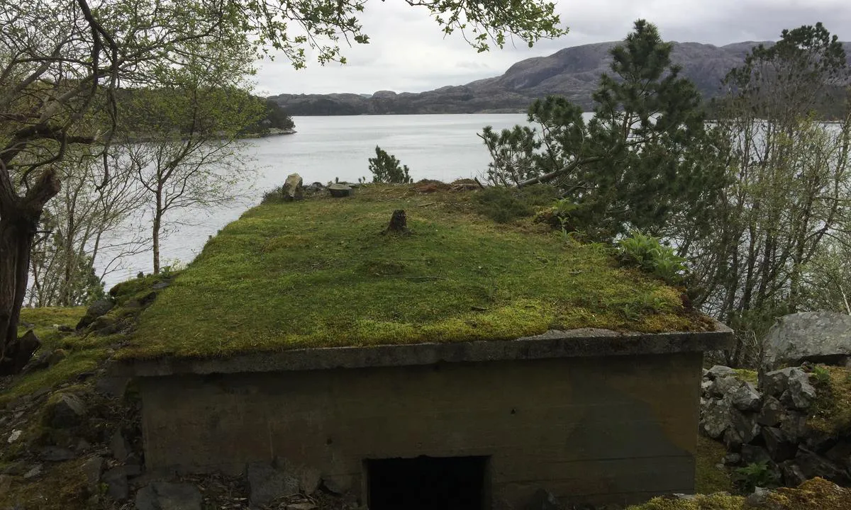
There is a lot of war history at Herdla, in addition, there is a beautiful pebble beach on the west side, as well as a sandy beach at the grass field where the airport was.
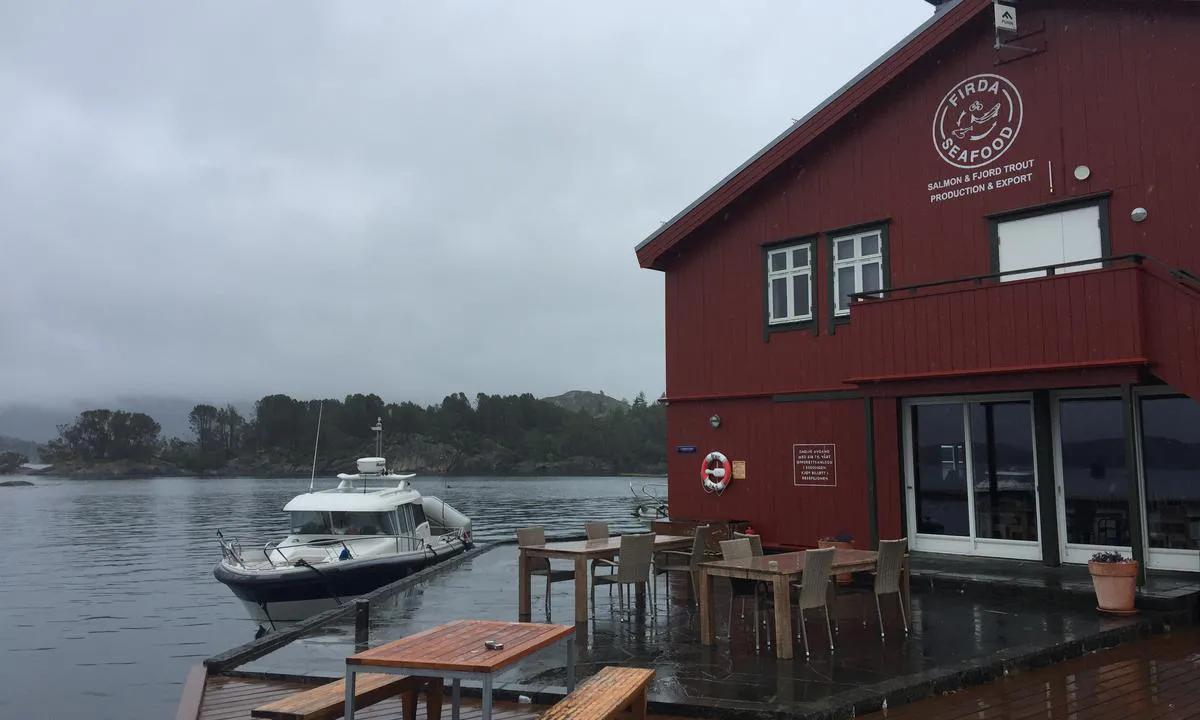
2 x helpful | written on 20. Aug 2022 | updated_on 2. Sep 2024
TESO says:
area
maritime qualities
description
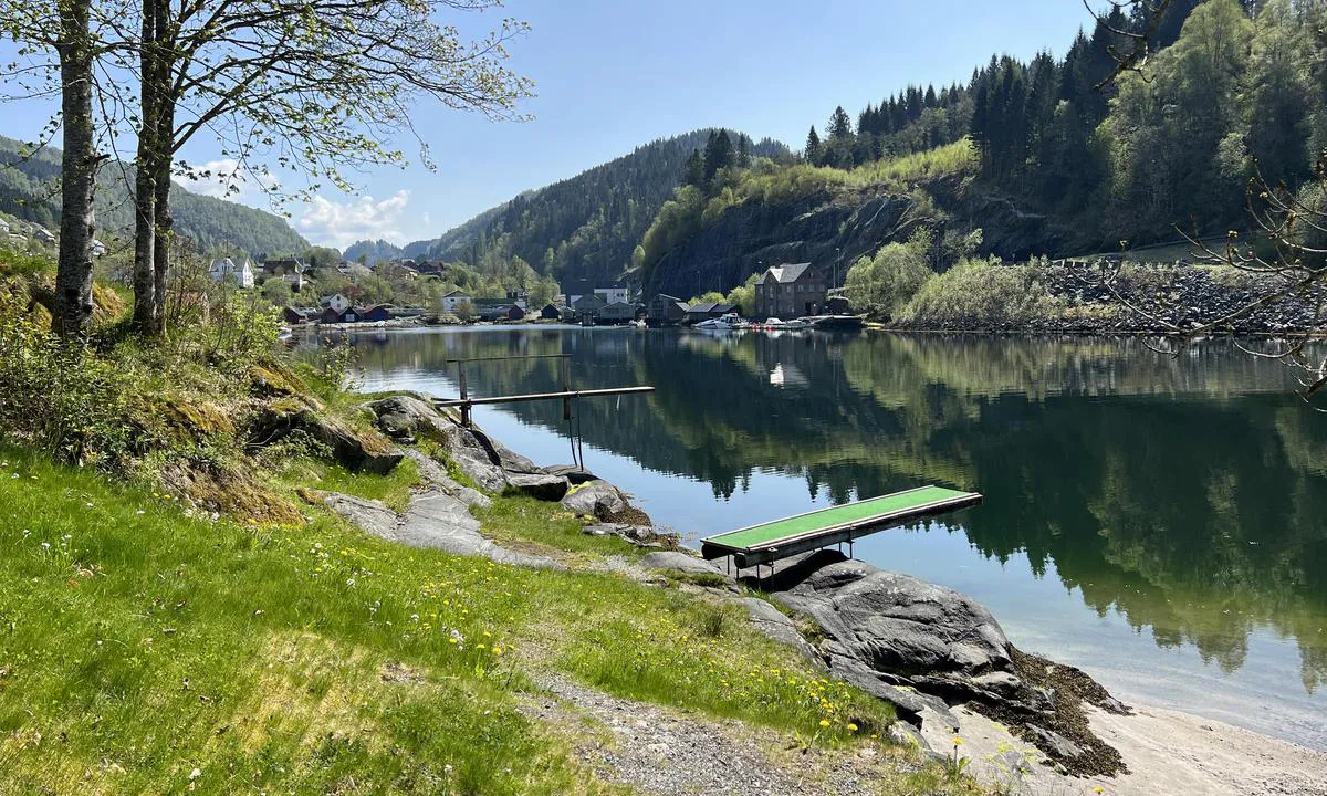
Sheltered harbor. Varying activity on the quay, a short walk to Lindås Center where groceries and various shops can be found. Also close to the Westland Hotel.
Moor at the floating dock.
Follow the map and keep a lookout over Lindåspollene, and exercise caution through Lindåssluse where the current can be very strong.
2 x helpful | written on 13. May 2023
TESO says:
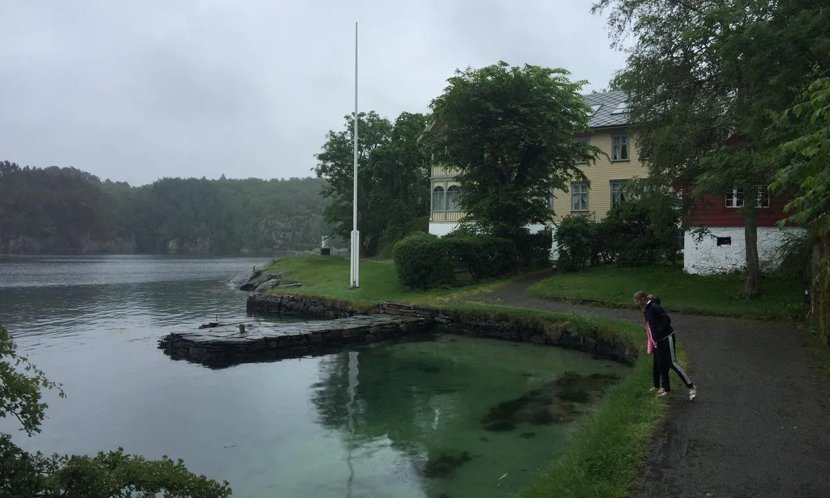
area
maritime qualities
description
Nice and well-protected natural harbour at the westernmost part of Austrheim. One can navigate here via Hjeltefjorden or the inner route from Kjelstraumen if there is wind/sea conditions. The inner route is not suitable for sailboats due to several bridges and overhead wires.
Easy to approach, some shallow areas at/in the entrance, but these are marked on the map and with stakes.
Quay and bolts in the rock. Good holding for anchor in sandy bottom.
Beautiful sandy lagoon at the innermost part of the bay.
A path leads up to the top of the island with a great view over Fedjeosen, Fedje, Holmengrå, and the sea to the west.
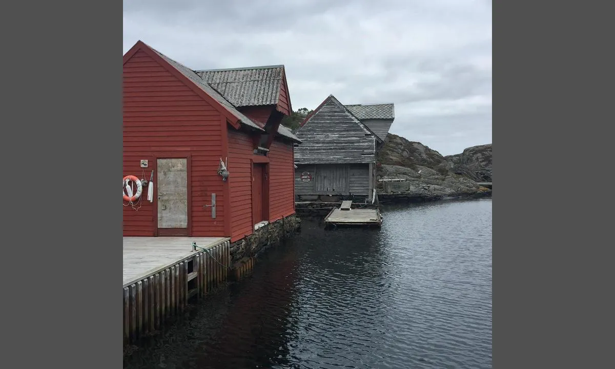
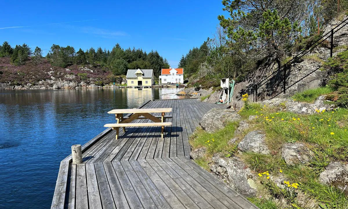
Beautiful boathouse environment at Rongevær (old fishing village).
The island is an outdoor area managed by the Bergen Omland Outdoor Council. Feel free to check their map at https://www.vestkystparken.no
2 x helpful | written on 1. Sep 2022 | updated_on 1. Sep 2022
TESO says:
area
maritime qualities
description
Easy entry from open sea. In case of swell, there may be some backwash from the mountain, which can create choppy seas. Depth is 7-9 meters at the entrance and in the bay, only getting shallower further inside the narrow sound. Be aware that with SW and W winds, there can be rough seas on the outer side. The entrance is exposed to such wind/seas.
The entrance is open with only one shallow area in the bay, which is marked with a stake.
Good holding ground for the anchor. Several jetties in the area are private. Moor with anchor and rope to land, or alongside the boathouses, or possibly swinging 'behind' the islet.
There are no bolts in the rock, but there are some trees where mooring is possible.
There is a beautiful lagoon with a sandy bottom in the neighboring bay which can be reached by dinghy or by mooring on this side of the bay.
Good and safe harbor with beautiful nature. Some older boathouses that 'belong here'. Here you can see sea eagles and owls. Good fishing on the outside. At the innermost part of the sound, there is a road leading into Turøy. You can, among other things, walk to Turøy Varden, which is a well-known sailing mark, or down to the harbor on the east side. It is also possible to follow the road inland towards the main road. Here you can take a bus to the store.
Great area for recreational diving.
2 x helpful | written on 1. Feb 2024 | updated_on 1. Feb 2024
TESO says:
area
maritime qualities
description
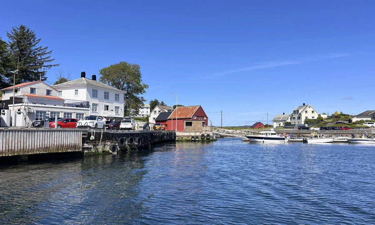
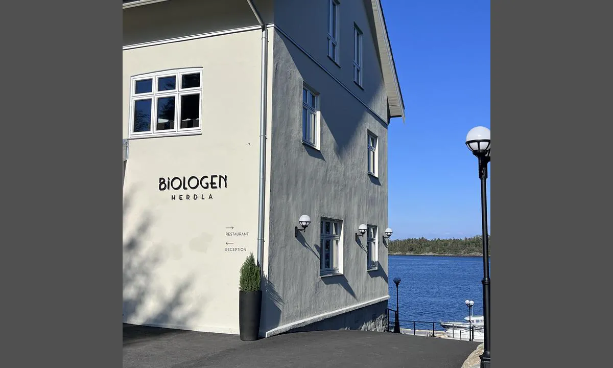
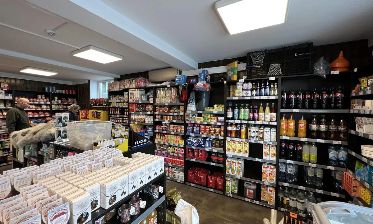
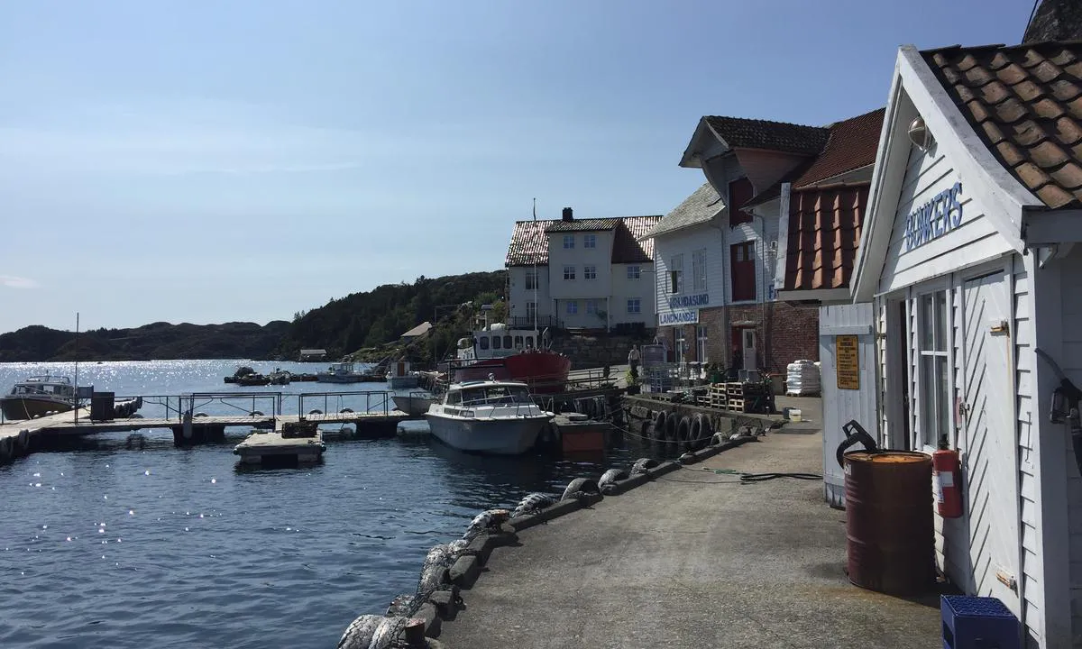
Easy approach. One moors to a solid concrete quay. Slightly high at low tide. It is also possible to moor at the wooden pier in extension of the concrete quay, or possibly at the transverse end if the boat is not too large. Good depths also for sailboats.
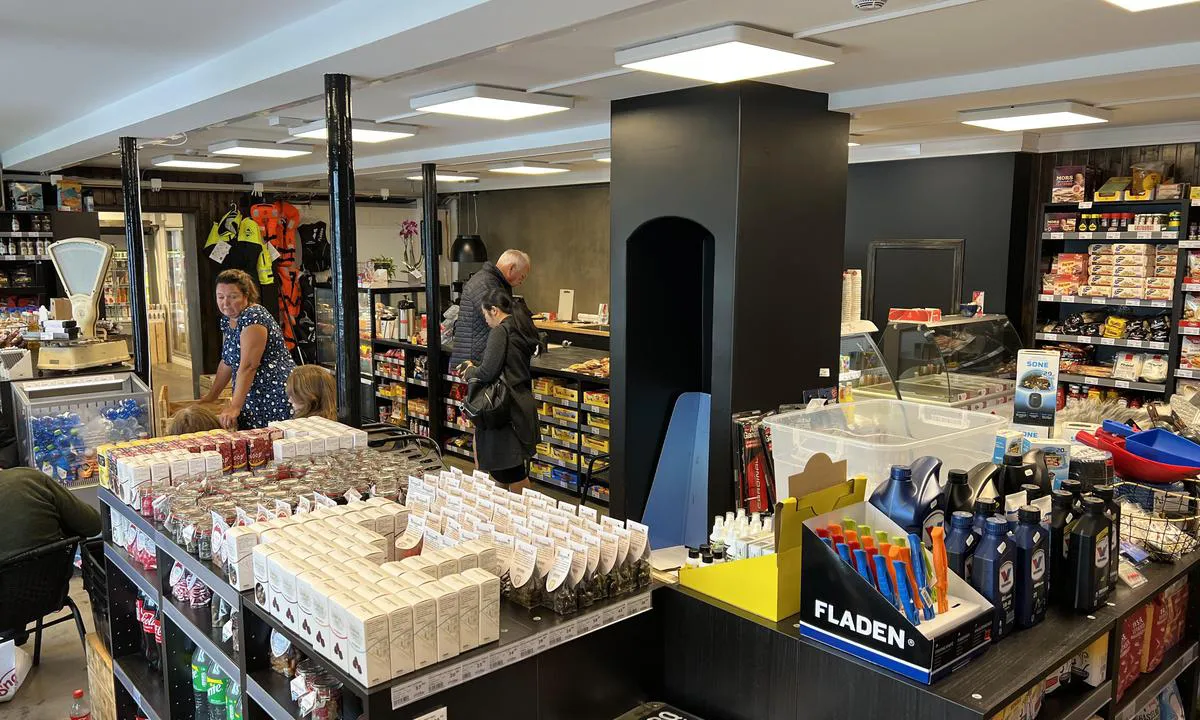
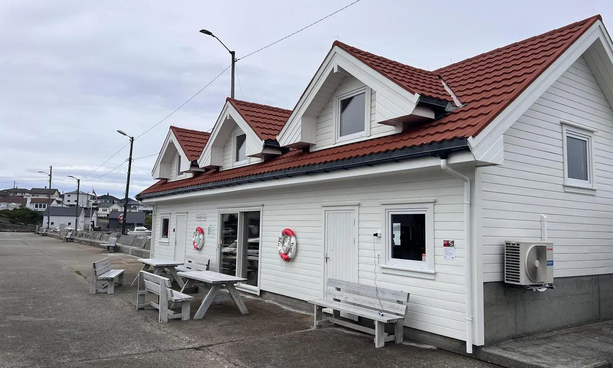
Short walk to Herdla Landhandleri with shop, pub, and fuel. Also short to Biologen Hotel with restaurant. There is also a sandy beach. The hotel has its own floating dock.
Freshwater and tables/benches on the quay.
Trash cans can be found at the RV parking about 100 meters from the quay.
Good harbor sheltered from all winds. Cozy rural environment.
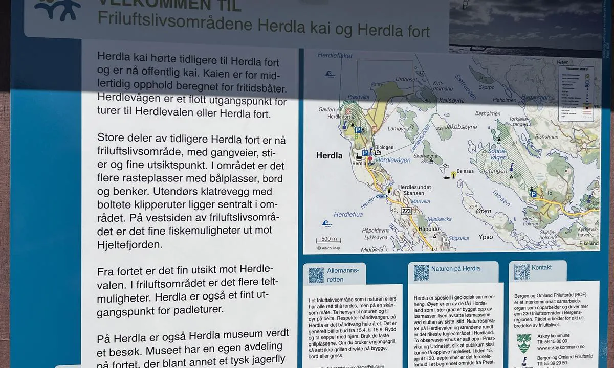
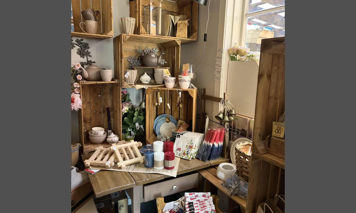
Great for a walk from the quay to Herdla Coastal Fort and the WWII airfield. Many remnants of both Nazis and the Cold War.
Via Ferrata and 'canyoning' are possible through Herdla Active, golf course nearby.
2 x helpful | written on 1. Sep 2024
TESO says:
area
maritime qualities
description
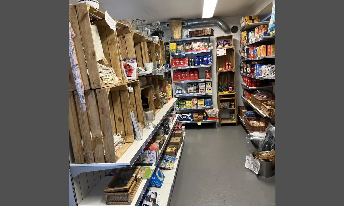
Feste is easily accessible in the well-marked inner channel northwards from Bergen. At Feste, there is petrol, diesel, fresh water, and a self-service grocery store with various additional items. There is also a fast-food kiosk on the quay. It's a nice place to stop for provisions before continuing further north. Two apartments are also available for rent here. See the website for information on opening hours, etc. https://festebrygge.wpengine.com/
Scheduled express boats between Sogn/Bergen pass several times a day. It is slow speed, but waves from passing vessels can cause some disturbances. Use adequate fenders.
There is a long and solid concrete floating dock where you can moor alongside on the outside. It is also possible to moor on the inside where there are approximately 2 boat lengths available. Private berths.
The quay is good but quite high if your boat is not large.
Feste is situated in a cozy rural cultural environment, a short distance from the Lyngheisenteret, which operates a farm in the traditional way. https://muho.no/lyngheisenteret, this is worth a visit. There is a floating dock at the Lyngheisenteret.
There are many cabins in the area and it can be lively at Feste.
2 x helpful | written on 26. Jun 2025 | updated_on 26. Jun 2025
TESO says:
area
maritime qualities
description
Oksen is privately owned. Originally a fish drying facility, after standing idle for many years, there have been attempts at different types of operations. The site is now out of operation. The quay facilities can be used. Good depth, larger fjord boats up to 30-40 meters can dock.
Easy arrival, but be aware that in the straits of Øygarden, tidal currents can be strong.
Beautiful rock formations on the island.
2 x helpful | written on 4. Apr 2024 | updated_on 4. Apr 2024
TESO says:
area
maritime qualities
description
Per Juni 2025 er det pågående rivnings- og bygningsarbeider ved marinaen, samt det bygges ny kai.
Broen Småpudden har 4,5 meter friseilingshøyde. Denne kan åpnes ved å kontakte Bergen Kommune:
"For å åpne Småpudden sender du en e-post til smapudden@bergen.kommune.no eller ringer telefonnummer 55 56 78 15.
Du må bestille broåpning senest 30 minutter før du skal seile gjennom. Det tar cirka 15 minutter fra broen åpnes til den lukkes. Grønt lys på brofoten varsler at båter kan seile gjennom sundet."
+++
Gode betong flytebrygger, dessverre er mye av kapasiteten opptatt av langtidsutleie. Ved fortøyning på innsiden av flytebryggen er det ganske trangt mellom kai og flytebrygge. Noen langside plasser, mest båser.
Området har i utgangspunktet høy kvalitet, men pågående bygningsarbeider kan nok sjenere noe.
Lun og god havn i alle vindretninger. På tross av at dette er midt i byen, er det stille og rolig til forskjell fra Vågen som kan være ganske hektisk.For båter som skal besøke Bergen over flere dager kan dette være ett godt alternativ.
Dagligvare/butikk rett over gangbroen og gangavstand (ca 20 min) til Maritim båtutstyrs butikk på Damsgård. Flytende badstue likeved.
Området har flere kafeer og restauranter og havnen tilbyr ellers alt som en by kan by på stortsett innenfor gang-avstand eventuelt Bybane som kan ta deg til sentrum eller ut til flyplassen.
Det er gangvei rundt store deler av Store Lungårdsvann om man ønsker å gå en tur. Ulriken´s topp er også innenfor rekkevidde for de spreke.
2 x helpful | written on 9. Jun 2025 | updated_on 9. Jun 2025
TESO says:
area
maritime qualities
description
Easy approach from Selbjørnsfjorden. An unmarked shallow area at the entrance, this is marked on the chart.
Beautiful recreational area managed by Austevoll Municipality and Vestkystparken. Originally a small farm and several house ruins remain. There is an outhouse and trash disposal at the parking area.
Nice grasslands suitable for camping or football. Shallow sandy bottom near one of the breakwaters.
More information can be found at: https://vestkystparken.no/tur/vestkystparkelementer/022144
Anchor holding can be poor in the outer parts of the harbor.
2 x helpful | written on 27. May 2025
TESO says:
area
maritime qualities
description
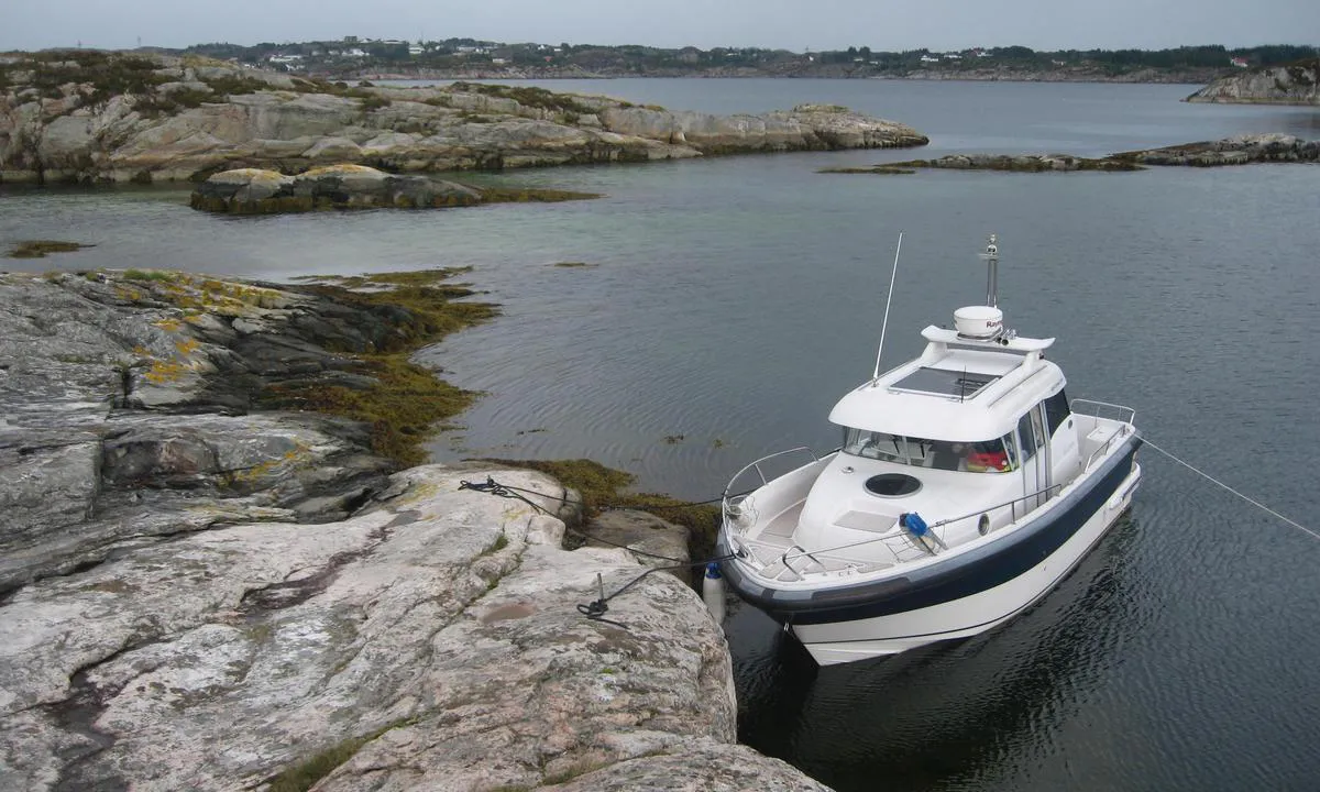
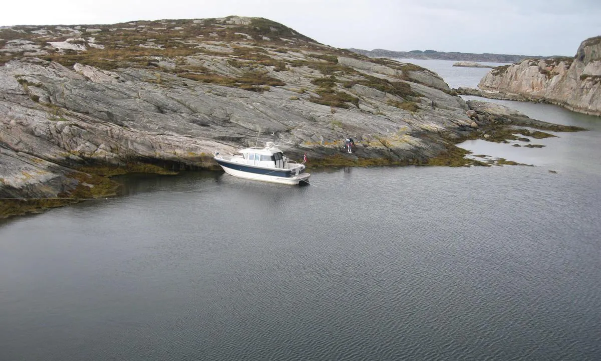
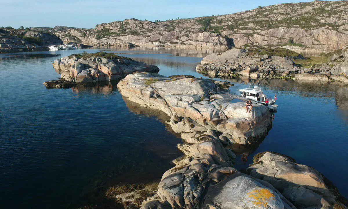
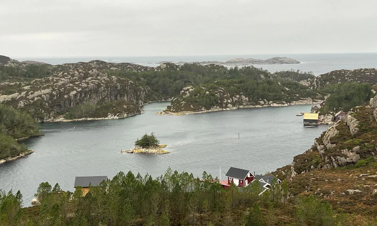
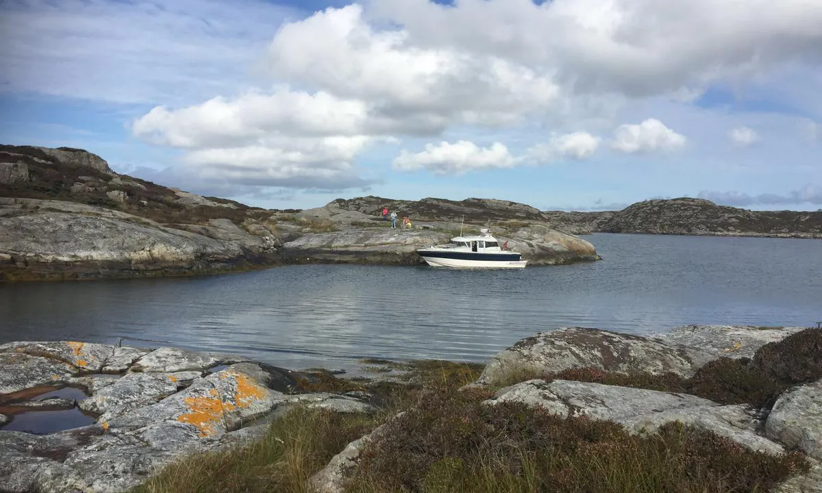
Great natural harbor. Easy approach from the channel in Nyhammersundet.
Mooring by anchor or with a stern anchor towards land. There are no bolts in the rock, so bring your own. There are several places to tie up; in one bay there is also a floating dock where it is possible to moor. This is private and belongs to a farm on the other side of the island.
Some vegetation of heather and pine can attract mosquitoes. Short trip to Eivindvik where it is possible to stock up on provisions, water, gasoline/diesel etc. In Eivindvik, there is also the Millennial Site/Gulating. One of the oldest assembly sites in the country.
2 x helpful | written on 31. Jan 2023
TESO says:
area
maritime qualities
description
Beautiful islets near Nyleia.
Outdoor recreation area BOF/Vestkystparken.no. It is possible to moor alongside in some places, otherwise, you can anchor or use a stern line to shore. Solid bolts in the rocks.
Beautiful smooth rocks and a nice swimming bay with a sandy bottom on the inside of one of the islets. The area has several sheltered coves, but it can be exposed to south and southeast winds. Traffic in Nyleia can also cause some waves, but this is not a problem; however, it should be considered if mooring alongside.
View of Folgefonnen.
2 x helpful | written on 31. Jan 2023
TESO says:
description
Approach and maritime conditions: Beautiful natural harbor located at the outer edge of the sea, west of Byrknesøy. It is exposed to winds from the west; in such cases, bays further inside the straits may provide better shelter.
Approach either from the sea via Grønøysund or from the south via Hjeltøysund. Northern Grønøysund is not navigable due to shallow depth (approx. 1 meter).
On the approach, you are exposed to sea conditions from the open ocean. Access via Hjeltøysund/south requires close attention to the chart as there is so-called paddemark off Byrknes, and it's shallow in the northern part of Hjeltøysund, approx. 1.5-2 meters.
Anchoring: Anchor towards land or possibly on the swing. Some mooring bolts from the fishing fleet. Good depth near land, and good holding for the anchor.
The area: Beautiful rocky outcrops and a nice view of the sea. Here you are in the wilderness, and it is a 'wild' place. Sea eagles in the area and good fishing. Several nearby bays have iridescent green seabeds from shell sand.
Short distance to Byrknes where water, diesel, and provisions are available.
1 x helpful | written on 25. May 2022
TESO says:
area
maritime qualities
description
New concrete floating dock and concrete quay. Approximately three boat lengths on each side of the floating dock. Possible to dock with a small boat at the innermost part of the inlet on the concrete dock.
The quay and floating dock are exposed to wind/waves from SW. We arrived with wind of 12-15 m/s from SW direction, and the floating dock was rocking heavily.
Cozy place with wartime history, including Herdla Airport which was a base for German planes, and numerous other traces from the war days.
Beautiful pebble beach and sandy beach on Herdla. Local providers offer activities such as paddling, windsurfing, canyoning/via ferrata.
1 x helpful | written on 20. Aug 2022
TESO says:
area
maritime qualities
description
Easy arrival and mooring at the floating dock by the General Store. The floating docks have slightly limited capacity. One can anchor with a stern line towards the open area nearby where there are some bolts in the rock.
Hosanger is a very sheltered harbor in all conditions and it gets warm inside the inlet even when it can be cool out on the fjord and along the coast.
1 x helpful | written on 13. May 2023 | updated_on 13. May 2023
TESO says:
area
maritime qualities
description
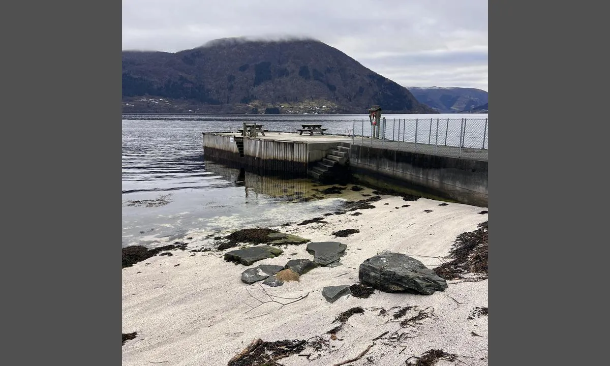
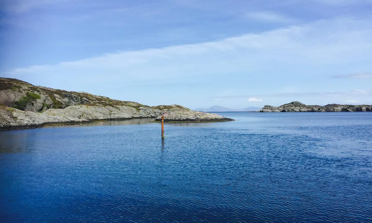
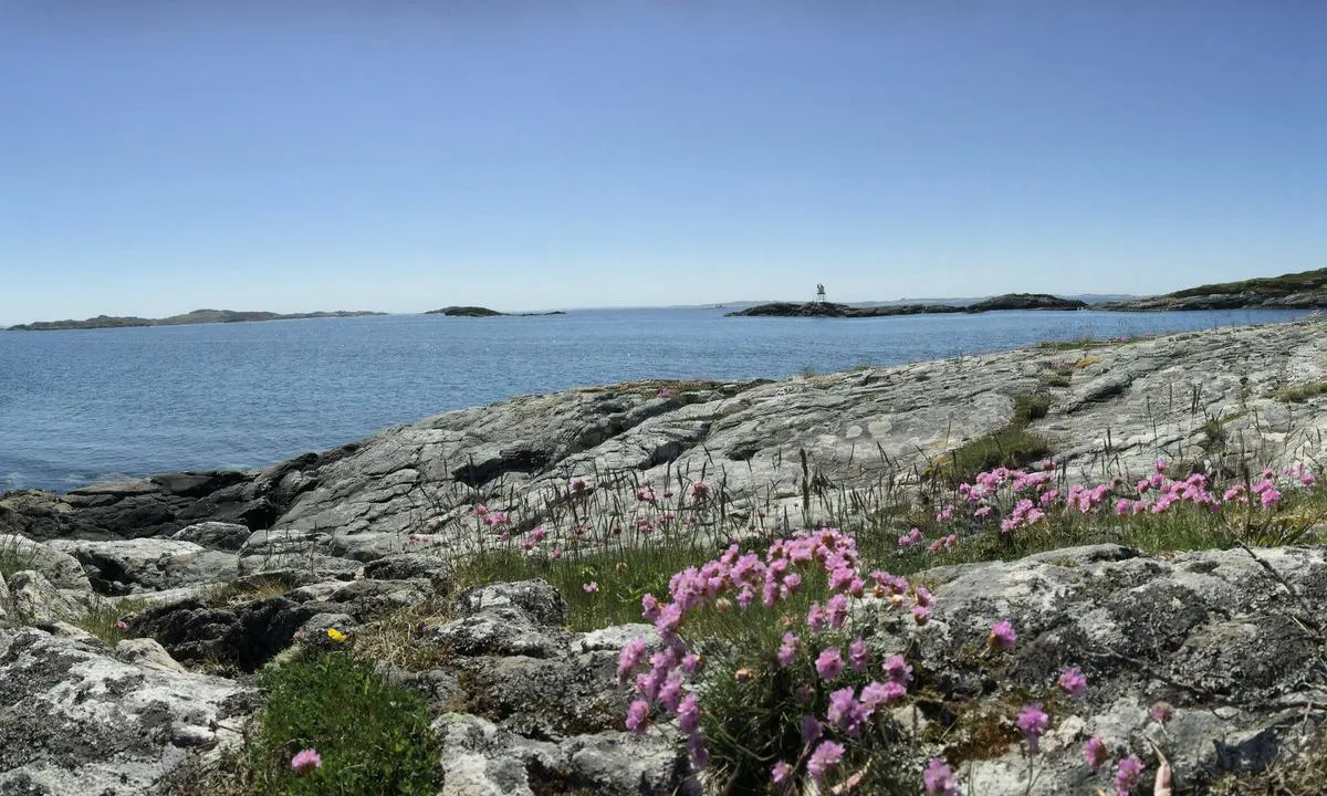
Great natural harbor where you can anchor, dock alongside, or moor with lines to shore. Large, nice, shallow sandy beach. With persistent strong south/southwest winds, there can be some swell in the harbor.
Sandy bottom, bolts in the rock. Equipped with landing piers in several places.
Easy access from the sea, via Viksfjord there are many shallows and reefs. These are marked on the map, but not all are marked in the 'terrain'.
1 x helpful | written on 28. Jul 2023
TESO says:
area
maritime qualities
description
Easy access, but be aware that the area around Svenner is full of shallows and reefs. Most are marked on the map but not in the 'terrain'.
Sandy bottom and bolts in the rock.
Unsuitable for northern winds. With persistent strong winds, there can be some swell.
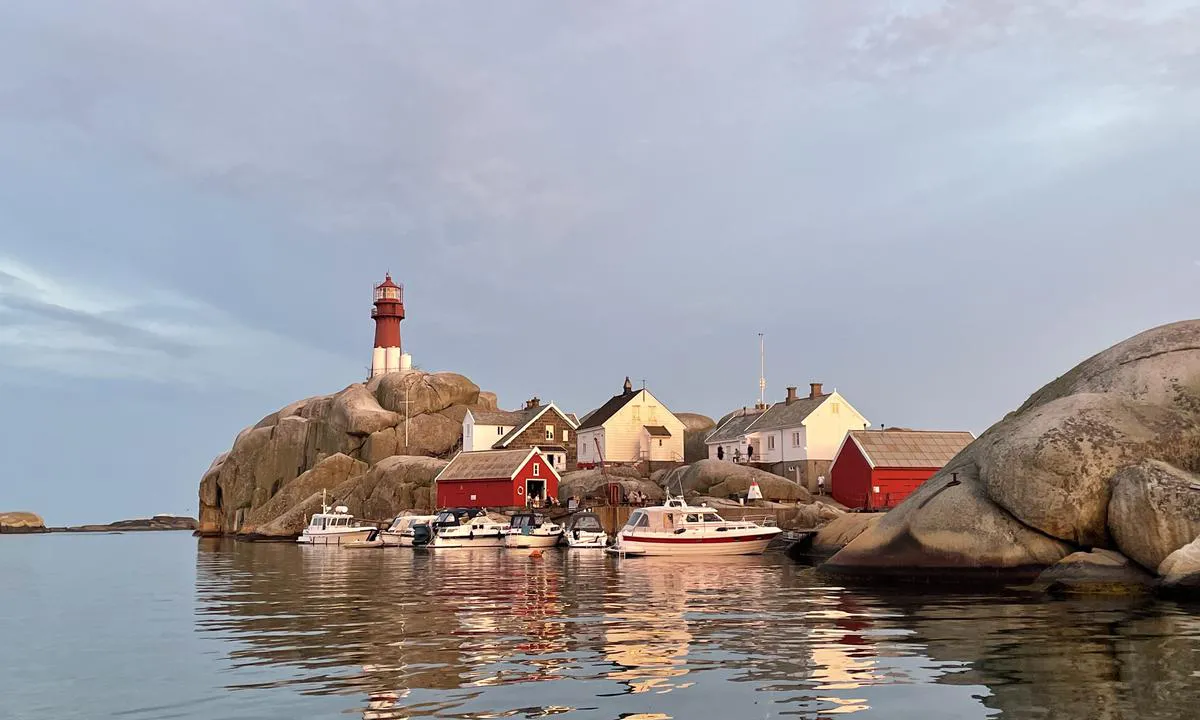
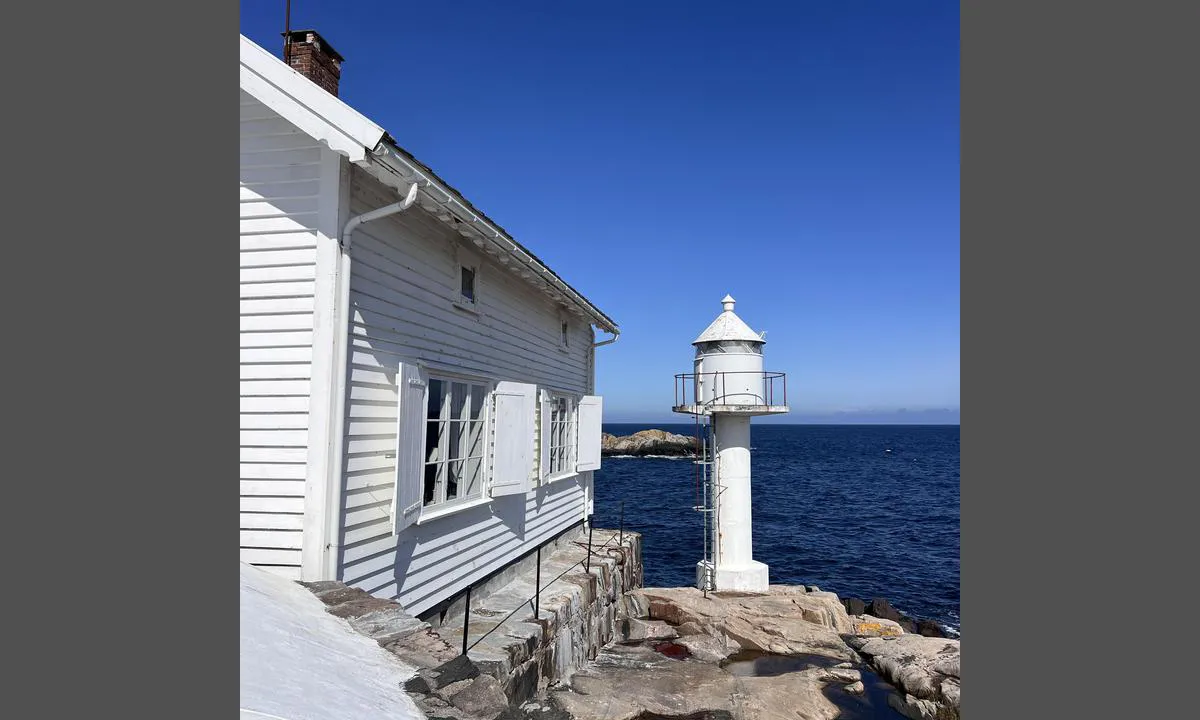
Beautiful lagoon with a child-friendly sandy beach. Footpath to Svenner lighthouse and the lighthouse harbor.
1 x helpful | written on 29. Jul 2023
TESO says:
area
maritime qualities
description
Narrow and shallow entrance. There should be a lookout at the bow. 90 degree turn to port as the bay opens up, there is also a rock on the port side to be aware of. Depth around 1.2 meters, so it is only suitable for smaller boats. Unsuitable for sailboats.
1 x helpful | written on 31. Jan 2024
TESO says:
area
maritime qualities
description
Great natural harbor best suited for slightly smaller boats, due to conditions in the approach. Depth approximately 1.2/1.3 meters. Recommend a lookout at the bow. Sharp 90-degree turn as the bay opens up.
Beautiful smooth rocks and a small hill with wide views to the sea and over the archipelago. Sailboats can potentially anchor outside the approach.
There are some "private" bolts in the cliffs; bringing your own is also recommended. The harbor is sheltered from most winds, but out here at the edge by the sea, there is some drift even on calm days. Also, remember that in windy conditions, it can be difficult to get out through the narrow and shallow approach.
1 x helpful | written on 31. Jan 2024
TESO says:
area
maritime qualities
description
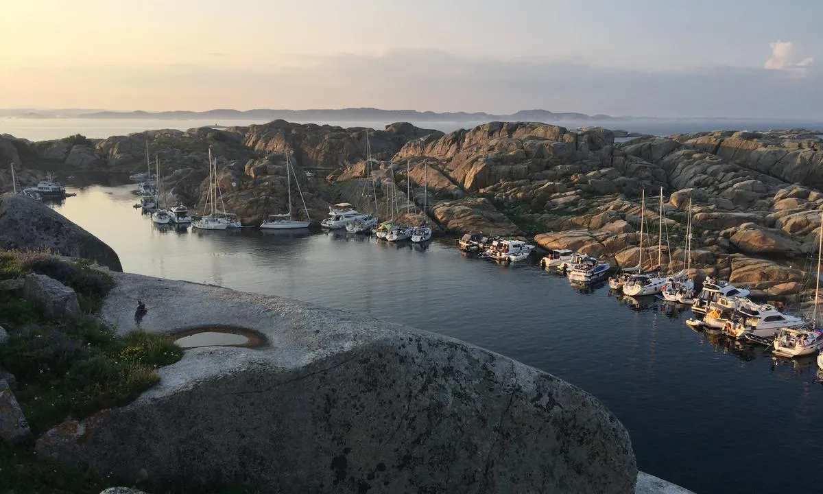
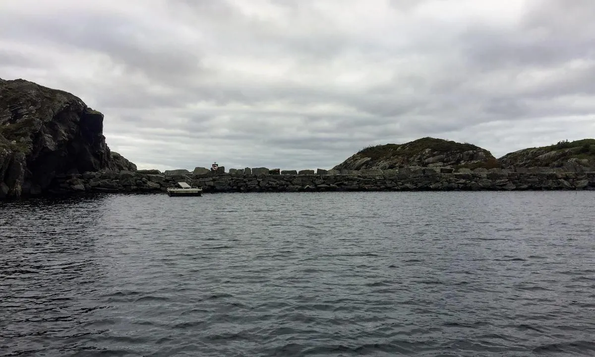
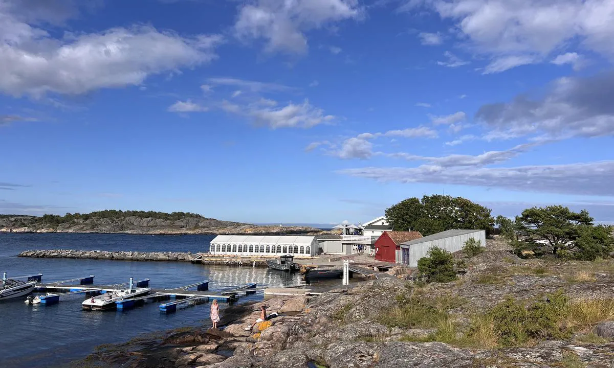
Great harbour at the outermost point in the seascape at the southern entrance to Risør. The harbour itself is well protected from most winds except from the northeast. The harbour is partially sheltered by a breakwater, so despite its location right by the sea and traffic in the fjord, it remains calm in the harbour.
Good mooring in berths by good floating docks. There are power pillars on the docks, but it is uncertain if there is power in them. There are no 'typical' facilities here, but there is a restroom for guests of the restaurants.
Harbour fees are paid via Vipps.
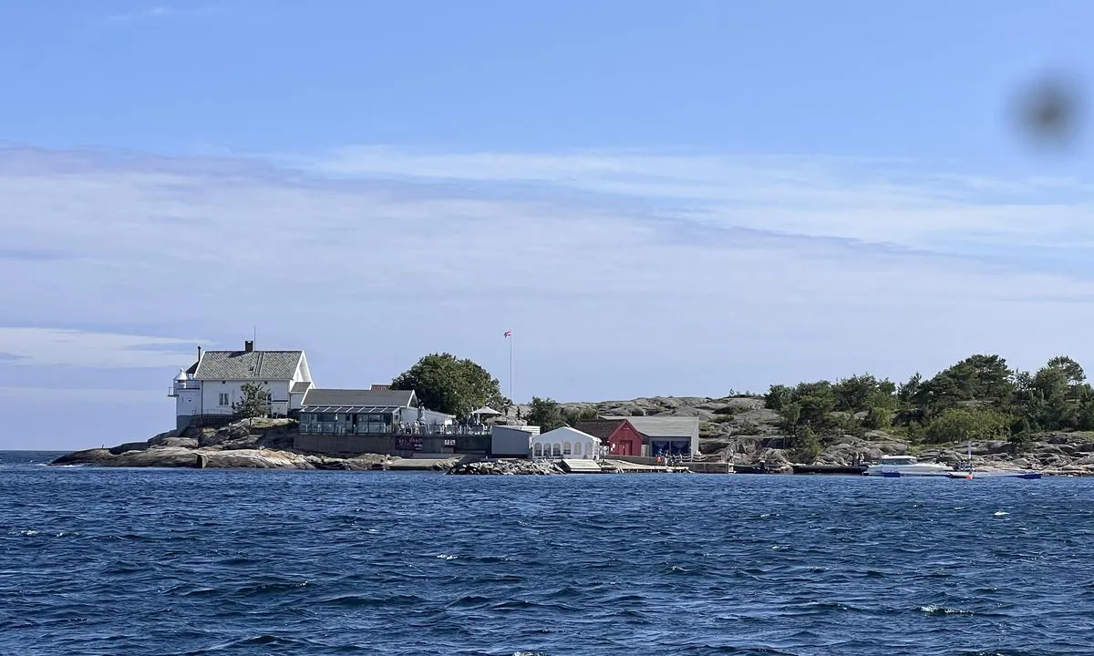
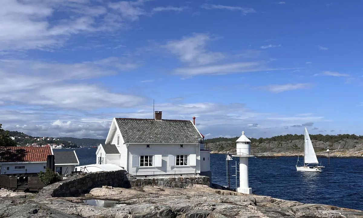
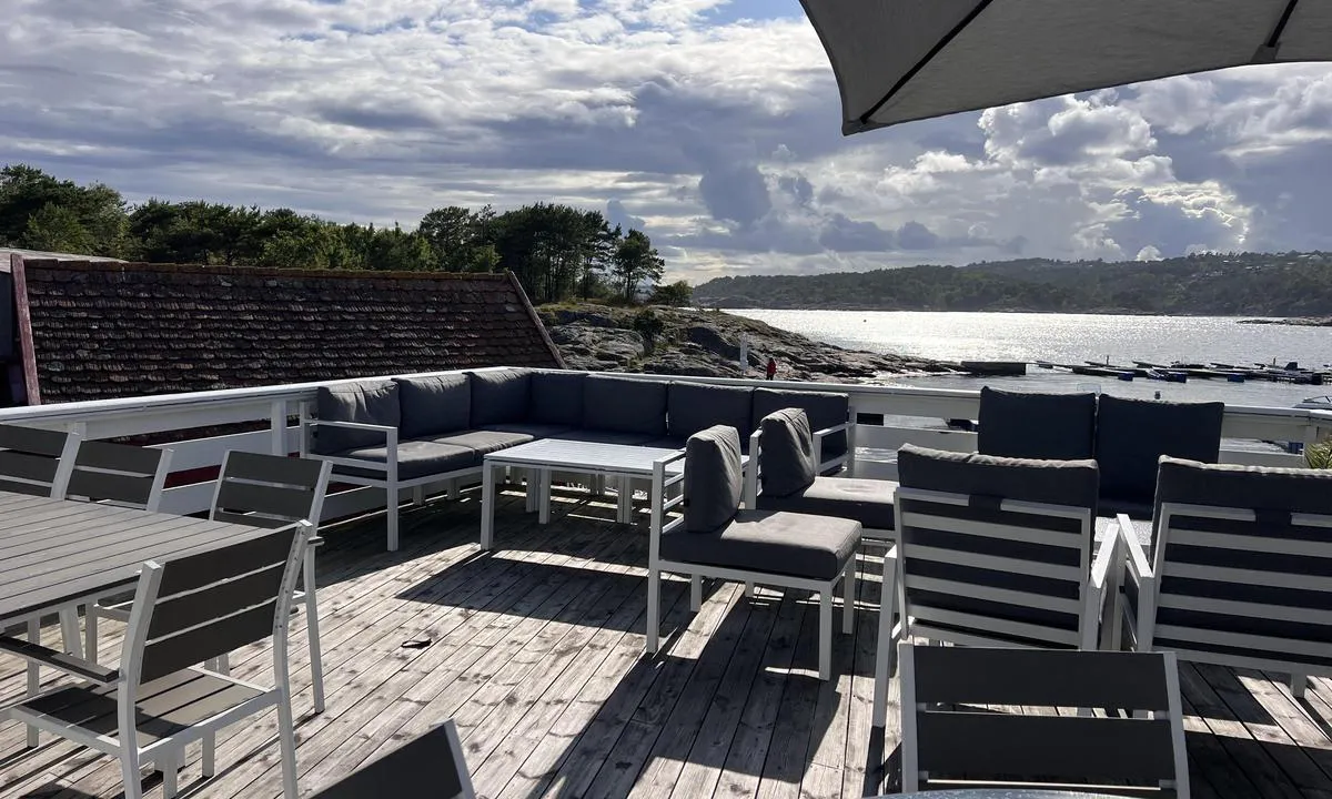
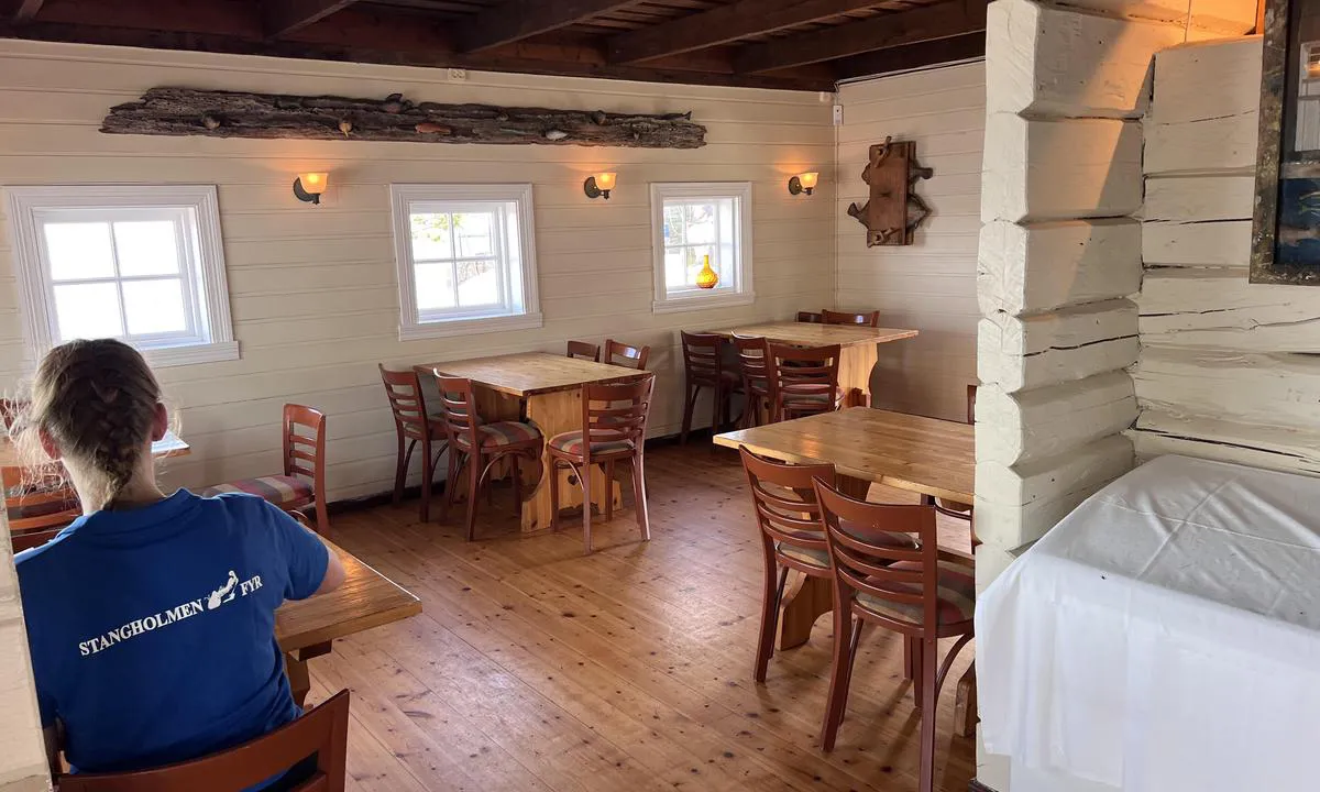
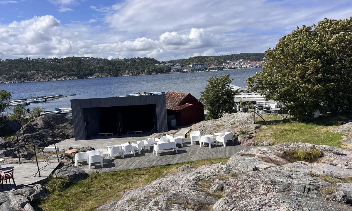
Stangholmen Lighthouse is operated by Risør Hotel. The place is very nice, the lighthouse houses a tavern, pub, a fine dining restaurant, and there is an ice cream kiosk on the quay. There is also a stage where concerts are held. Several sheltered terraces for restaurant guests.
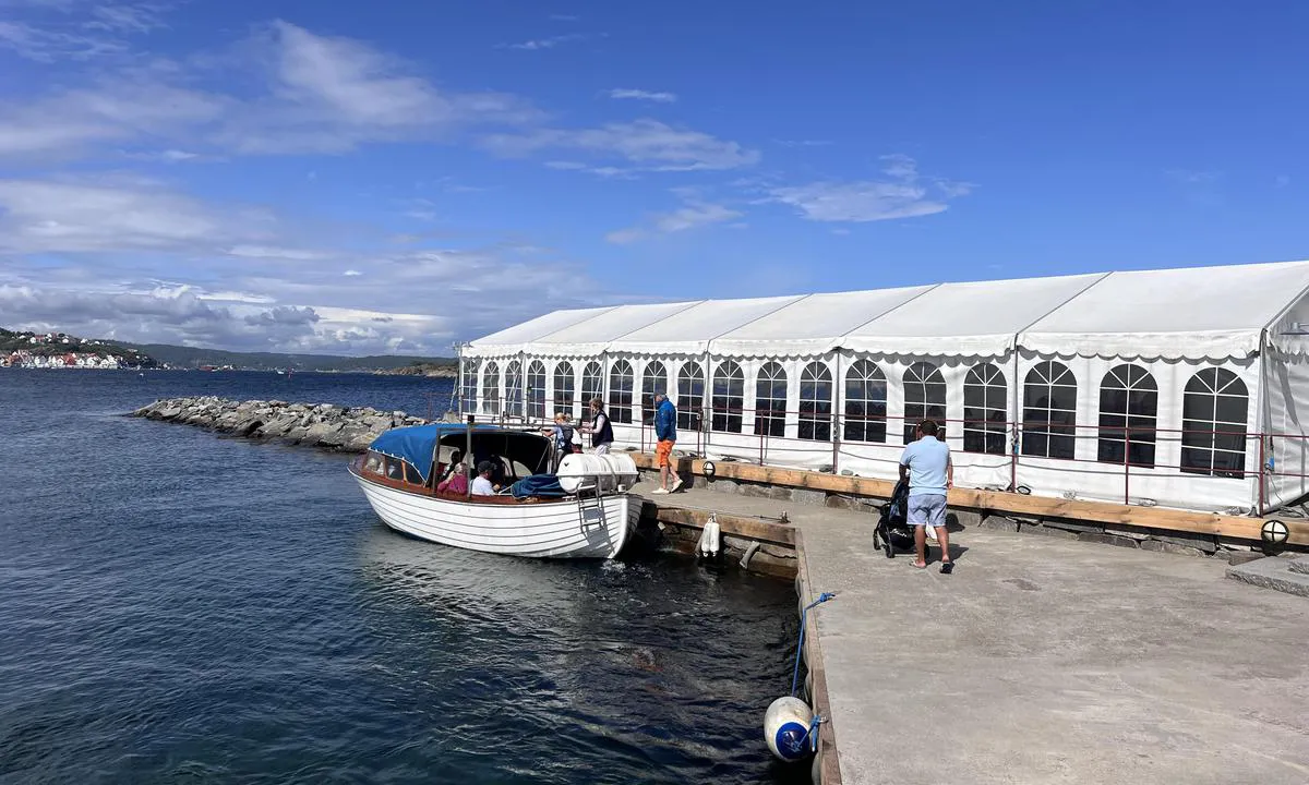
A small boat runs between Risør and Stangholmen.
The menu for the Tavern and the restaurant can be found at https://www.stangholmen.no/
1 x helpful | written on 7. Jul 2025 | updated_on 7. Jul 2025
TESO says:
area
maritime qualities
description
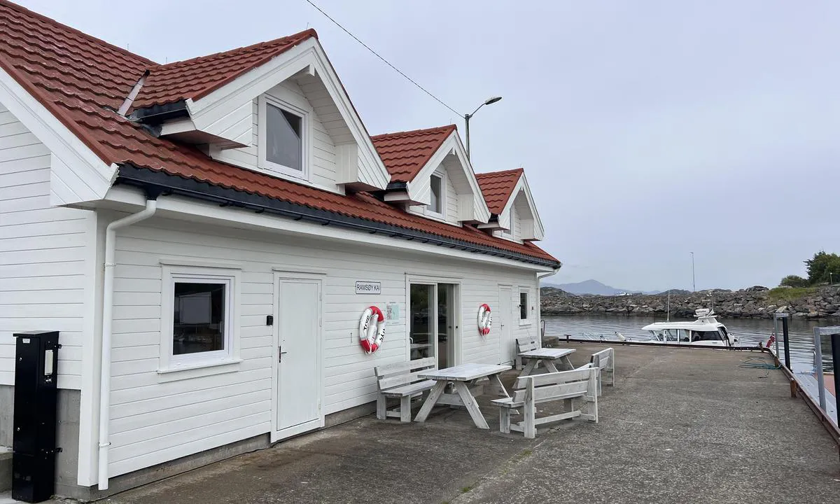
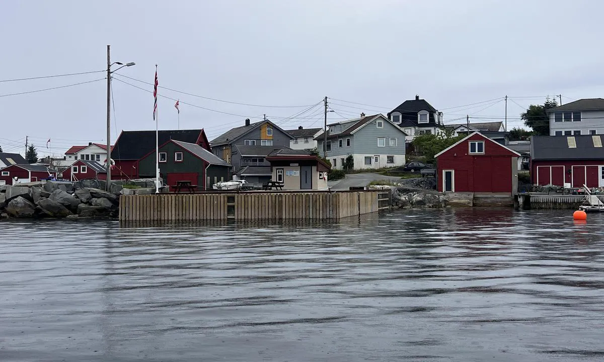
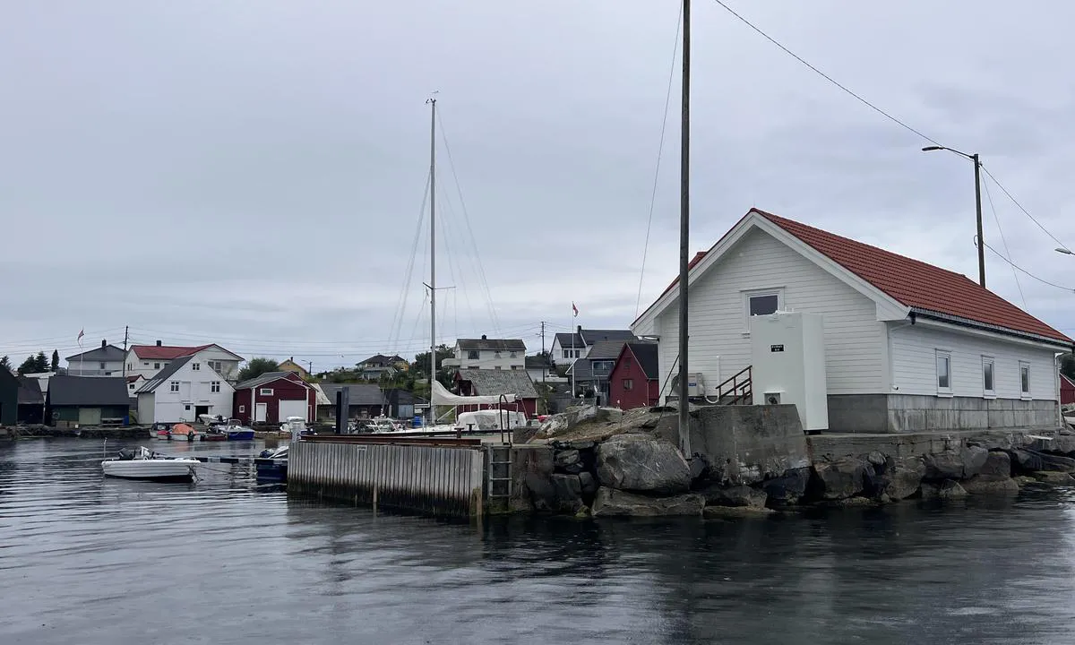
Cozy and sheltered harbor on an island connected to the mainland. A small community resides out here. Mooring to a concrete quay with a wooden front. Solid bollards. No fendering.
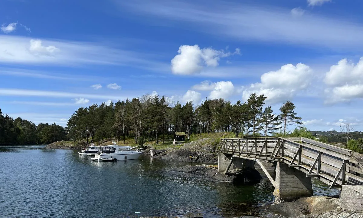
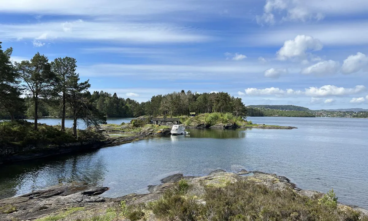
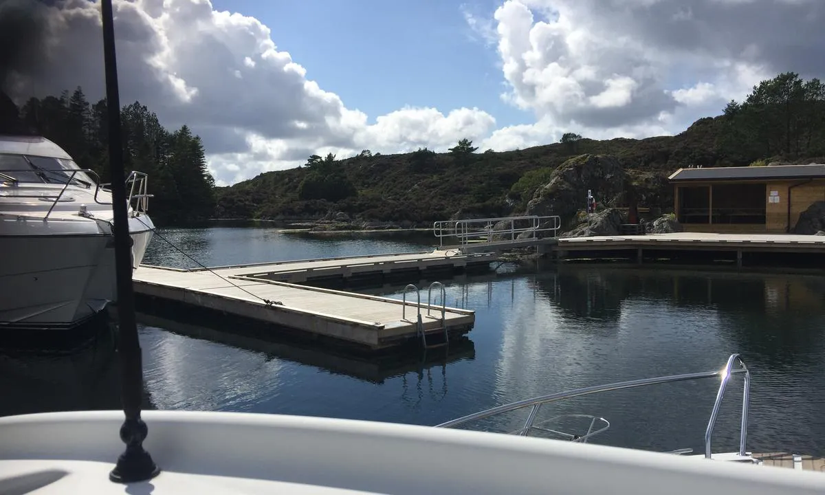
The harbor is well-placed in the main north/south route, but is well protected from winds in all directions. Hjeltefjorden is long and can have rough seas. Ramsøyhavn is sheltered on the eastern side of the island.
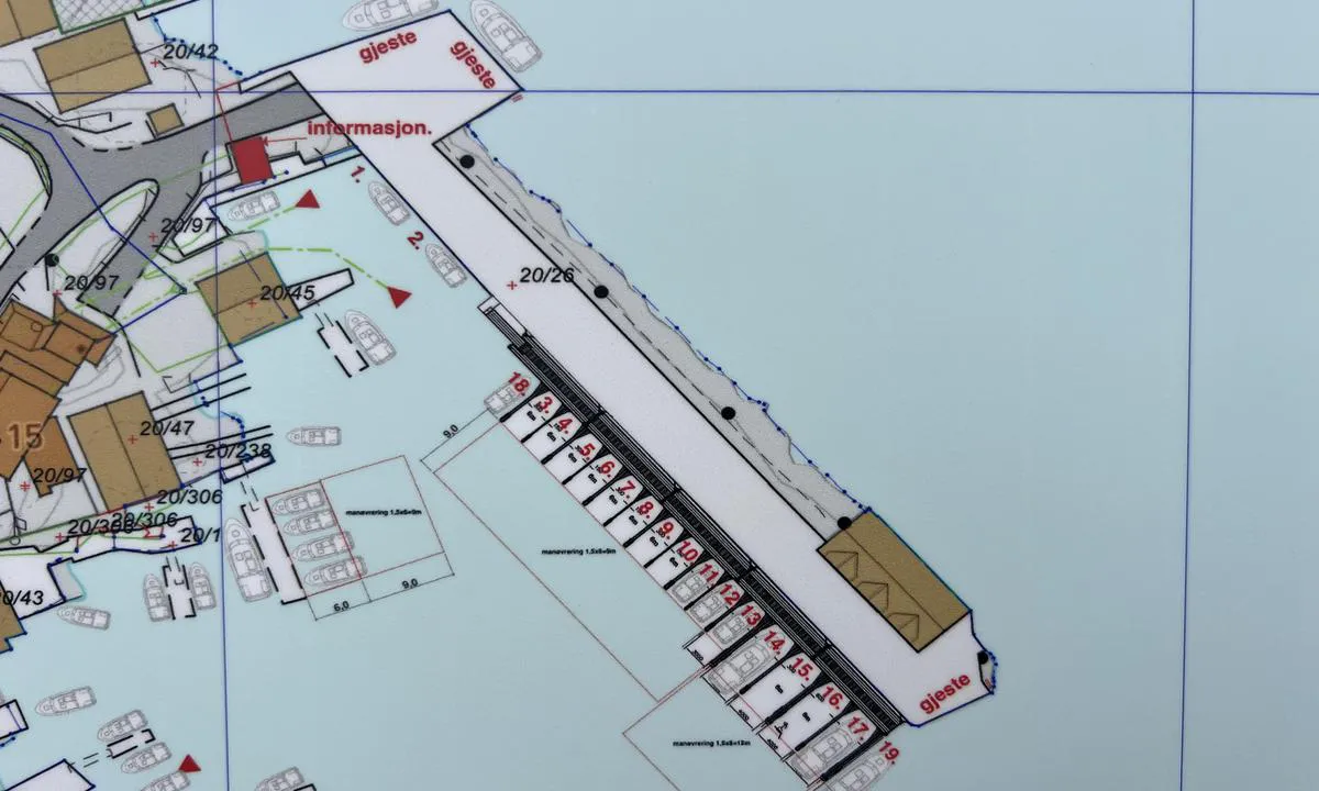
There are three piers that are guest docks (see image/map). All have good depth (5m+).
Easy arrival from Hjeltefjorden. For motorboats, it is also possible to navigate through Hanøysund, which is a beautiful passage with islets and straits.
From Ramsøy, you can take a walk over the breakwaters and bridge towards Askøy. There is also a bus connection to Kleppestø. From Kleppestø, there is a fast boat to Bergen city center. There are no stores on Ramsøy.
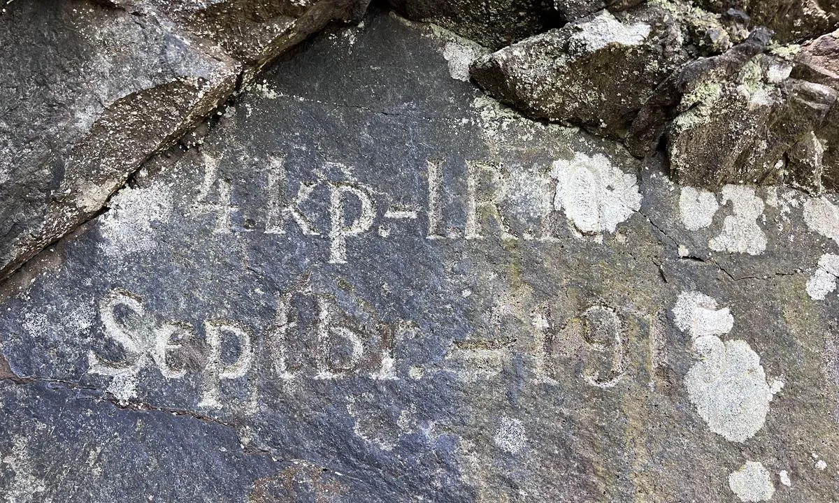
The wreck of the SS Spring, which collided in Hjeltefjorden on January 16, 1914, lies at the bay on the southern side near the bus roundabout. The wreck is situated from 8-40 meters below sea level. The wreck is not visible above water.
1 x helpful | written on 14. Jul 2024
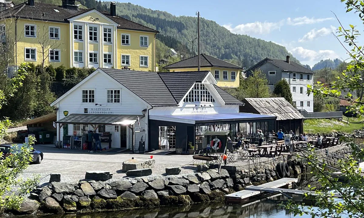
TESO says:
description
Navigation and Maritime Conditions: Easy entrance
Berthing: Alongside pontoon or alongside possibly with anchor towards quay. Depth about 5-10 meters.
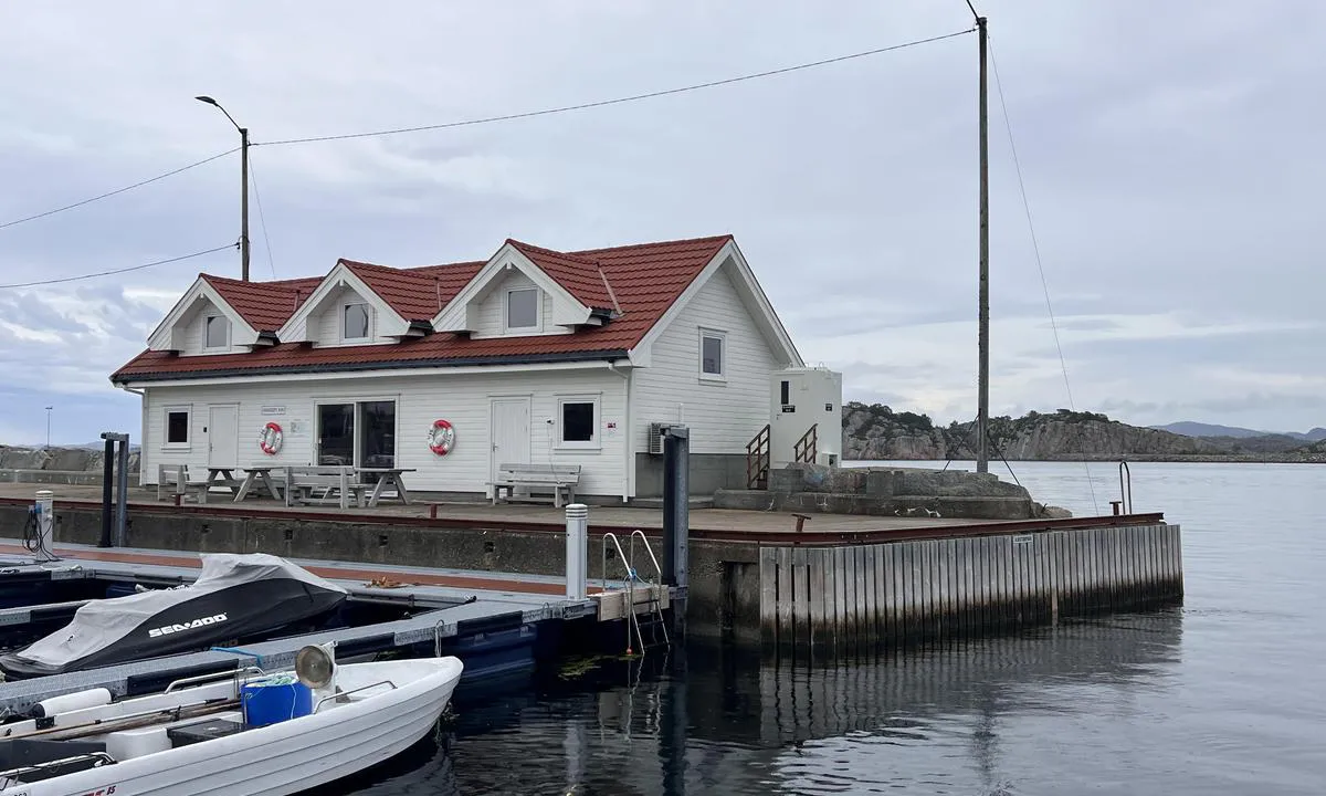
Express boat Bergen-Sogn stops/passes. This creates some waves, but you are moored behind heavy concrete piers which dampen this somewhat. Exposed to winds from the north, but if you moor at the innermost part near the general store, it is still sheltered.
Area: Pleasant guest harbor with restaurant/pub.
The statue of King Olav is placed here. There is also an amphitheater for concerts/festivals. Information center about salmon farming and a small museum.
Beautiful, venerable trading post worth one or more visits. Utkant festival is held in July.
You can take a walk along the road inward.
1 x helpful | written on 8. Jun 2022
TESO says:
area
maritime qualities
description
Aerial cable with a clearance of 6 meters in the outer part of the bay. There are no mooring bollards or quays in the area. In the outer part of the bay, there are some cottages and private docks.
Only suitable for boats lower than 6 meters, other areas in the vicinity are more suitable. Road access nearby the inner part of the bay.
1 x helpful | written on 2. Sep 2024
TESO says:
area
maritime qualities
description
Mooring at the municipal pier, right by Øksnes Marina. Mooring is possible on both sides of the pier. On the east side of the pier, there is good depth also for sailboats, the west side is shallow all the way in.
Short walk to Øksnes recreational area where there is a shallow bathing lagoon, timber-framed shelter, tent sites, grill, and tables/benches. There are also hiking trails here.
https://vestkystparken.no/tur/vestkystparkelementer/022228
1 x helpful | written on 2. Sep 2024 | updated_on 2. Sep 2024
TESO says:
area
maritime qualities
description
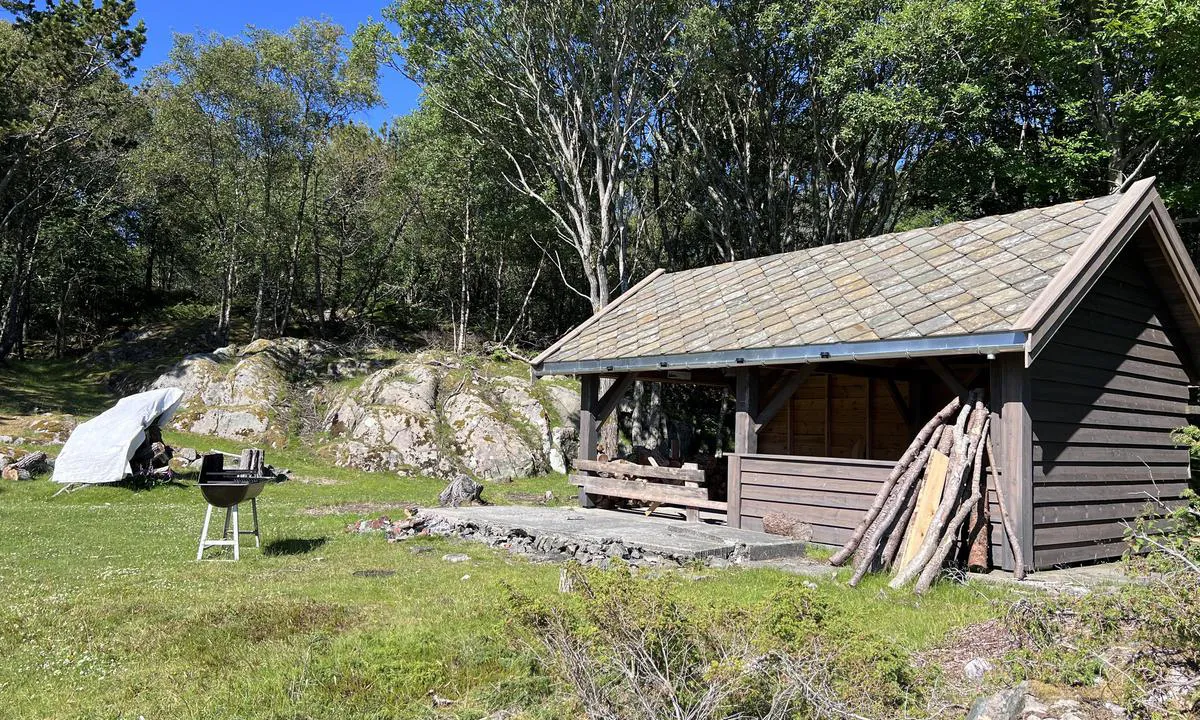
Wild area without any "infrastructure". Mooring by anchoring or against the rocks. Mooring bolts only in some places, so own bolts must be expected. Great swimming bay in the northeastern part of the area. Fireplace and tables/benches in the swimming bay.
Free area: https://vestkystparken.no/tur/vestkystparkelementer/022131
1 x helpful | written on 2. Sep 2024 | updated_on 2. Sep 2024
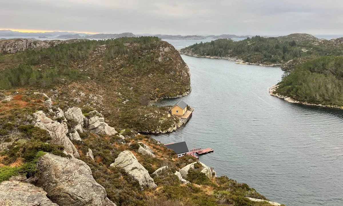
TESO says:
area
maritime qualities
description
Great natural harbor at the far west of the sea. It is accessible from the north via an inner lead on the west side, or from the south directly from the sea. From the north, there are some bridges to pass under, the lowest being 10 meters. The inner lead also has some unmarked shallow areas.
The harbor is well-equipped with good mooring options, both for anchoring and for the floating dock. The quay is mainly for disembarking.
BOF/Kystled offers houses for rent on the west side, which provide a great view and also a nice shallow swimming bay.
Despite its location at the outermost part of the sea, Hissøy is a harbor where one can be safely moored. Southern winds may blow over the breakwater, but you will still be well sheltered here. The harbor is not exposed to waves or swell.
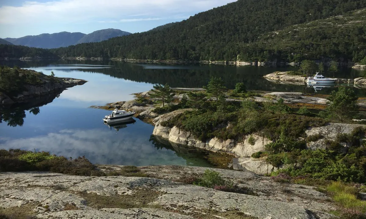
1 x helpful | written on 9. Apr 2024 | updated_on 10. Apr 2024
TESO says:
description
Approach and maritime conditions: The Marble Islands are located in the middle of Nordåsvannet, accessible via the current at Straume from Dolviken/Grimstadfjorden.
In the current, the water speeds up to 5-6 knots depending on the tide. Otherwise easily accessible without significant obstacles.
Due to the Straumebro bridge, this place is not suitable for sailboats.
Anchorage: Mooring is primarily done with an anchor towards the shore, but smaller boats (under 26 feet) can dock at the floating pier, though it is only suitable for shorter stays.
Bolts in the rock are found in several places, mainly in the area around the bridges.
The area: Recreational area managed by BOF.
Nice swimming bays, rocky outcrops, grassy meadows, shelters, diving boards, footbridges, and good paths in the forest.
An interesting island as there were marble quarries in older times that, among other things, supplied marble to Christianborg Palace in Copenhagen.
The island also has a beech forest.
1 x helpful | written on 23. May 2022
TESO says:
area
maritime qualities
description
Great natural harbour at the outermost part of the coastline. It is easy to navigate in here, but outside there can be rather large waves from the sea. However, it is possible to arrive via the more protected inner route/Nyleia.
Austrevågen is protected from the sea's swell. It is a sheltered and well-protected harbour. The area is partially a recreational area, see https://vestkystparken.no/tur/vestkystparkelementer/022224 for comprehensive information. There is a small floating dock suitable for smaller boats, as well as mooring bolts in some places. It is possible to anchor, with a stern line to the shore or at the floating dock.
There is a sandy bottom in large parts of the bay and good holding for anchors.
There is a beautiful sandy bottom at the innermost part of the bay. On land, there are some simple paths where you can go for a walk. There is a coastal cabin that can be rented, more info at vestkystparken.no.
It is a short distance to Bakkasund where there is a grocery store, fresh water, and fuel.
1 x helpful | written on 15. Sep 2025 | updated_on 15. Sep 2025
TESO says:
area
maritime qualities
description
Beautiful sandy lagoon where one can moor with an anchor towards a wooden pier. The floating pier is for launching kayaks.
Recreational area, see more info at https://vestkystparken.no/tur/vestkystparkelementer/022161
Concrete quay on the outer side of the islet which is for larger boats.
Possible to anchor at the outer end of the bay. The lagoon is somewhat shallow, and there is an overhead power line passing over the innermost part.
Great swimming spot at the innermost part of the cove.
1 x helpful | written on 15. Sep 2025 | updated_on 15. Sep 2025
TESO says:
area
maritime qualities
description
Beautiful archipelago just outside Nevlunghavn. Grass-covered and partially smooth-surfaced islets.
There are many good mooring opportunities (for motorboats) among the numerous islands. For sailboats, it is shallow between the islets. Mooring with anchor towards the land, there is also a landing pier. In some places, alongside mooring is possible.
There is an outhouse on the island. There are also two small beaches.
Good protection against wind/waves on the inside.
1 x helpful | written on 6. Aug 2022 | updated_on 6. Aug 2022
TESO says:
area
maritime qualities
description
Beautiful natural harbor towards the open sea. Especially suitable in calm weather or winds from the north/east direction. There are several options in the harbor, but particularly the lagoon towards the northeast is nice. Here there is a beautiful sandy bottom and a small beach. There are some bolts in the rock. Moor with an anchor towards land; it is also possible to lie alongside in a couple of places.
Upon entering the lagoon, there is a ridge extending out on the starboard side at the entrance. This is marked on the chart, but not with a beacon. Keep well to port when entering and preferably have a lookout.
There is good holding for the anchor in the sandy bottom. Beautiful rock slabs on land and if you go up to the top of the island, you can see all the way to Shetland...
This is a fair-weather harbor and you should check the weather forecast before staying overnight. The islands are situated towards the open sea and the waters can become rough. With south/southwest wind, it will blow directly into the harbor and swells can occur.
There are some shoals in the area and it is necessary to have a good lookout and keep an eye on the chart.
1 x helpful | written on 25. Sep 2025
TESO says:
area
maritime qualities
description
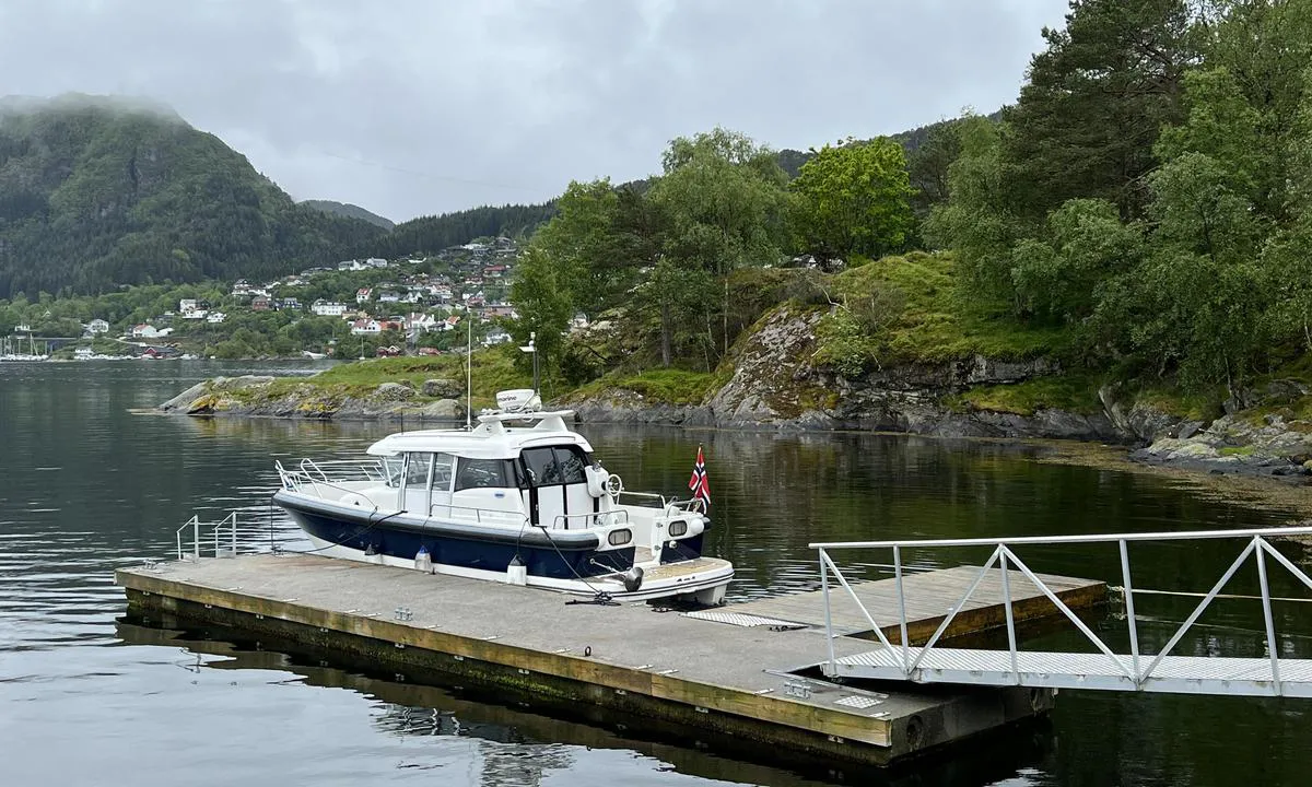
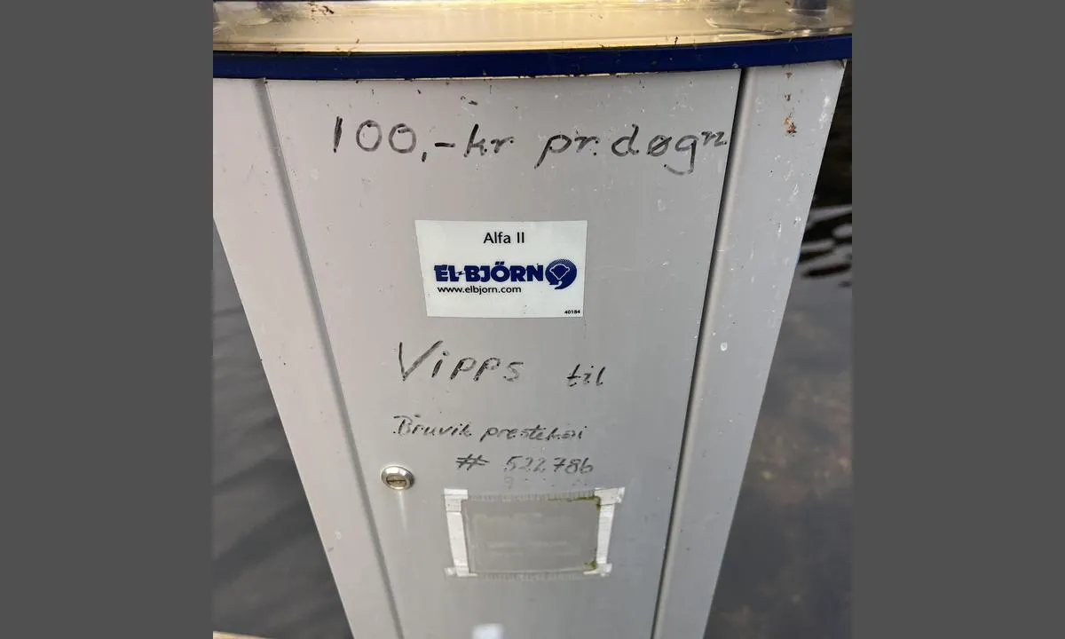
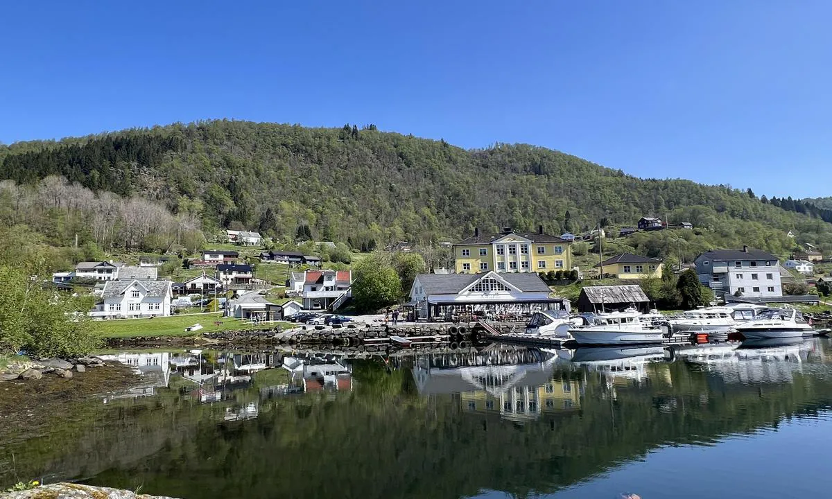
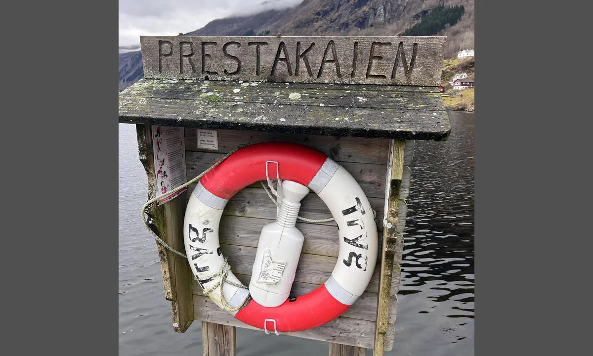
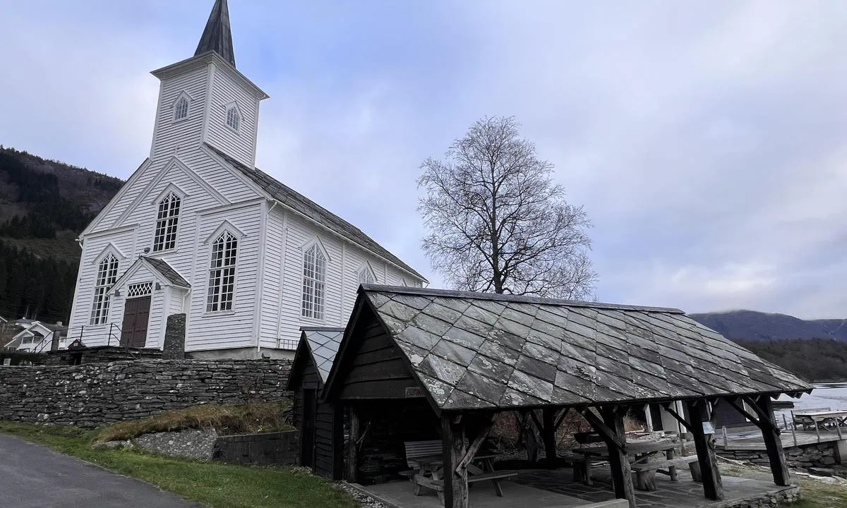
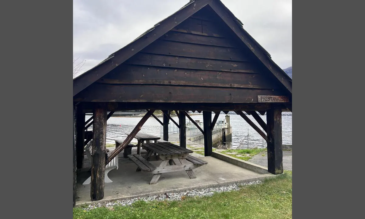
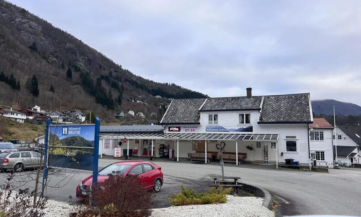
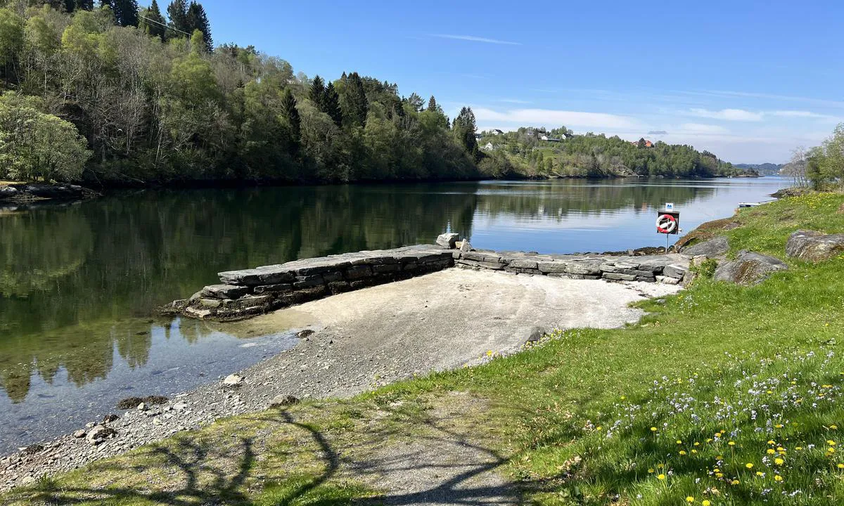
Fortøyning til god trekai ‘Prestekaien’. Gode pullerter og stiger i kaifront. Innsiden av kaien er mest i le men forbeholdt av/påstigning. Flott badestrand rett ved. Grindbygg med bord, benker og grill på land. God plass på kaien. Kort til Bruvik Snarkjøp (7-24). Lekeplass for barn på vei til butikken.
Gode dybder også for seilbåt.
Fra Bruvik er det mulig å gå 822 høydemeter opp på Brøknipa/Bruviknipa. Følg veien eventuelt stien opp ved kirken, deretter ca 4 km opp bak Bruvik, oppe i passet tar man av til venstre ved stor parkeringsplass og følger god sti til toppen hvor det er flott rundskue over Sørfjorden.
Litt lengre ute ligger Osterøy Museum som driver gårdtun på gamlemåten. Dette er ett flott sted å besøke, som viser hvordan man daglig livet var i gamledager: https://muho.no/osteroymuseum
1 x helpful | written on 9. Nov 2024 | updated_on 26. Jun 2025
TESO says:
area
maritime qualities
description
Great cove/inlet with many anchoring/mooring options. There are no bolts in the rock, so you need to bring your own. Mooring on a swivel or stern-to with anchor towards the rock. Longside mooring is possible in some areas.
Easy to navigate in, generally good depths. By the islands/straits just north of the inlet, there are some unmarked shallows, but these are marked on the chart.
There are several beautiful spots by the islands in the approach.
1 x helpful | written on 31. Jan 2023
TESO says:
area
maritime qualities
description
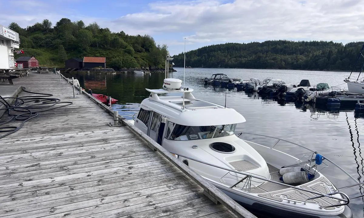
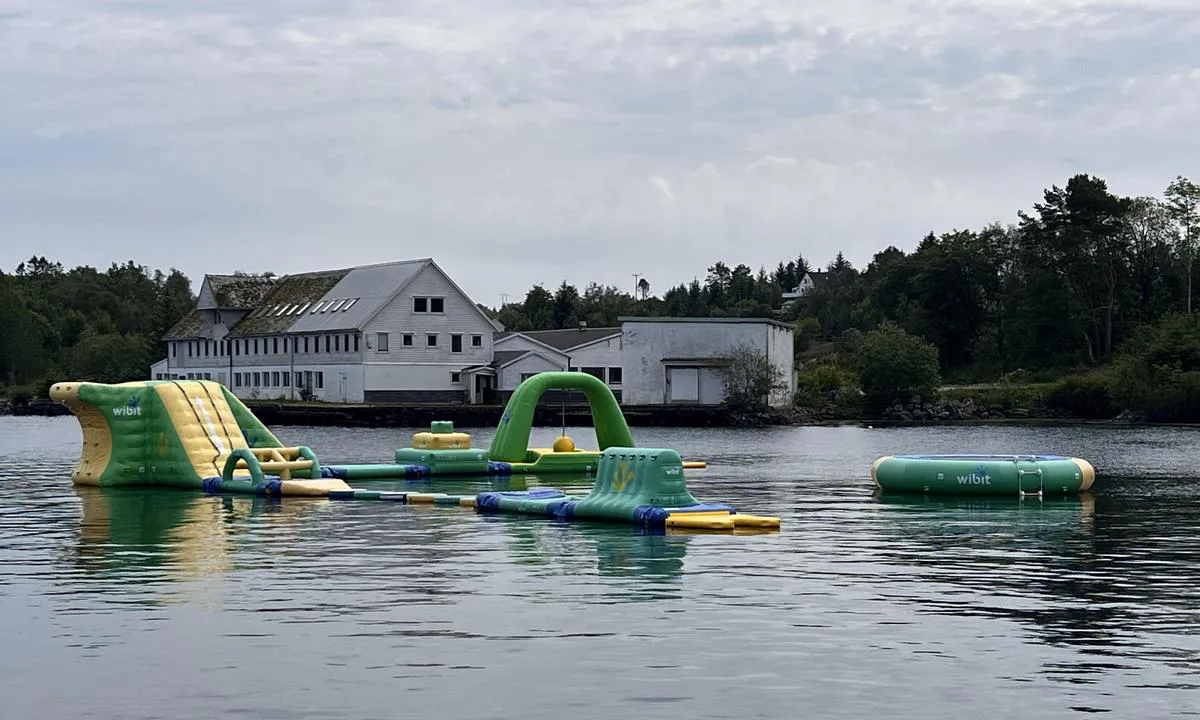
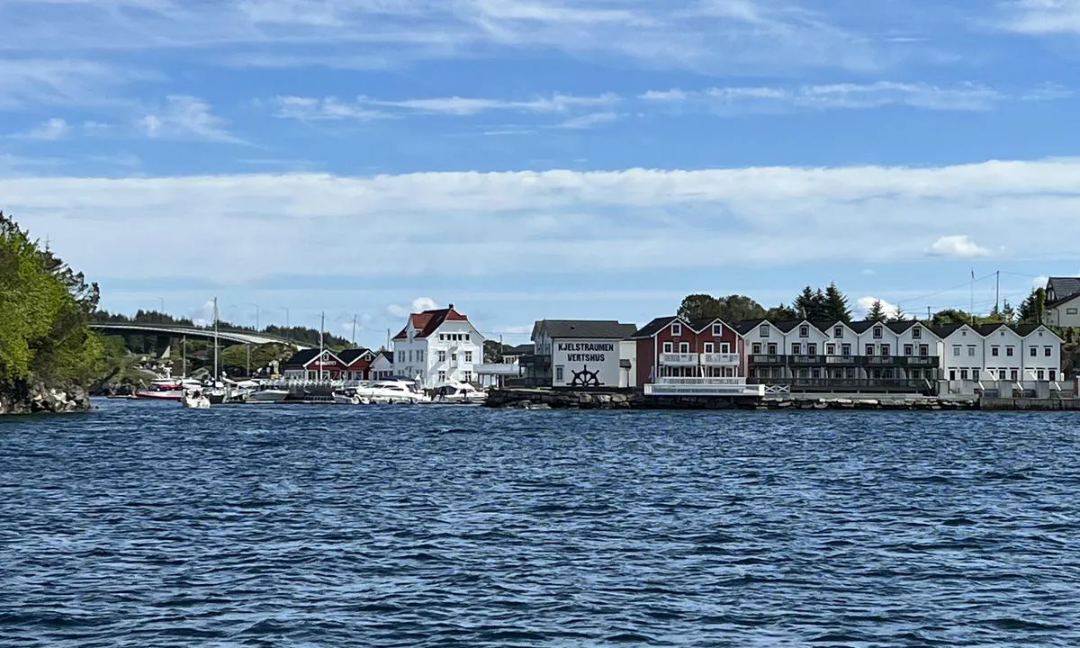
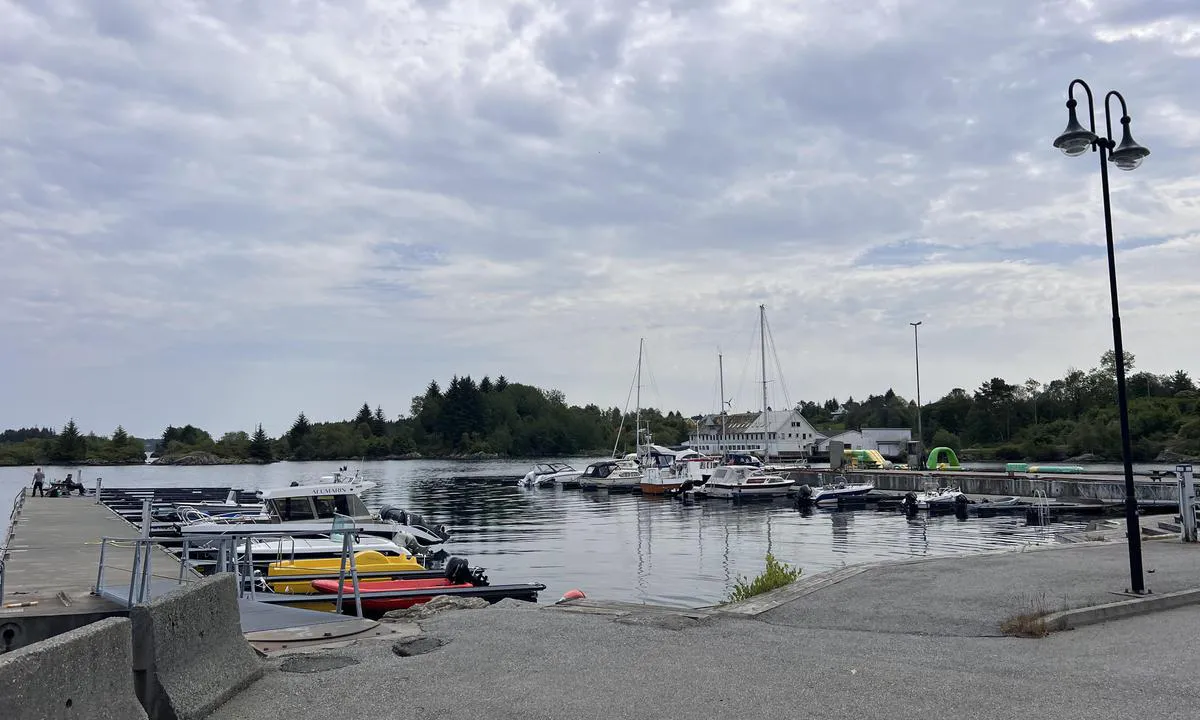
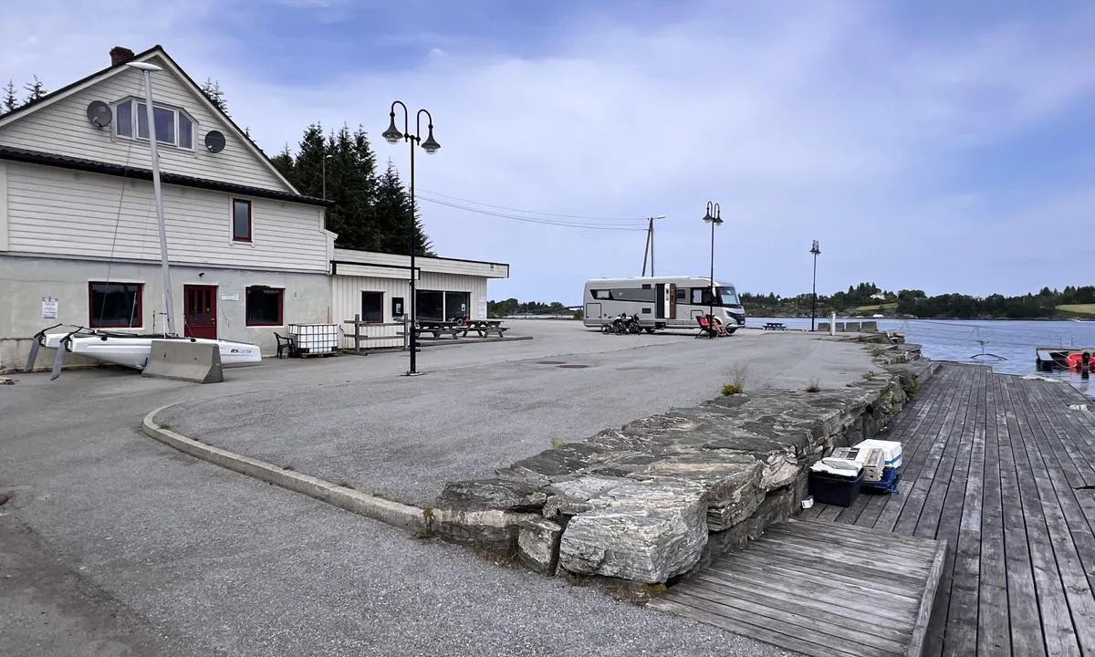
Lett å anløpe fra indre led, kommer man fra Fensfjorden så har Kilstraumen bro 15 mtr seilingshøyde, mens Fonnesstraumen bro har 25 mtr seilingshøyde. Det er tidevannstrøm i Kilstraumen som kan sette ganske sterkt. Mastrevik er en trygg havn ved alle vinder, men om man fortøyer på utsiden av flytebryggen kan bølger fra passerende fartøy sjenere noe.
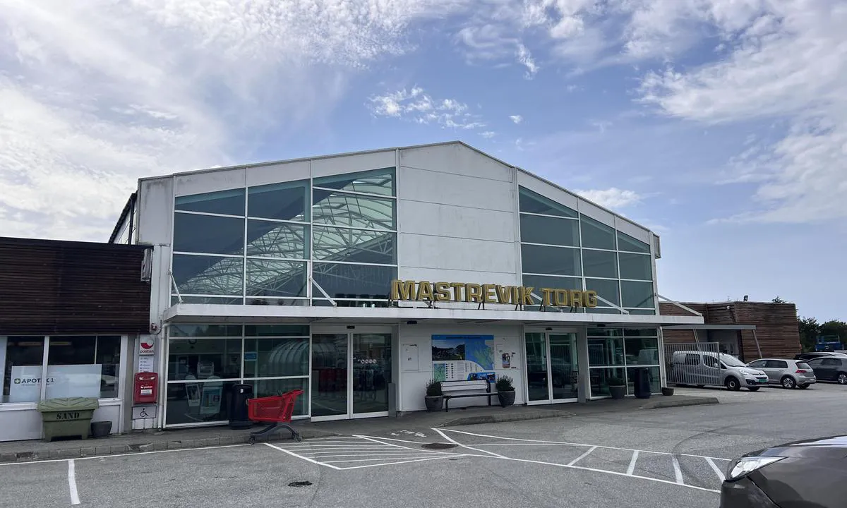
Ligger rett ved Kilstraumen Handelsted / gjestehavn som er en penere havn, men i Mastrevik er det gangavstand til Mastrevik Torg. Ca 5-6 min å gå. Mastrevik Torg har dagligvare butikk, klær, interiør og Skruen som er en jernvare/isenkram med det meste.
Badeleke som flyter på sjøen innerst i havnen. Selve kaiområdet er litt industripreget, men det er en flott gapahuk ytterst på kaien. Her er det benker og bord.
Like nord for Mastrevik ligger Vardetangen som er Norges vestligse punkt på fastlandet. Her er det dagsturhytte og fine grusveier til å gå tur. Kan nåes med jolle til likeved Fonnes hurtigbåtkai.
Mastrevik ligger på Fosnøy. Ved Fosnstraumen er det arkeologiske funn av bosettinger datert 5-10000 år tilbake i tid.
1 x helpful | written on 15. Jun 2025 | updated_on 16. Jun 2025
TESO says:
area
maritime qualities
description
.
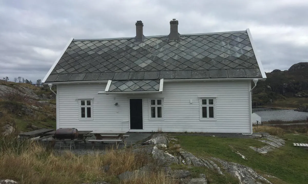
0 x helpful | written on 9. Nov 2024 | updated_on 9. Nov 2024
