Langøy - Hauglandshella

Natural harbour

favoritt

Region: Norway (3278), Vestland (579), Hordaland (375), Askøy (23) and Hauglandshella (6)

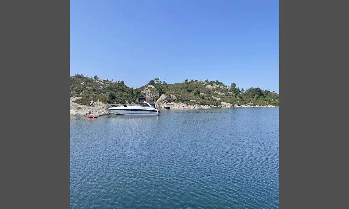
Langøy - Hauglandshella: {"base": "no", "no": "Det er noe fort\u00f8yningsbolter p\u00e5 vestsiden av v\u00e5gen. Her er og en gapahuk", "se": "Det finns n\u00e5gra f\u00f6rt\u00f6jningsbultar p\u00e5 v\u00e4stsidan av viken. H\u00e4r finns ocks\u00e5 ett vindskydd", "en": "There are some mooring bolts on the west side of the bay. There is also a lean-to shelter here.", "da": "Der er nogle fort\u00f8jningsbolte p\u00e5 vestsiden af vigen. Her er ogs\u00e5 et gapahuk."}
Langøy - Hauglandshella
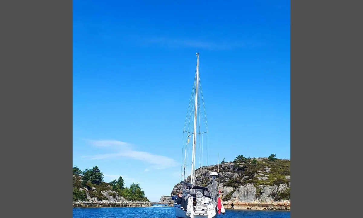
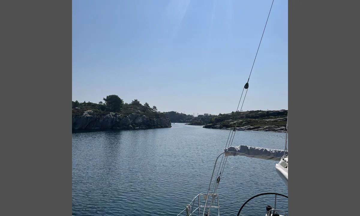
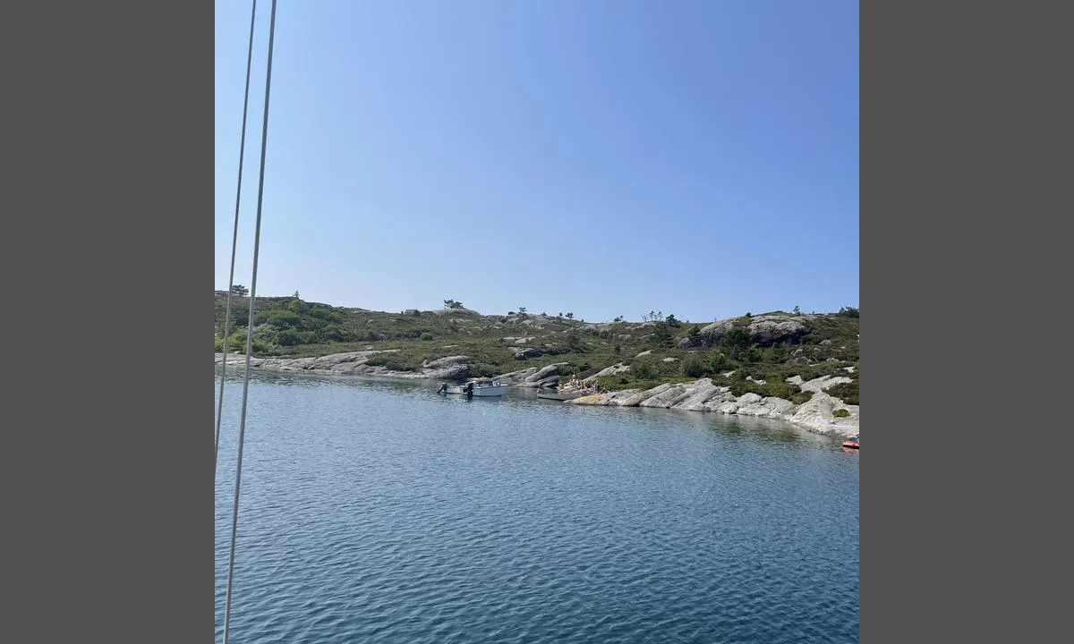
Langøy - Hauglandshella: {"base": "no", "no": "Bildet viser inn/utseiling til v\u00e5gen. God dybde selv om det er litt smalt", "se": "Bilden visar in/utsegling till viken. Bra djup \u00e4ven om det \u00e4r lite smalt", "en": "The picture shows the entrance/exit to the harbour. Good depth even though it is a bit narrow.", "da": "Billedet viser ind-/udsejling til v\u00e5gen. God dybde selvom det er lidt smalt"}
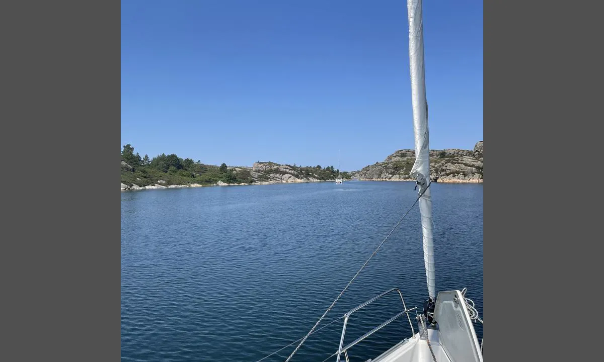
Langøy - Hauglandshella: {"base": "no", "no": "Midt i bildet, mellom b\u00e5tene ser en skj\u00e6ret som ligger omtrent midt i v\u00e5gen. P\u00e5 flo sj\u00f8 kan det v\u00e6re vanskelig \u00e5 se. En kan passere p\u00e5 alle sider av skj\u00e6ret", "se": "Mitt i bilden, mellan b\u00e5tarna ser man sk\u00e4ret som ligger ungef\u00e4r mitt i viken. Vid h\u00f6gvatten kan det vara sv\u00e5rt att se. Man kan passera p\u00e5 alla sidor av sk\u00e4ret", "en": "In the middle of the image, between the boats, you can see the reef that is situated approximately in the middle of the bay. At high tide, it can be difficult to see. You can pass on all sides of the reef.", "da": "Midt i billedet, mellem b\u00e5dene ser man sk\u00e6ret, der ligger omtrent midt i bugten. Ved h\u00f8jvande kan det v\u00e6re sv\u00e6rt at se. Man kan passere p\u00e5 alle sider af sk\u00e6ret."}
Langøy - Hauglandshella: {"base": "no", "no": "Popul\u00e6rt sted p\u00e5 finv\u00e6rsdager", "se": "Popul\u00e4r plats vid vackert v\u00e4der", "en": "Popular place on fair-weather days", "da": "Popul\u00e6rt sted p\u00e5 solskinsdage"}
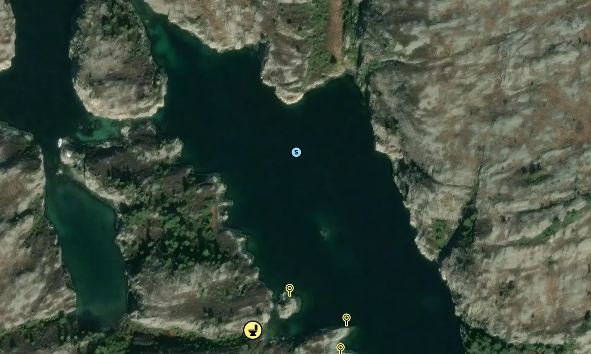
Flyfoto av Langøy 2

📸 Upload a photo

Show off your photos and help others plan their journey to Langøy - Hauglandshella.harbourmaps.com is created by the sailing community, in a collective effort to make cruising simpler and more fun. Uploading a photo takes less than a minutes and can be done from your phone, tablet or laptop.

📸 Upload a photo

Facilities

Available facilities: Toilet.

Updated on 3. Jun 2021. Update facilities.

Mooring

Options for mooring in this harbour: Anchoring, Towards land.

Updated on 3. Jun 2021. Update mooring.

Descriptions and reviews

MarLei says:

area

maritime qualities

description

Good holding ground, a mix of shell sand and clay. Approx. 10 meters depth at the innermost part of the bay. Great spot

[translated from Norwegian with AI]

1 x helpful | written on 14. Jul 2024

Do you know this harbour? It's a huge help to other sailors if you add a short description or review of the harbour.

📜 Add description

Map of Langøy - Hauglandshella

Facilities

Available facilities: Toilet.

Updated on 3. Jun 2021. Update facilities.

Mooring

Options for mooring in this harbour: Anchoring, Towards land.

Updated on 3. Jun 2021. Update mooring.

Wind protection

Protection next night

87 points

N E S W --> } } } } } } } } } } } } } } } } } } } } } } } } } } } } } } } } } } } } } } } } } } } } } } } } } } } } } } } } } } } } } } } } } } } } } } } } } } } } } } } } } } } } } } } } } } } } } } } } } } } } } } } } } } } } } } } } } } } } } } } } } } } } } } } } } } } } } } } } } } } } } } } } } } } } } } } } } } } } } } } } } } } } } } } } } } } } } } } } } } } } } } } } } } } } } } } } } } } } } } } } } } } } } } } } } } } } } } } } } } } } } } } } } } } } } } } } } } } } } } } } } } } } } } } } } } } } } } } } } } } } } } } } } } } } } } } } } } } } } } } } } } } } } } } } } } } } } } } } } } } } } } } } } } } } } } } } } } } } } } } } } } } } } } } } } } } } } } } } } } } } } } } } } } } } } } } } } } } } } } } } } } } } } } } } } } } } } } } } } } } } } } } } } } } } } } } } } } } } } } } } } } } } } } } } } } } } } } } } } } } } } } } } } } } } } } } } } } } } } } } } } } } } } } } } } } } } } } } } } } } } } } } } } } } } } } } } } } } } } } } } } } } } } } } } } } } } } } } } } } } } } } } } } } } } } } } } } } } } } } } } } } } } } } } } } } } } } } } } } } } } } } } } } } } } } } } } } } } } } } } } } } } } } } } } } } } } } } } } } } } } } } } } } } } } } } } } } } } } } } } } } } } } } } } } } } } } } } } } } } } } } } } } } } } } } } } } } } } } } } } } } } } } } } } } } } } } } } } } } } } } } } } } } } } } } } } } } } } } } } } } } } } } } } } } } } } } } } } } } } } } } } } } } } } } } } } } } } } } } } } } } } } } } } } } } } } } } } } } } } } } } } } } } } } } } } } } } } } } } } } } } } } } } } } } } } } } } } } } } } } } } } } } } } } } } } } } } } } } } } } } } } } } } } } } } } } } } } } } } } } } } } } } } } } } } } } } } } } } } } } } } } } } } } } } } } } } } } } } } } } } } } } } } } } } } } } } } } } } } } } } } } } } } } } } } } } } } } } } } } } } } } } } } } } } } } } } } } } } } } } } } } } } } } } } } } } } } } } } } } } } } } } } } } } } } } } } } } } } } } } } } } } } } } } } } } } } } } } } } } } } Next night 12:00 Ons 30 Apr 18:00 0:00 6:00 12:00 Tor 01 Mai 18:00 0:00 8m/s 0m/s

Want to know how the wind score works? Then you should read this explanation.

The wind forecasts come from yr.no (Norwegian Meteorological Institute), and was last updated 1 hour and 48 minutes ago (Wednesday 30 April 11:28 AM). The next night score shows you the worst hour between 22:00 and 08:00 the next night. We recommend that you check multiple sources for wind forecasts. windy.com is a good website to show larger wind systems.

The safe directions for this harbour was added at 3. Jun 2021. Click here to edit.

Last visits to Langøy - Hauglandshella

Thu 07 Sep 2023

EMBLA3 [MMSI: 257662360]

Wed 16 Aug 2023

JOLIS [MMSI: 257829190]

Fri 28 Jul 2023

CHRISTINA [MMSI: 912571904]

The visits are retrieved from AIS data. You can click to see all visiting ships to Langøy - Hauglandshella, as well as statistics about the ships that visits

Add this harbour to a journey

Check in now

Choose a different date than today

Important: When you check in to a harbour, you add it to a journey on this website. You are not booking a place in the marina.

Contributors

Users that contributed to this page: Anonymous sailor 1110, ©norgeskart.no and MarLei

harbourmaps.com is updated by the boating community. When you add information, a review or pictures to this page you are listed here with the other contributors (we list your user-name, which can be your real name or a pseudonym).

Closest harbours to Langøy - Hauglandshella
Filter by

Natural harbour
Marina
Safe wind next night

Order by

ABC
Popularity
Wind score next night

0 harbours

Show more harbours