Langøy - Hauglandshella

Puerto natural

favoritt

Region: Norway (3286), Vestland (579), Hordaland (375), Askøy (23) and Hauglandshella (6)

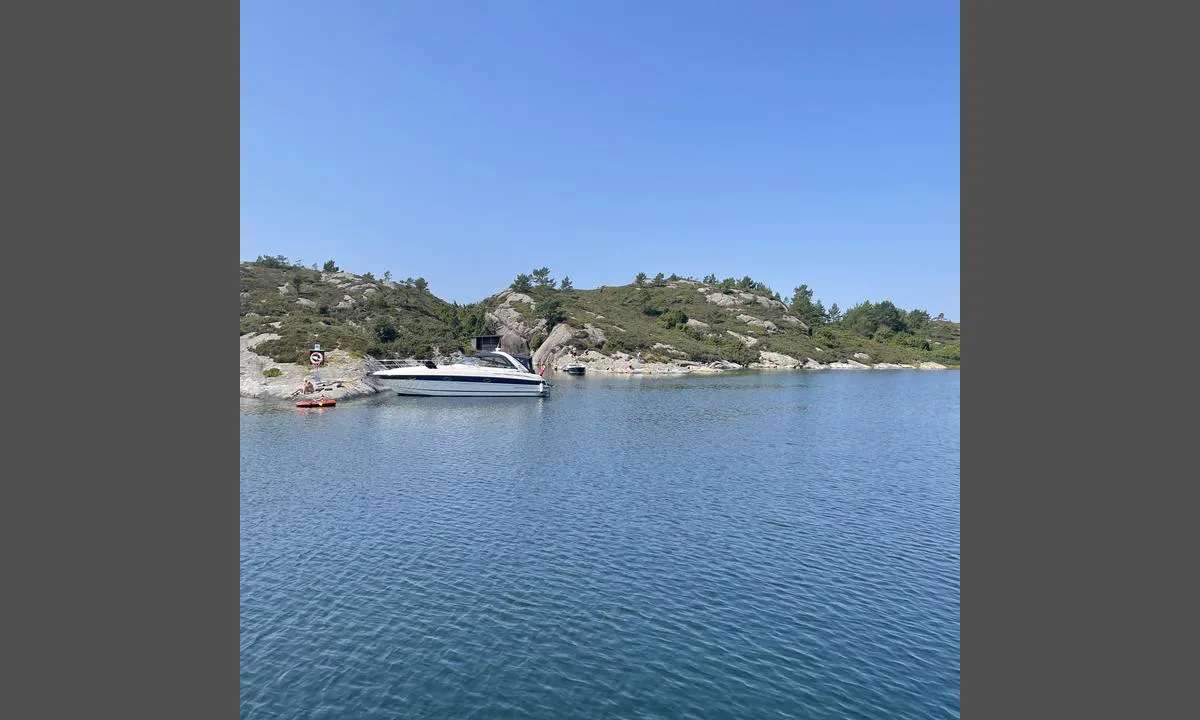
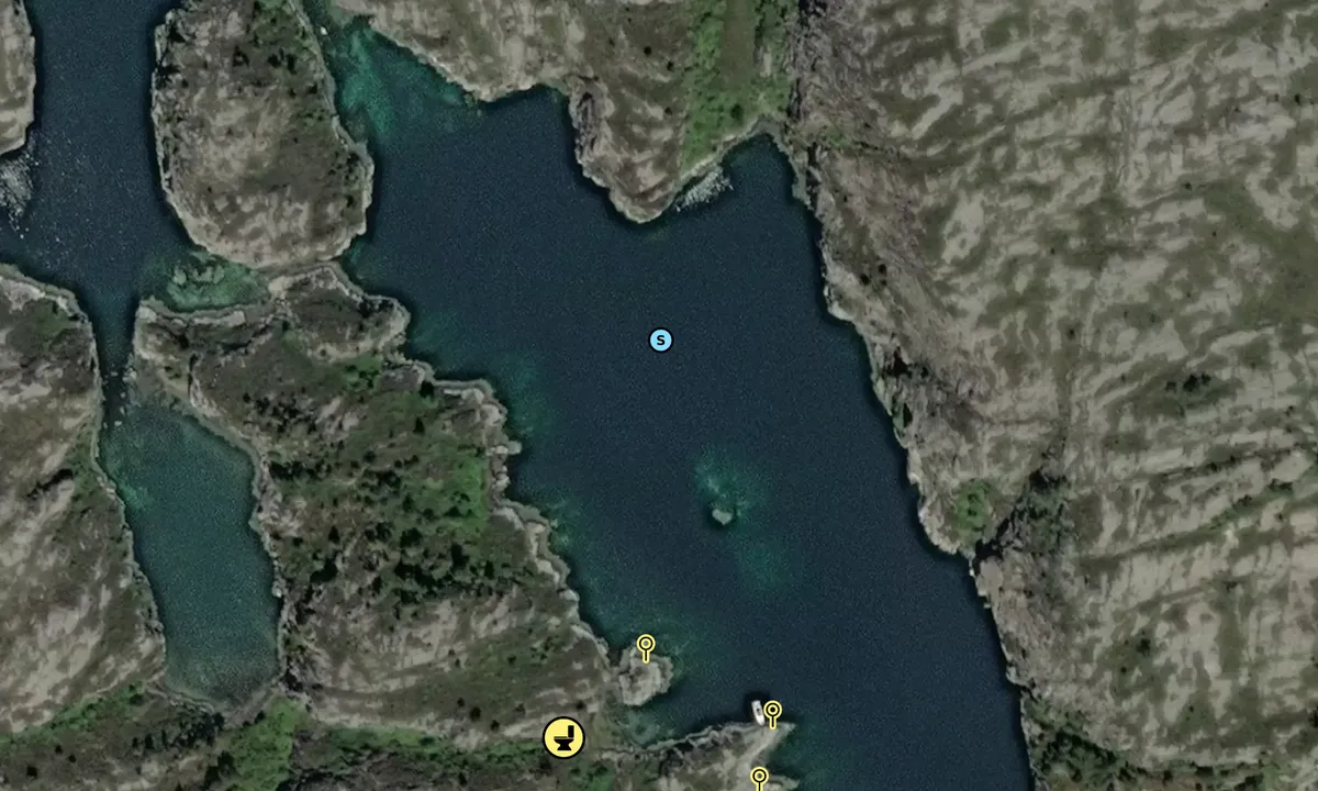
Langøy - Hauglandshella: {"base": "no", "no": "Det er noe fort\u00f8yningsbolter p\u00e5 vestsiden av v\u00e5gen. Her er og en gapahuk", "se": "Det finns n\u00e5gra f\u00f6rt\u00f6jningsbultar p\u00e5 v\u00e4stsidan av viken. H\u00e4r finns ocks\u00e5 ett vindskydd", "en": "There are some mooring bolts on the west side of the bay. There is also a lean-to shelter here.", "da": "Der er nogle fort\u00f8jningsbolte p\u00e5 vestsiden af vigen. Her er ogs\u00e5 et gapahuk."}
Langøy - Hauglandshella
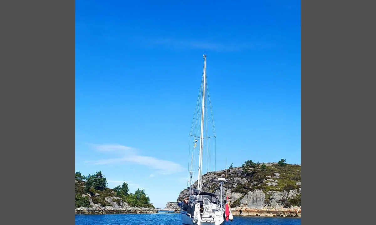
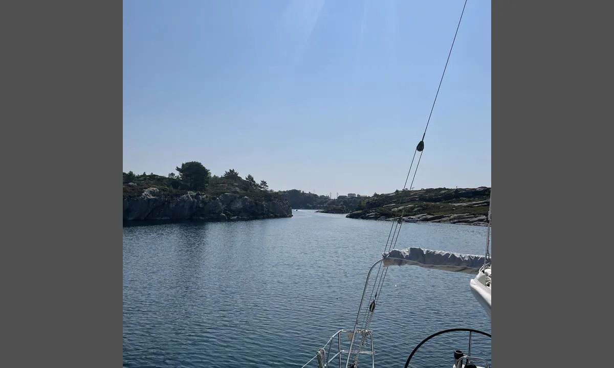
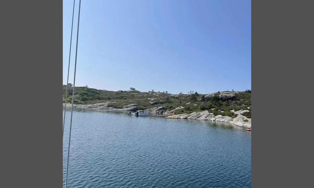
Langøy - Hauglandshella: {"base": "no", "no": "Bildet viser inn/utseiling til v\u00e5gen. God dybde selv om det er litt smalt", "se": "Bilden visar in/utsegling till viken. Bra djup \u00e4ven om det \u00e4r lite smalt", "en": "The picture shows the entrance/exit to the harbour. Good depth even though it is a bit narrow.", "da": "Billedet viser ind-/udsejling til v\u00e5gen. God dybde selvom det er lidt smalt"}
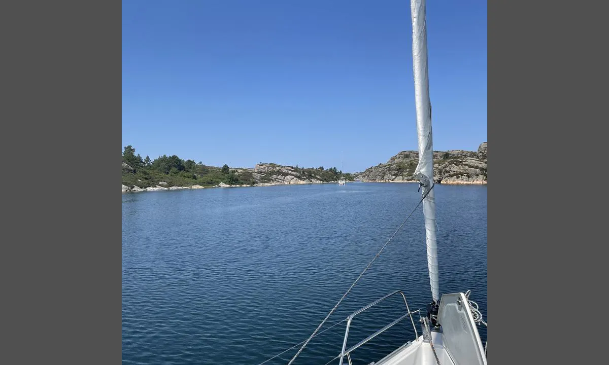
Langøy - Hauglandshella: {"base": "no", "no": "Midt i bildet, mellom b\u00e5tene ser en skj\u00e6ret som ligger omtrent midt i v\u00e5gen. P\u00e5 flo sj\u00f8 kan det v\u00e6re vanskelig \u00e5 se. En kan passere p\u00e5 alle sider av skj\u00e6ret", "se": "Mitt i bilden, mellan b\u00e5tarna ser man sk\u00e4ret som ligger ungef\u00e4r mitt i viken. Vid h\u00f6gvatten kan det vara sv\u00e5rt att se. Man kan passera p\u00e5 alla sidor av sk\u00e4ret", "en": "In the middle of the image, between the boats, you can see the reef that is situated approximately in the middle of the bay. At high tide, it can be difficult to see. You can pass on all sides of the reef.", "da": "Midt i billedet, mellem b\u00e5dene ser man sk\u00e6ret, der ligger omtrent midt i bugten. Ved h\u00f8jvande kan det v\u00e6re sv\u00e6rt at se. Man kan passere p\u00e5 alle sider af sk\u00e6ret."}
Langøy - Hauglandshella: {"base": "no", "no": "Popul\u00e6rt sted p\u00e5 finv\u00e6rsdager", "se": "Popul\u00e4r plats vid vackert v\u00e4der", "en": "Popular place on fair-weather days", "da": "Popul\u00e6rt sted p\u00e5 solskinsdage"}
Flyfoto av Langøy 2

📸 Sube una foto

Muestra tus fotos y ayuda a otros a planificar su viaje a Langøy - Hauglandshella.harbourmaps.com es creado por la comunidad de navegación, en un esfuerzo colectivo para hacer la navegación más simple y divertida. Subir una foto toma menos de un minuto y se puede hacer desde tu teléfono, tableta o portátil.

📸 Sube una foto

Instalaciones

Instalaciones disponibles: Aseo.

Actualizado el 3. Jun 2021. Actualizar instalaciones.

Amarre

Opciones para amarre en este puerto: Fondeo, Hacia tierra.

Actualizado el 3. Jun 2021. Actualizar amarre.

Descripciones y reseñas

MarLei dice:

área

cualidades marítimas

descripción

Buen anclaje, mezcla de arena de conchas y arcilla. Aproximadamente 10 metros de profundidad en el extremo interior de la ensenada. Lugar magnífico

[translated from Norwegian with AI]

1 x helpful | written on 14. Jul 2024

¿Conoces este puerto? Es de gran ayuda para otros marineros si añades una breve descripción o reseña del puerto.

📜 Añadir descripción

Mapa de Langøy - Hauglandshella

Instalaciones

Instalaciones disponibles: Aseo.

Actualizado el 3. Jun 2021. Actualizar instalaciones.

Amarre

Opciones para amarre en este puerto: Fondeo, Hacia tierra.

Actualizado el 3. Jun 2021. Actualizar amarre.

Protección contra el viento

Protección próxima noche

95 puntos

N E S W --> } } } } } } } } } } } } } } } } } } } } } } } } } } } } } } } } } } } } } } } } } } } } } } } } } } } } } } } } } } } } } } } } } } } } } } } } } } } } } } } } } } } } } } } } } } } } } } } } } } } } } } } } } } } } } } } } } } } } } } } } } } } } } } } } } } } } } } } } } } } } } } } } } } } } } } } } } } } } } } } } } } } } } } } } } } } } } } } } } } } } } } } } } } } } } } } } } } } } } } } } } } } } } } } } } } } } } } } } } } } } } } } } } } } } } } } } } } } } } } } } } } } } } } } } } } } } } } } } } } } } } } } } } } } } } } } } } } } } } } } } } } } } } } } } } } } } } } } } } } } } } } } } } } } } } } } } } } } } } } } } } } } } } } } } } } } } } } } } } } } } } } } } } } } } } } } } } } } } } } } } } } } } } } } } } } } } } } } } } } } } } } } } } } } } } } } } } } } } } } } } } } } } } } } } } } } } } } } } } } } } } } } } } } } } } } } } } } } } } } } } } } } } } } } } } } } } } } } } } } } } } } } } } } } } } } } } } } } } } } } } } } } } } } } } } } } } } } } } } } } } } } } } } } } } } } } } } } } } } } } } } } } } } } } } } } } } } } } } } } } } } } } } } } } } } } } } } } } } } } } } } } } } } } } } } } } } } } } } } } } } } } } } } } } } } } } } } } } } } } } } } } } } } } } } } } } } } } } } } } } } } } } } } } } } } } } } } } } } } } } } } } } } } } } } } } } } } } } } } } } } } } } } } } } } } } } } } } } } } } } } } } } } } } } } } } } } } } } } } } } } } } } } } } } } } } } } } } } } } } } } } } } } } } } } } } } } } } } } } } } } } } } } } } } } } } } } } } } } } } } } } } } } } } } } } } } } } } } } } } } } } } } } } } } } } } } } } } } } } } } } } } } } } } } } } } } } } } } } } } } } } } } } } } } } } } } } } } } } } } } } } } } } } } } } } } } } } } } } } } } } } } } } } } } } } } } } } } } } } } } } } } } } } } } } } } } } } } } } } } } } } } } } } } } } } } } } } } } } } } } } } } } } } } } } } } } } } } } } } } } } } } } } } } } } } } } } } } } } } } } } } } } } } } } } } } } } } } } } } } } } Next night 18:00 0:00 6:00 12:00 Fre 09 Mai 18:00 0:00 5m/s 1m/s

¿Quieres saber cómo funciona la puntuación del viento? Entonces deberías leer esta explicación.

Las previsiones del viento provienen de yr.no (Instituto Meteorológico Noruego), y se actualizaron por última vez 1 hour and 28 minutes ago (Jueves 08 Mayo 17:27). La siguiente puntuación nocturna te muestra la peor hora entre las 22:00 y las 08:00 de la siguiente noche. Recomendamos que consultes varias fuentes para los pronósticos de viento.windy.com es un buen sitio web para mostrar sistemas eólicos más grandes.

Las direcciones seguras para este puerto se añadieron en 3. Jun 2021. Haga clic aquí para editar.

Last visits to Langøy - Hauglandshella

Jue 07 Sep 2023

EMBLA3 [MMSI: 257662360]

Mié 16 Ago 2023

JOLIS [MMSI: 257829190]

Vie 28 Jul 2023

CHRISTINA [MMSI: 912571904]

The visits are retrieved from AIS data. You can click to see all visiting ships to Langøy - Hauglandshella, as well as statistics about the ships that visits

Añadir este puerto a un viaje

Regístrate ahora

Elija una fecha diferente a la de hoy

Importante: Cuando inicias sesión en un puerto, lo agregas a un viaje en este sitio web. No estás reservando un lugar en la marina.

Colaboradores

Usuarios que contribuyeron a esta página: ©norgeskart.no, Anonymous sailor 1110 and MarLei

harbourmaps.com es actualizado por la comunidad de navegantes. Cuando agregas información, una revisión o fotos a esta página, te enumeramos aquí con los otros contribuyentes (listamos tu nombre de usuario, que puede ser tu nombre real o un seudónimo).

Puertos más cercanos a Langøy - Hauglandshella

Filtrar por

Puerto natural
Marina
Viento seguro la próxima noche

Ordenar por

ABC
Popularidad
Puntuación de viento próxima noche

0 puertos

Mostrar más puertos