


London Guilds harbour (across the road from the G
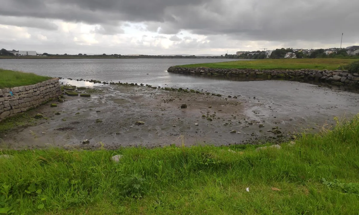
Natural harbour

Region: Ireland (266), Galway (27) and Wellpark (1)

Show off your photos and help others plan their journey to London Guilds harbour (across the road from the G .


Descriptions and reviews
Patrick Meagher says:
says:
area


maritime qualities
description
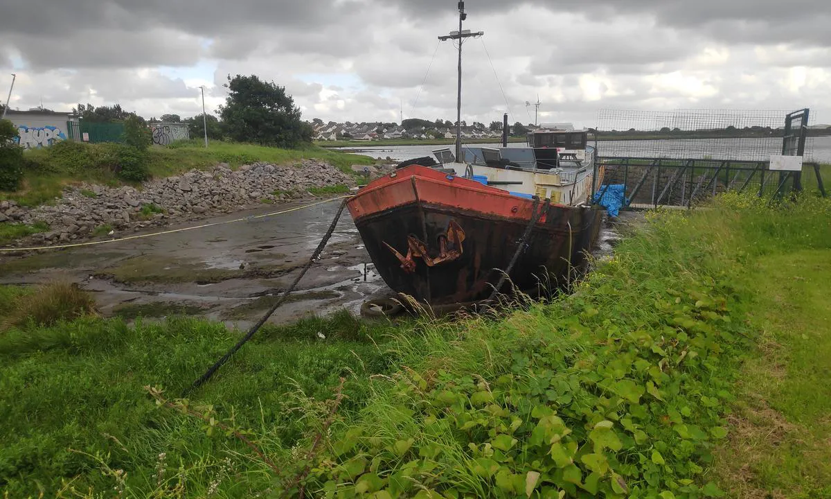
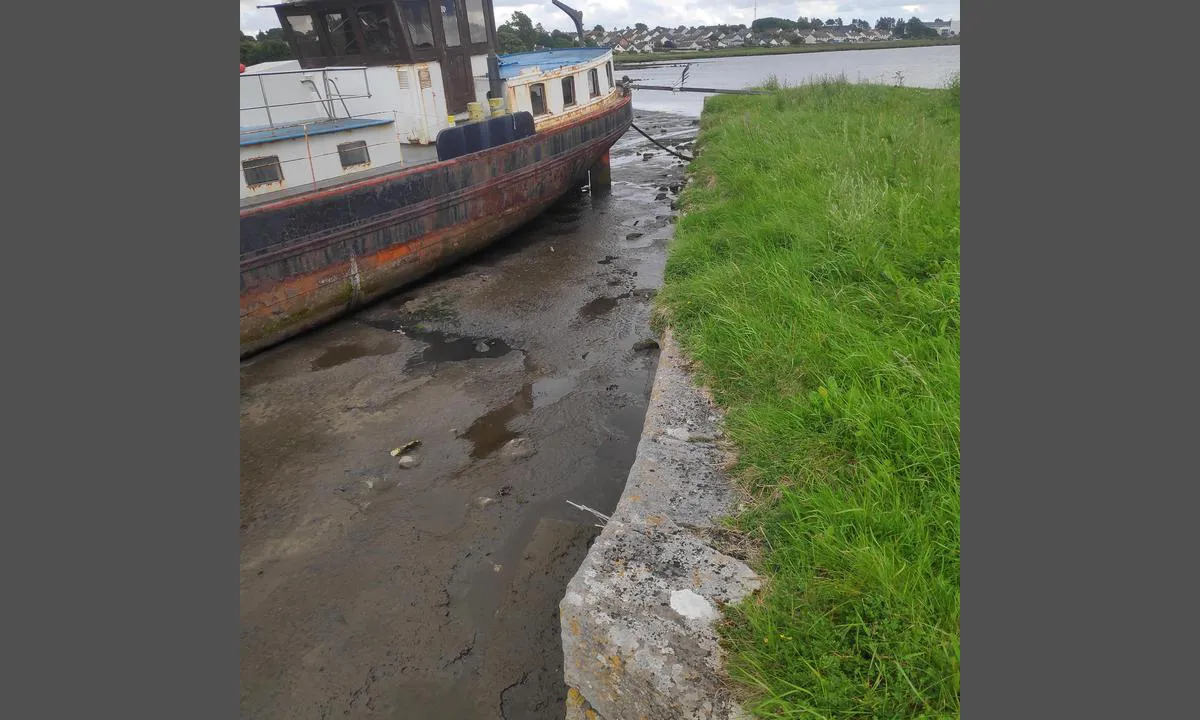
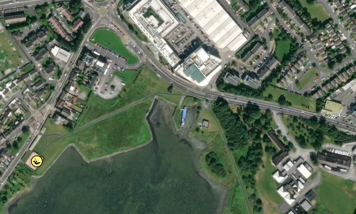
This habour was built in the 1820's, with money that was raised by charitable donations from the guilds in London, for famine relief in Ireland in the 1820's, after a year long hunger, that followed a bad harvest in 1822. It was built for the "poor fishermen of Galway". It is only possible to navigate here at high tide, and no masted vessel can get under the railway bridge at this time. At high tide you might get here in a dinghy or kayak. Dunno how this barge got here, but its been here for 5-6 years now.

1 x helpful | written on 16. May 2025
Do you know this harbour? It's a huge help to other sailors if you add a short description or review of the harbour.
Map of London Guilds harbour (across the road from the G

Wind protection
Protection next night
91 points


Want to know how the wind score works? Then you should read this explanation.
The wind forecasts come from yr.no (Norwegian Meteorological Institute), and was last updated 19 minutes ago (Tuesday 14 July 10:47 AM). The next night score shows you the worst hour between 22:00 and 08:00 the next night. We recommend that you check multiple sources for wind forecasts. windy.com is a good website to show larger wind systems.
The safe directions for this harbour was added at 16. May 2025. Click here to edit.
Last visits to London Guilds harbour (across the road from the G
The visits are retrieved from AIS data. You can click to see all visiting ships to London Guilds harbour (across the road from the G , as well as statistics about the ships that visits
Add this harbour to a journey
Choose a different date than today
Important: When you check in to a harbour, you add it to a journey on this website. You are not booking a place in the marina.
Contributors
Users that contributed to this page: Paddy Meagher and Patrick Meagher
harbourmaps.com is updated by the boating community. When you add information, a review or pictures to this page you are listed here with the other contributors (we list your user-name, which can be your real name or a pseudonym).
Closest harbours to London Guilds harbour (across the road from the G
Filter by
Order by
0 harbours
Show more harbours
