













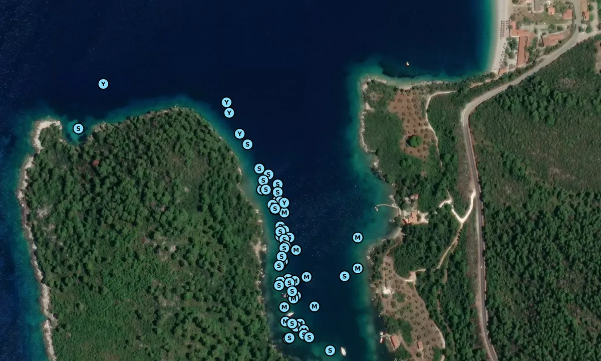









Panormos South

Natural harbour

favoritt

Region: Greece (1845)

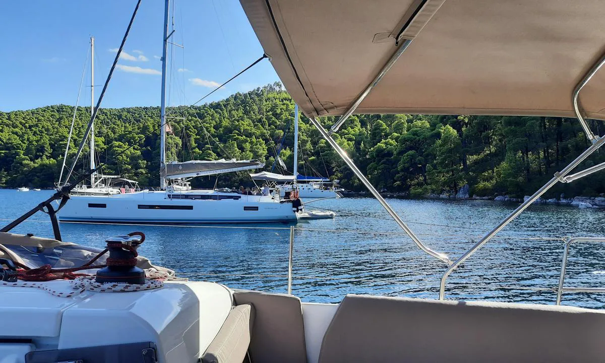
Panormos South: {"base": "de", "no": "Forankring med bauganker og line til lands. Vanndybde (bunnen faller bratt) og plass er uegnet for fri ankring.", "se": "F\u00f6r ankar med f\u00f6stertross. Vattendjupet (botten faller brant) och utrymmet \u00e4r ol\u00e4mpligt f\u00f6r fri ankring.", "en": "Moor by bow anchor with a line ashore. Water depth (the bottom drops steeply) and space are unsuitable for free anchoring.", "da": "For anker med n\u00e6sen mod land. Vanddybde (bunden falder stejlt) og plads er uegnet til frit anker.", "fr": "Ancre de proue avec amarre \u00e0 terre. La profondeur de l'eau (le fond descend abruptement) et l'espace ne conviennent pas pour mouiller librement.", "de": "Vor Buganker mit Landfeste. Wassertiefe (Grund f\u00e4llt steil ab) und Platz ist f\u00fcr freies Ankern ungeeignet.", "es": "Ancla de proa con amarra a tierra. La profundidad del agua (el fondo cae abruptamente) y el espacio no son adecuados para el fondeo libre.", "it": "Ormeggio con ancora a prua e cima a terra. Fondale (scende ripidamente) e spazio non idoneo per ancoraggio libero.", "pt": "\u00c2ncora de proa com amarra\u00e7\u00e3o em terra. A profundidade da \u00e1gua (fundo cai abruptamente) e o espa\u00e7o s\u00e3o inadequados para ancoragem livre.", "nl": "Voor boeganker met landvast. Waterdiepte (grond loopt steil af) en plaats is ongeschikt voor vrij ankeren.", "pl": "Na dziobowym kotwicowisku z cum\u0105 brzegow\u0105. G\u0142\u0119boko\u015b\u0107 wody (dno opada gwa\u0142townie) i miejsce nie s\u0105 odpowiednie do swobodnego kotwiczenia.", "uk": "\u041f\u0435\u0440\u0435\u0434\u043d\u0456\u0439 \u044f\u043a\u0456\u0440 \u0437 \u043a\u0440\u0456\u043f\u043b\u0435\u043d\u043d\u044f\u043c \u0434\u043e \u0431\u0435\u0440\u0435\u0433\u0430. \u0413\u043b\u0438\u0431\u0438\u043d\u0430 \u0432\u043e\u0434\u0438 (\u0434\u043d\u043e \u0440\u0456\u0437\u043a\u043e \u0441\u043f\u0430\u0434\u0430\u0454) \u0442\u0430 \u043c\u0456\u0441\u0446\u0435 \u043d\u0435 \u043f\u0456\u0434\u0445\u043e\u0434\u044f\u0442\u044c \u0434\u043b\u044f \u0432\u0456\u043b\u044c\u043d\u043e\u0433\u043e \u044f\u043a\u043e\u0440\u0456\u043d\u043d\u044f.", "ro": "\u00cenainte cu ancora de prova \u0219i funie de uscat. Ad\u00e2ncimea apei (fundul coboar\u0103 abrupt) \u0219i spa\u021biul nu sunt adecvate pentru ancorare liber\u0103.", "tr": "Demir atarken \u00f6nden \u00e7apa atarak, karaya ba\u011flay\u0131n\u0131z. Su derinli\u011fi (dip aniden derinle\u015fir) ve bo\u015fta demirlemek i\u00e7in yer uygun de\u011fildir.", "el": "\u03a0\u03c1\u03cc\u03b2\u03bf\u03bb\u03bf\u03c2 \u03b1\u03b3\u03ba\u03cd\u03c1\u03c9\u03c3\u03b7\u03c2 \u03bc\u03b5 \u03b1\u03b3\u03ba\u03c5\u03c1\u03bf\u03b2\u03bf\u03bb\u03af\u03b1 \u03c3\u03b5 \u03be\u03b7\u03c1\u03ac. \u03a4\u03bf \u03b2\u03ac\u03b8\u03bf\u03c2 \u03c4\u03c9\u03bd \u03c5\u03b4\u03ac\u03c4\u03c9\u03bd (\u03bf \u03b2\u03c5\u03b8\u03cc\u03c2 \u03ba\u03b1\u03c4\u03b5\u03b2\u03b1\u03af\u03bd\u03b5\u03b9 \u03b1\u03c0\u03cc\u03c4\u03bf\u03bc\u03b1) \u03ba\u03b1\u03b9 \u03bf \u03c7\u03ce\u03c1\u03bf\u03c2 \u03b4\u03b5\u03bd \u03b5\u03af\u03bd\u03b1\u03b9 \u03ba\u03b1\u03c4\u03ac\u03bb\u03bb\u03b7\u03bb\u03b1 \u03b3\u03b9\u03b1 \u03b5\u03bb\u03b5\u03cd\u03b8\u03b5\u03c1\u03b7 \u03b1\u03b3\u03ba\u03cd\u03c1\u03c9\u03c3\u03b7.", "cs": "P\u0159edn\u00ed kotva s lanem k b\u0159ehu. Hloubka vody (dno strm\u011b kles\u00e1) a prostor nejsou vhodn\u00e9 pro voln\u00e9 kotven\u00ed.", "hu": "Orrhorgony a partk\u00f6zeli k\u00f6t\u00e9llel. A v\u00edzm\u00e9lys\u00e9g (a fen\u00e9k meredeken esik le) \u00e9s a hely nem alkalmas szabad horgonyz\u00e1sra.", "fi": "Keula-ankkuri maakiinnityksell\u00e4. Veden syvyys (pohja laskee jyrk\u00e4sti) ja tila eiv\u00e4t sovellu vapaaseen ankkurointiin.", "bg": "\u0421 \u043d\u043e\u0441\u043e\u0432\u0430 \u043a\u043e\u0442\u0432\u0430 \u0438 \u0432\u044a\u0436\u0435 \u043a\u044a\u043c \u0431\u0440\u0435\u0433\u0430. \u0414\u044a\u043b\u0431\u043e\u0447\u0438\u043d\u0430\u0442\u0430 \u043d\u0430 \u0432\u043e\u0434\u0430\u0442\u0430 (\u0434\u044a\u043d\u043e\u0442\u043e \u0440\u044f\u0437\u043a\u043e \u0441\u0435 \u0441\u043f\u0443\u0441\u043a\u0430 \u043d\u0430\u0434\u043e\u043b\u0443) \u0438 \u043f\u0440\u043e\u0441\u0442\u0440\u0430\u043d\u0441\u0442\u0432\u043e\u0442\u043e \u043d\u0435 \u0441\u0430 \u043f\u043e\u0434\u0445\u043e\u0434\u044f\u0449\u0438 \u0437\u0430 \u0441\u0432\u043e\u0431\u043e\u0434\u043d\u043e \u0437\u0430\u043a\u043e\u0442\u0432\u044f\u043d\u0435.", "sr": "Na pram\u010danom sidru sa vezom na obalu. Dubina vode (dno naglo opada) i prostor nisu pogodni za slobodno sidrenje.", "et": "Eesankur maasilla kinnitusega. Veekald (p\u00f5hi langeb j\u00e4rsult) ja koht pole vabaks ankurdamiseks sobiv.", "lv": "Pirms priek\u0161\u0113j\u0101s enkura ar sauszemes stiprin\u0101jumu. \u016adens dzi\u013cums (dibens strauji kr\u012btas) un vieta nav piem\u0113rota br\u012bvai enkuro\u0161anai.", "lt": "Priekinis inkaras su tvirtinimu prie kranto. Vandens gylis (dugnas smarkiai leid\u017eiasi) ir vieta netinka laisvam inkaravimui."}
Satelite image of Panormos South

📸 Upload a photo

Show off your photos and help others plan their journey to Panormos South.harbourmaps.com is created by the sailing community, in a collective effort to make cruising simpler and more fun. Uploading a photo takes less than a minutes and can be done from your phone, tablet or laptop.

📸 Upload a photo

Facilities

Available facilities: Swimming area.

Updated on 23. Jul 2026. Update facilities.

Mooring

Options for mooring in this harbour: Anchoring, Towards land.

Updated on 23. Jul 2026. Update mooring.

Descriptions and reviews

Rolf0815 says:

area

maritime qualities

description

Fairly steep anchoring ground. Anchor only with a shore line. Be cautious of the wind pressure from the north pushing sideways on the boat.
With the dinghy, you can easily reach the pebble beach and the restaurants.

[translated from German with AI]

1 x helpful | written on 23. Jul 2026

Do you know this harbour? It's a huge help to other sailors if you add a short description or review of the harbour.

📜 Add description

Map of Panormos South

Facilities

Available facilities: Swimming area.

Updated on 23. Jul 2026. Update facilities.

Mooring

Options for mooring in this harbour: Anchoring, Towards land.

Updated on 23. Jul 2026. Update mooring.

Wind protection

Protection next night

83 points

N E S W --> } } } } } } } } } } } } } } } } } } } } } } } } } } } } } } } } } } } } } } } } } } } } } } } } } } } } } } } } } } } } } } } } } } } } } } } } } } } } } } } } } } } } } } } } } } } } } } } } } } } } } } } } } } } } } } } } } } } } } } } } } } } } } } } } } } } } } } } } } } } } } } } } } } } } } } } } } } } } } } } } } } } } } } } } } } } } } } } } } } } } } } } } } } } } } } } } } } } } } } } } } } } } } } } } } } } } } } } } } } } } } } } } } } } } } } } } } } } } } } } } } } } } } } } } } } } } } } } } } } } } } } } } } } } } } } } } } } } } } } } } } } } } } } } } } } } } } } } } } } } } } } } } } } } } } } } } } } } } } } } } } } } } } } } } } } } } } } } } } } } } } } } } } } } } } } } } } } } } } } } } } } } } } } } } } } } } } } } } } } } } } } } } } } } } } } } } } } } } } } } } } } } } } } } } } } } } } } } } } } } } } } } } } } } } } } } } } } } } } } } } } } } } } } } } } } } } } } } } } } } } } } } } } } } } } } } } } } } } } } } } } } } } } } } } } } } } } } } } } } } } } } } } } } } } } } } } } } } } } } } } } } } } } } } } } } } } } } } } } } } } } } } } } } } } } } } } } } } } } } } } } } } } } } } } } } } } } } } } } } } } } } } } } } } } } } } } } } } } } } } } } } } } } } } } } } } } } } } } } } } } } } } } } } } } } } } } } } } } } } } } } } } } } } } } } } } } } } } } } } } } } } } } } } } } } } } } } } } } } } } } } } } } } } } } } } } } } } } } } } } } } } } } } } } } } } } } } } } } } } } } } } } } } } } } } } } } } } } } } } } } } } } } } } } } } } } } } } } } } } } } } } } } } } } } } } } } } } } } } } } } } } } } } } } } } } } } } } } } } } } } } } } } } } } } } } } } } } } } } } } } } } } } } } } } } } } } } } } } } } } } } } } } } } } } } } } } } } } } } } } } } } } } } } } } } } } } } } } } } } } } } } } } } } } } } } } } } } } } } } } } } } } } } } } } } } } } } } } } } } } } } } } } } } } } } } } } } } } } } } } } } } } } } } } } } } } } } } } } } } } } } } } } } } } } } } } } } } } } } } } } Next night 6:00 12:00 Tir 08 Sep 18:00 0:00 6:00 12:00 Ons 09 Sep 8m/s 2m/s

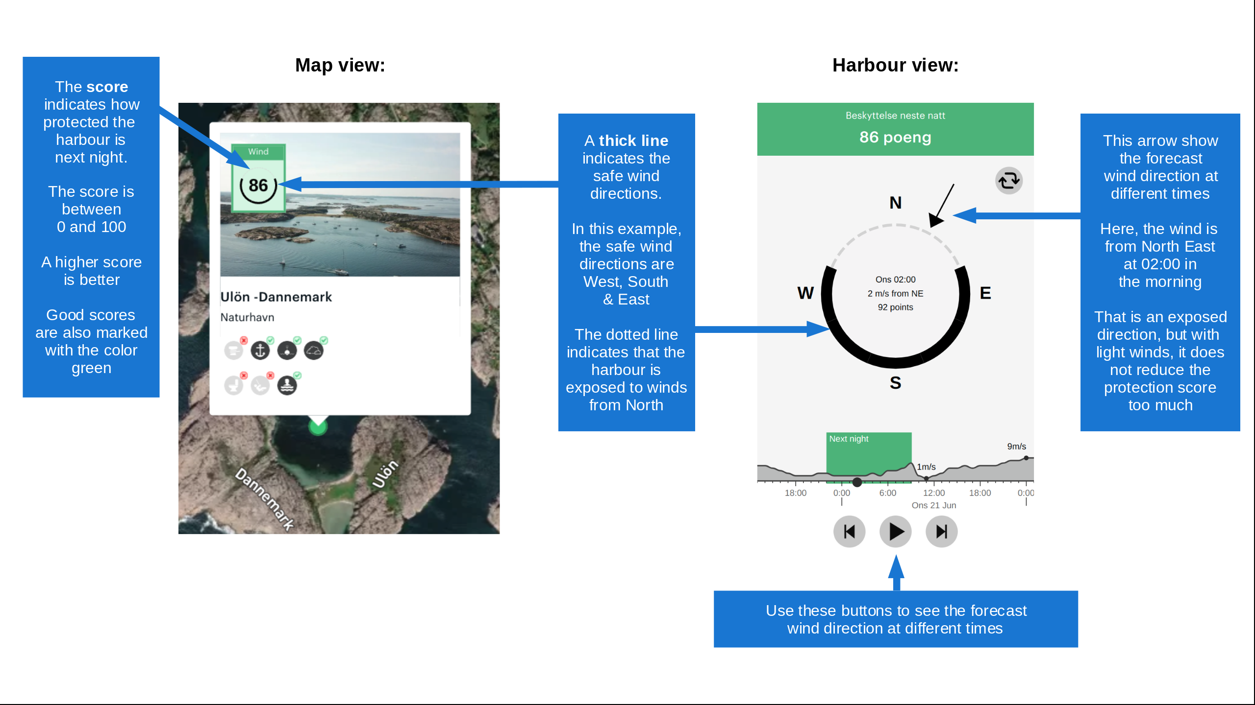
Want to know how the wind score works? Then you should read this explanation.

The wind forecasts come from yr.no (Norwegian Meteorological Institute), and was last updated 5 timer siden (Monday 07 September 09:25 PM). The next night score shows you the worst hour between 22:00 and 08:00 the next night. We recommend that you check multiple sources for wind forecasts. windy.com is a good website to show larger wind systems.

The safe directions for this harbour was added at 23. Jul 2026. Click here to edit.

Last visits to Panormos South

Sat 03 Aug 2024

MARIDAKI [MMSI: 256003102]

Wed 17 Jul 2024

FREEDOM [MMSI: 247284040]

Sun 14 Jul 2024

RUBATO [MMSI: 368156370]

CHILL OUT [MMSI: 240614300]

Fri 10 Nov 2023

KISTI TWO [MMSI: 235023233]

The visits are retrieved from AIS data. You can click to see all visiting ships to Panormos South, as well as statistics about the ships that visits

Add this harbour to a journey

Check in now

Choose a different date than today

Important: When you check in to a harbour, you add it to a journey on this website. You are not booking a place in the marina.

Contributors

Users that contributed to this page: Rolf0815

harbourmaps.com is updated by the boating community. When you add information, a review or pictures to this page you are listed here with the other contributors (we list your user-name, which can be your real name or a pseudonym).

Closest harbours to Panormos South

Filter by

Natural harbour
Marina
Safe wind next night

Order by

ABC
Popularity
Wind score next night

0 harbours

Show more harbours