Praia de Arneles

Natural harbour

favoritt

Region: Spain (1308), Galicia (185), Pontevedra (96) and O Igrexario (2)

{"base": "en", "no": "Fin strand med enkel adkomst med jolle.", "se": "Fin strand med l\u00e4tt tillg\u00e4nglighet med jolle.", "en": "Nice beach with easy access with a dinghy.", "da": "Dejlig strand med nem adgang med en jolle.", "fr": "Belle plage avec un acc\u00e8s facile en annexe.", "de": "Sch\u00f6ner Strand mit leichtem Zugang mit einem Dingi.", "es": "Bonita playa con f\u00e1cil acceso en bote auxiliar.", "it": "Spiaggia piacevole con facile accesso con un gommone.", "pt": "Bela praia com f\u00e1cil acesso com um bote.", "nl": "Mooi strand met gemakkelijke toegang met een bijboot.", "pl": "\u0141adna pla\u017ca z \u0142atwym dost\u0119pem dla pontonu.", "uk": "\u0413\u0430\u0440\u043d\u0438\u0439 \u043f\u043b\u044f\u0436 \u0437 \u043b\u0435\u0433\u043a\u0438\u043c \u0434\u043e\u0441\u0442\u0443\u043f\u043e\u043c \u043d\u0430 \u0448\u043b\u044e\u043f\u0446\u0456.", "ro": "Plaj\u0103 frumoas\u0103 cu acces u\u0219or cu o \u0219alup\u0103.", "tr": "G\u00fczel bir plaj, sandal ile kolay eri\u015fim sa\u011flanabilir.", "el": "\u038c\u03bc\u03bf\u03c1\u03c6\u03b7 \u03c0\u03b1\u03c1\u03b1\u03bb\u03af\u03b1 \u03bc\u03b5 \u03b5\u03cd\u03ba\u03bf\u03bb\u03b7 \u03c0\u03c1\u03cc\u03c3\u03b2\u03b1\u03c3\u03b7 \u03bc\u03b5 \u03c6\u03bf\u03c5\u03c3\u03ba\u03c9\u03c4\u03ae \u03b2\u03ac\u03c1\u03ba\u03b1.", "cs": "P\u011bkn\u00e1 pl\u00e1\u017e s snadn\u00fdm p\u0159\u00edstupem \u010dlunem.", "hu": "Sz\u00e9p strand, k\u00f6nny\u0171 megk\u00f6zel\u00edt\u00e9ssel egy gumics\u00f3nakkal.", "fi": "Mukava ranta, jonne p\u00e4\u00e4see helposti jollalla.", "bg": "\u0425\u0443\u0431\u0430\u0432 \u043f\u043b\u0430\u0436 \u0441 \u043b\u0435\u0441\u0435\u043d \u0434\u043e\u0441\u0442\u044a\u043f \u0441 \u043d\u0430\u0434\u0443\u0432\u0430\u0435\u043c\u0430 \u043b\u043e\u0434\u043a\u0430.", "sr": "Lepa pla\u017ea sa lakim pristupom pomo\u0107u \u010damca.", "et": "Ilus rand, kus on h\u00f5lpsasti juurdep\u00e4\u00e4s paadiga.", "lv": "Jauka pludmale ar vieglu piek\u013cuvi ar motorlaivu.", "lt": "Gra\u017eus papl\u016bdimys su lengvu priva\u017eiavimu pripu\u010diama valtimi."}
Satelite image of Praia de Arneles

📸 Upload a photo

Show off your photos and help others plan their journey to Praia de Arneles.harbourmaps.com is created by the sailing community, in a collective effort to make cruising simpler and more fun. Uploading a photo takes less than a minutes and can be done from your phone, tablet or laptop.

📸 Upload a photo

Facilities

Available facilities: Swimming area.

Updated on 9. Oct 2024. Update facilities.

Mooring

Options for mooring in this harbour: Anchoring.

Updated on 9. Oct 2024. Update mooring.

Descriptions and reviews

Jouni says:

area

maritime qualities

description

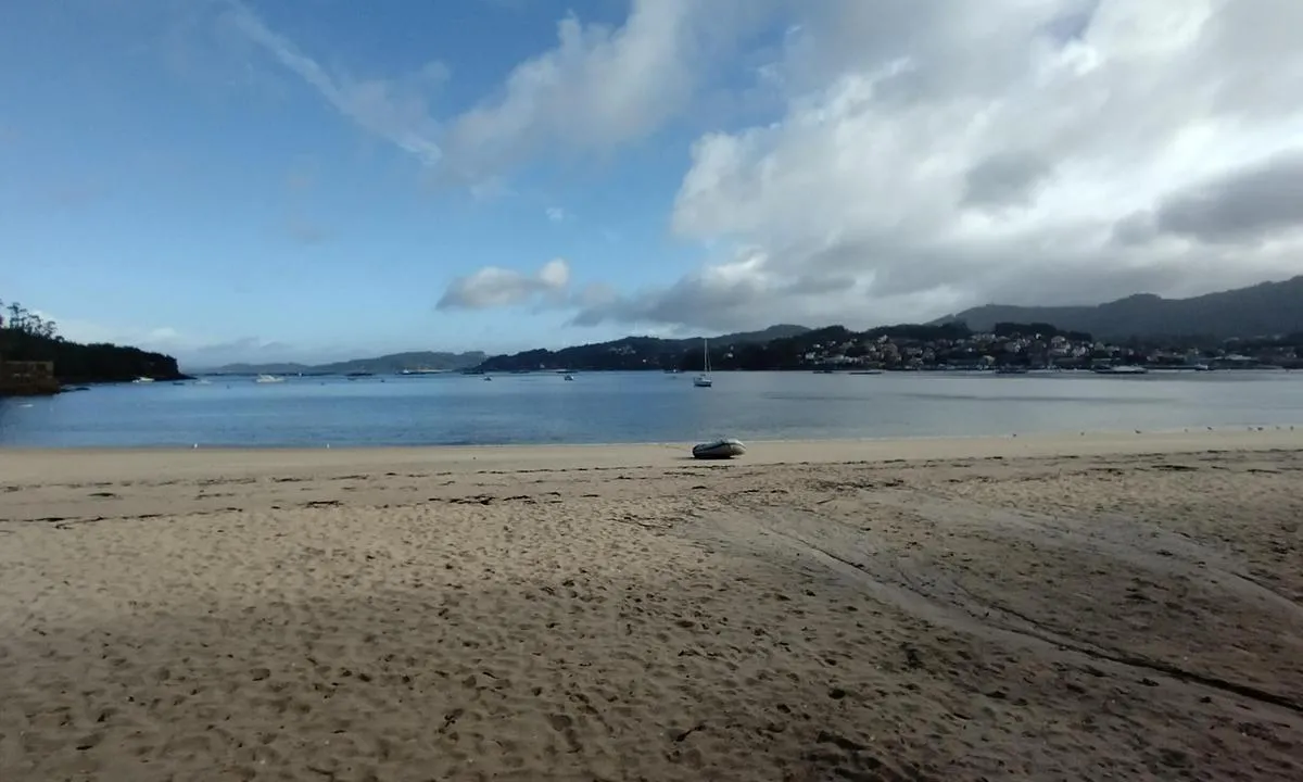
Not recommended to navigate in dark or in poor visibility. Lots of marine farms and buoys for local boats on the way in, big and small.
Plenty of space in front of the beach, when you get there. I went from east and south of all the marine farms (marked in charts).
Couple of charted rocks to be aware of, too.
4-7 meters depth with well holding sand.
Grocery stores and small villages close by.

I waited here a storm go by with southerly winds of 40+ knots. It was mostly less than 20 knots in the bay. Some heavier gusts came through now and then. Very little swell.

1 x helpful | written on 9. Oct 2024

Do you know this harbour? It's a huge help to other sailors if you add a short description or review of the harbour.

📜 Add description

Map of Praia de Arneles

Facilities

Available facilities: Swimming area.

Updated on 9. Oct 2024. Update facilities.

Mooring

Options for mooring in this harbour: Anchoring.

Updated on 9. Oct 2024. Update mooring.

Wind protection

Protection next night

72 points

N E S W --> } } } } } } } } } } } } } } } } } } } } } } } } } } } } } } } } } } } } } } } } } } } } } } } } } } } } } } } } } } } } } } } } } } } } } } } } } } } } } } } } } } } } } } } } } } } } } } } } } } } } } } } } } } } } } } } } } } } } } } } } } } } } } } } } } } } } } } } } } } } } } } } } } } } } } } } } } } } } } } } } } } } } } } } } } } } } } } } } } } } } } } } } } } } } } } } } } } } } } } } } } } } } } } } } } } } } } } } } } } } } } } } } } } } } } } } } } } } } } } } } } } } } } } } } } } } } } } } } } } } } } } } } } } } } } } } } } } } } } } } } } } } } } } } } } } } } } } } } } } } } } } } } } } } } } } } } } } } } } } } } } } } } } } } } } } } } } } } } } } } } } } } } } } } } } } } } } } } } } } } } } } } } } } } } } } } } } } } } } } } } } } } } } } } } } } } } } } } } } } } } } } } } } } } } } } } } } } } } } } } } } } } } } } } } } } } } } } } } } } } } } } } } } } } } } } } } } } } } } } } } } } } } } } } } } } } } } } } } } } } } } } } } } } } } } } } } } } } } } } } } } } } } } } } } } } } } } } } } } } } } } } } } } } } } } } } } } } } } } } } } } } } } } } } } } } } } } } } } } } } } } } } } } } } } } } } } } } } } } } } } } } } } } } } } } } } } } } } } } } } } } } } } } } } } } } } } } } } } } } } } } } } } } } } } } } } } } } } } } } } } } } } } } } } } } } } } } } } } } } } } } } } } } } } } } } } } } } } } } } } } } } } } } } } } } } } } } } } } } } } } } } } } } } } } } } } } } } } } } } } } } } } } } } } } } } } } } } } } } } } } } } } } } } } } } } } } } } } } } } } } } } } } } } } } } } } } } } } } } } } } } } } } } } } } } } } } } } } } } } } } } } } } } } } } } } } } } } } } } } } } } } } } } } } } } } } } } } } } } } } } } } } } } } } } } } } } } } } } } } } } } } } } } } } } } } } } } } } } } } } } } } } } } } } } } } } } } } } } } } } } } } } } } } } } } } } } } } } } } } } } } } } } } } } } } } } } } } } } } } } } } } } } } } } } } } } } } } } } } } } } } } } } } } } } } } } } } } } } } } } } Next night 6:00 12:00 Tor 01 Mai 18:00 0:00 6:00 12:00 Fre 02 Mai 7m/s 2m/s

Want to know how the wind score works? Then you should read this explanation.

The wind forecasts come from yr.no (Norwegian Meteorological Institute), and was last updated 3 hours and 46 minutes ago (Thursday 01 May 02:17 AM). The next night score shows you the worst hour between 22:00 and 08:00 the next night. We recommend that you check multiple sources for wind forecasts. windy.com is a good website to show larger wind systems.

The safe directions for this harbour was added at 9. Oct 2024. Click here to edit.

Praia de Arneles is surrounded by high hills or mountains. When strong winds come from the mountainous side there is a risk of turbulent or katabatic winds (also called "fall winds"), which may be rather unpleasant. In such conditions, you should not rely on the wind protection score for the coming night. Click to edit.

Last visits to Praia de Arneles

Wed 22 Jan 2025

AWANUI NZ [MMSI: 512206340]

Tue 21 Jan 2025

AWANUI NZ [MMSI: 512206340]

Thu 03 Oct 2024

LUNA [MMSI: 244030261]

Mon 16 Sep 2024

EAGLE UNO [MMSI: 224496350]

Sun 15 Sep 2024

DRAGON RAPIDE [MMSI: 224821160]

The visits are retrieved from AIS data. You can click to see all visiting ships to Praia de Arneles, as well as statistics about the ships that visits

Add this harbour to a journey

Check in now

Choose a different date than today

Important: When you check in to a harbour, you add it to a journey on this website. You are not booking a place in the marina.

Contributors

Users that contributed to this page: Jouni

harbourmaps.com is updated by the boating community. When you add information, a review or pictures to this page you are listed here with the other contributors (we list your user-name, which can be your real name or a pseudonym).

Closest harbours to Praia de Arneles

Filter by

Natural harbour
Marina
Safe wind next night

Order by

ABC
Popularity
Wind score next night

0 harbours

Show more harbours