


Ramsøy kai
Marina

Region: Norway (3470), Vestland (611), Hordaland (401), Askøy (26) and Hauglandshella (7)


Descriptions and reviews
TESO says:
says:
area

maritime qualities
description
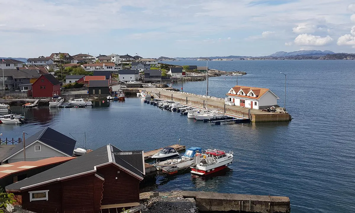
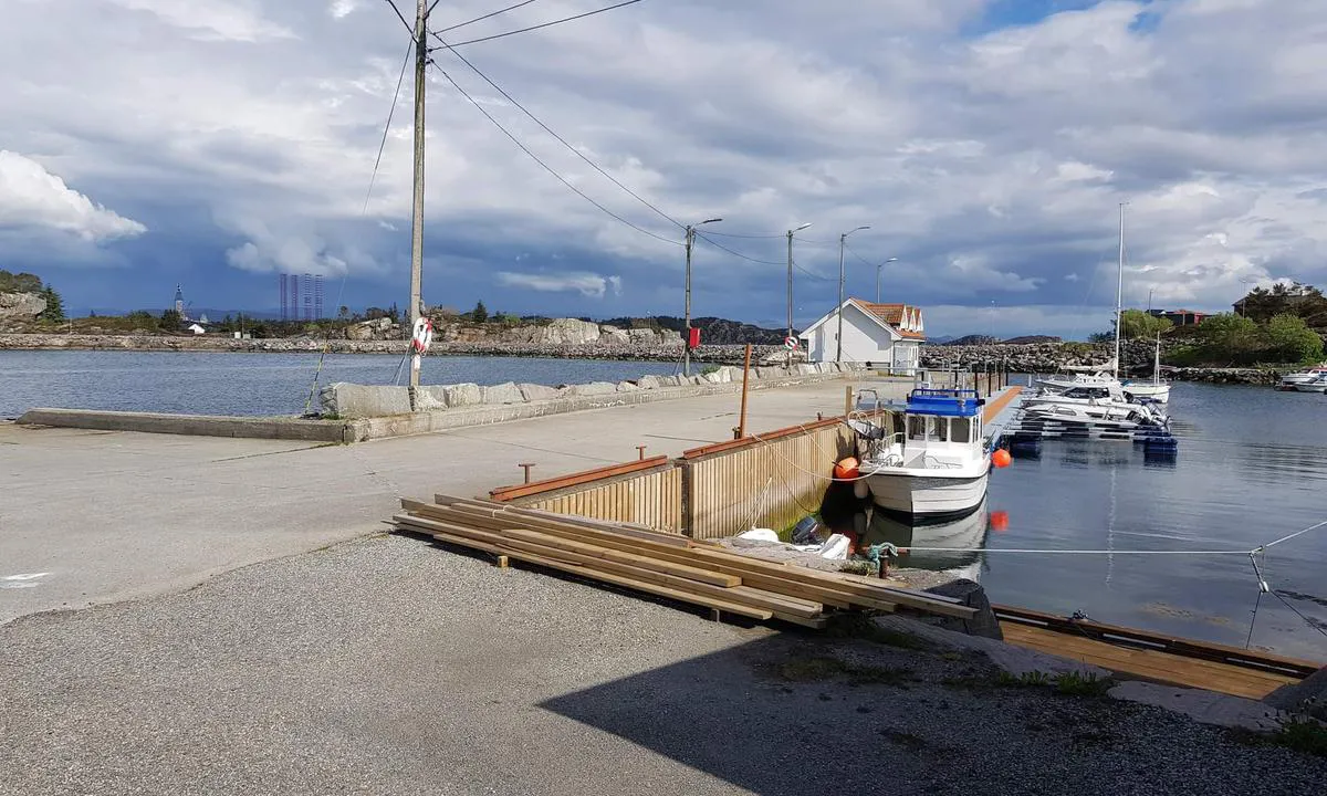
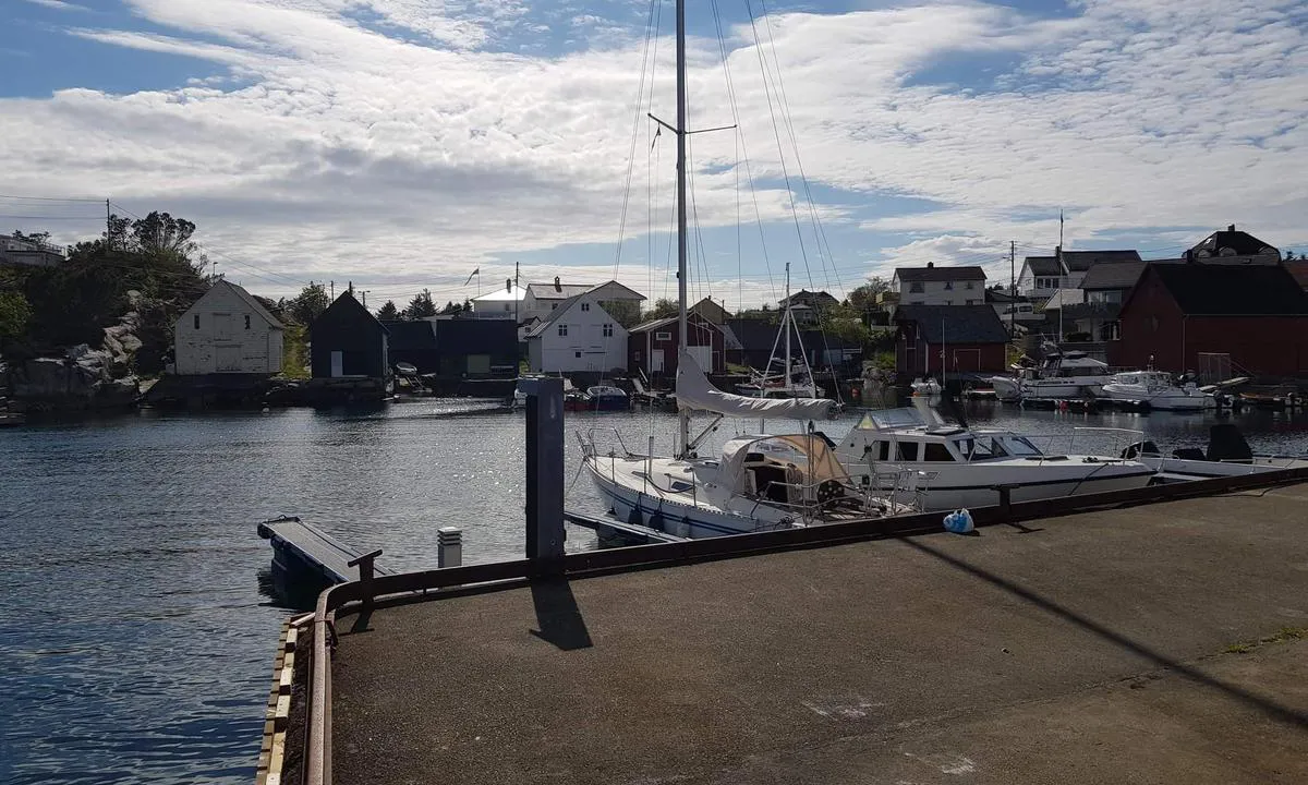
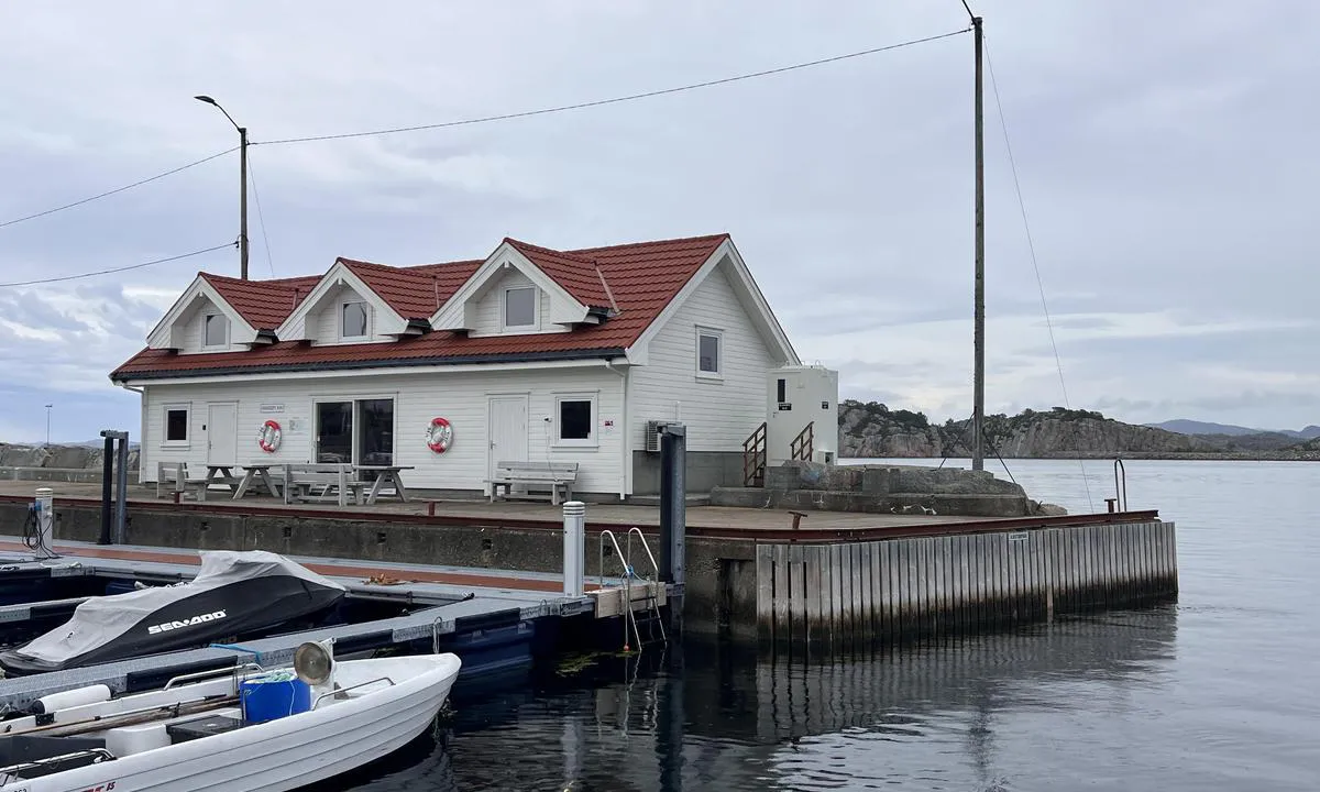
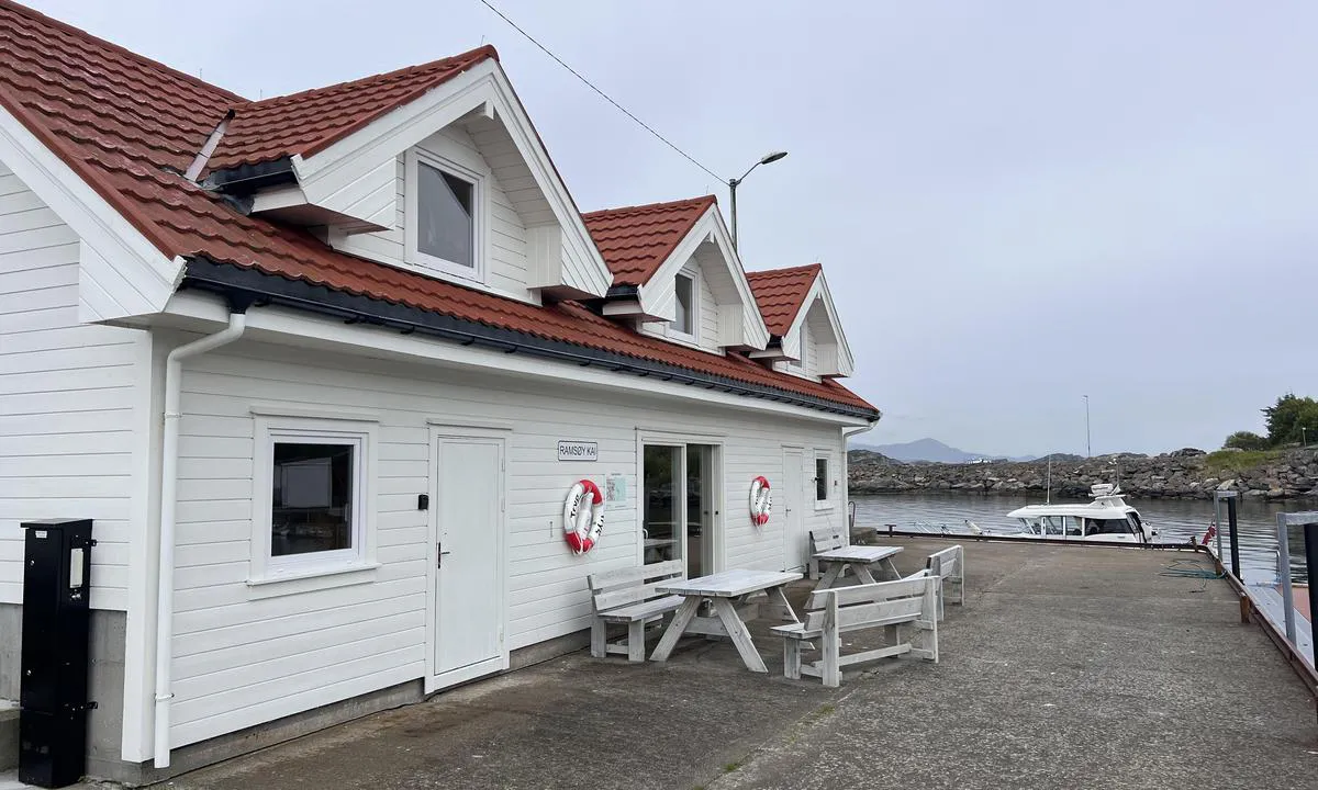
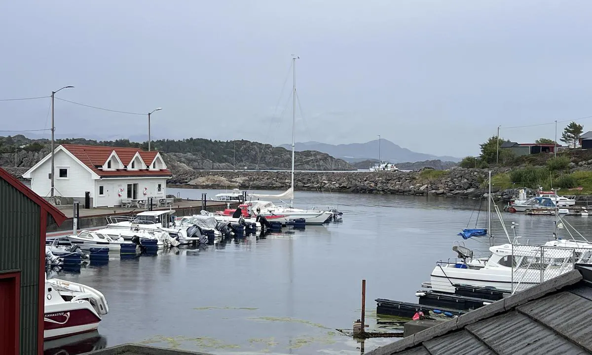
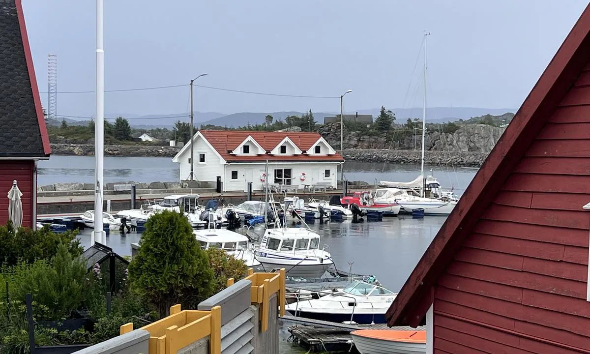
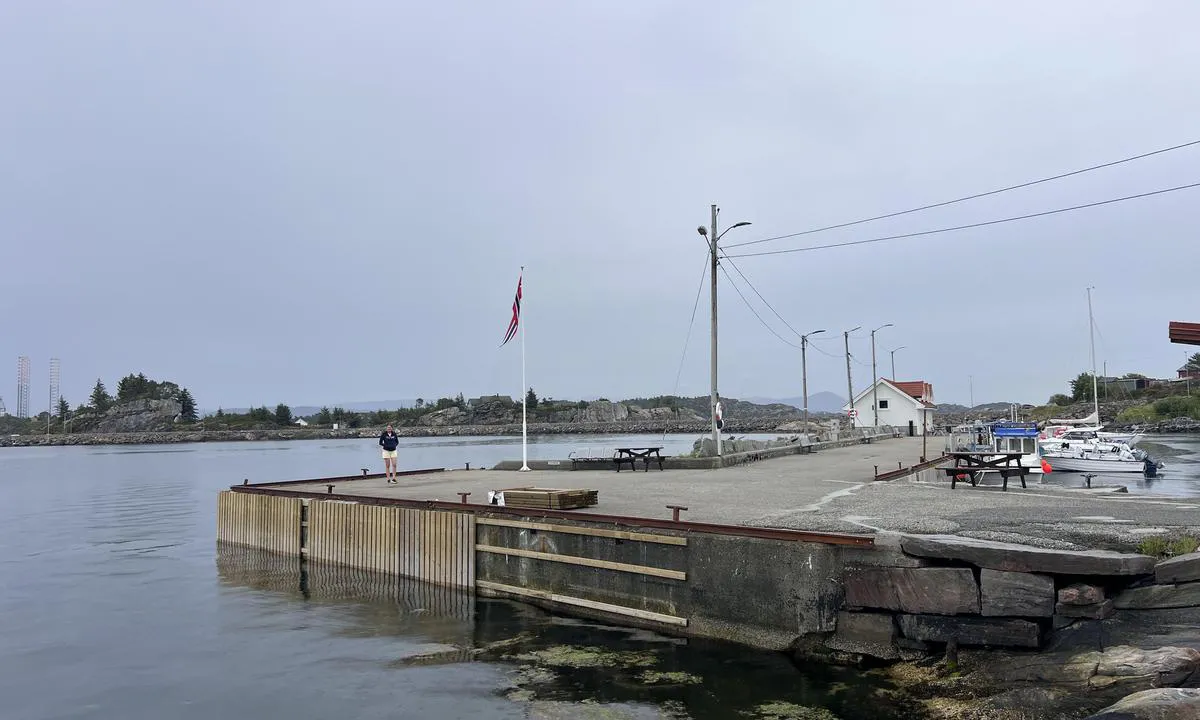
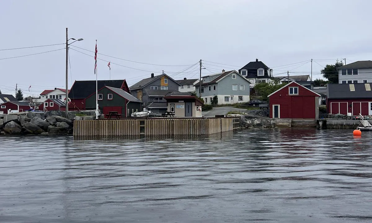
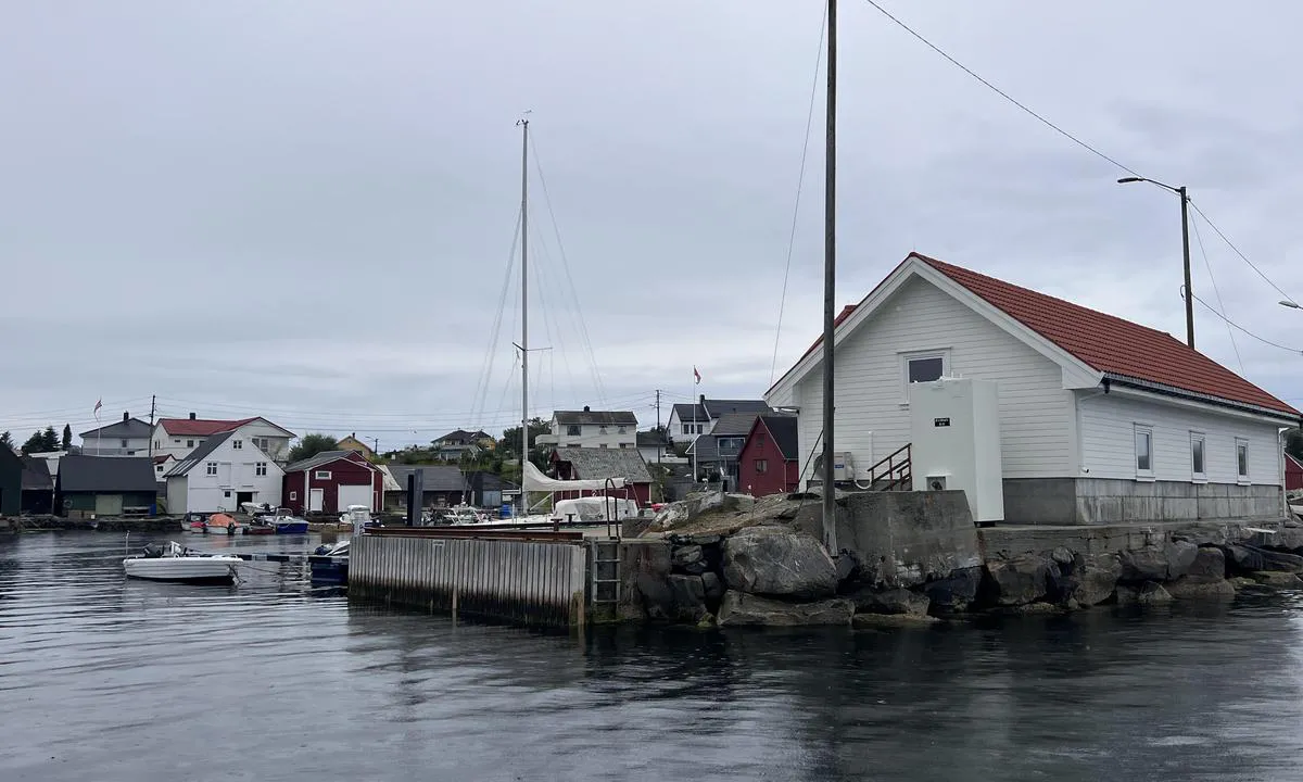
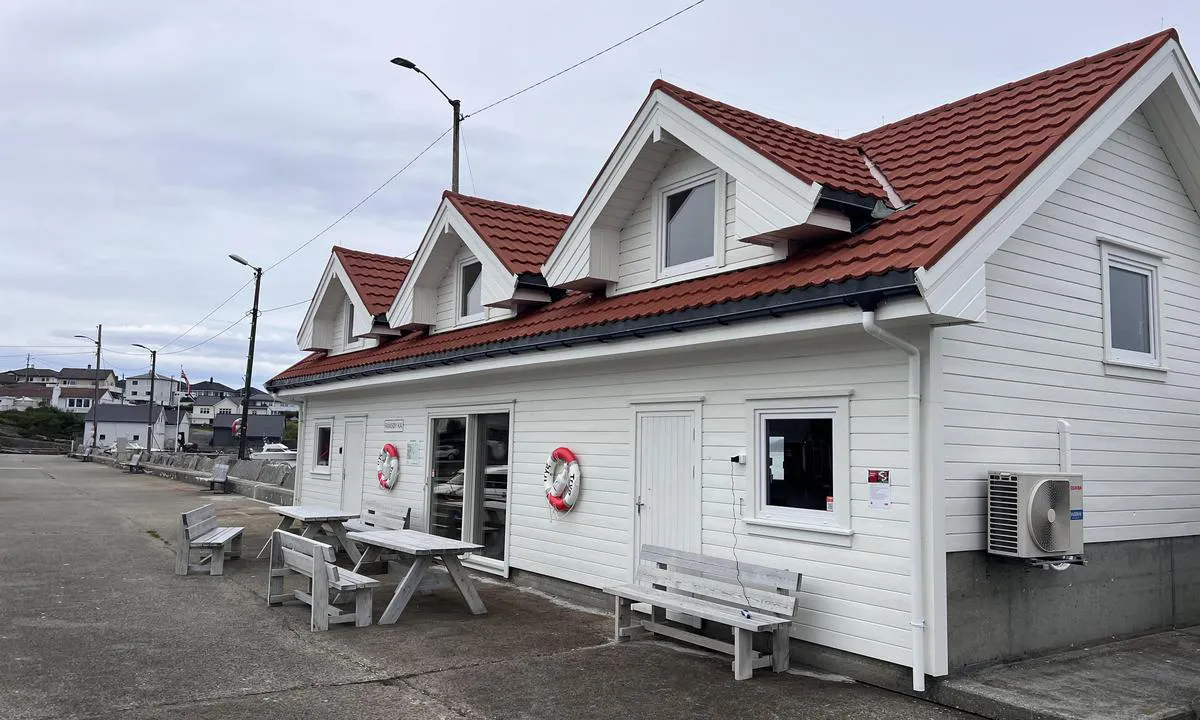
Cozy and sheltered harbor on an island connected to the mainland. A small community resides out here. Mooring to a concrete quay with a wooden front. Solid bollards. No fendering.
The harbor is well-placed in the main north/south route, but is well protected from winds in all directions. Hjeltefjorden is long and can have rough seas. Ramsøyhavn is sheltered on the eastern side of the island.
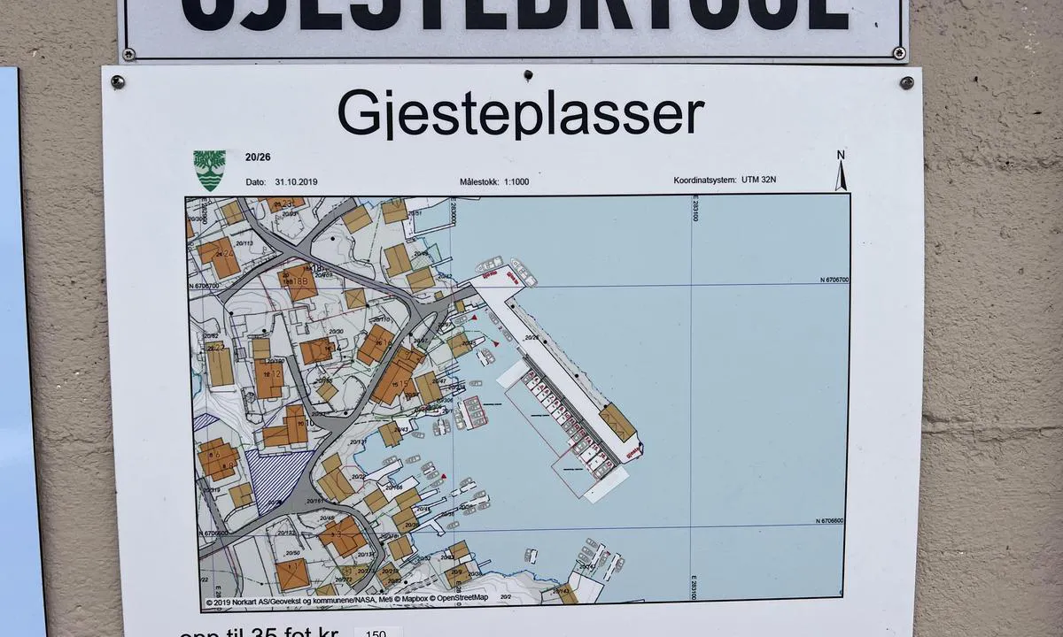
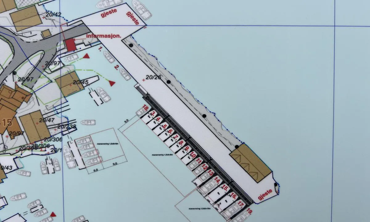
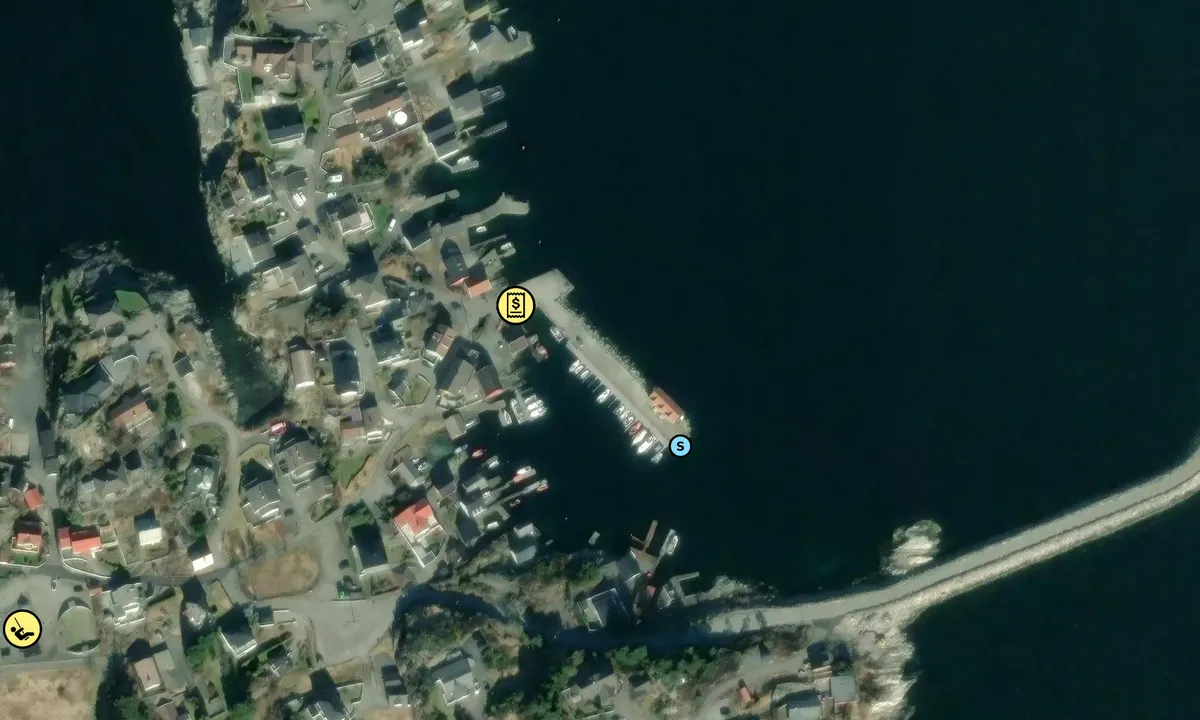
There are three piers that are guest docks (see image/map). All have good depth (5m+).
Easy arrival from Hjeltefjorden. For motorboats, it is also possible to navigate through Hanøysund, which is a beautiful passage with islets and straits.
From Ramsøy, you can take a walk over the breakwaters and bridge towards Askøy. There is also a bus connection to Kleppestø. From Kleppestø, there is a fast boat to Bergen city center. There are no stores on Ramsøy.
The wreck of the SS Spring, which collided in Hjeltefjorden on January 16, 1914, lies at the bay on the southern side near the bus roundabout. The wreck is situated from 8-40 meters below sea level. The wreck is not visible above water.
[translated from Norwegian with AI]

1 x helpful | written on 14. Jul 2024
Do you know this harbour? It's a huge help to other sailors if you add a short description or review of the harbour.
Map of Ramsøy kai

Wind protection
Protection next night
87 points


Want to know how the wind score works? Then you should read this explanation.
The wind forecasts come from yr.no (Norwegian Meteorological Institute), and was last updated 1 hour and 57 minutes ago (Saturday 27 June 08:27 PM). The next night score shows you the worst hour between 22:00 and 08:00 the next night. We recommend that you check multiple sources for wind forecasts. windy.com is a good website to show larger wind systems.
The safe directions for this harbour was added at 14. Jul 2024. Click here to edit.
Last visits to Ramsøy kai
Wed 19 Jul 2023 |
|
|
 MEDEA [MMSI: 258159470]
The visits are retrieved from AIS data. You can click to see all visiting ships to Ramsøy kai, as well as statistics about the ships that visits
Add this harbour to a journey
Choose a different date than today
Important: When you check in to a harbour, you add it to a journey on this website. You are not booking a place in the marina.
Contributors
Users that contributed to this page: Erik Karlsen and TESO
harbourmaps.com is updated by the boating community. When you add information, a review or pictures to this page you are listed here with the other contributors (we list your user-name, which can be your real name or a pseudonym).
Closest harbours to Ramsøy kai
Filter by
Order by
0 harbours
Show more harbours
