


Descriptions and reviews
Kzm says:
says:
area


maritime qualities
description
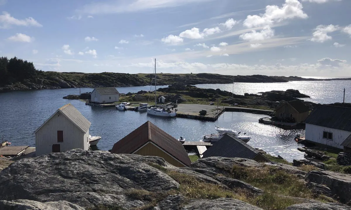
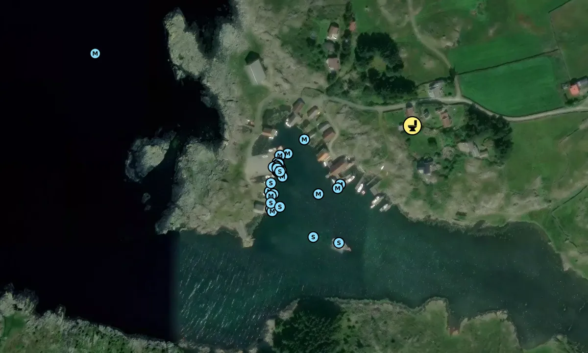
Lun og god havn, kartet viser en treer for været pga vestavinden, men vi ligger lunt og godt på betonkaia. Her er det akkurat plass til en ti meter lang seilbåt longside bak losbåten som ligger permanent(?) fortøyd innerst, men det går an å låne private brygger tvers over havna. Motorbåter kan også ligge på kortsiden av kaia, med baugen inn mot en slipp. I Havneguiden (noen år gammel) er det markert en bøye til å ligge på svai, men midt i vågen ligger en skøyte (også permanent?) ankret opp.
Det er en stolpe for strøm innerst på kaia, men er usikker på om den er til alment bruk. Det finnes et toalett i skolehuset rundt 100 m opp i veien, inngangen er på baksiden til uthuset bak selve skolehuset. Ved skolehuset finnes det også laminerte guidebøker til utlån som beskriver øyas historie, natur og geografi. Det går en del sauer på beite, så vær oppmerksom på det om du har hund (eller går barbent).
Ellers er lokalbefolkningen særdeles hyggelige her, og vi ble godt tatt imot på vår lille rundtur :-)

1 x helpful | written on 2. Jul 2025 | updated_on 2. Jul 2025
SY Lilly says:
description
When the wind blows from the east, the harbour is significantly less protected than what the chart suggests. The terrain to the east is almost level with the sea and therefore provides little shelter from the wind. The wind comes straight in along the 'channel' east of the concrete pier.
[translated from Norwegian with AI]
1 x helpful | written on 26. Nov 2023 | updated_on 26. Nov 2023
Stian B. Tveit says:
says:
description
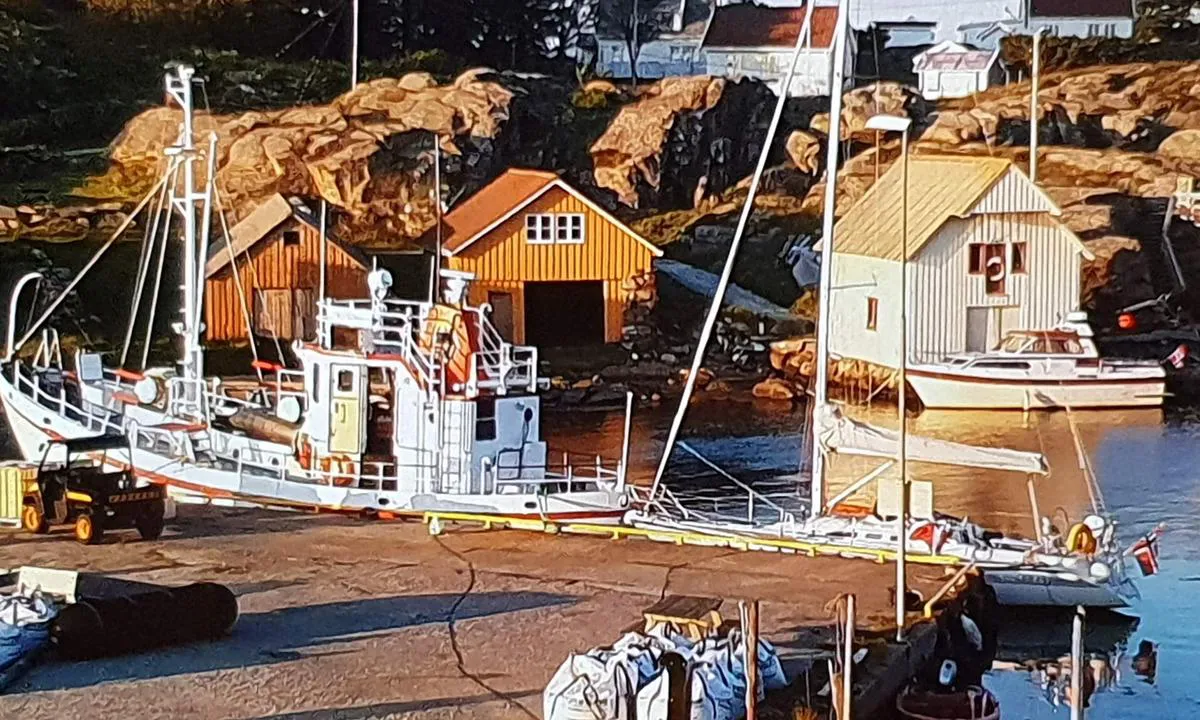
Approach and maritime conditions: Nice harbor. The quay is a public concrete quay. There is shore power at the quay, but no other services. Not great depth in the area, but sailboats can enter.
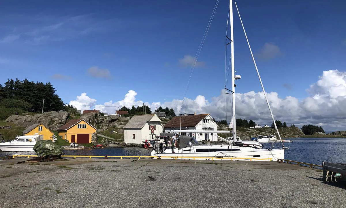
The area: Nice and quiet area. It is said that 1-3 people live on the island, otherwise it is only cottage residents. There are some ATVs that drive slowly in the area, but no cars. There are around 50 meters of paved road, the rest is gravel road. Somewhat poor mobile coverage in the harbor.
[translated from Norwegian with AI]
1 x helpful | written on 28. Aug 2021
Do you know this harbour? It's a huge help to other sailors if you add a short description or review of the harbour.
Map of Rott

Wind protection
Protection next night
85 points


Want to know how the wind score works? Then you should read this explanation.
The wind forecasts come from yr.no (Norwegian Meteorological Institute), and was last updated 1 hour and 18 minutes ago (Monday 27 July 11:30 PM). The next night score shows you the worst hour between 22:00 and 08:00 the next night. We recommend that you check multiple sources for wind forecasts. windy.com is a good website to show larger wind systems.
The safe directions for this harbour was added at 2. Jul 2025. Click here to edit.
Last visits to Rott
Fri 24 Jul 2026 |
|
|
Fri 10 Jul 2026 |
|
|
Sat 04 Jul 2026 |
|
|
Tue 23 Jun 2026 |
|
|
Sat 20 Jun 2026 |
|
|
 HAVSLOPAREN [MMSI: 265040890]
 RESTAURATION [MMSI: 257004600]
 SENIOR RITA [MMSI: 259006260]
 LIMA BRAVO [MMSI: 244010229]
The visits are retrieved from AIS data. You can click to see all visiting ships to Rott, as well as statistics about the ships that visits
Add this harbour to a journey
Choose a different date than today
Important: When you check in to a harbour, you add it to a journey on this website. You are not booking a place in the marina.
Contributors
Users that contributed to this page: Hans-Rune Kvernevik, Olav Pekeberg, SY Lilly, Kzm, Ingo W and Stian B. Tveit
harbourmaps.com is updated by the boating community. When you add information, a review or pictures to this page you are listed here with the other contributors (we list your user-name, which can be your real name or a pseudonym).
Closest harbours to Rott
Filter by
Order by
0 harbours
Show more harbours
