Straumhamn

Natural harbour

favoritt

Region: Norway (3278), Nordland (645), Hamarøy (27) and Buvåg (6)

Straumhamn
{"base": "no", "no": "I Straumhamn kan du ligge p\u00e5 svai eller fort\u00f8ye med lange liner til land fra akter og baug.", "se": "I Str\u00f6mhamnen kan du ligga p\u00e5 svaj eller f\u00f6rt\u00f6ja med l\u00e5nga linor till land fr\u00e5n akter och f\u00f6r.", "en": "In Straumhamn, you can anchor or moor with long lines to the land from stern and bow.", "da": "I Str\u00f8mhavn kan du ligge for svaj eller fort\u00f8je med lange liner til land fra agter og bov."}
Straumhamn: {"base": "no", "no": "Dette bilde er tatt innerst i havne, \u00f8st for stranden. Kun en b\u00f8ye, men landfester. Se opp for fallvinder.", "se": "Denna bild \u00e4r tagen l\u00e4ngst in i hamnen, \u00f6ster om stranden. Endast en boj, men med landf\u00e4sten. Se upp f\u00f6r fallvindar.", "en": "This picture is taken at the innermost part of the harbor, east of the beach. Only one buoy, but land fastenings. Watch out for downdrafts.", "da": "Dette billede er taget inderst i havnen, \u00f8st for stranden. Kun en b\u00f8je, men landfester. Se op for kastevinde."}
Straumhamn: {"base": "no", "no": "Ankerplass ved stranden.", "se": "Ankringsplats vid stranden.", "en": "Anchorage by the beach.", "da": "Ankerplads ved stranden."}
Straumhamn: {"base": "no", "no": "Mange ankringsplasser med mulighet for landfort\u00f8yning. Blikk mot vest og Lofotveggen.", "se": "M\u00e5nga ankringsplatser med m\u00f6jlighet f\u00f6r landf\u00f6rt\u00f6jning. Utsikt mot v\u00e4ster och Lofoten-v\u00e4ggen.", "en": "Many anchoring places with the possibility for shore mooring. View towards the west and the Lofoten Wall.", "da": "Mange ankerpladser med mulighed for landfort\u00f8jning. Udsigt mod vest og Lofotv\u00e6ggen."}
Straumhamn
Straumhamn: {"base": "no", "no": "Fint \u00e5 ankre midt i sundet, godt feste i leire.", "se": "Bra att ankra mitt i sundet, gott f\u00e4ste i lera.", "en": "Good to anchor in the middle of the sound, good holding in clay.", "da": "Dejligt at ankere midt i sundet, god holdeevne i ler."}
Straumhamn: {"base": "no", "no": "Straumhavn p\u00e5 Hammar\u00f8y. Norges peneste naturhavn?", "se": "Str\u00f6mhamn p\u00e5 Hammar\u00f6. Sveriges vackraste naturhamn?", "en": "Straumhavn on Hammar\u00f8y. Norway's most beautiful natural harbour?", "da": "Str\u00f8mhavn p\u00e5 Hammar\u00f8y. Norges smukkeste naturhavn?"}
Straumhamn
Straumhamn
Flyfoto av Straumhamn

📸 Upload a photo

Show off your photos and help others plan their journey to Straumhamn.harbourmaps.com is created by the sailing community, in a collective effort to make cruising simpler and more fun. Uploading a photo takes less than a minutes and can be done from your phone, tablet or laptop.

📸 Upload a photo

Facilities

Available facilities: Playground, Swimming area.

Updated on 26. Jun 2021. Update facilities.

Mooring

Options for mooring in this harbour: Anchoring, Towards land.

Updated on 30. Jun 2021. Update mooring.

Descriptions and reviews

Lars Erik Karlsen says:

description

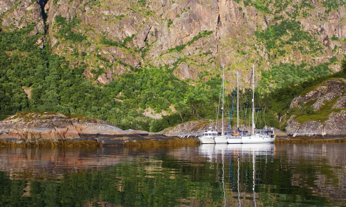
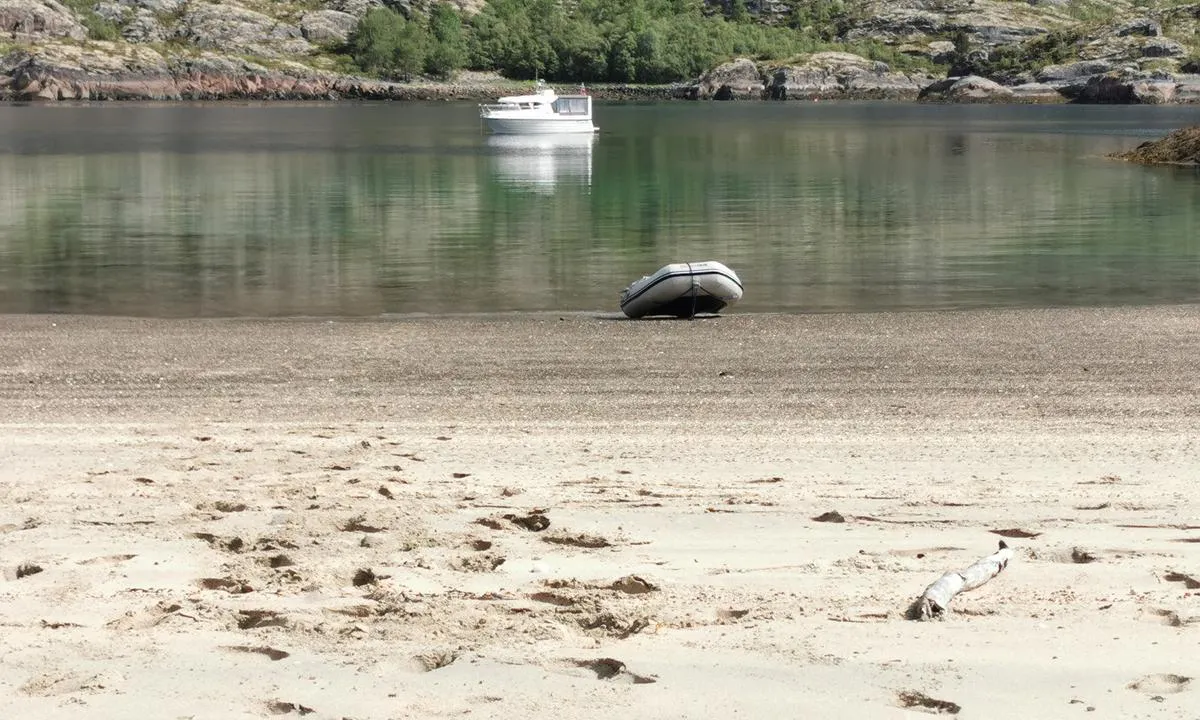
You can also moor all the way inside the bay with lines at the bow and stern. There are bolts with shackles in the rock.

[translated from Norwegian with AI]

1 x helpful | written on 2. Sep 2024

Seiler1 says:

area

maritime qualities

description

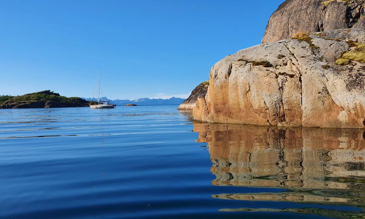
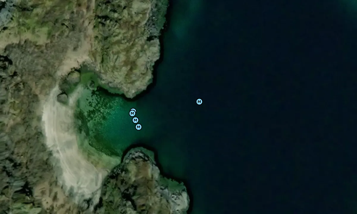
Please note that there is a large rock in the approach, indicated to be at 1m depth. It is easy to navigate around this to enter Straumshamn.

[translated from Norwegian with AI]

1 x helpful | written on 12. Jul 2024

Olav Pekeberg says:

description

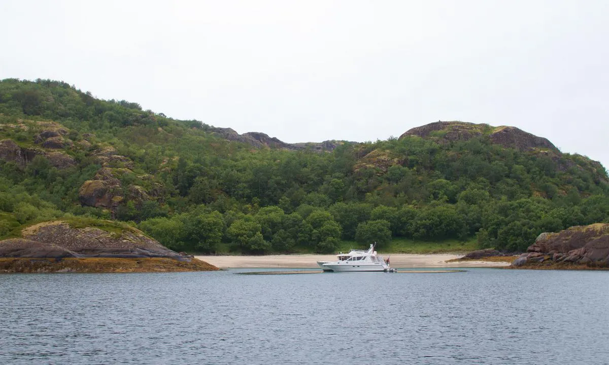
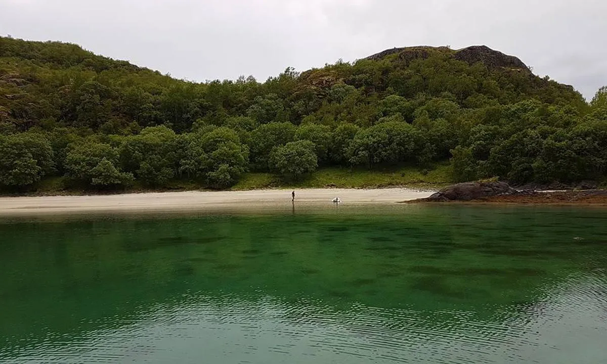
Approach and maritime conditions: Straumhamn is located west of Hamarøy just outside Hamarøyskaftet.

Anchorage: Anchorage depth 10-30 meters

[translated from Norwegian with AI]

0 x helpful | written on 30. Jun 2021

Do you know this harbour? It's a huge help to other sailors if you add a short description or review of the harbour.

📜 Add description

Map of Straumhamn

Facilities

Available facilities: Playground, Swimming area.

Updated on 26. Jun 2021. Update facilities.

Mooring

Options for mooring in this harbour: Anchoring, Towards land.

Updated on 30. Jun 2021. Update mooring.

Wind protection

Protection next night

89 points

N E S W --> } } } } } } } } } } } } } } } } } } } } } } } } } } } } } } } } } } } } } } } } } } } } } } } } } } } } } } } } } } } } } } } } } } } } } } } } } } } } } } } } } } } } } } } } } } } } } } } } } } } } } } } } } } } } } } } } } } } } } } } } } } } } } } } } } } } } } } } } } } } } } } } } } } } } } } } } } } } } } } } } } } } } } } } } } } } } } } } } } } } } } } } } } } } } } } } } } } } } } } } } } } } } } } } } } } } } } } } } } } } } } } } } } } } } } } } } } } } } } } } } } } } } } } } } } } } } } } } } } } } } } } } } } } } } } } } } } } } } } } } } } } } } } } } } } } } } } } } } } } } } } } } } } } } } } } } } } } } } } } } } } } } } } } } } } } } } } } } } } } } } } } } } } } } } } } } } } } } } } } } } } } } } } } } } } } } } } } } } } } } } } } } } } } } } } } } } } } } } } } } } } } } } } } } } } } } } } } } } } } } } } } } } } } } } } } } } } } } } } } } } } } } } } } } } } } } } } } } } } } } } } } } } } } } } } } } } } } } } } } } } } } } } } } } } } } } } } } } } } } } } } } } } } } } } } } } } } } } } } } } } } } } } } } } } } } } } } } } } } } } } } } } } } } } } } } } } } } } } } } } } } } } } } } } } } } } } } } } } } } } } } } } } } } } } } } } } } } } } } } } } } } } } } } } } } } } } } } } } } } } } } } } } } } } } } } } } } } } } } } } } } } } } } } } } } } } } } } } } } } } } } } } } } } } } } } } } } } } } } } } } } } } } } } } } } } } } } } } } } } } } } } } } } } } } } } } } } } } } } } } } } } } } } } } } } } } } } } } } } } } } } } } } } } } } } } } } } } } } } } } } } } } } } } } } } } } } } } } } } } } } } } } } } } } } } } } } } } } } } } } } } } } } } } } } } } } } } } } } } } } } } } } } } } } } } } } } } } } } } } } } } } } } } } } } } } } } } } } } } } } } } } } } } } } } } } } } } } } } } } } } } } } } } } } } } } } } } } } } } } } } } } } } } } } } } } } } } } } } } } } } } } } } } } } } } } } } } } } } } } } } } } } } } } } } } } } } } } } } } } } } } } } } } } } } } } } } } } } } } } } } Next night 12:00 Ons 30 Apr 18:00 0:00 6:00 12:00 Tor 01 Mai 18:00 7m/s 2m/s

Want to know how the wind score works? Then you should read this explanation.

The wind forecasts come from yr.no (Norwegian Meteorological Institute), and was last updated 1 hour and 42 minutes ago (Wednesday 30 April 09:28 AM). The next night score shows you the worst hour between 22:00 and 08:00 the next night. We recommend that you check multiple sources for wind forecasts. windy.com is a good website to show larger wind systems.

The safe directions for this harbour was added at 24. Jun 2021. Click here to edit.

Last visits to Straumhamn

Thu 21 Sep 2023

URSA MINOR [MMSI: 258008800]

Fri 18 Aug 2023

CONSENSUS II [MMSI: 257516720]

Wed 09 Aug 2023

CORDELIA [MMSI: 257772810]

Fri 28 Jul 2023

ALBA [MMSI: 258134770]

Tue 25 Jul 2023

CASSIOPEIA [MMSI: 265507730]

The visits are retrieved from AIS data. You can click to see all visiting ships to Straumhamn, as well as statistics about the ships that visits

Add this harbour to a journey

Check in now

Choose a different date than today

Important: When you check in to a harbour, you add it to a journey on this website. You are not booking a place in the marina.

Contributors

Users that contributed to this page: ©norgeskart.no, Olav Pekeberg, Berry Spruijt, Thor Ole Fongaard, Ingo W, Ulf Dahlslett and Thomas Fjordbak Jensen

harbourmaps.com is updated by the boating community. When you add information, a review or pictures to this page you are listed here with the other contributors (we list your user-name, which can be your real name or a pseudonym).

Closest harbours to Straumhamn

Filter by

Natural harbour
Marina
Safe wind next night

Order by

ABC
Popularity
Wind score next night

0 harbours

Show more harbours