Svinøya Svenøya Fræna

Natural harbour

favoritt

Region: Norway (3234), Møre og Romsdal (294), Hustadvika (19) and Elnesvågen (4)

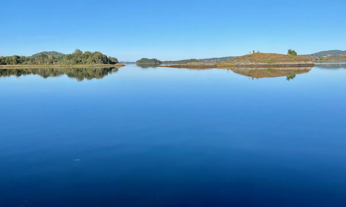
Svinøya Svenøya Fræna: {"base": "no", "no": "Utsikt mot nordvest. Ankringsplassen er godt beskyttet og uansett vind s\u00e5 blir det ingen sj\u00f8 her inne.", "se": "<p>Utsikt mot nordv\u00e4st. Ankringsplatsen \u00e4r v\u00e4l skyddad och oavsett vind blir det ingen sj\u00f6 h\u00e4r inne.</p>", "en": "View towards the northwest. The anchorage is well protected and regardless of the wind, there will be no waves in here.", "da": "Udsigt mod nordvest. Ankerpladsen er godt beskyttet, og uanset vind bliver der ingen s\u00f8 herinde."}
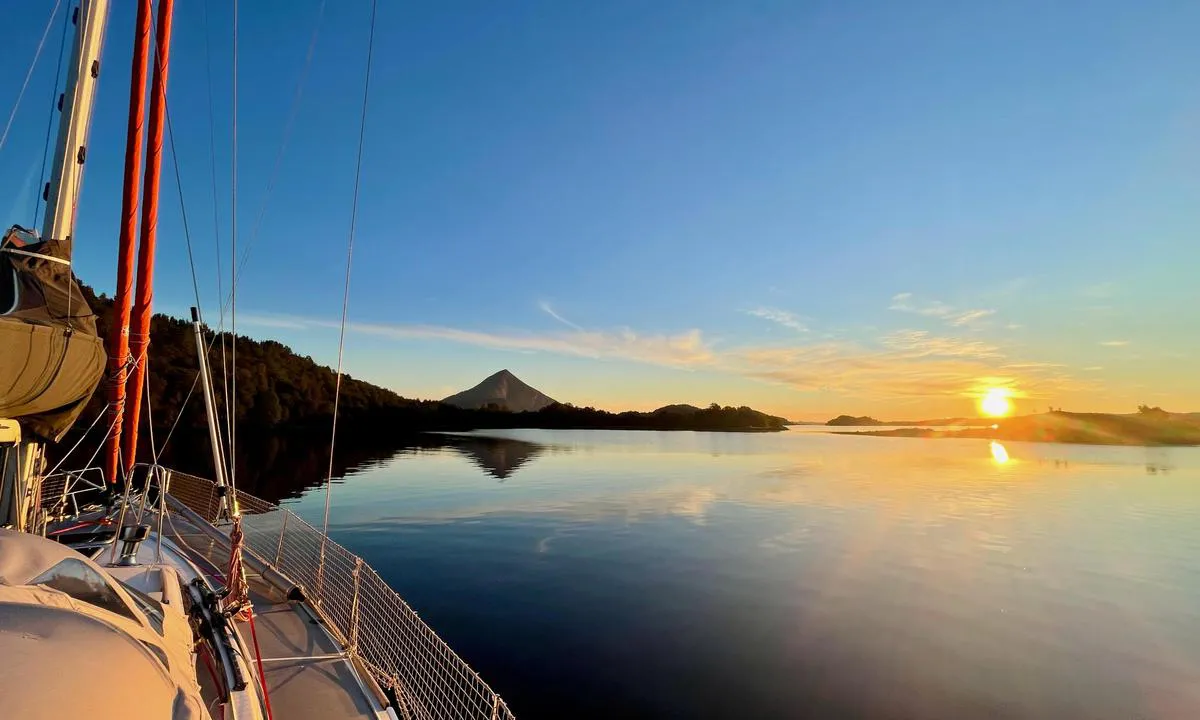
Svinøya Svenøya Fræna: {"base": "no", "no": "Sukkertoppen rett forut er Jendemsfjellet (633 moh.) Det st\u00e5r n\u00e6rmest som en stor pyramide i S\u00f8re Fr\u00e6na, og fra toppen er det en flott utsikt over store deler av kommunen og utover mot storhavet. Her ser man helt ut til Ona Fyr! Det spesielle med denne turen er at til tross for at den er ganske kort, s\u00e5 f\u00e5r man virkelig \"topptur\"-f\u00f8lelse n\u00e5r man kommer opp. Turen passer godt for familier p\u00e5 tur, og det kreves ikke noe spesielt ekstra turutstyr. Gode joggesko eller helst fjellsko er \u00e5 anbefale. Turbeskrivelse: G\u00e5 skogsvegen opp mot en gammel l\u00f8e, videre opp til \u00e5sen, der man tar av til h\u00f8yre langs god skogssti. Siste delen g\u00e5r p\u00e5 sti med noe stein/ur. Fantastisk utsikt p\u00e5 \u00f8verste delen av turen!.", "se": "<p>Sukkertoppen rakt fram\u00e5t \u00e4r Jendemsfjellet (633 m \u00f6.h.) Det st\u00e5r n\u00e4stan som en stor pyramid i S\u00f6dra Fr\u00e6na, och fr\u00e5n toppen \u00e4r det en fantastisk utsikt \u00f6ver stora delar av kommunen och ut mot det stora havet. H\u00e4r kan man se hela v\u00e4gen ut till Ona fyr!</p><p>Det speciella med denna tur \u00e4r att trots att den \u00e4r ganska kort, f\u00e5r man verkligen en \"topptur\"-k\u00e4nsla n\u00e4r man kommer upp. Turen passar bra f\u00f6r familjer p\u00e5 utflykt, och det kr\u00e4vs ingen speciell extra utrustning. Bra joggingskor eller helst vandringsk\u00e4ngor rekommenderas.</p><p>Beskrivning av turen: G\u00e5 skogsv\u00e4gen upp mot en gammal lada, vidare upp till \u00e5sen, d\u00e4r man tar av till h\u00f6ger l\u00e4ngs en bra skogsstig. Sista delen g\u00e5r p\u00e5 stig med en del sten/r\u00f6s. Fantastisk utsikt p\u00e5 den \u00f6versta delen av turen!.</p>", "en": "The mountain straight ahead is Jendemsfjellet (633 m.a.s.l.). It stands almost like a large pyramid in S\u00f8re Fr\u00e6na, and from the top, there is a great view over large parts of the municipality and out towards the open sea. From here, you can see all the way to Ona Lighthouse! The special thing about this hike is that despite being quite short, you really get a 'summit tour' feeling when you get to the top. The hike is well-suited for families, and no special extra hiking equipment is required. Good running shoes, or preferably mountain boots, are recommended. Description of the hike: Follow the forest road up towards an old barn, then continue up to the ridge, where you turn right onto a good forest path. The last part goes on a path with some stones/scree. Fantastic view at the top part of the hike!", "da": "Sukkertoppen lige forude er Jendemsfjellet (633 moh.). Det st\u00e5r n\u00e6rmest som en stor pyramide i S\u00f8re Fr\u00e6na, og fra toppen er der en fantastisk udsigt over store dele af kommunen og ud mod storhavet. Her kan man se helt ud til Ona Fyr! Det s\u00e6rlige ved denne tur er, at p\u00e5 trods af at den er ganske kort, s\u00e5 f\u00e5r man virkelig en \"topptur\"-f\u00f8lelse, n\u00e5r man kommer op. Turen egner sig godt til familier p\u00e5 tur, og der kr\u00e6ves ikke noget specielt ekstra udstyr til turen. Gode l\u00f8besko eller helst vandresko er at anbefale. Turbeskrivelse: G\u00e5 skovvejen op mod en gammel lade, videre op til h\u00f8jen, hvor man drejer til h\u00f8jre langs en god skovsti. Den sidste del g\u00e5r p\u00e5 en sti med noget stenur. Fantastisk udsigt p\u00e5 den \u00f8verste del af turen!"}
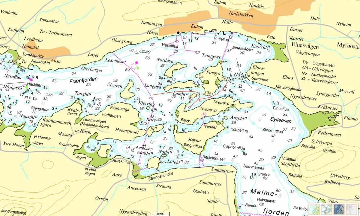
Svinøya Svenøya Fræna: {"base": "no", "no": "Trygg innseiling for seilb\u00e5t med dybde inntil 3 meter tegnet med r\u00f8dt. 2,5m dybden angitt mellom skj\u00e6ret og Lamholmen er IKKE riktig. Der er det grunnere enn 1,8m..!  \r\nG\u00e5 rundt p\u00e5 \u00f8stsiden av Lamholmen der det er merket med 3 meter dybde.", "se": "Trygg insegling f\u00f6r segelb\u00e5t med djup upp till 3 meter markerad med r\u00f6tt. 2,5 m djupet angivet mellan sk\u00e4ret och Lamholmen \u00e4r INTE korrekt. D\u00e4r \u00e4r det grundare \u00e4n 1,8 m..!\nG\u00e5 runt p\u00e5 \u00f6stsidan av Lamholmen d\u00e4r det \u00e4r markerat med 3 meter djup.", "en": "Safe entry for sailboats with a depth of up to 3 meters is marked in red. The 2.5m depth indicated between the reef and Lamholmen is NOT correct. It is shallower than 1.8m there..! Proceed around the east side of Lamholmen where it is marked with a 3 meter depth.", "da": "Tryg indsejling for sejlb\u00e5d med dybde indtil 3 meter tegnet med r\u00f8dt. 2,5m dybden angivet mellem sk\u00e6ret og Lamholmen er IKKE korrekt. Der er det grundere end 1,8m..! G\u00e5 rundt p\u00e5 \u00f8stsiden af Lamholmen, hvor det er markeret med 3 meter dybde."}
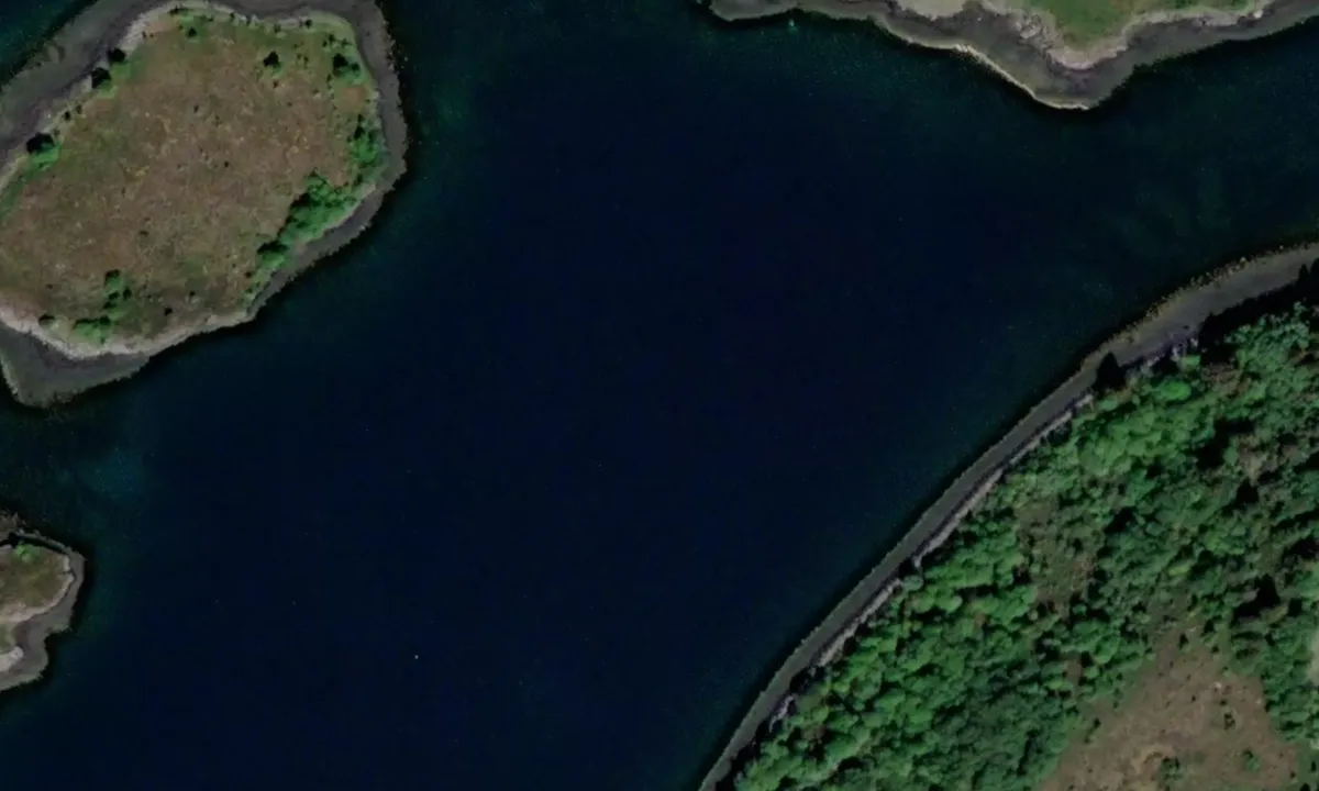
Flyfoto av Svinøya Svenøya Fræna

📸 Upload a photo

Show off your photos and help others plan their journey to Svinøya Svenøya Fræna.harbourmaps.com is created by the sailing community, in a collective effort to make cruising simpler and more fun. Uploading a photo takes less than a minutes and can be done from your phone, tablet or laptop.

📸 Upload a photo

Facilities

We don't have any data on available facilities in this harbour. If you know which facilities are available here, please update this site to help your fellow sailors. Update facilities.

Mooring

We don't have any data on how to moor in this harbour. If you know how to moor here, please update this site to help your fellow sailors. Update mooring.

Descriptions and reviews

Do you know this harbour? It's a huge help to other sailors if you add a short description or review of the harbour.

📜 Add description

Map of Svinøya Svenøya Fræna

Facilities

We don't have any data on available facilities in this harbour. If you know which facilities are available here, please update this site to help your fellow sailors. Update facilities.

Mooring

We don't have any data on how to moor in this harbour. If you know how to moor here, please update this site to help your fellow sailors. Update mooring.

Wind protection

Protection next night

89 points

N E S W --> } } } } } } } } } } } } } } } } } } } } } } } } } } } } } } } } } } } } } } } } } } } } } } } } } } } } } } } } } } } } } } } } } } } } } } } } } } } } } } } } } } } } } } } } } } } } } } } } } } } } } } } } } } } } } } } } } } } } } } } } } } } } } } } } } } } } } } } } } } } } } } } } } } } } } } } } } } } } } } } } } } } } } } } } } } } } } } } } } } } } } } } } } } } } } } } } } } } } } } } } } } } } } } } } } } } } } } } } } } } } } } } } } } } } } } } } } } } } } } } } } } } } } } } } } } } } } } } } } } } } } } } } } } } } } } } } } } } } } } } } } } } } } } } } } } } } } } } } } } } } } } } } } } } } } } } } } } } } } } } } } } } } } } } } } } } } } } } } } } } } } } } } } } } } } } } } } } } } } } } } } } } } } } } } } } } } } } } } } } } } } } } } } } } } } } } } } } } } } } } } } } } } } } } } } } } } } } } } } } } } } } } } } } } } } } } } } } } } } } } } } } } } } } } } } } } } } } } } } } } } } } } } } } } } } } } } } } } } } } } } } } } } } } } } } } } } } } } } } } } } } } } } } } } } } } } } } } } } } } } } } } } } } } } } } } } } } } } } } } } } } } } } } } } } } } } } } } } } } } } } } } } } } } } } } } } } } } } } } } } } } } } } } } } } } } } } } } } } } } } } } } } } } } } } } } } } } } } } } } } } } } } } } } } } } } } } } } } } } } } } } } } } } } } } } } } } } } } } } } } } } } } } } } } } } } } } } } } } } } } } } } } } } } } } } } } } } } } } } } } } } } } } } } } } } } } } } } } } } } } } } } } } } } } } } } } } } } } } } } } } } } } } } } } } } } } } } } } } } } } } } } } } } } } } } } } } } } } } } } } } } } } } } } } } } } } } } } } } } } } } } } } } } } } } } } } } } } } } } } } } } } } } } } } } } } } } } } } } } } } } } } } } } } } } } } } } } } } } } } } } } } } } } } } } } } } } } } } } } } } } } } } } } } } } } } } } } } } } } } } } } } } } } } } } } } } } } } } } } } } } } } } } } } } } } } } } } } } } } } } } } } } } } } } } } } } } } } } } } } } } } } } } } } } } } } } } } } } } } } } } Next night 6:00 12:00 Lør 14 Des 18:00 0:00 6:00 12:00 Søn 15 Des 13m/s 3m/s

Want to know how the wind score works? Then you should read this explanation.

The wind forecasts come from yr.no (Norwegian Meteorological Institute), and was last updated 2 hours and 25 minutes ago (Saturday 14 December 02:27 AM). The next night score shows you the worst hour between 22:00 and 08:00 the next night. We recommend that you check multiple sources for wind forecasts. windy.com is a good website to show larger wind systems.

The safe directions for this harbour was added at 1. Jan 2023. Click here to edit.

Last visits to Svinøya Svenøya Fræna

The visits are retrieved from AIS data. You can click to see all visiting ships to Svinøya Svenøya Fræna, as well as statistics about the ships that visits

Add this harbour to a journey

Check in now

Choose a different date than today

Important: When you check in to a harbour, you add it to a journey on this website. You are not booking a place in the marina.

Contributors

Users that contributed to this page: Fjellmatrosene and ©norgeskart.no

harbourmaps.com is updated by the boating community. When you add information, a review or pictures to this page you are listed here with the other contributors (we list your user-name, which can be your real name or a pseudonym).

Closest harbours to Svinøya Svenøya Fræna

Filter by

Natural harbour
Marina
Safe wind next night

Order by

ABC
Popularity
Wind score next night

0 harbours

Show more harbours