See where in the harbor you can dock and anchor
Have you wondered where in the harbor you can find guest docks? Or where you can anchor and dock against the shore in natural harbors? HarbourMaps shows you this on the map.
Many leisure boats are equipped with AIS and share their position through this. HarbourMaps checks every night where leisure boats with AIS have docked. We run the data through an advanced algorithm to pick out the overnight stays made when a boat is traveling. This way, you can easily and accurately see where others have docked and anchored before you.
When you zoom in on the map, light blue points appear where others have previously docked. Inside the points, you will see the letters M, S, and Y. These are abbreviations for Motorboat, Sailboat, and Yacht. It is particularly helpful to distinguish these boat types in shallow harbors.
We pick up AIS signals worldwide. This means that the functionality to see where guests dock in harbors is also available globally. Let's look at some examples:
1. Nynäshamn
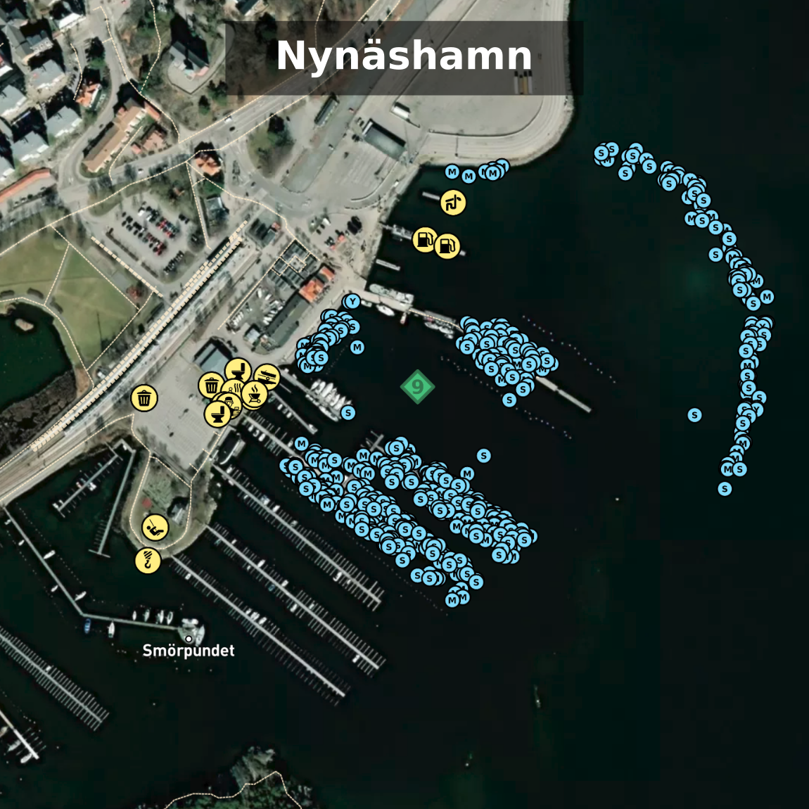
Here we see Nynäshamn located at the southern end of the archipelago outside Stockholm. In Nynäshamn there are many docks, and we can clearly see which docks are used by visiting boats. Docks without blue dots are fixed spots that cannot be used by guests. On the far right, we also see that many have moored in "nothing." There is a new floating dock that wasn't there when the satellite image was taken.

3. James Island
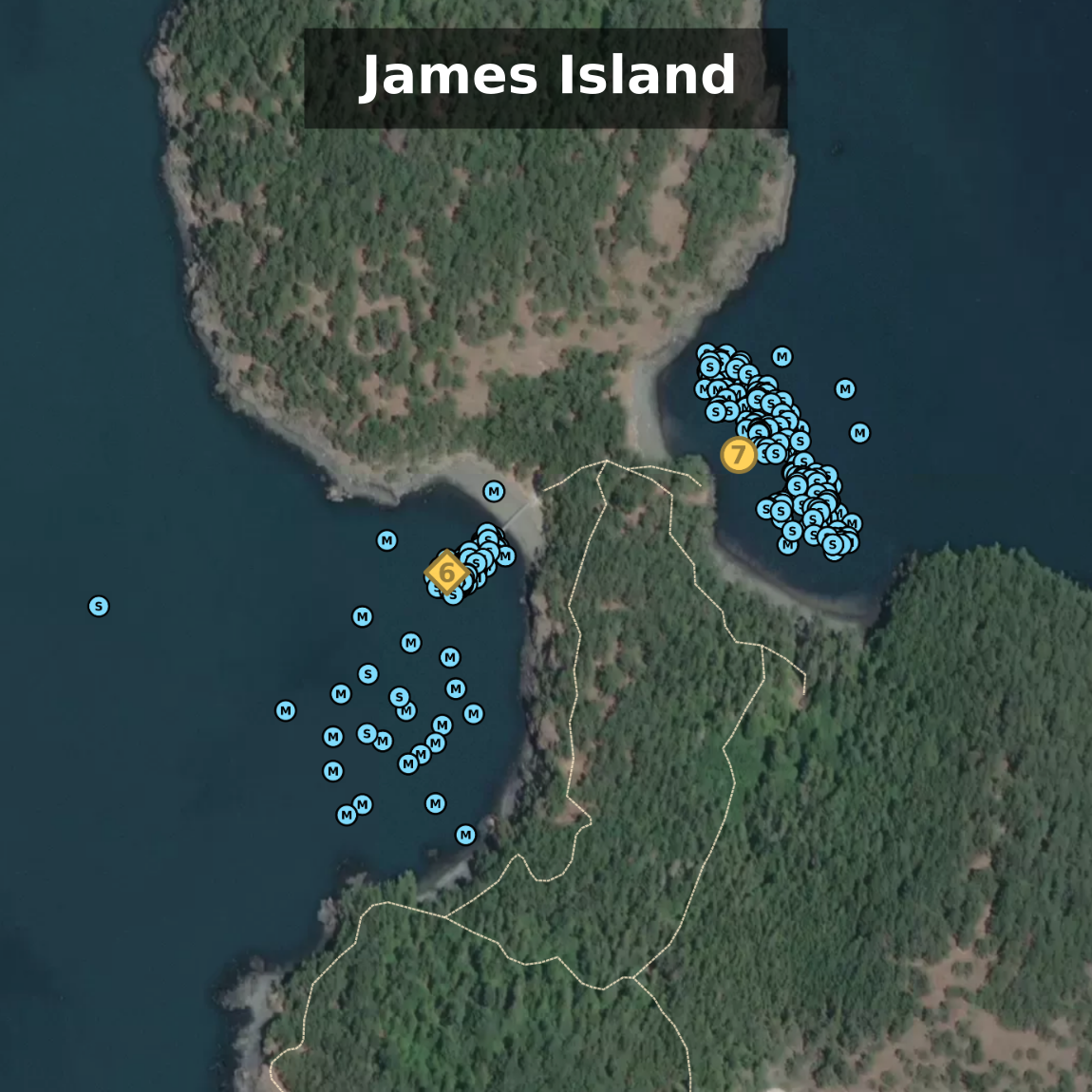
Here we see James Island, which is part of the San Juan Islands outside Seattle in the USA. Here it is common to anchor on both the east and west sides, as well as moor to a dock on the west side.

4. Komiža
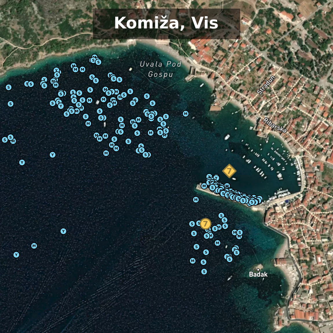
Here we see Komiža Town Quay where guests moor on the inside of the breakwater. It is also common to anchor just outside the breakwater or north in the harbor. In the middle of the image, we see the entrance to the harbor, where it is obvious that one should not anchor.

Share AIS data with the HarbourMaps
AIS signals are collected by volunteers who have AIS receivers and forward the data to entities that compile it into a complete picture for the world. The site that most boaters share signals with is MarineTraffic. The data there is closed, so the HarbourMaps needs your help to collect data. Contact us at olav@pekeberg.com if you have an AIS receiver and are willing to share data with us. If you already share with MarineTraffic, they can stream the data further.


