Søndre Missingene

Natural harbour

favoritt

Region: Norway (3278), Viken (191), Ytre Oslofjord (171), Østfoldkysten (110) and Fredrikstad (39)

Søndre Missingene: {"base": "no", "no": "S\u00f8ndre  Missingen med innseilingen \u00f8stfra til venstre i bildet. L\u00e5 fint p\u00e5 svai i lite vind. Bl\u00e5 b\u00f8ye helt inne godt i le fra vind og sj\u00f8!.", "se": "S\u00f6dra Missingen med inseglingen \u00f6sterifr\u00e5n till v\u00e4nster i bilden. L\u00e5g fint f\u00f6r ankar i lite vind. Bl\u00e5 boj helt inne v\u00e4l i l\u00e4 fr\u00e5n vind och sj\u00f6!", "en": "S\u00f8ndre Missingen with the approach from the east to the left in the picture. Lay nicely at anchor in light winds. Blue buoy well sheltered from the wind and sea!", "da": "S\u00f8ndre Missingen med indsejlingen \u00f8stfra til venstre i billedet. L\u00e5 fint p\u00e5 svaj i lidt vind. Bl\u00e5 b\u00f8je helt inde godt i l\u00e6 fra vind og s\u00f8!"}
Søndre Missingene: {"base": "no", "no": "Bildet er tatt fra S\u00f8ndre Missingen mot S\u00f8r/S\u00f8r\u00f8st.", "se": "Bilden \u00e4r tagen fr\u00e5n S\u00f6dra Missingen mot Syd/Syd\u00f6st.", "en": "The picture is taken from S\u00f8ndre Missingen towards South/Southeast.", "da": "Billedet er taget fra S\u00f8ndre Missingen mod Syd/Syd\u00f8st."}
Søndre Missingene
Søndre Missingene: {"base": "no", "no": "Enkel innseilingen med to svarte pinner over rett. Havna ser du f\u00f8rst til h\u00f8yre n\u00e5r du kommer inn til den bl\u00e5 b\u00f8yen. Dypt nok for seilb\u00e5t inntil brygga.", "se": "Enkel inseglningen med tv\u00e5 svarta pinnar \u00f6ver rakt. Hamnen ser du f\u00f6rst till h\u00f6ger n\u00e4r du kommer in till den bl\u00e5 bojen. Tillr\u00e4ckligt djupt f\u00f6r segelb\u00e5t invid bryggan.", "en": "Simple approach with two black poles in a line. The harbour is first seen on the right when you reach the blue buoy. Deep enough for a sailboat near the pier.", "da": "Enkel indsejling med to sorte pinde over ret. Havnen ser du f\u00f8rst til h\u00f8jre, n\u00e5r du kommer ind til den bl\u00e5 b\u00f8je. Dyb nok til sejlb\u00e5d indtil kajen."}
Søndre Missingene
Flyfoto av Søndre Missingene

📸 Upload a photo

Show off your photos and help others plan their journey to Søndre Missingene.harbourmaps.com is created by the sailing community, in a collective effort to make cruising simpler and more fun. Uploading a photo takes less than a minutes and can be done from your phone, tablet or laptop.

📸 Upload a photo

Facilities

Available facilities: Toilet.

Updated on 18. Sep 2022. Update facilities.

Mooring

Options for mooring in this harbour: To pier/wharf, Anchoring, Mooring buoy<br>(for easy "anchoring", not to be confused with bouys used in marinas), Towards land.

Updated on 18. Sep 2022. Update mooring.

Descriptions and reviews

Asgeir Larsen says:

description

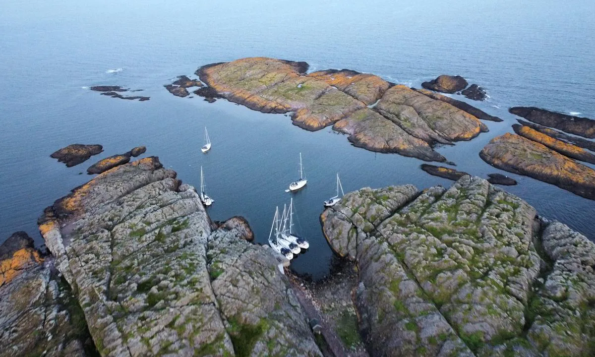
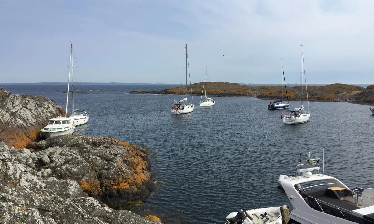
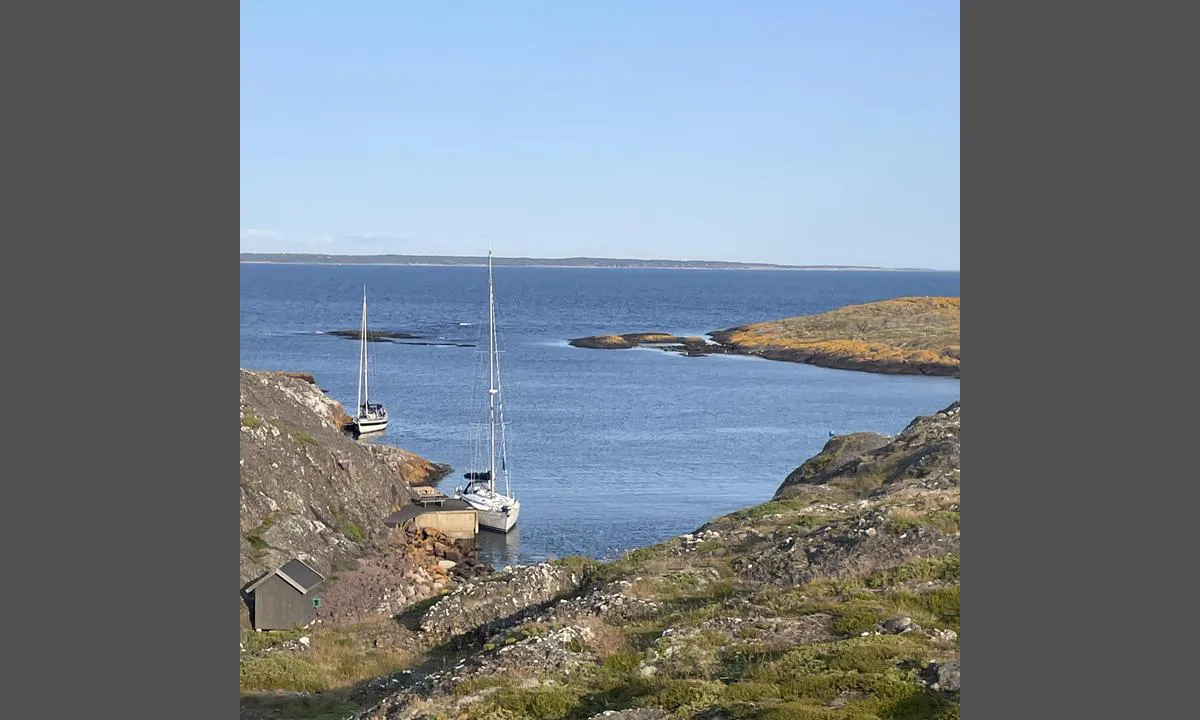
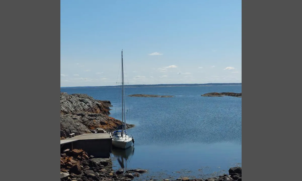
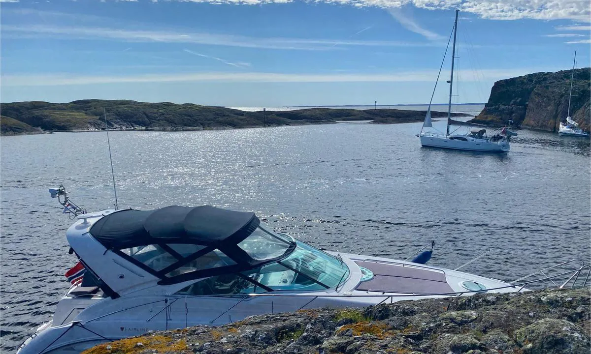
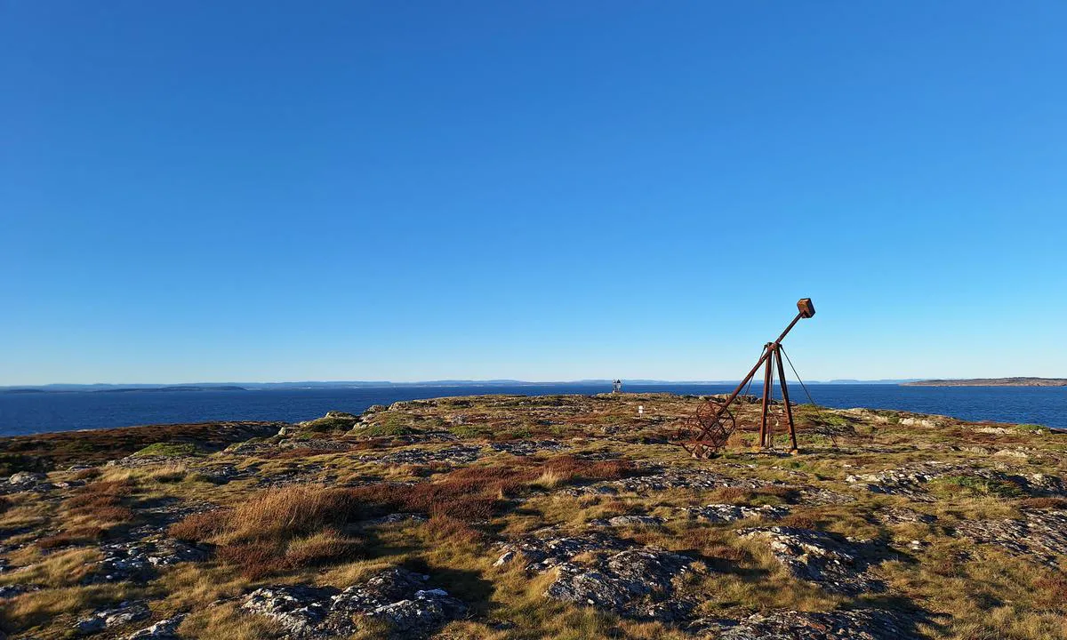
Approach and maritime conditions: Søndre Missingene is located about 6 km southwest of Slevik and about 3 km south of Rauer, Fredrikstad. Two range markers (black triangles on a white background) mark the entrance from the east, keep clear of Missingskjæra east of Søndre Missingene.
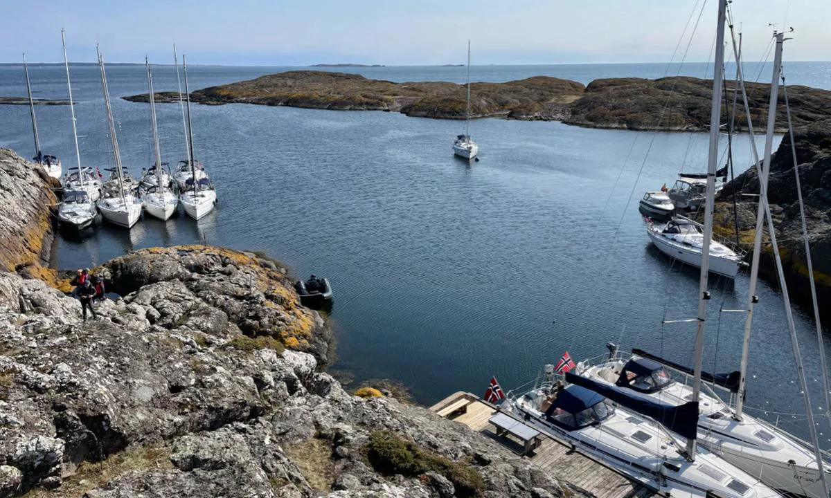
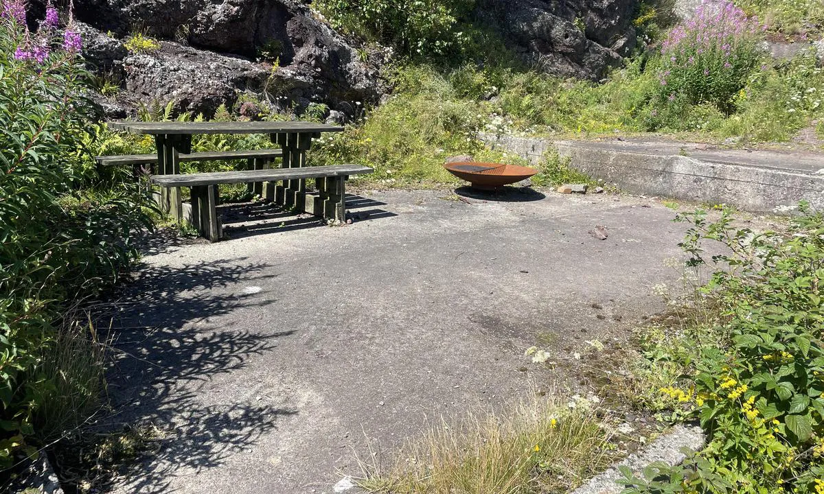
Anchoring: 8 meters. There is space for a couple of boats at the dock, otherwise, mooring is done alongside the shore, with a stern anchor and bow in or swinging at anchor.
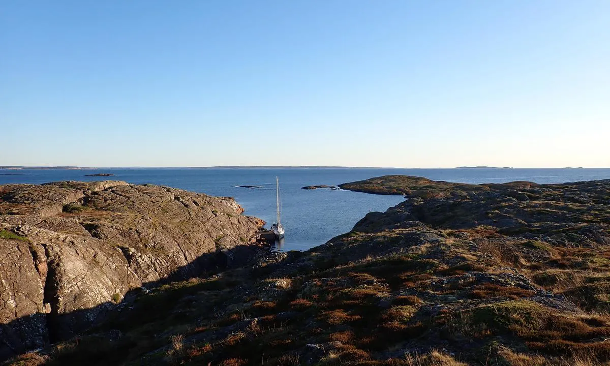
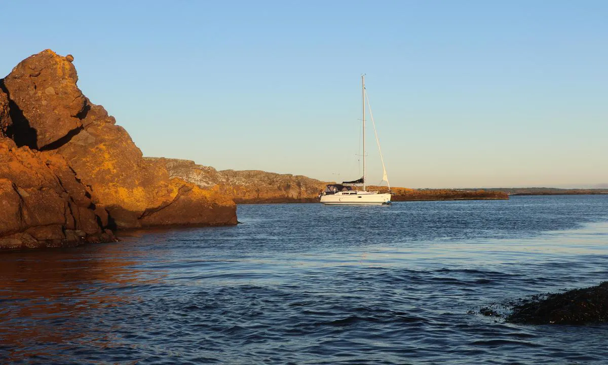
The area: The majority of the island is a nature reserve, but the area around the dock is a recreational area. The bedrock consists of a conglomerate of rhomb porphyry, a volcanic rock. This creates an exciting landscape, but the rock can be quite sharp in some places. The site is popular for diving, partly because of the frigate Schleswig which sank here in 1711.

[translated from Norwegian with AI]

1 x helpful | written on 9. Jun 2021

Do you know this harbour? It's a huge help to other sailors if you add a short description or review of the harbour.

📜 Add description

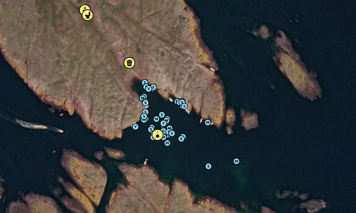
Map of Søndre Missingene

Facilities

Available facilities: Toilet.

Updated on 18. Sep 2022. Update facilities.

Mooring

Options for mooring in this harbour: To pier/wharf, Anchoring, Mooring buoy<br>(for easy "anchoring", not to be confused with bouys used in marinas), Towards land.

Updated on 18. Sep 2022. Update mooring.

Wind protection

Protection next night

74 points

N E S W --> } } } } } } } } } } } } } } } } } } } } } } } } } } } } } } } } } } } } } } } } } } } } } } } } } } } } } } } } } } } } } } } } } } } } } } } } } } } } } } } } } } } } } } } } } } } } } } } } } } } } } } } } } } } } } } } } } } } } } } } } } } } } } } } } } } } } } } } } } } } } } } } } } } } } } } } } } } } } } } } } } } } } } } } } } } } } } } } } } } } } } } } } } } } } } } } } } } } } } } } } } } } } } } } } } } } } } } } } } } } } } } } } } } } } } } } } } } } } } } } } } } } } } } } } } } } } } } } } } } } } } } } } } } } } } } } } } } } } } } } } } } } } } } } } } } } } } } } } } } } } } } } } } } } } } } } } } } } } } } } } } } } } } } } } } } } } } } } } } } } } } } } } } } } } } } } } } } } } } } } } } } } } } } } } } } } } } } } } } } } } } } } } } } } } } } } } } } } } } } } } } } } } } } } } } } } } } } } } } } } } } } } } } } } } } } } } } } } } } } } } } } } } } } } } } } } } } } } } } } } } } } } } } } } } } } } } } } } } } } } } } } } } } } } } } } } } } } } } } } } } } } } } } } } } } } } } } } } } } } } } } } } } } } } } } } } } } } } } } } } } } } } } } } } } } } } } } } } } } } } } } } } } } } } } } } } } } } } } } } } } } } } } } } } } } } } } } } } } } } } } } } } } } } } } } } } } } } } } } } } } } } } } } } } } } } } } } } } } } } } } } } } } } } } } } } } } } } } } } } } } } } } } } } } } } } } } } } } } } } } } } } } } } } } } } } } } } } } } } } } } } } } } } } } } } } } } } } } } } } } } } } } } } } } } } } } } } } } } } } } } } } } } } } } } } } } } } } } } } } } } } } } } } } } } } } } } } } } } } } } } } } } } } } } } } } } } } } } } } } } } } } } } } } } } } } } } } } } } } } } } } } } } } } } } } } } } } } } } } } } } } } } } } } } } } } } } } } } } } } } } } } } } } } } } } } } } } } } } } } } } } } } } } } } } } } } } } } } } } } } } } } } } } } } } } } } } } } } } } } } } } } } } } } } } } } } } } } } } } } } } } } } } } } } } } } } } } } } } } } } } } } } } } } } } } } } } } } } } } } } } Next night 18:00 0:00 6:00 12:00 Tor 01 Mai 18:00 0:00 11m/s 3m/s

Want to know how the wind score works? Then you should read this explanation.

The wind forecasts come from yr.no (Norwegian Meteorological Institute), and was last updated 1 hour and 51 minutes ago (Wednesday 30 April 01:28 PM). The next night score shows you the worst hour between 22:00 and 08:00 the next night. We recommend that you check multiple sources for wind forecasts. windy.com is a good website to show larger wind systems.

The safe directions for this harbour was added at None. Click here to edit.

Last visits to Søndre Missingene

Fri 25 Apr 2025

RELAX II [MMSI: 257120850]

Wed 23 Apr 2025

FROYA [MMSI: 258258340]

Fri 11 Apr 2025

AURORA [MMSI: 258185630]

Sat 05 Apr 2025

RELAX II [MMSI: 257120850]

Fri 04 Apr 2025

FINNVIKEN [MMSI: 257450220]

The visits are retrieved from AIS data. You can click to see all visiting ships to Søndre Missingene, as well as statistics about the ships that visits

Add this harbour to a journey

Check in now

Choose a different date than today

Important: When you check in to a harbour, you add it to a journey on this website. You are not booking a place in the marina.

Contributors

Users that contributed to this page: Jørn Skuterud, ©norgeskart.no, Pia Martinsen, LEP, @alanasailing, Asgeir Larsen, Susann @casa_quist and Neste Sommer

harbourmaps.com is updated by the boating community. When you add information, a review or pictures to this page you are listed here with the other contributors (we list your user-name, which can be your real name or a pseudonym).

Closest harbours to Søndre Missingene

Filter by

Natural harbour
Marina
Safe wind next night

Order by

ABC
Popularity
Wind score next night

0 harbours

Show more harbours