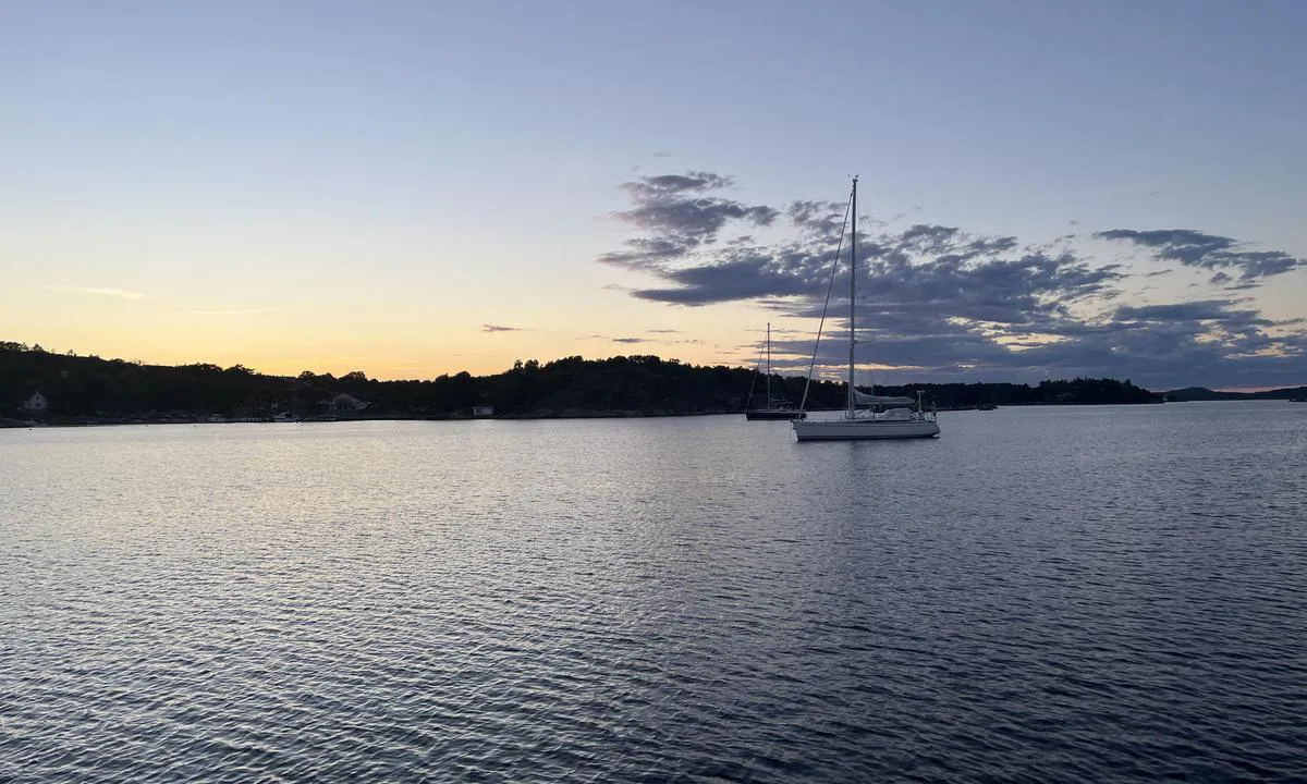
Message from the system: You need to log in to write a review of the harour.

Brotsøbukta: {"base": "no", "no": "Fra cirka midt i havna nordover. Godt om plass!", "se": "Fr\u00e5n cirka mitten av hamnen norrut. Gott om plats!", "en": "From approximately the middle of the harbor northwards. Plenty of space!", "da": "Fra cirka midt i havnen nordover. Godt om plads!"}
Satelite image of Brotsøbukta

📸 Upload a photo

Show off your photos and help others plan their journey to Brotsøbukta.harbourmaps.com is created by the sailing community, in a collective effort to make cruising simpler and more fun. Uploading a photo takes less than a minutes and can be done from your phone, tablet or laptop.

📸 Upload a photo

Facilities

We don't have any data on available facilities in this harbour. If you know which facilities are available here, please update this site to help your fellow sailors. Update facilities.

Mooring

Options for mooring in this harbour: Anchoring.

Updated on 28. Jul 2022. Update mooring.

Descriptions and reviews

Johan Almqvist says:

area

maritime qualities

description

Large area south and west of the red light ULEHOLMEN N.
Anchoring in mud at approximately 6-8 meters depth. Some boat traffic but less than other places in the area.
Fewer private buoys here than further south in the strait.

[translated from Norwegian with AI]

1 x helpful | written on 28. Jul 2022 | updated_on 28. Jul 2022

Do you know this harbour? It's a huge help to other sailors if you add a short description or review of the harbour.
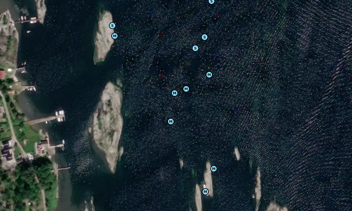
📜 Add description

Map of Brotsøbukta

Facilities

We don't have any data on available facilities in this harbour. If you know which facilities are available here, please update this site to help your fellow sailors. Update facilities.

Mooring

Options for mooring in this harbour: Anchoring.

Updated on 28. Jul 2022. Update mooring.

Wind protection

Protection next night

93 points

N E S W --> } } } } } } } } } } } } } } } } } } } } } } } } } } } } } } } } } } } } } } } } } } } } } } } } } } } } } } } } } } } } } } } } } } } } } } } } } } } } } } } } } } } } } } } } } } } } } } } } } } } } } } } } } } } } } } } } } } } } } } } } } } } } } } } } } } } } } } } } } } } } } } } } } } } } } } } } } } } } } } } } } } } } } } } } } } } } } } } } } } } } } } } } } } } } } } } } } } } } } } } } } } } } } } } } } } } } } } } } } } } } } } } } } } } } } } } } } } } } } } } } } } } } } } } } } } } } } } } } } } } } } } } } } } } } } } } } } } } } } } } } } } } } } } } } } } } } } } } } } } } } } } } } } } } } } } } } } } } } } } } } } } } } } } } } } } } } } } } } } } } } } } } } } } } } } } } } } } } } } } } } } } } } } } } } } } } } } } } } } } } } } } } } } } } } } } } } } } } } } } } } } } } } } } } } } } } } } } } } } } } } } } } } } } } } } } } } } } } } } } } } } } } } } } } } } } } } } } } } } } } } } } } } } } } } } } } } } } } } } } } } } } } } } } } } } } } } } } } } } } } } } } } } } } } } } } } } } } } } } } } } } } } } } } } } } } } } } } } } } } } } } } } } } } } } } } } } } } } } } } } } } } } } } } } } } } } } } } } } } } } } } } } } } } } } } } } } } } } } } } } } } } } } } } } } } } } } } } } } } } } } } } } } } } } } } } } } } } } } } } } } } } } } } } } } } } } } } } } } } } } } } } } } } } } } } } } } } } } } } } } } } } } } } } } } } } } } } } } } } } } } } } } } } } } } } } } } } } } } } } } } } } } } } } } } } } } } } } } } } } } } } } } } } } } } } } } } } } } } } } } } } } } } } } } } } } } } } } } } } } } } } } } } } } } } } } } } } } } } } } } } } } } } } } } } } } } } } } } } } } } } } } } } } } } } } } } } } } } } } } } } } } } } } } } } } } } } } } } } } } } } } } } } } } } } } } } } } } } } } } } } } } } } } } } } } } } } } } } } } } } } } } } } } } } } } } } } } } } } } } } } } } } } } } } } } } } } } } } } } } } } } } } } } } } } } } } } } } } } } } } } } } } } } } } } } } } } } } } } } } } } Next night 18:00 0:00 6:00 12:00 Tor 01 Mai 18:00 0:00 8m/s 2m/s

Want to know how the wind score works? Then you should read this explanation.

The wind forecasts come from yr.no (Norwegian Meteorological Institute), and was last updated 1 hour and 35 minutes ago (Wednesday 30 April 03:27 PM). The next night score shows you the worst hour between 22:00 and 08:00 the next night. We recommend that you check multiple sources for wind forecasts. windy.com is a good website to show larger wind systems.

The safe directions for this harbour was added at 1. Jun 2023. Click here to edit.

Last visits to Brotsøbukta

Fri 02 Aug 2024

LEON [MMSI: 258992780]

Thu 01 Aug 2024

GEMMA [MMSI: 257072430]

Mon 29 Jul 2024

LEON [MMSI: 258992780]

VITESSE [MMSI: 258121270]

Tue 23 Jul 2024

TRITON [MMSI: 257027100]

The visits are retrieved from AIS data. You can click to see all visiting ships to Brotsøbukta, as well as statistics about the ships that visits

Add this harbour to a journey

Check in now

Choose a different date than today

Important: When you check in to a harbour, you add it to a journey on this website. You are not booking a place in the marina.

Contributors

Users that contributed to this page: Johan Almqvist and Olav Pekeberg

harbourmaps.com is updated by the boating community. When you add information, a review or pictures to this page you are listed here with the other contributors (we list your user-name, which can be your real name or a pseudonym).

Closest harbours to Brotsøbukta

Filter by

Natural harbour
Marina
Safe wind next night

Order by

ABC
Popularity
Wind score next night

0 harbours

Show more harbours