Langør/Stavn Fjord

Puerto natural

favoritt

Region: Denmark (623), Aarhus Bugt (37) and Samsø (10)

Langør/Stavn Fjord
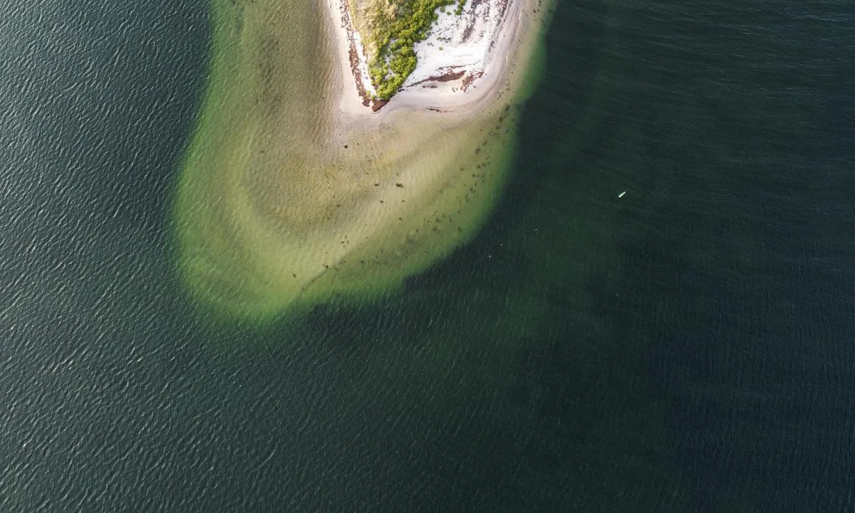
Langør/Stavn Fjord: {"base": "no", "no": "Ved innseilingen rundt \u00abLille\u00f8re\u00bb, etter gr\u00f8nn stake stikker sandbanken et godt stykke lenger ut enn kartet v\u00e5rt viste (Navionics 2024).", "se": "Vid inseglingen runt \"Lille\u00f8re\", efter gr\u00f6n k\u00e4pp sticker sandbanken ut en bra bit l\u00e4ngre \u00e4n v\u00e5rt sj\u00f6kort visade (Navionics 2024).", "en": "At the entrance around \"Lille\u00f8re\", after the green buoy, the sandbank extends significantly further out than our chart indicated (Navionics 2024).", "da": "Ved indsejlingen rundt \u00abLille\u00f8re\u00bb, efter gr\u00f8n stage, str\u00e6kker sandbanken sig et godt stykke l\u00e6ngere ud end vores kort viste (Navionics 2024).", "fr": "En approchant l'entr\u00e9e autour de \u00abLille\u00f8re\u00bb, apr\u00e8s la balise verte, le banc de sable s'\u00e9tend beaucoup plus loin que ce que notre carte indiquait (Navionics 2024).", "de": "Beim Einlaufen um \u00abLille\u00f8re\u00bb, direkt nach der gr\u00fcnen Bake, erstreckt sich die Sandbank deutlich weiter hinaus, als es unsere Karte (Navionics 2024) zeigte.", "es": "En la entrada alrededor de \u00abLille\u00f8re\u00bb, despu\u00e9s de la baliza verde, el banco de arena se extiende mucho m\u00e1s all\u00e1 de lo que nuestro mapa mostraba (Navionics 2024).", "it": "All'ingresso intorno a \u00abLille\u00f8re\u00bb, dopo il segnalatore verde, la barra di sabbia si estende molto pi\u00f9 lontano di quanto mostrato nella nostra mappa (Navionics 2024).", "pt": "Na entrada ao redor de \"Lille\u00f8re\", ap\u00f3s a estaca verde, o banco de areia se estende consideravelmente mais longe do que o nosso mapa mostrava (Navionics 2024).", "nl": "Bij het binnenvaren rond 'Lille\u00f8re', steekt de zandbank na de groene boei een flink stuk verder uit dan onze kaart aangaf (Navionics 2024).", "pl": "Przy wej\u015bciu do portu wok\u00f3\u0142 \u00abLille\u00f8re\u00bb, po mini\u0119ciu zielonej boi, piaszczysta \u0142awica wystaje znacznie dalej, ni\u017c pokazywa\u0142a nasza mapa (Navionics 2024).", "uk": "\u041f\u0440\u0438 \u0432\u0445\u043e\u0434\u0456 \u043d\u0430\u0432\u043a\u043e\u043b\u043e \u00ab\u041b\u0456\u043b\u043b\u0435\u043e\u0440\u0435\u00bb, \u043f\u0456\u0441\u043b\u044f \u0437\u0435\u043b\u0435\u043d\u043e\u0433\u043e \u0437\u043d\u0430\u043a\u0430 \u043f\u0456\u0449\u0430\u043d\u0430 \u043c\u0456\u043b\u0438\u043d\u0430 \u0432\u0438\u0441\u0442\u0443\u043f\u0430\u0454 \u0437\u043d\u0430\u0447\u043d\u043e \u0434\u0430\u043b\u0456, \u043d\u0456\u0436 \u043f\u043e\u043a\u0430\u0437\u0443\u0432\u0430\u043b\u0430 \u043d\u0430\u0448\u0430 \u043a\u0430\u0440\u0442\u0430 (Navionics 2024).", "ro": "La intrarea \u00een jurul \u00abLille\u00f8re\u00bb, dup\u0103 parul verde, banca de nisip se extinde mult mai departe dec\u00e2t a ar\u0103tat harta noastr\u0103 (Navionics 2024).", "tr": "\u2018Lille\u00f8re\u2019 etraf\u0131ndan giri\u015fte, ye\u015fil \u015famand\u0131ra sonras\u0131 kum bank\u0131, haritam\u0131z\u0131n g\u00f6sterdi\u011finden (Navionics 2024) olduk\u00e7a daha ileriye \u00e7\u0131k\u0131yor.", "el": "\u039a\u03b1\u03c4\u03ac \u03c4\u03b7\u03bd \u03b5\u03af\u03c3\u03bf\u03b4\u03bf \u03b3\u03cd\u03c1\u03c9 \u03b1\u03c0\u03cc \u03c4\u03bf \u00abLille\u00f8re\u00bb, \u03bc\u03b5\u03c4\u03ac \u03c4\u03bf \u03c0\u03c1\u03ac\u03c3\u03b9\u03bd\u03bf \u03c3\u03ae\u03bc\u03b1, \u03b7 \u03b1\u03bc\u03bc\u03bf\u03c5\u03b4\u03b9\u03ac \u03b5\u03ba\u03c4\u03b5\u03af\u03bd\u03b5\u03c4\u03b1\u03b9 \u03b1\u03c1\u03ba\u03b5\u03c4\u03ac \u03c0\u03b5\u03c1\u03b9\u03c3\u03c3\u03cc\u03c4\u03b5\u03c1\u03bf \u03b1\u03c0\u03cc \u03cc,\u03c4\u03b9 \u03ad\u03b4\u03b5\u03b9\u03c7\u03bd\u03b5 \u03bf \u03c7\u03ac\u03c1\u03c4\u03b7\u03c2 \u03bc\u03b1\u03c2 (Navionics 2024).", "cs": "P\u0159i vplouv\u00e1n\u00ed kolem \u00abLille\u00f8re\u00bb, po zelen\u00e9m naviga\u010dn\u00edm znaku vy\u010dn\u00edv\u00e1 p\u00edse\u010dn\u00fd pruh mnohem d\u00e1le, ne\u017e ukazovala na\u0161e mapa (Navionics 2024).", "hu": "A \u00abLille\u00f8re\u00bb k\u00f6r\u00fcli bej\u00e1ratn\u00e1l, a z\u00f6ld c\u00f6l\u00f6p ut\u00e1n a homokpad j\u00f3val messzebbre ny\u00falik ki, mint ahogy azt a t\u00e9rk\u00e9p\u00fcnk (Navionics 2024) mutatta.", "fi": "Saapuessasi satamaan \u00abLille\u00f8re\u00bbn ymp\u00e4ri, vihre\u00e4n viitan j\u00e4lkeen hiekkapenkka ulkonee selv\u00e4sti pidemm\u00e4lle kuin karttamme osoitti (Navionics 2024).", "bg": "\u041f\u0440\u0438 \u0432\u043b\u0438\u0437\u0430\u043d\u0435\u0442\u043e \u043e\u043a\u043e\u043b\u043e \u00abLille\u00f8re\u00bb, \u0441\u043b\u0435\u0434 \u0437\u0435\u043b\u0435\u043d\u0430\u0442\u0430 \u043a\u043e\u043b\u043e\u043d\u0430, \u043f\u044f\u0441\u044a\u0447\u043d\u0430\u0442\u0430 \u0431\u0430\u043d\u043a\u0430 \u0438\u0437\u043b\u0438\u0437\u0430 \u0434\u043e\u0441\u0442\u0430 \u043f\u043e-\u043d\u0430\u0432\u044a\u0442\u0440\u0435, \u043e\u0442\u043a\u043e\u043b\u043a\u043e\u0442\u043e \u043f\u043e\u043a\u0430\u0437\u0432\u0430 \u043d\u0430\u0448\u0430\u0442\u0430 \u043a\u0430\u0440\u0442\u0430 (Navionics 2024).", "sr": "\u041f\u0440\u0438 \u0443\u043b\u0430\u0441\u043a\u0443 \u043e\u043a\u043e \u201eLille\u00f8re\u201c, \u043d\u0430\u043a\u043e\u043d \u0437\u0435\u043b\u0435\u043d\u0435 \u043e\u0437\u043d\u0430\u043a\u0435, \u043f\u0435\u0448\u0447\u0430\u043d\u0438 \u0431\u0430\u043d\u043a \u0441\u0435 \u043f\u0440\u0443\u0436\u0430 \u0437\u043d\u0430\u0442\u043d\u043e \u0434\u0430\u0459\u0435 \u043d\u0435\u0433\u043e \u0448\u0442\u043e \u0458\u0435 \u0442\u043e \u043d\u0430\u0448 \u043a\u0430\u0440\u0442 \u043f\u0440\u0438\u043a\u0430\u0437\u0438\u0432\u0430\u043e (Navionics 2024).", "et": "Sissepurjetamisel \u00fcmber \u00abLille\u00f8re\u00bb, p\u00e4rast rohelist m\u00e4rki ulatub liivabank palju kaugemale, kui meie kaart (Navionics 2024) n\u00e4itas.", "lv": "Ieejot ap \u00abLille\u00f8re\u00bb, p\u0113c za\u013c\u0101s stakas smil\u0161u s\u0113re iziet daudz t\u0101l\u0101k nek\u0101 m\u016bsu kart\u0113 par\u0101d\u012bts (Navionics 2024).", "lt": "Plaukiant \u012flankon aplink \u00abLille\u00f8re\u00bb, po \u017ealiojo \u017eymeklio, sm\u0117lio sekluma irkasi gerokai toliau nei m\u016bs\u0173 \u017eem\u0117lapyje nurodyta (Navionics 2024)."}
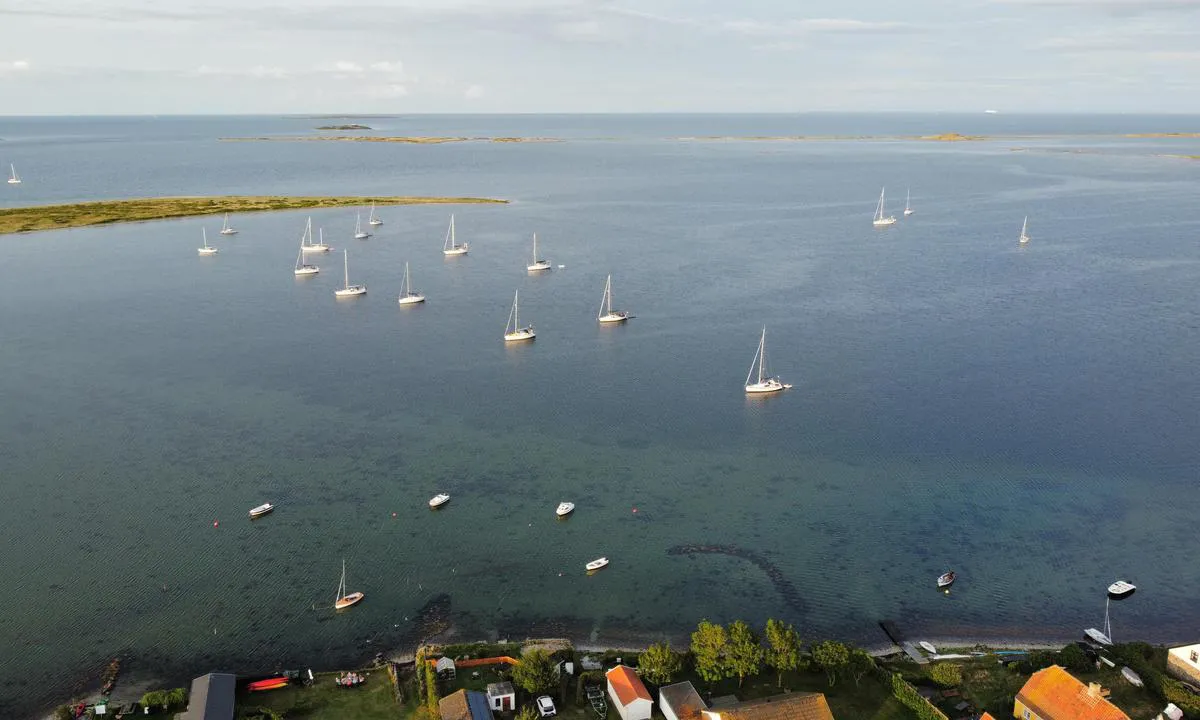
Langør/Stavn Fjord: {"base": "de", "no": "Foto: realdania.dk / Se", "se": "Foto: realdania.dk / Se", "en": "Photo: realdania.dk / View", "da": "Foto: realdania.dk / Se", "fr": "Photo : realdania.dk / Voir", "de": "Foto: realdania.dk / Sehen", "es": "Foto: realdania.dk / Ver", "it": "Foto: realdania.dk / Guarda", "pt": "<img src='realdania.dk' alt='Foto: realdania.dk / Ver' />", "nl": "Foto: realdania.dk / Zien", "pl": "Zdj\u0119cie: realdania.dk / Zobacz", "uk": "\u0424\u043e\u0442\u043e: realdania.dk / \u041f\u0435\u0440\u0435\u0433\u043b\u044f\u043d\u0443\u0442\u0438", "ro": "Foto: realdania.dk / Vedere", "tr": "Foto: realdania.dk / G\u00f6r", "el": "\u03a6\u03c9\u03c4\u03bf\u03b3\u03c1\u03b1\u03c6\u03af\u03b1: realdania.dk / Sehen", "cs": "Foto: realdania.dk / Zobrazit", "hu": "Fot\u00f3: realdania.dk / N\u00e9zd", "fi": "Kuva: realdania.dk / N\u00e4e", "bg": "\u0421\u043d\u0438\u043c\u043a\u0430: realdania.dk / \u0412\u0438\u0436", "sr": "Fotografija: realdania.dk / Pogledajte", "et": "Foto: realdania.dk / Vaata", "lv": "Foto: realdania.dk / Skat\u012bt", "lt": "Nuotrauka: realdania.dk / \u017di\u016br\u0117kite"}
Langør/Stavn Fjord
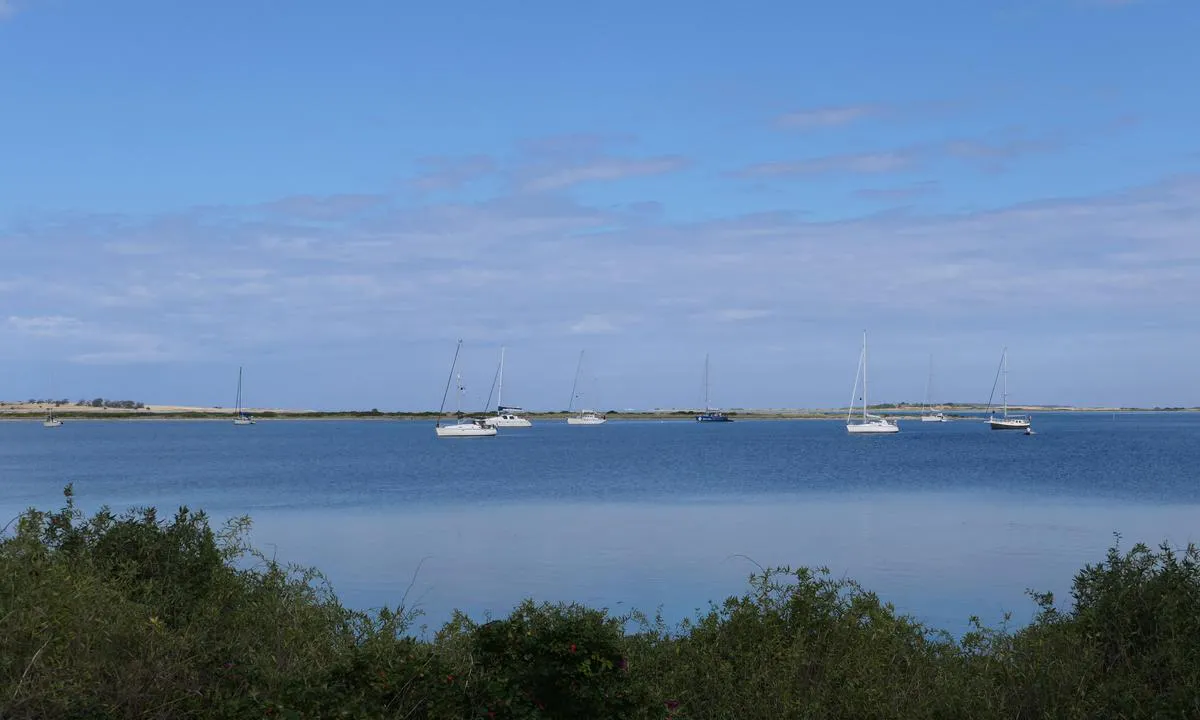
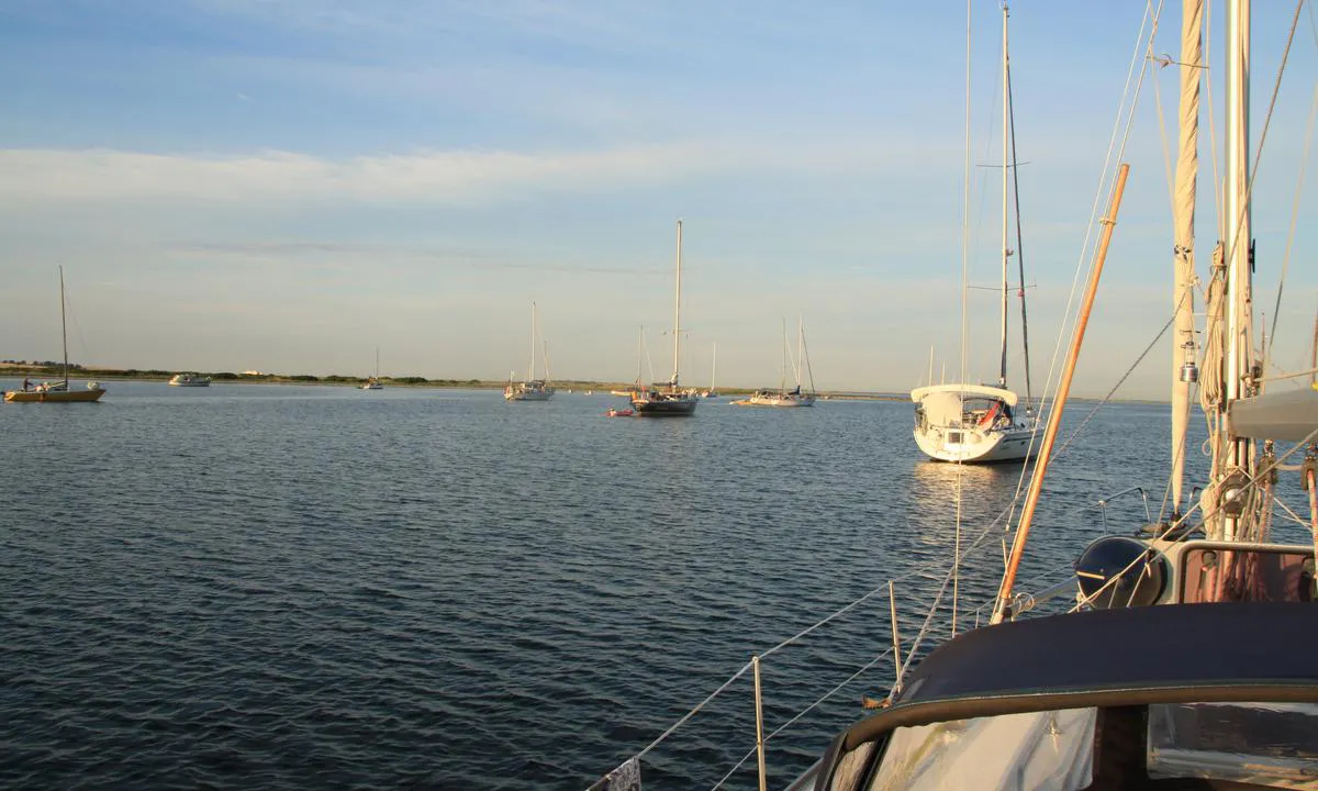
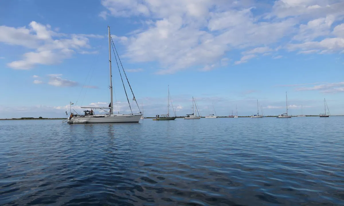
Langør/Stavn Fjord: {"base": "no", "no": "Mot nord\u00f8st", "se": "Mot nordost", "en": "Towards the northeast", "da": "Mod nord\u00f8st"}
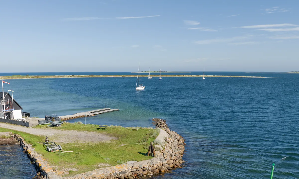
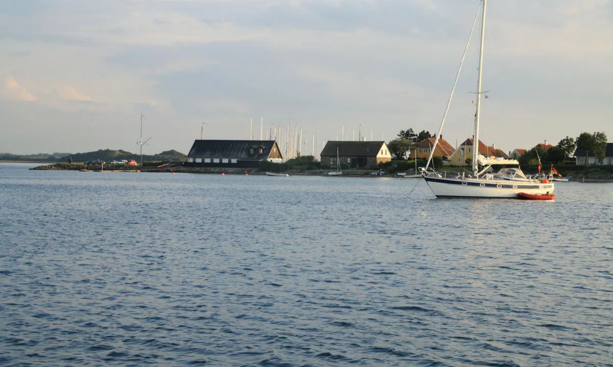
Langør/Stavn Fjord: {"base": "da", "no": "Ti minutter med jolle inn til Lang\u00f8r havn", "se": "Tio minuter med jolle in till Lang\u00f6r hamn", "en": "Ten minutes by dinghy to Lang\u00f8r harbor", "da": "Ti minutter med jolle inn til Lang\u00f8r havn"}
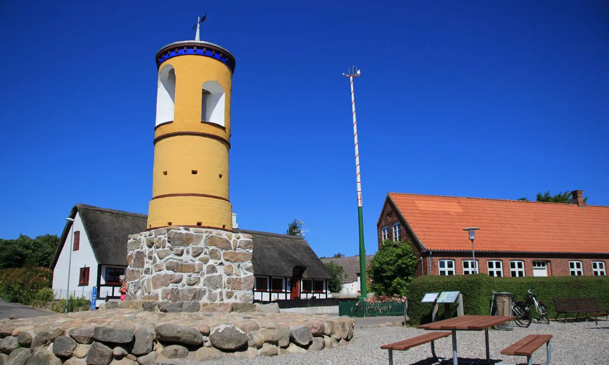
Langør/Stavn Fjord: {"base": "no", "no": "Klokket\u00e5rnet tilh\u00f8rer kirken som ligger litt vekk fra plassen, s\u00e5 ved feil vindretning kunne ikke buboerne h\u00f8re klokkene, derfor denne", "se": "Klocktornet tillh\u00f6r kyrkan som ligger lite bort fr\u00e5n platsen, s\u00e5 vid fel vindriktning kunde inv\u00e5narna inte h\u00f6ra klockorna, d\u00e4rf\u00f6r detta", "en": "The bell tower belongs to the church which is situated a bit away from the place, so with the wrong wind direction, the residents couldn't hear the bells, therefore this", "da": "Klokket\u00e5rnet tilh\u00f8rer kirken, som ligger lidt v\u00e6k fra pladsen, s\u00e5 ved forkert vindretning kunne buboerne ikke h\u00f8re klokkerne, derfor denne"}
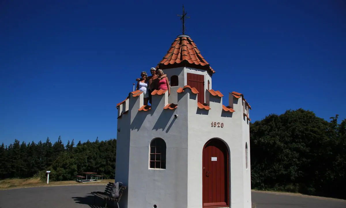
Langør/Stavn Fjord: {"base": "no", "no": "Utkikken p\u00e5 Bjalleberg, tungt \u00e5 sykle opp, men g\u00e5r ille fort ned", "se": "Utkiken p\u00e5 Bjalleberg, tungt att cykla upp, men g\u00e5r v\u00e4ldigt fort ner", "en": "The lookout at Bjalleberg, tough to cycle up, but goes wickedly fast down", "da": "Udkigsposten p\u00e5 Bjalleberg, tungt at cykle op, men g\u00e5r rasende hurtigt ned"}
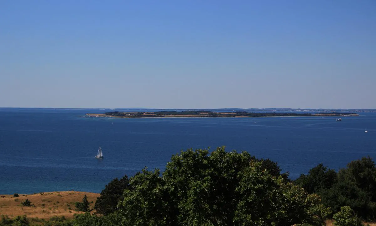
Langør/Stavn Fjord: {"base": "no", "no": "Thun\u00f8, er ogs\u00e5 en utrolig vakker liten \u00f8y. Ifra utsikten p\u00e5 Bjalleberg", "se": "Thun\u00f8 \u00e4r ocks\u00e5 en otroligt vacker liten \u00f6. Utsikten fr\u00e5n Bjalleberg", "en": "Thun\u00f8 is also an incredibly beautiful little island. From the view at Bjalleberg", "da": "Tun\u00f8, er ogs\u00e5 en utrolig smuk lille \u00f8. Fra udsigten p\u00e5 Bjalleberg"}
Langør/Stavn Fjord
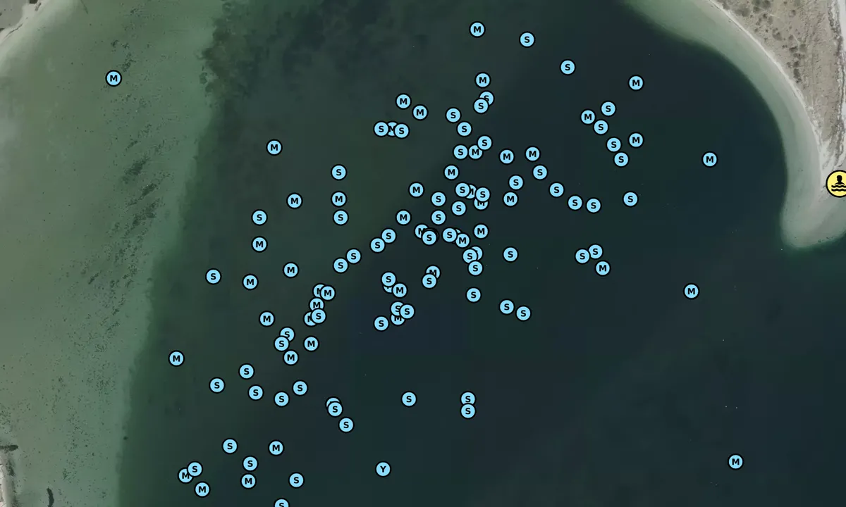
Satelite image of Langør/Stavn Fjord

📸 Sube una foto

Muestra tus fotos y ayuda a otros a planificar su viaje a Langør/Stavn Fjord.harbourmaps.com es creado por la comunidad de navegación, en un esfuerzo colectivo para hacer la navegación más simple y divertida. Subir una foto toma menos de un minuto y se puede hacer desde tu teléfono, tableta o portátil.

📸 Sube una foto

Instalaciones

Instalaciones disponibles: Parque infantil, Zona de baño.

Actualizado el 31. Mar 2022. Actualizar instalaciones.

Amarre

Opciones para amarre en este puerto: Fondeo.

Actualizado el 31. Mar 2022. Actualizar amarre.

Descripciones y reseñas

Bjørn Solem dice:

descripción

Navegación y condiciones marítimas: En el centro del lado este de Samsø. No entrar/salir después de la luz del día, hay muchos bajíos pero están bien señalizados con boyas habituales. Tengo un calado de 2 m y va bien en la bahía de anclaje aunque parezca demasiado poco profundo
Fondeo: El fondo es de arena, con parches vegetados pero bien visibles debido a unos 3 m de agua.
Área: Es lo más cercano que puedes llegar a una laguna en el Pacífico. Bancos de arena bajos rodean toda la bahía, con buenas oportunidades para nadar. Puede haber bastante viento pero sin oleaje.
El puerto de Langør está a diez minutos remando, allí hay un pequeño quiosco y baños con duchas. También hay alquiler de bicicletas, autoservicio. Alquila una bicicleta y dirígete hacia el norte a la «capital» Nordby y almuerza en uno de los muchos pequeños cafés. También sube al punto más alto, Bjalleberg, con una vista increíble, especialmente hacia Thunø un poco al oeste.

[translated from Norwegian with AI]

1 x helpful | written on 31. Mar 2022

¿Conoces este puerto? Es de gran ayuda para otros marineros si añades una breve descripción o reseña del puerto.

📜 Añadir descripción

Mapa de Langør/Stavn Fjord

Instalaciones

Instalaciones disponibles: Parque infantil, Zona de baño.

Actualizado el 31. Mar 2022. Actualizar instalaciones.

Amarre

Opciones para amarre en este puerto: Fondeo.

Actualizado el 31. Mar 2022. Actualizar amarre.

Protección contra el viento

Protección próxima noche

74 puntos

N E S W --> } } } } } } } } } } } } } } } } } } } } } } } } } } } } } } } } } } } } } } } } } } } } } } } } } } } } } } } } } } } } } } } } } } } } } } } } } } } } } } } } } } } } } } } } } } } } } } } } } } } } } } } } } } } } } } } } } } } } } } } } } } } } } } } } } } } } } } } } } } } } } } } } } } } } } } } } } } } } } } } } } } } } } } } } } } } } } } } } } } } } } } } } } } } } } } } } } } } } } } } } } } } } } } } } } } } } } } } } } } } } } } } } } } } } } } } } } } } } } } } } } } } } } } } } } } } } } } } } } } } } } } } } } } } } } } } } } } } } } } } } } } } } } } } } } } } } } } } } } } } } } } } } } } } } } } } } } } } } } } } } } } } } } } } } } } } } } } } } } } } } } } } } } } } } } } } } } } } } } } } } } } } } } } } } } } } } } } } } } } } } } } } } } } } } } } } } } } } } } } } } } } } } } } } } } } } } } } } } } } } } } } } } } } } } } } } } } } } } } } } } } } } } } } } } } } } } } } } } } } } } } } } } } } } } } } } } } } } } } } } } } } } } } } } } } } } } } } } } } } } } } } } } } } } } } } } } } } } } } } } } } } } } } } } } } } } } } } } } } } } } } } } } } } } } } } } } } } } } } } } } } } } } } } } } } } } } } } } } } } } } } } } } } } } } } } } } } } } } } } } } } } } } } } } } } } } } } } } } } } } } } } } } } } } } } } } } } } } } } } } } } } } } } } } } } } } } } } } } } } } } } } } } } } } } } } } } } } } } } } } } } } } } } } } } } } } } } } } } } } } } } } } } } } } } } } } } } } } } } } } } } } } } } } } } } } } } } } } } } } } } } } } } } } } } } } } } } } } } } } } } } } } } } } } } } } } } } } } } } } } } } } } } } } } } } } } } } } } } } } } } } } } } } } } } } } } } } } } } } } } } } } } } } } } } } } } } } } } } } } } } } } } } } } } } } } } } } } } } } } } } } } } } } } } } } } } } } } } } } } } } } } } } } } } } } } } } } } } } } } } } } } } } } } } } } } } } } } } } } } } } } } } } } } } } } } } } } } } } } } } } } } } } } } } } } } } } } } } } } } } } } } } } } } } } } } } } } } } } } } } } Next night 0:00 6:00 12:00 Man 18 Aug 18:00 0:00 6:00 7m/s 1m/s

¿Quieres saber cómo funciona la puntuación del viento? Entonces deberías leer esta explicación.

Las previsiones del viento provienen de yr.no (Instituto Meteorológico Noruego), y se actualizaron por última vez 2 hours and 9 minutes ago (Domingo 17 Agosto 18:27). La siguiente puntuación nocturna te muestra la peor hora entre las 22:00 y las 08:00 de la siguiente noche. Recomendamos que consultes varias fuentes para los pronósticos de viento.windy.com es un buen sitio web para mostrar sistemas eólicos más grandes.

Las direcciones seguras para este puerto se añadieron en 31. Mar 2022. Haga clic aquí para editar.

Langør/Stavn Fjord y/o los mares circundantes no están bien protegidos de los fuertes vientos y olas, y debes tener precaución en mal tiempo. Haga clic para editar el nivel de protección.

Últimas visitas a Langør/Stavn Fjord

Mié 13 Ago 2025

TAKE FIVE [MMSI: 211127160]

Vie 01 Ago 2025

ELLY [MMSI: 211868730]

Dom 27 Jul 2025

PAJOMA [MMSI: 211582890]

Sáb 26 Jul 2025

OJA [MMSI: 211715330]

Vie 25 Jul 2025

TRIDEFIX [MMSI: 211309950]

The visits are retrieved from AIS data. You can click to see all visiting ships to Langør/Stavn Fjord, as well as statistics about the ships that visits

Añadir este puerto a un viaje

Regístrate ahora

Elija una fecha diferente a la de hoy

Importante: Cuando inicias sesión en un puerto, lo agregas a un viaje en este sitio web. No estás reservando un lugar en la marina.

Colaboradores

Usuarios que contribuyeron a esta página: Olav Pekeberg, Bjørn Solem, Arjen Weber and Jarle A.

harbourmaps.com es actualizado por la comunidad de navegantes. Cuando agregas información, una revisión o fotos a esta página, te enumeramos aquí con los otros contribuyentes (listamos tu nombre de usuario, que puede ser tu nombre real o un seudónimo).

Puertos más cercanos a Langør/Stavn Fjord

Filtrar por

Puerto natural
Marina
Viento seguro la próxima noche

Ordenar por

ABC
Popularidad
Puntuación de viento próxima noche

0 puertos
Mostrar más puertos